The Han River
The Han River (한강) is fourth longest in Korea. However, its waters hold the most cultural relevance of any on the peninsula.
- Length — 494 km (307 mi)
- Basin Area — 35,770 km² (22,226 mi²)
- Origin — Mount Taebaek (태백산), Gangwon Province
- Termination — Yellow Sea (West Sea; 황해)
Geography
The Han River flows 513 kilometers (319 miles) westward from its origins on Mount Taebaek (태백산) in the eastern Province of Gangwon. While ranking fourth on the peninsula, its length comes in second in South Korea.
Two Rivers Converge

The Han River exists as a unified force only for the last 138 kilometers. Before that, its waters course through two separate rivers: the Bukhangang (North Han River; 북한강) and Namhangang (South Han River; 남한강).
(Korea measures the Han River from the start of the South Han River, on Mount Taebaek (태백산) in Gangwon Province.)
Twelve (12) kilometers east of Seoul at Yangpyeong Dumulmeori (양평 두물머리), the North and South rivers combine and continue westward through the capital.
The Imjin River (임진강) joins the Han before it spills over tidal flats at the mouth of the Yellow (West) Sea (황해), along the DMZ (Demilitarized Zone).
North Han River (Bukhangang)
- Length — 317 km (197 mi)
- Basin Area — 10,834 km² (6,732 mi²)
- Origin — Mount Kumgang (금강산), North Korea
- Termination — Yangpyeong Dumulmeori (양평 두물머리)
The North Han River (Bukhangang; 북한강) originates in North Korea, dribbling from atop Mount Kumgang (금강산). In South Korea, streams merge near Hwacheon County (화천군) and create the river proper.
The river travels through Gangwon Province and past the city of Chuncheon (춘천) in Gyeonggi Province (경기도), before meeting the South Han River outside Seoul.
Learn more about the river on the Bukhangang Bicycle Path page.

South Han River (Namhangang)
- Length — Length 375 km (233 mi)
- Basin Area — 12,577 km² (7,815 mi²)
- Origin — Mount Taebaek (태백산), Gangwon Province, South Korea
- Termination — Yangpyeong Dumulmeori (양평 두물머리)
The South Han River (Namhangang; 남한강) pours forth from Mount Taebaek (태백산) in the east coast Province of Gangwon (강원도) in South Korea.
Three Names for the Nam
Bukhangang? Namhangang? Can you make the river names more confusing? Sure.
The South Han River (or Namhangang) takes on a few more monikers.
- At its origin, locals call the waters descending from Mount Taebaek the Golji Stream (골지천).
- Near Jeongseon County (정선군), as it absorbs tributaries, the snaking current becomes the Joyang River (조양강).
- Just south in Yeongwol County (영월군), the banks fatten and transform into the Donggang River (동강강).
The river is born again after its waters cross Chungju Dam (충주댐) and Chungju Lake (충주호). It assumes the name “Namhangang” (남한강), or South Han River.
The Width of the Han

Though shorter than some, the Han River’s width is legendary. Towards the end of its run in Seoul, the gap between river banks reaches one kilometer, the widest on the peninsula.
Let’s put that in perspective:
- The width of the Thames in London: 450 meters (1,476 feet).
- The width of the Seine in Paris: 200 meters (656 feet).
- The width of the Han in Seoul: 1,000 meters (3,280 feet).
Other than Guangzhou, worldwide that’s one of the girthiest births a river takes through a major metropolitan city.
While the past century brought upgraded infrastructure tech, for most of history the Han’s width prevented bridges from crossing its waters.
The Han Before Time
The Han of yesteryear acted nothing like the docile old dog of today. Before the concrete revetments and underwater weirs, it walked on the wild side.
That Old Han Look

One hundred years ago, what did the Han look like? Imagine globs of golden islands that cuddled the roots of drooping trees. Sandy shorelines littered with the lounging husks of fishing vessels. Primordial forests buzzing. Fishing popping from the currents.
Silty ridges hid close to the water’s surface. They would often leap from below and snag the bottoms of boats.
A River Named Shifty
Don’t let this idyllic scene fool you. In these ancient, untamed days, twin dangers lurked just below: mercurial flow and shifting sands.
Loose sediment formed much of the river’s container. That meant the shape of the river changed often.
How often? A heavier than usual snowfall melting from mountaintops. A typhoon (태풍의; hurricane) passing over the peninsula. A yearly visit from the East Asian monsoonal flow. These regular events dislodged islands and sandbars whole and scattered their contents downriver.
This sudden shift in form would then disrupt and redirect the water flow, drying out some regions, overflowing others.
So on Tuesday, a massive wall of water carried away your fishing village. But by Thursday, puddles sat at the bottom of the riverbed.
Rivers Boon
The river sometimes punished its dependents for no good reason. But it also brought bounties.
Like the Nile, regular floods replenished the basin, creating fertile grounds to grow sturdy crops. The waters also filled fishers’ nets with hopping fish and squirming sacks of crustaceans.
This conveyor belt of veggies and meat helped stabilize villages and allowed populations to grow.
Saltwater Highway
Another example of the river’s wild disposition, during high tides the broad mouth of the Han often gulped heaps of Yellow (West) Sea water. This tidal flow was so forceful, fishers could ride a saltwater current upstream for up to twenty kilometers.

Transformation
The late 20th century brought massive changes and development to Korea. By the 1970s, the Han River swelled with both agriculture and industrial runoff.
To prepare for the 1988 Olympic Games in Seoul, the government enacted the Han River Comprehensive Development Plan (한강종합개발), a major infrastructure and terraforming project that sought to clean up the river.
Besides banning the dumping of industrial waste and sewage runoff, the project stabilized the flow of the Han by building weirs and dredging the riverbed.
Dredging
Dredging? Like scraping the bottom of the river? What would that do?
Because much of the Han ran shallow, slight changes in the riverbed caused dramatic effects downriver.
So the government sent crane-enabled barges and pumps to scoop and suck tons of sand and sediment from the bottom of the Han River.
The deepened river slowed the current, fixed the flow of water, and helped drain sudden influxes of water, staving off flooding.
Weirs and Dams

But large influxes of water, too, became less frequent. Why?
Both the Han River Restoration Project (한강종합개발; 1982-1986) and the Four Rivers Project (4대강 정비 사업; 2009-2012) built dams and weirs along the Han Rivers. These giant water gates captured the river’s energy and evened out the fluctuations in water levels.
Inside Seoul, in place of oversized structures built above the river, the city added underwater weirs to Gimpo Bridge (김포대교) and Jamsil Bridge (잠실대교). In particular, Gimpo Bridge’s submerged barrier blocks heavier saltwater from the Yellow (West) Sea from drifting too far upriver and destroying freshwater ecosystems.
The Positives
The dredging, dams, and weirs calmed the river. Once unpredictable, when you ride the Han River today, you won’t notice the subtle changes in water levels.
By containing flooding, developers felt confident to develop riverside complexes and highrises. The Seoul city government built the Hangang Park system in Seoul.
Regulating the water quality also stabilized fresh water resources. Gone were droughts from redirected water flow. The steady flow of H2O quenched the thirst of a multiplying population.
The Negatives
However, the massive terraforming had and continues to have negative side-effects, too.
Dread the Dredge
The deepened riverbeds destabilized the riverbanks. Erosion ate away at the edges of the river, tearing up wetlands, habitats and floodplains.
And because the erosion worsened, the government installed endless concrete revetments, or artificial riverbanks. These not only further disrupted the feeding grounds and living spaces of the river’s native species, it drained the ecological beauty from the waterside.

Wiley Weirs
To compound the problems, the underwater weirs and dams blocked the migration of fish. Even though they built fish bridges, the fish population dwindled, disrupting food chains, starving migratory birds.
Those Darn Dams
Projects like the Paldang Dam (팔당댐) just east of Seoul, created artificial lakes that flooded the land behind them. These new, artificial ecosystems fomented massive algae blooms that starved the water of oxygen, killing more creatures and natural environments.
History

Once known as Hangaram (한가람), which translates to “big” or “great river,” the Hangang was pivotal to developing Korea. It was once said that whoever controlled the Han, controlled the peninsula. Why? Three reasons.
First, the fertile soil bordering the river provided bountiful farmland. And what is jet fuel for up-and-coming civilizations? Food surpluses.
Second, with over 320 kilometers (200 miles) of navigable waterway that flows into the Yellow (West) Sea, the Han became an invaluable route to China, Korea’s most valuable ancient trading partner, and on-again, off-again ally.
Third, the Han River rests at the longitudinal midpoint of the peninsula. Because hills and mountains blanket much of Korea’s topography, the river and its tributaries became the highway from which emperors could send their tax collectors and bureaucrats into the heart of their kingdom.
Prehistory
Before the rise of kingdoms and empires, the Han River was home to various tribal groups. In sites like Amsa-dong Prehistoric Site (암사동 선사주거지) near Gwangnaru Hangang Park (광나루한강공원) in Seoul, archaeologists discovered earthenware pots, bone tools, and more from this era.
The ancient people of the Han gathered sustenance by fishing and foraging in the nearby hills.
Early fisher people spear fished the Han. However, when fishing nets hit the scene, a stream of river-born protein increased the population and established more permanent settlements.
The bronze age introduced hardier tools, intricate onggi pottery (옹기), and new farming techniques to the Han basin region. The expansion and diversification of food sources created more complex political structures and the birth of kingdoms.

Three Kingdoms
From 57 BCE to 668 ACE, three Korean kingdoms emerged on the Korean peninsula. For seven hundred years, each battled for control of the peninsula.
During this time, whichever state occupied Han River region had a distinct advantage over the other kingdoms.
Baekje
While many Neolithic people settled and tilled the Han River, Baekje (백제; 18 BCE ~ 660 ACE) was the first kingdom to occupy the basin. Their capital, Wiryeseong (위례성), sat in the lower reaches of the river. It is the first known significant settlement in the area that is now Seoul.
You can still find evidence of the Baekje (백제) by visiting the earthen walls of Mongchon (몽촌토성) and Pungnap (풍납동토성) Fortresses near Olympic Park (올림픽공원).
Baekje grew a reputation for maritime might. Their navy sailed the Han River and Yellow (West) Sea, controlling much of western Korea, from modern day Pyongyang (평양) to the southern coast.
Goguryeo
The Kingdom of Goguryeo (고구려; 37 BCE ~ 668 ACE) formed before Baekje (백제) along the banks of the Yalu River (압록강) in modern day China.
Starting as a band of tribes, they developed into a military powerhouse that conquered chunks of Manchuria and the northern Korean peninsula.
At its height, Goguryeo (고구려) controlled more land than the Baekje (백제) and Silla (신라) Kingdoms. Their capitol was situated where Pyongyang (평양), North Korea’s current capital, today stands.
In the 4th century ACE, recognizing the strategic advantage of the Han River, Goguryeo’s King Jangsu invaded the upper regions of the basin. This cut Baekje off from its inner kingdom and forced them to retreat south, ending their five-hundred (500) year control of the river.
While Goguryeo (고구려) kept their capital in the north, they set up military outposts along Han and reinforced the border along Baekje and Silla’s territories.
Silla
The Kingdom of Silla (신라; 57 BCE ~ 935 ACE) emerged in the southeast corner of the peninsula. Though the oldest, it was the last to centralize its government.
Silla (신라) didn’t wield the military might of a Goguryeo (고구려) or Baekje (백제). They survived and expanded using diplomacy and opportunism.

Silla & Baekje Alliance
After seeing the Kingdom of Goguryeo (고구려) overwhelm Baekje (백제) and conquer the Han River basin in the 4th Century, Silla (신라) expected they were next in the conquering queue.
So, in 551 ACE, Silla (신라) reached out to Baekje (백제) and formed a pact. Together they pushed Goguryeo (고구려) back to their northern homeland.
The Baekje (백제) recovered the lower Han River basin. However, Silla (신라) bit off a chunk of territory and claimed the upper reaches of the Han.
The Old Uno Reverse Card
In time, Silla (신라) found an opportunity. The Han River, with its direct water route to China, was too valuable to leave for Baekje (백제). So they decided…
Two years after their joint conquest, Silla (신라) attacked their old allies and took the entire Han River for themselves.
Silla (신라) was quick to set up diplomatic ties with the Tang Dynasty in China. Together they consumed the Baekje (660 ACE) and squashed Goguryeo (668 ACE) Kingdoms.
Unified Peninsula
After using their newfound power to send the Tang Empire packing, the Silla became the first political force to conquer and control the entire Korean peninsula.
Seoul-less Capital
The Unified Silla Kingdom and succeeding Kingdom of Goryeo (고려; 918 BCE ~ 1392 ACE) established their capitals away from the Han River.
(After unification, Silla kept their capital in Seorabeol (서라벌), present day Gyeongju (경주) in southwest Korea.
(And when Goryeo (고려) came to power, self identifying as descendents of the northern Goguryeo Kingdom (고구려), they moved the capital to modern day Kaesong (개성) in present day North Korea.)
However, both Silla (신라) and Goryeo (고려) saw how vital the Han River was to maintaining a grip on the peninsula. Both invested resources to regulate the region, installing police and military fortifications.
Joseon Dynasty

Upon the ascension of a new dynasty, superstition deemed it unlucky to seat your new capital at the site of the old one. So after generals overthrew Goryeo (고려) and established the Joseon Dynasty (조선; 1392 ACE ~ 1897 ACE), they needed to go capital shopping.
After consulting military and economic advisors, and referencing feng shui, the new king, King Taejo, moved the capital back to the Han River.
Previously known as Wiryeseong (위례성), King Taejo named the new city Hanyang (한양) or Hanseong (한성). From this point forward, Hanyang (한양) — renamed Seoul after Japanese Occupation — became the political and cultural center of the peninsula.
Why the Han?
Like the kingdoms before, Joseon Dynasty’s (조선) economy revolved around agriculture and trade. And, before planes, trains, and automobiles, what was the fastest way to move goods? The most efficient? By boat.
With over two-hundred miles of waterway that stretched deep into the peninsula and reached out into the Yellow (West) Sea, the Han River became the highway in which everything passed: crops, artisanal goods, taxes.
Riverside Neighborhoods
Hanyang became the center of the Korean universe. Major landowners purchased residences in the capital. They set up ports and granaries along the Han River to receive and store crops and goods. Soon, these outposts turned into buzzing trading bazaars.
Many of the neighborhoods in today’s Seoul can trace their foundation to these marketplaces.
Along the north side of the river, the largest ports were Yongsan (용산), Mapo (마포), and Seogang (서강). Daily, they swelled with ships set to offload rice from upstream farms.
Dongbinggo (동빙고) and Seobinggu (서빙고), near Ichon Hangang Park (이촌한강공원), became known for ice-making. Ttukseom (뚝섬) grew a reputation for storing timber and munitions. Songpa (송파), near Jamsil Hangang Park (잠실한강공원), stored rice, wood, and products from all over the country.

The Modern Era
Invasions by both Japanese and Qing Dynasty (Chinese) forces during the Joseon Dynasty (조선) forced Korea to adopt an isolationist policy, earning them the moniker “the hermit kingdom.” However, by the late 1800s the modern world banged at the door.
In 1866, because Korea’s kings persecuted Catholic missionaries, seven French naval vessels invaded Ganghwa Island (강화도) at the mouth of the Han River in the Yellow (West) Sea.
By the 1890s, German and American steamboats paddled their way up the Han, chipping away at Korea’s diplomatic wall.
The Korean Empire
The First Sino-Japanese War (1894 ~ 1895) gave Japan increasing influence over Korea. It also created a revolution that overthrew of the antiquated Joseon Dynasty and established the Korean Empire (대한제국; 1897 ~ 1910).
The new state’s first ruler, Emperor Gwangmu (광무제), sought to drag Korea into the modern world. He instituted the Gwangmu Reform (광무개혁). The policies aimed at updating Korea’s politics and infrastructure.
The reforms helped build Korea’s first street cars, railway, the first modern bridge to cross the Han River: Hangang Railway Bridge (한강철교), christened in 1900.

(Though the Korean War destroyed it, you can find the restored, green painted Hangang Railway Bridge today. It spans the banks from Ichon Hangang Park to Yeouido Hangang Park.
Japanese Occupation
Beginning in 1876, Japan interfered in Korean politics. (They’d tried invading a few times before.) By signing treaties with Korea’s allies, employing spies, and assassinating Korean leaders, Japan harpooned the peninsula and tightened the slack. By 1910, Japan annexed Korea.
Until the end of World War II (1945), the Japanese Empire stripped the nation of its sovereignty. They forced Korean women to be sex slaves and Korean men to fight for the Imperial Japanese Army.
Japan also modernized Korea. They built extensive networks of railroad lines and paved roads, and erected more bridges across the Han River.
Like colonized nations before, Korea’s economy boomed. Its agriculture and fishing industries pumped out ten times more meat and grain.
However, like colonized nations before, none of that wealth flowed to the annexed inhabitants. All output flowed to Japan and their war against the Allies.
Korean War
In June 1950, North Korea invaded South Korea, beginning the Korean War (한국전쟁; 1950 ~ 1953). Within only a few days, Northern forces entered Seoul.
Hangang Railway Bridge Detonation
The North’s rapid advance caught the South Korean army off guard. They retreated to the southern banks of the Han River and rigged the Hangang Railway Bridge with explosives.
Panicked, a colonel ordered the detonation of the bridge with four-thousand (4,000) still crossing. Up to eight-hundred (800) souls perished in the explosion.
Within a few hours, the North Korean army overtook Seoul and gained control of the Han River.
Pusan Perimeter
Having lost its capital, South Korea fought a series of losing battles. From June to September, the Northern Army pushed them back to the Nakdong River (낙동강).
South Korea maintained a fingernail hold on the peninsula. Their 230 km (140 miles) border held off constant attacks.
Invasion of Incheon
The South Korean government maintains a posture of readiness. Why? Technically, the Korean War (1950~1953) never ended.
After the U.N. (U.S.) beefed up their military budget. American and South Korean troops invaded Incheon in September 1950.
Led by Douglas MacArthur of WWII fame, the operation was a tremendous success. Within a few days, the U.N. forces marched into Seoul and liberated the capital along the Han.
Battle Line Han
Three months after they liberated Seoul, Northern and Chinese forces regrouped and took back the capital.
From 1951 onward, the war remained in a stalemate near the 38th Parallel. Like in centuries past, the Han River became a site of heated contention. For Seoul alone, five major battles led to the capital changing hands four times.
At War’s End
The Korean War devastated Korea’s culture and infrastructure. Railroads and roads splintered under constant bombardment. Every bridge over the Han fell in strategic retreats. Only rubble and poverty remained.
Miracle on the Han
In the 1950s, Korea plodded forward as one of the poorest nations on earth. Beginning in the 1960s, however, Park Chung-hee (박정희) enacted policies to rapidly developed the economy.
His administration built highways, railways, airports. They blocked imports and commanded citizens to buy Korean. And they gave huge tax breaks and barely-there-interest-rate loans to up-and-coming chaebols (재벌), Korea’s family owned mega-corporations (Samsung, Hyundai, LG, Lotte).
This period, known as the Miracle on the Han (한강의 기적), saw staggering increases in Korea’s gross domestic income (GDP).

In 1960, Korea’s GDP per person was $158.25 (or $1,366.81 in 2019). By 2019, that rose to $31,846.22. Adjusted for inflation, that’s a 2,230% increase.
The river of cash exploded development, improved health and educational institutions, and doubled the country’s population. (25 million to 51 million, from 1960 to 2019).
Pollution
The revolutionary economic turnabout helped the humans at the expense of — you guessed it — the environment.
Before the “miracle,” summer brought families and children to Han River’s sandy beaches. The clean current provided a cooling retreat. But then industrialization stuck its toes in the water.
Throughout Seoul and up the Han River, factories and residential complexes sprang up. To speed up progress, some cut corners. Some dumped sewage. Industrial waste appeared downstream. By the 1970s, the government banned swimming in the Han.
America Enters the Chat
In 2000, the United States Military admitted, then apologized for dumping toxic chemicals in the Han River. This inspired the film The Host (괴물) by Bong Joon-ho (봉준호), Oscar-winning director of Parasite (기생충).

Han River Development Plan
In 1981, the Olympic Committee chose Seoul to host the 1988 Summer Olympic Games. However, the pollution tarnished the proposed site along the Han River.
To prepare for the international audience, with the opportunity to display their ascension, the Korean government instituted the Han River Comprehensive Development Plan (한강종합개발) to clean up and revitalize the river.
Focused on the Han River in Seoul, the plan included three components.
First, the planning committee needed to build Olympic facilities and other shiny new toys, including:
- Jamsil Sports Complex (잠실종합운동장) — built both for the 1986 Asian Games and 1988 Olympics, it served as the main Olympic stadium.
- Olympic Boulevard (올림픽대로) — a high speed road on the south banks of the Han River.
- Olympic Bridge (올림픽대교) — the first cable-stayed bridge on the peninsula, the bridge collapsed during construction. It opened in 1989, a year after the Olympics.
- Olympic Park (올림픽공원) — seated next to the Olympic Village, the park’s facilities were the site of several competitions. The public space now holds monuments, museums, and a historic fortress.

Second, the project improved water quality by banning factories and farms from dumping chemicals and agricultural waste into the Han. Workers also built new sewage treatment facilities that better collected and processed human waste.
Last, the comprehensive plan instituted projects to alter and stabilize the river, preventing the mercurial changes in water levels.
As mentioned above, the government built underwater weirs, added concrete revetments, and dredged the bottom of the Han River.
The Dredge Effect
Dredging the Han had positive and negative side effects.
The negative? As discussed before, scrapping countless barges full of sediment from the bottom of the river collapsed riverbanks and destroyed wetland ecosystems.
The positives? Besides (possibly) staving off flooding, the deepened river allowed cruise ships to depart to sail the Han.
Enter Sandman
What did they do with all that dirt, you ask? Two things.
First, they sold the sandy bits to developers.
Look across the Seoul skyline. You’ll spot fields of highrises with concrete skeletons. From where did those construction materials come? Yep, the Han.
Second, the government deposited the unsellable sediment along the river banks.
The extra bit of terra firma enlarged many Hangang Parks in Seoul. In fact, the extra riverbed dirt created new islands, including Seorae Island (서래섬) and Nodeul Island (노들섬).
Hangang Renaissance Project
Started in 2007, with plans to conclude in 2030, the Hangang Renaissance Project (한강르네상스 사업) is an ongoing government effort to revitalize the Han River in Seoul.
The project seeks to continue the cleanup and beautification started by, and reverse errors created by the Han Restoration Project. The goals include restoring and preserving natural ecosystems, while also expanding and enhancing the parks along the Han River.
Revetment Revision
Throughout the years, as Seoul rose, concrete revetments infiltrated the banks of the Han. These embankments supported the riverbanks weakened during dredging.
However, the revetments overtook wetlands and destroyed ecosystems, altering how and where birds and other animals migrated.
Hangang Renaissance to the rescue! The project removed kilometers of concrete revetments. In their place, they placed eco parks.
These ecological zones benefited the riverside twofold. They act as a natural floodplain, soaking up overflowing water. And they provide a space for Seoul citizens to commune with the dimming spirits of the outdoors.
The Renaissance Project expanded these nature-approved facilities:

Pedestrian Parks
The Hangang Renaissance Project didn’t stop there. It updated almost every park along the Han in Seoul.
It added more lighting. Planted trees. Built sports facilities, swimming pools, and fountains. Not to mention, they repaved and connected all the bicycle paths along the Han River in Seoul.
Like the Renaissance, the programed also commissioned some unique attractions that daily bring Seoulites down to the river:
- Some Sevit (세빛섬) and Banpo Grand Rainbow Fountain Bridge (반포대교) in Banpo Hangang Park
- J-Bug Cultural Complex (뚝섬자벌레) in Ttukseom Hangang Park
- Waterlight Stage (물빛무대) and Waterlight Square (물빛광장) in Yeouido Hangang Park
- Seoul Battleship Park (서울함 공원) in Mangwon Hangang Park
- Gwangnaru Bike Park (광나루자전거공원) in Gwangnaru Hangang Park
- Nanji Campground (난지캠핑장) and Nanji Riverside Pool (난지물놀이장) in Nanji Hangang Park

The Four Rivers Project
While the Han Restoration and Renaissance Projects focused on revitalizing the Han River in Seoul, the Four Rivers Project (4대강 정비 사업) had a more ambitious aim: to revitalize South Korea’s four major rivers:
Like both preceding programs, the Four Rivers Project’s goals were to:
- limit flooding.
- secure water for drinking and irrigation.
- reduce pollution.
- create riverside recreational spaces.
- promote regional development.
How do you control floods and droughts? First you dredge the river beds — 5.2 billion meters² worth. Then you build weirs.
Weir Control
Also called low head dams, engineers placed weirs along each rivers’ course. Civil engineers can raise or lower the enormous gates, allowing more or less water to pass through.
In times of drought, the weirs shift and direct water into H2O starved regions. After heavy rainfall, they can block surges from flooding urban areas, and redistribute overflow into floodplains.

Four Rivers Dams and Weirs
The Four Rivers Project built thirteen weirs and four dams along South Korea’s four major rivers. On the South Han River Path, you can find three.
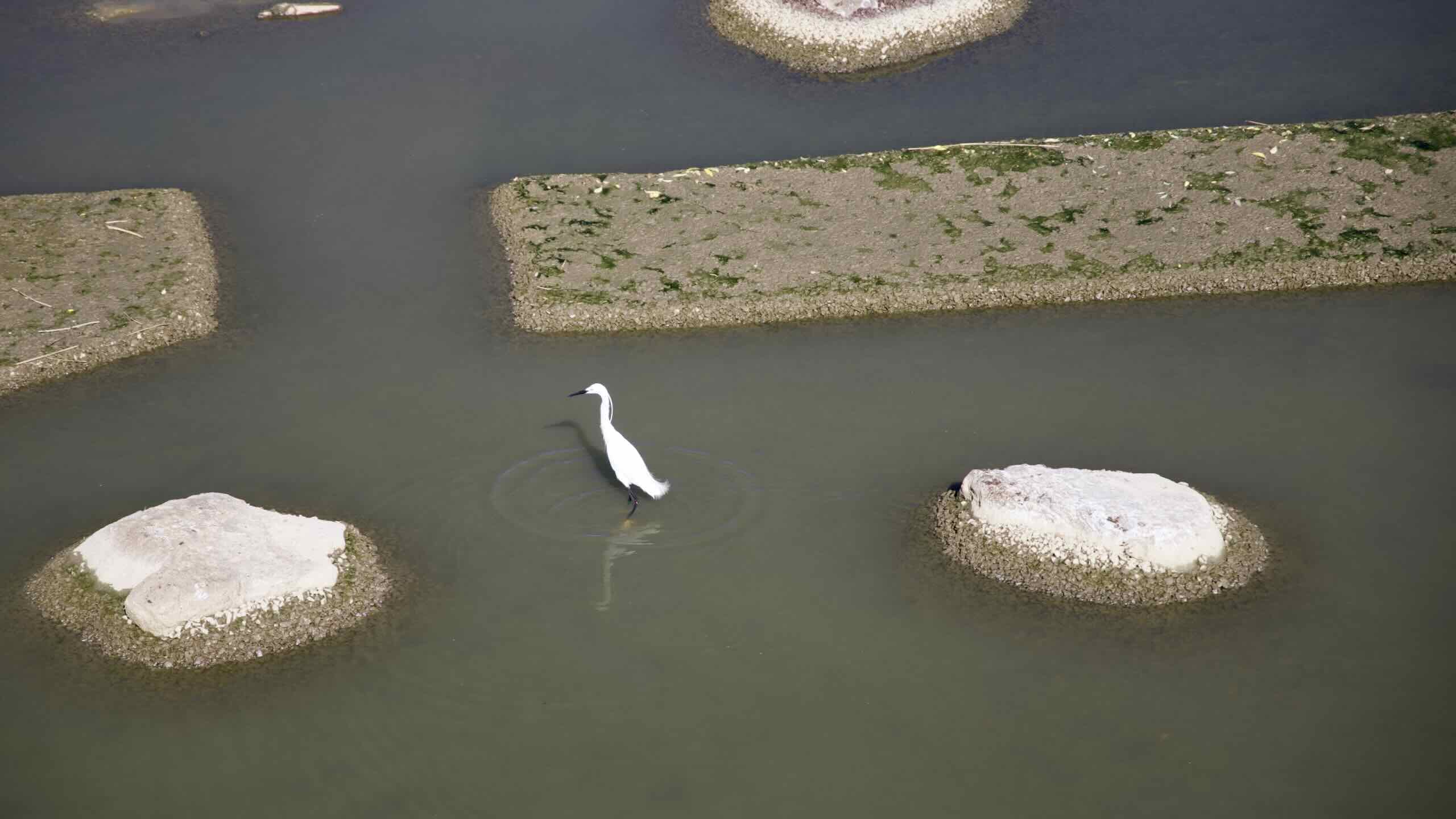
Each of these weirs’ unique designs reflects their area. For example, the oblong-shaped structures atop Ipo-bo symbolize the eggs of an egret, an important bird to the region.
Bike Paths, Ho!
The project tackled pollution, restored wetlands, and installed parks for families to appreciate Korea’s natural beauty.
And, oh yes, they built and connected 1,728 kilometers worth of bike paths along all of Korea’s four major rivers.
Wow! That’s a lot of bike path. Enough to let someone explore Korea by Bike.

The Han Today
Years of industrialization and major infrastructure projects tamed the Han River.
At one time a highway, a battle zone, a trade route, and a tool of the revenue services, now the river serves two primary purposes: recreation and a source of freshwater.
Recreation
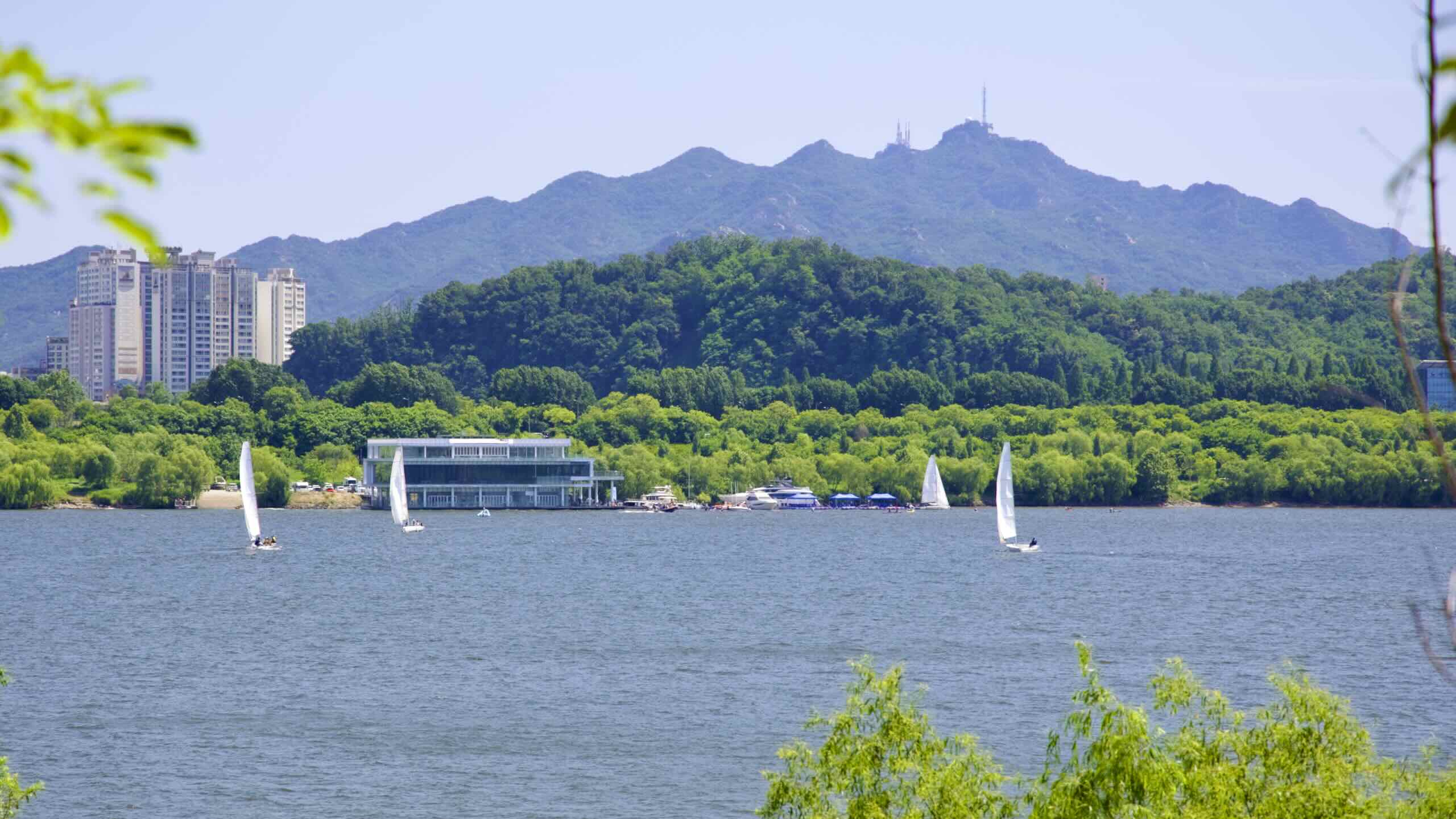
All along the Han River, from Seoul to Chungju, you’ll find recreational vehicles, from speedboats to kayaks.
In Seoul, except for Gangseo and Gwangnaru, every Hangang Park installed water recreation facilities.
Windsurfers flock to Ttukseom and Mangwon. Corporate retreaters rent kayaks and cross the river from Ichon to Banpo. And in Jamwon, weekend warriors scoot around the Han on rented motorboats, waterski, and yachts.
The cities outside Seoul also take advantage of the Han River.
The Hwangpo Boats (황포돛배) of Yeoju (여주) set sail daily, giving tourists a unique view of the river using recreated boats from the Joseon Dynasty.
Near Chungju, the Tangeum Lake International Rowing Regatta (탄금호 국제조정경기장) sits beside the Han. Besides hosting competitions and practices, the regatta’s rowing academy let’s families take a sleek rowboat out for a glide.

Drink the Han
The Han River is a major source of freshwater in Korea.
Farms feed their fields from the waters of the North and South Han. However, the government strictly regulates upstream development and waste management.
Why? Where do you think Seoul gets its drinking water? The Han River, of course.
In fact, the Han quenches the thirst of almost all the residents in the Seoul Capital Area (수도권), including Incheon (인천), and Gyeonggi Province (경기도). With a combined population of twenty-five (25) million, that means the Han flows through the guts of almost half of South Korea.
Han? No Trade
With direct access to Korea’s most populous city, why can’t you see an endless parade of ships queuing in and out of the Han River? Three letters: DMZ.
The mouth of the Han River, which flows into the Yellow (West) Sea, sits on the Demilitarized Zone (DMZ), the fraught border between North and South Korea. While the war has long been dormant, it hasn’t stopped. (There’s an armistice. But no peace treat.)Both corporations and the government, therefore, feel it’s safer to drop off cargo at Incheon Port (인천항) just west of Seoul. Why risk sending billions in goods through a war zone?


