Bike Incheon to Seoul

Seoul City icon
Start your Cross-Country biking adventure in Incheon, Seoul’s Sister City.

Welcome to the start of the Cross-Country Route.

Where are you? Incheon Metropolitan City (인천광역시; map) along the Yellow Sea. Behind you, the Ara West Sea Lock clogs the west end of the Gyeongin Ara Waterway.

Place your front tire on the marble Start Line embedded in the bike path (road view). It reads “Start 0 Meters / End 630,000 Meters.” That’s a long way to go.

Take a moment before you set off. Breath the sea air. Look around.

Quick Stats
Link button to Kakao Maps directions.
Directions
Google Maps Logo
Google Maps

Ara West Sea Lock

0 km (Ara Bike Path (South Side))
0%

Where am I? The Ara West Sea Lock. It’s the entry and exit point from the Yellow Sea into the Ara Waterway.

Where is it? Behind you. At the end of an access road (road view), you’ll come to a wide, square-shaped gulp of water held calm by a sea lock. This is the point where the Ara Waterway spills into the Yellow Sea.

Behind the square plot of water sits a fin-shaped control tower hangs. Below the tower, two rectangle locks. These water gates accept ships, then raise and lower them to the water level of the Ara Waterway or Yellow Sea.

Ara Waterway’s Eight Views

The city of Incheon designated eight scenic views (수향8경) along the Ara Waterway. West to East, beginning from the Ara West Sea Lock, they run:

What are they? We’ll explore more in depth below.

Can you read Korean? Click here for a detailed map of the Ara Waterway written in Hangul.

Gyeongin Passenger Terminal and Tower

Let’s continue to pan around the area. Glance to your left (road view). A swooped awning connects two metal knit buildings.

The nearest is the Gyeongin Ara Passenger Terminal (경인아라뱃길여객터미널; map). You can’t miss it. Its white rising beams resemble a ship’s sail. This is the 2nd View of the Ara Waterway’s eight scenic views.

Here visitors buy tickets to an amphibious bus that cruises up and down the Ara Waterway. Depending on weather, the bus operates every thirty minutes to an hour, 9:30 AM to 6 PM.

Just behind the terminal, sharing the same block, you’ll find the Gyeongin Port Integration Operation Center (경인항 통합운영센터; map), open 9 AM to 6 PM.

This general services building operates a convenience store, small museum, and a Bicycle Certification Center. More on that below.

Its lobby also provides access to the Ara Observation Tower (아라타워; map), a twenty-four-story tall lookout deck offering city and sea vistas.

While the tower is free, the cafe and restaurant charges for their steak dishes and sunset sights.

Jeongseojin Square and Sunset Bell

From the starting line, let’s keep scanning the horizon.

Glance left. On the corner of the near block, discover a house-sized white pebble with a bell-shaped hole cut through the middle. That’s the Sunset Bell (노을종; map).

Built with stones fished from the Yellow Sea, every evening the sun triggers a multimedia show of light and music as the heavenly sky ball descends through the bell-shaped hole. As you’d expect, this spot brings lovers and proposals.

The Sunset Bell is just one feature of Jeongseojin Square (정서진광장; map). Behind the sculpture, surrounded by a recreational pond, sits Arabit Island (아라빛섬; map). In summer, patrons cross a wooden bridge above paddle boats. Two towering windmills above cast silent, swooping shadows.

(Sunset Square mirrors locales along the east coast where early risers visit on New Year’s Day to watch the year’s first sunrise over Korea. Famous sunrise spots include Yeongdeok Sunrise Park, Mangyang Pavilion, and Jeongdongjin.)

Start Gate

Look in front of you (road view). A Start Gate arching over the bike path reads “서울 (Seoul) 21 km” and “부산 (Busan) 633 km.”

In the bottom corner, K-water plastered their logo. This public/private corporation manages Korea’s water resources. Working with local and federal agencies, they also built and maintain much of Korea’s cycling infrastructure.

Yellow Sea and Yeongjong Island

Just to your right, you’ll find the Yellow Sea (황해; map; West Sea), the first of eight views — scenic spots or landmarks — along the Ara Waterway.

If you arrive at low tide, you’ll spot a swath of muddy underbelly and turtle shell islands.

The sea gets its name from the winds that swipe sand from China’s Gobi Desert and sprinkle the yellow silt over the waves.

Across the Yellow Sea, Yeongjong Bridge (영종대교; map) hops to Yeongjong Island (영종도; map) where Incheon International Airport, Korea’s busiest, buzzes.

The Yellow Sea Birds

The Yellow Sea. More than a sea. When water recedes, it becomes the world’s largest tidal mudflats. It may look like an endless expanse of bland, brown goop. But it teams with life, facilitating an awe-inspiring display of endurance and perseverance.

Come spring and fall, this muddy underbelly becomes a major stop for migratory birds on the East Asian–Australasian Flyway. Tens of millions of birds fly non-stop as much as 9,600 kilometers (6,000 miles), from as far away as Australia and New Zealand.

Once they reach the Yellow Sea, what do these max-out creatures do? They land. Then eat, shoving their beaks into the sticky mud, rooting around for the worms, mollusks, and shrimp wriggling just underneath. 

During the migratory season, waves of birds pause for a few days and gorge their shrunken organs. They double their body weight to prepare for the next 8,000 kilometers (5,000 miles) leg of their journey up to the thawing tundras of Siberia and Alaska.

From the starting point, near the of the Ara West Sea Lock, if you catch a low tide you might spot a spoon-billed sandpiper grabbing a tiny crab from the dark, dank dredges of the Yellow Sea mudflats. Or a red-crowned crane resting before continuing its annual migration marathon.

Ara West Sea Lock Certification Center

One last sight to point out (road view) before you hit the path. The most important sight. A little red phone booth just on your right. The Ara West Sea Lock Certification Center.

Certification Center? If you don’t already know, Korea adorns their thousand-plus kilometer network of bike paths with red phone booths (a.k.a., “certification centers”)

Inside each booth sits a stamp to mark your Bike Passport. Fill up your passport and win awards.

Get Certified

Inside the Ara West Sea Lock Certification Center in Incheon, South Korea.
Find a stamp to stamp your bike passport inside the Ara West Sea Lock Certification Center.

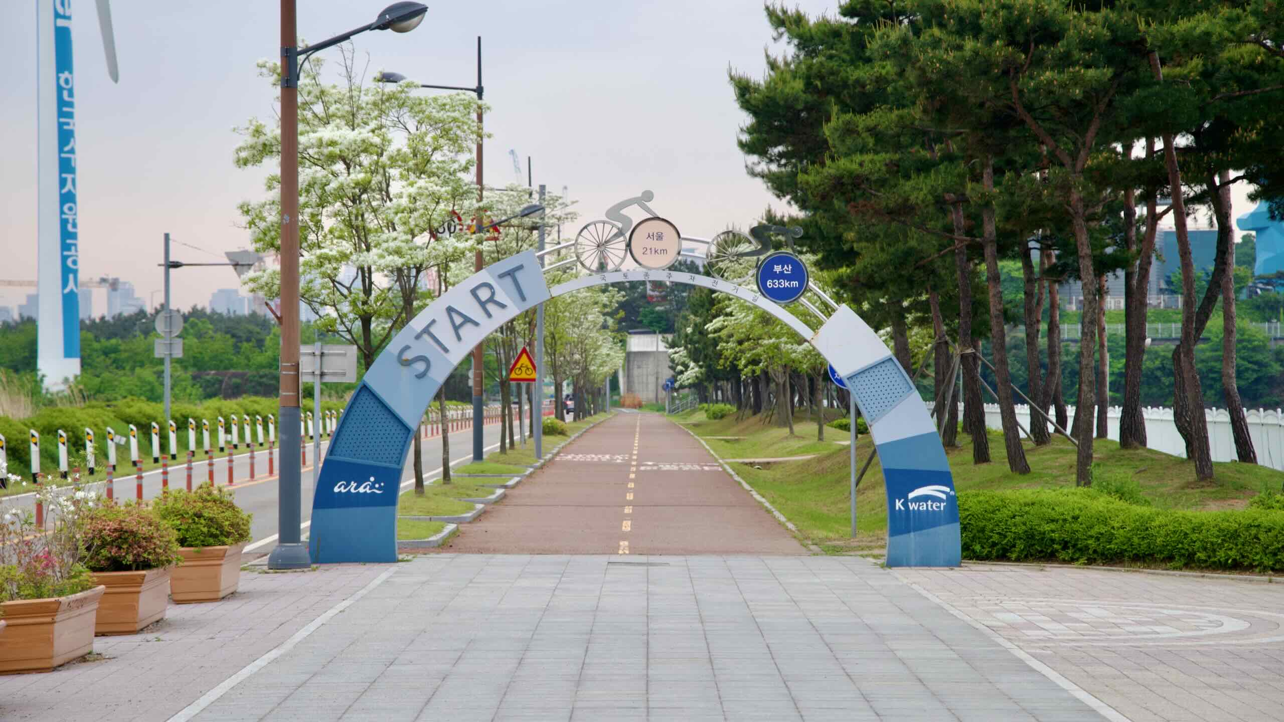
How does it work? Visit the Gyeongin Port Integration Operation Center (경인항 통합운영센터; map) between 9:30 AM and 5:30 PM and buy a Bike Passport.

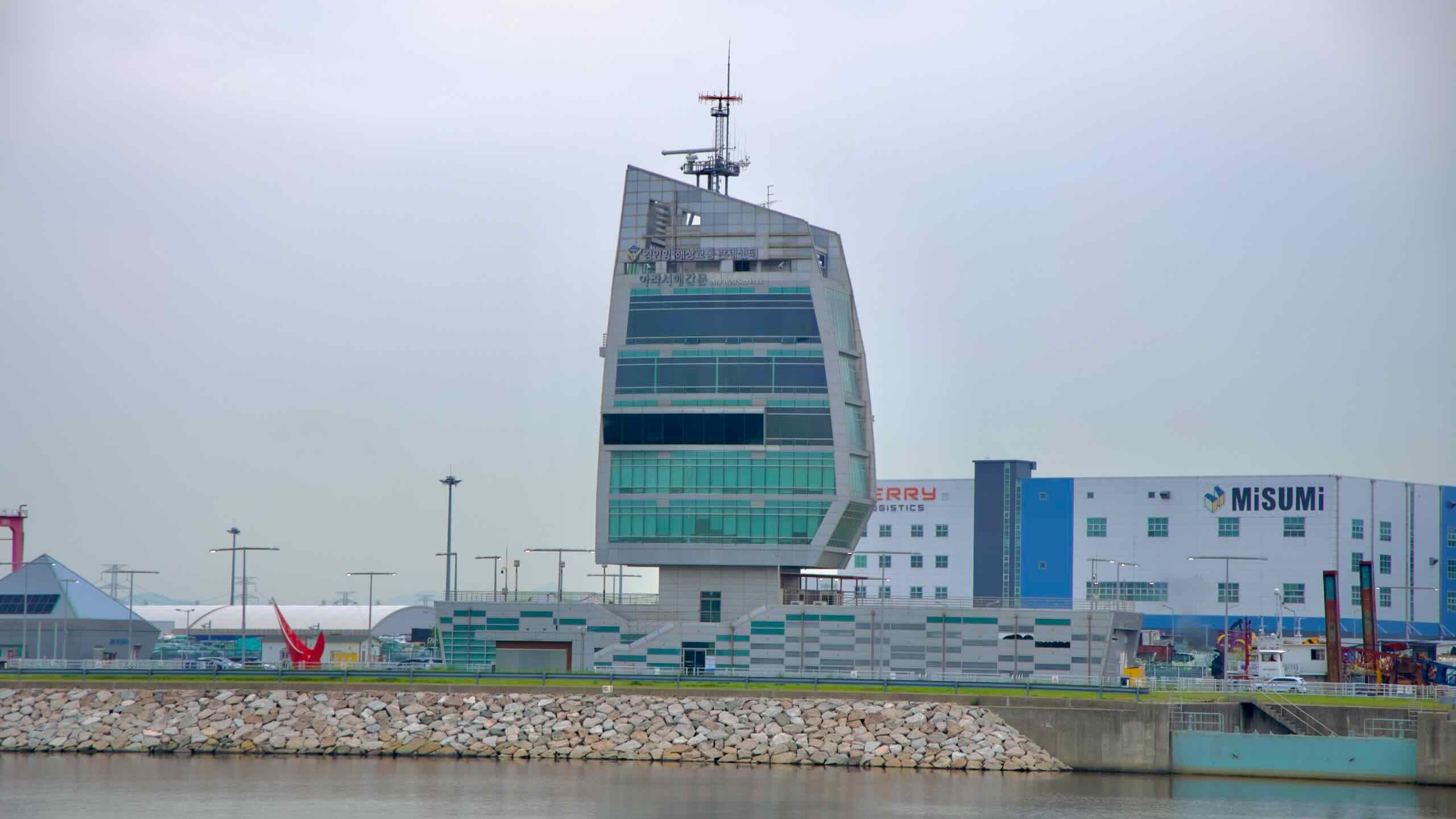
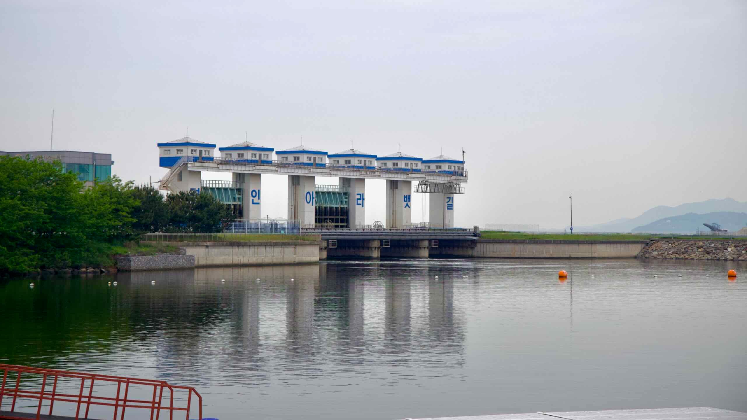
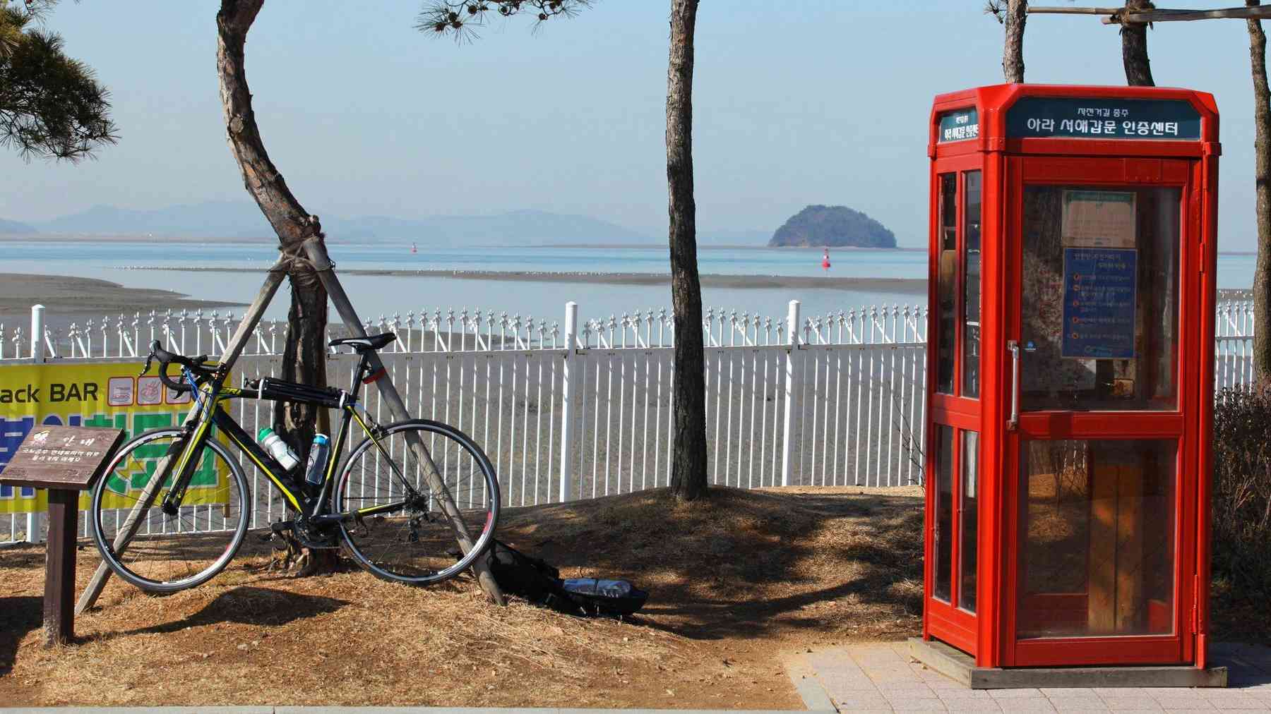
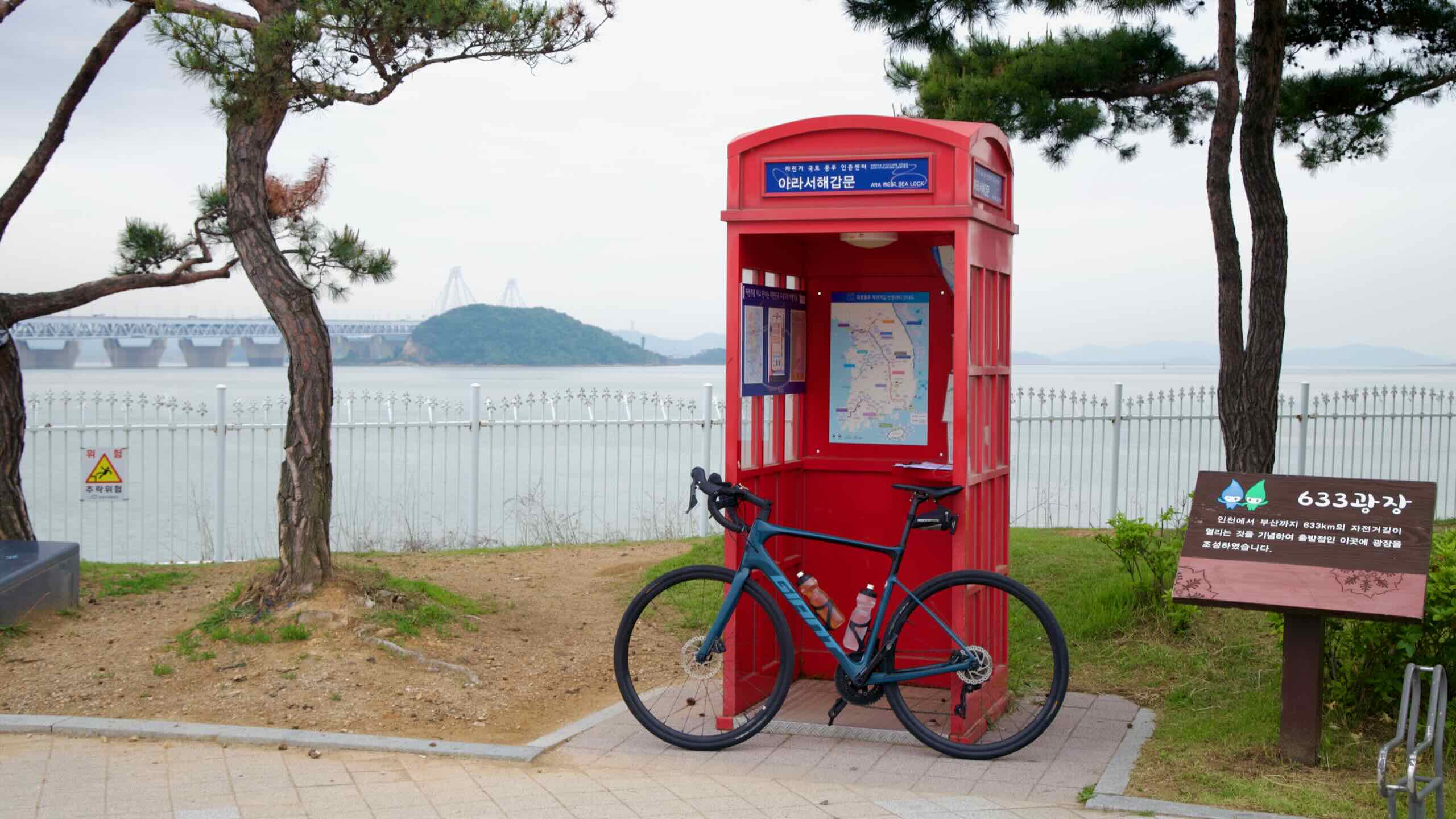
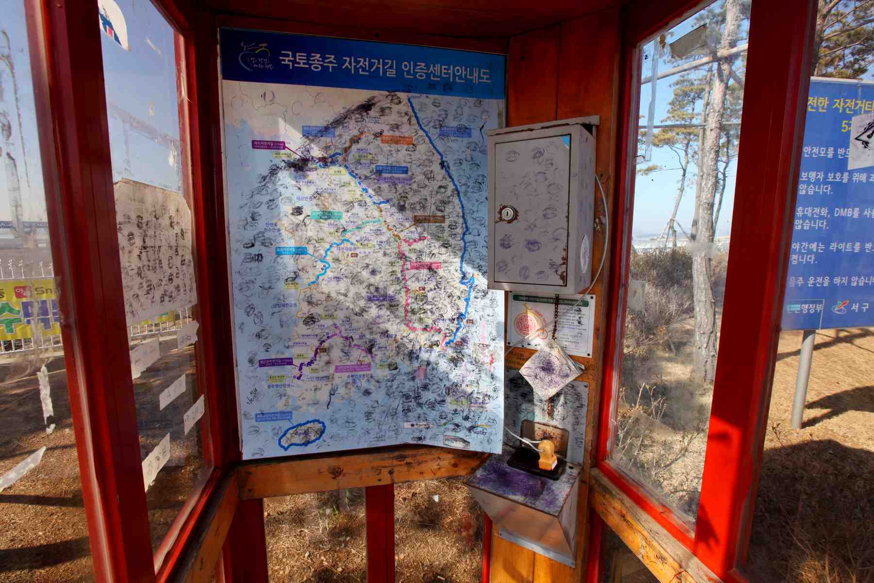
Head back to the red booth near the start line. Step inside. Turn your Bike Passport to page 13 and find an empty dot labeled “아라서해갑문 인증센터” (Ara West Sea Lock). Dab the stamp on the ink pad and press down on your passport. Only eight-six more stamps to go!

아라서해갑문
인증센터
0 km (0 mi) from start
Google Maps Logo
Google
Link button to Kakao Maps directions.
Kakao
Ara West Sea Lock certification center checkpoint stamp for Korea's Bicycle Certification system.

Cross the Start Line

Ink dry? Then let’s get down to business.

Start your cycle tracker app. Double check your water bottles. Tie down the loose bits. Let’s hit the bike path. 

Push past the Starting Line and under the gate.

Oh no! A hundred meters down the road, the bike path dead ends.

Glance up at the blue sign at the end of the path. Its arrow points leftward across the access road. Hop over the street (road view) and onto the path with an overhead garden tunnel.

The path will take you by Arabit Island (아라빛섬; map) and under a pair of sweeping windmills.

Become a Korea by Bike member and get exclusive and ad-free content.

Subscribe for updates.

Day-Trip Membership — 3 months

Touring Membership — 6 months

Endurance Membership – 2 years

Grand Slam Membership — Lifetime