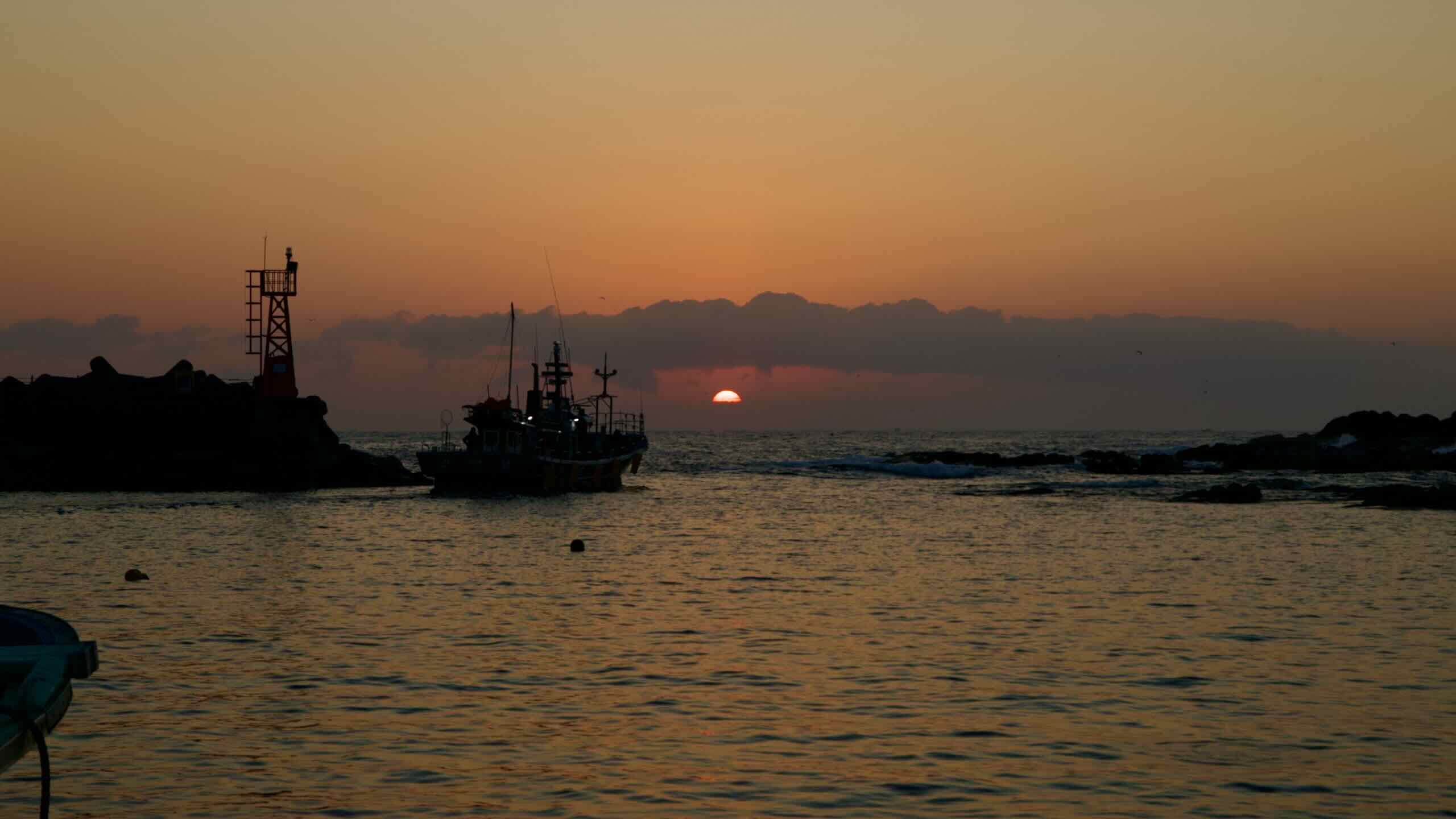
Begin your journey where you completed the Yangyang & Sokcho cycling section, just outside of Jangsa Port. Climb a 20-meter hill past the stone marker separating Sokcho City and Goseong County, then descend to the Yongchon Stream (map).
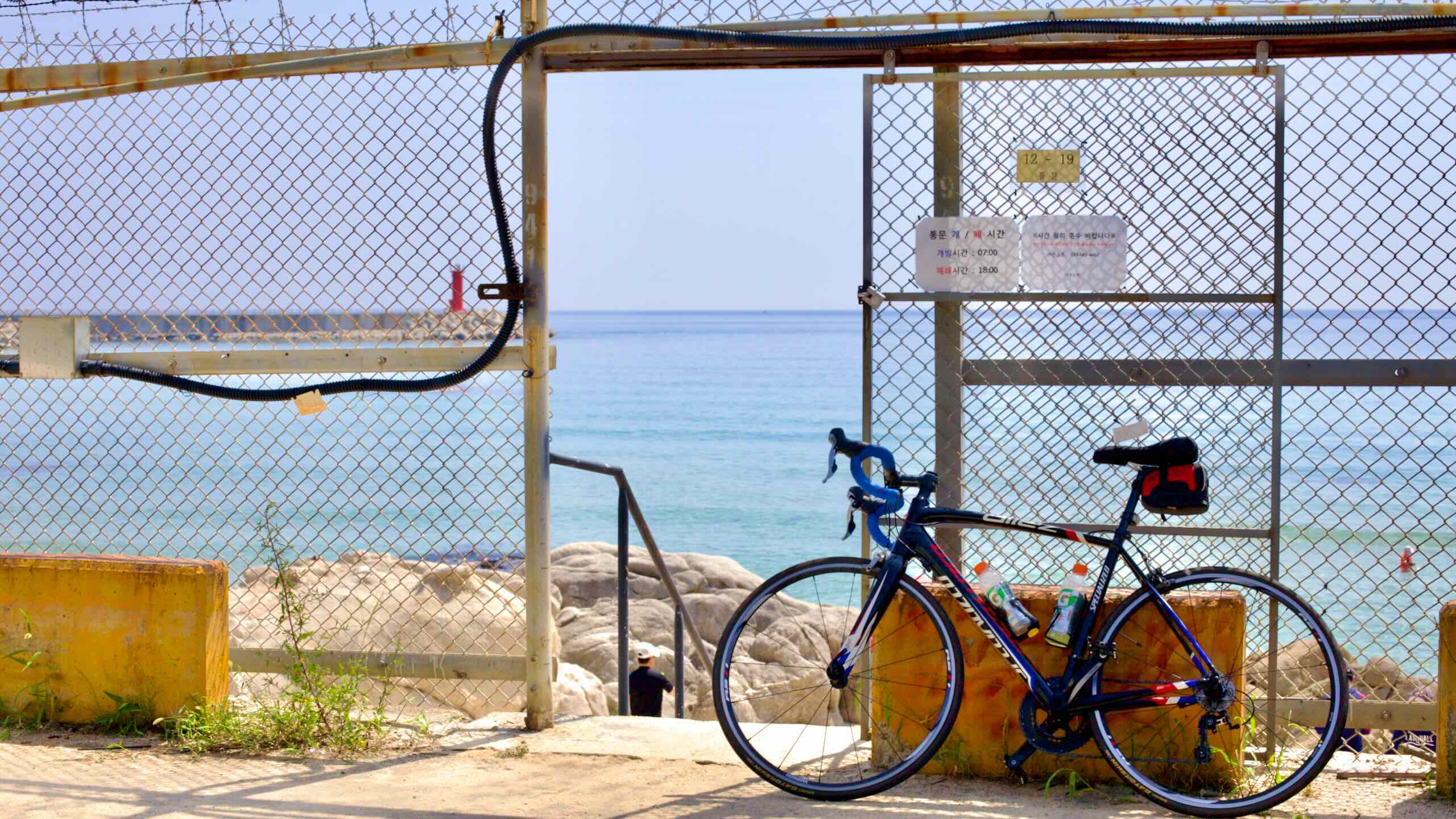
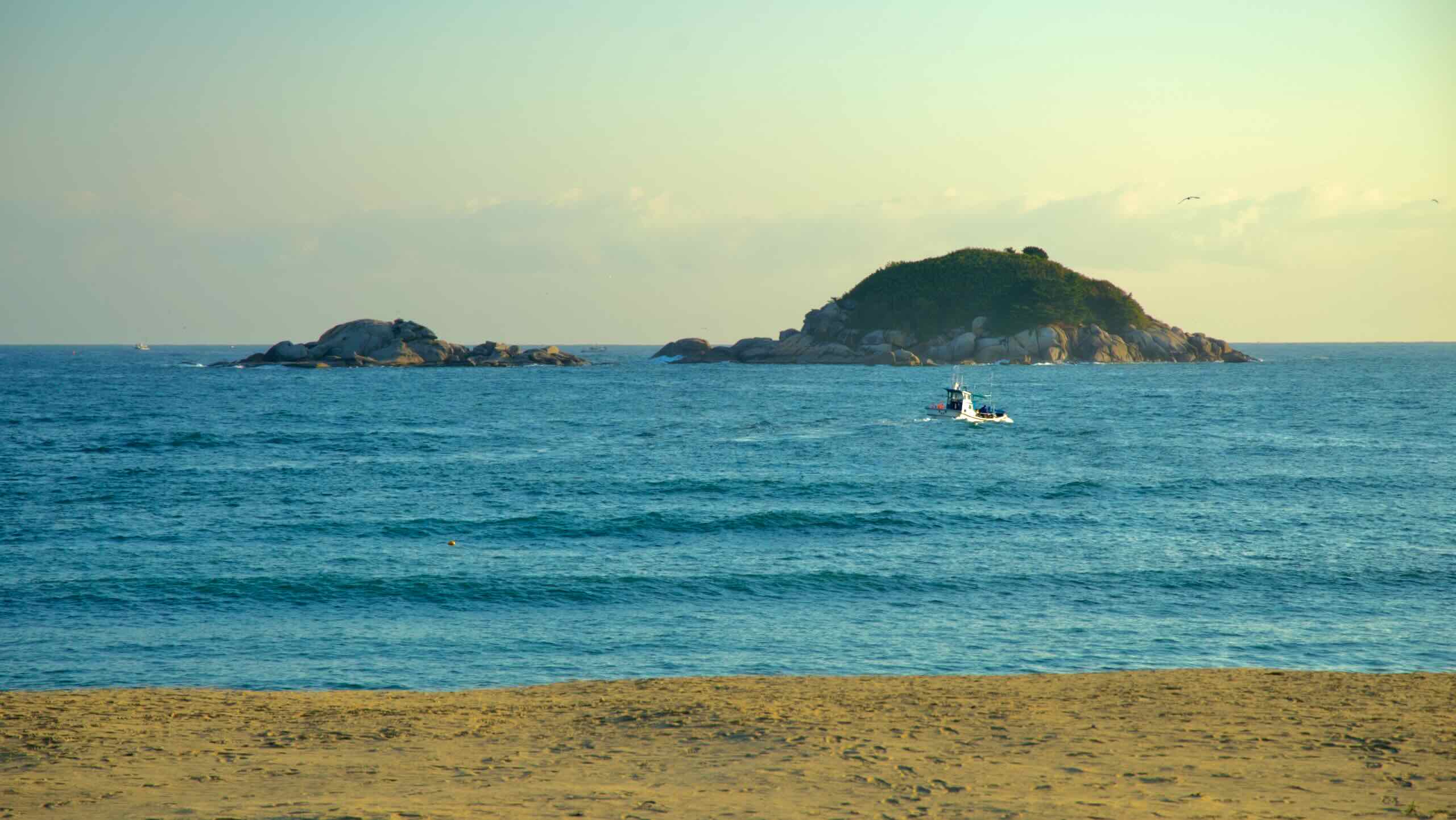
After crossing Yongchon Bridge (map), turn right and follow the waterway to Bongpo Beach (봉포해변; map), Goseong County’s southernmost beach (road view).
Opened in 1990, Bongpo Beach is one of the county’s busier beaches, attracting visitors from nearby Sokcho City. Adjacent to Bongpo Port, it features white sandy shores and shallow waters suitable for swimmers of all ages. Amenities include bathrooms and equipment rental (tubes and parasols).
During summer, the beach fills with visitors. Amateur fishers cast lines from the port’s breakwaters, and snorkelers explore underwater life.
Kensington Resort (켄싱턴리조트; map) takes up a big chunk of the seafront. It offers a wooden promenade and beachfront cabanas, with Cheonggan Jeongkondo Campground (청간정콘도; map) providing caravans on the beach’s southern end.
Just off the Bongpo Beach’s shore lies Jukdo Island (죽도; map; Jukdo). Named for the bamboo (juk) covering it, this uninhabited island provides a picturesque backdrop for beachgoers.
At the north end of Bongpo Beach, you’ll find Bongpo Village Sea Wind Park (봉포리 해풍공원; map). The park features a fountain, some shops offering refreshments, and a rest stamp booth in its northeastern corner. Here, get your Bongpo Beach Certification Center stamp (봉포해변 인증센터; map), the first in Goseong County.
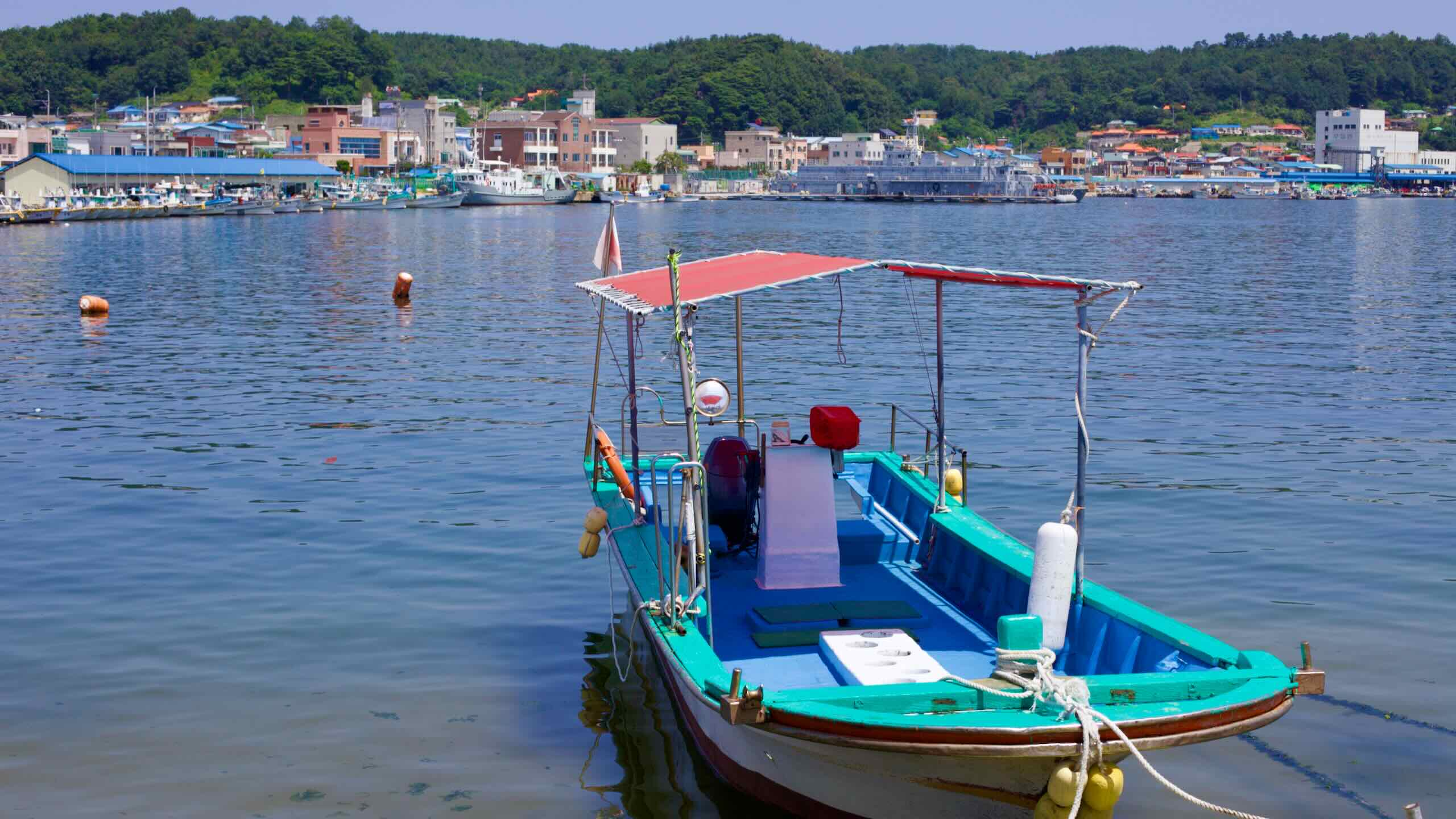
From Bongpo Beach, glide into Bongpo Port (봉포항; map). This small port, hosting around 50 ships, serves as the main source of income for the fishers of Bongpo Village. Near the start of its breakwater, you’ll find the Bongpo Port Live Fish Center (봉포항활어회센타; map) along with other local restaurants, offering fresh seafood at reasonable prices.
Continue on up the coast and discover seaside restaurants, accommodations, and towering apartments packed along the bustling roads (road view) of Cheonjin Beach (천진해수욕장; map).
Along with Bongpo Beach, Cheonjin Beach is a famous scenic spot known for clean sands and rocky outcrops. Though Cheonjin Port doesn’t have facilities to dock boats, its breakwater smoothes out the East Sea’s waves, making swimming easier at Cheonjin Beach.
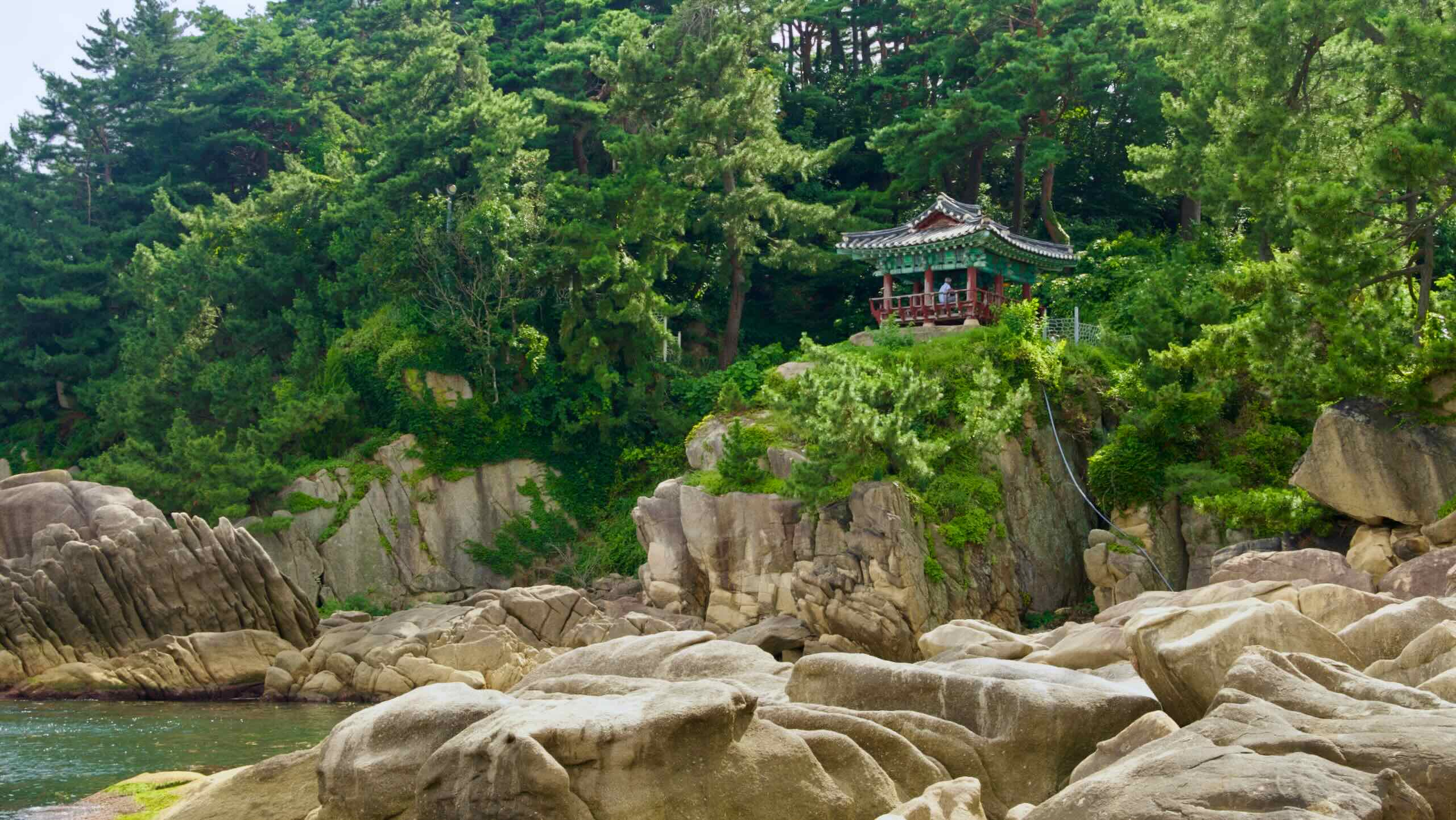
Want to see Cheonjin Port’s most famous tourist landmark? Curl around the top of the port and turn right between houses (road view). As you navigate raised boardwalks over the marshlands around Cheonggan Stream (천진천; map) as it splits in two and spills into the East Sea (aerial view), look up to the top of a hill overlooking the stream. Find Cheonggan Pavilion (road view), the first Gangwon Bike Path highlight on the Goseong cycling section
After crossing Cheonggan Bridge (청간교; map), the turn into the pavilion’s elongated parking lot and find the pavilion’s entrance (road view).
And the pavilion is Gangwon State’s Tangible Cultural Property No. 32.
Over its more than 500-year history, Cheonggan Pavilion has been a retreat for painters, scholars, and esteemed figures who visited to write, paint, or simply enjoy the tranquil surroundings.
Historical records don’t specify the date which Cheonggan Pavilion saw its first sunrise. However, records indicate it was repaired in 1520. So its origin probably dates a bit deeper into the Joseon Dynasty (1392 ~ 1897).
Throughout the pavilion’s life, it’s felt the blunt forces of Korea’s wartime history.
In 1884, the Gapsin Coup — when Japan fomented an insurrection that failed to overthrow the Joseon Court — incinerated Cheonggan Pavilion, leaving only its 12 stone pillars.
After the local government rebuilt Cheonggan Pavilion in 1928, fighting during the Korean War (1950 ~ 53) again razed the pavilion to the ground.
In 1953, President Syngman Rhee ordered workers to rebuild Cheonggan Pavilion. To commemorate its rebirth, he wrote one of two plaques that hang from the pavilion’s rafters.
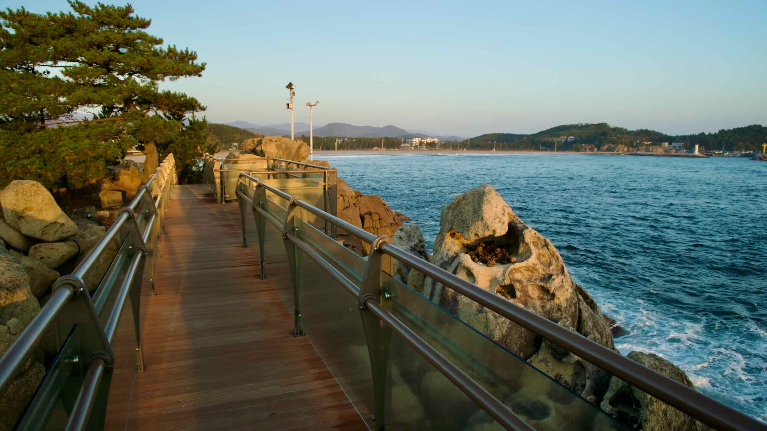
From Cheonggan Pavilion’s parking, cycle a raised boardwalk around Cheonggan Pavilion’s tree-covered hill (road view), passing over Cheonggan Pavilion Beach (청간정해수욕장; map).
Ride through Cheonggan Beach (청간해변; map), a sandy stretch lined with places to eat and sleep, until you meet the breakwaters of Ayajin Port (아야진항; map).
Once named Daeyajin, during Japan’s occupation of Korea, Japanese officials changed its name to Ayajin because they could not pronounce its name.
Ayajin Port has a unique shape. It features two separate harbors enclosed by two breakwaters and divided by a narrow strip of land protruding from the mainland. Fishing boats dock within these harbors. At the tip of the protruding land, you’ll find a small courtyard with awnings where you can rest and view the port’s rotund red and white lighthouses.
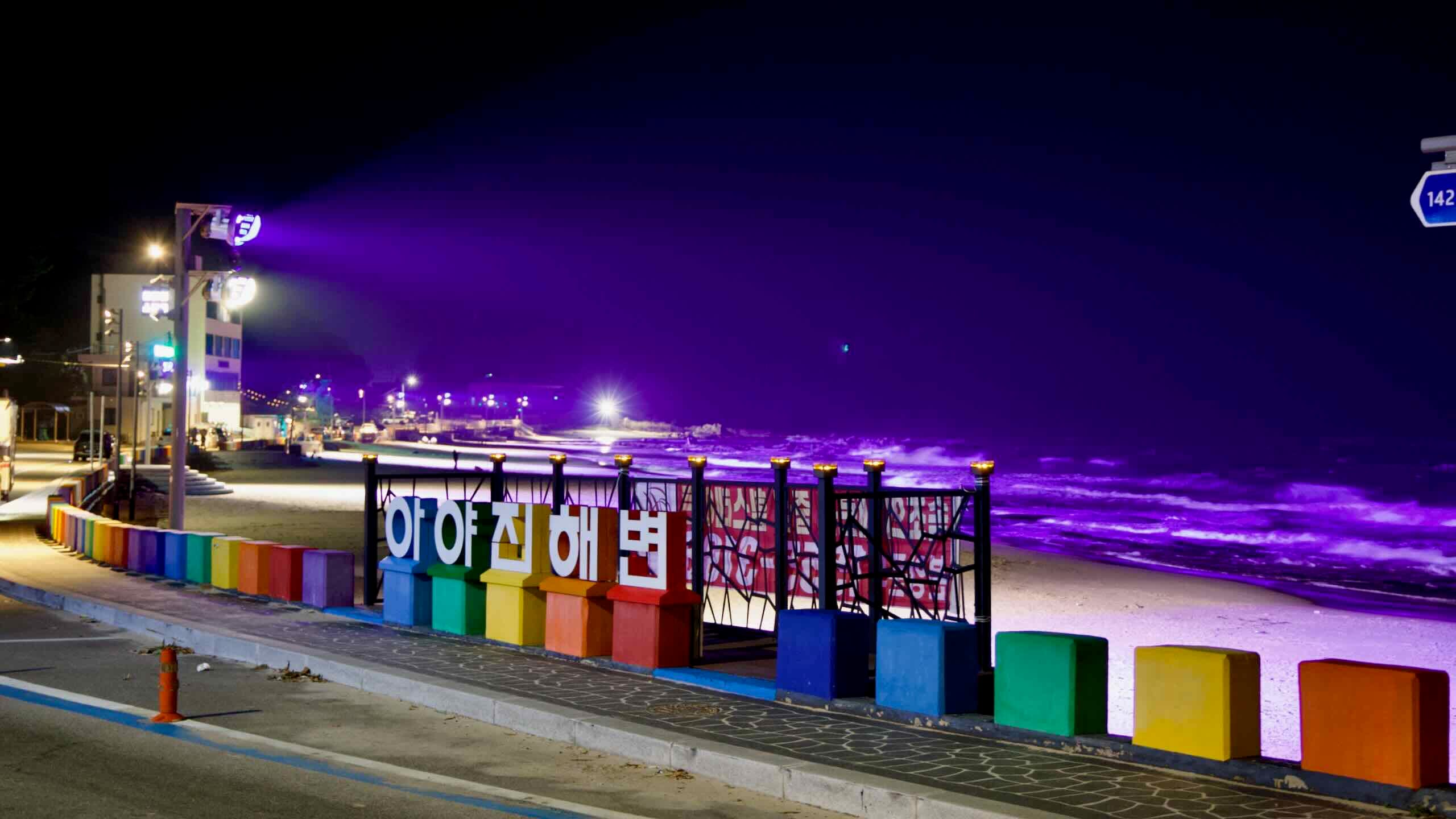
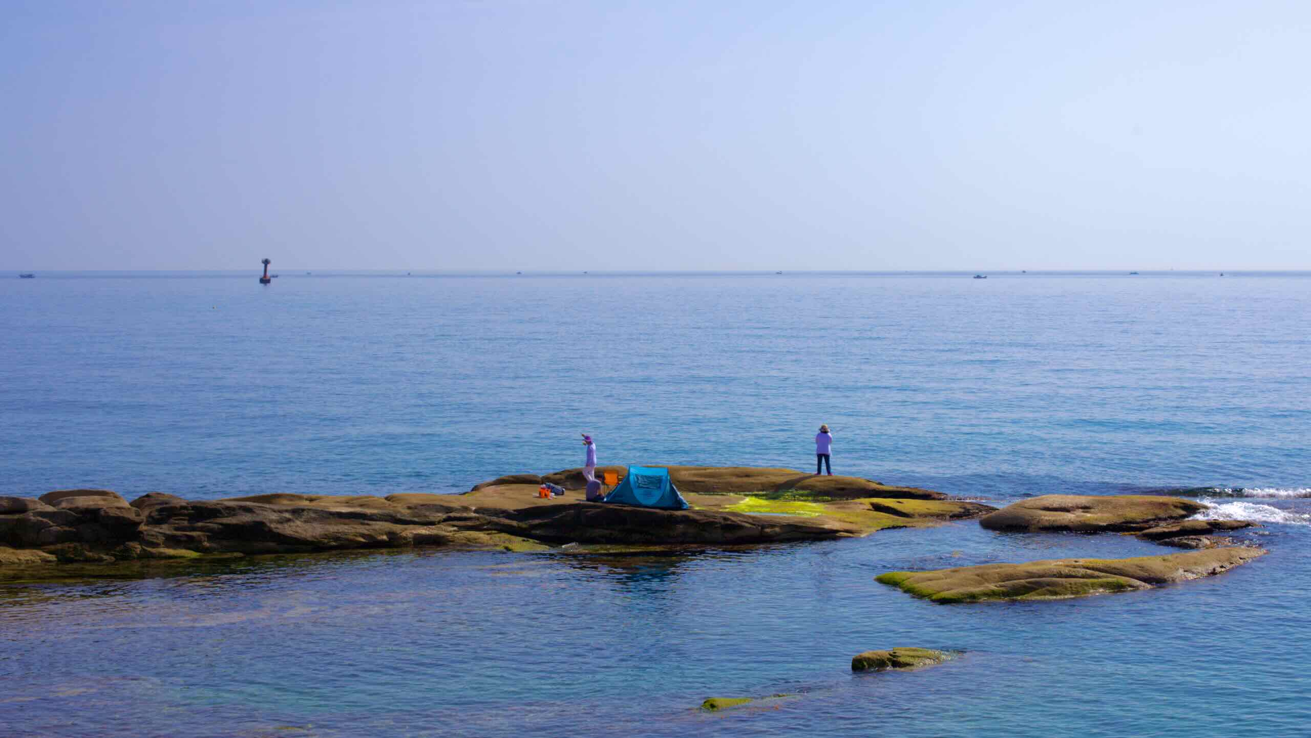
Follow the blue-lined roads through the crowded harbor and spill out onto Ayajin Beach (아야진해변; map). Lined with pensions (map) and cafes (map), the beach combines sandy shores for swimming in the south with a northern section filled with smooth rocks, ideal for snorkeling, fishing, and exploration.
The tourist-friendly beach also features a rainbow road, an observation deck that extends over the water at its southern end (road view), and colorful lights that bathe the sand and rocks at night (road view).
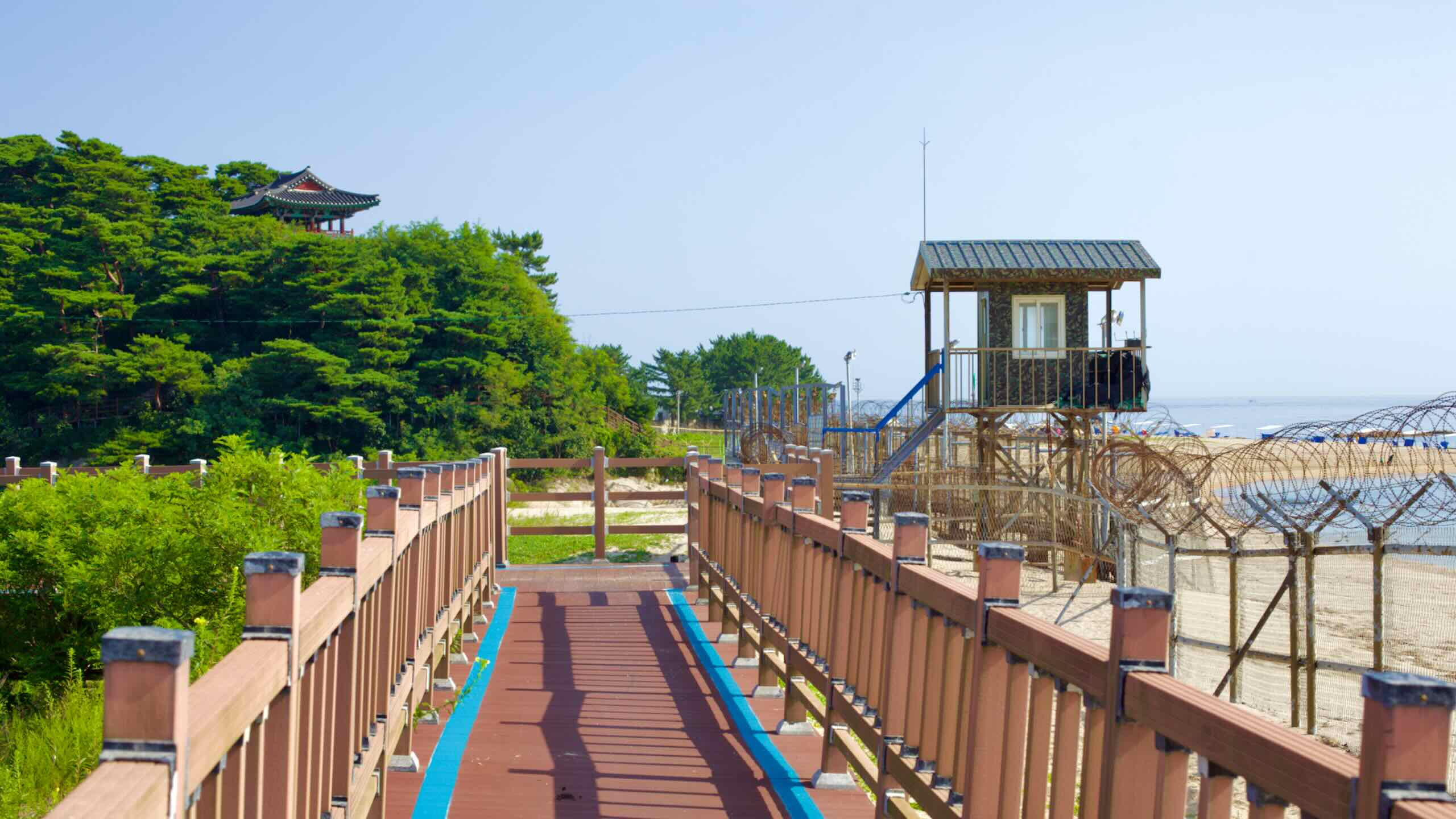
Just north of Ayajin Beach, you’ll encounter barbed wire fencing as you head inland and ascend a 15-meter hill. Descend a small backroad to a sandy beach bordered by pensions (map). Wrap around a green coastal hill until you reach Gyoam Port (교암항; map; directions).
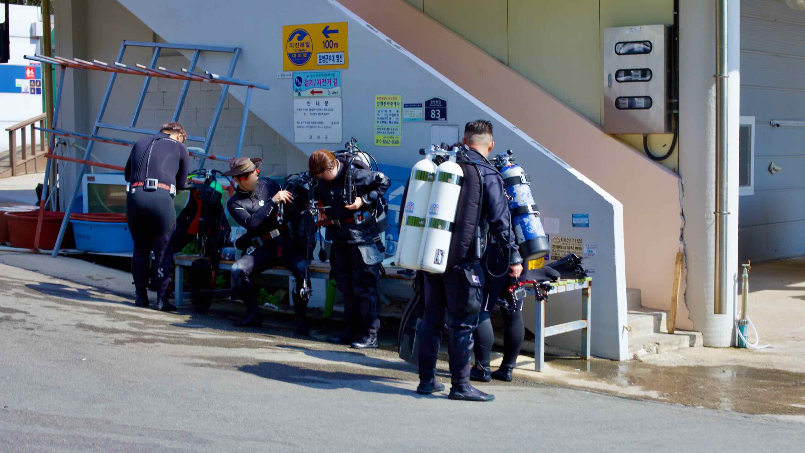
Gyoam Port is a tiny harbor featuring small houses facing the sea and breakwaters protecting a modest number of fishing boats that supply local seafood restaurants. It also offers a contemporary touch with the modern Bbaejangi Dive Resort (베짱이다이브리조트; map) at the bottom of the harbor, which includes a café and a scuba diving rental shop.
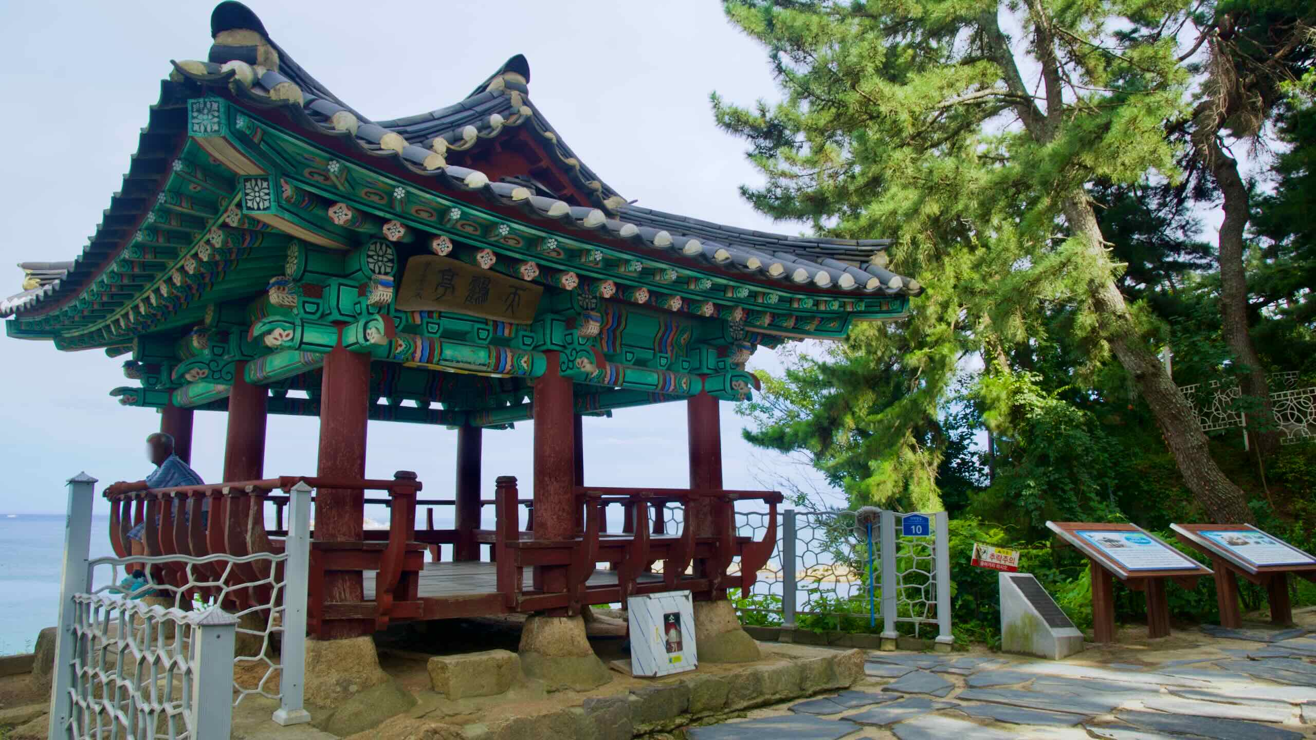
Gyoam Port’s most notable feature lies on the green coastal hill just south of the port. On the hill’s north side, find a set of stairs (road view) leading up to Cheonhak Pavilion (천학정; map).
One of the Eight Views of Goseong (고성8경), Cheonhak Pavilion is smaller and less known than Cheonggan Pavilion, which is 3 kilometers to the south. However, many visitors find the views from Cheonhak Pavilion atop its sheer cliff, looking down at waves crashing against rugged boulders below, to be even more impressive.
Built by local leaders in 1931, the one-story pavilion features a unique octagonal roof with double eaves and has two bays at the front and sides. A signboard hanging from its rafters holds dedications and poems.
Surrounded by centuries-old pine trees, Cheonhak Pavilion is a well-known spot to catch the sunrise over the East Sea. Visitors can also glimpse the uninhabited, rocky Gado Island (가도; map) to the southeast.
Depart northward from Gyoam Port and ride along Gyoam Beach (교암해변; map) until you skim the outskirts of Muam Port (문암항; map) less than a kilometer later. Muam Port is a seaside settlement lost in time, with seafood restaurants huddled around a collection of weathered fishing vessels.
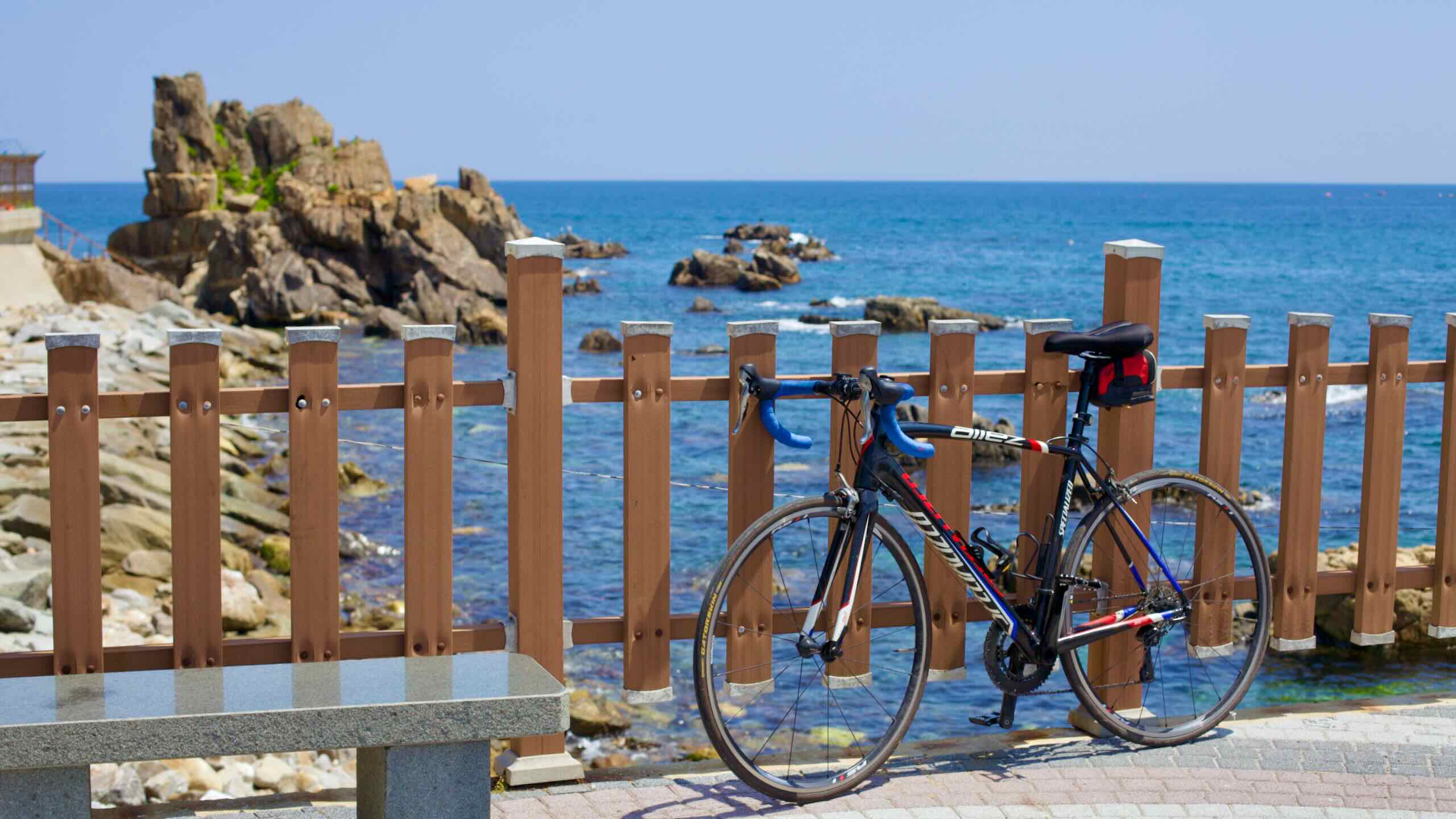
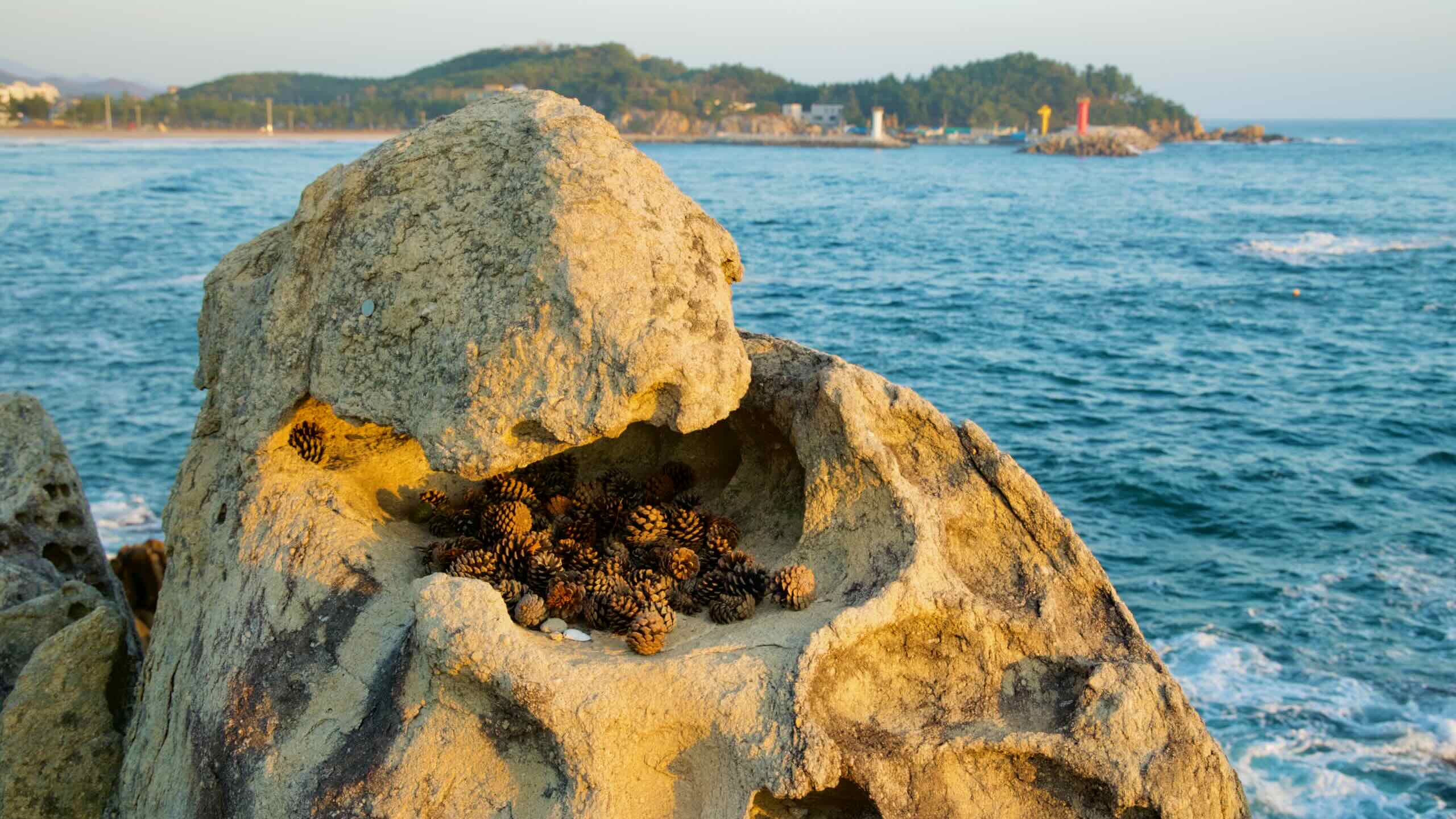
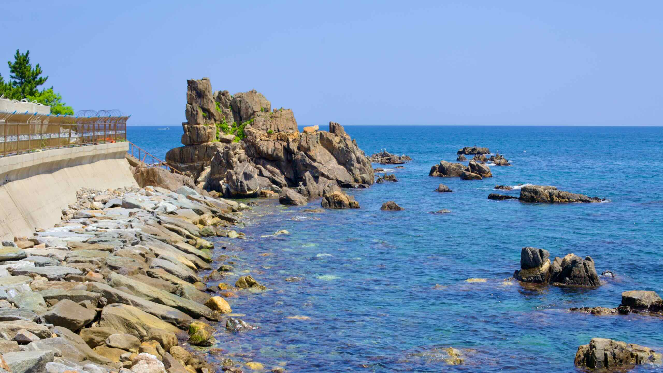
Like Gyoam Port, Muam Port also holds a secret gem. Travel to its north end and discover Neungpadae (능파대; map), a unique rock formation that forms the harbor’s backbone.
Neungpadae, designated as a National Geopark, was originally an island. Over centuries, Munam Stream (map) spilled into the East Sea, depositing silt that connected Neungpadae to the mainland.
The name “Neungpa” translates to “beautiful waves,” describing the sea crashing into the countless crevices and holes covering the dark coastal rocks.
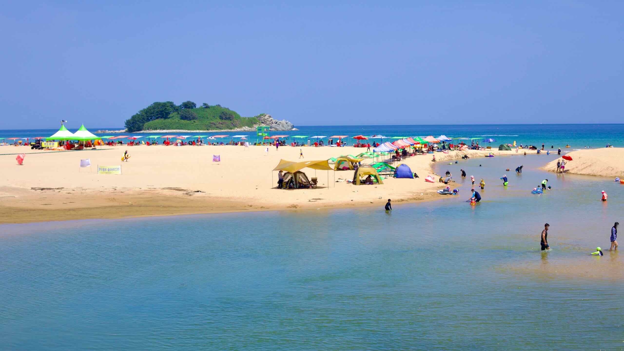
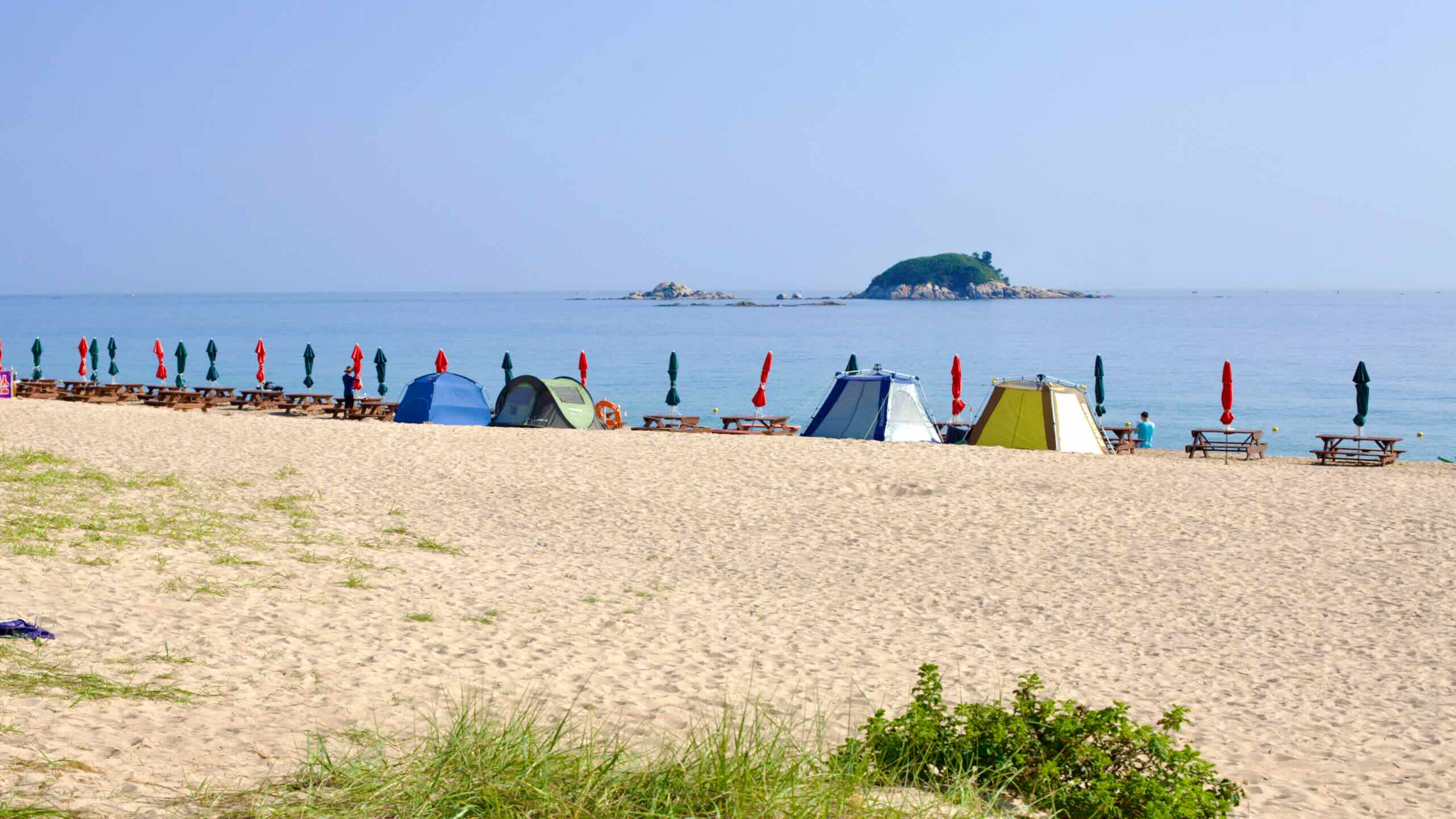
Continue up the coast to Baekdo Beach (백도해수욕장; map). This 300-meter beach offers a thick pine forest, a view of the small Baekdo Island (백도; map), and the Baekdo Beach Auto Camping Site (백도해수욕장오토캠핑장; map). The campsite has 74 caravan sites occupying much of the beach area.
North of the beach, pass by Baekdo Port (백도항; map). While the cycling route doesn’t enter the harbor, you can take an 800-meter detour to discover large boulders and a green hill with sheer cliffs surrounding the secluded harbor.
After Baekdo, arrive at Jajakdo Beach (자작도해수욕장; map), which has a campground and several pensions.
Sampo Beach is 800 meters long and features pink sea thrift flowers and a lush pine forest. A string of small rocky islands off its shores, known as the “Train Rocks,” attracts fishers, snorkelers, and scuba divers who explore their underwater habitats.
In the summer, festivals take place on Sampo’s shores, including the “Midnight Picnic Festival,” where bands and DJs perform. Nearby surf shops (map) offer training and board rentals, similar to many beaches on Korea’s northeast coast.
At the top of the beach, cross over a small stream outside of Oh-ho Port. On the north side of the bridge, you’ll find a fork in the road (road view).
The Right Path (straight) shortens the Gangwon Bike Path. It travels along the coastal side of Songji Lake, passing notable features like Seonang Rock and the Songji Lake Observation Tower (directions; 2.7 km).
Pedal straight into Oh-ho Port (오호항; map). The port’s name, “Oh-ho,” translates to “Five Pools,” referencing the area’s five tidal inlets.
This small harbor, known for its clear sea waters, has become a site for deep-sea ventures by commercial companies and the Marine Deep Water Research Center (해양심층수연구센터; map). A year-round fishing program allows visitors to experience flounder and traditional net saury fishing.
On the hill north of Oh-ho Port, a walking trail accessible during designated hours leads to a lighthouse with an observation deck.
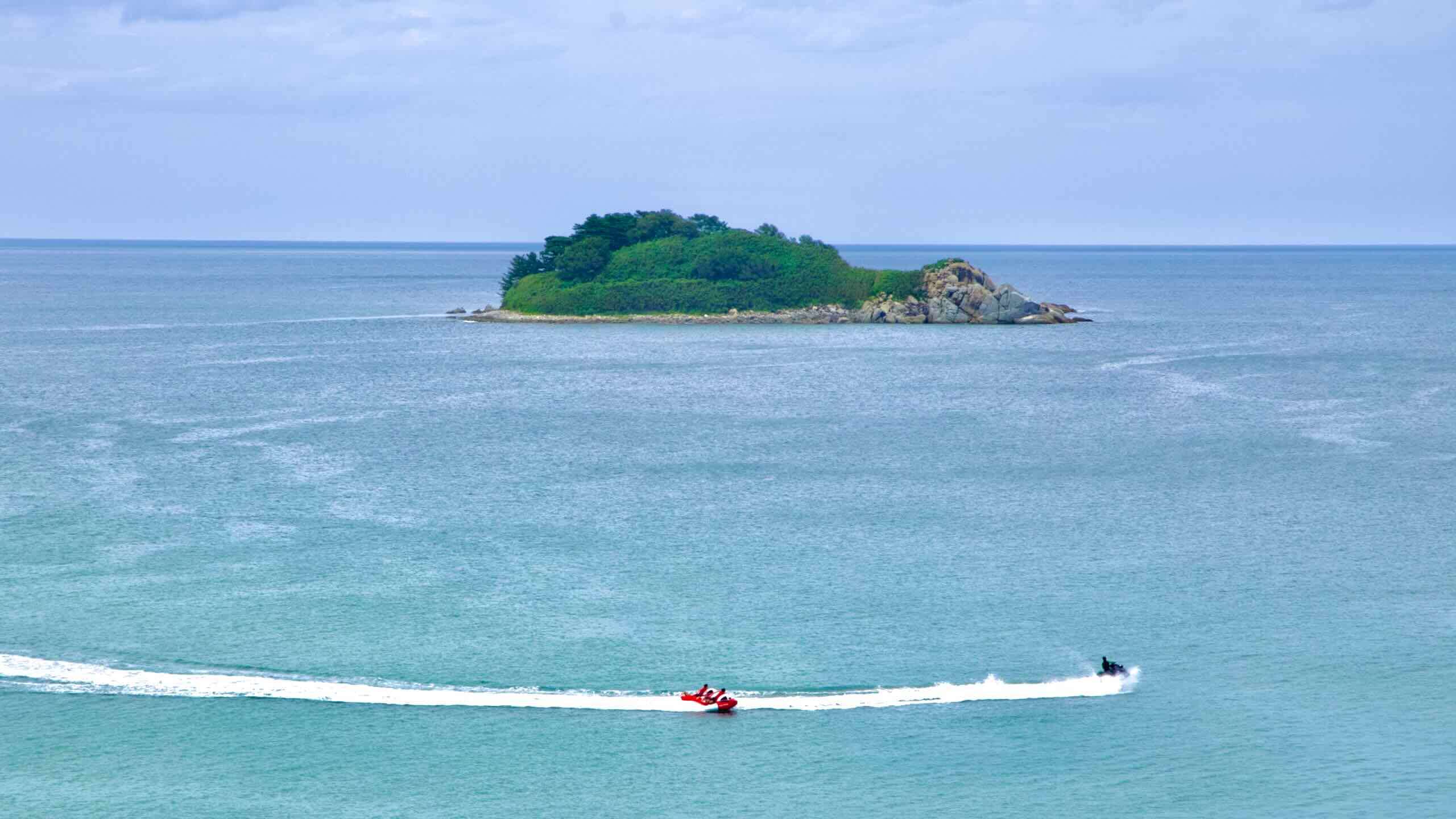
North of Oh-ho Port lies Songji Lake Beach (송지호해수욕장; map), a well-known beach in Goseong County. Stretching 2 kilometers, this beach has clear waters and shallow depths. It offers views of Jukdo Island (map), located 300 meters offshore. Jukdo is recognized for its rock formations and bamboo groves.
The beach is named after the nearby Songji Lake, designated a national tourist site due to its ecological significance.
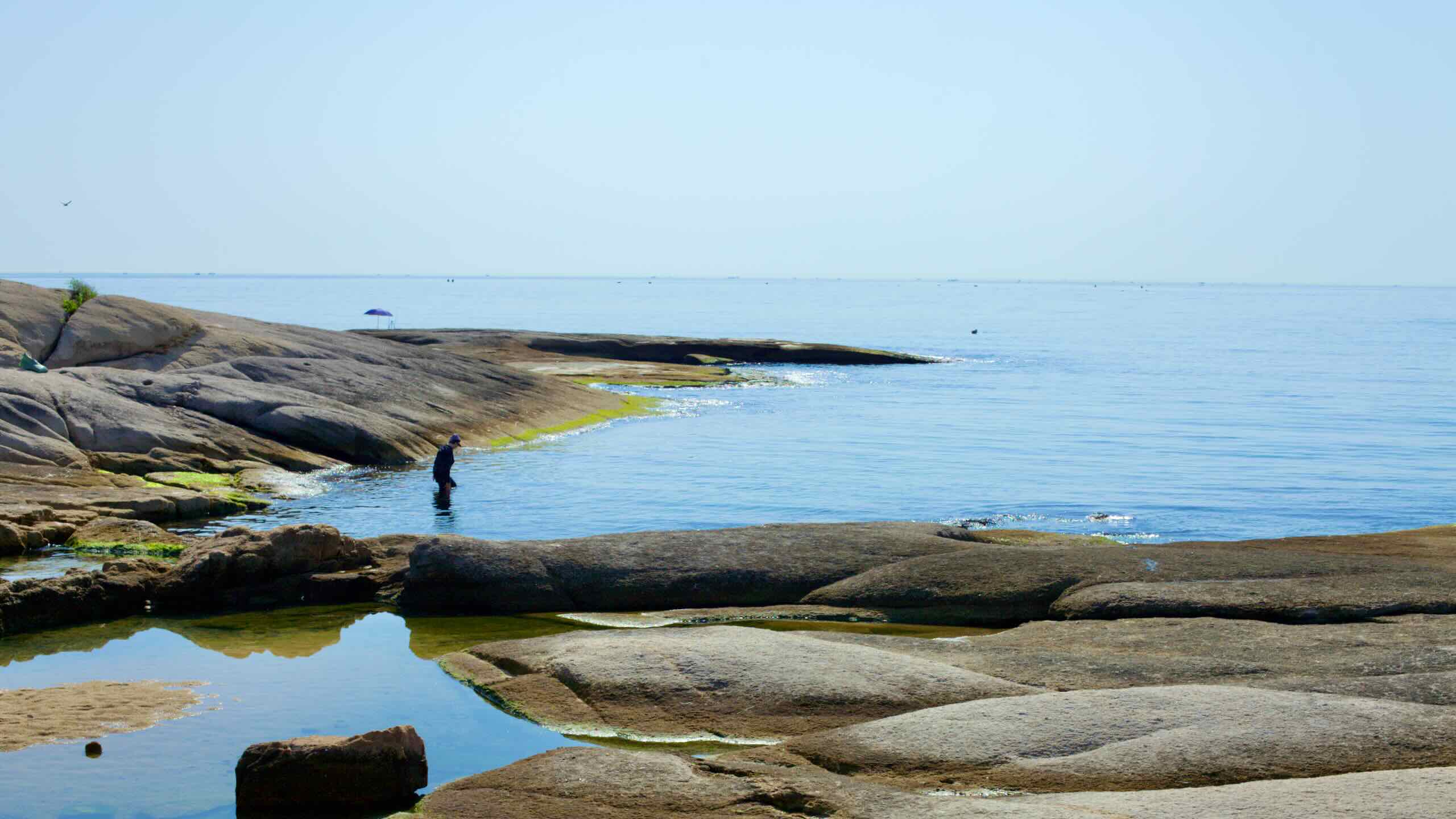
At the southern end of Songji Lake Beach, find a rocky outcrop known as Seonang Rock (서낭바위; map). It features topography formed over millennia as the sea’s waves eroded granite stones.
The name “Seonang Rock” originates from the nearby Seonangdang Shrine in Oho-ri village. This traditional Korean site is dedicated to Seonangsin, the village’s guardian deity. The area around the shrine is revered, and local taboos discourage disturbing the land.
From Songji Lake Beach, ride inland onto raised boardwalks. Cross the outlet where Songji Lake flows into the East Sea, pass under East Sea Road (동해대로; map; road view), and enter Songji Lake Park on the eastern bank of the lake.
A local legend tells of an old monk who, after being refused alms by a wealthy landowner, threw an iron mortar into a rice field. Water sprang from the spot, creating Songji Lake.
Six kilometers in circumference, Songji Lake’s brackish environment supports both freshwater fish like carp and mullet and saltwater species like sea bream and horse mackerel. During winter, its salty waters prevent the lake from freezing, making it an ideal habitat for migratory birds like swans, mallards, and geese.
The best way to explore Songji Lake is at Songji Lake Park (송지호공원; map). Located on the lake’s eastern shore, the park lies directly on the cycling path and serves as a rest stop for travelers along the East Sea Road.
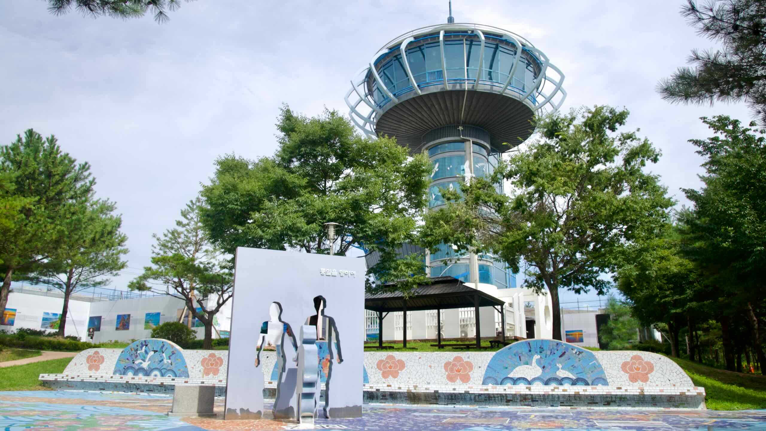
Songji Lake Park features walking paths, public art installations, and the Songji Lake Migratory Bird Network Tower (송지호관망타워; map), a four-story observatory opened in July 2007. The tower provides panoramic views of the lake and its avian inhabitants. It includes a bird exhibition hall and serves as a popular educational center for children.
After exploring the observatory and lakeside park, return to the bike path and ride up the road for a kilometer until you find a fork in the route (road view). Here, the Left Path—which traverses the backside of Songji Lake and visits Wanggok Hanok Village—rejoins the Right Path.
Let’s head back to Oh-ho Port and take the Left Path (road view) to explore the backside of Songji Lake (directions).
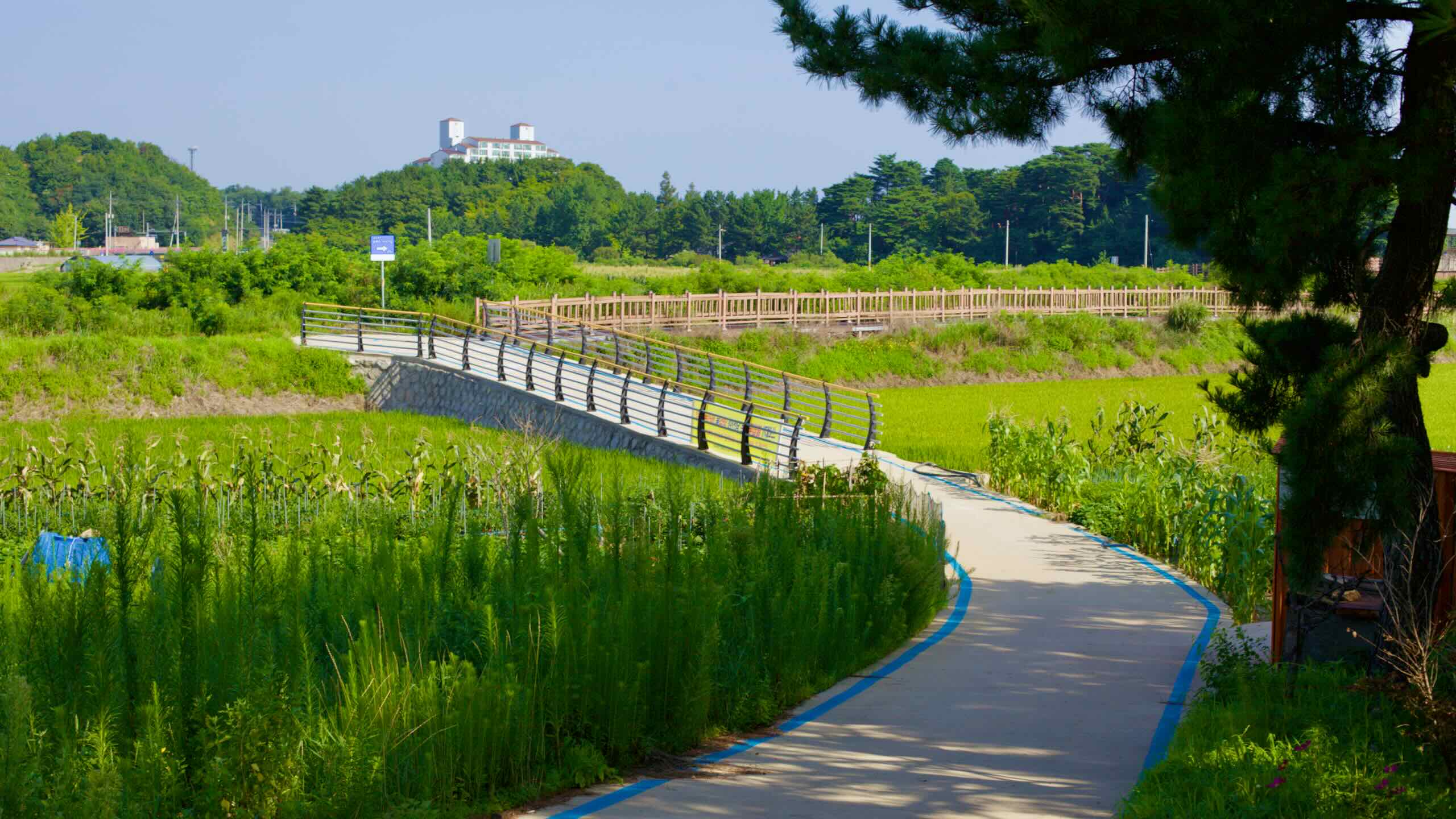
Travel along the roads outside of Oh-ho Port until you reach a rustic cycling path that encircles Songji Lake (road view). Continue for several kilometers along the water, passing an access road leading to Songji Lake Pavilion (송호정; map; road view), which offers an aerial view of the lake from its western banks.
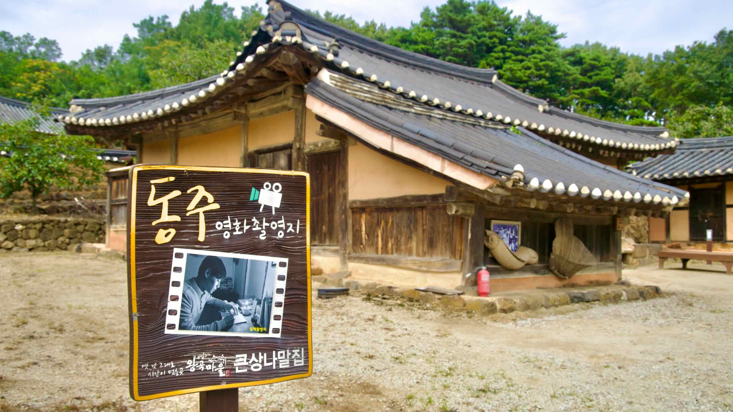
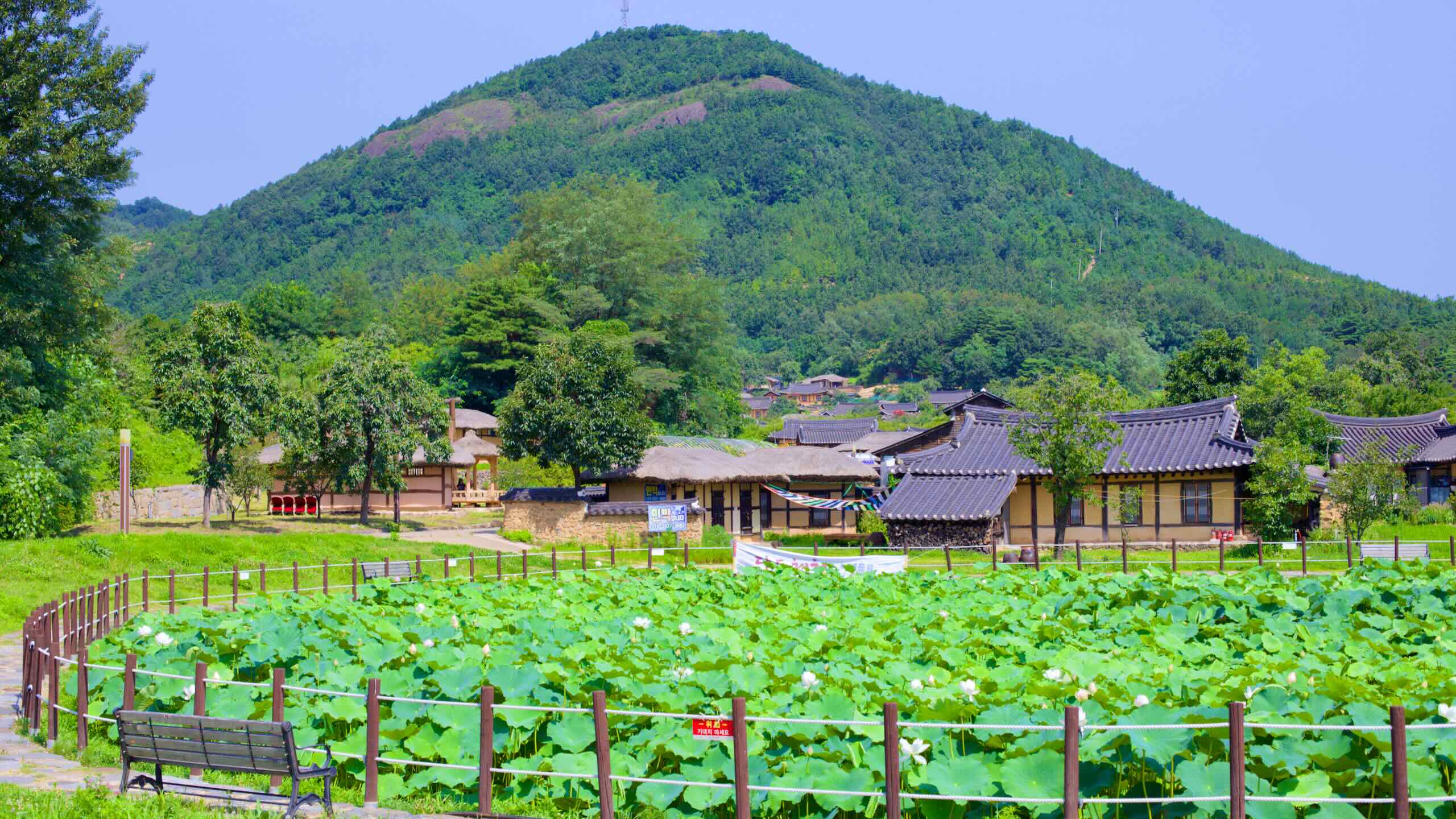
After navigating through farming roads, you’ll come to an intersection with a small pond filled with blooming lotus flowers in summer (road view). Just beyond, spot a series of ancient Korean hanok houses climbing a low hill beneath green peaks. Welcome to the southern entrance of Wanggok Hanok Village, a highlight of the Gangwon Bike Path.
Wanggok Hanok Village (왕곡 한옥마을; map) is filled with traditional hanok houses dating back hundreds of years. Surrounded by mountains, this culturally protected village offers a glimpse into Korean life during the late Joseon Dynasty (1392–1897). Visitors can experience staying overnight through the Hanok Stay Program.
At the end of the Goryeo Dynasty (918–1392), a royal scholar named Ham Buyeol (함부열) opposed the rise of the new Joseon Dynasty. He fled the western capital, crossed the Taebaek Mountains, and settled in Goseong County. Later, his grandson and members of the Choi family from Gangneung founded what is now Wanggok Village.
Descendants of the Ham and Choi families remained loyal to the village for centuries. They rebuilt after Japanese invaders razed it during the Imjin Wars (1592–1598) and preserved its traditional way of life.
The village’s current buildings date back 200 years, featuring yangtong hanok houses (양통집) that originated from Hamgyong Province (함경도; map) in present-day North Korea. In 2000, Korea designated the village as National Important Folk Material No. 235.
After exploring the ancient hanoks, hop back on the road and travel a few hundred meters until a blue bike sign directs you down another lakeside cycling path (road view). Continue for a kilometer until you reach the East Sea Road (map), rejoining the Right Path that explored Songji Lake Park (map).