Bike Samcheok & Donghae
The first section of the Gangwon Bike Path runs from the bottom of Samcheok City (삼척시; map) to Donghae City (동해시; map) along the East Sea in Gangwon Province.


Possibly the most challenging section of any certification bike path, this course climbs from the sea to seven 70 to 100-meter tall coastal hills using curving, high gradient two-lane roads.
But the route also features a parade of unique highlights, including a pair of candlestick-shaped rocks, soaring observatories, cable cars, and sweeping views of the East Sea from high-angle look-out spots.


- Imwon Port (12.6 km)
- Lady Suro Park (12.6 km)
- Haesindang Park (19.3 km)
- Jangho Port (21.3 km)
- Yonghwa Beach (22.9 km)
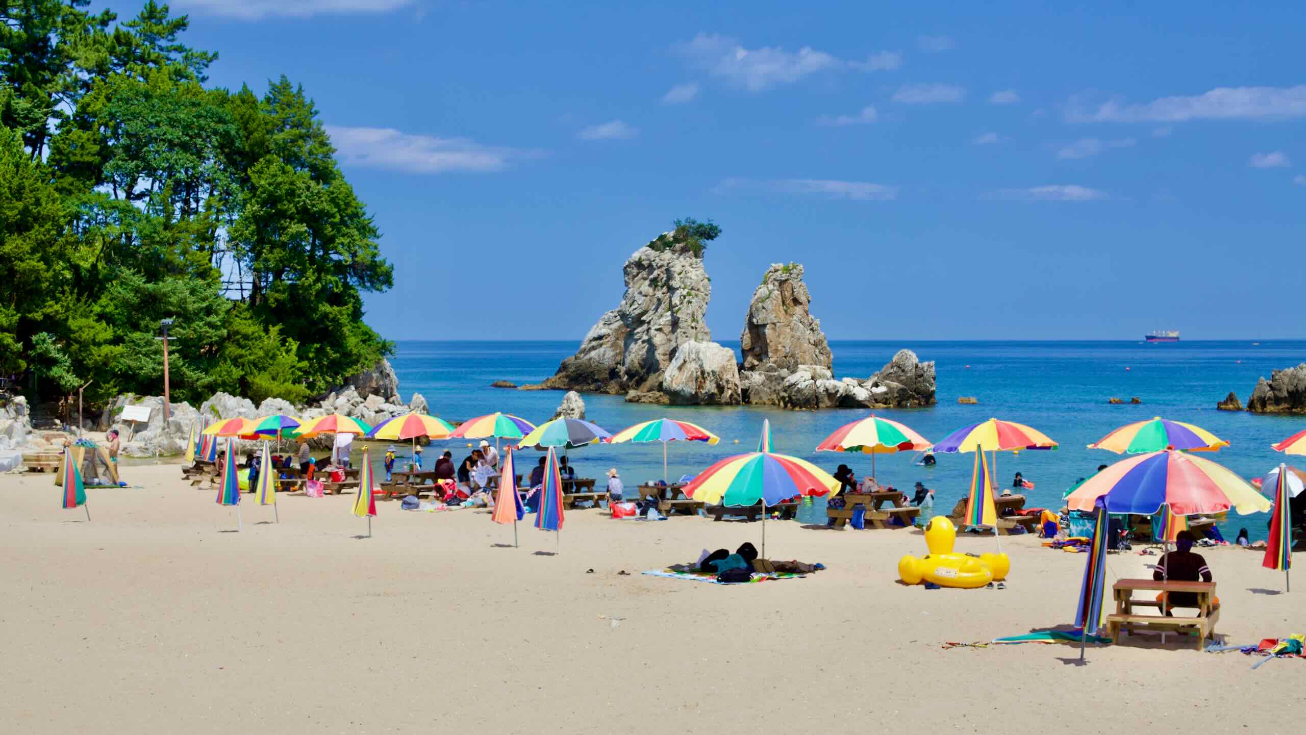
- Chogok Dragon Cave & Candlestick Rock (25.3 km)
- Deokbong Mountain (38.8 km)
- Hanjae Park (44.9 km)
- Jukseoru Pavilion (47.5 km)
- Isabu Road (49.9 km)
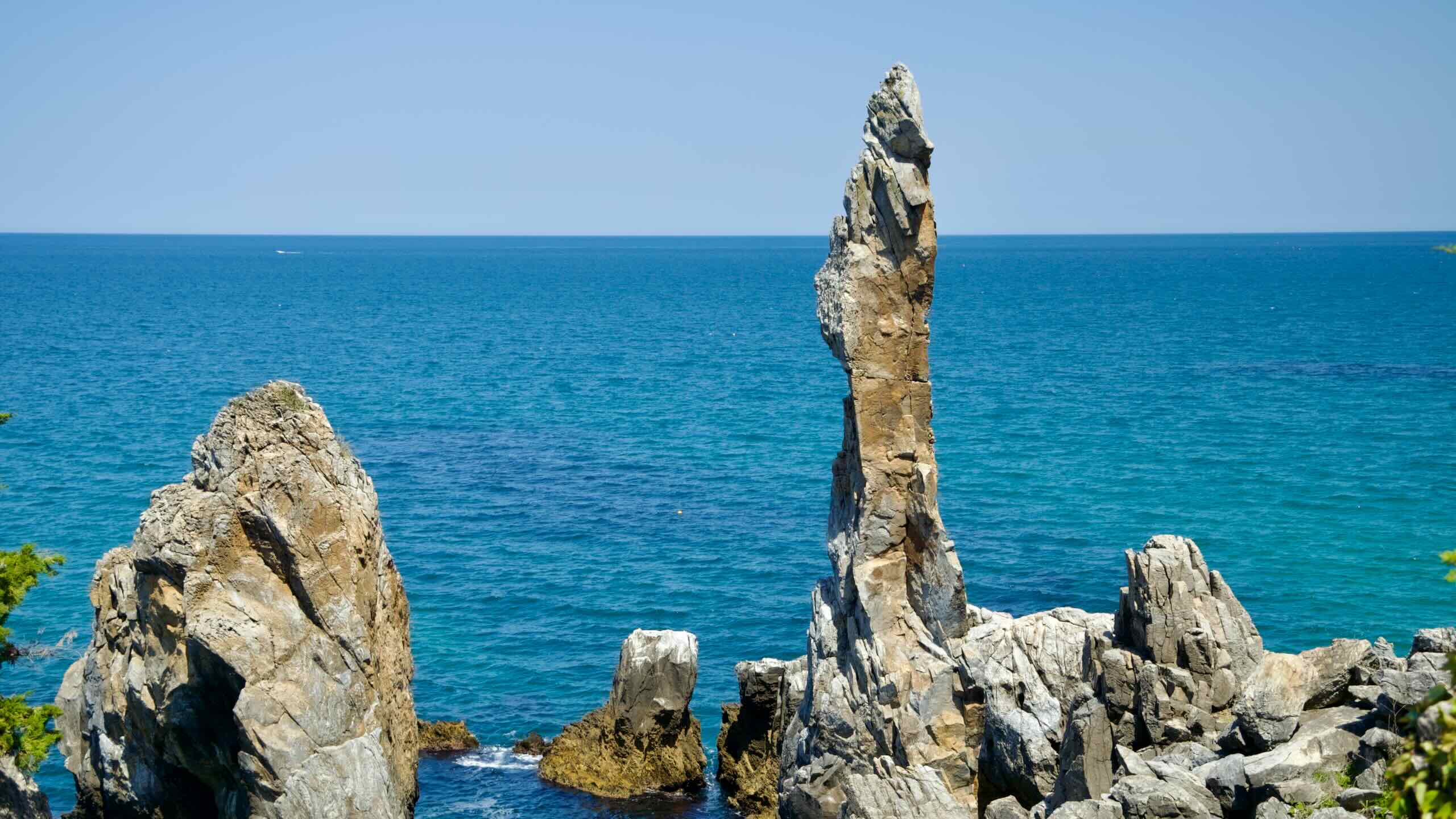
- Chuam Candlestick Rock (55.8 km)
- Mukho Lighthouse & Sky Valley (69.2 km)
- Mangsang Beach (74.8 km)
Before we dive into the guide, a bit of business. How are you going to get onto the Gangwon Bike Path?
- Are you cycling the gap between the Gyeongbuk and Gangwon Bike Paths? Click here!
- Are you taking a bus to the start line? Click here!
Seokho Port to Gopo Port
Cycle a steep mountain pass between the end of the Gyeongbuk Bike Path and beginning of the Gangwon Bike Path.
- Galyeongjae Pass
- Difficulty 🚲🚲🚲🚲
- (short, but 100-meter hill)
Cycling the entire East Coast Route, from south to north? Did you just finish the Gyeongbuk Bike Path? Tecnicially, there is a 4.8-kilometer gap between the southern Gyeongbuk and northern Gangwon Bike Paths.
There are two ways around the gap:
- Take a bus.
- Cycle the gap.
Cycling the gap? Start at Seokho Port (석호항; map) at the very top of Uljin County. Continue riding inland through the port’s town and onto a 104-meter climb up the Galyeongjae Pass (갈령재; map). Be careful ascending and descending. The road does not have a designated cycling lane.
Flow down into Gopo Port, the southernmost port of Samcheok City and Gangwon State.
Gopo Port to Imwon Port
Ride past a split village until you reach a seafood haven for coal miners and tourists, which hides a soaring statue on a coastal mountaintop.
- Imwon Certification Center
- Imwon Port
- Lady Suro Memorial Park
- Difficulty 🚲🚲🚲🚲 (90-meter incline)


Welcome to Gangwon Province. First item to see on our list is Gopo Port. It lies along the East Sea coast
Gopo Port
Gopo Village (고포마을; map) gains its fame for because it straddles two provinces: North Gyeongsang Province and Gangwon State. The border bisects the settlement, with about half of its 40 households living on either side.
While the residents live in administratively different regions, they share similar customs and freely pass between the northern Gopo Beach (고포해수욕장; map) and southern Gopo Port (고포항; map). They also work together to harvest the village’s famous seaweed from the sea.
Continue your cycling journey north along the gentle coast, by sandy beaches and coastal pines until you meet Hosan Beach.
Hosan Beach
Hosan Beach (호산해변; map) is 500-meter wide white sand beach of bisected by the freshwater Gagok Stream (가곡천; map) as it flows into the East Sea. Throughout the year, fishers sit on the stream’s banks to catch sweetfish.
At the mouth of Gagok Stream rests Sol Island (Solseom; 솔섬; map). It became famous after being photographed by British photographer Michael Kenna. But nearby mineral extraction plants have spoiled the scenery, with giant round silos now populating the coastal landscape.
Wolcheon Recreation Area
Continue cycling north. As you pass over Gagok Stream on Wolcheongyo Bridge (월천교; map), spot the Wolcheon Recreation Area (월천유원지; map). Built on the stream’s south banks, the site, managed by the local village, hosts campgrounds, lush poplar trees to cool down summer visitors, foot massage paths, and bathrooms about 1 kilometer from the East Sea.
According to legend, Wolcheon Amusement Park was where the ancient Goguryeo (고구려) and Silla (신라) Kingdoms struggled over territory 2,000 years ago.
Hosan Port Pass
Hop back on your bicycle and prepare for the next big climb. As you snake past Hosan Port (호산항; map) and over Hosan Stream (호산천; map), you’ll begin your way ascent up Hosan Port Pass (map).
This climb rises to several back-to-back 90-meter peaks along a curving, mountainous road. On several the climb’s dips, you’ll find roads winding to the tiny Nogok Port (노곡항; map) and Bihwa Port (비화항; map), which offer quaint seaside views and restaurants.
After conquering the mighty hills, roll down towards Imwon Port and stop halfway down.
Imwon Certification Center
Perched near an unassuming overlook, by guard rails and bike stands, sits the Imwon Certification Center (임원 인증센터; map), the Gangwon Bike Path’s southernmost stamp booth (road view).
Dismount your bike, take out your Bike Passport, and claim your stamp. Hop back on and slide into Imwon Port.
- Bike Passport Page 36
- Certification Center: ❌
- Passport store: ❌
Imwon Port


Imwon Port (임원항; map), Samcheok City’s largest southern port, formed 30 years ago as a destination for local coal miners. They visited the harbor to fill their bellies after a long day in the mine. Over the years, its reputation for seafood spread throughout the country. Now, most weekends and holidays, the port’s parking lots swell with visitors.
The most famous dish? Raw fish. Each morning at 5 AM, Imwon’s fishing vessels return with their catch and distribute it to local restaurants.
The most popular dish is assorted raw fish served with chopped vegetables and soybean powder. The price is around ₩20,000 per person, cheaper compared to similar or lesser dishes served in Seoul.
You’ll find many stand-alone restaurants serving raw fish, like Mijori Raw Fish Restaurant (미조리횟집; map), which serves a famous spicy fish soup. But most eateries congregate under one roof at the Imwon Port Raw Fish Center (임원항회센터; map), where you can also purchase dried specialties like squid and seaweed.
Imwon Port also holds the Imwon Bus Terminal (임원시외버스터미널; map), the largest and nearest intercity bus terminal to the bottom part of the Gangwon Bike Path. A great entry point if you don’t feel like cycling the gap between the Gyeongbuk and Gangwon Bike Paths.


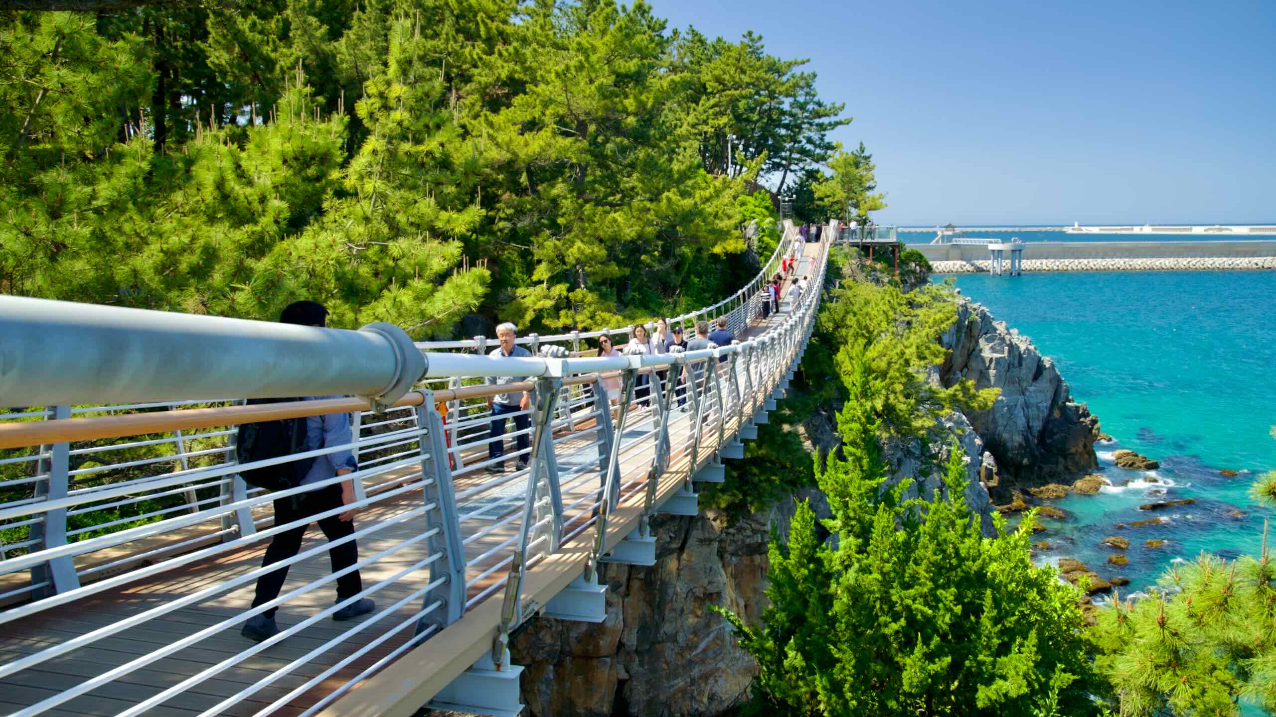
Want to explore a towering sculpture atop a soaring coastal mountain? Venture to the back of Imwon Port and find a 51-meter-tall elevator shaft clinging to the side of a craggy cliff. For ₩3,000, from 9 AM to 6 PM, it’ll whisk you up to a hiking trail that meanders half-a-kilometer to Lady Suro Memorial Park (수로부인헌화공원; map).
The park features various sculptures, a small café, and an 11-meter tall sculpture of Lady Suro riding a dragon, a legend from the Unified Silla period (668 ~ 935 CE).
The story goes, Lady Suro was traveling Gangwon Province’s coast and spotted a blooming azalea on a coastal cliff. No one would make the perilous climb to fetch it until an elder herding cattle offered to help. He climbed the sheer cliffs and plucked the flower. When he returned, he recited the Heonhwaga (헌화가).
But as Lady Suro accepted the flower, a dragon rose from the sea and dragged her into the depths. Desperate, the locals sang a hymn called Haega, which they believed held power. Moved by the community’s spirit, the dragon returned Lady Suro unharmed.
Become a member or login to your account to read more!
Become a Korea by Bike member and get exclusive and ad-free content.
- Day-Trip Membership ($5) — three months of access.
- Touring Membership ($9) — six months of access.
- Endurance Membership ($20) — two years of access.
- Grand Slam Membership ($30) — lifetime access.
Subscribe for updates.
Day-Trip Membership — 3 months
Touring Membership — 6 months
Endurance Membership – 2 years
Grand Slam Membership — Lifetime