An ancient resident climbed Jukdo Mountain and gazed down at Chuksan Port’s natural bay. He thought its shape resembled a cow laying down. Hence, “Livestock Port.”
Like Ganggu Port, Chuksan’s major claim to fame is its snow crabs. Fishers scoop the critters from the neighboring East Sea and filter them into Chuksan’s local restaurants and beyond.
Jukdo Mountain
Many of Korea’s east coast ports have a similar shape: flat coastline with breakwaters to protect against oncoming waves. Chuksan Port is different. The Taebaek Mountains, Korea’s largest mountain range, surrounds its bay with green summits.
Jukdo Mountain (죽도산; map) is Chuksan’s most famous. This petite peak rises 80 meters (262 ft) on the port’s western end. Its name, /jūk/ (죽) or “bamboo,” comes from the blanket of bamboo shoots that cover its slopes.
Until the Joseon Dynasty (1392), Jukdo Mountain was an island. Centuries of silt buildup from nearby Chuksan Stream (축산천; map) joined the mountain to the mainland.
The tower was originally just a lighthouse. It sends light beams over the East Sea every 5 seconds. But in 2011, engineers added observation decks to the 2nd and 5th floors. Its doors are open to the public Tuesday through Sunday, 10 AM ~ 5PM.
To reach the lighthouse, visitors must trek a 15~20 minute trail starting from the docks on the north side of Jukdo Mountain. The hike passes grape vines and bamboo forests.
From the lighthouse’s 5th floor observatory, visitors can get a 360° view of the port and East Sea. If lucky, they might spot a pod of migrating whales.
Chuksan Fish Market (축산항어시장; map) sits in the middle of Chuksan Port. Its vendors sell snow crabs, Pacific saury, squid, and more. Patrons can buy live seafood on the market’s 1st floor, then take it to a 2nd floor restaurant.
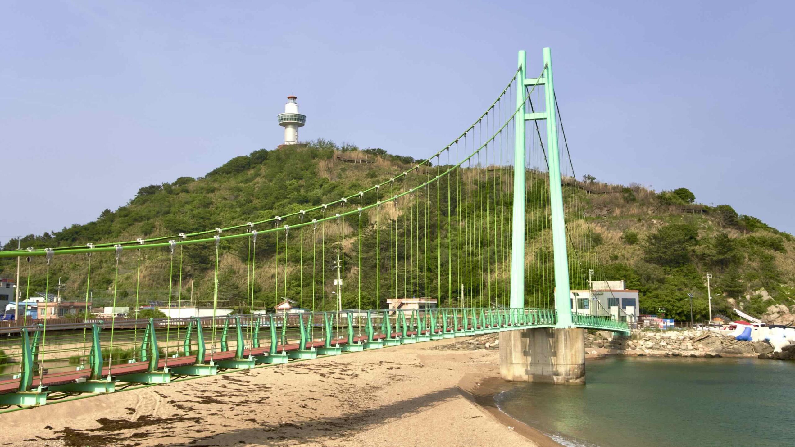
Blue Road Bridge (블루로드다리; map) is a 139-meter-long (456 ft) suspension bridge just south of Jukdo Mountain.
Chayu Village (차유마을; map), south of Chuksan, claims to be Yeongdeok’s original “Snow Crab Village.” It offers “experiences” catching fish, snow crabs, squid, and more.
Daeso Mountain Beacon Mound (대소산 봉수대; map) sits on top of Daeso Mountain (대소산; map; 286m) north of Chuksan Port. Now just a stony outline, during the Joseon Dynasty (1392 ~ 1897), the beacon was part of a chain that stretched along the east coast and connected to Namsan Mountain in Seoul. Daeso Mountain Beacon’s keeper would light a fire in the beacon’s tower to message nearby beacons, who would then signal the next beacon. (Think Lord of the Rings.)
Yeongdeok Blue Road
Yeongdeok Blue Road (영덕블루로드; map) is a scenic hiking trail that travels along Yeongdeok County’s coastal roads. Its four courses (A, B, C, & D) take sightseers on a tour of all the county’s major seaside highlights. The Haeparang Trail and Korea by Bike explore the same landmarks covered by Yeongdeok’s Blue Road.