Tour Jamsil Hangang Park on the Han River Bike Path in Seoul.
28.7 km (Seoul (South Side))
53.5%
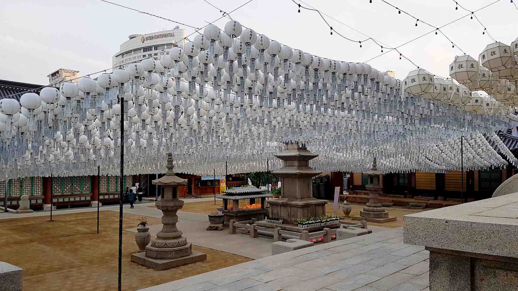
Jamsil Hangang Park (잠실한강공원; map) lives on top of the Songpa District in southeastern Seoul. It lies near a handful of the mega-city’s major recreational landmarks:
Jamsil Hangang Park is the second smallest park in the Hangang Park system. It presents typical park accouterments: swimming pools and rec courts. And it offers a few notable highlights, like a fish bridge that bypasses a river weir.
Like Jamwon Park just west, Jamsil gained fame for its money-printing silkworms. In fact, the neighborhood’s name translates to silkworm (잠; /jam/) room (실; /shēl/).
Today, Jamsil comprises six separate neighborhoods, numbers 1~6 (잠실1동, 잠실2동, 잠실3동 etc.) They contain wealthy areas punctuated by the Lotte World Tower, the tallest in the nation.
Like the others, money and status rule Songpa. Unlike the others, Songpa’s past runs deep.
Lotte World Tower in Seoul’s Songpa District measures 555 meters tall. It's Korea's tallest and sixth globally.
The First of Three Kingdoms
Until the dawn of the Common Era (CE), tribes divided the Korean peninsula into territorial plots.
Legend has it, the northern Kingdom of Goguryeo (고구려; map; 37 BCE ~ 668 ACE) had three princes: Yuri (유리왕), Biryu (비류), and Onjo (온조왕). Yuri, the oldest, was heir to the throne.
Jamsil Sports Complex (잠실종합운동장; map), or “Seoul Sports Complex,” towers over the intersection of the Han River and Tan Stream (탄천; map) in Seoul.
The site includes six sports facilities. They were completed in 1984 as part of a massive infrastructure project that transformed the undeveloped Songpa District before the 1986 Asian and 1988 Summer Olympics in Seoul.
The centerpiece of Jamsil Sports Complex is Jamsil Olympic Stadium (잠실종합운동장올림픽; map) or “Seoul Olympic Stadium.” Seating 100,000 (69,950 today), it held both the opening and closing ceremonies for the 1988 Olympics.
All of Jamsil Sports Complex’s facilities remain active, hosting several of Korea’s professional sports teams or admitting the public for exercise and pickup games.
Want to explore the Jamsil Sports Complex? Scoot through the underpass at the back of the courtyard in Jamsil Hangang Park (road view). It leads to the Olympic Stadium’s toes.
From Jamsil Sports Complex, pedal into the meat of Jamsil Hangang Park.
Pass by lawns filled with trees, families, and, if come at the right time, art from the Han River “Heung” Project (한강 “흥” 프로젝트). Its sculptures and installations cycle through every Han River Parks at different times throughout the year.
Jamsil E-Land Cruise
Midway down Jamsil Hangang Park, arrive at a pair of docks on the riverbanks (road view). On top of the eastern dock sits a sign that reads Jamsil E-Land Cruise (잠실 이랜드크루즈; map).
You won’t find daily Han River cruises here, though. Only chartered ships depart from this berth. But anyone can enter the restaurants and shops on the eastern pier.
Glance inland from the E-Land Cruise docks. There stands a canopied rest stop, a sign for the defunct Han River Land, and, beside a bike rental stall, an assemblage of retired freight containers known as the Square Square Place (사각사각플레이스; map).
These furnished steel containers house work and performance spaces for five artists-in-residence on a yearly tenure. Here they create all modes of art, from visual to literary.
Square Square Space’s main stage hosts music, dance, or theater performances. And summer, fall, and spring festivals bring crowds to view the artist’s seasonal harvests.
Jamsil Bridge
Keep riding. Pass an assemblage of park staples: swimming pools, playground, and a maze of gardens called the Nature Learning Center (자연학습장; map).
Sheets of water cascade over a curved embankment below the Jamsil Bridge’s pillars (road view), connecting high and low water levels.
Six concrete towers on the bridge’s north end hold watergates that raise and lower to regulate the river’s flow (road view).
If you haven’t noticed yet, this ain’t your typical “Point-A-to-B” bridge.
In the late 20th century, engineers set out to tame the tempestuous Han River. So they dredged the riverbed and installed weirs (water gates) below two bridges.
Ah! That’s why engineers installed the Jamsil Fish Way (잠실물고기길; map). This fish ladder comprises 228-meters of tiered steps that allow 31 native fish species to hop upstream, avoiding the weir’s strong currents and bulky barriers.
View Jamsil Fish Way from an observation deck just east of the bridge (road view).
Come to a pair of city blocks dominated by one of Korea’s most successful family-owned conglomerates, or chaebols (재벌): the Lotte Corporation.
On the western city block, find Lotte World (롯데월드; map), the world’s third largest indoor theme park. It buzzes under a giant dome and over an ice skating rink. Outside, a bridge extends to Magic Island (매직아일랜드; map) on Seokchon Lake (석촌호수; map).
On the eastern city block soars the ceramic-inspired, 556-meter Lotte World Tower (롯데월드타워; map), Korea’s tallest skyscraper (6th in the world). Check the building’s registry and discover apartments, businesses, and an observation deck occupying the top six floors.
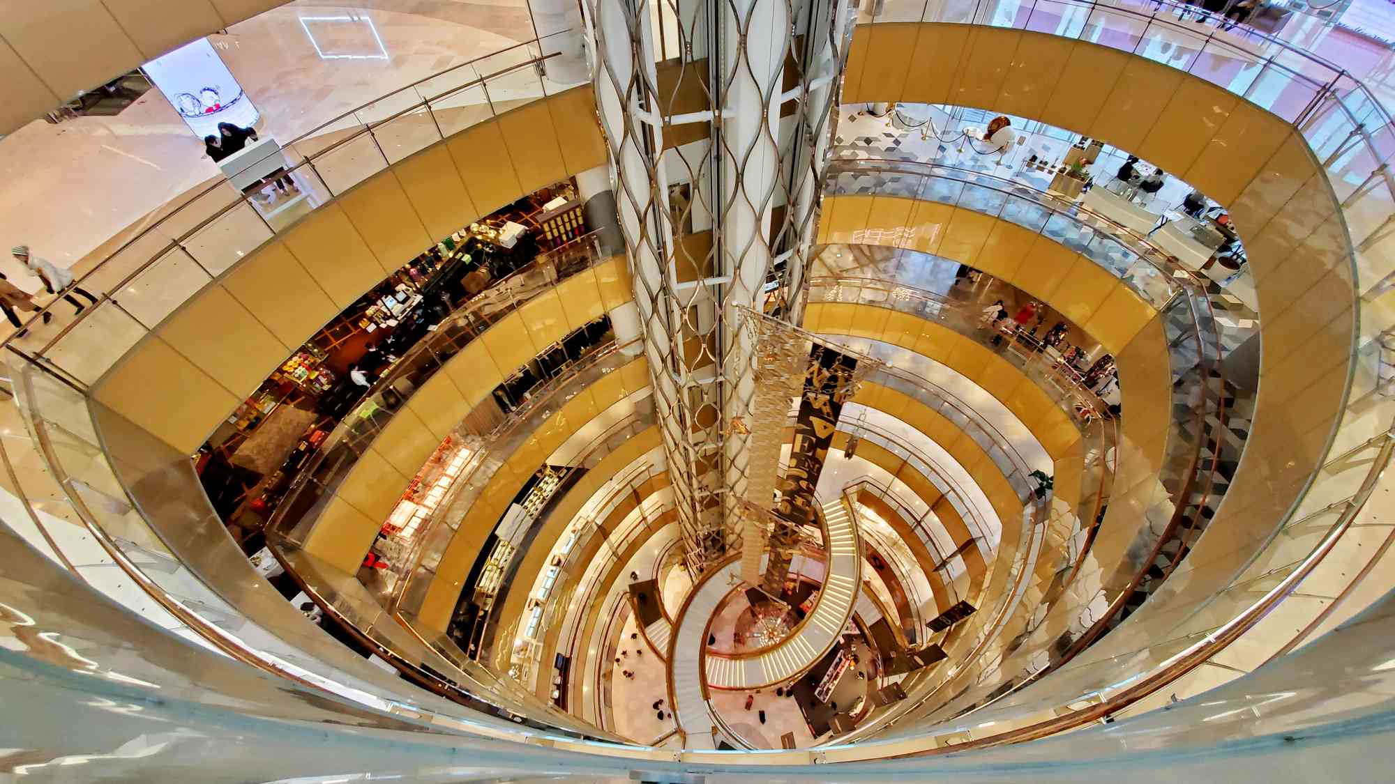
Lotte World Mall (롯데월드몰; map) squats below the mega-tower. It offers branded Korean and international merch in its 11-story retail space.
Trying to get out of Seoul with your bike? Head here. Buy a ticket. Stuff your wheels in an intercity bus’s undercarriage, climb aboard, and relax.
Jamsil Park’s End
Olympic Bridge was one of many infrastructure projects built to prepare for the '88 Summer Olympics.
Let’s continue on the South Side!
Circle round the roundabout below Jamsil Railroad Bridge and take the eastward, low path. Continue into Gwangnaru Hangang Park, the Hangang Park system’s closing credits.