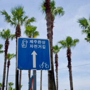
The Jeju Fantasy Bicycle Path (제주환상 자전거길) circles Jeju Island, South Korea’s largest island. The route follows the coastline and forms a complete loop back to its starting point in Jeju City.
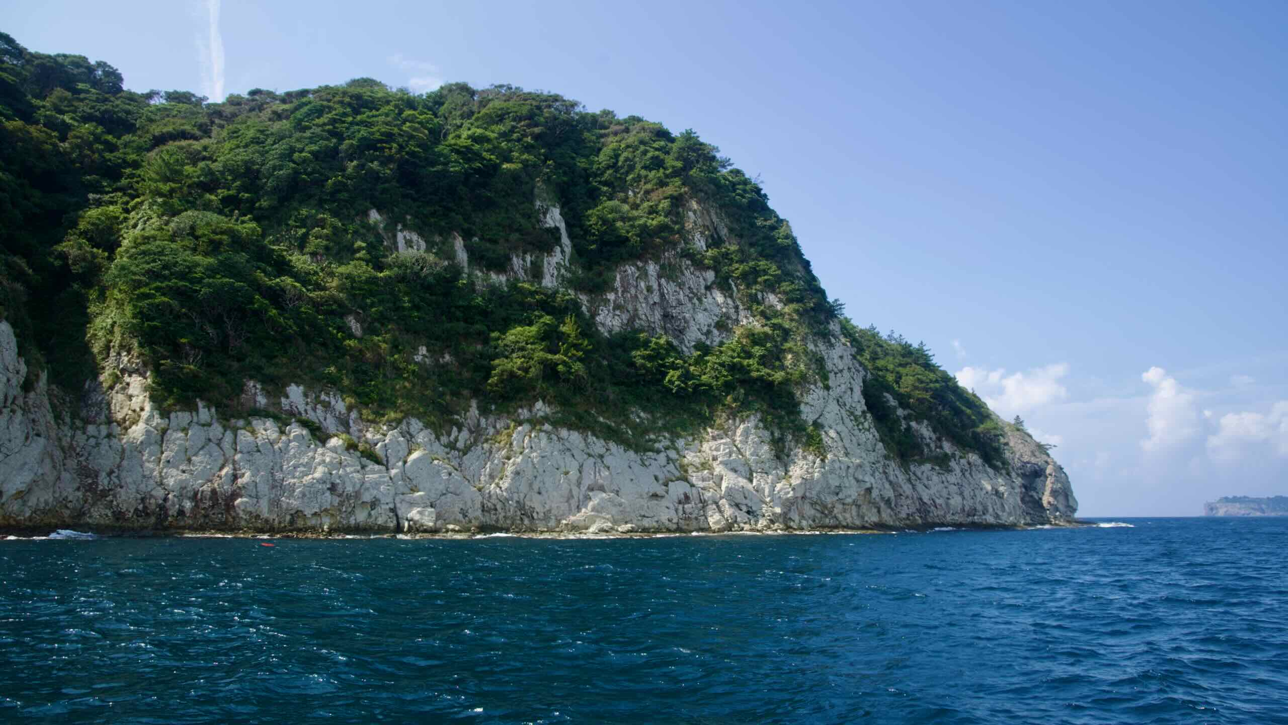
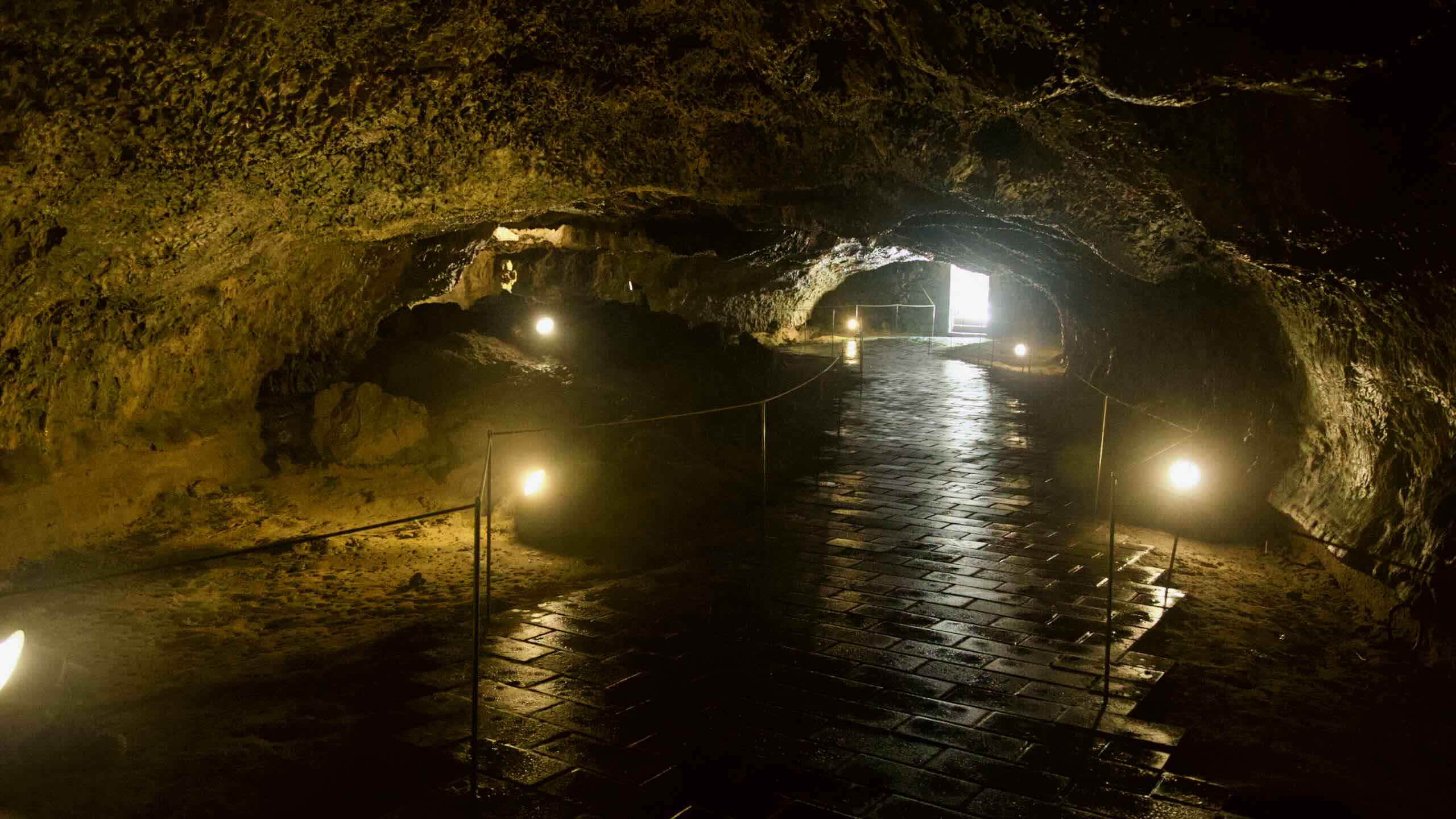
Along the way, cyclists encounter dormant volcanoes, sea cliffs, waterfalls, beaches and coastal villages. Jeju sits about 80 kilometers south of the Korean peninsula, and its volcanic landscape produces hundreds of oreum (parasitic cones) and lava tubes that make the island unique.
Jeju Island has two cities: Jeju City occupies the northern half and serves as the island’s administrative and transport hub, while Seogwipo City covers the southern half and holds many tourist sights. The Jeju Fantasy Bike Path crosses both municipalities as it encircles the island.
The Jeju Fantasy Bike Path circles Jeju Island. It is a roughly 234-kilometer coastal route that starts and ends in Jeju City on the island’s center-north shore.
You can follow the coastline either clockwise or counterclockwise. In this guide we will follow counterclockwise so riders can cruise on the right side of the road, closer to the sea.
The route first runs west and south to Daejeong Town, then east to Pyoseon Town, and then up the island’s east and north coasts back to Jeju City.
This guide officially starts beside Yong Du Am Rock on Jeju’s north coast, just a hop away from Jeju International Airport, the main gateway to the island. You’ll roll out along Jeju City’s shoreline almost immediately.
Which direction should you ride?
The route is laid out counterclockwise. From Jeju City, you ride west and then south to Daejeong, then along the bottom coast to Pyoseon, and then curve around Jeju’s east and north coasts back into Jeju City.
The first leg runs from Jeju City on the north shore to Daejeong Town on the southwest coast. Measuring about 76 kilometers, this section includes some challenges, such as several sharp 20-plus-meter hills along the central-west coast.
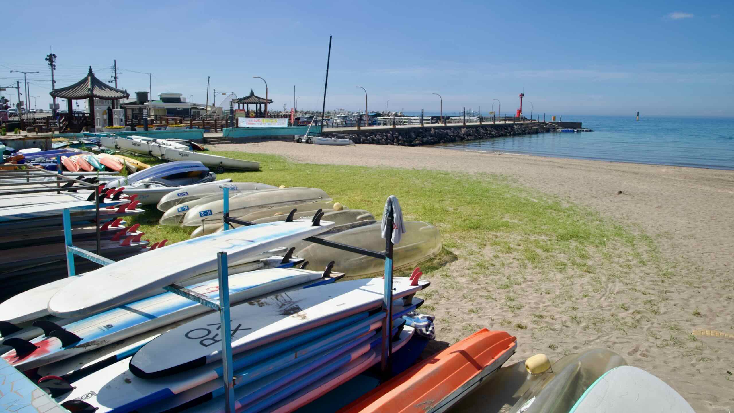
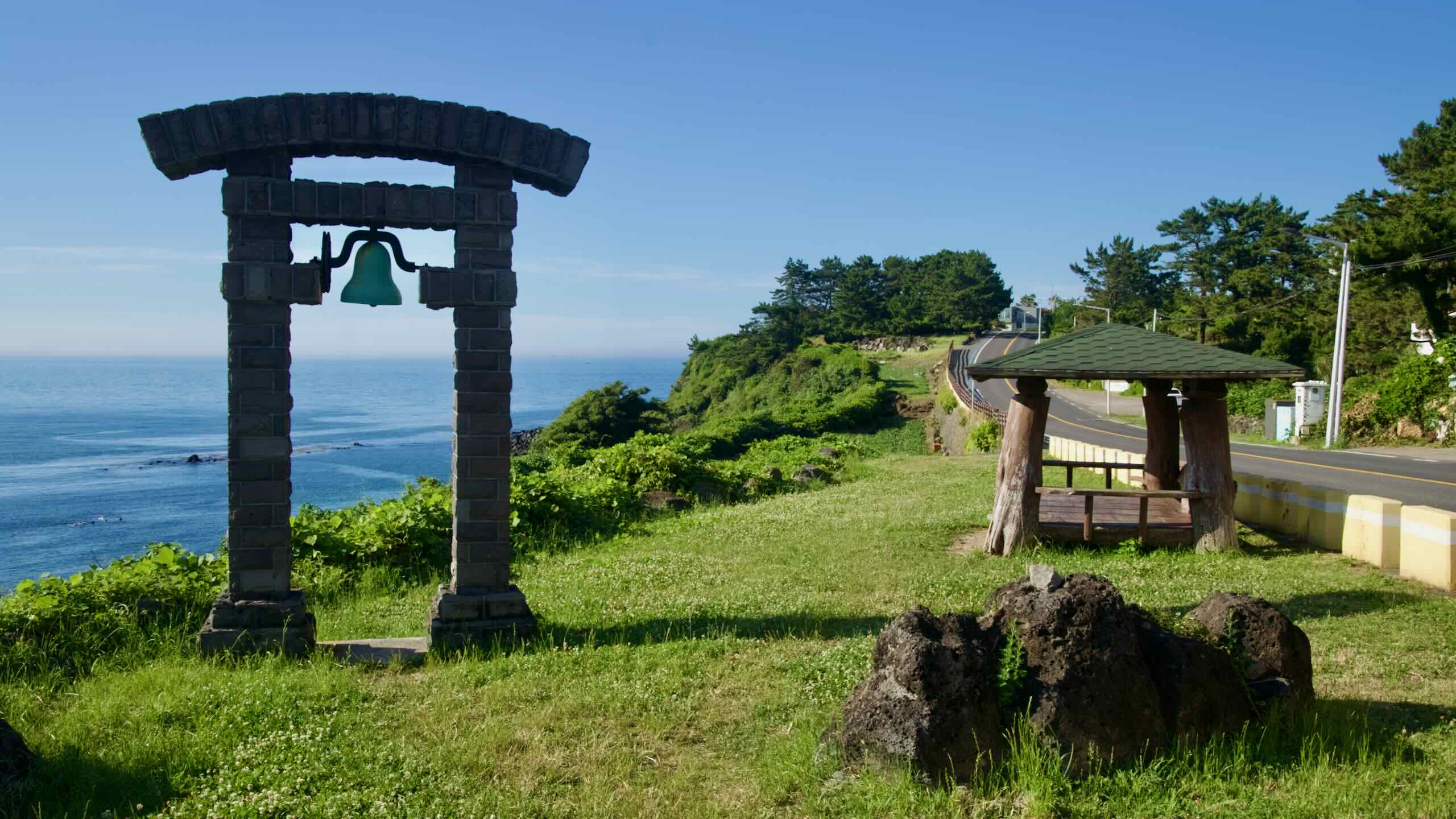
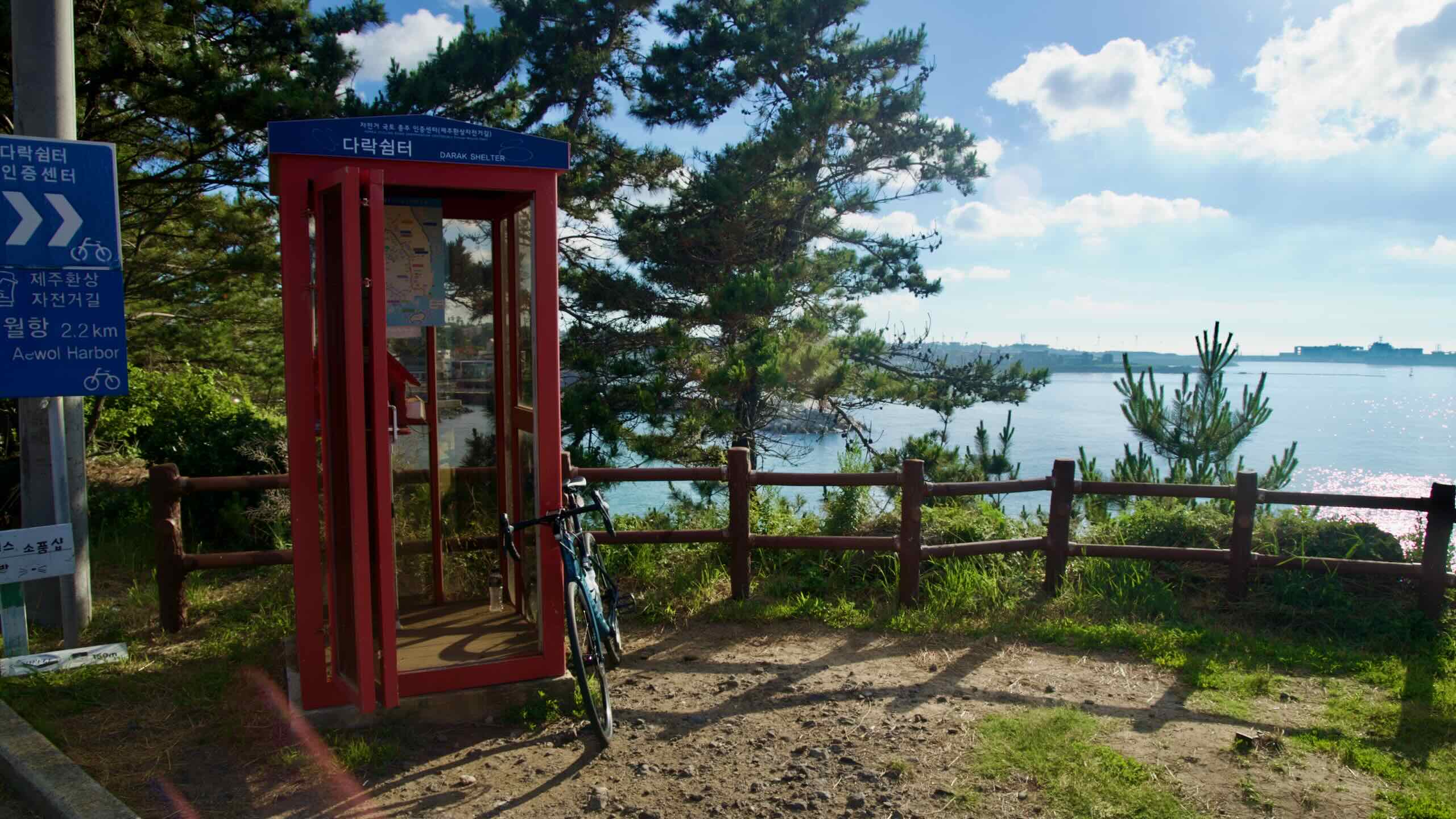
Travel through Iho Tewoo, known for its red and white horse-shaped lighthouses, then continue toward cafés and fishing harbors along Hagu-Aewol Coastal Road. Here, you climb low coastal ridges until Darak Shelter (your second stamp booth), which sits on a cliff above the sea.
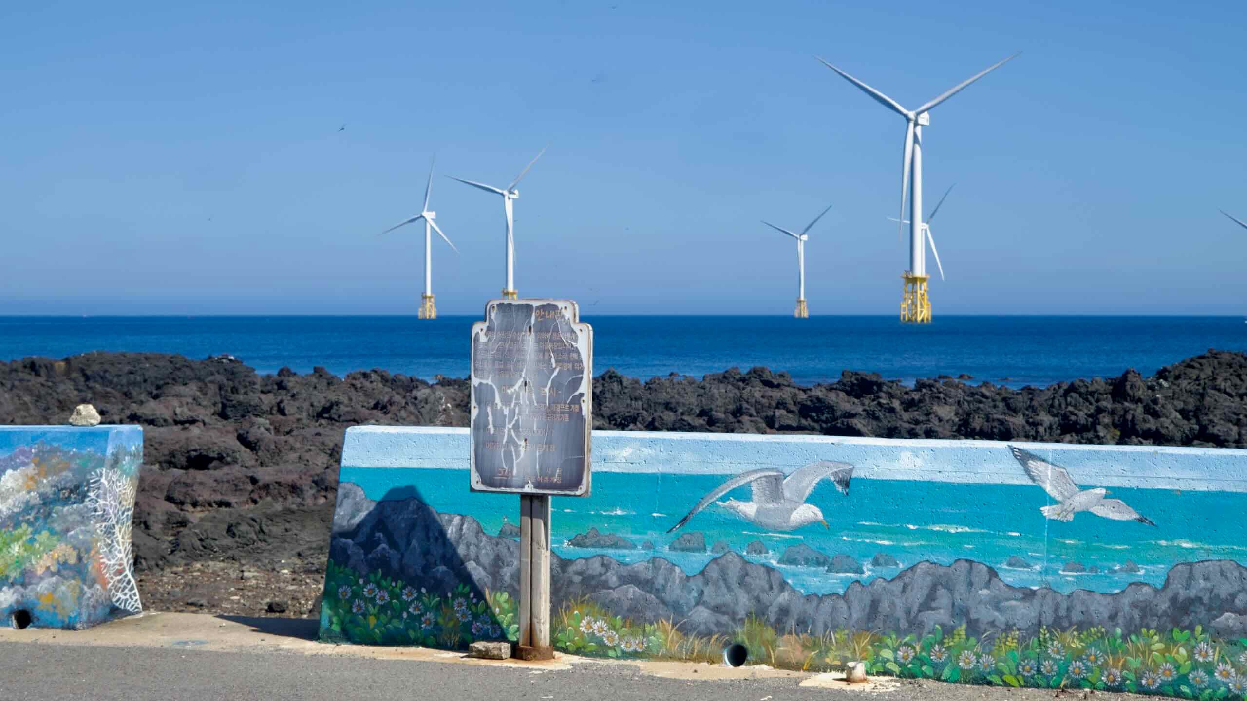
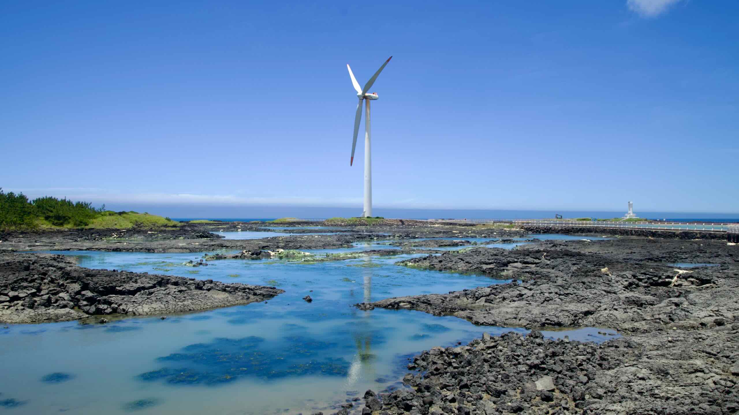
Next, cruise past offshore wind turbines and follow working ports until you reach a peacock park and one of Jeju’s most picturesque beaches, with views of nearby Biyang Island. Afterwards, ride along shorelines marked with tide pools, traditional saltpans carved into volcanic rock, and training sites for Jeju’s haenyeo divers.
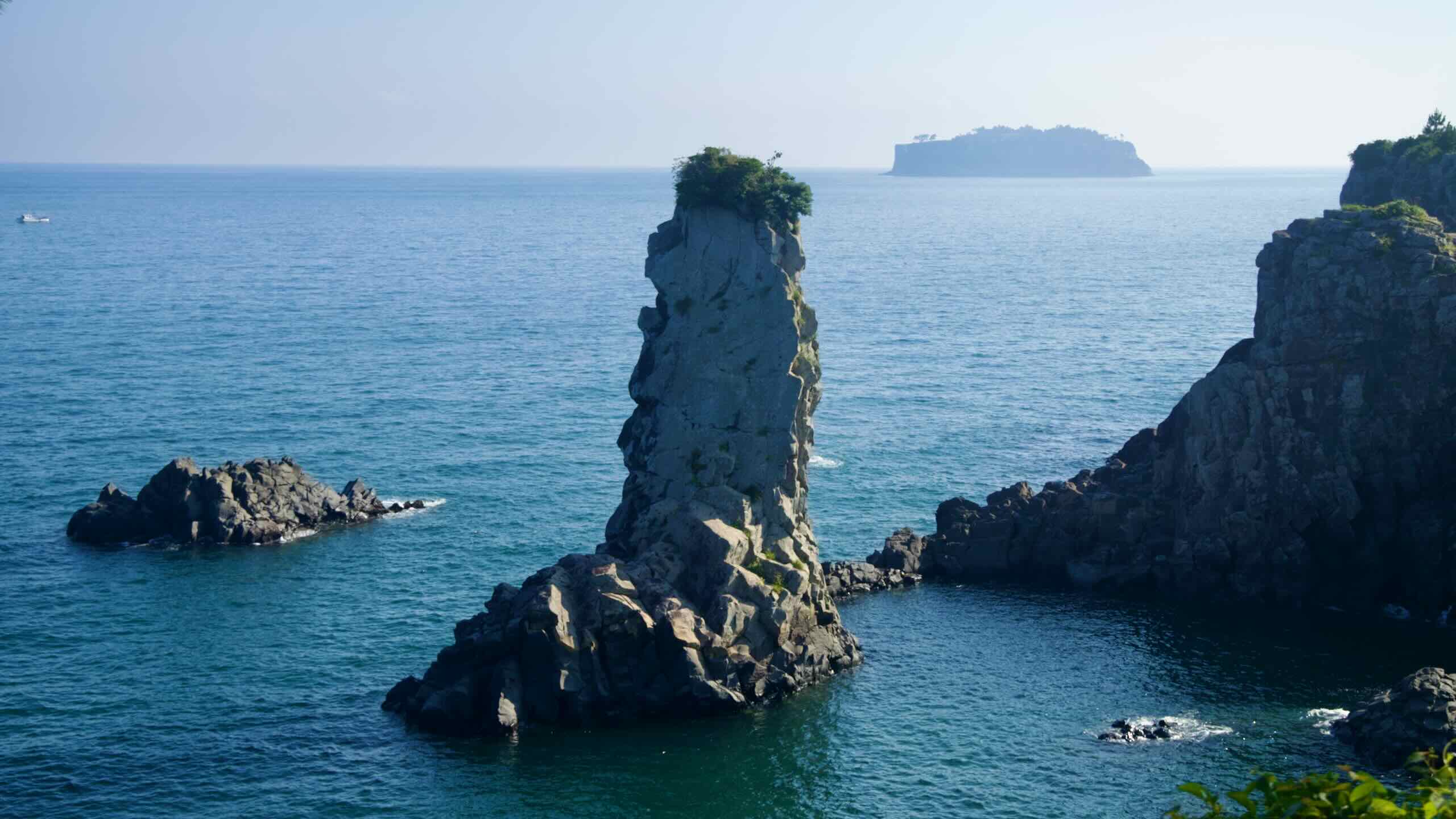
As you approach Daejeong, you’ll find quiet stretches with isolated and rugged ports offering panoramas of uninhabited islands and sunsets over the Korea Strait.
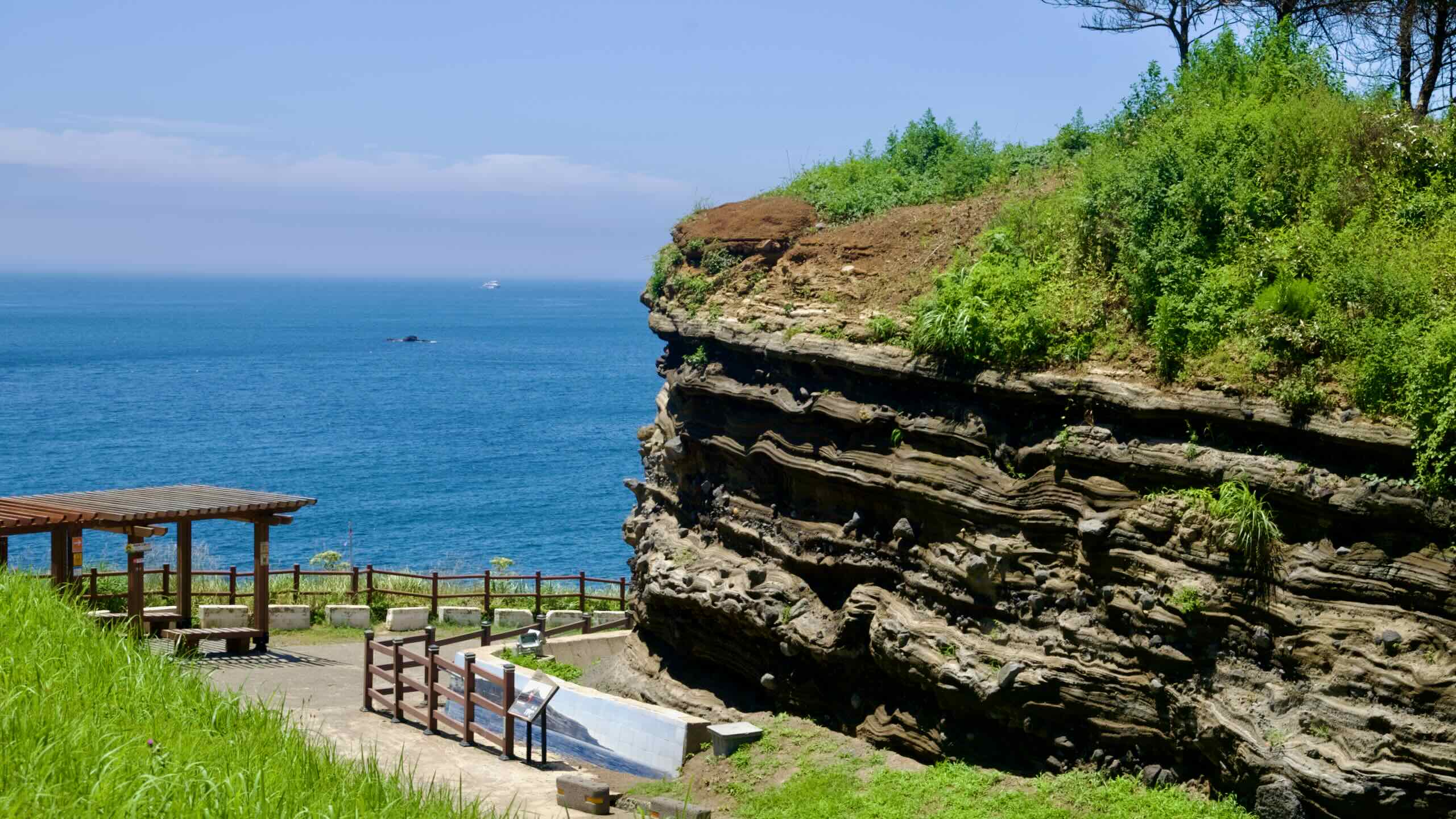
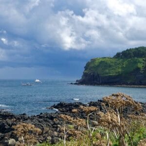
The second leg runs along the south coast of Jeju Island in Seogwipo City. It features the most challenging climb, wrapping around the photogenic, rock-faced Sanbang Mountain before dropping into the Jungmun Tourist Complex.
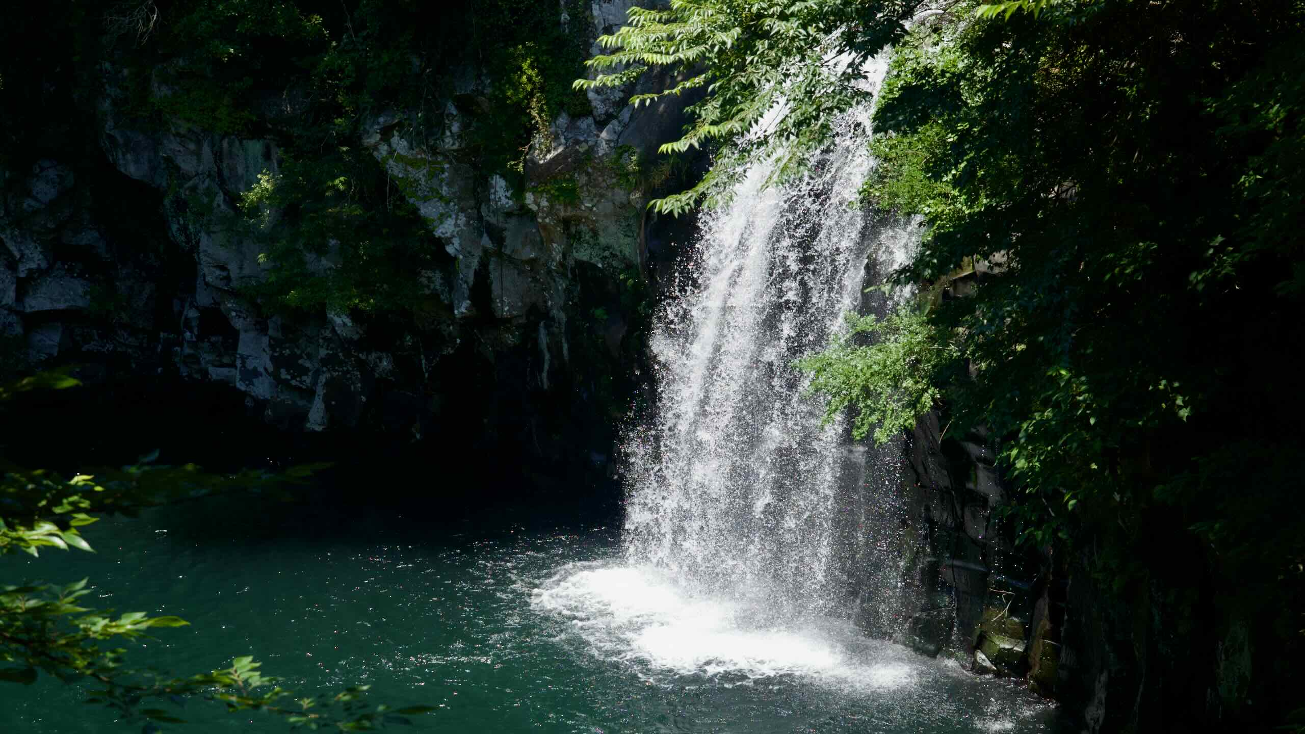
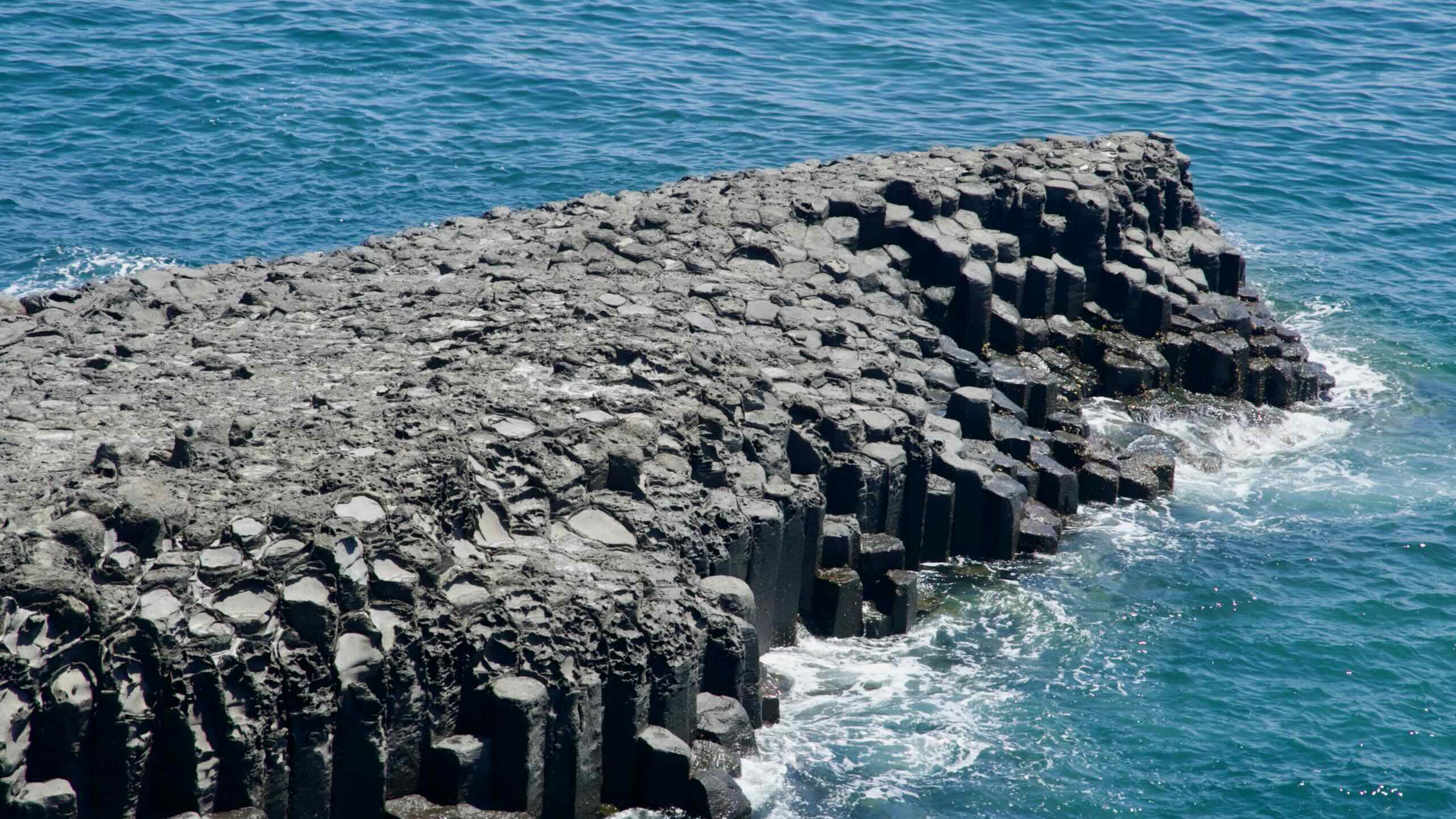
This section strings together major natural and cultural sites, with views of Yongmeori Coast’s layered cliffs and Sanbang Mountain’s sheer volcanic dome. After passing high-end resorts and a tucked-away beach, you’ll meet Daepo Jusangjeolli Cliffs (towering hexagonal basalt columns) and one of the only waterfalls in the world that splashes down into the sea.
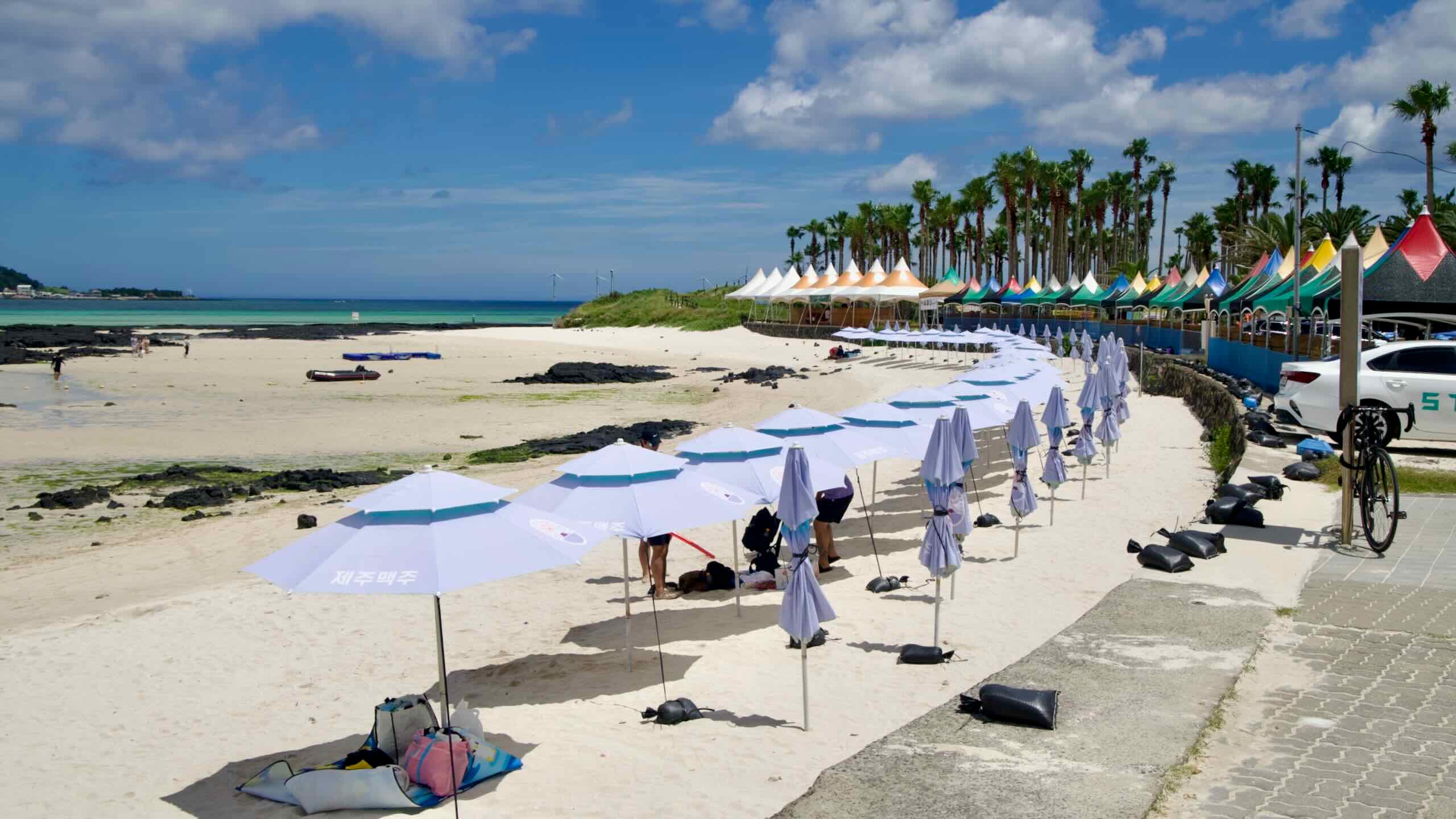
The second half of the route traverses the Beophwan Badang Coast, where haenyeo divers work in the water. Offshore, you’ll find three islands protected as natural reserves because of their abundant coral and sealife. After passing a recreational estuary, you land at an expansive sandy beach and folk village in Pyoseon.
The final leg starts in Pyoseon Village and wraps Jeju’s east and northeast coasts before returning to Jeju City on the central northern coast.
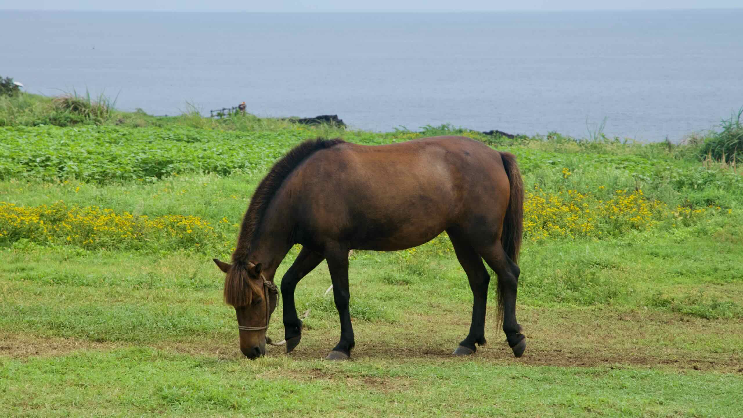
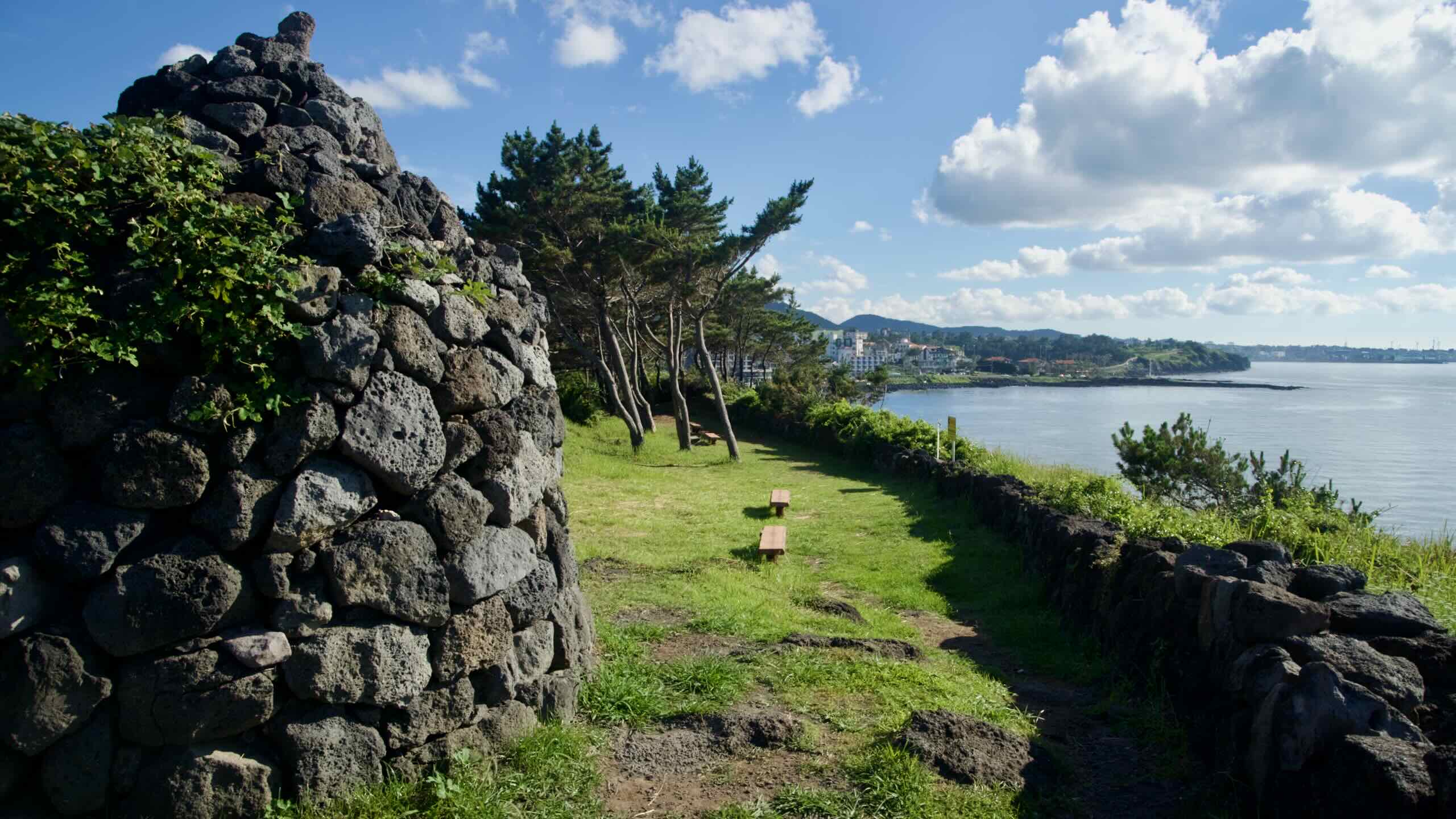
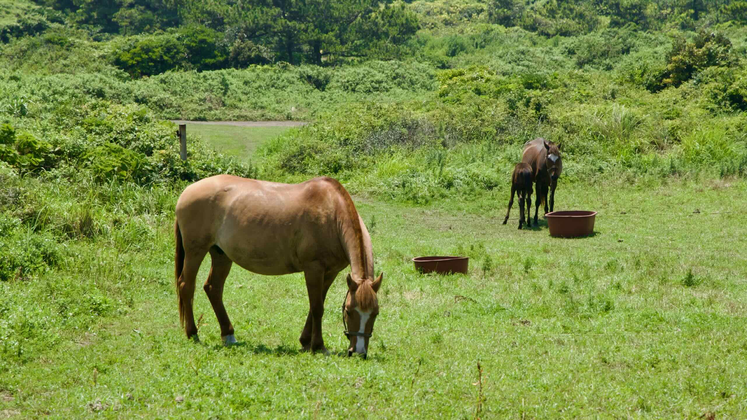
Head along bike lanes and Jeju’s busy coastal thoroughfare, passing a horse ranch and stretches of Jeju’s ancient coastal defensive wall system, originally built to repel seaborne raids almost a thousand years ago.
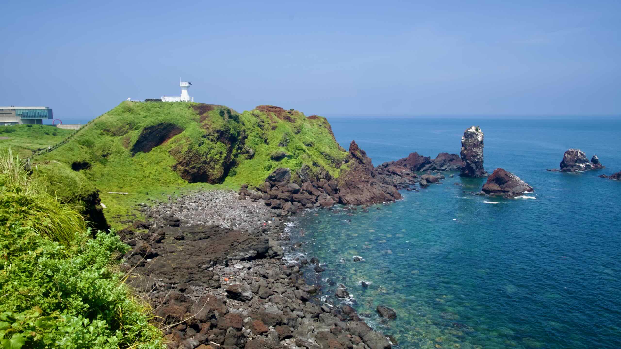
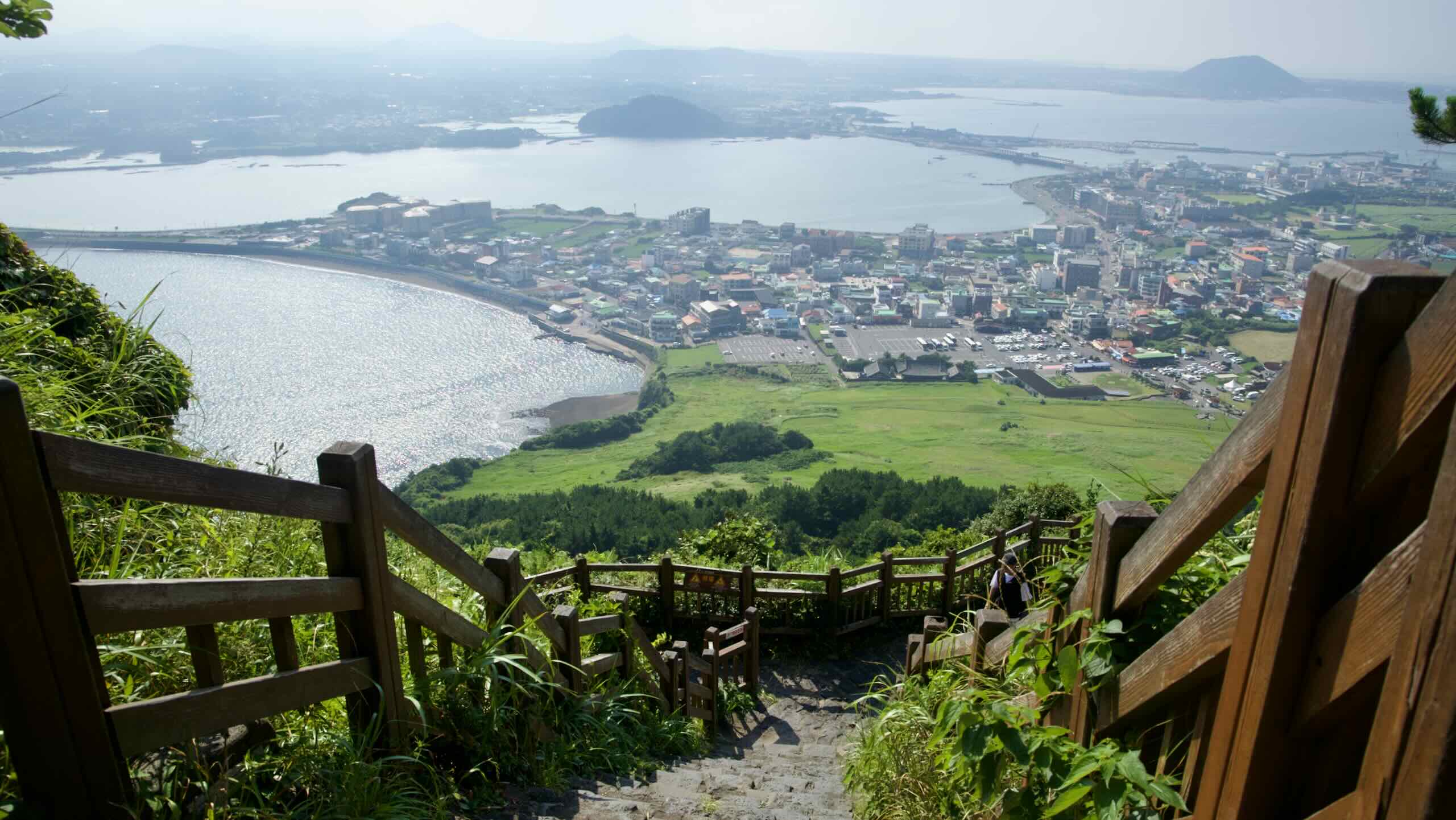
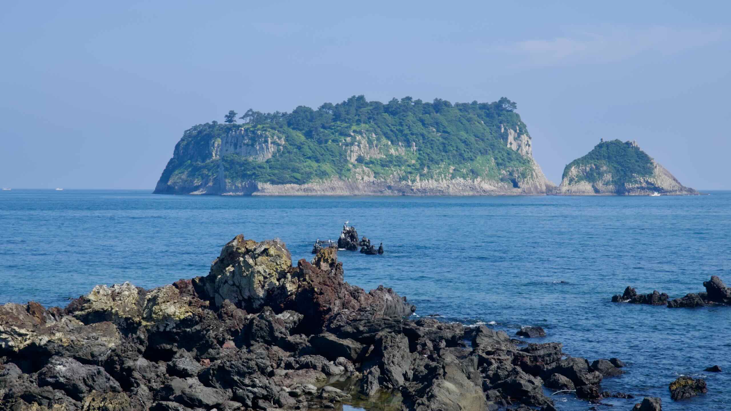
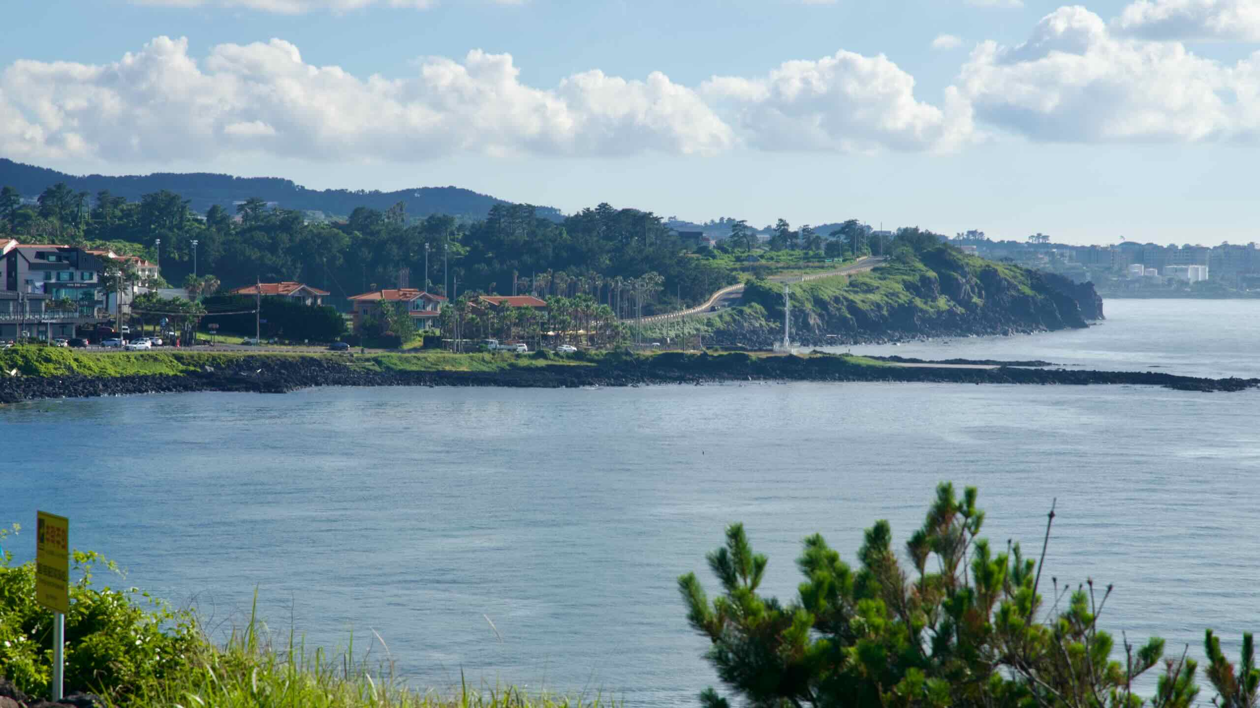
Near the middle of the eastern shoreline, you meet Seopjikoji Coast, which hosts free-roaming horses grazing among the hiking fields, and Seongsan Ilchulbong (Sunrise Peak), Jeju’s famous tuff cone and UNESCO World Heritage Site.
At Seongsan Village, ferries run to Udo Island, known for coral-sand beaches and black lava coves. The route then bends onto Jeju’s northern coast, passing a twin summit oreum and a rabbit-shaped islet blanketed in summer lilies.
The Jeju Fantasy Bike Path circles Jeju Special Province and its two cities. Read these quick breakdowns of each municipality.
Jeju Special Self-Governing Province (제주특별자치도; map) governs the entirety of Jeju Island, which rests 293 kilometers off the southwest coast of the peninsula. Known as Korea’s Hawaii, the island grew up alongside, but culturally different from mainland Korea, with unique folklore and art. A matriarchal society ruled by freediving women, Jeju often resisted interference from the peninsula’s rule and fought back against Japanese colonization. Today, other than fishing and limited farming, the island makes money through tourism. The dormant volcanoes of Seongsan Ilchulbong and Halla Mountain (South Korea’s tallest) and endless beaches attract mainland Koreans and visitors from nearby nations.
Jeju City (제주시; map) occupies the top half of Jeju Island. Known as the administrative side, or “the people north of Halla Mountain,” since ancient times, when Jeju’s three fathers crawled from three enshrined holes, the city held the island’s rulers and most of its people. Jeju’s only airport and biggest port form the main points of entry onto the island. Though Seogwipo possesses more tourism wonders, Jeju City encompasses its own basket of treasures, including beaches, museums, and offshore isles.
Seogwipo City (서귀포시; map) claims the bottom part of Jeju Island. Less populated than Jeju City, the district is one of Korea’s most developed tourist destinations. Filled with hotels, resorts, and terra firma glory, Seogwipo boasts a lake-topped peak, pristine beaches, a troop of waterfalls, sculpted offshore islands, and Jeju’s most iconic dormant cone volcano. The city also holds the Jeju World Cup Stadium, where Jeju’s professional football (soccer) club plays.
Elevation
A palm‑lined hill road passes a modern lodge and gardens.
Jeju looks harmless from the map: a loop around the island, hugging the sea. How bad could it be?
For long stretches (especially on the east and north coasts), you’re nearly at sea level, spinning past harbors, beaches, and black lava walls.
But Jeju has a volcanic past. That means headlands, oreums (parasitic cones), and inland passes.
The Jeju Fantasy Bike Path spreads out its big climbs. A major one sits on the southeast coast, there are some short climbs on the northeast, and there’s a prolonged uphill re-entering downtown Jeju City.
Below are the climbs you’ll feel the most, listed in counterclockwise order (the direction this guide takes). Let’s dig in.
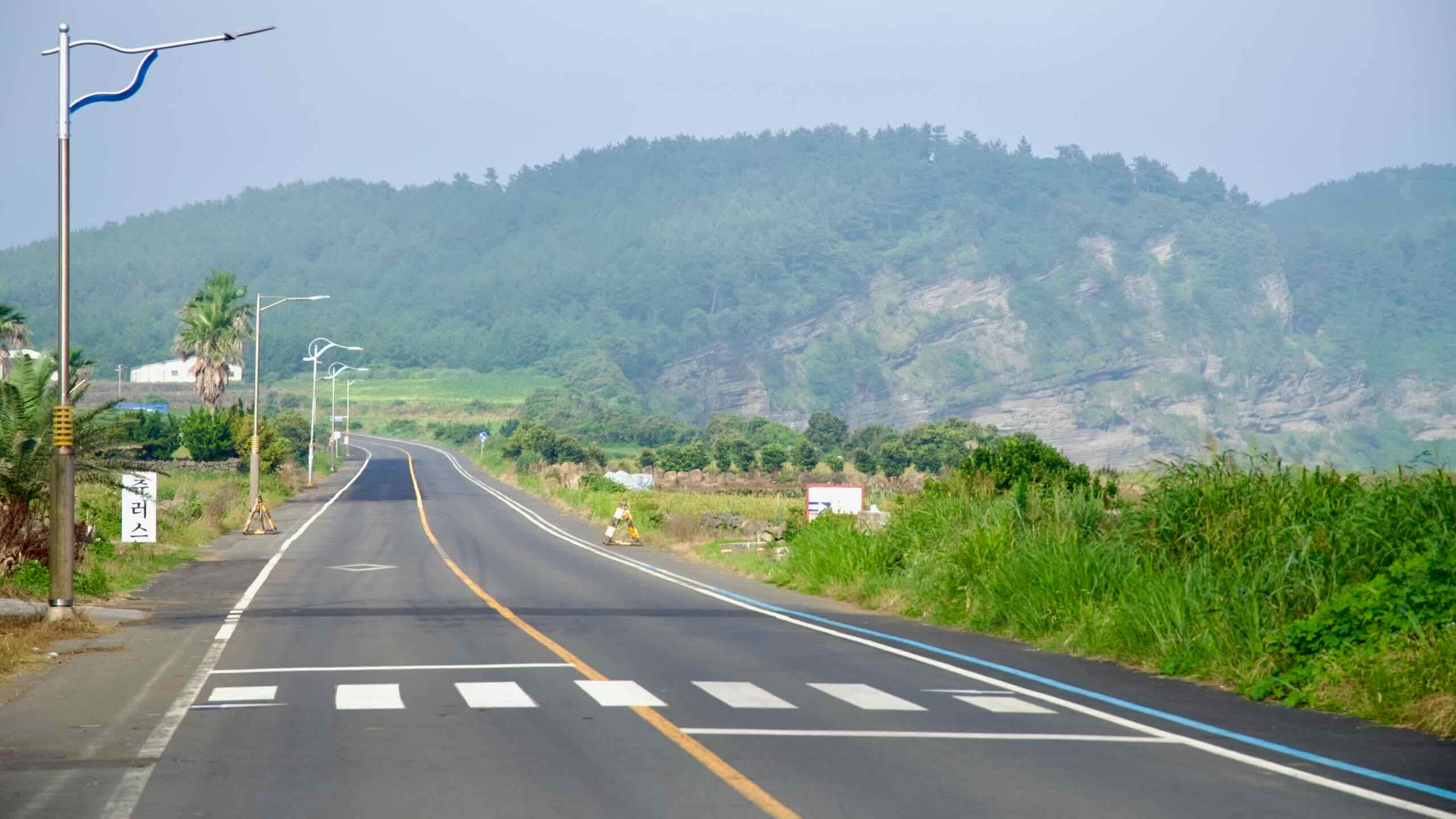
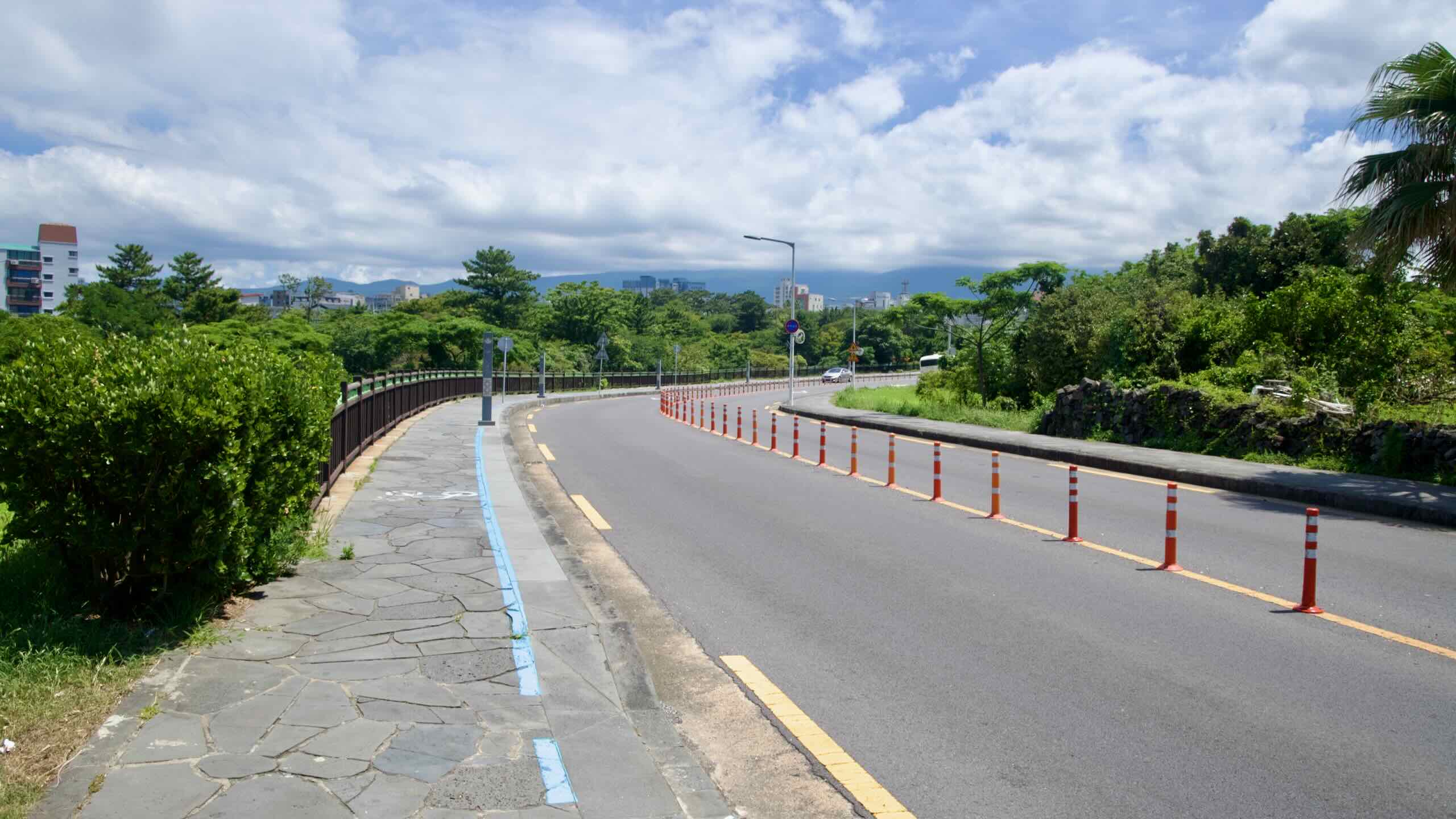
The northwest coast features Hagu-Aewol Coastal Road, a 4-kilometer urban trek through Aewol with punchy little hills on a beautiful coastal roadway. You’ll roll into a fishing village, pop up and over a lava bluff, bomb back down to the sea, repeat (directions).
Your steepest climb is a 24-meter push near Shineom Port (map), with another sharp 20-meter uphill to Darak Shelter.
The Mighty Climb
The signature climbs on the Jeju Fantasy Bike Path come back-to-back:
From the Sagye Coast up past Sanbang Mountain
Flow onto Iljuseo Road (map) and begin your climb up Gunsan Oreum
This back-to-back effort is the most challenging uphill stretch on Jeju Island’s coast. Beginning at 0 meters above sea level, the top sits 165 meters in the sky. However, the total elevation gain is spaced out over roughly 15 kilometers. So if you ride at a moderate to slow pace, with plenty of breaks, the climb can be conquered.
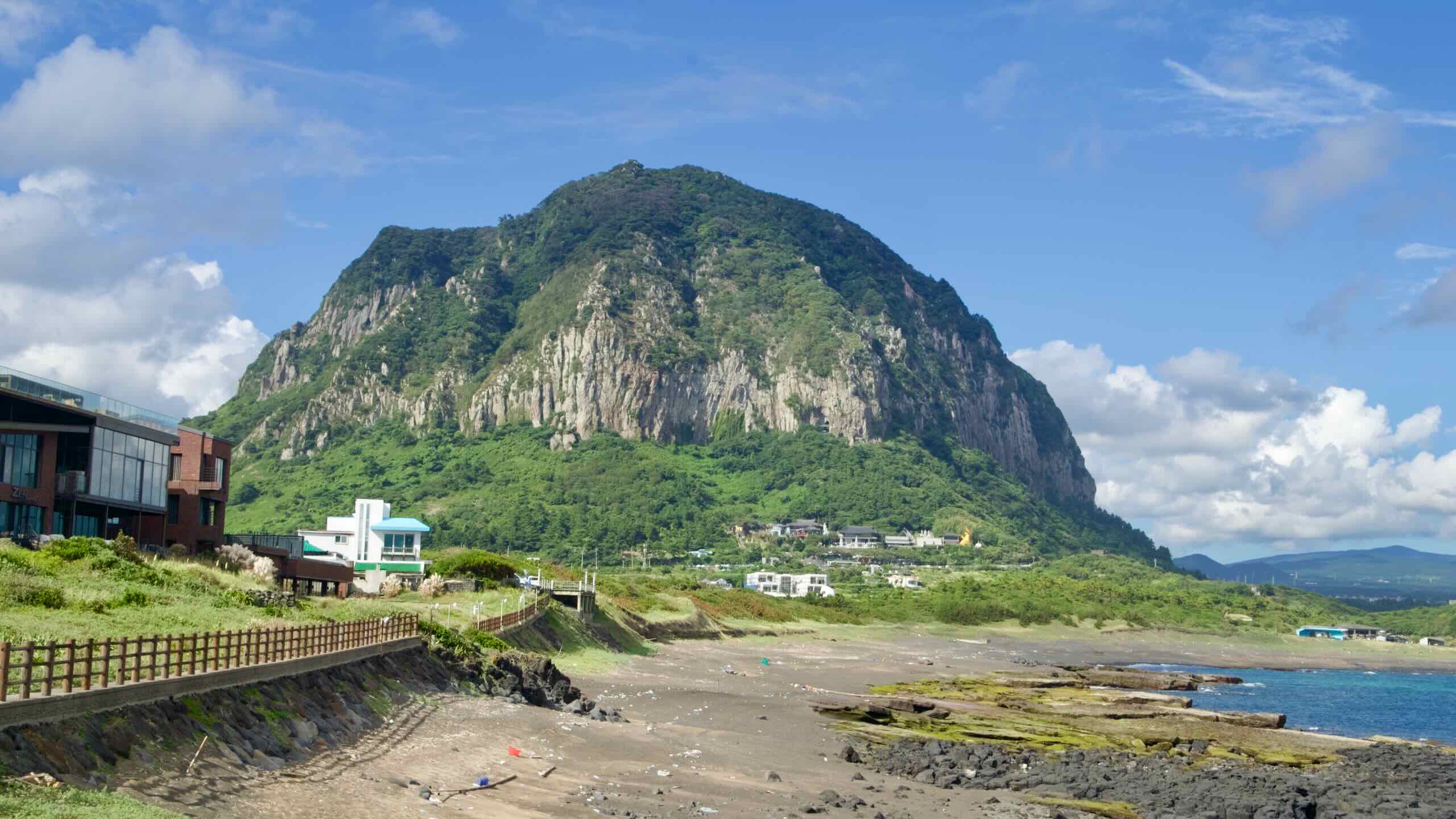
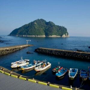
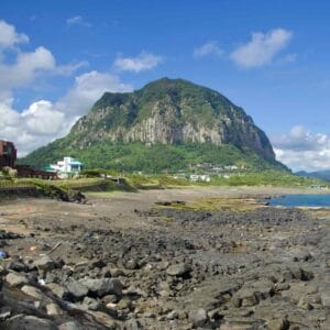
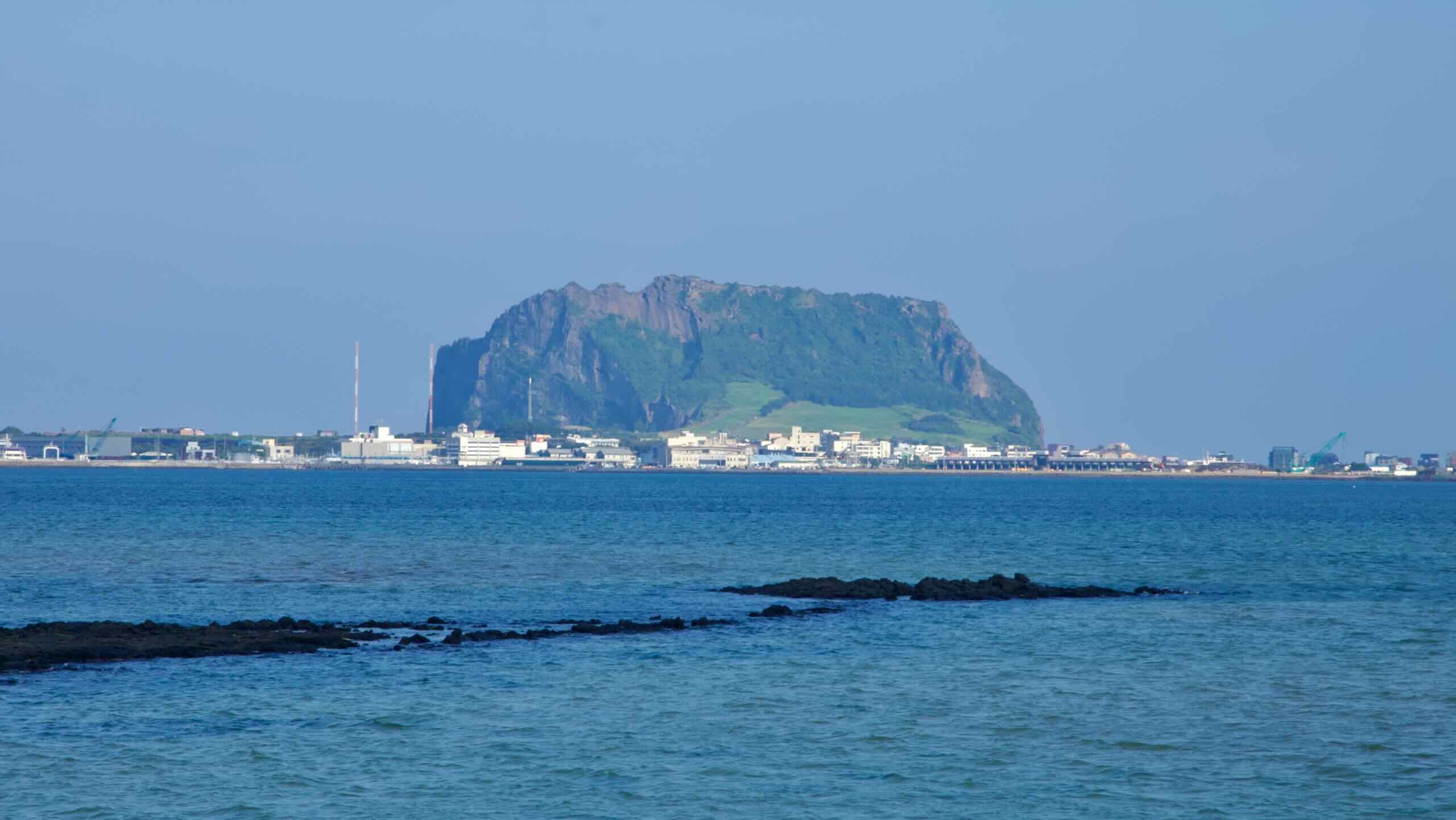
Start at Sagye Port beneath Sanbang Mountain, a sheer 395-meter volcanic dome that towers above the otherwise flat coastline.
From the harbor, the Sanbang Mountain Pass climbs 54 meters over 1.9 kilometers at an average 2.84% grade (directions). You’re still on regular town roads here — weaving past seafood spots, guesthouses, and the base of Sanbang Mountain — but you’re already working.
Total Climb: 54 m
Distance: 1.9 km
Avg Gradient: 2.84%
As you round the mountain, protected bike shoulders carry you toward Iljuseo Road, the main artery that’s going to drag you inland and up.
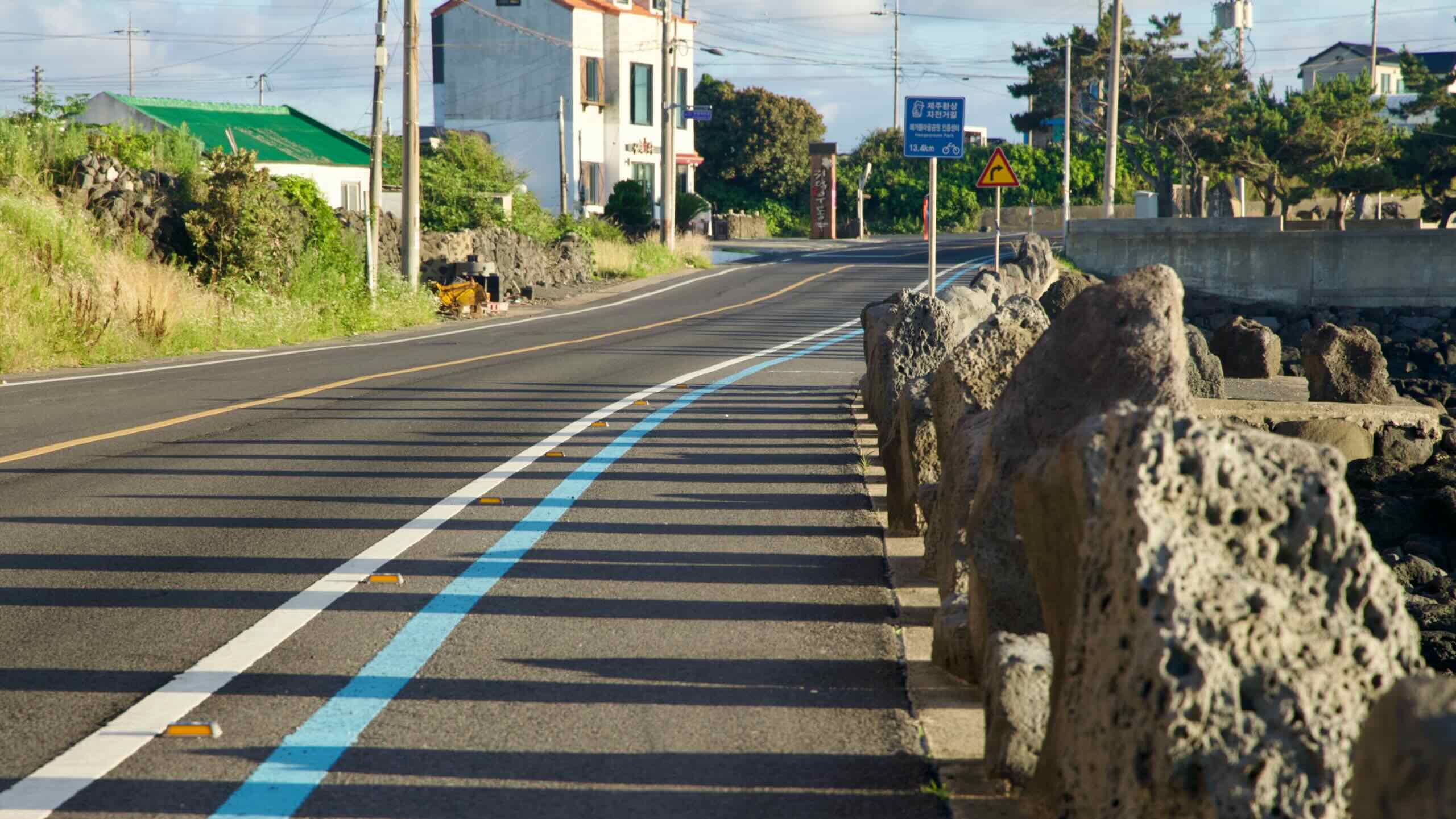
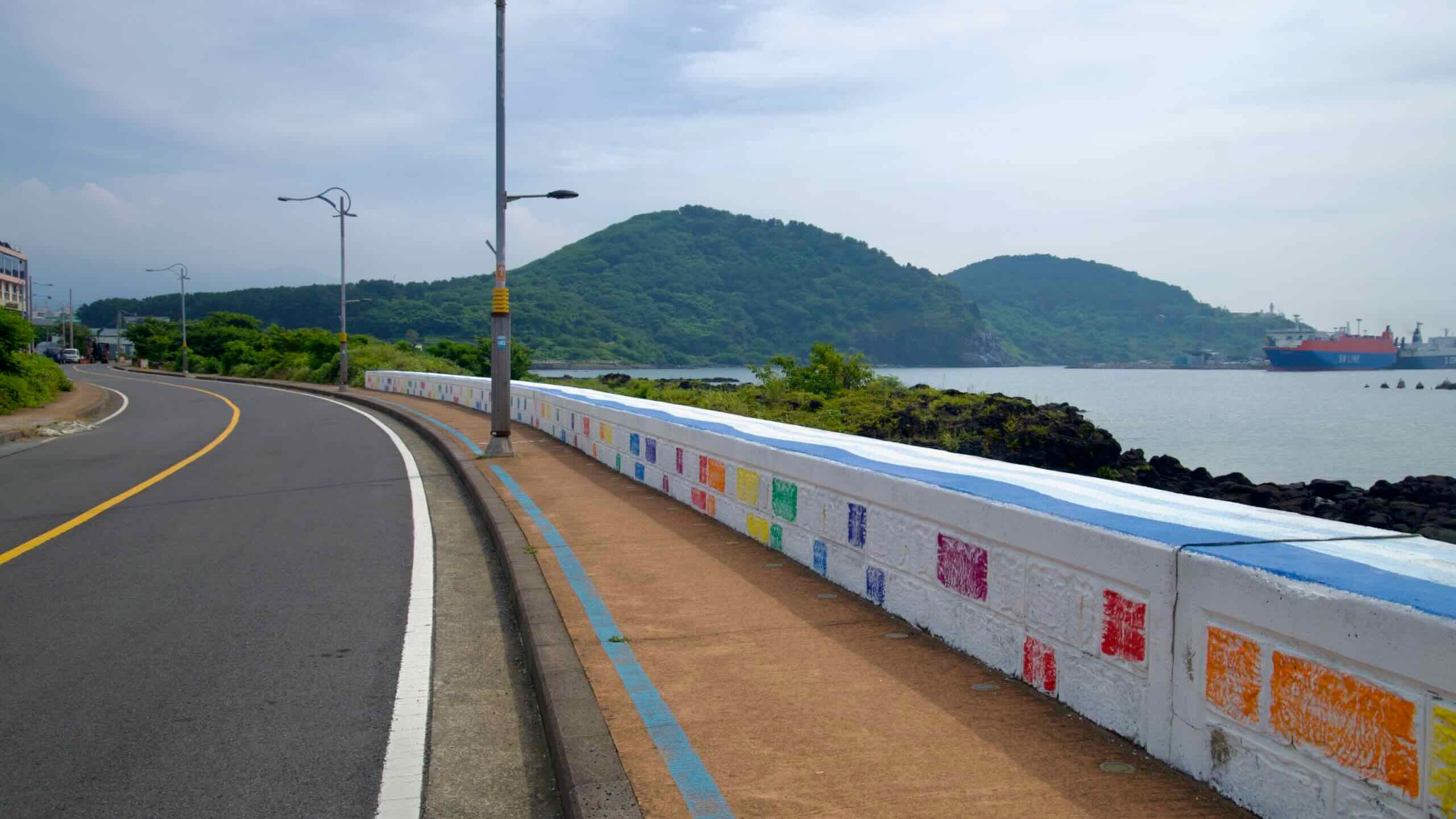
The Jeju Fantasy Bike Path mostly follows the shoulders of roadways and designated bike lanes on sidewalks. But the route mixes in several surface types.
On Jeju’s big coastal arterials (for example, the Iljuseo/Iljudong corridors), you ride in a dedicated bike lane, often separated by a curb or concrete median. You’ll experience this most on Seogwipo’s southwest coast and again on the island’s northeast.
Separated seaside bike lanes.
Much of the northwest uses physically separated lanes with cones or barriers as the road climbs and dips along basalt headlands (for example, Hagu-Aewol Coastal Road).
As you ride counterclockwise from Jeju City and eventually return to Jeju City, you’ll find the booths tucked into parks, beaches, and scenic overlooks. Open your Bike Passport, press the certification center’s custom stamp, and move on.
Collect every stamp and earn the Jeju Fantasy certification. These stamps also count toward Korea’s Grand Slam award.
Certification Centers
Let’s take a look at each of the certification centers and where you’ll find them.
Yong Du Am Certification Center (용두암 인증센터; map) — Hidden inside Yongdam Park near Yong Du Am Rock (“Dragon Head Rock”) on Jeju City’s north shore. This is where you officially start the Jeju Fantasy Bike Path and pick up your very first stamp.
Haegeoreum Park Certification Center (해거름마을공원 인증센터; map) — On Jeju’s northwest coast along busy Iljuseo Road, in Haegeoreum Park (“Sunset Park”). The booth sits between bushes next to the bike path.
Beophwan Badang Certification Center (법환바당 인증센터; map) — Stands near the end of Jamnyeo Square by Beophwan Port at the end of Beophwan Badang Coast on Seogwipo’s south coast. The square features sculptures celebrating Jeju’s haenyeo (traditional women divers).
The Jeju Fantasy Bike Path loops around Jeju Island, combining coastal and inland cycling experiences. It traverses 234 kilometers of varied terrain, showcasing Jeju’s landscapes, coastal roads, and cultural landmarks.
Close view of Yongduam (Dragon Head Rock) on Jeju’s north shore.
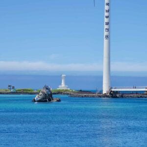
Yong Du Am Rockstands as one of Jeju Island’s iconic landmarks. Situated on the northeastern coast near Jeju International Airport, it’s a convenient stop for visitors beginning or concluding their Jeju journey. The rock formation’s name translates to “Dragon Head Rock,” inspired by its striking resemblance to a dragon rising from the sea.
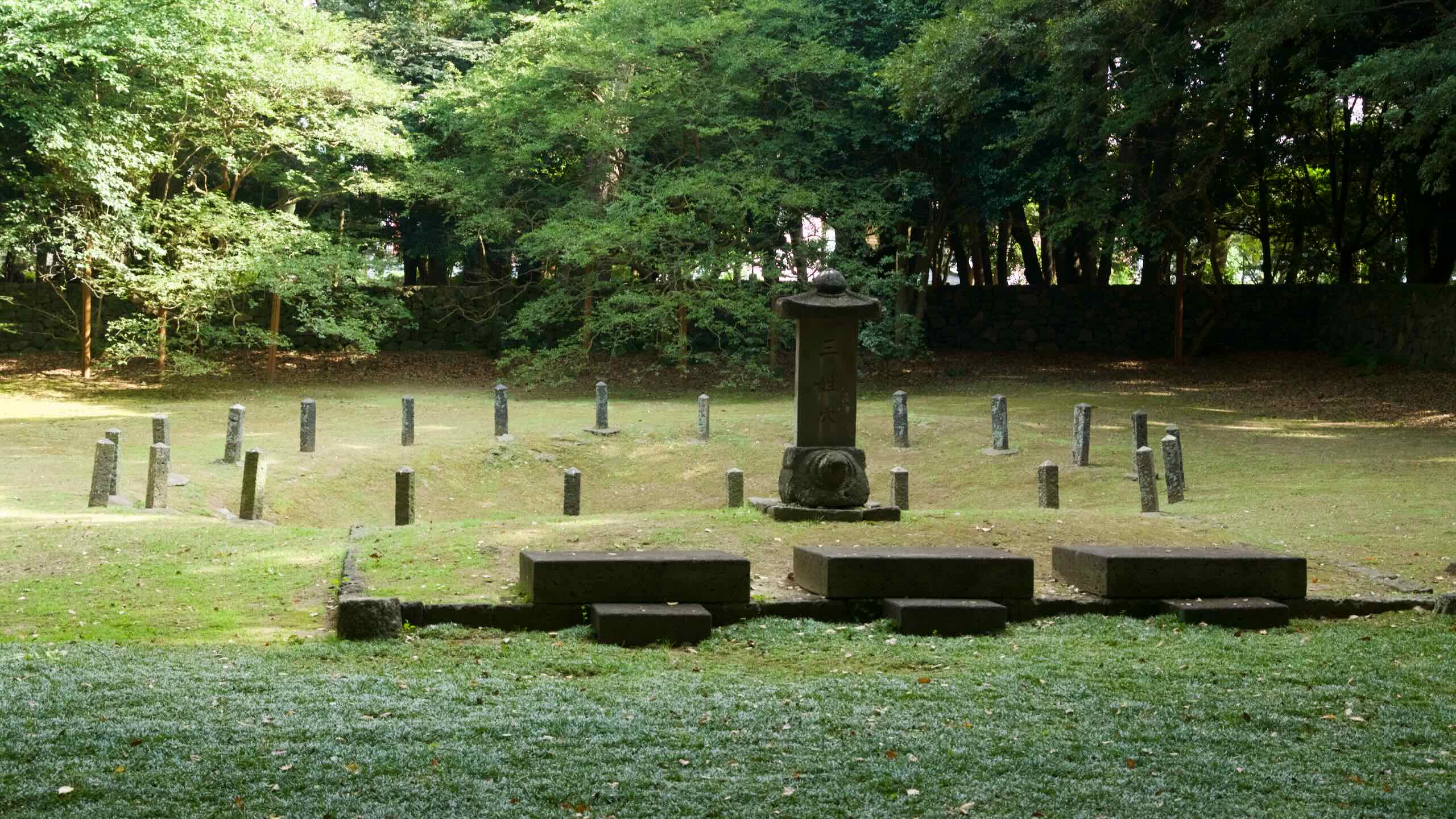
Short stone posts encircle the three sacred holes of Samseonghyeol inside a grassy basin.
Samseonghyeol Archaeological Site, located in Jeju City, is a significant historical and cultural landmark tied to the origin myths of Jeju Island.
Known as the “Three Clans’ Holes,” this site is where, according to legend, three demigods emerged from the earth to become the founders of Jeju’s ancient kingdom of Tamna. Designated as Historic Site No. 134 in 1964, it is a key destination for those interested in Jeju’s mythology, history, and cultural heritage.
Hyeopjae Beach with Biyangdo Island and turquoise water.
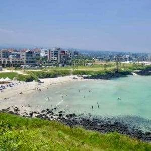
Nestled along Jeju’s picturesque western coastline in Hallim Town, Hyeopjae Beach and Geumneung Beach form a captivating seaside duo. These neighboring beaches are known for their pristine white sands, crystal-clear waters, and breathtaking views of Biyang Island.
Visitors can enjoy the lively atmosphere of Hyeopjae or the serene charm of Geumneung, both offering unique experiences just a short walk apart.
Shaded palm‑lined path creating a tunnel‑like promenade.
Nestled on the western coast of Jeju Island near Hyeopjae Beach, Hallim Parkis a sprawling botanical and cultural park that blends natural beauty with local heritage.
Established in 1971 on barren coastal land, the park has grown into a lush, 100,000-square-meter destination featuring nine themed zones. Visitors can explore subtropical gardens, ancient lava caves, a traditional folk village, and more, all against the backdrop of stunning coastal scenery.
The airways between Gimpo International Airport in Seoul and Jeju Island are the busiest in the world.
Jeju Island (제주도; map) is the largest island in South Korea and a prominent destination for travelers drawn to its unique volcanic landscapes, rich cultural heritage, and ecological significance. Officially known as Jeju Special Self-Governing Province, the island covers an area of 1,833 square kilometers, with Hallasan Mountain at its center, rising 1,947 meters above sea level. The island’s distinct geographical features include over 360 volcanic cones, known locally as oreums, and a coastline marked by lava formations and sandy beaches.
Referred to as Tamna Kingdom (탐라) in ancient records, Jeju Island was an independent kingdom before its incorporation into the Korean Peninsula’s governance in 1404. Today, Jeju is a UNESCO World Natural Heritage Site, recognized for its geological and ecological importance.
Geography
The airways between Gimpo International Airport in Seoul and Jeju Island are the busiest in the world.
Jeju Island sits in the southernmost part of Korea, approximately 450 kilometers from Seoul, separated from the mainland by the Jeju Strait (제주해협; map). Here’s a brief rundown of its geology:
Its elliptical shape stretches 73 kilometers from east to west and 31 kilometers from north to south.
The coastline spans 253 kilometers, encompassing rocky shores, lava cliffs, and a few sandy beaches.
Hallasan Mountain occupies its middle. A dormant shield volcano and the highest peak in South Korea, its slopes give rise to diverse ecosystems, ranging from subtropical lowlands to alpine environments.
Jeju’s geological formation began millions of years ago through volcanic activity. The island’s rich history includes its time as the independent Tamna Kingdom, which engaged in trade with China and Japan. During the Joseon Dynasty, Jeju became a place of exile for political dissidents, further shaping its unique culture and traditions.
(Remember, if you’re flying or sailing to Jeju from South Korea, it’s a domestic journey. No immigration or customs. However, you must present identification to board. And if you’re a foreigner, they won’t accept your library card. Passports or ARCs only.)
Airplanes
The airways between Gimpo International Airport in Seoul and Jeju Island are the busiest in the world.
All airlines traveling to the island accept bicycles as checked baggage. And because many mainland cyclists venture to Jeju, workers handle thousands of flying bikers a year.
The airways between Gimpo International Airport in Seoul and Jeju Island are the busiest in the world.
Don’t like flying? Take a boat.
Ferries depart from mainland Korea to Jeju Island from several ports along Korea’s coasts, including Mokpo, Busan, Incheon, and more.
Why so many ferries? I thought airplanes were the most popular transportation to Jeju.
True. The flights average an hour from Seoul to Jeju. Most ferries average four hours from the bottom coast of Korea, and over 13 hours from Incheon.
As mentioned earlier, many visitors scoot around the island in a car because Jeju lacks trains and speedy bus service.
While the majority rent, others prefer to take their own. And you can’t bring a car on a passenger jet. So almost all ferries bound for Jeju include a lower deck for cars, motorbikes, and bicycles.
The airways between Gimpo International Airport in Seoul and Jeju Island are the busiest in the world.
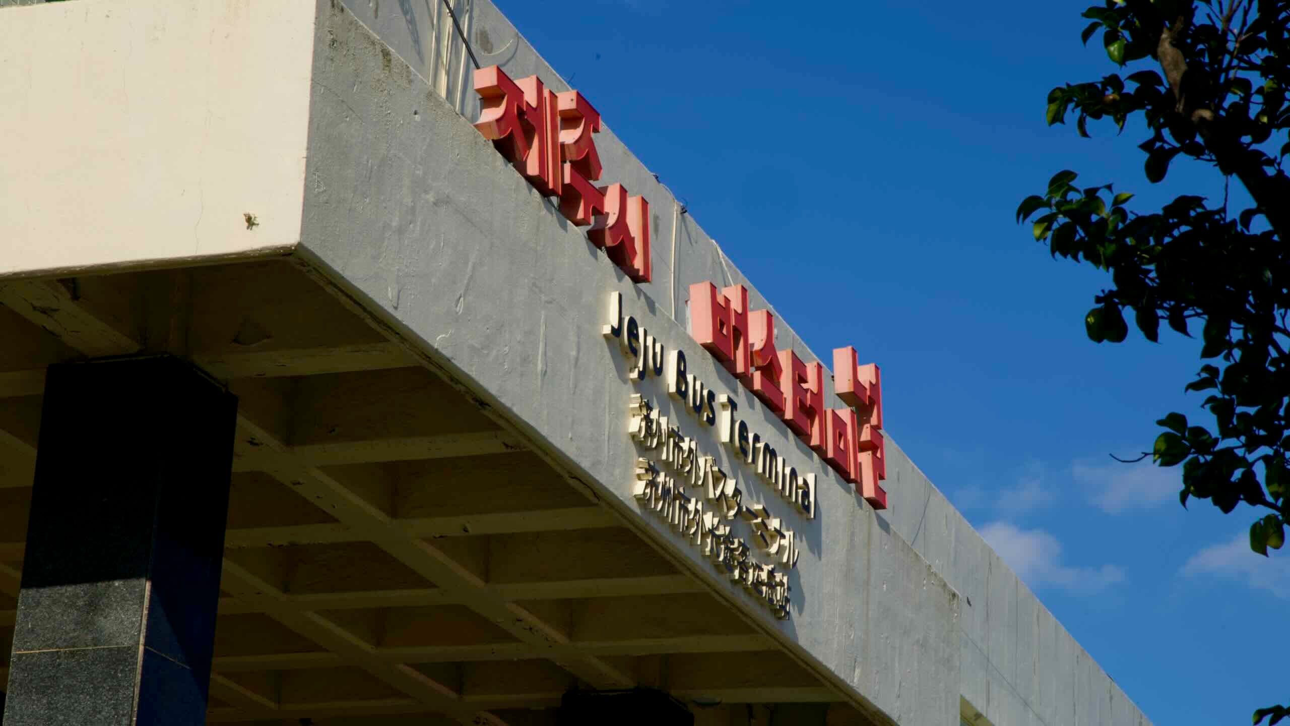
Jeju island offers only one form of public transportation: buses.
On the mainland, there’s a clear distinction between bus types. City buses accept transportation cards and stop at regular old bus stops. Intercity and express buses require tickets, depart from terminals, and land in another city or part of the country.