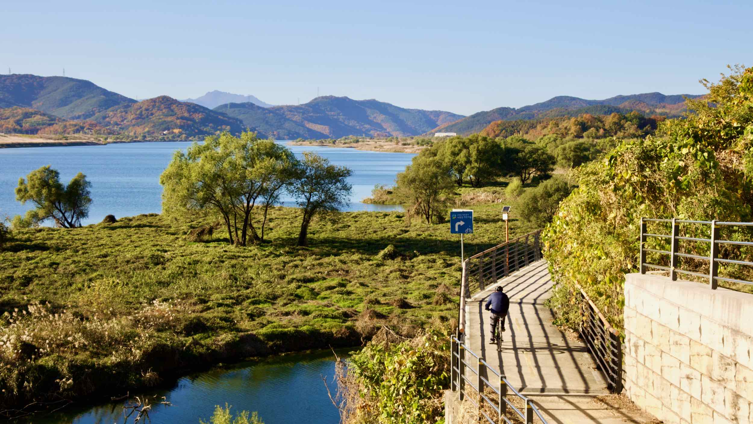
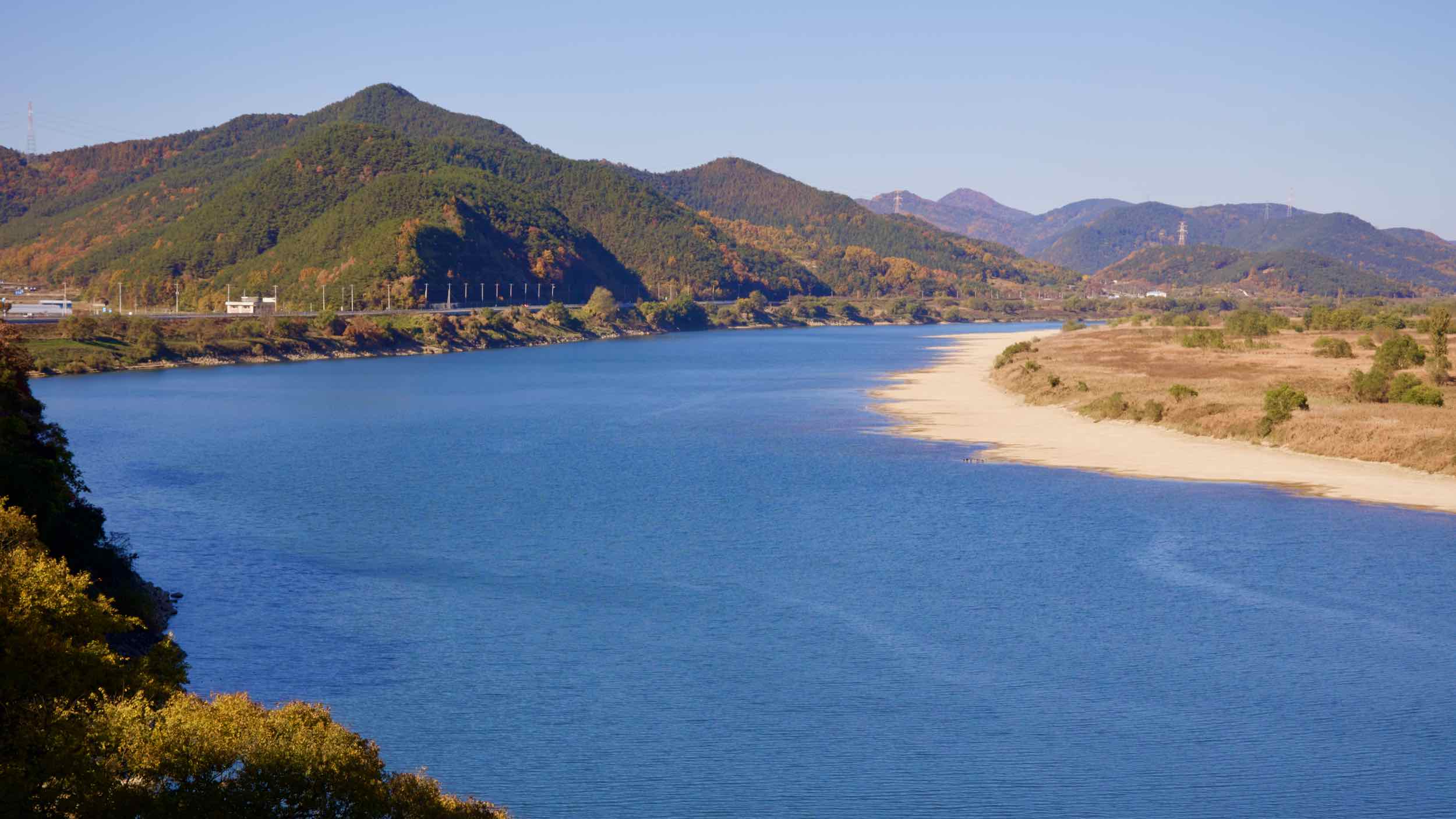
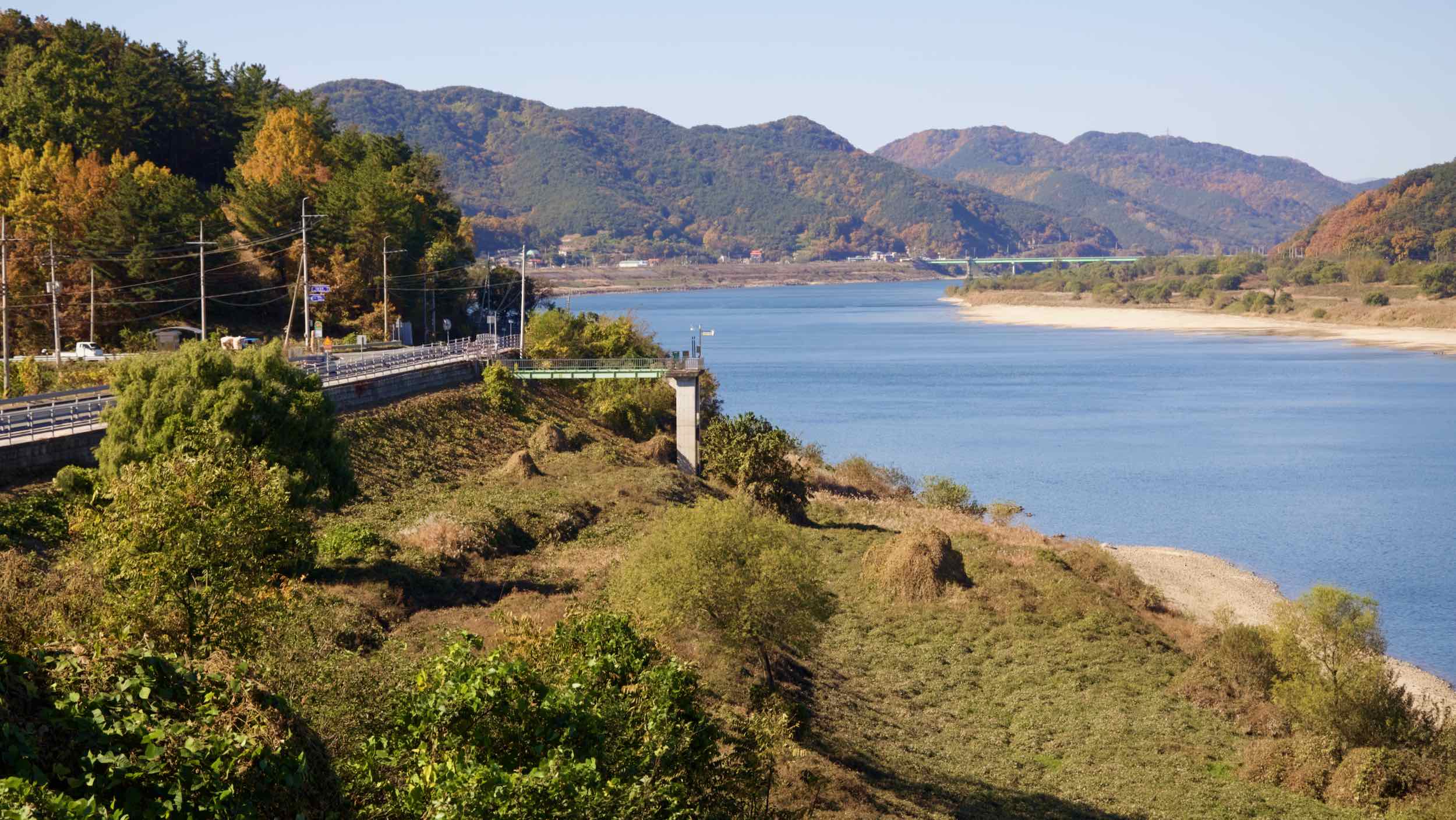
Bike Daegu to Changnyeong
Off into the country. The fourth leg of the Nakdonggang Bike Path brings you into green spaces between farms and urban outposts. Along the way, pass an ancient Confucion academy, watergates, and the river’s most challenging hills (directions).
Gangjeong Goryeong Weir to Dalseong Weir
Flow out of Daegu and into riverside parks. Cross an ancient ferry that brought the region’s first “ghost barrel.”
From the edge of Daegu, cross Gangjeong Goryeong Weir to the west side of the Nakdong River (road view).
Amble down a bike path adorned with sculptures. Near baseball and rec fields, cross Samunjin Bridge (사문진교) and curl around into the parking lot of Hwawon Garden Park (화원동산).
Samunjin Ferry
Glance to the river banks and find the Samunjin Ferry (사문진나루터). Now quiet, it was a bustling river port during the Joseon Dynasty (1392~1897). After unloading their cargo, merchants and sailors stopped by a (now restored) inn near the ferry to dine and drink.
Around 1900, an American missionary brought the first piano to the region via the Samunjin Ferry. Locals named the instrument “ghost barrel” because of the magic that emanated from the hollow wood. Every October, 100 pianists perform here around the many piano statues.
Dip under an overpass, over a short bridge, and pop out onto the river flanked by greenhouses.
The next 15 kilometers swing around a bend in the Nakdong, by countless farms and a local waterside park.
Arrive at Dalseong Weir (달성보; Dalseong-bo). Its nearby management building hosts a convenience store, rooftop balcony, observatory, and the Dalseong-bo Certification Center.
Dalseong Weir (달성보; Dalseong-bo) sits 21 kilometers downriver from the Gangjeong Goryeong Weir on the edge of Daegu City. It’s the sixth watergate on the Nakdong River built by the Four Rivers Project (2009~2011).
Sluice gates take up 162 meters of its 580-meter length. They prevent flooding and secure water for local farmers. Three small hydro power plants on its east side create 16 GWh of electricity annually for 1,400 homes.
Dalseong Weir to Dodong Seowon
Swirl through a riverside town, then tackle (or not) the Nakdong route’s third tallest climb. Arrive at a centuries old UNESCO Confucian Academy.
- Hyeonpung Town
- Daramjae Pass
- Dodong Seowon Confucian Academy
Head across Dalseong Weir to the west side of the Nakdong and curve 3 kilometers to Bakseokjin Bridge (박석진교). Before it, find a fork in the path (road view).
- Head left to ride the west side. Not a part of the “official route,” this path climbs and zig-zags along a ridgeline topped by a 179-meter peak (directions).
- Turn right to stay on the “official route.” Cross the bridge to the Nakdong’s east side.
Let’s stick to the “official route.” It offers a less exertive path and passes a Nakdong River highlight.
Jump to the river’s east side and land in Hyeonpung Town (현풍읍). Tired? Is it dark? Wheel into town and find motels to crash and restaurants to feast.
Still some daylight left? Roll on.
Navigate Hyeonpung’s streets and sidewalks until you rejoin bike paths along the river (directions). Less than 5 kilometers later (road view), a country road interrupts the biking lanes.
Here you have two choices:
- Head across the country road and climb 102 meters up Daramjae Pass (다람재). It offers a high-angle, painterly view of the Nakdong and Dodong Seowon Confucian Academy (directions; 2.5 km; road view).
- Follow a protected shoulder along the country road. It blasts through a tunnel and under Daramjae Pass (directions, 1.3 km; road view).
Took the easy route? Travel through the dark tunnel through the hillside and emerge near the Dodong Seowon Confucian Academy (도동서원).
Took the hard route? Descend the switchbacks from Daramjae Pass and arrive near Dodong Seowon Confucian Academy.
Dodong Seowon Confucian Academy (도동서원) sits at the bottom of Jindeung Mountain (진등산) 30 kilometers south of Daegu along the Nakdong River.
Its name, “Dodong,” translates to “teaching” (/dō/; 도) from the “east” (/dōng/; 동). (Korea is “east” of China.)
Dodong Seowon to Hapcheon Changnyeong Weir
Roll by campgrounds and follow a wavy riverside path by an ancient pavilion. Then, before ending at the Nakdong’s sixth weir, choose a hill with a temple and a view, or country roads that save time and effort.
From Dodong Seowon Confucian Academy, the bike path flattens and curves around a bend.
Roll upon a straightaway lined with the Nakdong River Leports Valley (레포츠밸리), an auto campsite, and the gleaming Nakdong River Training Center (낙동강수련원), which teaches young and old how to camp, raft, and more.
At the end of the straightaway lives the National 119 Rescue Headquarters (중앙119구조본부). It holds a fleet of helicopters and Korea’s Search and Rescue Team (KOSAR).
Wind around jagged, tree-lined curves and climb an embankment with a view (road view) of the Daegu National Industrial Complex (대구국가산업단지). Samsung and LG chaebols snatched this massive plot from nature’s jaws and set up chemical, car, and electronics factories.
Next, zoom down 3 kilometers of undulating, zig-zagging bike path (directions; road view), past the 500-year-old Ino Pavilion (이노정). Near the end, a series of boardwalks glide over the river’s edge. Stop the second of two switchback climbs. Gaze back at the snaking route (road view).
Wheel onto a road with a bike lane separated by a guardrail. After 1.5 kilometers, the road and bike lane diverge (road view), presenting you with two options:
- Stay in the bike lane and climb a 135-meter hill along the river (directions).
- Hop the guardrails and follow the road, avoiding the hill (directions).
The “official route” hops the guardrail and avoids the hill. But if you’re up for adventure, stay in the bike lane. Make the climb, discover the hill-bound Musimsa Temple (무심사), and slog through a muddy patch (road view).
Both the hill and road paths land on Hapcheon Changnyeong Weir (합천창녕보; Hapcheon Changnyeong-bo), the sixth Nakdong River watergate.
This weir’s management building doesn’t hold a convenience store. But it offers water fountains, an observatory, and the Hapcheon Changyeong-bo Certification Center.
Completed in 2011, Hapcheon Changnyeong Weir (합천창녕보; Hapcheon Changnyeong-bo) is the seventh of eight weirs built by the Four Rivers Project on the Nakdong River.
Along its 328-meter, 138 meters are 11.5-meter tall rotating watergates that store water upriver during droughts, and release it during floods. Two hydro generators on the weir’s east end generate 25 GWh of electricity each year.
Hapcheon Changnyeong Weir to Bakjin Pass
Fill your water bottles. The next section runs deep into the river’s rural parts and features the bike path’s steepest climb, which provides a hawk’s-home view of the landscape.
Ride across Hapcheon Changnyeong Weir. Cycle until you roll onto the protected lanes of a country road (road view). Follow the traffic and snake along modest riverside hills.
Is the sun setting? Are your legs led? Near the end of the country road, find a motel (road view) and a tiny town with a mart and restaurants (road view). Stop here to recharge! You won’t pass civilization again soon.
After the tiny town, hop between bike paths and empty country roads as the river bends 13.3 kilometers around a horn (directions).
Bakjin Pass
Up ahead, the toes of Jandeung Mountain (잔등산) extending to the riverside force the bike path inland and up Bakjin Pass (박진고개), the Nakdonggang Bike Path’s tallest and steepest climb. And unlike most other hills, this one is unavoidable.
From a base of 15 meters, follow switchback turns to a 173-meter peak (directions).
Find a lookout platform at the top (road view). Take a breather. Gaze out from the perch at the wide, winding Nakdong River.
Bakjin Pass to Namji Bridge
Tackle another mighty pass (or not) as the Nakdong River bends east into Namji Town (남지읍).
- Yeongaji & Angaesil Passes
- Namji Town
- Namji Canola Flower Bed
- Namji Bridge
Sail down from Bakjin Pass and cross Bakjin Bridge (박진교). After a breezy riverside stretch, the bike path T-bones a country road (road view).
Which way should I go? Left or right? Here are your options.
- Take a right to follow the “official route” (directions). It climbs 163 meters up the back-to-back Yeongaji (영아지고개) & Angaesil Passes (안개실고개).
- Take a left to follow a country road over an 83-meter hill.
Taking the second option (left turn)? It presents an easier alternative. But it lacks the pic-worthy backdrop and travels along an unprotected road (directions; road view).
Have the spirit? Try the first option (take a right).
Yeongaji & Angaesil Passes
Skim the river, then begin your ascent in the back of a tiny town (road view). Along a tree-crowded ridgeline, wind along a bike path that doubles as a hiking trail (road view). Between the passes, pause at a resting deck. Gaze out (road view).
Both routes land in downtown Namji Town.
- The easy route slogs through trafficked roads to the Nakdong River. Ride west till you come upon Namji Bridge.
- The hard route sails through farms west of downtown. After landing on the Nakdong, ride east to Namji Bridge through the Namji Canola Flower Bed (남지유채밭), which blooms yellow in spring.
Namji Bridge? I see three Namji Bridges!
Let’s break it down.
- Namji-dae-gyo (남지대교), or “Namji Big Bridge,” is a newer beam bridge that carries cars and cyclists south across the Nakdong River from in Namji Town’s east (road view).
- Namji-gyo (남지교) or “Namji Bridge,” sits 1.5 kilometers upriver. It sports golden trusses and allows cars and bikes (road view).
- Just below the gold-trussed Namji Bridge hangs the retired blue trusses of Namji-gyo (남지교; road view) or “Namji Bridge.” (Yes. It’s the same name.)
The “official route” uses the blue-trussed Namji Bridge, which age and technology made obsolete. Now it ushers Sunday strollers and cyclists across the Nakdong River.
(Don’t get picky about your bridges. Cross any Namji Bridge and you’ll land on the Nakdonggang Bike Path.)