The Nakdong River
- Length — 510 km (317 mi)
- Basin Area — 23,384 km² (9,029 sq mi)
- Origin — Maebong Mountain (매봉산), Gangwon Province (강원도)
- Termination — Korea Strait or South Sea (Namhae; 남해)
The Nakdong River (낙동강) is South Korea’s longest. It stretches from the Taebaek Mountain Range in the north and flows like an accented “Ć“ through the southeast Gyeongsang Provinces before spilling into the Korea Strait in Busan City (부산시).
Along with the Han, Geum, and Yeongsan, South Koreans revere the Nakdong as one of the nation’s Four Major Rivers. It continues to play an important role in Korea’s development.
Let’s map out its geography before learning some of its historical highlights.
Namesake
“Nakdong.” Does the name mean anything?
Sangju City (상주시) was once called “Nakyang” (낙양). Because of its prominent status as a bread basket and transportation hub, locals referred to the river that ran by it as “Nak-dong-gang” (낙동강).
What does “dong” (동) and “gang” (강) mean? “East” and “river.”
So the name translates to, “River that flows east of Nakyang” (Sangju City).
Geography
The Nakdong River spans 510 kilometers (317 mi). That ranks first in South Korea, but third on the Korean Peninsula. The Yalu (압록강; Amrok) and Tumen (두만강) Rivers span a mightier 790 and 521 kilometers, forming the border between North Korea and China.
Most of the streams and rivers in Gyeongsang Provinces, including the Yeong (영강; 78 km), Geumho (금호강; 116 km), Miryang (밀양강; 102 km), and Nam (남강; 186 km), dump their innards into the Nakdong, creating a 23,384 km² (9,029 sq mi) basin area.

Source
Korea’s ancient histories (신증동국여지승람) claimed that three small ponds in Taebaek City (태백시) were the Nakdong’s source.
Collectively named Hwangji Pond (황지연못), citizens worshiped a spring near the northernmost pond. Water sprang from its bowels even during the most severe droughts. So locals erected a monument and performed rain ceremonies near this eternal well.
In the 20th century, topographers followed a branch to the top of Maebong Mountain (매봉산; 602.5 m). There they discovered Ragged Spring (너덜샘), the true source of the Nakdong River.
Course
From its source, Ragged Spring, the Nakdong begins as Hwangji Stream (황지천), flowing Maebong Mountain (매봉산). After it merges with Cheolam Stream (철암천; map) just below Taebaek City, the waters assume the name “Nakdong River.”
This narrow stream then saunters through a series of dams and artificial lakes crowned at the end by the Andong Dam (안동댐) and Andong Lake (안동호), where the Nakdonggang Bike Path starts.
In Andong City (안동시), the Nakdong River runs westward for 60 kilometers, creating the top part of the accented “Ć.”
Near Sangju City, the Nakdong River makes a hard left turn southwards as the Yeong River (영강) flows into it.
(This is also the point where the Saejae Bike Path, which follows the Yeong near its end, continues onto the Nakdonggang Bike Path along the Cross-Country Route.)
From Sangju, the Nakdong courses through the middle of North (경상북도) and South (경상남도) Gyeongsan Provinces for 160 kilometers. This longest stretch forms the vertical part of the accented “Ć.”
After passing Gumi and Daegu, Korea’s fourth largest city, the river again swivels 90-degrees eastward in Changnyeong County, forming the bottom of the river’s “Ć.”.
After The Nakdong takes its final turn south in Yangsan City (양산시), it flows through Busan, Korea’s second biggest city, and empties into the Korea Strait on the southeast coast.
From Sangju, the Nakdong courses through the middle of North (경상북도) and South (경상남도) Gyeongsan Provinces for 160 kilometers. This longest stretch forms the vertical part of the accented “Ć.”
After passing Gumi and Daegu, Korea’s fourth largest city, the river again swivels 90-degrees eastward in Changnyeong County, forming the bottom of the river’s “Ć.”.
After The Nakdong takes its final turn south in Yangsan City (양산시), it flows through Busan, Korea’s second biggest city, and empties into the Korean Strait on the southeast coast.
Fast Start, Gentle End
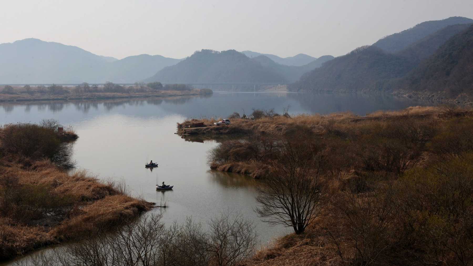
As the Nakdong River slides down the Taebaek Mountains in its upper reaches, it churns, sucking in oxygen for trout, trees, and thistles to multiply.
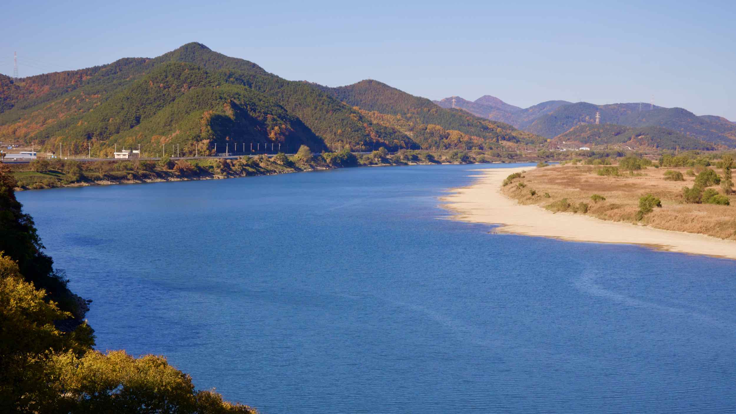
But beyond Andong City, the river’s slope mellows. For its final 160-kilometer stretch, its tilt nears zero-degrees, slowing the current and allowing the sediment it swiped upstream to clump together and create islands and deltas.
The Gimhae Delta (김해 평야), claimed by Busan’s Gangseo District (강서구), is Korea’s largest. It sits at the end of the Nakdong as it flows into the Korea Strait (South Sea). This massive, muddy wetland also boasts the country’s most productive soil for crops and habitat for creatures of the water, land, and air.
An Iffy End
The Nakdong River splits in two as it reaches the top of the Gimhae Delta, diverging east and west.
Koreans once viewed the west stream as the primary route. However, in 1935, the government built a series of floodgates at its head, choking its flow.
Now, the stream east of the Gimhae Delta assumes the Nakdong River’s main line. It flows past Eulsukdo Island, the Nakdonggang and Cross-Country Routes’ finish lines.

Birds & Wetlands
The Nakdong’s silty islands aren’t the best for human development. The ground is too slushy to build subways under or skyscrapers upon. But the birds love the land.
Every migration season, thousands of rare and threatened birds flock to the Gimhae Delta and Eulsukdo Island’s critter-rich paradises, or zoom to the Joonam Reservoir (주남저수지) or Upo Wetlands’ (우포늪) upstream bogs.
Here, winged creatures like squawk ducks from Russia and white-naped cranes from Mongolia, gorge themselves on the river’s slithery fish and squirmy snail bounty.
Disaster, Disaster
In the past, the Nakdong’s gentle downriver currents generated ideal islands for wild ones, but inspired fear among the town dwellers.
The almost stagnant flow led to frequent floods, most pronounced in the southern Yangsan and Miryang Cities. It also allowed seawater to creep upriver and poison local farmland.
Adding another monster to the river dwellers’ fever dreams, the Nakdong’s river bed coefficient — difference between its high and low water levels — was once the greatest in the nation. When low, the river sank into bone-dry banks. When high: Judgment Day.
During the Great Flood of 1925, a series of typhoons created by the East Asia Monsoonal flow dumped years’ worth of water into the Nakdong. The river rose, swallowed and swept away every people-built habitat in its basin.
Nak, Nak, Weirs Here
Like the Han River in Seoul, as Korea developed in the 20th century, the government set out to tame the tempestuous Nakdong River.
So in the 1970s, the government constructed a series of dams on the upper regions of the Nakdong River, including the Andong Dam. This dampened floods, relieved droughts, and snatched a bit of electricity for the industrializing nation.
The largest river transformation project, however, was the Four Rivers Restoration Project. Between 2009 and 2011, public and private corporations like K-Water dredged the Nakdong River’s bed and built a series of eight weirs or watergates.

What did they do?
Dredging removes industrial pollutants and deepens the river, reducing the duration of floods.
The weirs regulate water flow. Because Korea receives most of its rainfall in the summer, the watergates trap water to irrigate upriver farms during the dry sky spring and winter months.
Floods: minimized. Crops: watered.
Land Transformation
So humans and the Nakdong now live in harmony? The weirs and dams boosted farmers’ yields and gave developers the security to build 30-story apartments riverside. But, as always, there was a cost.
Dredging destroyed the Nakdong’s silty islands and sandbars, which were home to thousands of wetland flora and fauna.
The stagnant water behind the weirs allowed algae to flourish and starve the river of oxygen. This decimated fish populations and robbed migrating birds of their pit stop refuel.
And land-starved developers snatched the Gimhae Delta, once a thriving bird-opulos, and filled it with Gimhae International Airport, endless checkered farm fields, and a bustling neighborhood.
Pollution on the Nakdong
Daegu and Gumi Cities lie midway down the Nakdong River. While a bit of pollution leaks into the waterway from upriver communities, the Nakdong’s currents get a healthy dose of industrial waste as it passes these large manufacturing hubs.
Major spills from Gumi and Daegu factories in 1991 and 2008 forced the downriver citizens of Busan to create one of the most advanced water filtration systems.
History
Since time immemorial, the Nakdong River was the main artery for the people of Yeongnam (영남), the former name for today’s southeastern North and South Gyeongsang Provinces.
Early states grew using the river’s fertile banks, building larger and larger settlements. But the Silla Dynasty, which seized control in 532 CE, was the first to use the Nakdong’s full potential.

Highway to Hegemony
Two thousand years ago, the Silla Dynasty (57 BCE ~ 935 CE) was one of the Three Kingdoms that struggled for control on the Korean peninsula.
Clinging to a southeast corner, the weaker Silla couldn’t compete with Goguryeo Kingdom’s mighty military and the Baekje Kingdom’s naval superiority.
In 562, however, Silla snatched the Nakdong River from the Gaya Confederacy (가야; 42~562 CE). First, they used the river’s productive farmland to fill their grain reserves.
Second, using their trade relationship with the Yamato in Japan, the Silla used the far reaching waterway to send military equipment up river to defend and later conquer territory.
Later, with the help of China’s Tang Dynasty, Silla vanquished both the Baekje and Goguryeo Kingdoms, uniting the Korena peninsula for the first time.
River Ports Galore
The Goryeo (고려; 918~1392 CE), and Joseon (조선; 1392~1897 CE) Dynasties, which succeeded the Silla, regarded the Nakdong as one of four important rivers, which also included the Han, Geum, and Yeongsan.
As we learned before, the Nakdong River’s shallow tilt slows its current to a crawl. While this behavior led to flooding, it also made it easy for motorless ships to navigate upriver.
Through major river ports along the Nakdong, farmers sent their harvests down, and fishers their the South Sea (Korea Strait) catch upriver.
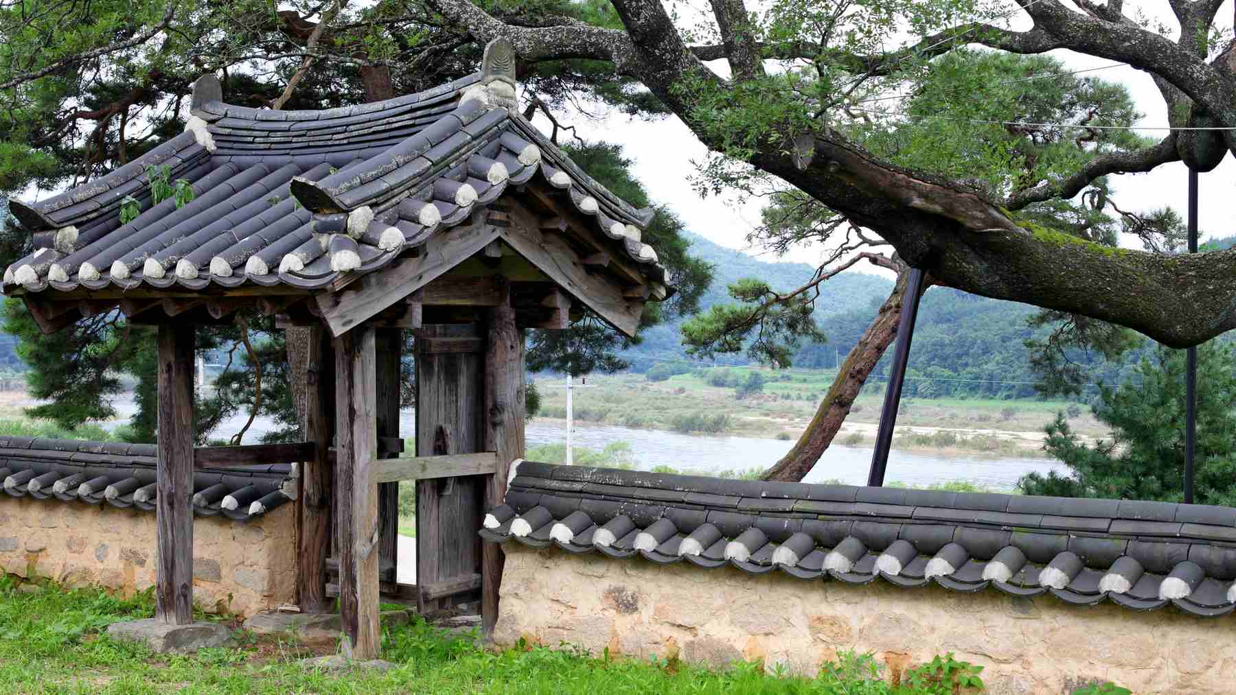
The port in Andong City (안동시) marked the farthest point boats could transport seafood before it spoiled. So during the Joseon Dynasty, foodies from around the kingdom visited Andong to dine on its famed salted, sea-caught mackerel. (Andong’s mackerel still draws crowds.)
The Modern Era
In the 20th century, the Nakdong River proved its importance once again. It continued to pump out tons of rice, but also formed a crucial defensive line during the Korean War.
Pusan Perimeter
After WWII and the Japanese Occupation (1910~1945), communists took the north half of Korea. Capitalists the lower half. Less than five years later, the North invaded the South, sparking the Korean War (1950~1953).
North Korea boasted a larger army, more natural resources, and the element of surprise. So, just three days after crossing the 38th parallel on June 25th, 1950, the Northern Forces (KPA) overwhelmed Seoul and continued their blitzkrieg deep into the peninsula.
By August, the South Korean Army (ROK) and UN Forces (USA) lost Daegu, the second capital, and retreated to the southeast corner of the country.
Known as the Pusan (Busan) Perimeter (부산 교두보 전투), South Korea’s new borders wedged between seas in the east and south, mountains in the north, and the Nakdong River to the west.
Low on ammo, tanks, and hope, Southern forces engaged in a ceaseless series of skirmishes against KPA troops along the Nakdong.
As troops and heavy equipment trickled into Busan, the US Command, led by General MacArthur, hatched a plan.
In mid-September, 1950, the UN and ROK swung around the west coast of Korean and retook Seoul via Incheon (인천시; map). They beat back Northern forces almost to the border with China. However, Chinese forces entered the chat and drove the UN and ROK back to Seoul.
The war stagnated for two more years around today’s DMZ until China, the US, and North Korea signed the Korean Armistice in 1953.
South Korea almost collapsed in the first few months the war. But the Nakdong River marks the furthest point of retreat.
Bridge of Patriotism
Scrambling to halt the Northern Army’s unchecked advance in the opening stages of the war, UN and ROK forces exploded bridges along major waterways.
August, 1950, in Chilgok County’s Waegwan Town (왜관읍), the retreating army denoted Waegwan Iron Bridge (왜관철교). However, like Seoul’s Hangang Railroad Bridge, fleeing citizens were still crossing. Many died.
Before the war ended, Waegwan rebuilt the bridge and named it Bridge of Patriotism (호국의다리) after those who perished. The Nakdonggang Bike Path passes this blue trussed bridge (road view).
A Not-So Grand Idea
In 2006, candidate and future President Lee Myung-bak (이명박; 2008~2013) proposed South Korea build a few canals. Not simple hops between lakes, but terraforming connections between the Han and Nakdong, and the Geum and Yeongsan Rivers. He called the project the Grand Korean Waterway (한반도 대운하).
What would that do?
Link Seoul, Busan, and the southwestern Honam Region via waterway, allowing ships to pass from the Yellow Sea (West Sea) through the heart of the country and into the Korea Strait (South Sea).
The problems?
While the proposed canal to link Han and Nakdong canal spanned only 40 kilometers, the route passes the Sobaek Mountain Range (소백산맥), which the high-climbing Saejae Bike Path treks. Mountain canals don’t come cheap.
Second, much of the Han and Nakdong Rivers are neither wide nor deep enough to accommodate modern ships. To alter their specs would have required dredging, broadening, and unimaginable destruction of ecosystems.
Third, roads and rail. Korea already had plenty of them. Why drill through a mountain when trucks and trains get the job done faster?
Lee Myung-bak scrapped the Grand Canal under pressure from environmentalists and common sense. He did, however, get two water projects built:
- The Gyeongin Ara Waterway is in Incheon. It connects the Han River with the Yellow Sea and hosts the Ara Bike Path.
And the Four Rivers Restoration Project, which placed fifteen weirs, dredged 5.2 billion square meters of riverbed, and paved 1,728 kilometers of bike path along Korea’s four major rivers.