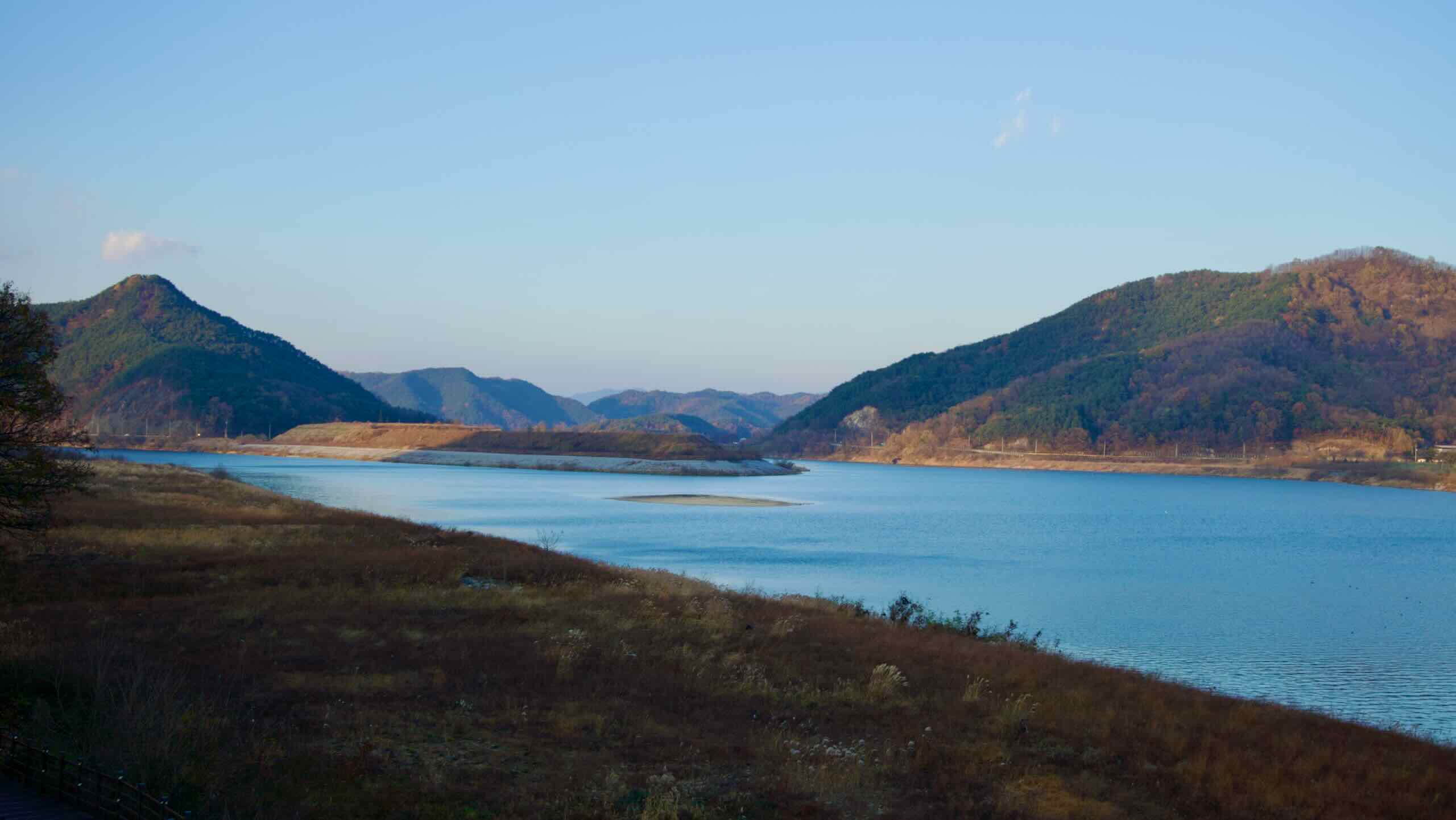
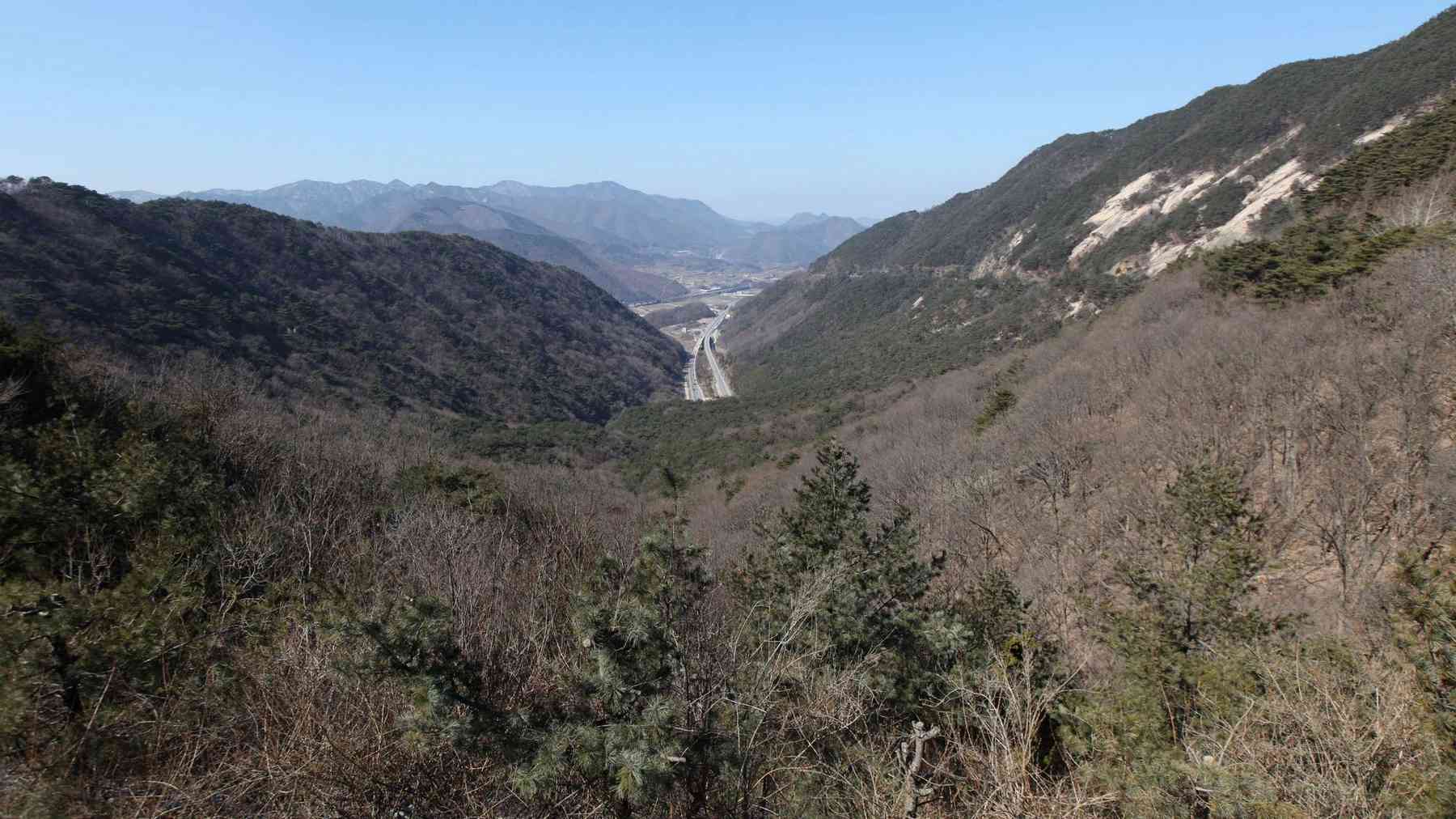
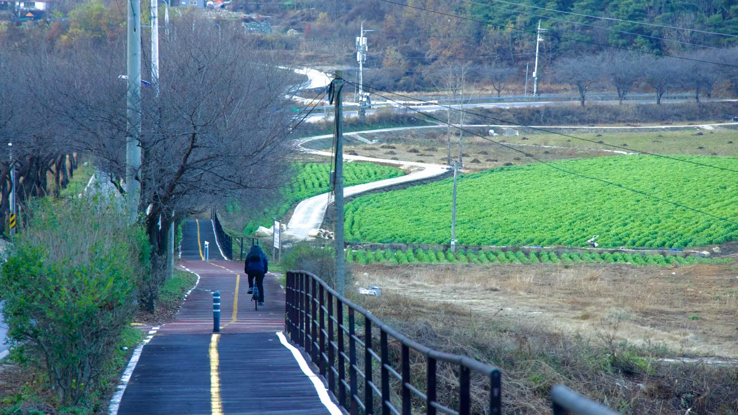
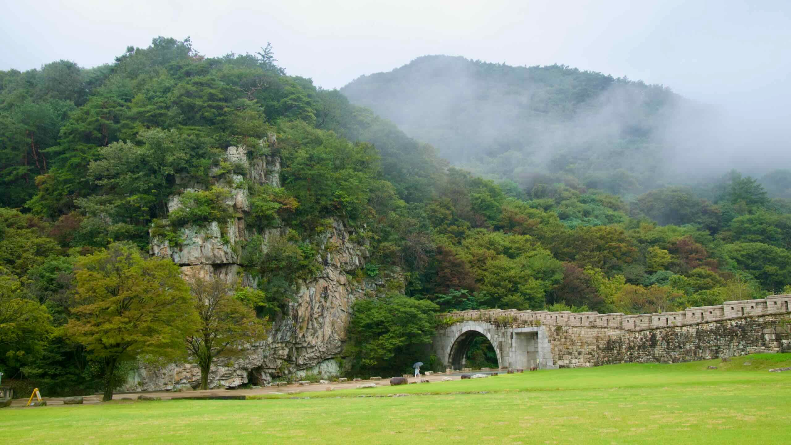
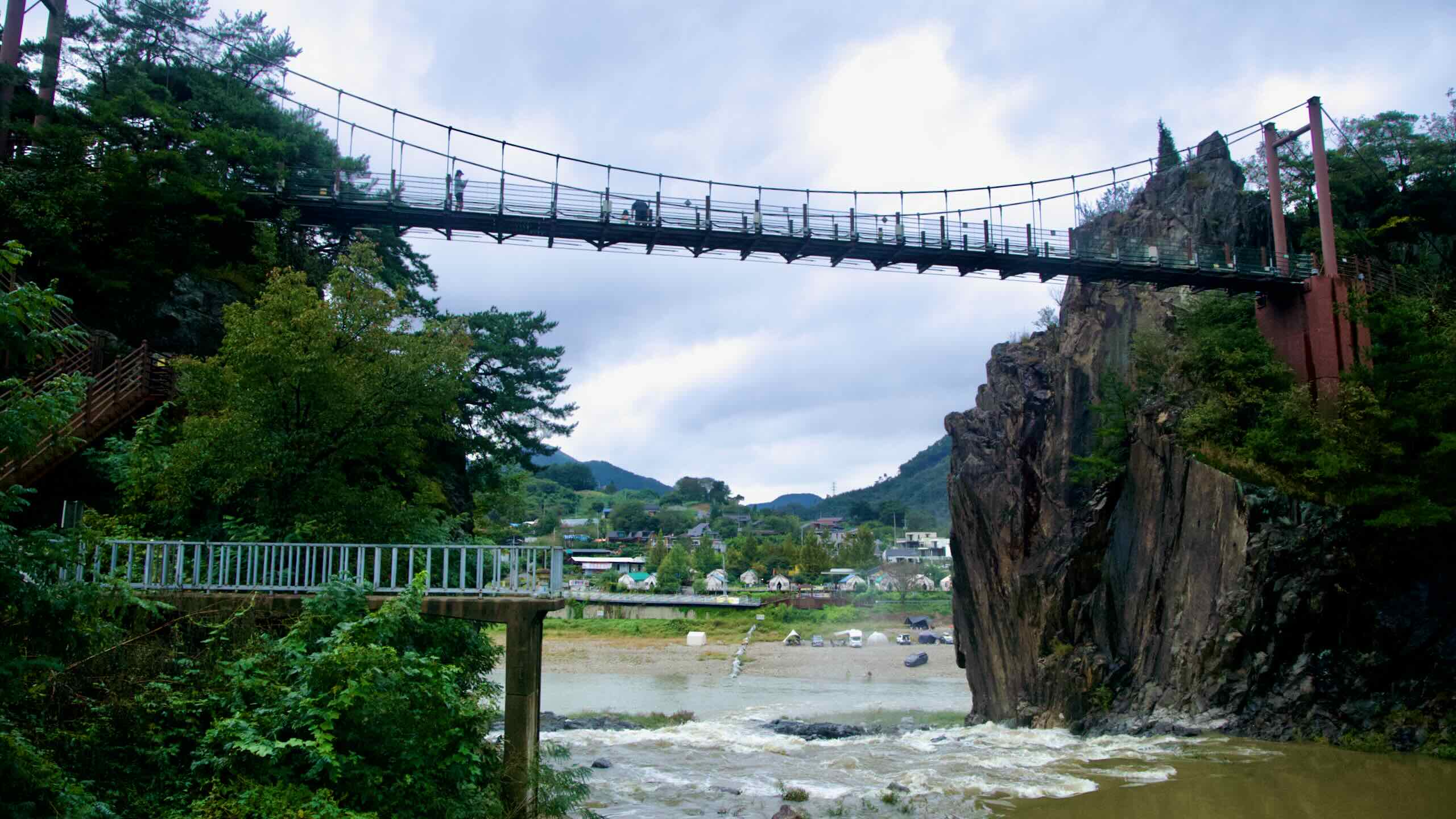
Bike Chungju to Sangju
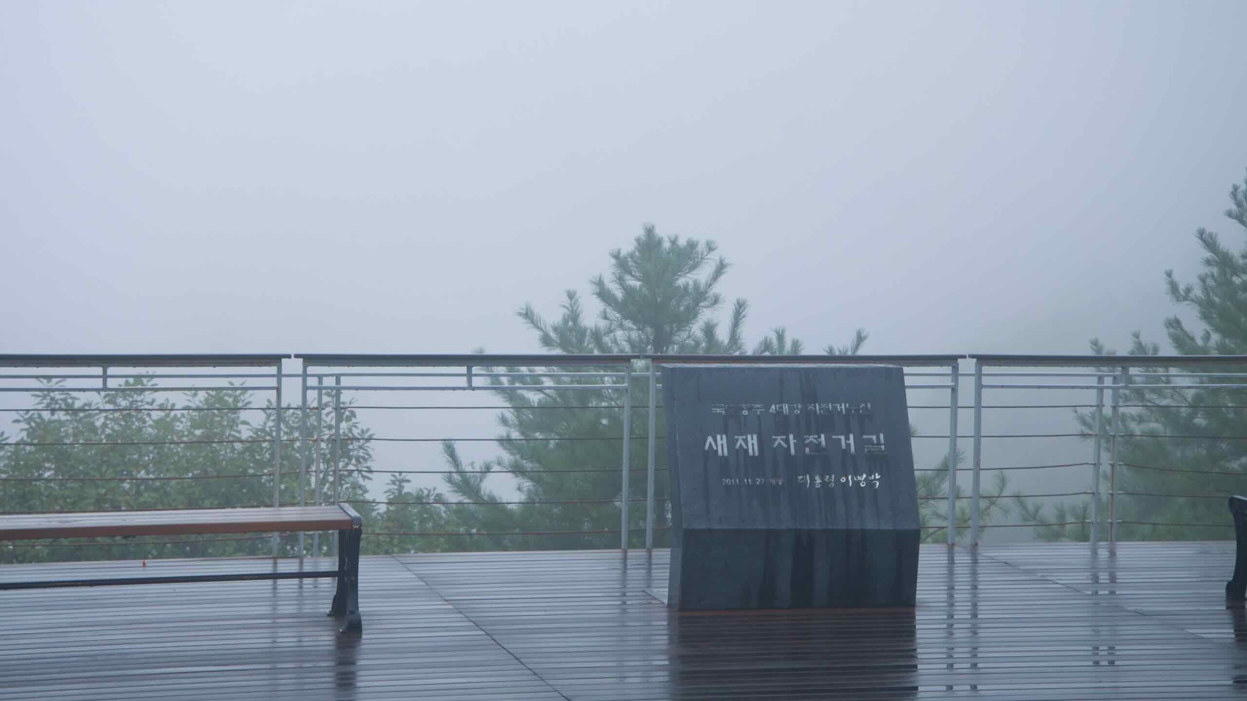
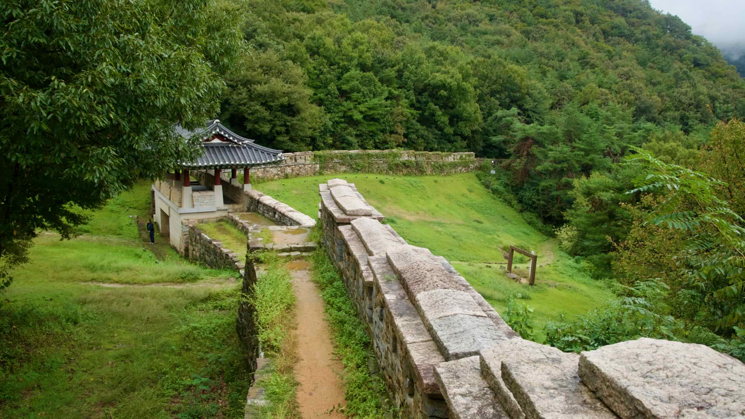
The Saejae Bike Path course spans only 100 kilometers. With grit and determination, you can conquer it in a day. However, the journey from downtown Chungju to Sangju Cities crosses a pair of mighty peaks and extended uphill slogs.
Fill your water bottles, pack your tools, and get loose. Let’s conquer those inclines.
Tangeumdae Park to Sujupal Peaks
Wash out of downtown Chungju City and flow up a wide mountain stream to a crown of spires rising above a waterfall.
- Tangeumdae Park
- Dal Stream
- Sujupal Peaks
Start at Chungju Tangeumdae Certification Center (충주탄금대인증센터) in Tangeumdae Park, one of the Hangang Bike Path’s ending points.
(Chungju Dam Certification Center, 6 kilometers east, marks the Hangang’s official end. But if you’re just aiming for the Cross-Country Certification, you don’t need to collect the stamp.)
Tangeumdae Park (탄금대) covers Daemun Mountain (대문산; 107-meter peak) on the northwest bank of downtown Chungju, where the South Han River and Dal Stream (달천; Dalcheon) meet.
The park’s site gained fame for two historical events.
Pop out of Tangeumdae Park and cycle to the Dal Stream. As wide as a river, and one of five that form the Ocheon (Five Streams) Bike Path, the Dal Stream encircles downtown Chungju before flowing into the South Han River.
Flow stream-side bike path to the southeast, hop onto city streets, then dip under Yuju Makdari Bridge (유주막다리; road view).
Cycle along on a depopulated country road drenched in green. Dal Stream shimmers beside. Durung Mountain (두룽산), one of many Sobaek Mountain Range giants, rises in the behind.
After crossing Seolun Stream (설운천; road view), ride Dal Stream south past an encampment of restaurants serving hoe (호), or raw fish (road view).
Drift down a tree-lined road, then stop and marvel at the sheer, leaf-blanketed mountainsides (road view). Thank the gods you don’t have to climb them… yet.
Hop over Sitkgye Bridge (싯계교) to the south side of the Dal Stream. Curve around a bend in the stream and find Palbong Glamping (팔봉글램핑) on an embankment at the bottom (road view). These boxy tents look over the Dal Stream to Sujupal Peaks (수주팔봉; Sujupalbong).
Sujupal Peaks is a rock wall topped with stony spires. When viewed from across the stream, spectators can count eight (/pal/; 팔) peaks. Hence, “Sujupal Peaks (수주팔봉).”
Need a break? Clamber down to stream-side pebble beach. Watch Seokmundong Stream (석문동천) burst through Sujupal Peaks and spill down a waterfall into the Dal Stream.
Above it, Sujupal Peaks Cloud Bridge (수주팔봉구름다리) hangs between two spires.
Sujupal Peaks to Suanbo
Begin your upward climb up to the Suanbo, a resort town blessed with hot springs.
- Seokmundong Stream
- Suanbo Hot Springs
West of Sujupal Peaks, cross Palbong Bridge (팔봉교) and say goodbye to the Dal Stream.
Continue on Palbong Road (팔봉로), pass along the backside of Sujupal Peaks, and join the Seokmundong Stream (석문동천).
Here the bike path begins a gradual upward tilt.
Travel on a looping country road. Barrel down a straightaway (road view), hop over a short hill beyond a motel (road view).
Navigate crop fields until you climb onto National Route 3 (국도3호선). You’ll haunt this north-south, country-spanning, four-lane highway for the rest of the Saejae Bike Path.
Follow National Route 3 on a bordering bike path, then cross it at a stop light (road view) onto Suanbo Road (수안보로).
Ride this rural road upwards past farm houses. Arrive in Suanbo Township (수안보면), known for its Suanbo Hot Springs.
Suanbo Hot Springs (수안보 온천) is Suanbo Township’s (수안보면) main attraction. For centuries, visitors dropped by this mountain outpost and bathed in hot springs, believing the mineral infused water, gushing from 250 below, arrested the hands of father time.
As you enter town, notice a park with a white awning draped over a performance space (road view). This is Multang Park (물탕공원).
Find an open-air footbath beside the stage. If you don’t want to pay the coinage to enter one of the many surrounding resorts, remove your shoes and dip your toes in the town’s famed hot spring waters for free.
Wait! Before you pamper, find the Suanbo Oncheon Certification Center (수안보온천인증센터) seated just in front of Multang Park (road view).
Suanbo Town
Suanbo (수안보면) lies on the southern, mountainous border of Chungju. It reaches into Woraksan National Park (월악산국립공원) in the east, and touches North Gyeongsang Province’s Goesan County (괴산군; Goesan-gun) in the south.
“Sunabo.” Interesting name. Does it mean anything? Yes.
Suanbo to Sojo Pass
Summit the first of a pair of high passes along the Saejae Bike Path.
- Terraced Lawn with Stone Marker
- Sojo Pass
Sojo Pass
Slingshot under Nation Route 3 (road view) and begin your ascent up Sojo Mountain Pass (소조령).
How tall is it? The summit reaches 380 meters above sea level.
Sounds bad. Well, you start at 241 meters. So you’re only staring down a 139-meter climb over 2.3 kilometers with a 6% average incline.
How about the road conditions? It’s a country road adorned with winding switchbacks, farm houses (road view), and a shoulder too narrow to ride. Keep an eye out for the occasional barreling bongo truck, Korea’s do-everything pickup truck.
Halfway to the top, pause at a terraced lawn with a stone marker (road view). Take a rest. Gaze out at Nation Route 3 in the valley below and the mountainsides above. Because the Sojo Pass’s summit lacks a view, this is your best panoramic view.
Climb back aboard and cycle an upward winding 1.2 kilometers to the top of Sojo Pass. Watch out for the speed cameras (road view)!
Sojo Pass to Ihwa Pass
Sail from Sojo Pass past a waterfall, Buddhas, and Catholics. Then climb the tallest pass on Korea’s certification bike paths.
- Suok Falls
- Rock-Carved Buddhas
- Yeonpung Hanggyo
- Yeonpung Holy Land
- Ihwa Pass
Roll over the top of Sojo Pass into Goesan County (괴산군) and begin your descent.
Have disc brakes? Satisfy your need for speed.
Have rim brakes? Feather your levers. You’ve got a long way down. The hotter they get, the less effective they become.
And keep an eye out for cars. The road down has a shoulder with a bike decal. But it’s rock-strewn and decorative. Stay in the car lane.
Halfway down Sojo Pass, find a left-hand T-intersection leading to a parking lot (road view).
Have time for a quick detour? Turn onto the road, cycle partway up a hill, and find a sidewalk with an apple statue holding a metal box (road view).
Lock your bike and hike two minutes down the path and find Suok Falls.
(The apple statues are a separate bicycle certification system for the tiny town of Yeonpung, which sits at the bottom of Sojo Pass. Don’t stamp your bike passport with them!)
Suok Falls (수옥폭포) is a 20-meter tall waterfall comprising three stages. The second and third drop-offs form centuries-old divots in their stony landing.
Rock-Carved Seated Buddhas
Climb back aboard your bike. Head back to the main road and continue rolling downhill from Sojo Pass for 1.7 kilometers.
Keep an eye out for a tiny gravel parking lot, another apple statue, and a set of stairs. Those steps lead 30 meters to Rock-Carved Seated Buddhas (원풍리마애불상군), a national treasure.
Sculptors created this pair of Buddah images during the Goryeo Dynasty (고려; 918~1392). They sit in a 3.6 square meter chamber, chiseled from a twelve-meter tall rock wall. Time and weather blurred most of their features. But you can still make out the Buddhas’ sacred robes and merciful expressions.
Yeonpung Village
Climb back on your bike. Ride past Hanji Museum (한지박물관), dedicated to Korean paper making, and roll into a roundabout (road view) on the east edge of Yeonpung Village (연풍면).
Besides a one or two motels and restaurants untouched by franchising, this sleepy town on the border of Goesan County holds a few notable features.
- Yeonpung Hanggyo (연풍향교) — an ancient public school (hyanggyo) built in 1515. Fire destroyed its main halls in 1950, but rebuilt a few decades later.
- Yeonpung Holy Land (천주교연풍성당) — a complex of Catholic features. More below.
- Haengchon Crossroads Certification Center (행촌교차로인증센터)
Ah! A stamp.
Hold up!
The Haengchon Crossroads stamp booth, which sits near the town’s eastern roundabout (your present location), is not for the Saejae Bike Path. It’s the first certification center on the Ocheon Bike Path, which rides westward along five streams to the Geumgang Bike Path.
(Grab the stamp anyway. Page 22.)
*For the Ocheon Bike Path. Not the Saejae Bike Path.*
Yeonpung Holy Land (천주교연풍성당) lives on the west side of Yeonpung Village. Once the site where Catholics were martyred, this compound now features a cathedral, ancient hanok where rebel priests preached, and a variety of other commentative features.
Ihwa Pass
The climb up Ihwa Pass (이화령) is the longest and tallest of all Korea’s certification paths. It crosses below Joryeong Mountain (조령산; 1,026 m) a smidge southwest of the Mungyeong Saejae Pass, the highest point along the old Great Yeongnam Road (영남대로), which connected Seoul to Busan.
Don’t feel intimidated. While Ihwa Pass’s top hangs 539 meters above sea level, you start your climb at 234 meters. So, technically, you’re almost already halfway to the top.
The switchback-riddled rural up offers wood-planked decks spaced about every kilometer (road view). Stop at them often. Rest. Grab a God’s-eye view Yeonpung Village and the valley below.
As you continue on, don’t feel ashamed to walk. (I did.) The gradient isn’t steep (5.8%), but the distance taxes (5.3 km).
Phew! You made it to the top. Let’s glance around.
- A tunnel perches at the top of the pass. Marking the border between Goesan County and Mungyeong City, it allows you to switch between an east (road view) and west (road view) panorama of National Route 3 snaking through the valleys below.
- On the tunnel’s west side, find a building titled Ihwa Pass Rest Area (이화령휴게소). It hosts a restaurant, coffee shop, and a small mart. Outside perch vending machines.
- Just in front of the Ihwa Pass Rest Area sits the Ihwaryeong Rest Area Certification Center (이화령휴게소인증센터). Grab your stamp and get ready for the downhill section.
Ihwa Pass to Jinnamgyoban
Find your breath after climbing the highest climb. Then sail by a mountain town and into a horseshoe.
- Mungyeong Ceramic Museum
- Mungyeong Saejae Pass
- Mungyeong Town
- Yeong River
- Jinnamgyoban Area
Did the descent from Sojo Pass wracked your nerves? The dive from Ihwa Pass will twist in the thumbscrews.
Slide under the Ihwa’s summit-top tunnel and begin your descent.
Riding in winter? The pass’s east flank is the windward side. It collects the most snow and ice.
Reminder! Your brakes create work by creating friction, which grills your wheels’ rims or disc brakes, exponentially lessening your stopping power. Even worse, for rim brakes, all that heat can expand and weaken your tires’ rubber until… Pop!
So feather your brakes! Rest your bike at one of the wood-plank rest areas that populate the downhill section (road view). You’ve gained a lot of potential energy climbing to the top. If you let it go all at once, you’ll find yourself knock, knock, knocking on heaven’s door.
Splash down on the outskirts of Mungyeong Town (문경읍) amongst a gaggle of tourist traps on Chogok Stream (초곡천). Around, find:
- Mungyeong Ceramic Museum (문경도자기전시관) — This museum preserves the works of the area’s treasured living and dead ceramic artists. Its two floors exhibit and sell Mungyeong earthenware, porcelain, and more.
- Yakdol Korean Beef Town (문경약돌한우타운) — It is a restaurant famed for serving raw and cooked beef fed with ancient medicinal, crushed yakdol (약돌) stones.
- Omija Theme Park (오미자테마공원) — North of Chogok stream, this building promotes omija (오미자), a.k.a. five-flavor-berries, because of their sweet, bitter, salty, spicy, and sour taste. Mungyeong City produces 40% of the nation’s omija supply, which folks use to make tea and alcohol.
Cross Chogok Stream and come to a T-intersection (road view). Here lie two options:
- Turn right and continue on the Saejae Bike Path.
- Turn left to go on a 3.2 kilometer detour (6.4 round trip) up to Mungyeong Saejae Provincial Park (directions).
Mungyeong Saejae Provincial Park sits on top of Mungyeong Saejae Pass. It was the highest climb along the ancient Great Yeongnam Road, which connected Seoul with Busan. Inside the park, find the Mungyeong Gateways, three ancient fortress gates built after the 16th century Japanese Invasions.
Turn right and continue on the Saejae Bike Path. Pass under a decorated gate (road view), by a shop littered with ceramic pots, and into the heart of Mungyeong Town.
Mungyeong City, Town, & Jeomchon
Mungyeong City. Mungyeong Town. The Jeomchon Neighborhoods. What’s the difference?
First, here’s a briefer about how Korea divides up its administrative territories.
- Metropolitan Cities (광역시; gwang-yeok-shi), like Seoul and Busan, are self-governing. They don’t fall under any other jurisdiction.
- Provinces (도; do) are large territories that govern cities and counties.
- Cities (시; shi) and counties (군; gun) are below provinces. They usually have a downtown area, but also include smaller towns and villages within their borders.
- Towns (읍; eub) and villages (면; myeon) are small settlements within cities and counties.
- Neighborhoods (동; dong) are divisions of a city’s downtown area.
Of the three mentioned above, Mungyeong City (문경시), in North Gyeongsang Province (경상북도), is the top-level administrative district. It contains:
- Mungyeong Town (문경읍) — Though it sports the title “Mungyeong,” it isn’t the major population center of Mungyeong City.
- Jeomchon Neighborhoods (점촌동) — These five neighborhoods or dongs (동), hold most of Mungyeong City’s people and its city hall.
Why the deep explainer?
Want to leave or arrive in Mungyeong City? Use Mungyeong Bus Terminal (문경버스터미널) or Mungyeong Train Station (문경역), right?
Wrong! Jeomchon Bus Terminal (점촌터미널) and Jeomchon Train Station (점촌역) are Mungyeong City’s busiest ports. Use them.
Skirt along the western edge of Mungyeong City, past Cafe Old (올드), and meet Joryeong Stream (조령천).
Follow this dribbling waterway south, zig-zagging over bridges, zooming along farm access roads, plowing by fields and low hanoks, floating under tree-spiked, humpback hills and a stilt-walking expressway.
Five kilometers later, arrive at Bongsaeng Bridge (봉생교). This short, non-describe bridge offers a perspective of the petite Joryeong Stream as it flows into the Yeong River (영강; road view).
Say “hi.” The Yeong will escort you to the end of the Saejae Bike Path, where it spills into the Nakdong, Korea’s longest river.
Lock onto the waterway. Follow it south by a gaggle of restaurants and pensions and into the Jinnamgyoban Area.
The Jinnamgyoban Area (진남교반) covers a horseshoe bend in the Yeong River (영강). Around it, discover these headline sites.
- The Silla Kingdom constructed Gomo Mountain Fortress (고모산성) near the end of the 5th century. They used it to protect against the northern invading Goguryeo Army.
- Mungyeong Omija Theme Tunnel (문경오미자테마터널) is an old train tunnel that the local tourism board transformed into a walking tourist tunnel. Inside, find colored lights, murals, and a wine bar serving locally grown omija (오미자) or five-flavor-berries.
- Tokkibiri Cliffside Road (문경토끼비리; a.k.a. Rabbit Road), carved into the mountainside, begins near Gomo Fortress and leads to a spectacular view of the Jinnamgyoban Area.
- A closed down section of the Mungyeong Rail Bike (문경철로자전거) encircles the horseshoe riverbend. It once carried rail bikes to Buljeong Station.
Flow around this deep bend in the Yeong River and arrive at the next section of your journey.
Jinnamgyoban to Jeomchon
Pass a decommissioned rail station before reentering city life in the Jeomchon Neighborhoods.
- Buljeong Station
- Jeomchon Downtown
- Sungbo Youth Hostel
At the end of the Jinnamgyoban Area, careen around another riverbend and under National Route 3. A couple hundred meters down the path, discover Buljeong Station.
Buljeong Station (불정역) was once a stop along the Mungyeong Line (문경선), which carried coal dug from mountainsides between Mungyeong Town and the Jeomchon Neighborhoods.
After the line closed, Mungyeong City transformed the site into a pension, then rail bike stop. Now, the trail station building, built from Yeong River stones, hosts a doll museum.
In courtyard beside Buljeong Station sits the Mungyeong Buljeong Station Certification Center (문경불정역인증센터; road view). Grab your stamp and go!
Ride south along the Yeong River. Follow blue bike signs across bridges and along snoozing crop fields.
After a water-level crossing (road view), jump to the south banks of the Yeong, sneak into a riverside park (map) whose mulberry trees blossom pink in spring.
At a second water-level crossing (road view), the bike path splits and runs along both sides of the river until downtown Jeomchon. Here are your options.
- Keep straight along the south side of the river and stay on the “official” bike path.
- Head across the bridge for a brief detour by Sungbo Youth Hostel (성보촌유스호스텔), a rainbow painted pension with a barbecue restaurant, pool, and art workshops.
Let’s stick to the bottom of the river. Speed down an access road near horizon-stretching fields.
At Yeong River Bridge (영강교), find yourself on the edge of the Jeomchon Neighborhoods. They are Mungyeong City’s downtown and the last major settlement along the Saejae Bike Path.
(Saejae Bike Path’s finish line lives in Sangju City (상주시). But distance, hills, and quick roads separate Sangju’s downtown from the bike path.)
Want to head into Jeomchon to fill that black hole in your gut? Reserve a room to rest your creaking bones? Or catch a train or intercity bus off this forsaken rock?
Wait! You’re on the edge of Jeomchon’s oblong downtown. If you cycle into the city now, you’ll need to complete an obstacle course of stoplights and careening cars.
Cycle further down the waterway, by Yeong River Sports Park (영강체육공원), its rec fields and towering climbing wall. Curl into Jeomchon’s belly and find a closer entry point (road view) leading to the Jeomchon Train Station (점촌역), a restaurant and motel hotspot.
Jeomchon to Sangpung Bridge
Ride Saejae Bike Path’s tail along undulating roadside paths and through sprouting farm fields.
Slide away from downtown Jeomchon. Follow the Yeong River, along grassy river banks, past a pair of retired prop planes (road view), and by a blanket of farm fields.
Jump over a teeny stream and ride until you meet a tiny enclave of jagged pine trees. Under its shade floats a petite pavilion on stilts (road view). Tired from Saejae’s climb(s). Take a load off. Rehydrate. Listen to the murmuring Yeong.
Jump back on and sail south.
Arrive at the intersection of the Yeong River and Ian Stream (이앙천). Because they merge at an acute angle (map), the cycling route swings around a kilometer-long switchback.
Head up Ian Stream, over Gwanam Bridge (관암교), which divides Mungyeong and Sangju Cities, then back down to the Yeong.
Cycle a wide-sweeping bike path under sleeping mountains and curve around the final bend in the Yeong River.
Along a straightaway, stop and glance at a wedge of land in the waterway. This is the spot where the Yeong flows into the Nakdong River (road view).
So, am I on the Nakdonggang Bike Path? Not yet.
Keep your wheels turning.
Just past the merging point, a gravel offramp leads to Toegang Village (퇴강리), a small riverside settlement (road view).
Toegang Catholic Church
Follow this turnoff 260 meters into Toegang and discover the Toegang Catholic Church (퇴강성당; directions; road view).
First opened in 1922, Toegang Church was Sangju City’s first Catholic institution and remains an important hub for the region. Its red-brick, Gothic-style main hall, recognized by North Gyeongsang Province as an important cultural treasure, didn’t rise until 1956.
Pedal on. Travel down a cycling boardwalk (road view), then glide between fields near the Nakdong River.
Uh oh! You thought Saejae’s climbs were behind you? The next few kilometers slam into a few short but abrupt hills along a riverside road (road view).
Pass a hilltop pavilion on stilts (road view), then roll down to Sangpung Bridge (상풍교).
Sangju Sangpung Bridge Certification Center (상주상풍교인증센터) perches on the northwest end (road view). This final stamp marks the end of the Saejae Bike Path and the start of the Nakdonggang Bike Path… sort of.
The Nakdonggang’s true start lies 70 kilometers upriver in Andong City. It snakes down to the Sangpung Bridge (your present location) then continues south to Busan.
(You want to begin at the Nakdonggang’s true start line? Cycle back up to Jeomchon Intercity Bus Terminal (점촌터미널). Find five buses per day (timetable) that run to Andong.)
No time for a day-long detour? Just riding the Cross-Country Route? Forget about the Andong stamp. You don’t need it for the Cross-Country Certification. Continue down the Nakdong River.