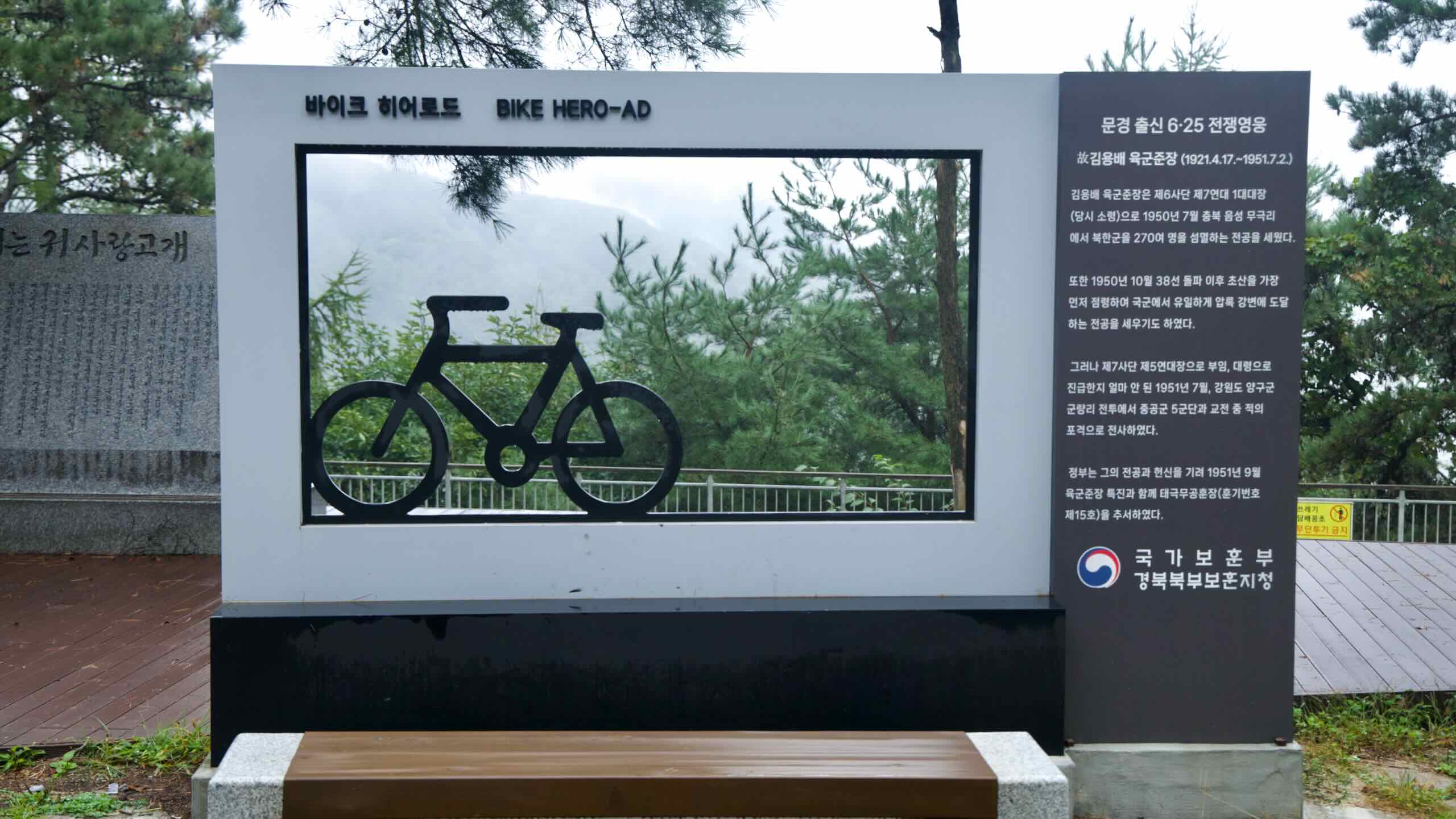
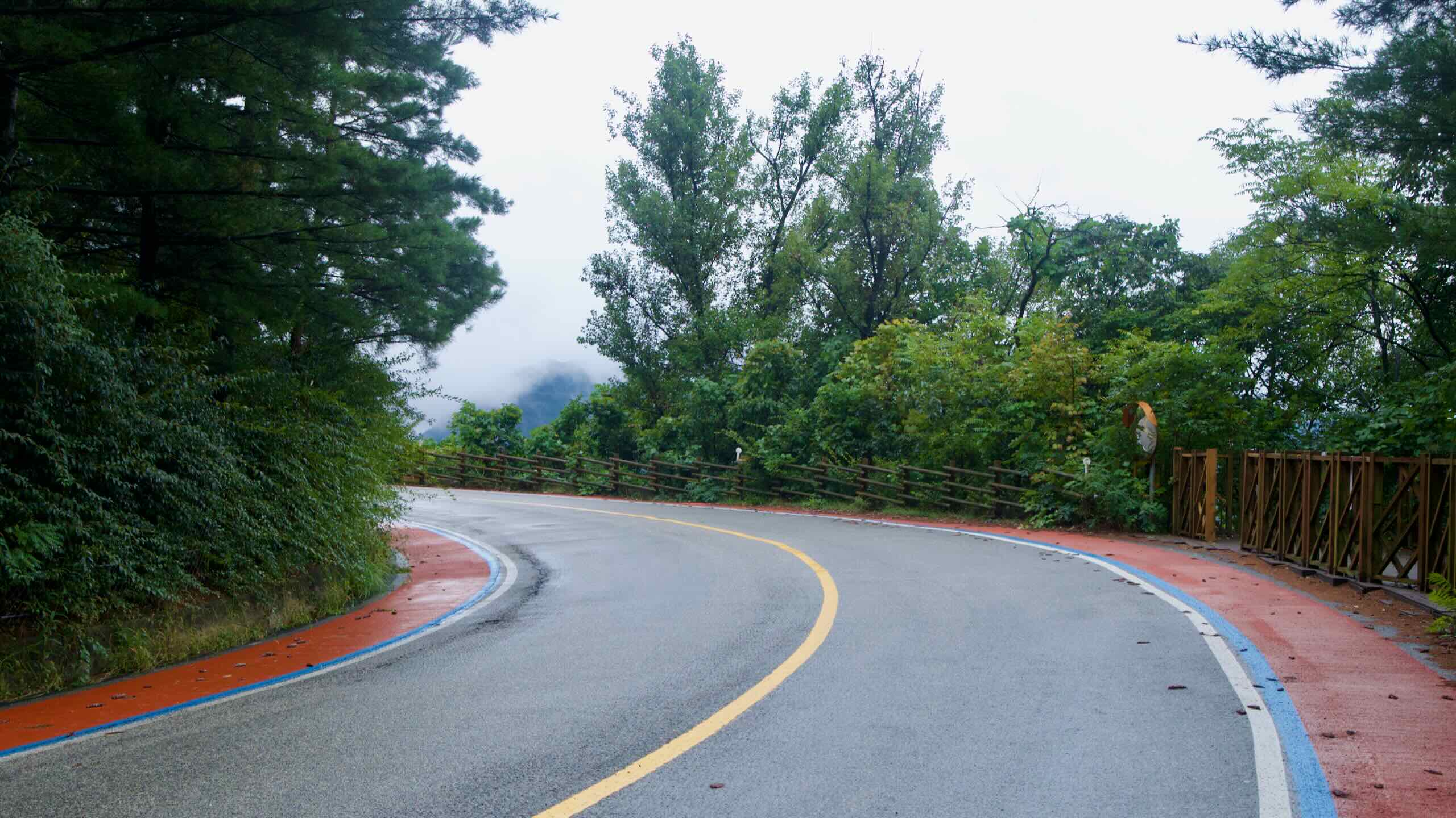
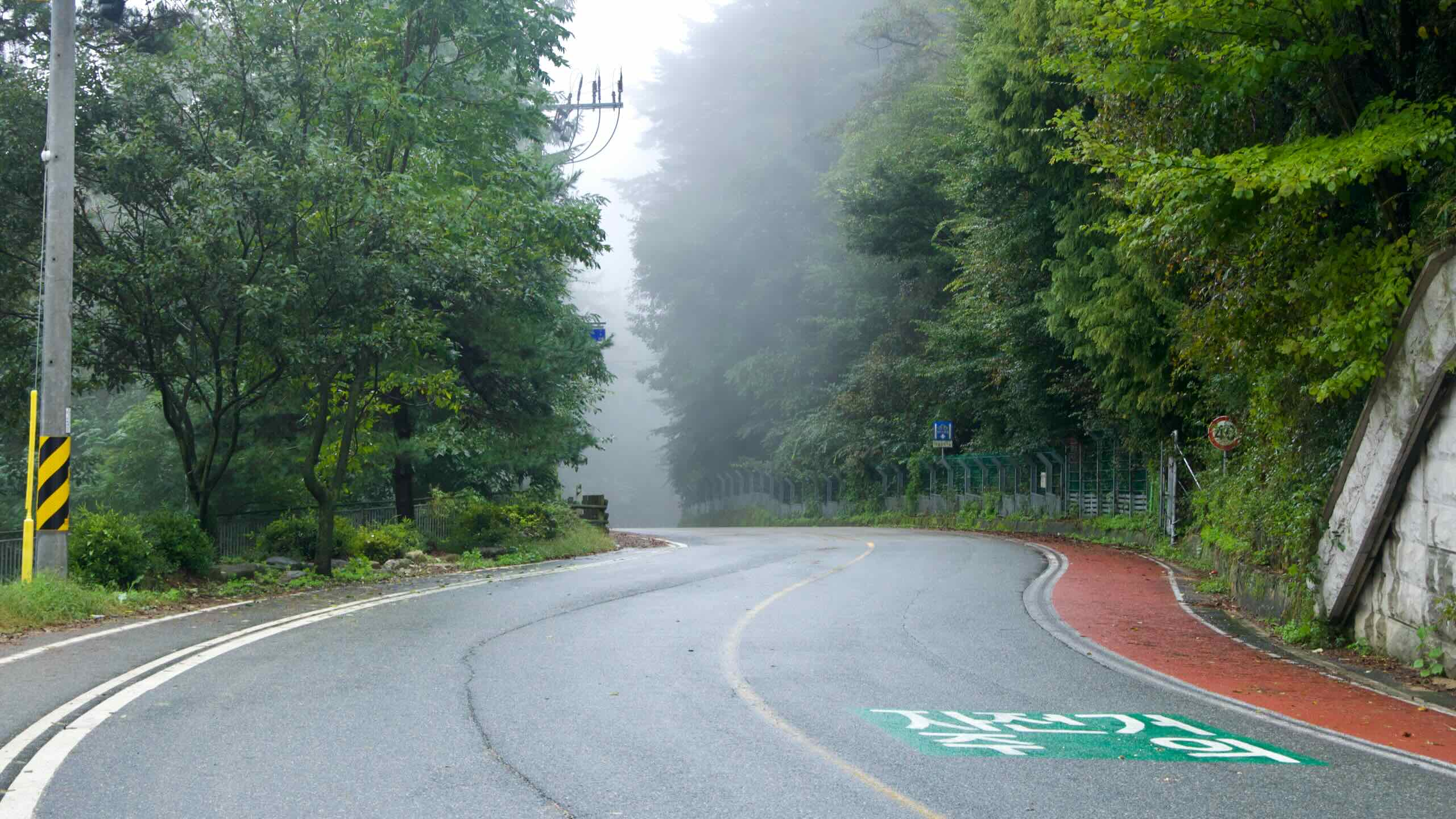
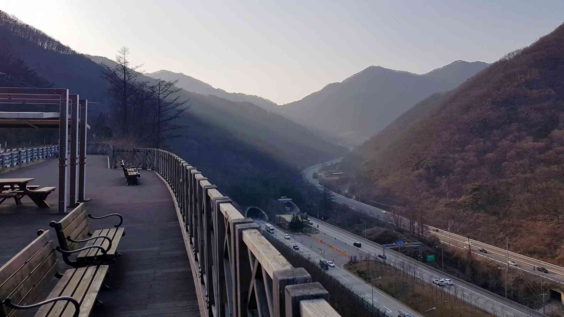
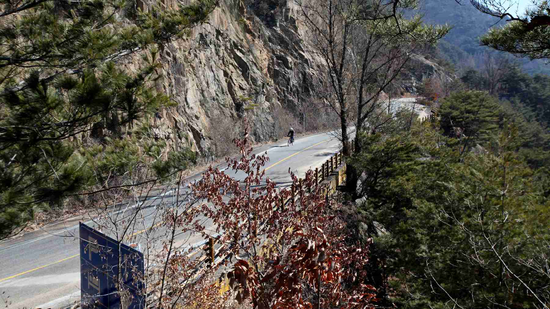
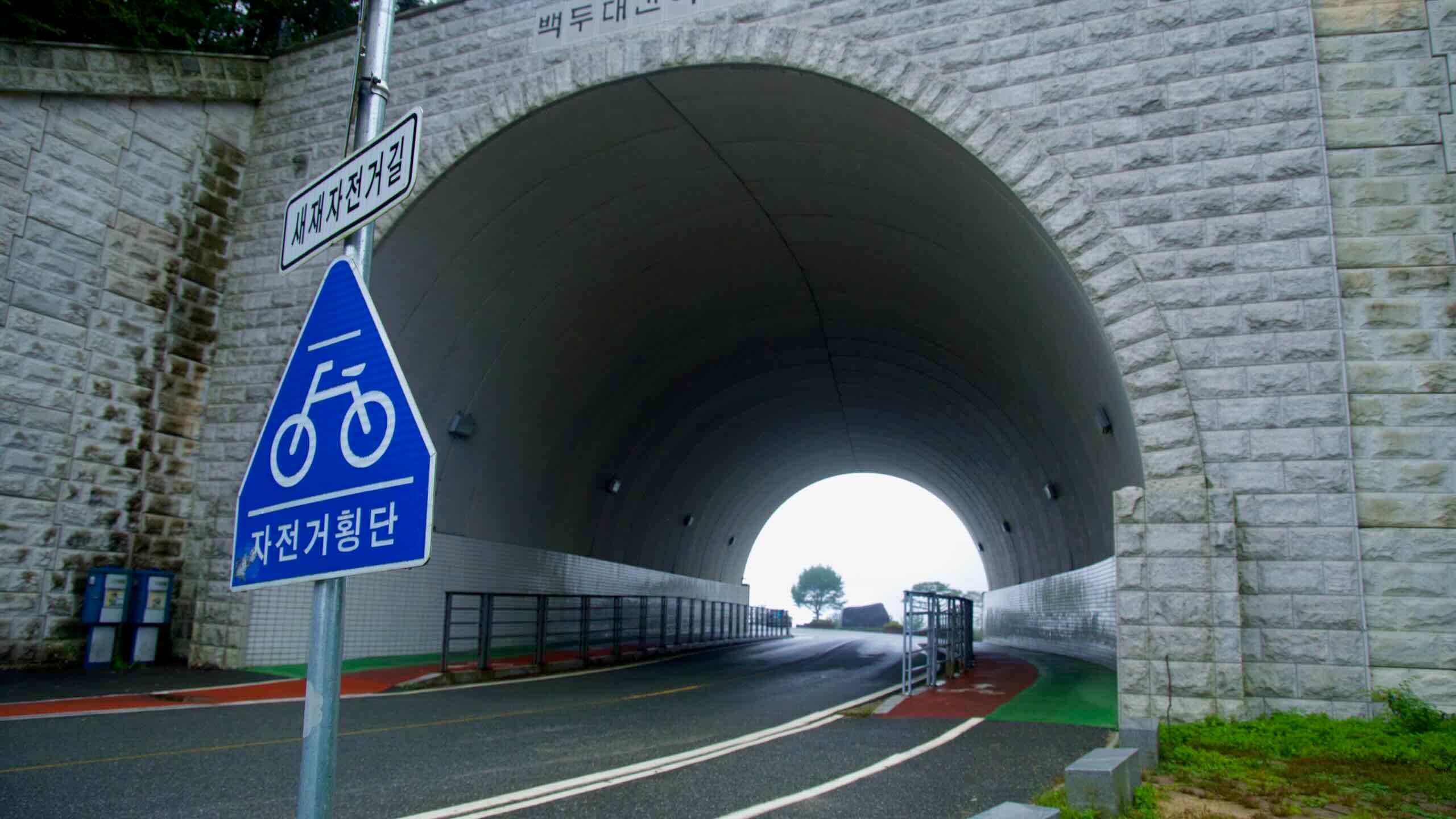
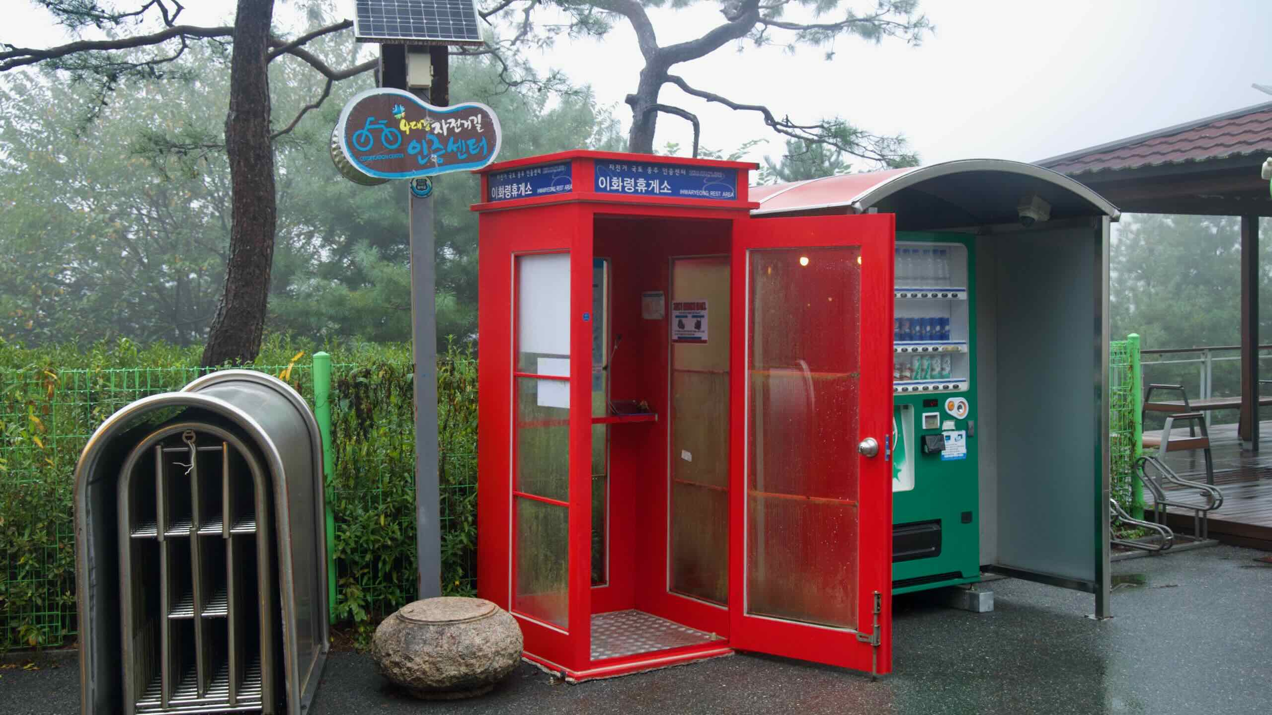
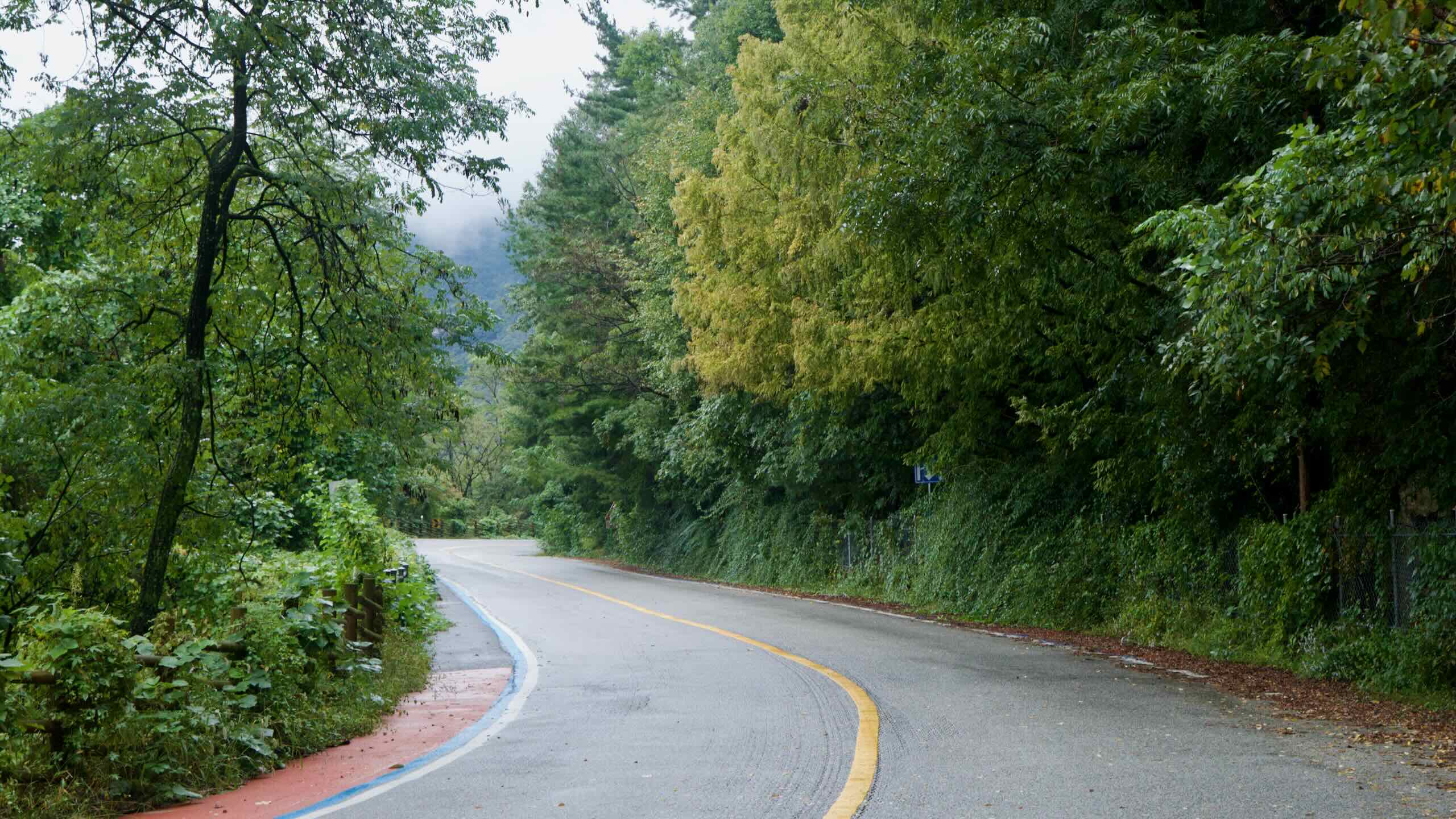
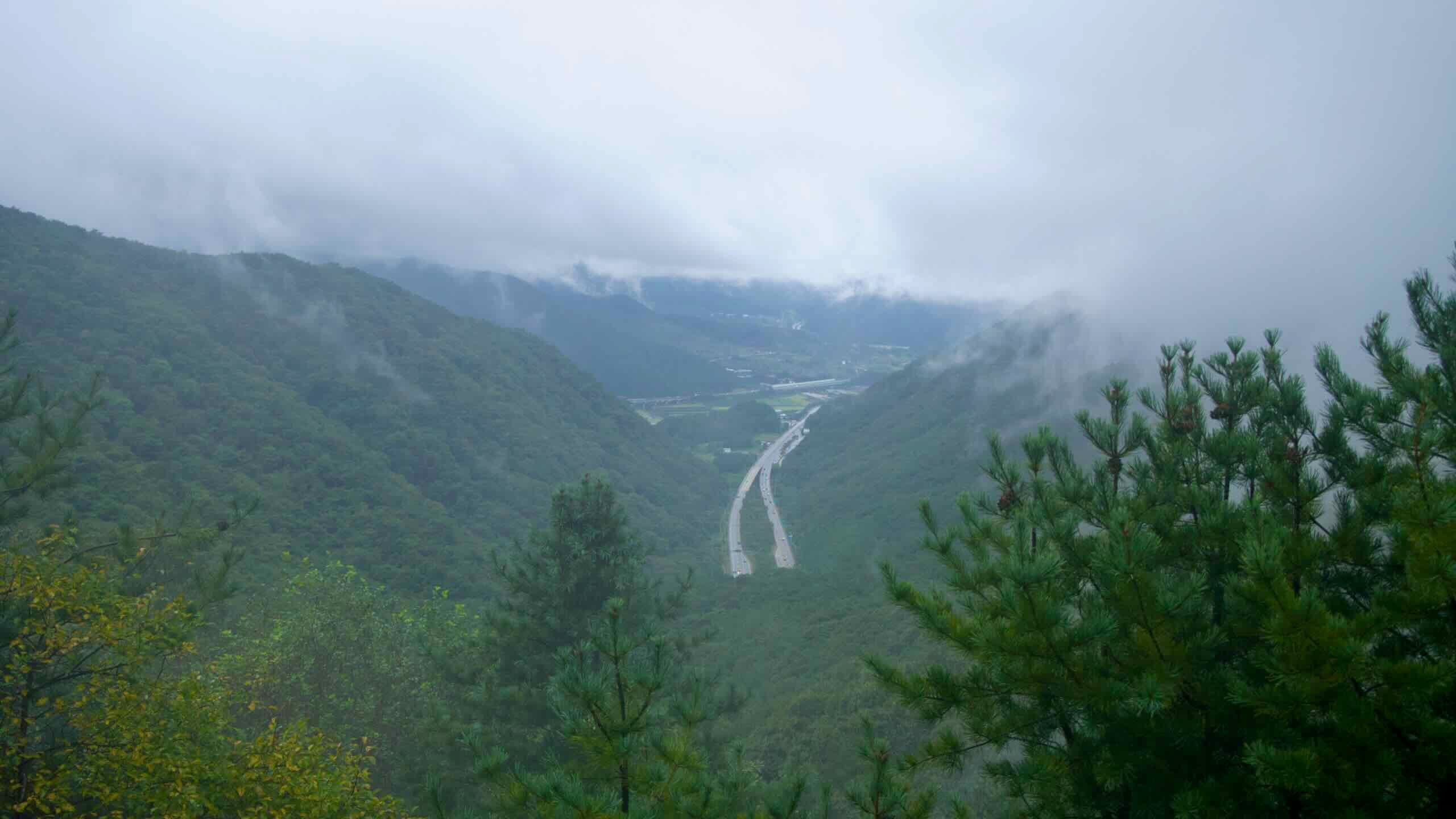
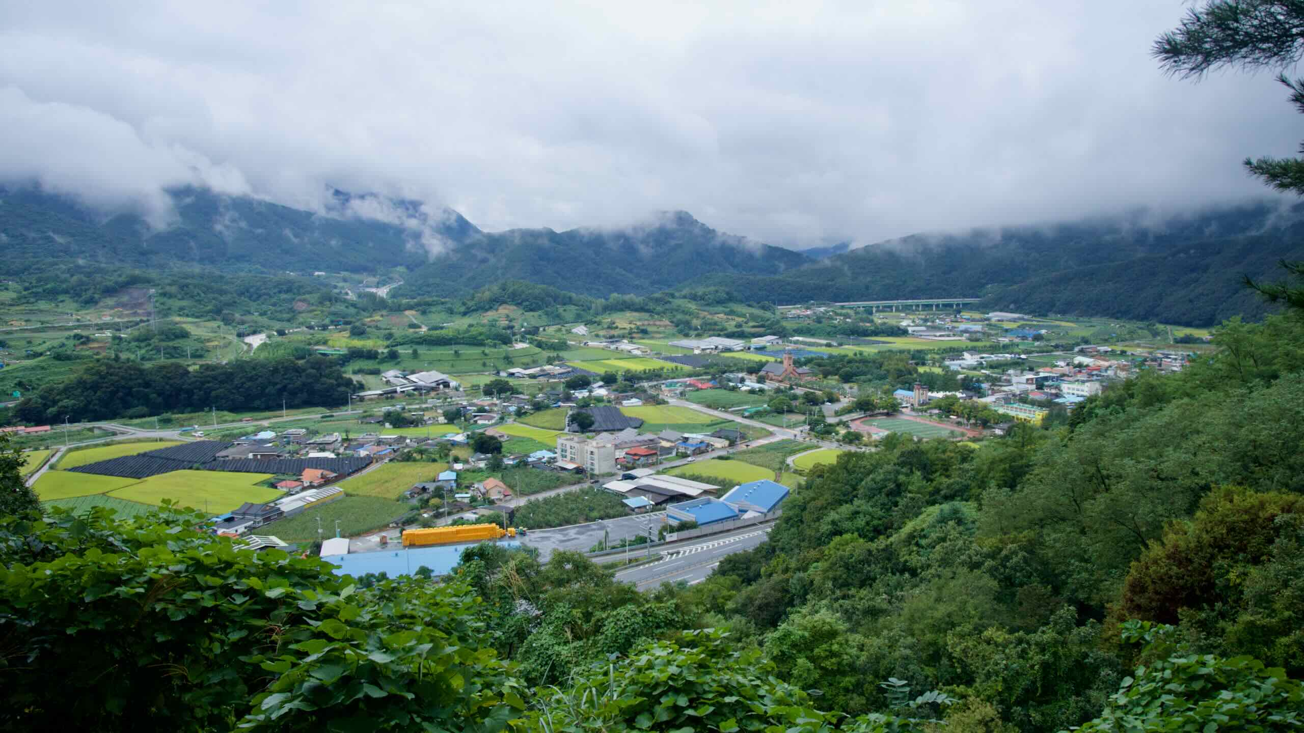
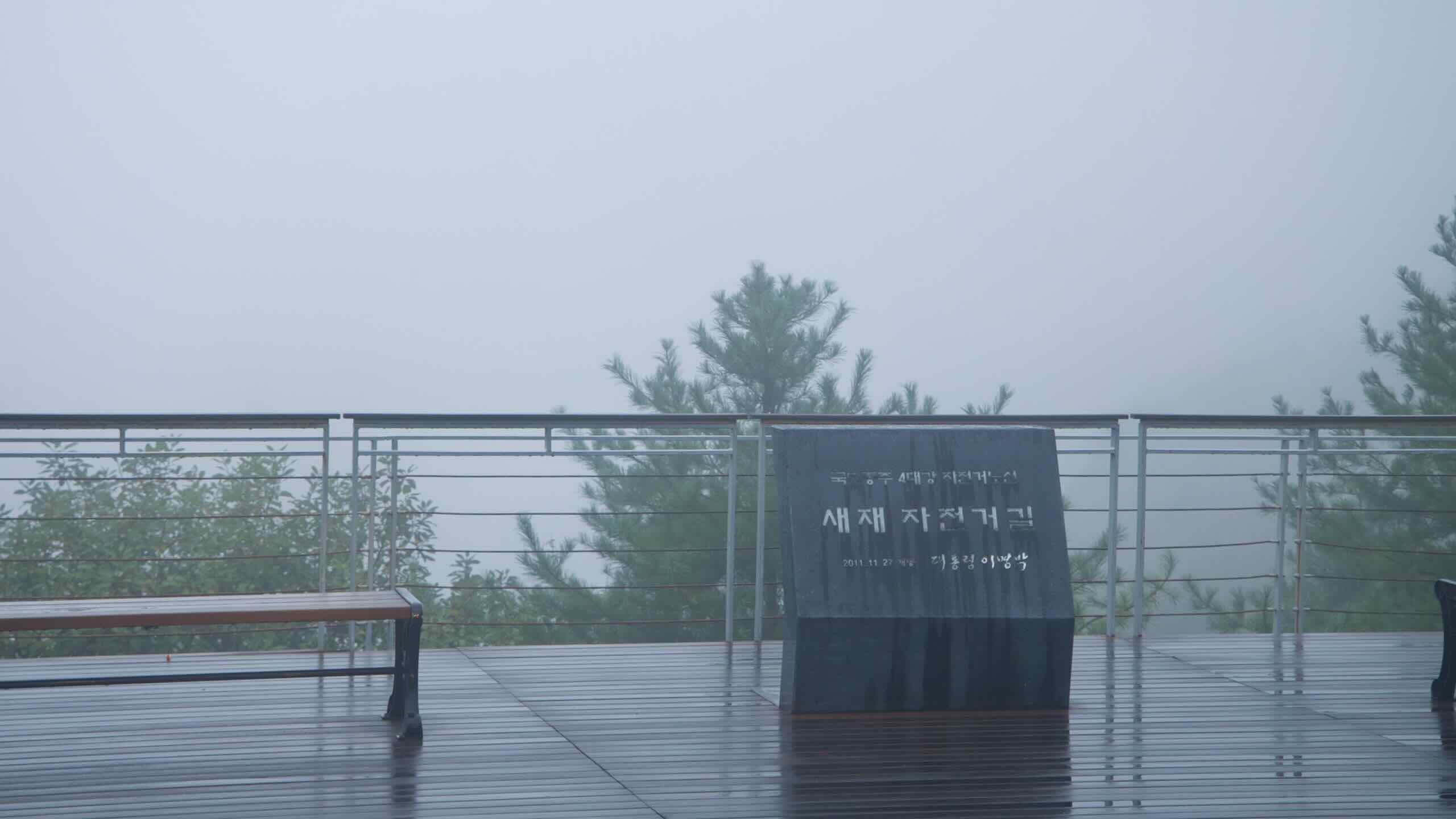
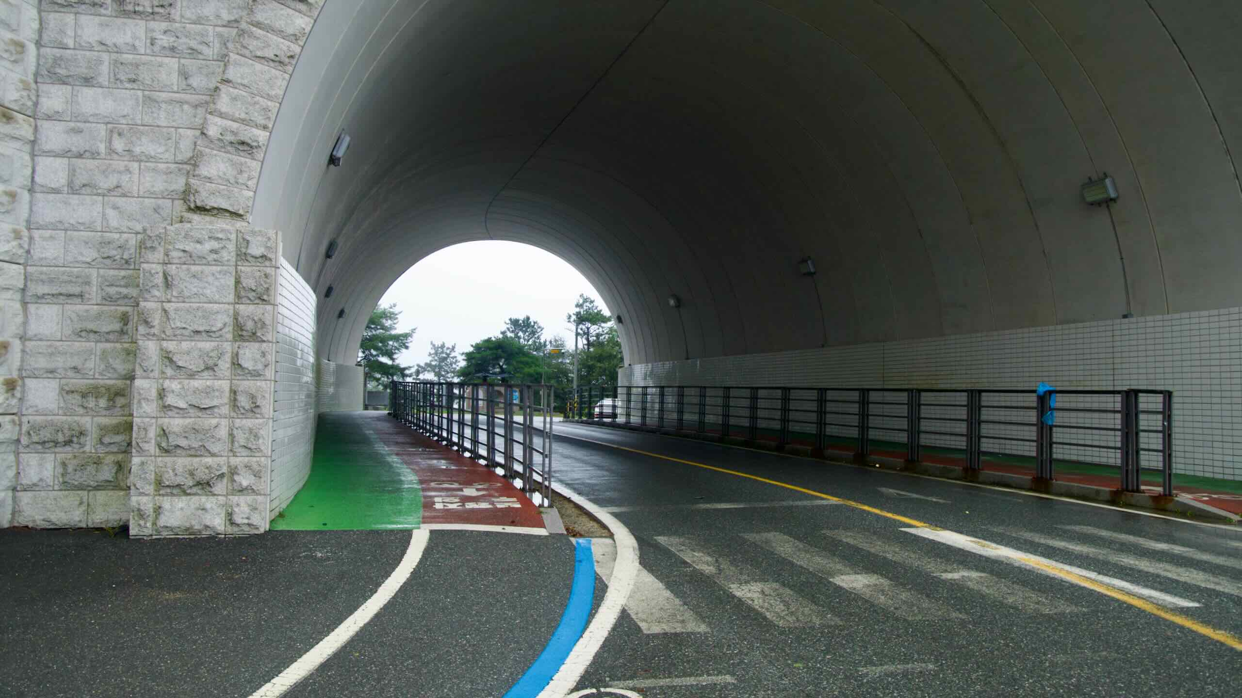
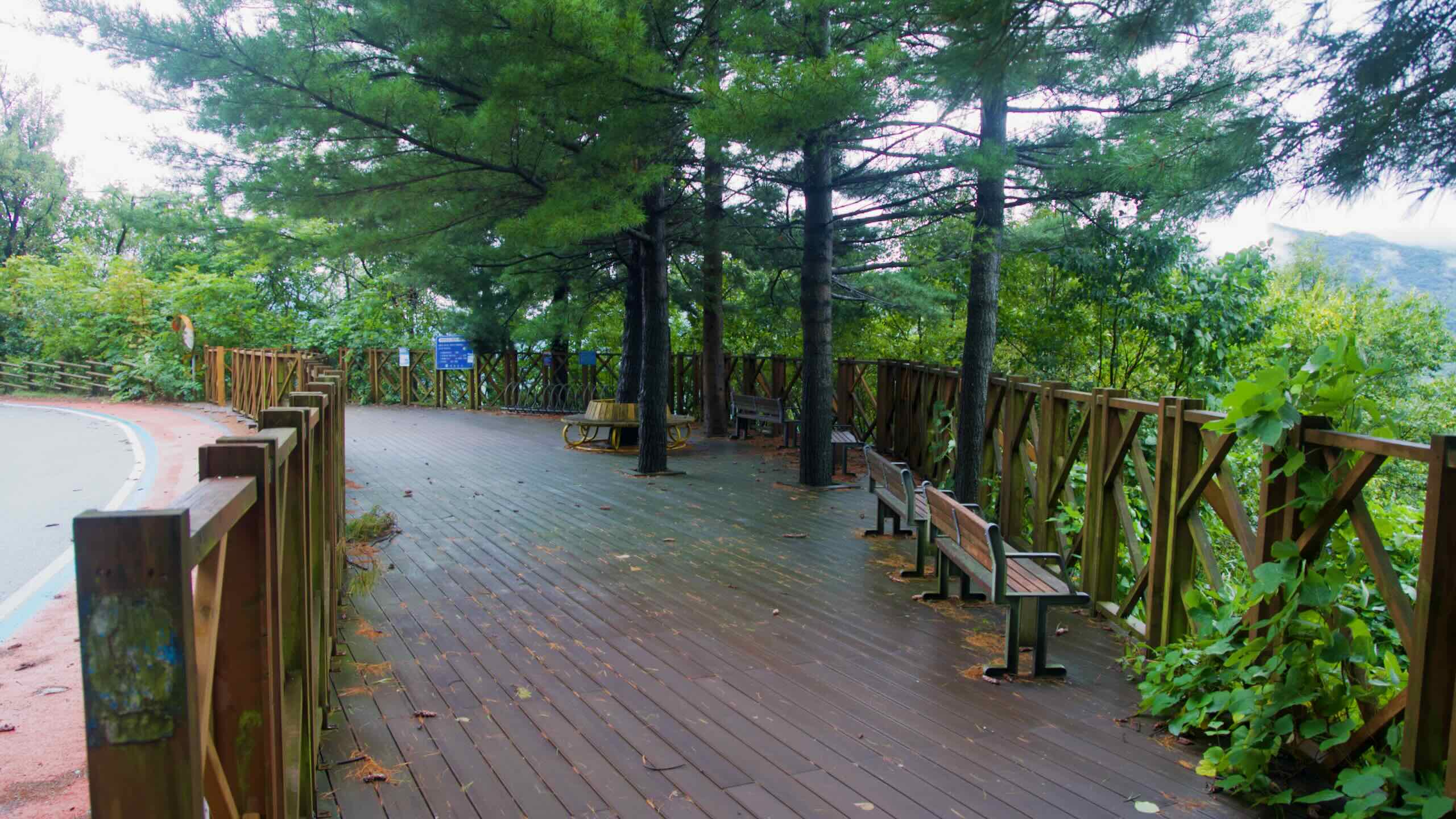
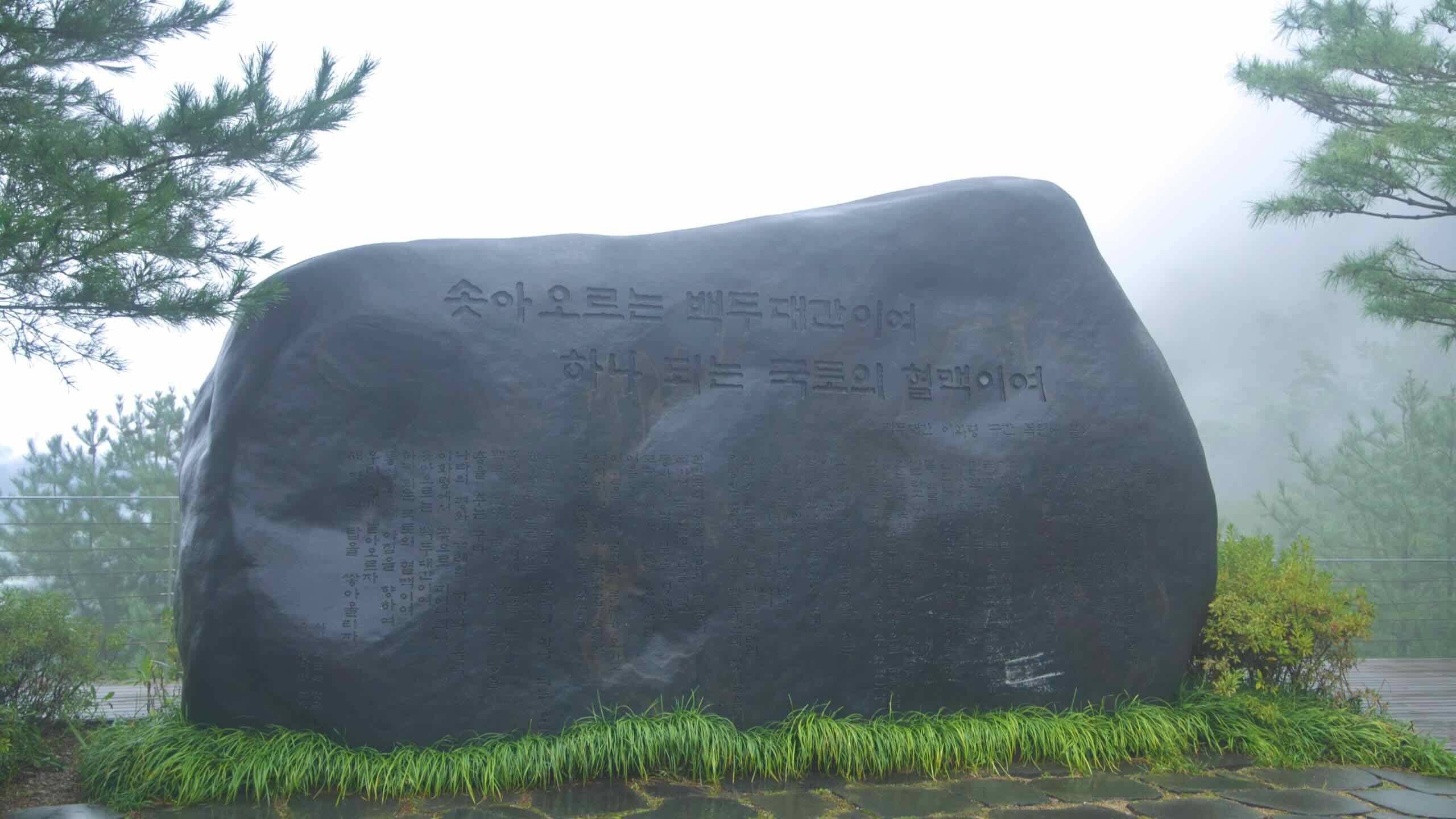
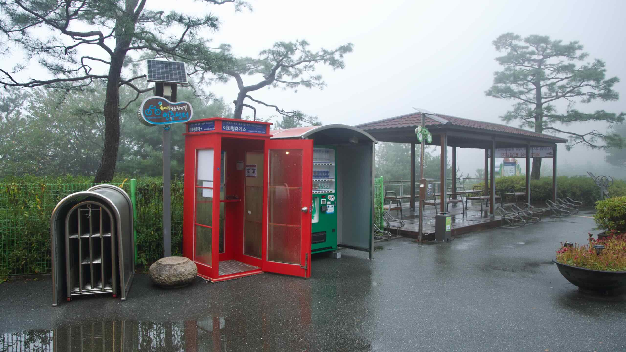
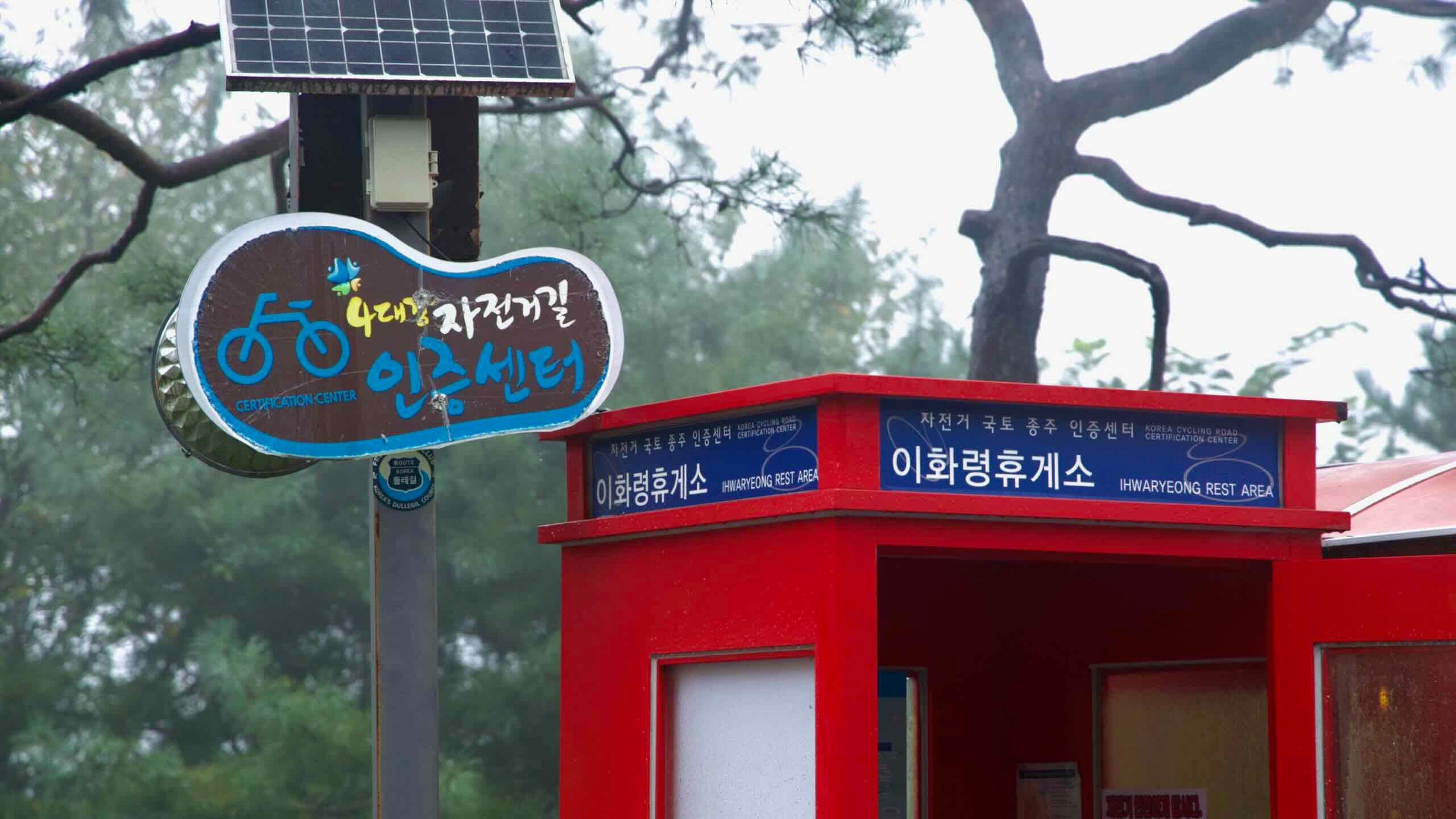
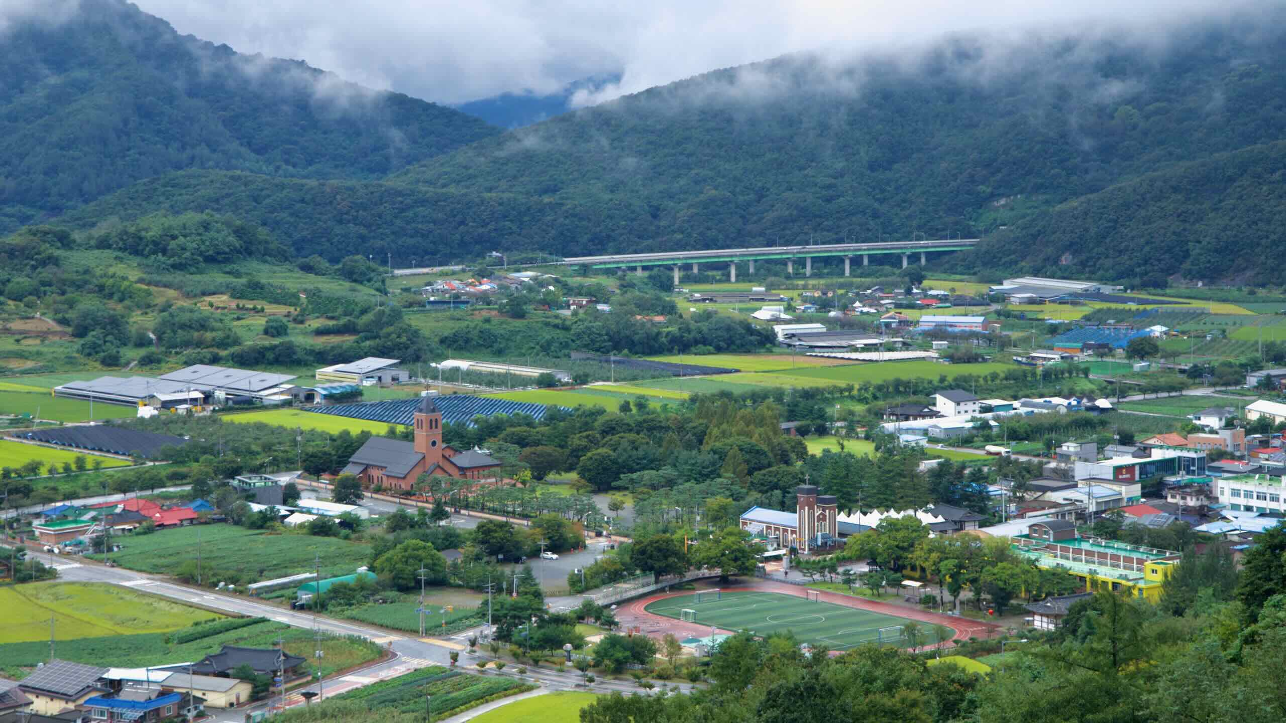
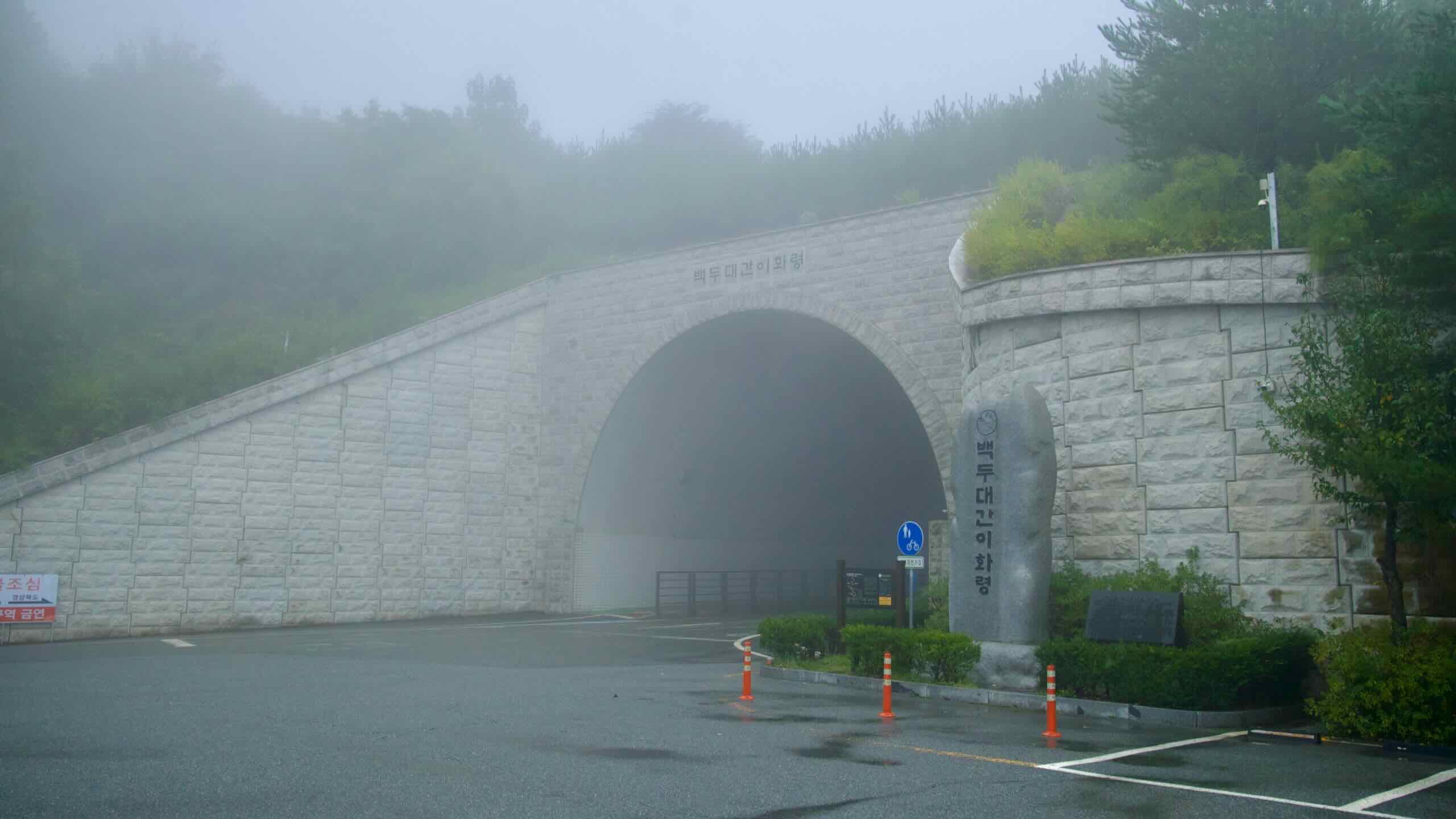
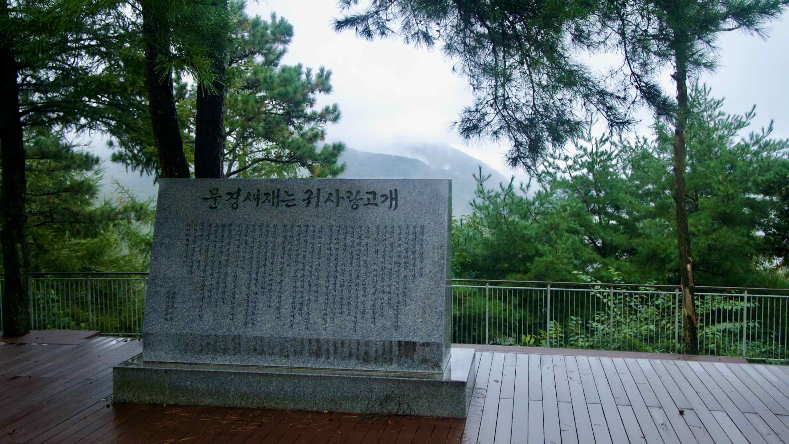
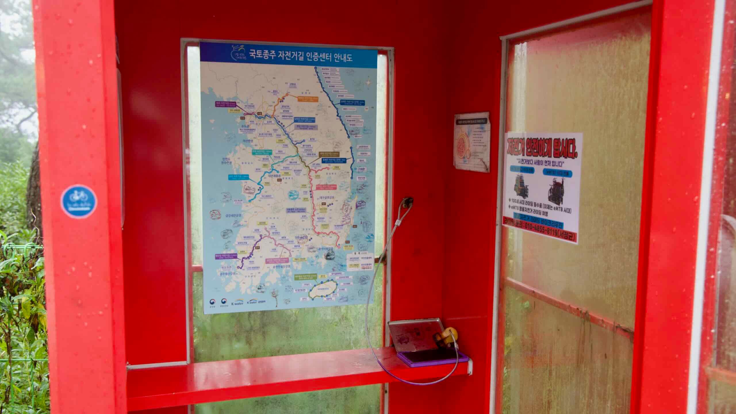
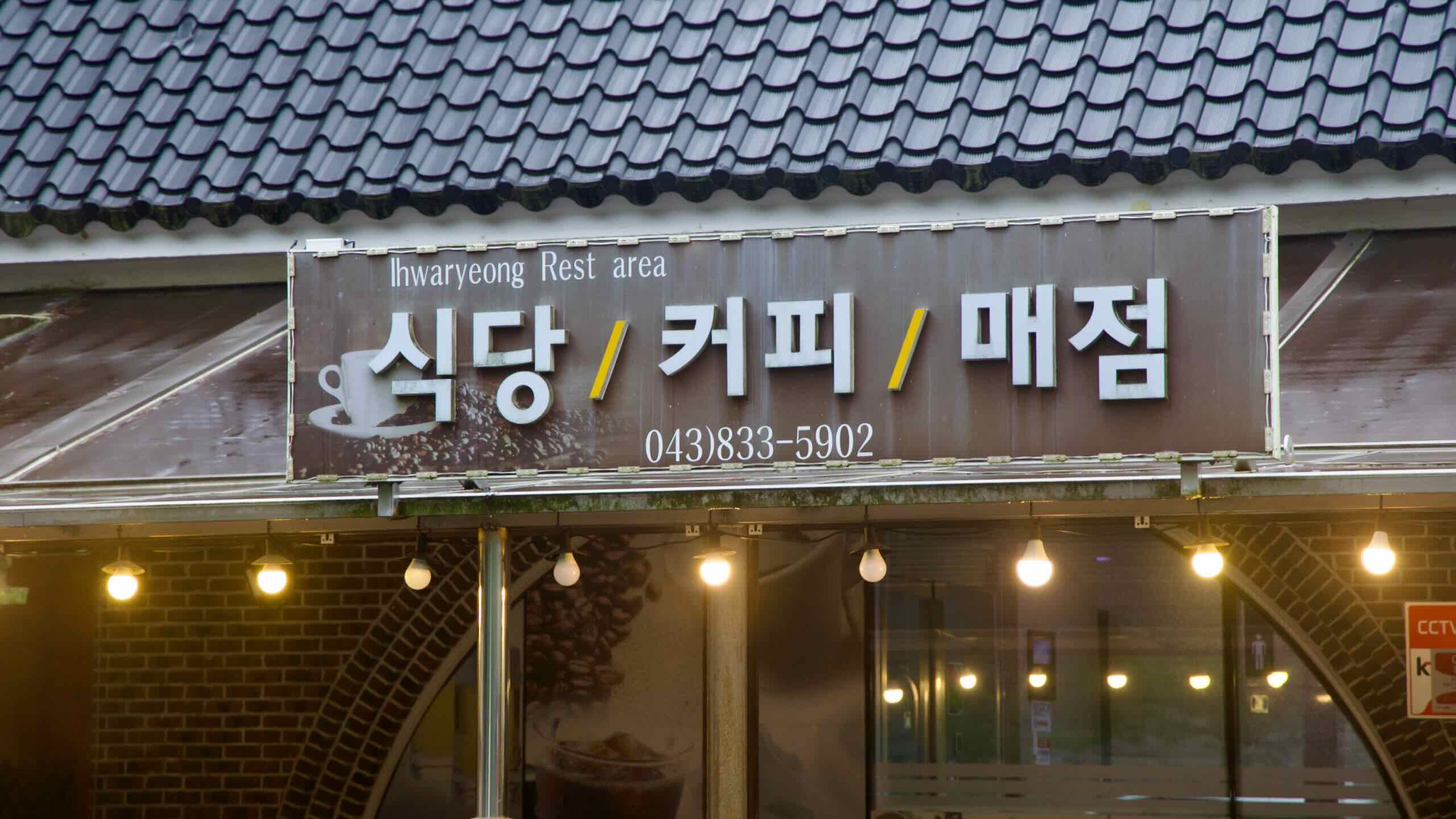
View from Ihwa PassSaejae Bike PathLearn about Ihwa Mountain Pass and the views it offers.A bike-shaped frame and tribute panel mark a viewpoint near Ihwa Pass.Exterior of the tiled‑roof Ihwaryeong Rest Area under pines after rain at Ihwa Pass.The westward view of the Ihwa Mountain Pass along the Cross-Country Route’s Saejae Bike Path in Korea.A wet road with a bike symbol disappears into fog on the Ihwa Pass descent.Roadside rest areas with magnificent views lie on both sides of Ihwa Pass.Rock walls, a curving mountain road, and pine trees decorate the climb up Ihwa Pass on the Saejae Bike Path.The rest area's leading to Ihwa Pass offer terrific high-angle views of Yeonpung Village along the Saejae Bike Path.Does the climb up Ihwa Pass make you tired? Find decks every kilometer. Stop and take in the view.A wet forest road curves near Ihwa Pass with a red shoulder path and blue edge line under tall pines.A red kiosk with a stamp stands beside a humming vending machine on the summit.The Saejae Bike Path stamp and frame stand beside the foggy road at Ihwa Pass. Ihwa Mountain Pass (이화령; map; 539 m) is the highest ascent in Korea’s cycling certification system. It slips through the Sobaek Mountain Range below Joryeong Mountain (조령산; map; 1,026 m). MapThe westward view from on top of Ihwa Pass shows Nation Route 3 weaving through Yeonpung Village.The resting decks leading Ihwa Pass shows National Route 3 in the valley below and mountains in the sky above.Entrance to the Baekdudaegan Ihwa Pass tunnel with bike and pedestrian lanes.Misty valley views open from a pine-framed overlook near Ihwa Pass.Benches on a pine‑shaded wooden deck at the west overlook near Ihwa Pass.Don't worry about heavy traffic when climbing the Ihwa Pass (이화령). But keep an eye out for speeding farmer trucks.A highway winds through a forested valley below Ihwa Pass after rain.Rock walls, a curving mountain road, and pine trees decorate the climb up Ihwa Pass on the Saejae Bike Path.A low stone marker and wet deck sit in thick fog atop Ihwa Pass.Inside the Ihwaryeong Tunnel, traffic lanes run beside a protected bike path.From the west platform, fields and rooftops stretch toward misted ridges near Ihwa Pass.An inscribed boulder stands on the deck at foggy Ihwa Pass. While the climb is exhausting, the summit offers superb high-angle views of the area.Ihwa Pass Tunnel (이화령터널; map) crowns the top of the mountain pass. It also marks the border between Goesan County (괴산군; map) in North Chungcheong Province and Mungyeong City (문경시; map) in North Gyeongsang Province.Pass through the tunnel to switch between eastward and westward facing platforms.The west platform looks out into Yeonpung Town (연풍면; map) in Goesan County.The east platform offers a glimpse of Mungyeong Town (문경읍; map) in Mungyeong City.Below Ihwa Pass’s summit, National Highway 3 (국도3호선; map) carves a path between Joryeong and Heeyang Mountains, then disappears into a tunnel below.A red certification booth and vending machine serve cyclists at the summit.The east end of Ihwa Pass is the windward side. It gets more shade and lingering snow in winter. Watch out!Locals refer to the Ihwa Mountain Pass as Mungyeong Saejae because of its proximity to the historic mountain pass.Sign and red kiosk mark the Ihwaryeong certification center on the mountain pass.Close view of the Ihwaryeong Rest Area sign for restaurant, coffee, and shop.Fog thickens around the arched entrance to the Ihwa Pass tunnel.String lights warm the Ihwaryeong Rest Area restaurant and café in mountain mist.A granite stele recounts Mungyeong Saejae history on a rainy wooden deck.Inside the booth, riders stamp passports beneath a posted route map.A high‑angle view over Yeonpung’s fields and rooftops from the overlook at Ihwa Pass.The stone-faced portal of the Baekdudaegan Ihwaryeong Tunnel crowns the summit road. A few more features sit atop of the Ihwa Pass:Ihwa Pass Rest Area (이화령휴게소; map) sits on the west side of the tunnel. It holds a quick-stop shop, vending machines, and a restaurant.Ihwaryeong Rest Area Certification Center (이화령휴게소 인증센터; map) hangs next to the Rest Area. Stamp your Bike Passport here.Hiking trails spiral off from the top of Ihwa Pass and lead to Joryeong Mountain. Highlights Get There Saejae Pass