North Chungcheong Province
- North Chungcheong Province (충청북도; Chungcheongbuk-do)
- 7,407 km² (2,860 sq mi) — 8th among 9 provinces
- 1,844,148 people — 7th among 9 provinces
- 216 folks per km² (558 per sq mi)
The province’s border curls around North Gyeongsang Province (경상북도; Gyeongsangbuk-do). This odd crescent shape forces the province’s counties and cities to stack on a line.
This pushes the furthest west (Cheongju City) and east (Danyang County) districts far apart. They hold different cultures, landscapes, and opportunities.
Let’s dive a little deeper.
Bike Paths
North Chungcheong Province hosts three certification bike paths. The:
The Hangang and Saejae Bicycle Paths account for half the Cross-Country route, which starts/ends in Seoul Metropolitan City (서울시) and Busan Metropolitan City (부산시).
Hangang Bicycle Path
The last leg of the Hangang Bicycle Path enters Chungju City from Gyeonggi Province’s Yeoju City and finishes at Chungju Dam (충주댐).
Saejae Bicycle Path
The Saejae Bicycle Path picks up where the Hangang Bike Path leaves off at the Tangeumdae Certification Center (탄금대인증센터) in Chungju City (충주시).
The Saejae Bike Path ascends country roads near Mungyeong Saejae Pass before passing into North Gyeongsang Province’s Mungyeong City.
Ocheon Bicycle Path
Most of the Ocheon Bicycle Path travels through North Chungcheong Province.
The bike path begins (or ends) in Yeonpung Village (연풍면; Yeonpung-myeon) in Goesan County (괴산군; Goesan-gun). (The Saejae Bicycle Path travels through this town, as well.)
The Ocheon Bike Path continues west through Jeungpyeong County (증평군; Jeungpyeong-gun) and Cheongju City (청주시; Cheongju-gun).
It first bows out of the province when it enters the Special Self-Governing City of Sejong (세종특별자치시). The path continues an epic nine (9) kilometers through Sejong before it concludes.
History
During the first six hundred years of the common era, Three Kingdoms waged continual war with each other in Korea:
Though power and territories shifted, their borders often fell over North Chungcheong Province. Each took turns conquering the area, reforming its boundaries, and razing its villages.
Ancient fortifications adorn the hills and parks of the province’s important twin cities: Cheongju and Chungju.
The kingdoms also contended for control of North Chungcheong because of its access to the South Han River (남한강; Namhangang). The river’s large tributary system webbed throughout the peninsula and provided a trading route to China.
When the peninsula unified under Silla, the kingdom grouped North and South Chungcheong Province (충청남도) into one: Yanggwang Province (양광도; Yanggwang-do).
A Great Road & Gate
During the Joseon Dynasty (조선; 1392 ACE ~ 1897 ACE), one road dominated traffic from Hanyang (한양; present-day Seoul) to Dongae (동래; present-day Busan): the Great Yeongnam Road (영남대로).
The path followed the Nakdong River (낙동강; Nakdonggang) in the lower half of the peninsula, and the Han River (한강; Hangang) in the north.
Where North Chungcheong Province and North Gyeongsang Province (경상북도; Gyeongsangbuk-do) meet, the road turns treacherous.
Treacherous how? Three words: Mungyeong Saejae Pass (문경새재).
The Sobaek Mountain Range follows the southern border of North Chungcheong Province. Its peaks and mountains don’t provide many traveler friendly routes.
The crossing point? Mungyeong Saejae: a 642 meter (2,106 feet) high gap between Joryeong (조령산; Joryeongsan; 1,026 m) and Juheul (주흘산; Juheulsan; 1,108 m) Mountains.
The name “Saejae” literally translates to “bird” (새; /sae/) “pass” (재; /jae/). Implying birds needed to rest when ascending the steep pass.
The mountain pass acted as a natural gateway between the Joseon Kingdom’s regions. Anyone crossing from Hanyang (Seoul) to Gyeongsang Province (경상도) — now divided into North and South provinces — needed to endure the unforgiving cross.
The Gates Too Late
In the 1590s, Japan invaded Korea. They used the Great Yeongnam Road and Mungyeong Saejae Pass to shoot north and conquer Hanyang (Seoul) within only a few months, razing cities and murdering every soul along the way.
Following Japan’s expulsion from the peninsula, the Joseon Dynasty erected three fortress gates atop the Mungyeong Saejae Pass. However, they never halted an invasion.
Today the gates decorate Mungyeong Saejae Provincial Park (문경새재도립공원).
A Divided Province
During the Joseon period, Gyeonggi Province bit off northern chunks of North Chungcheong Province. Gangwon nibbled some of the eastern bit.
Only in 1896 did the North Chungcheong Province take its shape — a shrimp standing on its hind legs, reaching east.
The odd proportions create a province where the borders of every county and city — save for Jeungpyeong County — borders another province.
North Chungcheong’s western counties touch Daejeon (대전시), Korea’s fourth largest city. Eastern Jecheon City and Danyang County (단양군; Danyang-gun) relate more to the culture of Gangwon Province (강원도).
Geography
Geography also divides North Chungcheong Province. Foreboding terrain limits the eastern bits. While flat and forgiving topography aided the western territories’ expansion.
Eastern Province
What does eastern North Chungcheong Province look like? Mountainous.
Sobaek Mountain Range
Sobaek Mountain Range (소백산맥) breaks away from the Taebaek Mountain Range (태백산맥) near Taebaek Mountain (태백산; Taebaeksan) along Korea’s east coast.
The Sobaek Range creeps along the bottom of the province. Like a river or a coastline, this natural barrier defines the southern border.
In eastern Danyang, some of the range’s most scenic peaks adorn the landscape, including Sobaek Mountain (소백산; Sobaeksan). It rises 1,439 meters (4,721 feet) and provides the mountain chain’s namesake.
Western Province
Traveling westward, North Chungcheong’s landscape slopes downwards. Several streams and tributaries that feed both the Han River (한강) and Geum River (금강) carve away at the Sobaek Range’s limestone walls.
Five Streams
These streams give the Ocheon Bicycle Path its name. How?
- Oh (오) is the sino-Korean number for five (5)
- Cheon (천) means stream.
These “Five Streams,” dribbling from mountaintops and aquifers, include, from east to west:
- Ssang Stream (쌍천; Ssangcheon). A small stream that starts in Yeonpung Village (연풍면) and feeds into Dal Stream.
- Dal Stream (달천; Dalcheon). This large stream starts on Songni Mountain (속리산; Songnisan) and flows into the Han River near Chungju.
- Seonghwang Stream (성황천; Seonghwangcheon). A small stream that starts below a gaggle of mountains west of Goesan. It flows into the Dal Stream.
- Bogang Stream (보강천; Bogangcheon). A tiny stream that feeds off a reservoir above Cheongju and flows into the Miho Stream.
- Miho Stream (미호천; Minhocheon). A large stream that begins west of a small town (금왕읍) in Eumseong County (음성군; Eumseong-gun). It drains into the Geum River (금강).
These streams don’t just carve wondrous valleys. Many of the province’s cities and towns sit in their basins.
Temperature
Because the province doesn’t dip a toe in any major body of water, temperatures vary more than its coastal neighbors.
The mountain infested, eastern districts of Chungju City, Jecheon City (제천시), and Danyang County (단양군) regularly receive fresh coats of snow in winter. Their low temps compare to Gangwon Province (강원도), an area known for skiing and Olympic Games.
Western Cheongju City (청주시), and Goesan (괴산군) and Jeungpyeong (증평군) Counties lie lower than their eastern sisters. Though cold, they escape the worst of winter’s bitter chill.
Economy
Where do the people of North Chungcheong Province live? Cheongju City.
Like over half. 839,626 of the province’s 1,596,710. That’s 62%. Why the disparity?
Korea’s Highway of Highways
The Gyeongbu Expressway (경부고속도로). Not only does it connect the largest and second largest cities (Seoul and Busan), the expressway is one of Korea’s oldest and the most trafficked modern highway.
During the highway’s planning phase, to save money, engineers avoided the rugged, high terrain of the Sobaek Mountains. That meant navigating away from Eastern North Chungcheong Province.
This lack of freeway access starved eastern districts like Chungju and Danyang of traffic. And poured economic rocket fuel in the western Cheongju’s tank.
(The Jungbu Naeryuk Expressway (중부내륙고속도로), completed in 2004, brought high speed road access to eastern and central North Chungcheong Province.)
Left the Farm
Because North Chungcheong Province lacks sea access, its districts focused their economies around farms.
Many of counties and cities gloat about their specialty crops, including:
- the red peppers of Goesan and Eumseong Counties.
- the apples of Chungju City.
- the ginseng of Jeungpyeong County.
- the grapes of Yeongdong County (영동군; Yeongdong-gun).
- the jujubes of Boeun County (보은군; Boeun-gun).
However, their reliance on farming has led to a stagnating economy. Worldwide, few young folks avoid sacrificing their nightlifes and brunches for a life of predawn wake-up calls and fickle weather systems.
Coupled with isolating terrain and lack of highway access, the small counties in North Chungcheong have aging and evaporating populations.
Innovation Cities
However, some cities are experiencing double digit growth. How? Innovation cities.
Cheongju, the capital and population powerhouse, created business friendly zones and built industrial campuses and research facilities. This attracted value-added companies in contemporary tech and manufacturing fields.
The focus on post-industrial industries grew Cheongju’s population and further imbalanced power. Cheongju boasts by far the power in the region.
Highlights
Let’s take a window tour of North Chungcheong Province’s highlights. Hold on tight!
Mountain Paradises
The Sobaek Mountain Range (소백산맥) runs through the bottom border of the province. It brings waves of rocky peaks and national parks.
Sobaek Mountain
Sobaek Mountain (소백산; Sobaeksan) is the namesake mountain for the Sobaek Mountain Range (소백산맥). It rises 1,440 meters (4,723 feet). It covers Danyang County (단양군; Danyang-gu) and parts of North Gyeongsang Province (경상북도).
Sobaeksan National Park encompasses Sobaek mountain and several other surrounding mountains. It is one of three protected parks in the province (twenty-two (22) in the nation).
In the spring, you’ll find blazing azaleas on the mountainside attracting hikers and festivals. Thick snowfall blankets the peak in winter.
Songni Mountain
Songni Mountain (속리산; Songnisan) sits on the Sobaek Mountain Range. It’s highest peak, Cheonhwangbong (천왕봉) reaches 1,058 meters (3,471 feet).
The mountain is the crown jewel of Songnisan National Park (속리산국립공원), which includes several mountains in southwestern Boeun County.
Since ancient times, Songni was famed for beauty. Exposed granite bedecks its peaks. Hiking trails traverse prominent ridges. An ancient temple filled with treasures clings to its slopes.
Wolak Mountain
Worak Mountain (월악산) is another peak on the Sobaek Mountain Range. The mountain rises 1,095 meters tall (3,593 feet) just south of Chungju Lake (충주호), near the Saejae Bicycle Path.
Worak is one of Korea’s most famous. With a name translating to “the mountain where the moon hangs,” since ancient times, the people thought the peaks held a strong mountain spirit.
During the mongol invasions in the 1200s, locals fled to the mountain. When the Mongols pursued, the weather turned. The invaders fled, thinking they angered the mountain.
Worak is also the headliner of North Chungcheong’s third national park (월악산국립공원). Like the other parks, you’ll find wild landscapes and rich Buddhist sites, like Deokjusa Temple (덕주사).
Temple Territory
Most of Korea’s Buddhist temples are mountain dwelling. And North Chungcheong, with its undulating landscape, offers a few unmatched examples.
Beopjusa Temple
Founded in 553 Beopjusa Temple (법주사), is one of Korea’s oldest temples. This UNESCO World Heritage Site holds the oldest wooden structure standing on the peninsula.
The temple hangs from the sides of Songni Mountain. At one time, the retreat held over 3,000 monks. While the capacity shrunk, today still claims many national treasures, including Palsangjeon (팔상전), a five-story wooden pagoda, the tallest in the country.
The temple offers temple stays for common folk from around the world.
Guinsa Temple
Guinsa Temple (구인사) is another important Buddist landmark near Sobaek Mountain in Danyang. It’s the headquarters for the Cheontae sect of Korean Buddhism.
Founded in 1945, the temple is one of Korea’s newest. And you can see it in their buildings. While traditional wooden halls stand only one or two stories tall, Guinsa’s halls boast a modern concrete skeleton and rise three, four, and five stories.
Is there a reason for the vertically enhanced temples? Why, yes. There’s no room. The temple nestles in a narrow, craggy valley between lofty peaks.
Like other temples, Guinsa operates its own farm, offers free meals to all (as long as you finish every morsel), and provides temple stays.
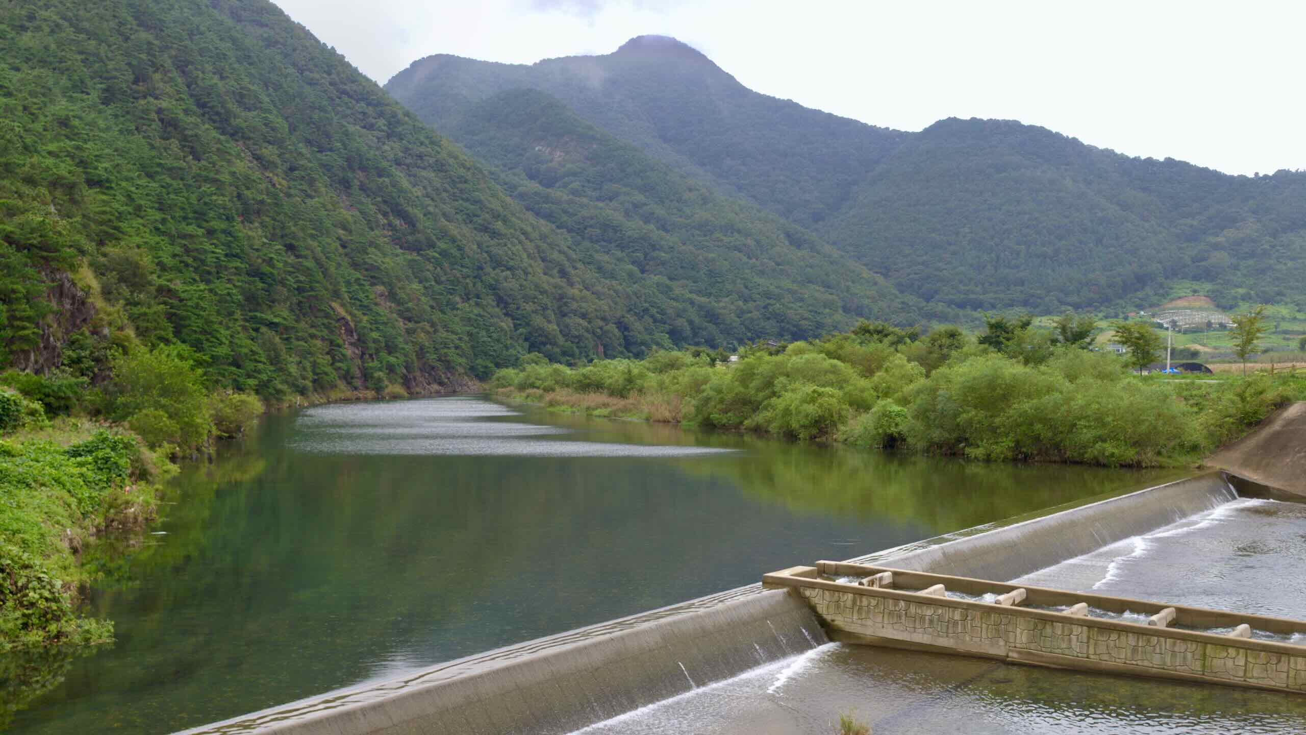
Lakes, Caves, & Valleys, Oh My!
So North Chungcheong Province is just mountains and mountain dwelling temples? No. The province has a few more natural wonders up its sleeve.
Valleys of Beauty
Hwayang Valley (화양구곡) sits on the southern border of Goesan County (괴산군). It earns its reputation from its verdant and clear, babbling waters.
And just down the way in Goesan, Ssanggok (쌍곡계곡) carves through limestone to create nine unique valleys. Some offer majestic rock formations. Others, waterfalls and vistas of awe.
Lovely Lakes
Chungju Lake (충주호; Chungju-ho) marks the start of the South Han River (남한강; Namhangang). Korea’s largest multipurpose dam, Chungju Dam (충주댐), created the lake in 1985. The artificial body covers 68-square-kilometers (42 mi2) between the cities of Chungju and Jecheon (제천시; Jecheon-si).
Like the Chungju Lake, Daecheong Dam (대청댐) formed Daecheong Lake (대청호) in 1981. The man-made lake sits on the eastern border between the Daejeon Metropolitan City (대전광역시; Daejeon-si) and North Chungcheong Province. Beside the waters you’ll find Cheongnamdae (청남대), a presidential villa converted to a museum.
Gosu Cave
Korea designated the Gosu Cave (고수동굴; Gosudonggul) a national monument in 1978. But for countless generations, its otherworldly rock formations fomented wonder.
The 450 million-year-old limestone cave stretches 1.7 kilometers. It features the usual stalagmites, stalagmites, and underground lakes. But it also holds rare Aragonite rock formations.
The cave sits on Donggang River (동강강), a precursor to the Han River, in Danyang County.
The Eight Beauties of Danyang
County of Danyang (단양군) is the easternmost district in North Chungcheong Province. With just over 80% of the county covered with mountainous terrain, the tourists flock to Danyang for its untamed wilderness.
To aid in the natural tourism, Danyang created its own list of eight scenic views (단양팔경). From peaks to waterfalls, the list includes highlights from their natural treasures. Their swath of Korea is famous for its untouched mountains and unique landscape.
- Dodamsambong (도담삼봉) — three tall rocks on the South Han River.
- Stone Gate (석문) — an open cave frequented by fairies and hermits.
- Gudambong (구담봉) — turtle shaped cliffs.
- Sainam (사인암) — high stone wall and clear stream.
- Oksunbong (옥순봉) — riverside sheer rock wall with adjacent red trestle bridge.
- Sangseonam (상선암) — rocky creek with waterfalls and babbling streams.
- Jungseonam (중선암) — layers of white rocks on a crystal stream.
- Haseonam (하선암) — large rock surrounded by white rocks at the base of a mountain.