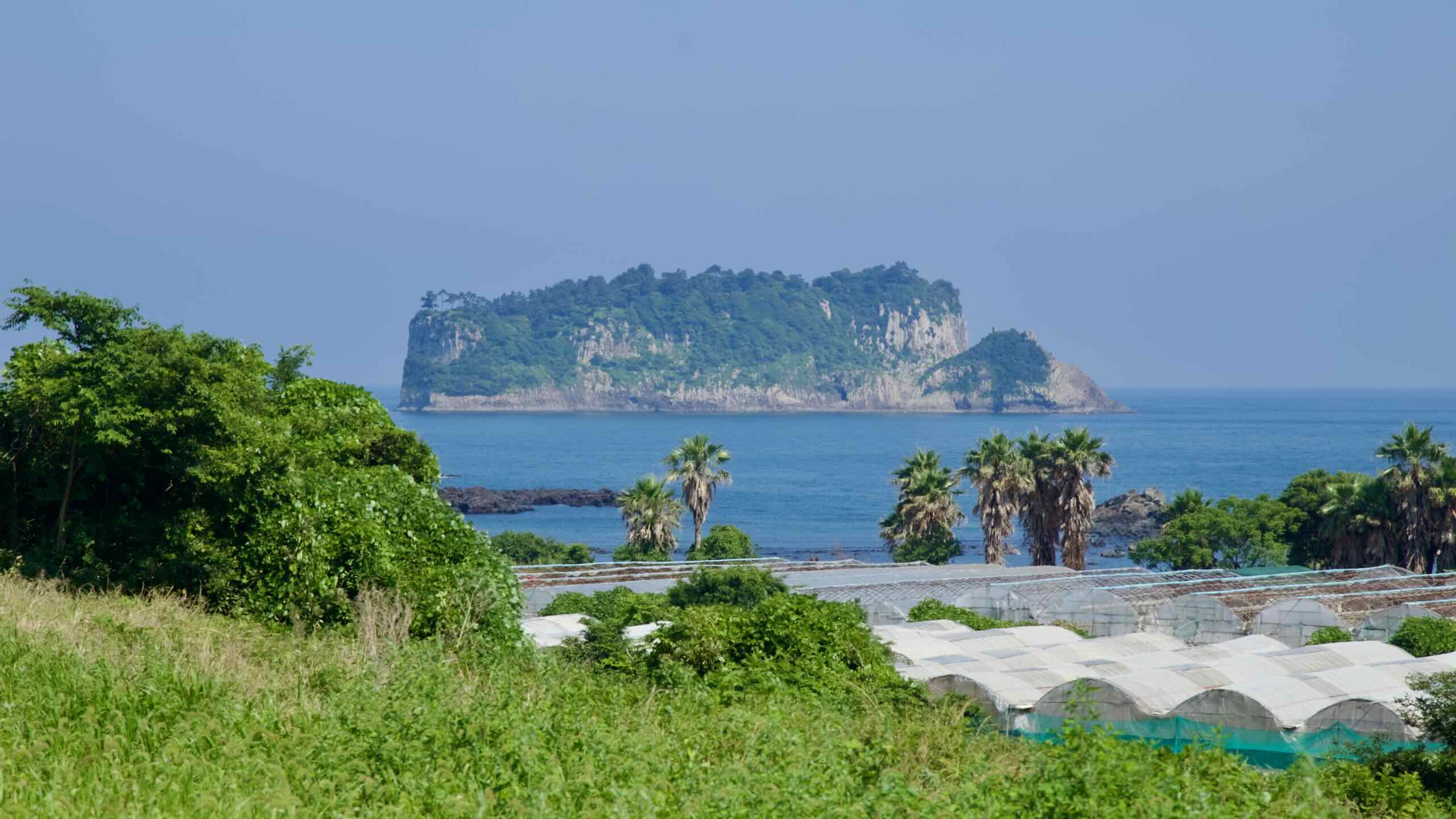
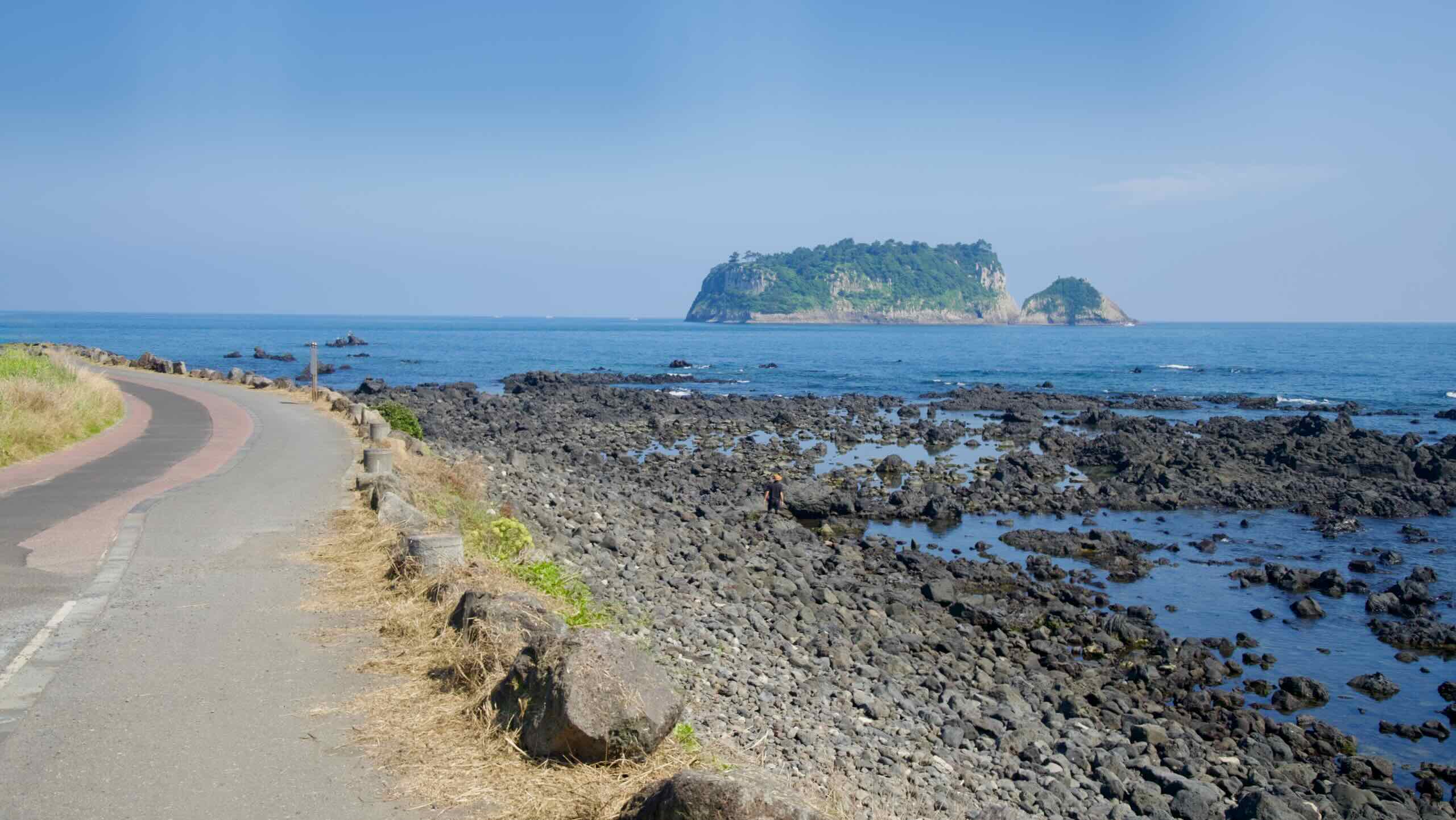
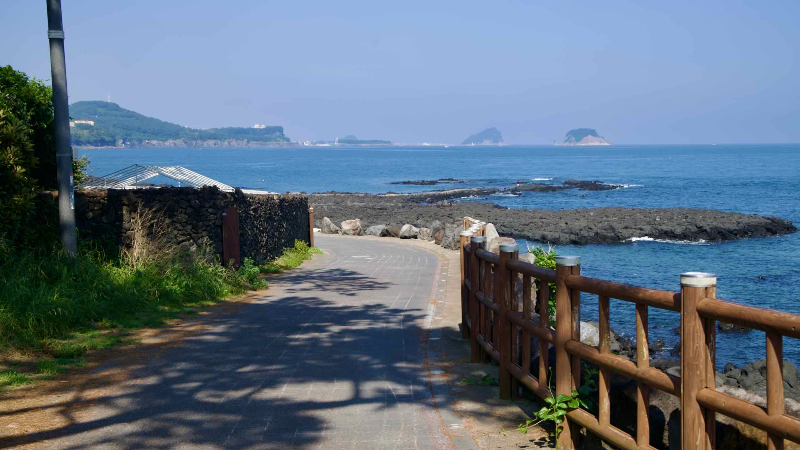
Beophwan Badang Coast (법환바당; map) is a 1.3-kilometer coastal stretch on Seogwipo City’s coast. It offers a glimpse into Jeju’s traditional fishing culture and views of three ecologically protected islands off Jeju’s coast.
With its black volcanic coastline, the area is also part of the famous Olle Trail Route 7, which is often regarded as one of the most scenic segments of Jeju’s extensive hiking trails.
Visitors walking or cycling along this route can enjoy views of Beom Island, a volcanic islet known for its striking columnar joints formed by rapid cooling of lava.
Three Islands
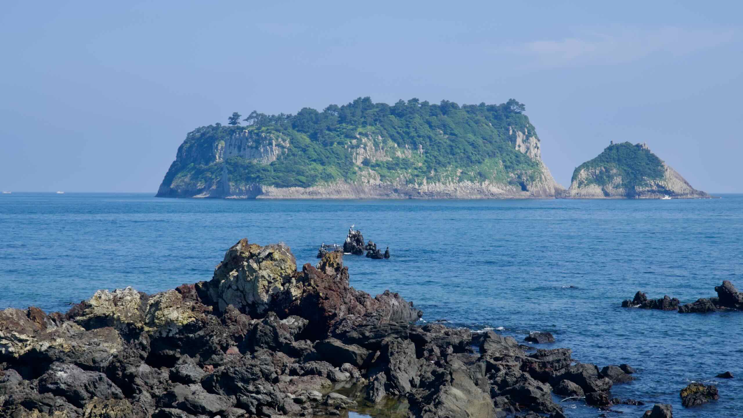
Three large uninhabited islands lie off the Beophwan Badang Coast. Designated Natural Monuments and a UNESCO Biosphere Reserve, they form part of the Seogwipo Provincial Marine Park.
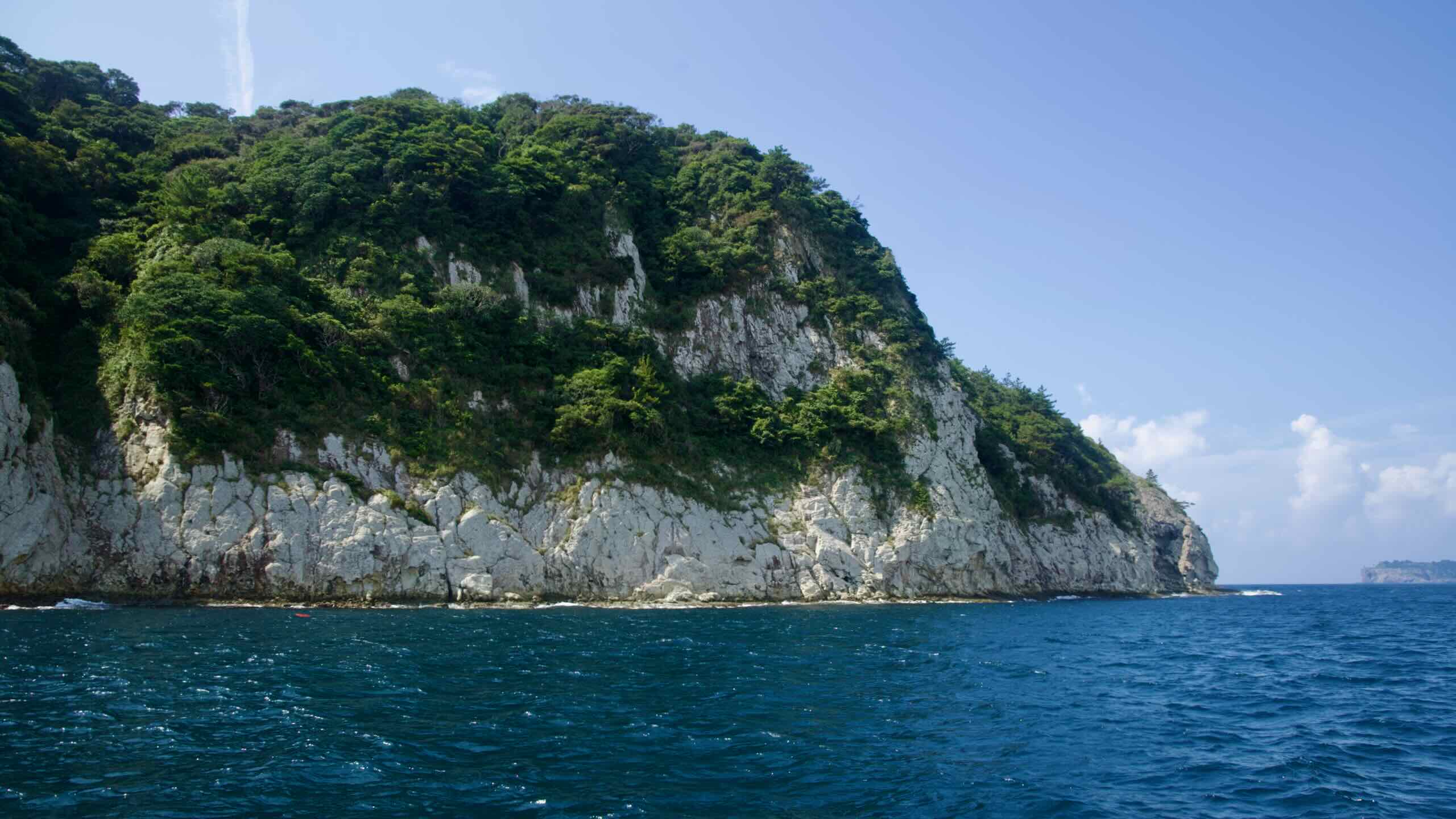
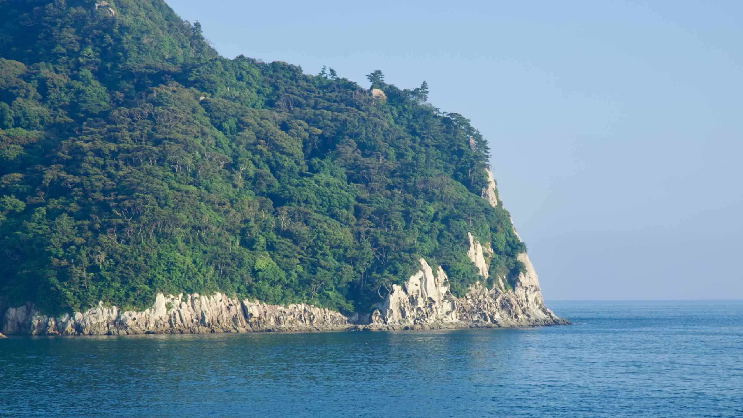
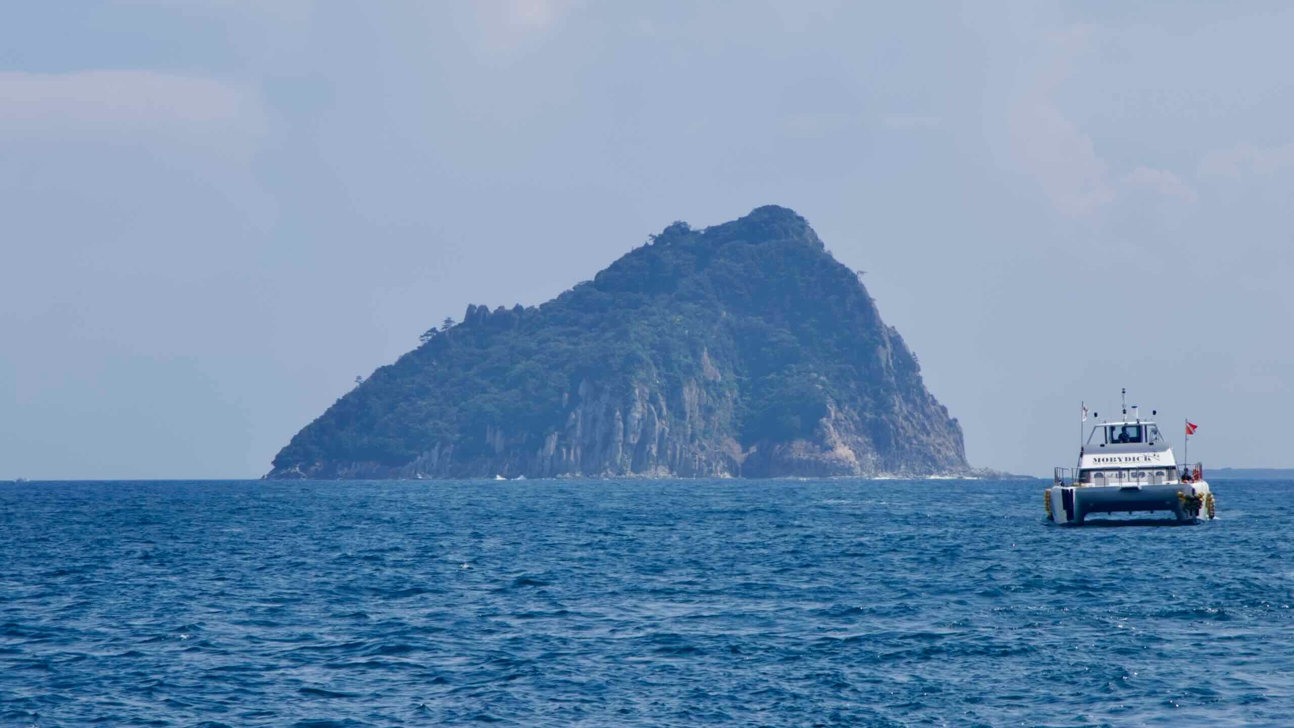
Visible from the coast of Beophwan, Beom Island (범섬; map; Beomseom) is the westernmost of three islands off the section of coast, located about 5 kilometers southwest of Seogwipo Harbor. It’s named for its resemblance to a crouching tiger, earning it the nickname “Tiger Island.”
Formed by underwater volcanic eruptions like Seongsan Ilchulbong, Beom Island features dramatic vertical rock formations and sea caves.
One of the island’s defining features is the presence of twin sea caves. According to local legend, the caves were created by Seolmundae Halmang, the mythical giant credited with forming Jeju Island, as she rested on Hallasan. As she lay down using Hallasan Mountain as a pillow, her toes extended and punched holes into the rock, forming the sea cave.
The caves and surrounding cliffs, shaped by millennia of weathering, are featured in natural documentaries and listed as Korea’s Natural Monument No. 421, which also includes Mun Island (문섬; map; Munseom) a little further east along Jeju’s coast.
The waters surrounding Beom Island host diverse marine ecosystems that include vibrant coral reefs and abundant fish species. This makes the area a premier destination for scuba diving and fishing, particularly for species like red sea bream and amberjack. Visitors can also enjoy sightseeing cruises, offering close views of the island’s rugged cliffs and forests.
Due to its ecological significance, access to the surrounding waters is restricted, and activities such as fishing or diving require special permits.
The middle of the three islands, Mun Island (문섬; map; Munseom) lies about 1.3 km south of Seogwipo city. Named “Mosquito Island” (Munseom) for its once-plentiful mosquitoes, it’s composed of fine-grained volcanic rock (trachyte), featuring well-developed columnar joints, sea-stack formations, and wave-cut benches that shape its rugged cliffs.
The island rises to an elevation of around 73 m and is topped with a dense grove of evergreen trees, including Elaeocarpus trees protected as Jeju Natural Monument No. 45.
Beneath the waves, Munseom is celebrated for its vibrant and diverse marine ecosystem. Subtropical fish inhabit its waters year-round, and the surrounding sea features a rich coral garden, home to 92 species.
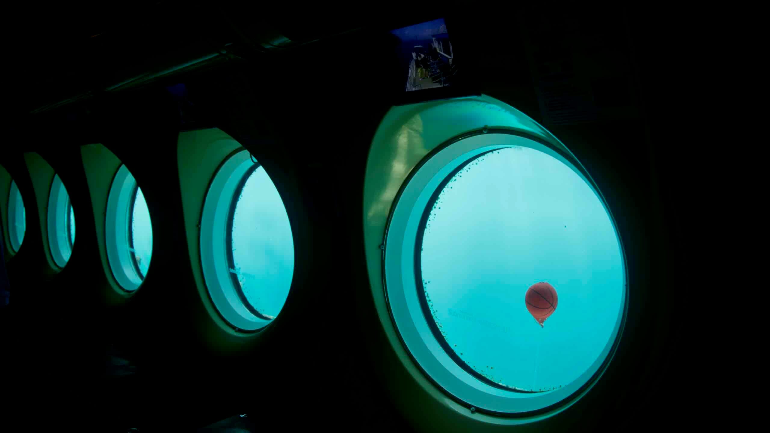
With its clear waters, Munseom draws scuba divers, sightseeing cruises, and tourists submarines to its soft coral colonies and a shipwreck on the northern side.
Seop Island (섭섬; map; Seopseom) is the easternmost island, laying just 450 meters offshore. Its name means “Island of Dense Forest”.
This uninhabited islet is composed of fine-grained volcanic rock (trachyte) and rises 155-meters above sea level. Its steep slopes display well-developed columnar joints, tors, and wave-cut benches.
The island is vegetated with evergreen forest and is ecologically notable as the only natural habitat in Korea for spleenwort, a small fern designated as a Natural Monument.
Though it holds a less flamboyant underwater environment compared to Munseom or Beomseom, Seopseom boasts hard-coral formations resembling tree branches and hosts dive routes suitable for both beginners and intermediate divers.
Jigwido
Jigwi Island (지귀도; map; Jigwido) is a fourth, distant island not usually associated with the Seogwipo Provincial Marine Park, lying 4 kilometers south of the shoreline.
Its name, meaning “an island where land enters the sea,” reflects its flat, elongated, oval-like shape. The flat lava plateau surrounded by basalt rock coasts stands about 5 to 10-meters high, with a central plain covered in silver grass
Jigwido has been privately owned since 1982 by the Unification Church, previously led by Moon Seon-myung. The island is noted for its wild rabbit population, which—locals say—was deliberately introduced by Moon for hunting.
The surrounding shallow coastal waters make Jigwido easily accessible for anglers and divers. It’s a designated tourism fish zone—offering safe rock-fishing platforms—and popular for diving and free-diving experiences.
History and Culture
Beophwan Badang has long been associated with Jeju’s haenyeo (female divers). The area is home to the Beophwan Haenyeo School (map), where visitors can learn about the lives of these divers and their sustainable fishing practices.
Informational signs along the coast also share local stories and traditions tied to the sea, including the significance of landmarks like Dumuneemul.
Known as the “Two Faces Pool,” Dumuneemul Park (두머니물공원; map) marks the western end of the Beophwan Badang Coast and sits at the boundary between Beophwan and Gangjeong villages.
The spring historically served as a meeting point for haenyeo (female diver) leaders from both communities, fostering harmony and resolving disputes over fishing rights. It also provided a vital freshwater source for locals and divers after arduous dives.
From June through October, visitors can join guided muljil (diving) sessions led by local divers. Informational signs along the coast share local stories and traditions tied to the sea, including the significance of landmarks like Dumuneemul.
Beophwan Port (법환포구; map) marks the eastern end of the Beophwan Badang Coast and offers sweeping views of Beomseom, Seopseom, and Munseom Islands.
The port is also known as “Maksukgae” since the late Goryeo period, when General Choi Yeong set up his military camp here.
Near the port’s breakwaters is Jamnyeo Square, filled with sculptures of sealife and the revered haenyeo divers.
Beophwan Port hosts many cafés, restaurants, and guesthouses, and is known for snorkeling with clear water and cool springs; a few travelers sighted dolphins in the area.
Beophwan Port is also home to the Beophwan Haenyeo School (map), where visitors can learn about the lives of these divers. Nearby Beophwan Village holds the largest population of haenyeo divers in Jeju.
Beophwan Badang’s volcanic coastline provides a great backdrop for leisurely walks and cycling. The area’s unique geology, featuring basalt rock formations and tide pools, is especially captivating during sunset. Visitors can observe seabirds perched on jagged rocks and, at low tide, explore tidal zones rich with marine life.
Seeking a brief visit? The stretch between Dumuneemul and Beophwan Port (법환항; map) is the most picturesque course (directions). The route offers scenic views, shaded paths, and an introduction to the local culture.