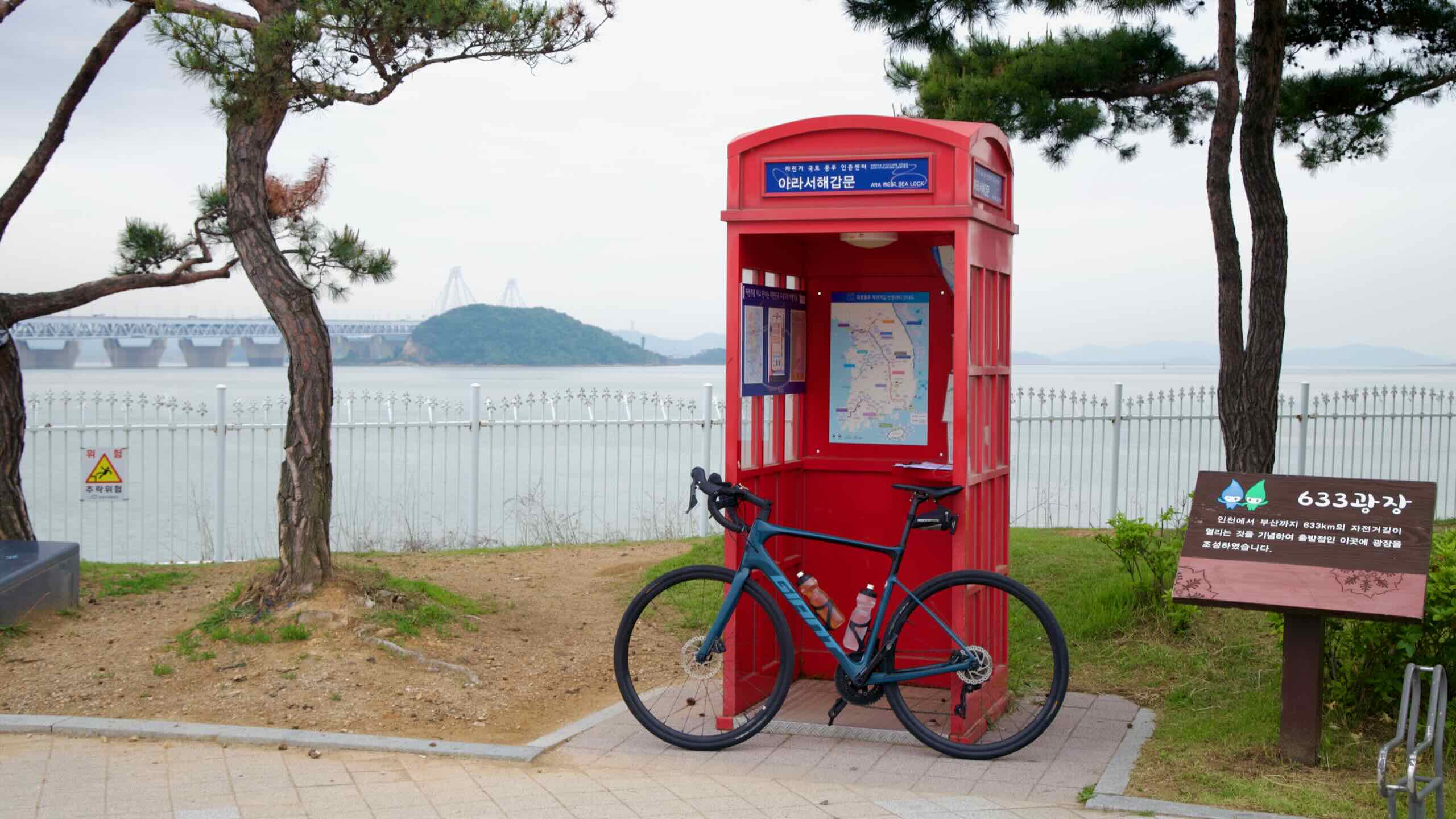
The route begins near the Ara West Sea Lock, the point where the canal spills into the Yellow Sea. As you ride east towards Seoul, discover biking paths, parks, and other highlights on opposite sides of the canal.
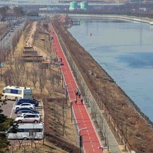
The main bike path sails along the canal’s south side. But interesting landmarks inhabit the north side, as well.
Fourteen bridges connect the canal’s north and south banks. Under them sit bike rental stations, restrooms, art installations, and more park facilities.
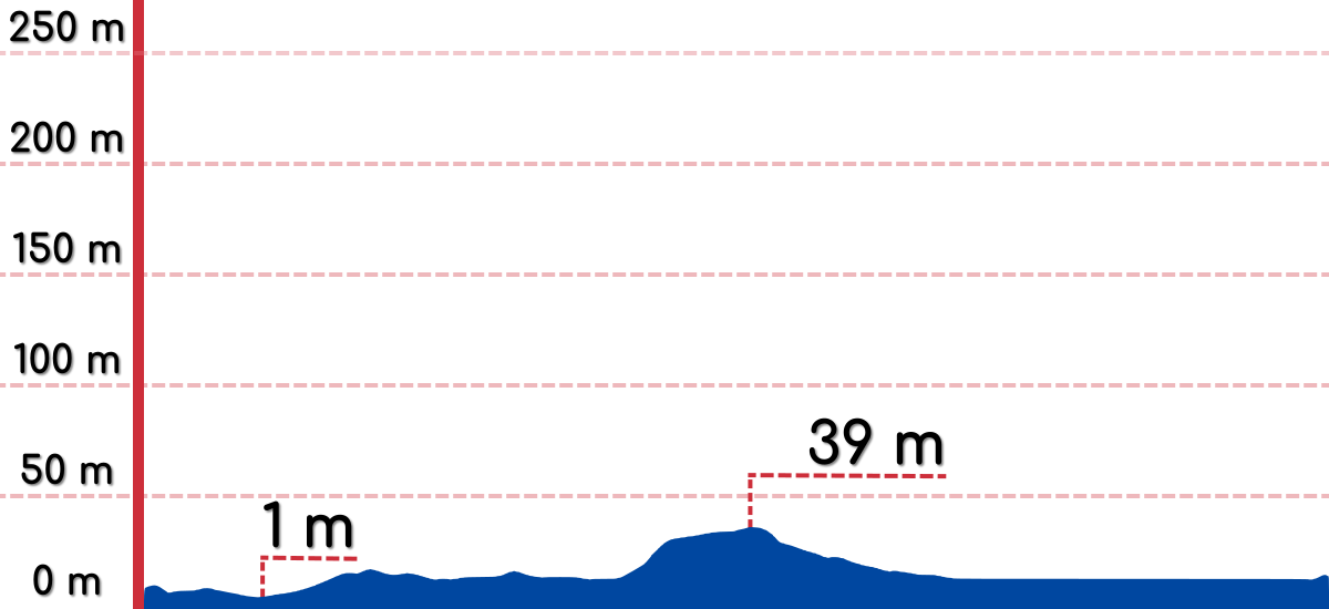
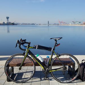
The Ara Bicycle Path is the easiest of Korea’s certification bike paths. It follows a flat canal for a meager 21 kilometers. Keep a steady pace and you can conquer its course in less than two hours.
Cycling paths run along both the north and south sides of the Ara Waterway. Both are flat and travel about 20 kilometers. But they have a few key differences.
The “official” certification bike path runs along the south side. Both of the Ara Bike Path’s certification centers sit on the bottom side of the Ara Waterway.
You must hop over the canal to travel along the north side. Three bridges with elevators that lead to the bike paths make crossing simple.
On the canal’s south side, the bike path splits in two after Duri Eco Park (road view). If you keep straight, you’ll travel under a bridge and onto the Gulpo Stream Bike Path. If you turn right, you’ll hop over a bridge and continue on the Ara Bike Path. Turn right! Don’t take a 10 kilometer detour down Gulpo Stream into downtown Incheon.
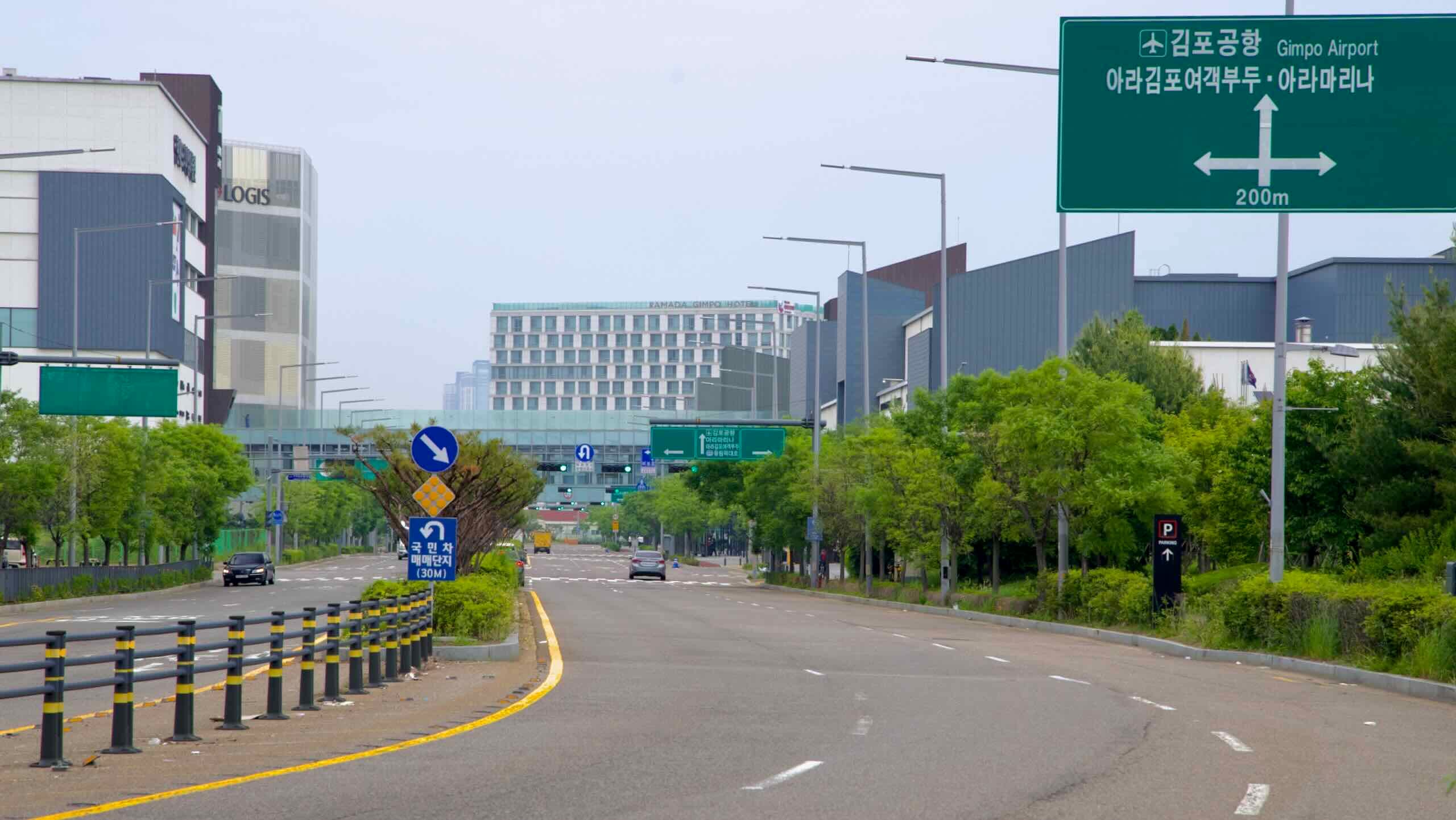
Near the end of the Ara Bike Path, the cycling path on the north side of the canal navigates city streets near Ara Gimpo Passenger Terminal (길찾기; 2.3 km).
On the canal’s south side, near the end of the bike path, the course navigates industrial roads before landing near Ara Hangang Lock (directions; 1.6 km).
Lost? Look for cycling lanes embedded into sidewalks and blue bike signs pointing the way.
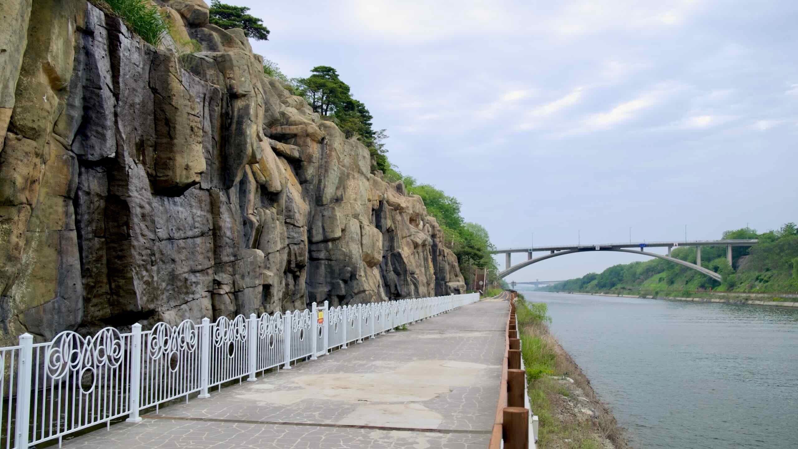
The Ara Bicycle Path is the shortest certification bike path. But it offers several scenic stops, curiosities, and architecture. Let’s go take a brief tour.
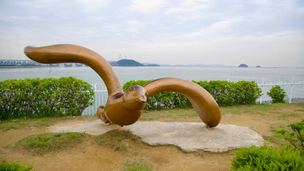
A bronze seabird sculpture with wings spread wide faces the Yellow Sea.
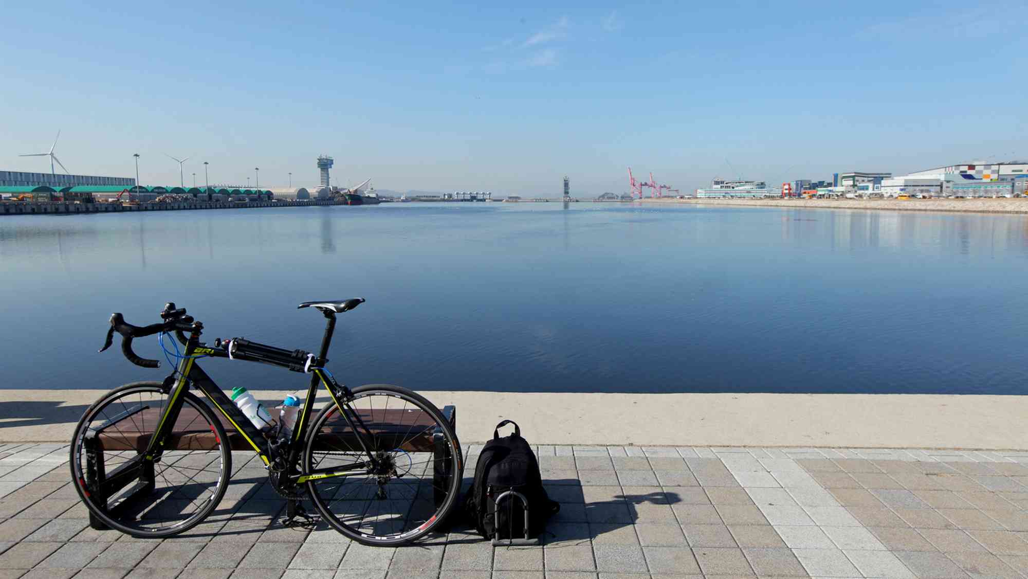
The Ara Bike Path begins on the edge of the Yellow Sea (West Sea). You can see it from the Ara West Sea Lock, the cycling course’s start line. The body of water stretches from the Korean peninsula to China.
The Yellow Sea has two traits that make it unique:
Its name comes from the yellow sand deposited on its waves from seasonal Gobi Desert winds.
On low tides, the Yellow Sea becomes the largest mud flat in the world. During spring and fall, thousands of migrating birds land on the exposed sea floor to fill their starved bellies with wiggling molluscs, shrimps, and other critters.
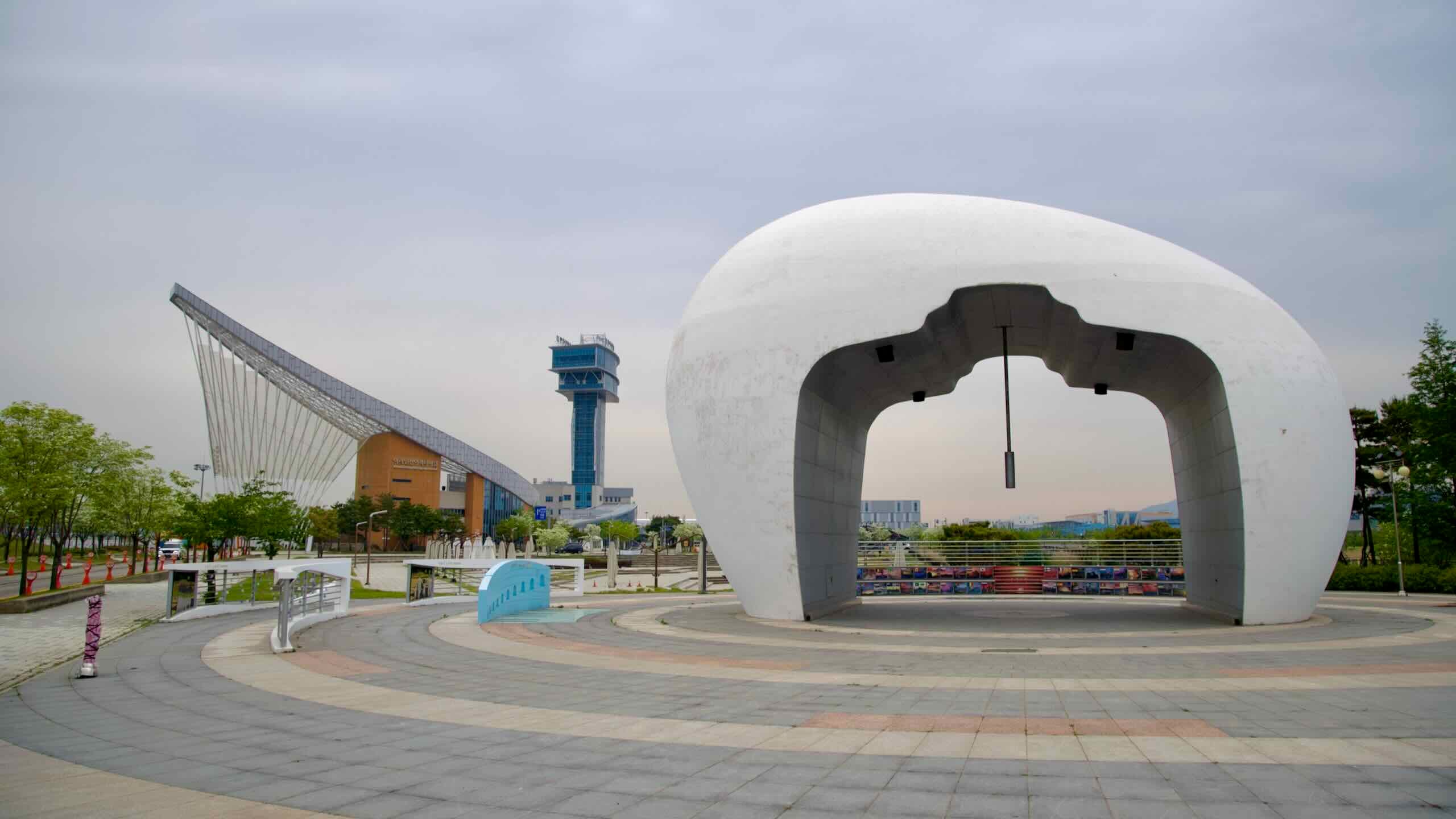
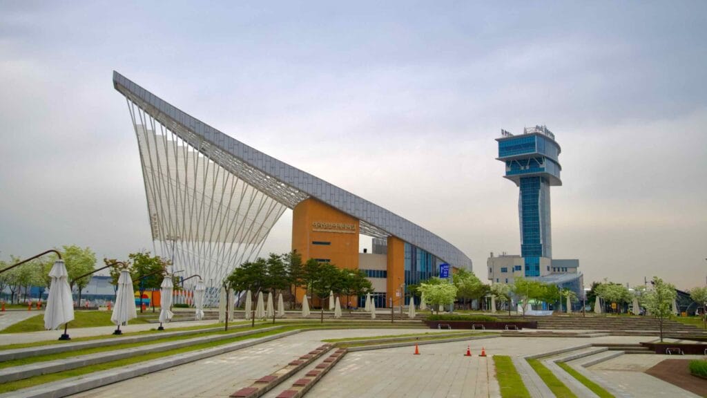
The Ara Passenger Terminal and Tower anchor Korea’s inland canal port.
The Gyeongin Ara Passenger Terminal hangs near the start of the Ara Bike Path, where the Ara Waterway spills into the Yellow Sea.
The terminal comprises two buildings connected by sweeping white beams that resemble a ship’s sail. An observation tower, ferry terminal, and a place to buy and certify your bike passport fill out the complex.
“Ara” (아라) derives from Arirang, an ancient Korean folk song.
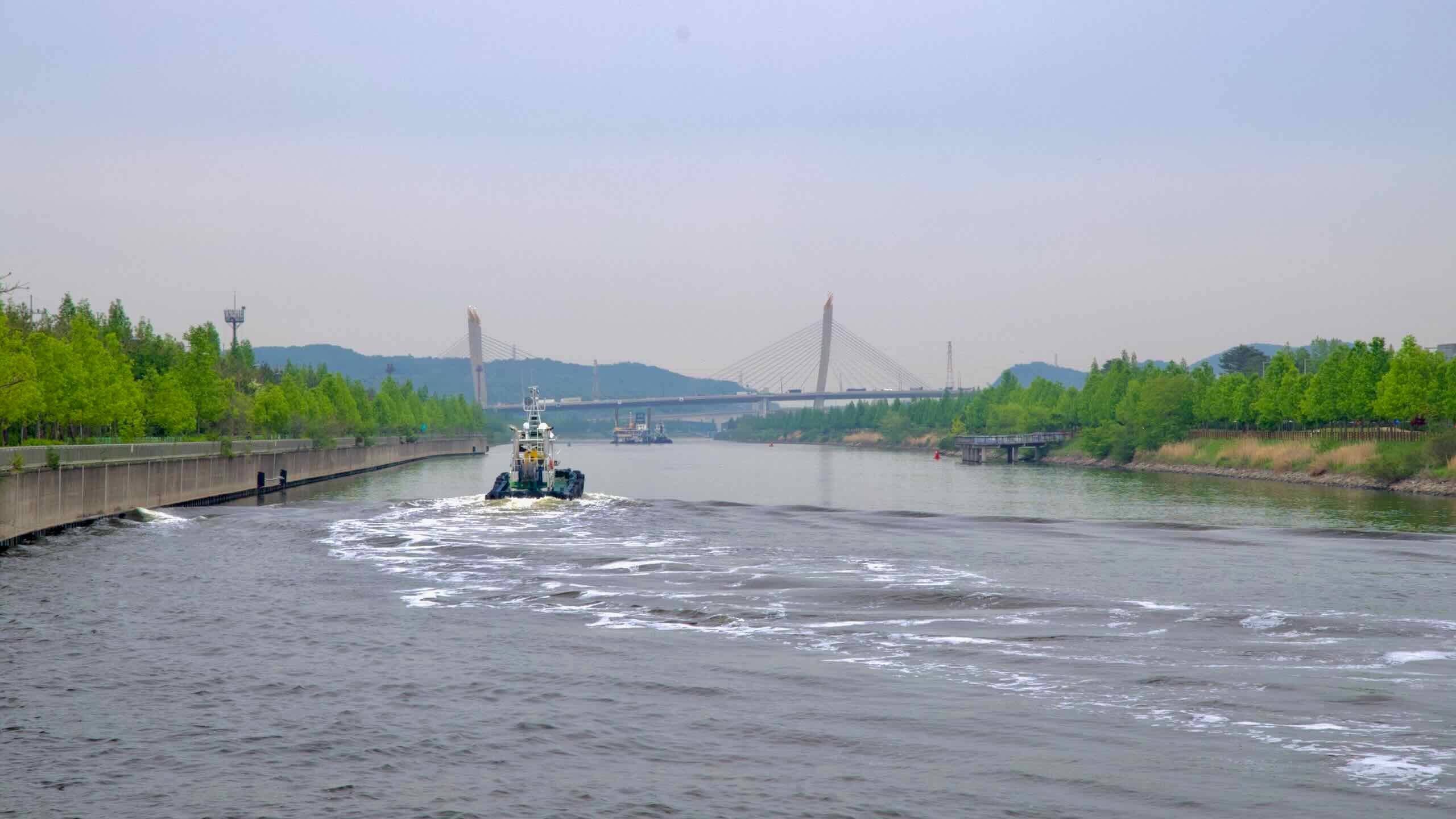
The Ara Waterway is Korea’s first human-made canal. Eighteen kilometers long. Eighty meters wide. Six meters deep. The canal starts at the Han River in Seoul and flows into the Yellow Sea.
The AREX (Airport Express) is an all-stop subway that takes passengers from Incheon International Airport to Seoul Station in downtown Seoul. However, passengers with full-size bikes may only ride on weekends by reserving in advance on the AREX website.
Can’t book a space on the AREX? There are alternatives.
Bucheon Bus Terminal is far from the start of the bike path. But it offers an alternative entry point on weekdays, when subways don’t allow full-size bikes.
Behind Seoul and Busan, Incheon Metropolitan City (인천광역시; map) is Korea’s third most populous city. It holds over three million residents.
Nestled against the Yellow Sea in the nation’s northwest, Incheon is a part of the Seoul Capital Area (수도권), which includes Gyeonggi Province (경기도; map) and its dozens of cities.
Incheon International Airport (인천국제공항; map) is the primary hub for Korea’s international travelers. In 2016, the airport ranked fifth for cargo and nineteenth for passengers worldwide.
Incheon was one of the first cities in Korea to designate fifty thousand acres of its territory as a Free Economic Zone. Foreign businesses that set up operations inside it can receive tax breaks and more.
Here are a few more highlights.
New Songdo City — a smart city built on reclaimed Yellow Sea tidal flats.
Chinatown — Korea’s oldest operating Chinatown with historic sites and authentic food.
Wolmido — an island connected to the mainland with parks and gardens. During the Korean War, it was a primary site for the Battle of Inchon.