Cycle along natural wonders and interesting landmarks on the bottom of Jeju Island.
The Jeju Fantasy Bicycle Path’s second of three legs starts in Daejeong Town (대정읍; map) in Seogwipo City (서귀포시; map). Climb over a rolling hill and land in the Jungmun Tourist Complex, filled with tourist highlights. Then skirts along the island’s south coast until you land in Pyoseon Village (표선면; map).
Meet a few rocky wonders before embarking on the most challenging climb along the Jeju Fantasy Bike Path. After the ascent, roll down into one of the island’s tourist epicenters.
Well rested from your first leg of the Jeju Fantasy Bike Path? Good. Let’s keep it rolling.
From Songaksan Certification Center (송악산 인증센터; map), ride along the coast past along Hyeongjehaean Road (형제해안로; map; Brother’s Coast Road) by coffee shops (map), accommodations (map), and restaurants (map).
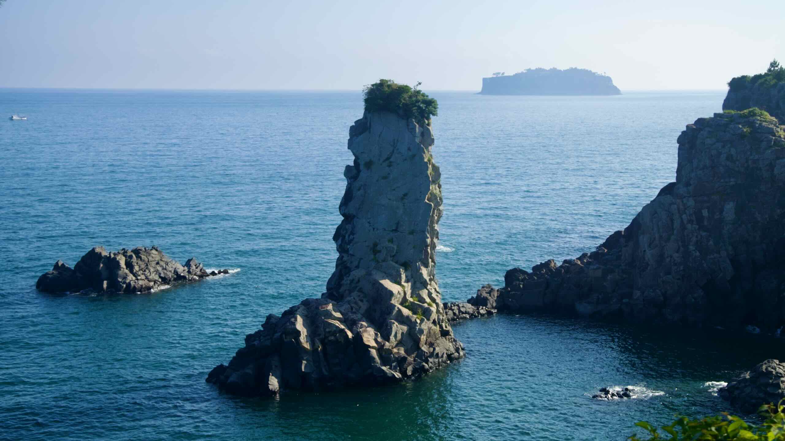
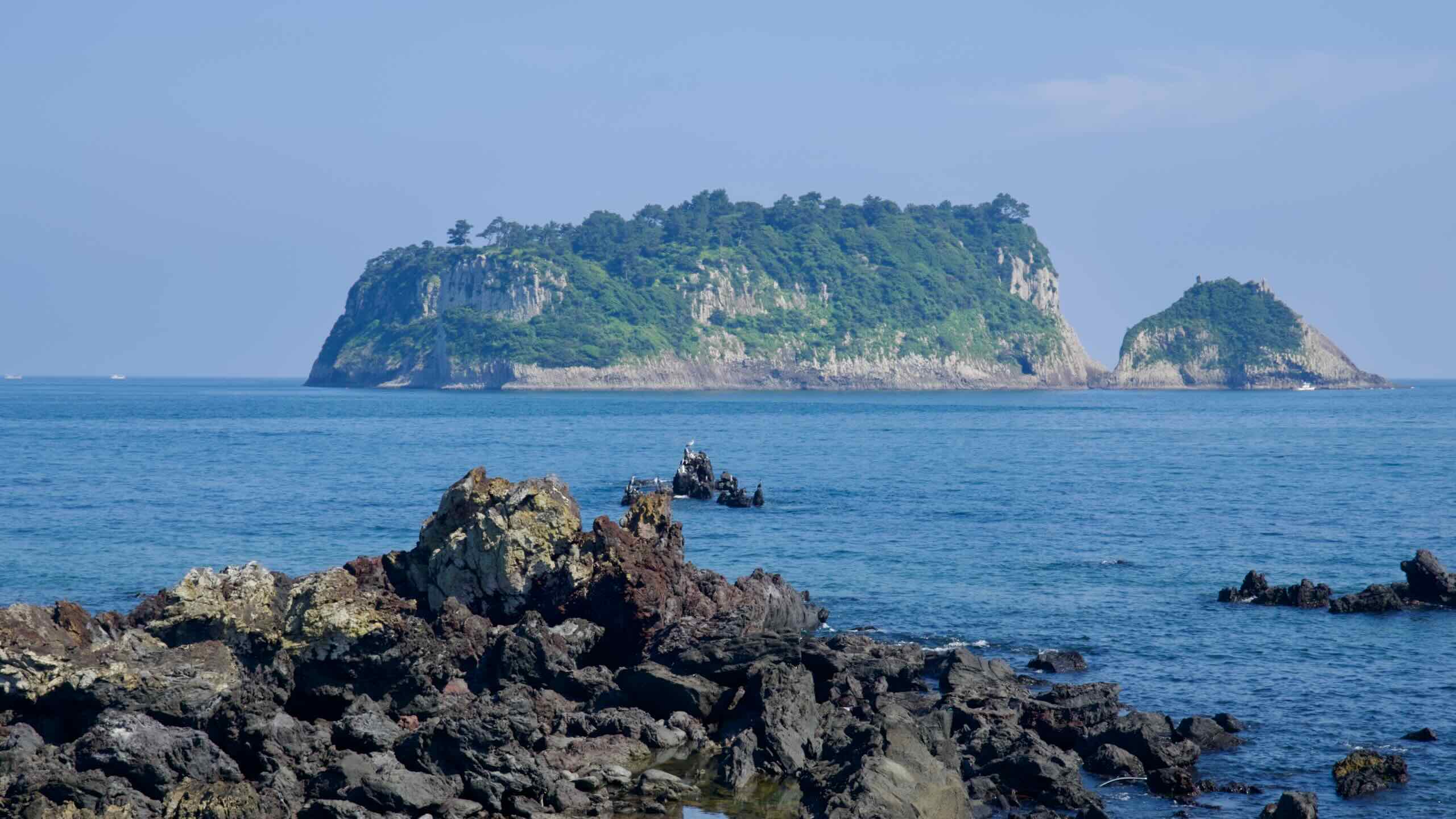
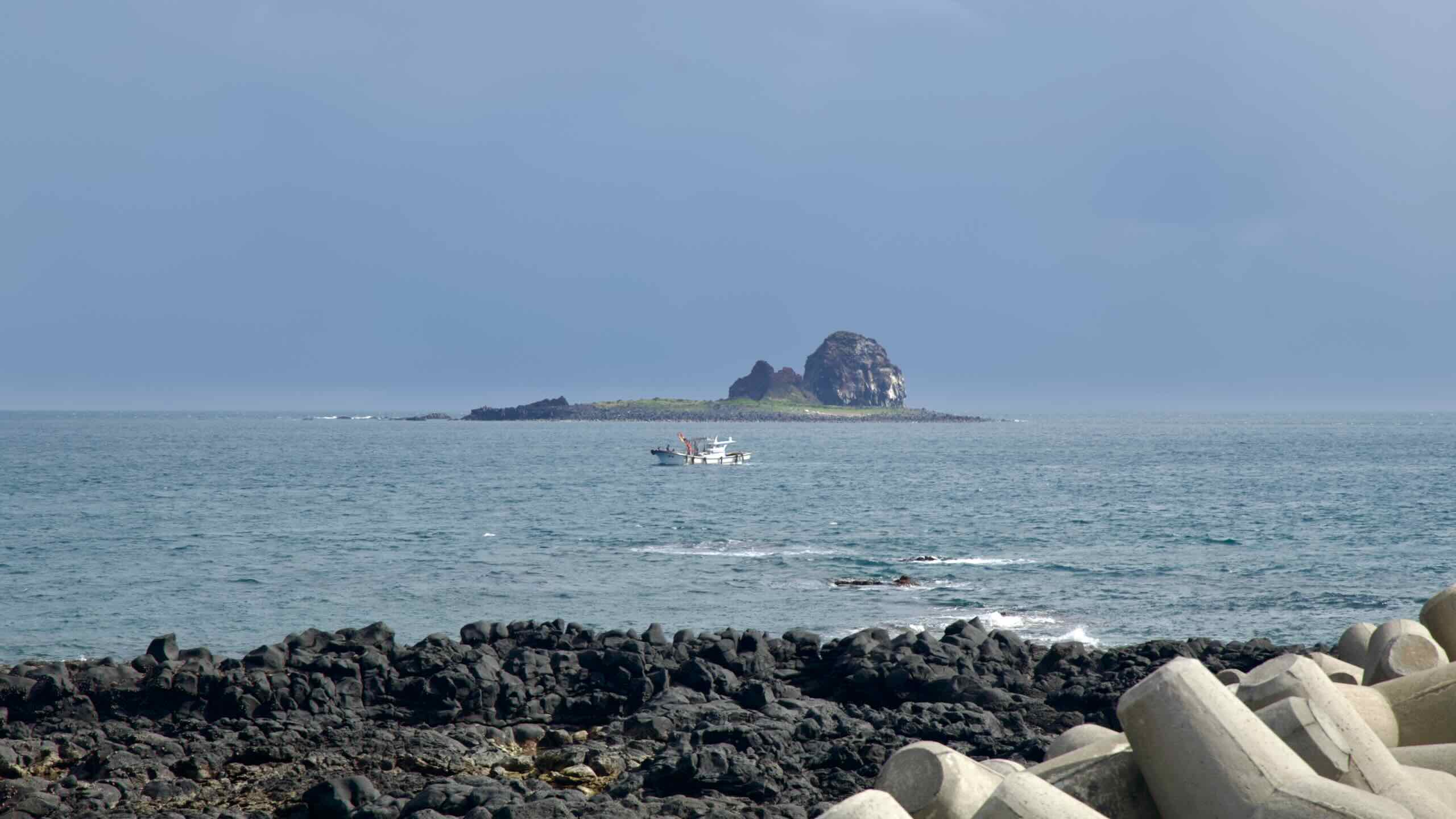
Why the name “Brother’s Coast”? Look into the waters and find Hyeongje Islets (형제섬; map Brothers’ Island).
These two uninhabited rocky islets just off Jeju’s southern coast resemble two brothers—one low and wide (Bonseom), the other taller (Otseom). Though, depending on the tide and vantage point, submerged reefs and smaller formations may appear, adding a few more islets to the island family.
The surrounding waters are renowned for fishing and seascapes. Divers can explore submerged arches and dense marine life of seagrass, soft corals, and schools of fish like tang and chromis. On land, many photographers flock to the coast to catch the sun setting between the brother islets.
Sagye Coastline
This stretch along Jeju’s southwestern shoreline is also called the Sagye Coastline, because it runs between Sagye Port and Hwasun Port (outside of the cycling route), passing Sagye Beach along the way.
Sagye Port (사계항; map) is a compact fishing harbor that serves as a practical waypoint for nearby boat tours and seafood vendors.
Sagye Beach (사계해변; map) is a lava rock-lined beach with patchy sand and strong wind. Not ideal for swimming, but its backdrop of Sanbang Mountain and open ocean offer a great setting for seafood (map) restaurants and seaside parks (map).
Hwasun Port (화순항; map), which the Jeju Fantasy Bike Path does not cross, is a quiet working port surrounded by green farmland and basalt seawalls. Without much tourist infrastructure, it gives a snapshot of Jeju’s coastal fishing life.
Hwasun Golden Sand Beach (화순 금모래 해변; map) rests beside Hwasun Port. Despite its name, the beach features smooth black sand and a freshwater pool, fed by cool spring water, popular with families for its shallow depth and kid-friendly features.
After traveling this windswept coastline past Sagye Beach, flow through Sagye Port and find a small lookout at its far end (map)
Yongmeori Coast, seated at the base of Sanbang Mountain, is known for its dramatic sandstone cliffs, tidal pools, and historical significance. Its name, meaning “Dragon’s Head Coast,” derives from its resemblance to a dragon extending its head into the sea.
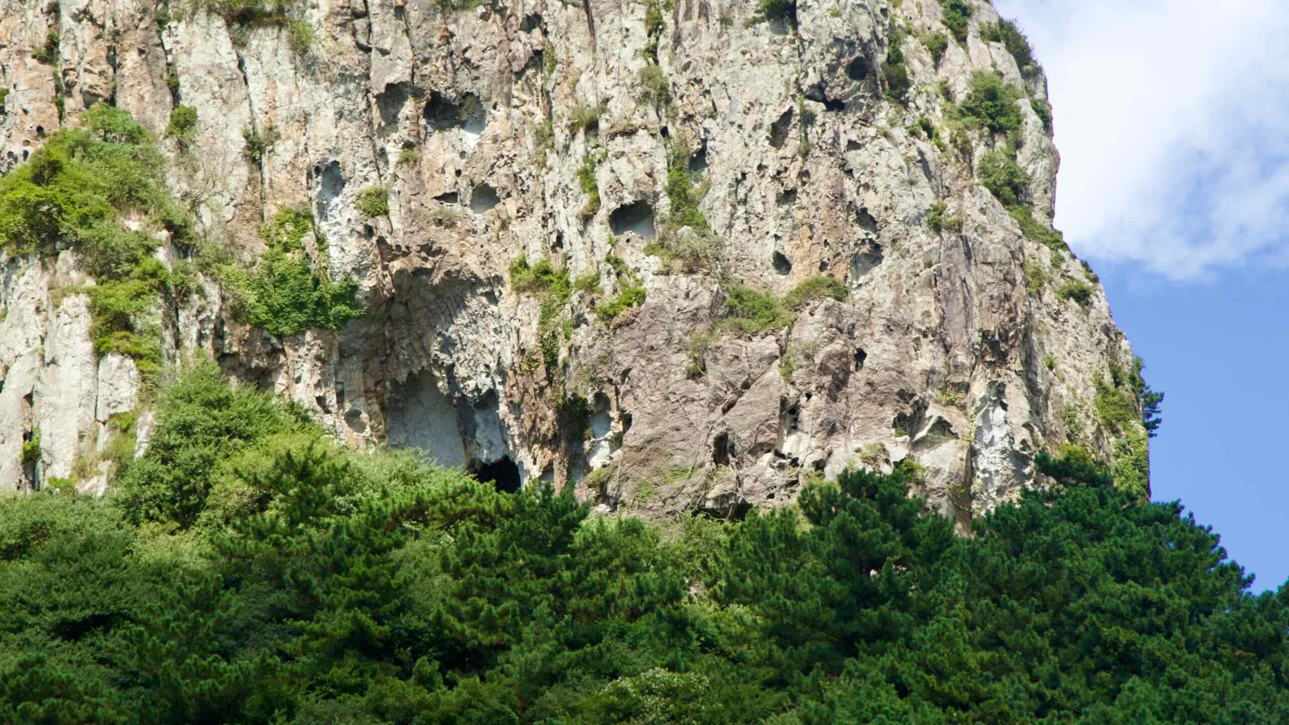
The coast’s formations are the result of millions of years of geological activity, including underwater volcanic eruptions and subsequent erosion, resulting in features such as parallel strata, tafoni (honeycomb weathering patterns), and sea caves.
Yongmeori is a UNESCO Global Geopark, one of Jeju’s oldest volcanic formations, and also a window into the island’s geological evolution.
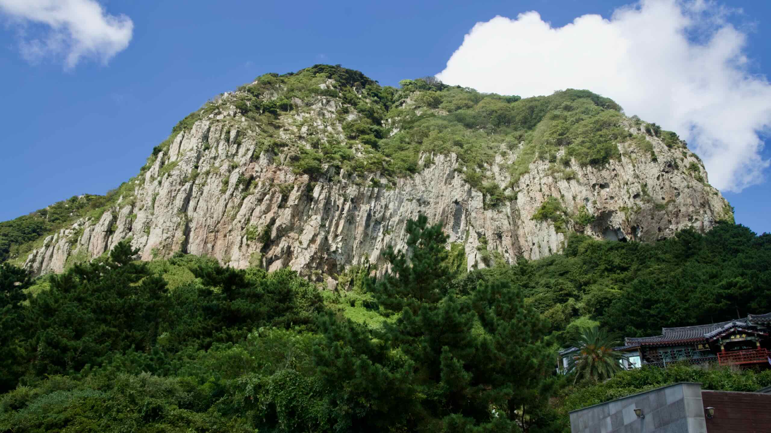
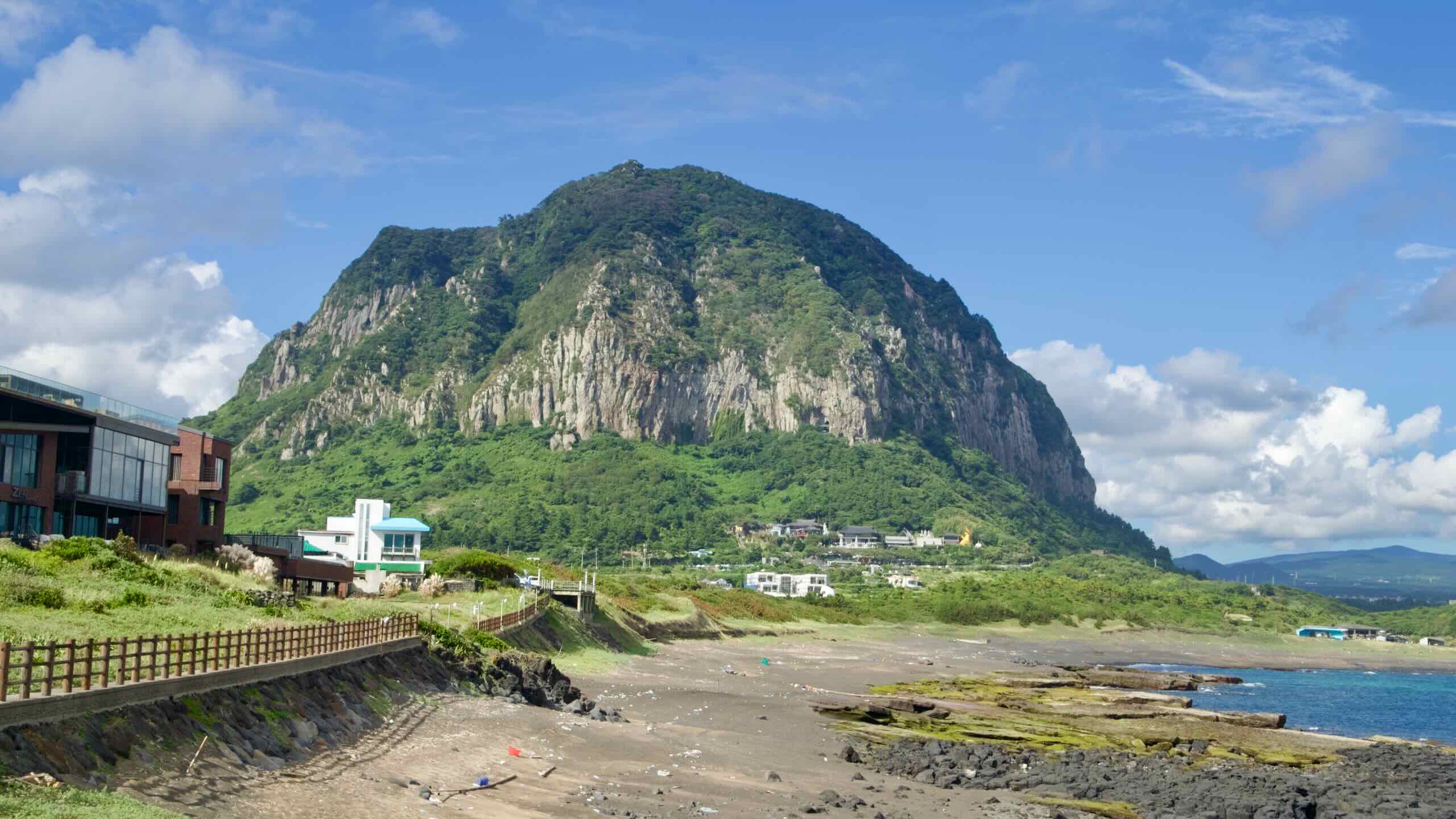
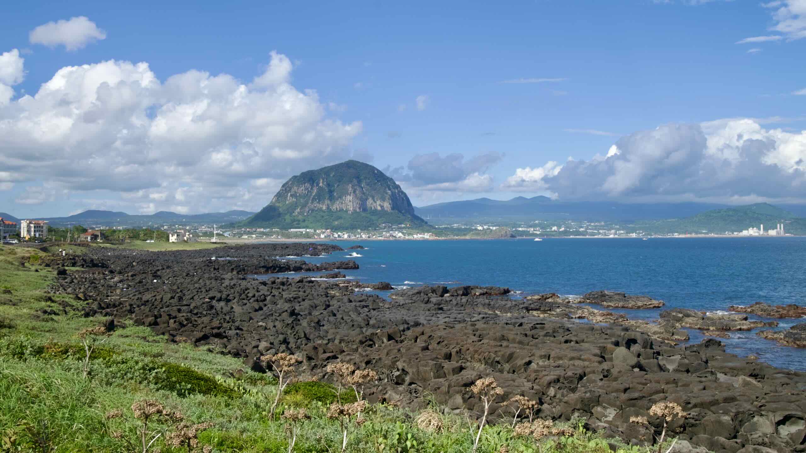
Now from Sagye Port’ s lookout point, glance up at the towering sheer mountain with sheer rock walls. Say hello to Sanbang Mountain, one of Jeju Island’s most striking natural peaks.
Standing 395 meters tall, this dome-shaped volcanic mountain stands out against the flat surrounding landscape. Formed approximately 80,000 years ago during ancient volcanic activity, Sanbang Mountain is unique for its lack of a summit crater, distinguishing it from other volcanic formations on the island.
The mountain’s name, meaning “mountain with a cave,” reflects its defining feature: Sanbanggulsa (산방굴사; map), a natural grotto that hosts a temple.
The Sanbang Mountain Pass (directions) begins near the bottom of Sagye Port. It features a 54-meter climb over 1.9 kilometers with a 2.84% gradient.
Cycle up through quaint but busy towns on city streets, passing accommodations (map) and eateries (map).
Sanbanggulsa & Bomunsa Temples
As Sanbang Mountain grows closer, notice a large gold buddha statue and temple perched at the base of the sheer cliffs. That’s Bomunsa Temple (보문사; map), which many believe dates back centuries. It features pavilions and statues depicting famed Buddhist legends.
Veer 400 meters off the Sanbang Mountain Pass climb (directions) and then climb a short but steep stairway and come to Sanbanggulsa—literally “Mountain Cave Temple”—a small, cave-set Buddhist shrine offering a blend of legend, nature, and quiet reverence.
The cave, about five meters tall, houses a seated statue of the Historical Buddha, said to date back to the Goryeo dynasty, with water droplets falling from the ceiling into small rock pools below—a mystical sight tied to local folklore.
Sanbangsan Canola Flower Fields
Continue on up the Sanbang Mountain Pass. Hit the top of Sagye Port’s town and turn left on another vehicle road with a bike-lane shoulder (road view), rounding the base of Sanbang Mountain.
If you’re cycling in late March or April, the fields surrounding the mountain should be swelling with yellow. Lining the mountain’s foot, find Sanbang Mountain Canola Flower Fields (산방산유채꽃밭; map). These open-air agricultural fields have become popular stops for photographers and tourists.
As you round the mountain, take another right at a four-way intersection (road view) and pedal onwards until you meet Iljuseo Road (일주서로; map; road view). This main thoroughfare with protected shoulders and sidewalks for cyclists will carry you over the next climb and drop you in the Jungmun Tourist Complex.
Ride along the bustling Iljuseo Road east along the backside of Sanbang Mountain. In about 2.5 kilometers, the road begins to tilt uphill.
Welcome to the Gunsan Oreum Climb (directions). This extended uphill section rises a total of 111 meters. The ascent takes place over several stages, broken up by the busy intersections along Iljuseo Road. The 5.7-kilometer ascent usually features a gentle but persistent 1.95% gradient.
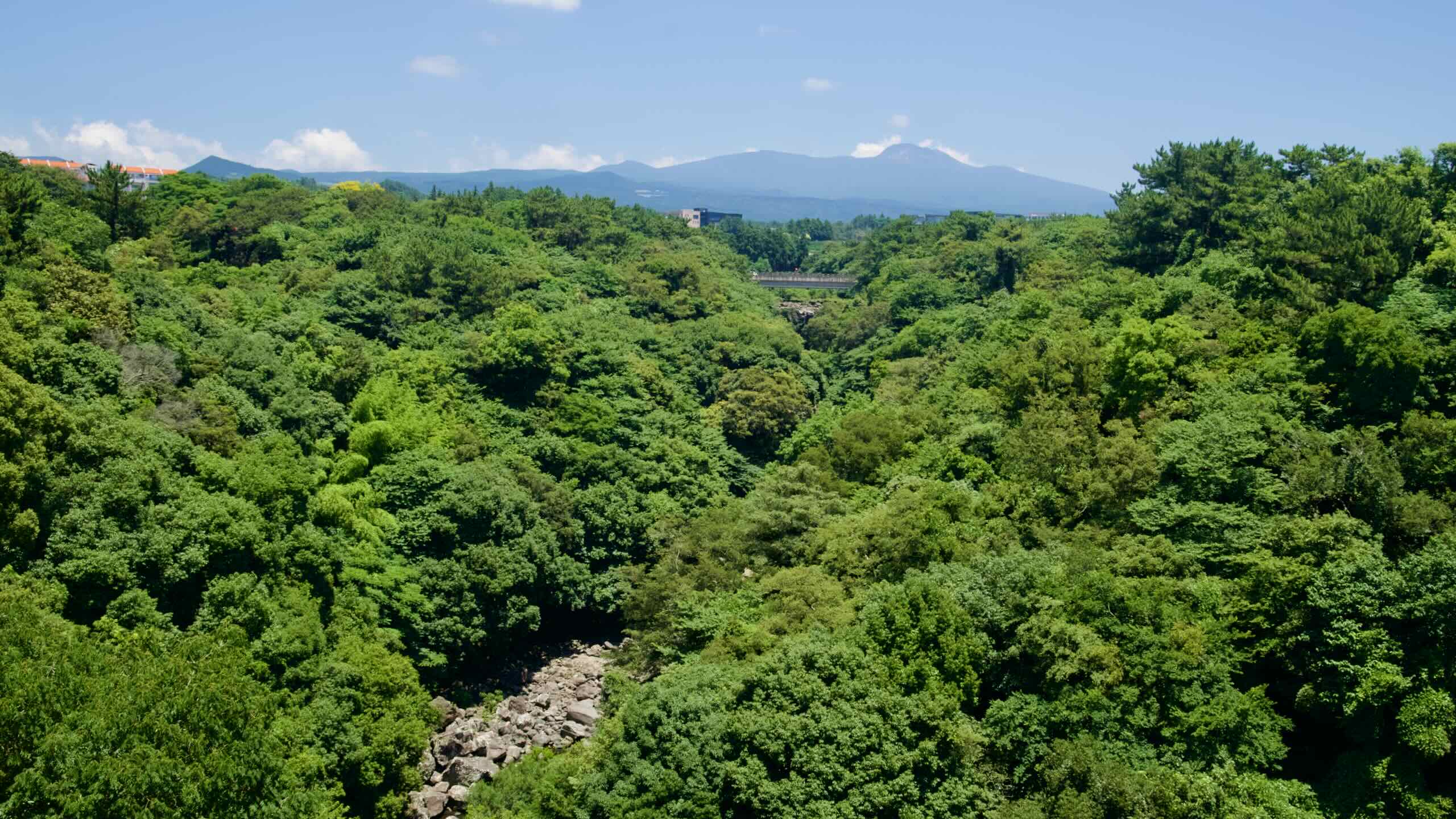
Gunsan Oreum
The Gunsan Oreum Climb also features the most extended sections away from the coastline. Why?
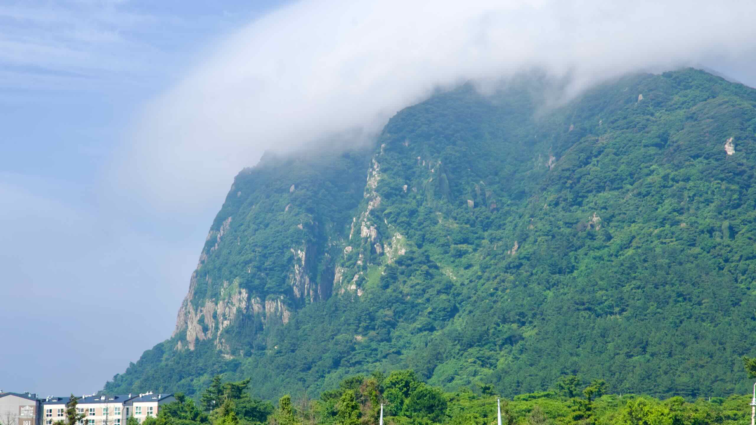
This area of Jeju is littered with volcanic hills like Walla Peak (월라봉; map; Walabong) and the expansive Gunsan Oreum (군산오름; map), the largest parasitic cone on Jeju with a hikable 334-meter peak offering 360° views of Hallasan and Marado.
Ancient geomancy (feng shui) practitioners believed that Gunsan Oreum holds great energy. They believed that burials on Gunsan Oreum’s summit blocked its positive energy and created droughts.
As you cycle onwards and upwards, pass by loads of shops selling Hallabong (한라봉 or dekopon). Born from crossing the Kiyomi orange and Ponkan tangerine, hallabong has been cultivated almost exclusively on Jeju Island since the 1990s, thriving in the island’s volcanic soil and mild, sun-drenched winters.
Hallabong’s name honors Mount Halla—Jeju’s towering volcanic peak—and mirrors the peak’s distinctive rounded form topped with a characteristic “bump.”
Often given during celebrations, hallabong features sweet, juicy flesh, low acidity, few seeds, and an easy-to-peel skin, making it ideal for effortless snacking.
After reaching the top of the Gunsan Oreum Climb, the road tilts and begins descending into one of the tourist hearts of Seogwipo City.
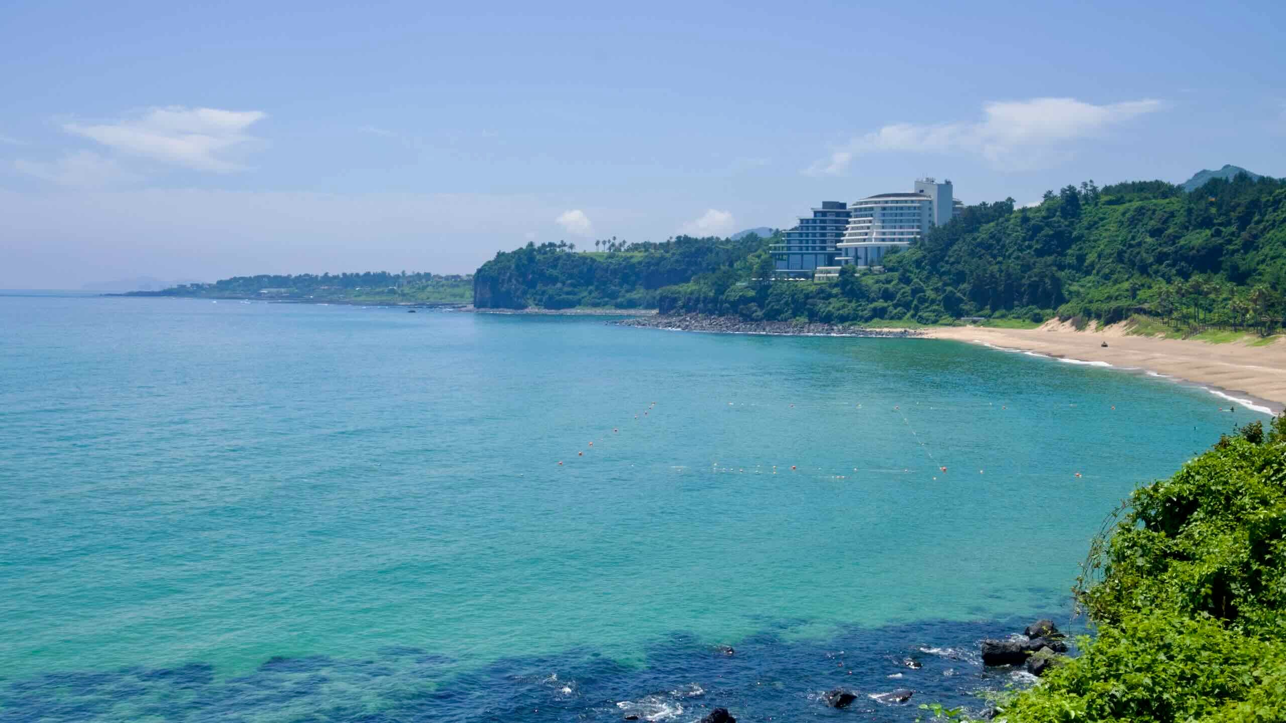
Dip down to a four-way intersection (road view), then flow up a tree-lined side road (road view) along the back side of a golf course and the Grand Joseon Jeju (그랜드조선 제주; map), one of Jeju’s five-star resorts with a lineup of upscale offerings, including six restaurants, a rooftop bar, and indoor and outdoor pools.
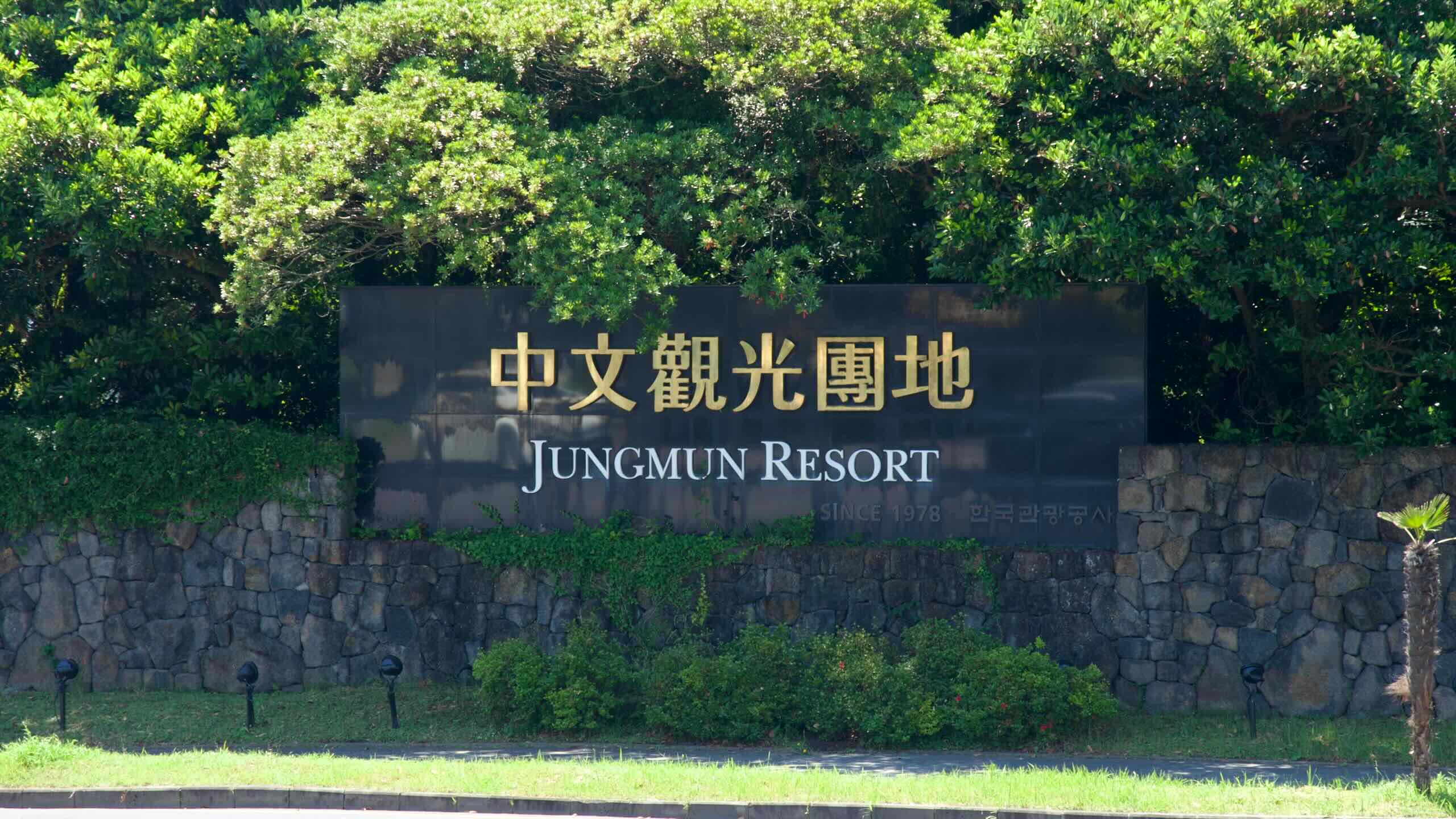
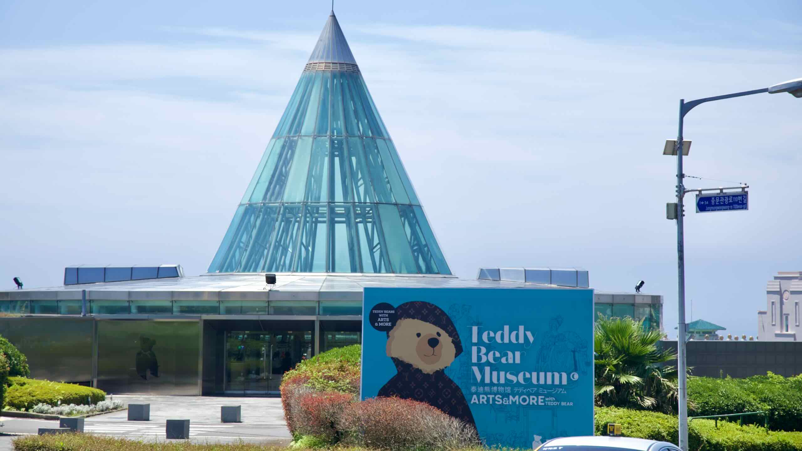
The Jungmun Tourist Complex is Jeju’s most expansive resort district, spanning Jungmun, Saekdal, and Daepo neighborhoods in Seogwipo. Established in the late 1970s as a global tourism hub, it today features luxury hotels like The Suites and Lotte Hotel Jeju, an international convention center, and golf courses.
Let’s take a look at some of the area’s notable attractions.
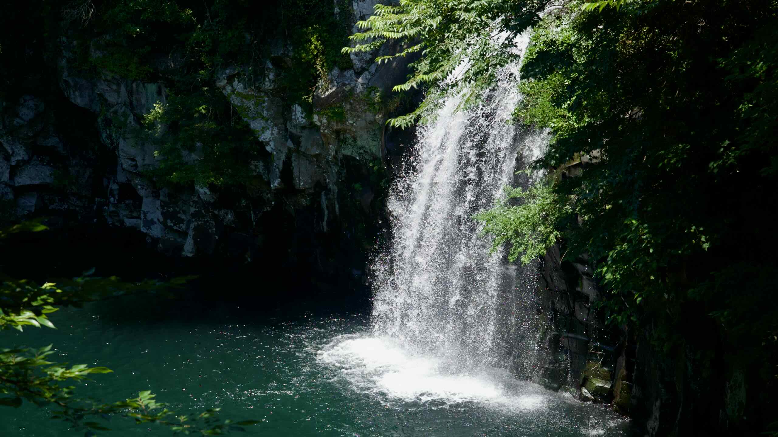
Cheonjeyeon Falls is a trio of waterfalls—each feeding into the next—pouring from a dramatic 22-meter drop into an emerald pool below. The surrounding warm-temperate forest, a designated natural monument, is lush with rare plant species. Nearby stand the curving arch of Seonim Bridge (Seven Nymphs Bridge) and Cheonjeru Pavilion.
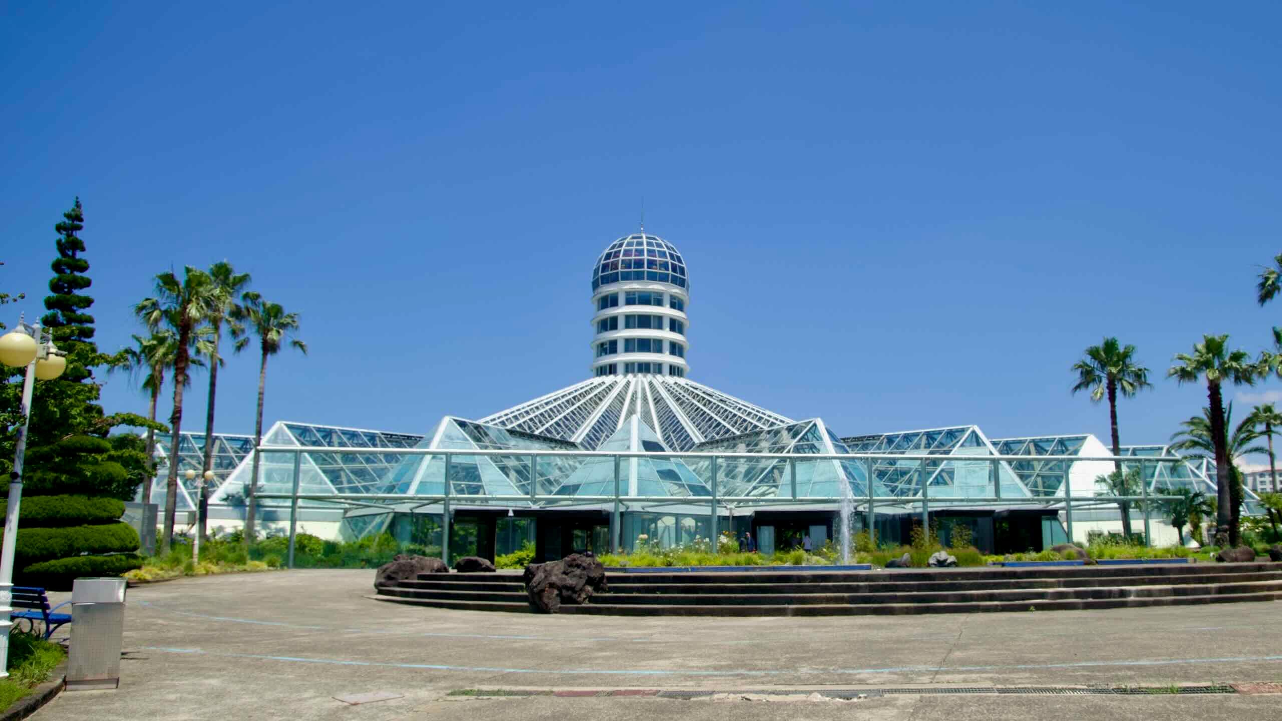
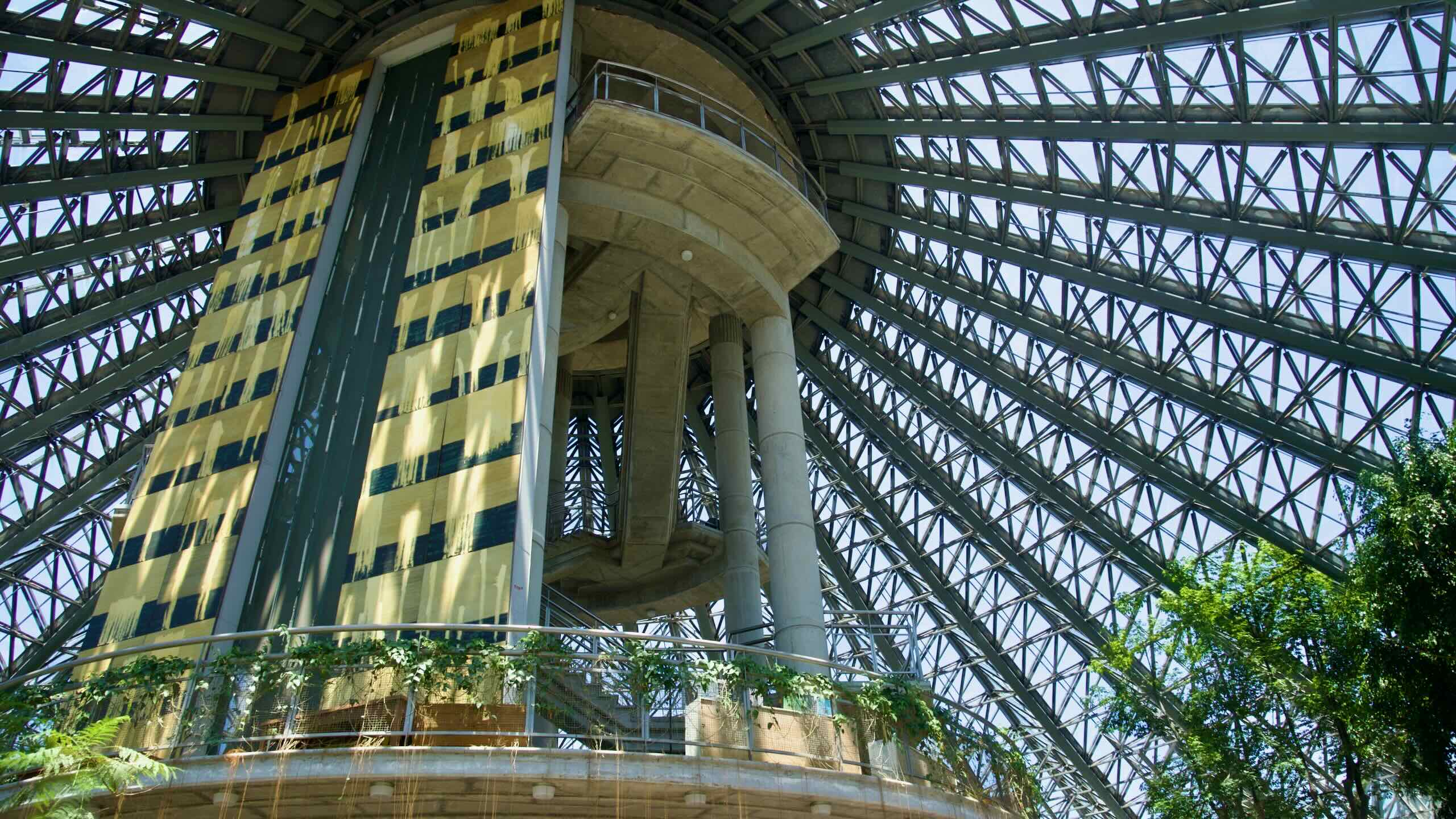
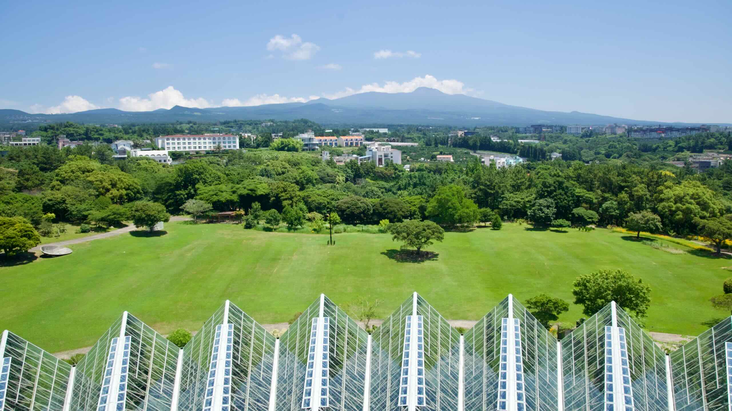
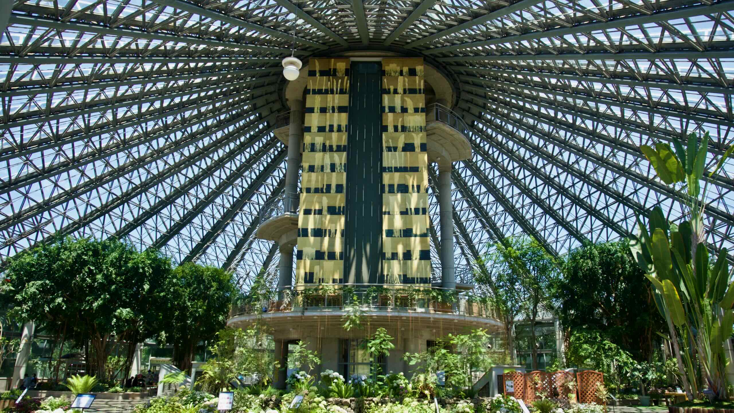
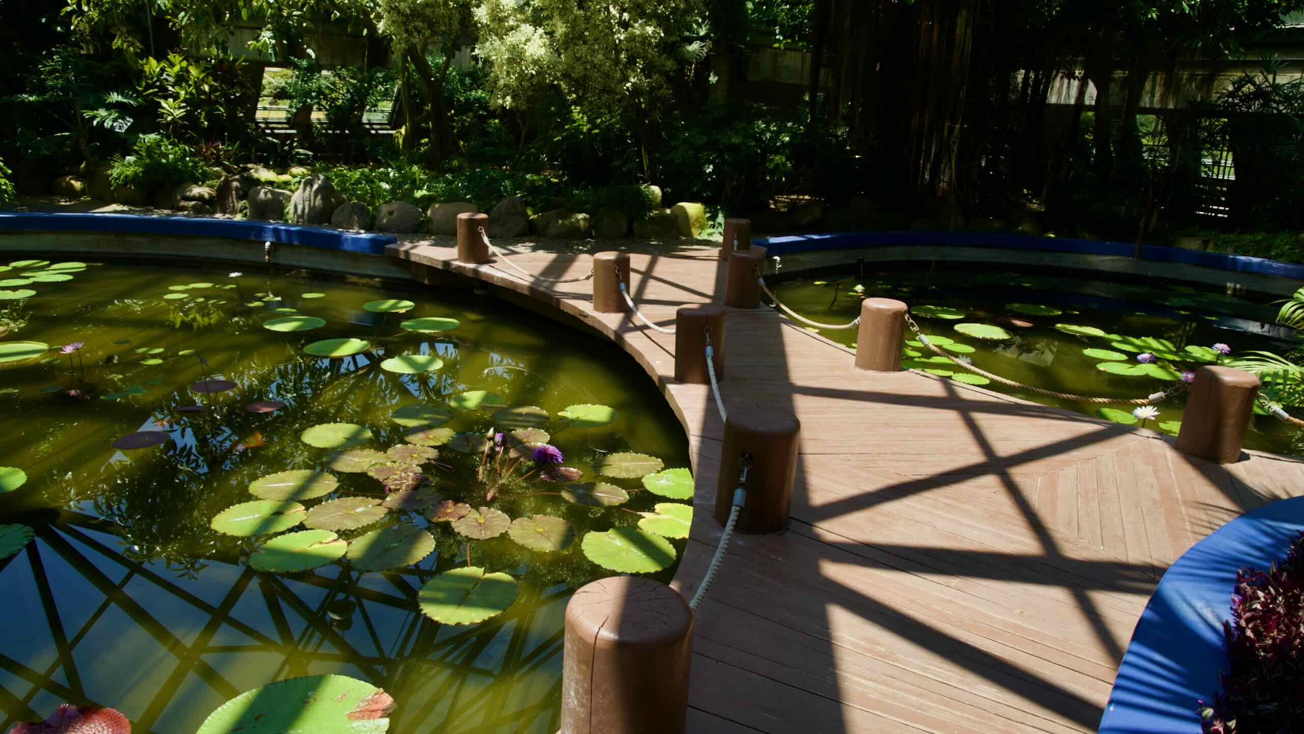
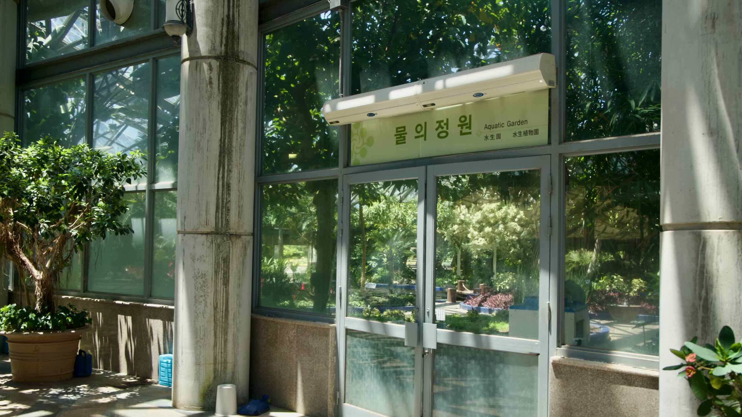
One of Asia’s largest indoor botanical gardens, Yeomiji Botanical Garden spans over 12,500 m² under a sunflower‑shaped greenhouse. Inside, six themed gardens—ranging from tropical jungle to cactus and aquatic displays—are complemented outside by internationally styled landscapes like French, Italian, and native Korean gardens.
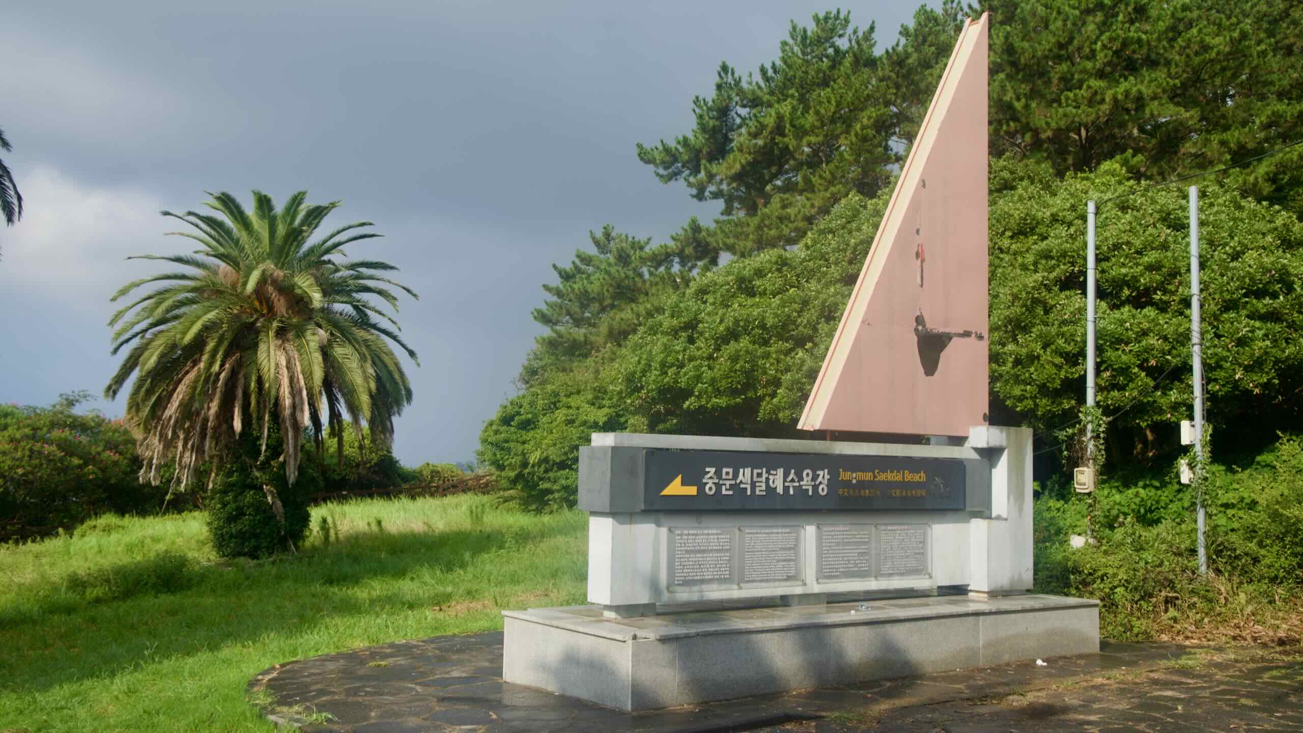
Jungmun Saekdal Beach is famed for its 560-meter-long crescent shape and striking multicolored sands, showcasing hues of black, white, red, and gray against dramatic cliffs. It regularly ranks among Korea’s best beaches, celebrated for its scenic beauty and safe swimming conditions. The beach also offers windsurfing, water-skiing, parasailing, and surfing, with annual events adding to its lively beach vibe.