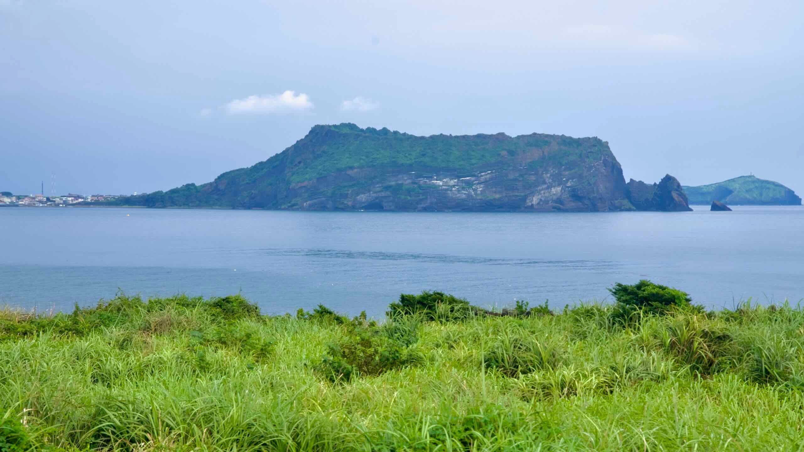
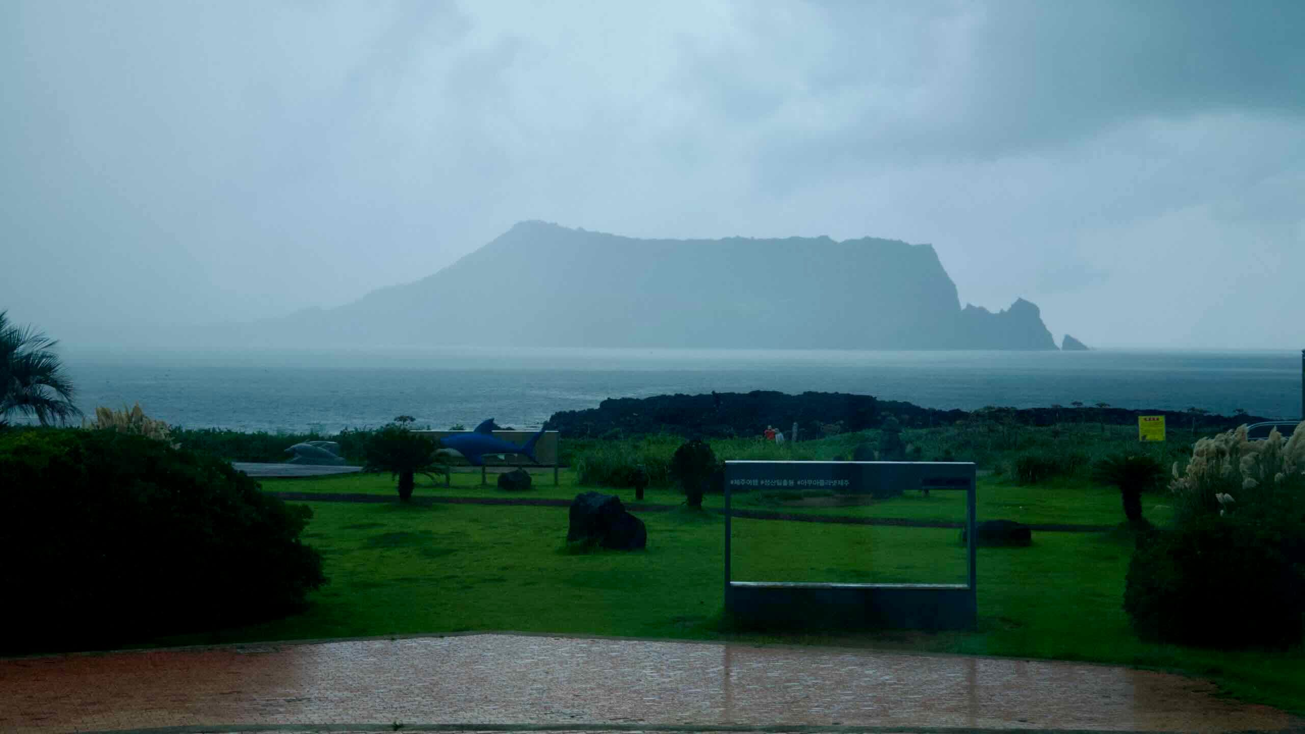
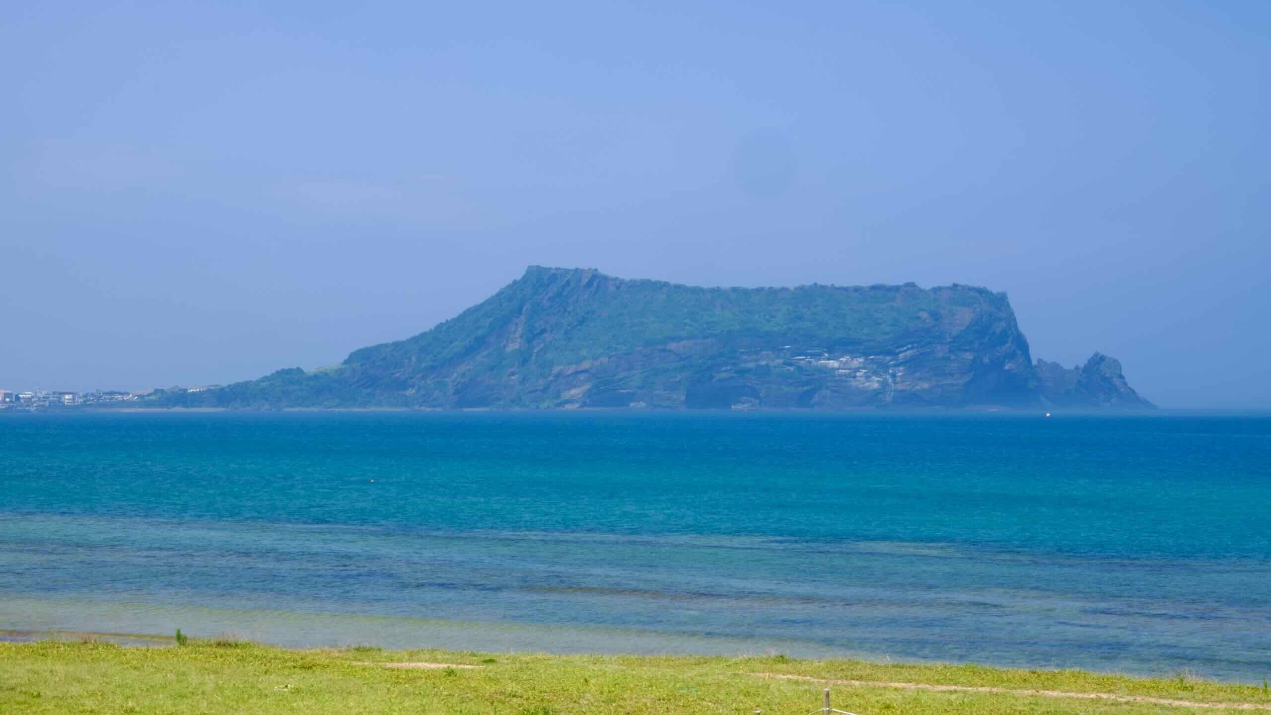
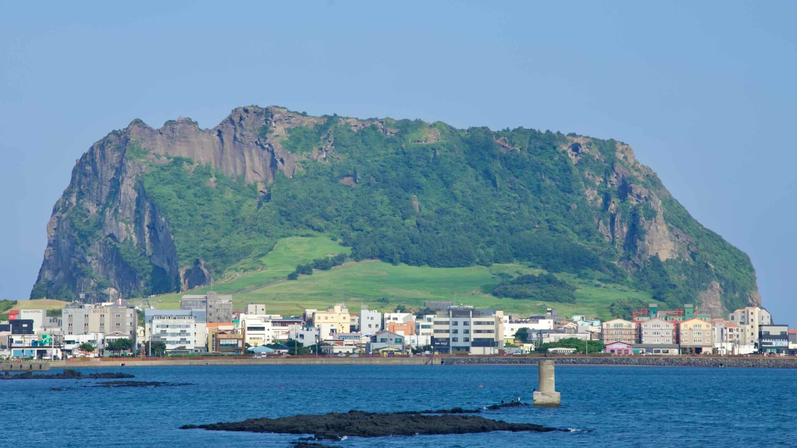
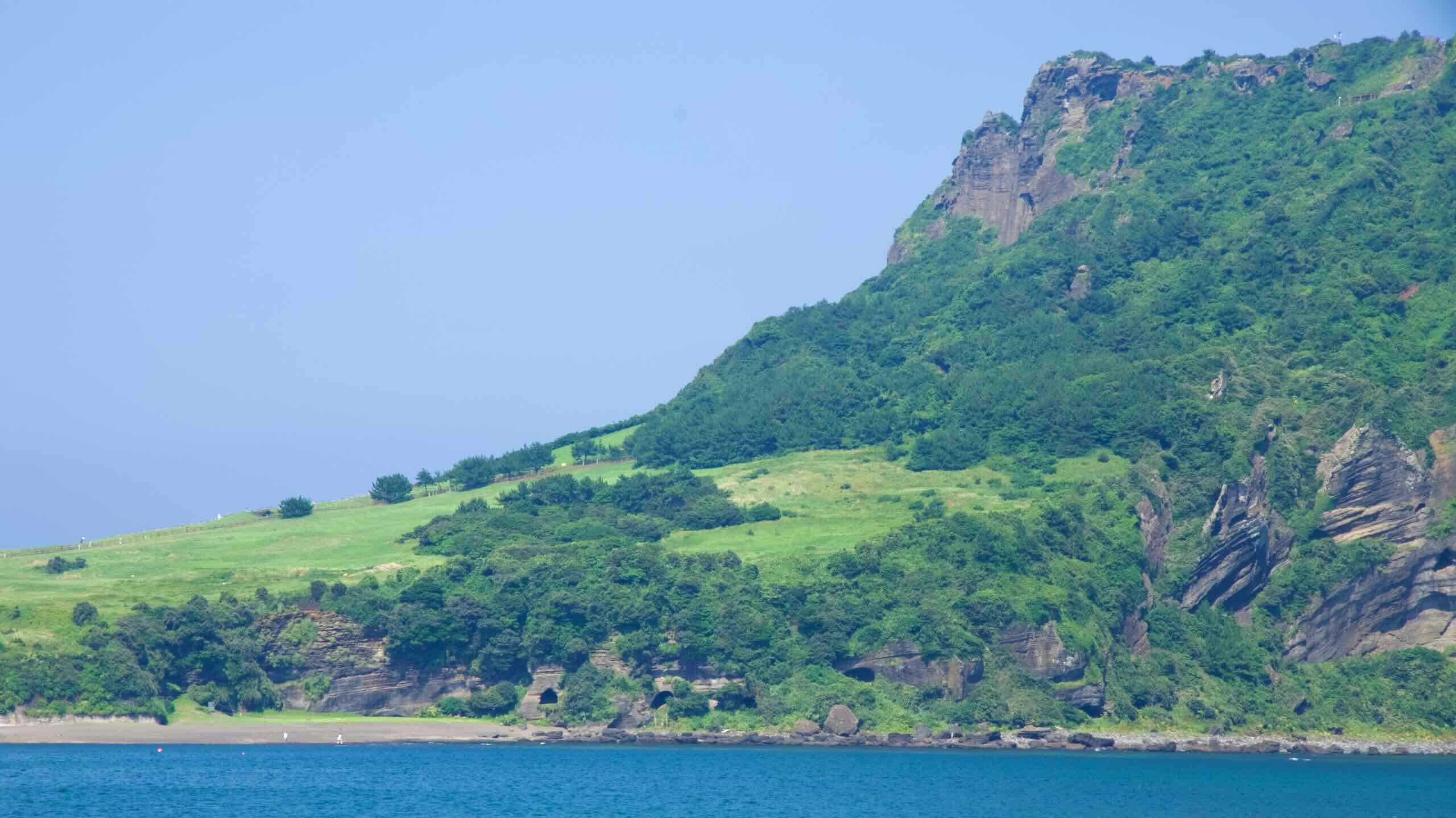
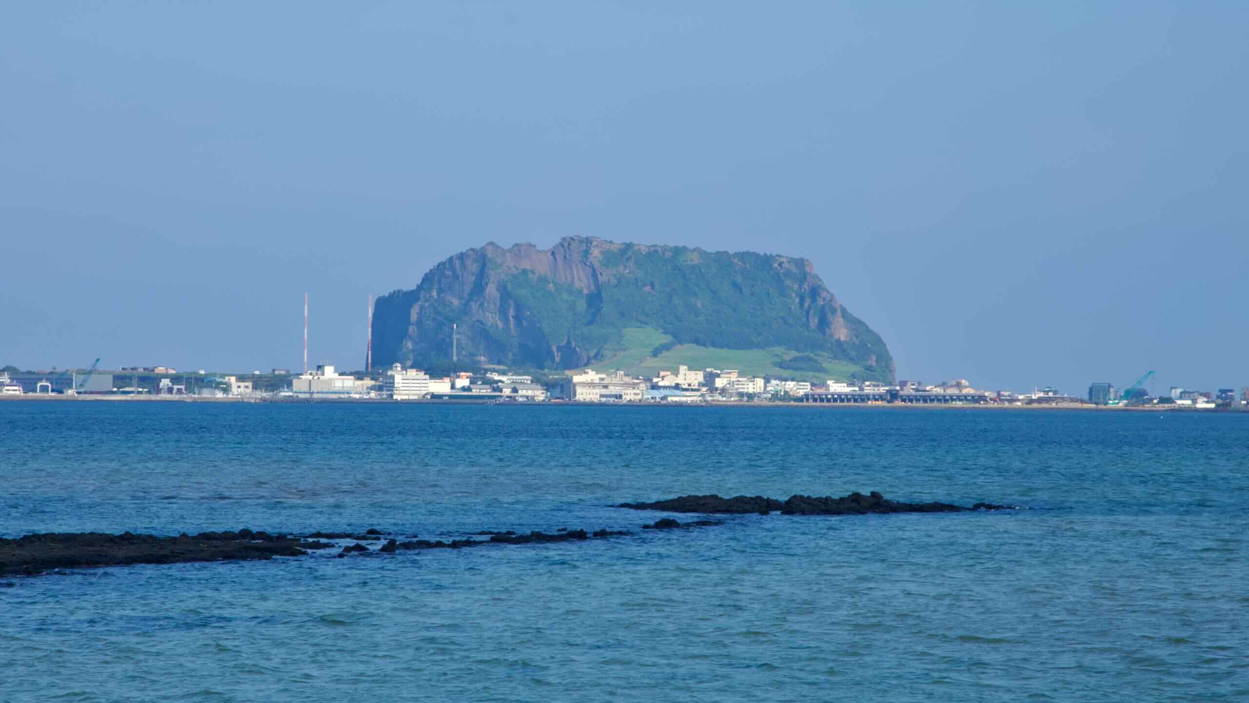
Formed approximately 5,000 years ago by an underwater volcanic eruption, this tuff cone rises 182 meters above sea level. Its broad, bowl-like crater and striking coastal cliffs have earned it a place among Jeju’s top ten scenic wonders, known as Yeongju Sip Gyeong (영주십경).
Seongsan Ilchulbong also gains fame because visitors often come during sunrises to view the sun poking up from the sea’s horizon, painting colorful hues on the tuft cone.
Geology
Seongsan Ilchulbong formed during the late Pleistocene epoch, approximately 5,000 years ago, through underwater volcanic eruptions.
These eruptions occurred when rising magma interacted explosively with shallow seawater. The intense shock fractured the magma, producing fine volcanic ash and pyroclastic materials that settled to form the tuff cone’s distinct layers.
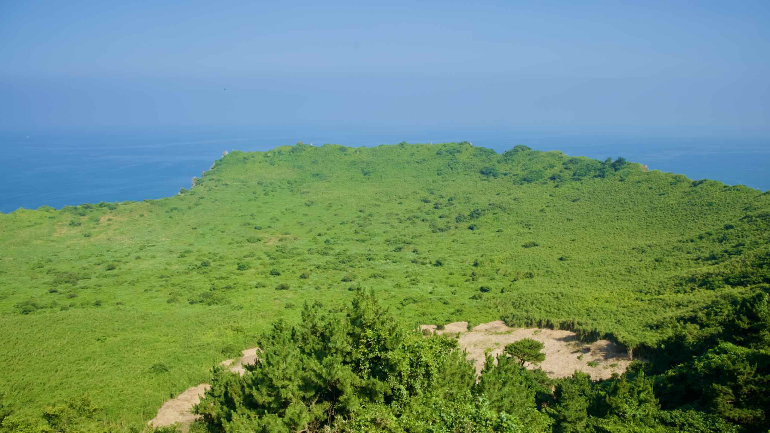
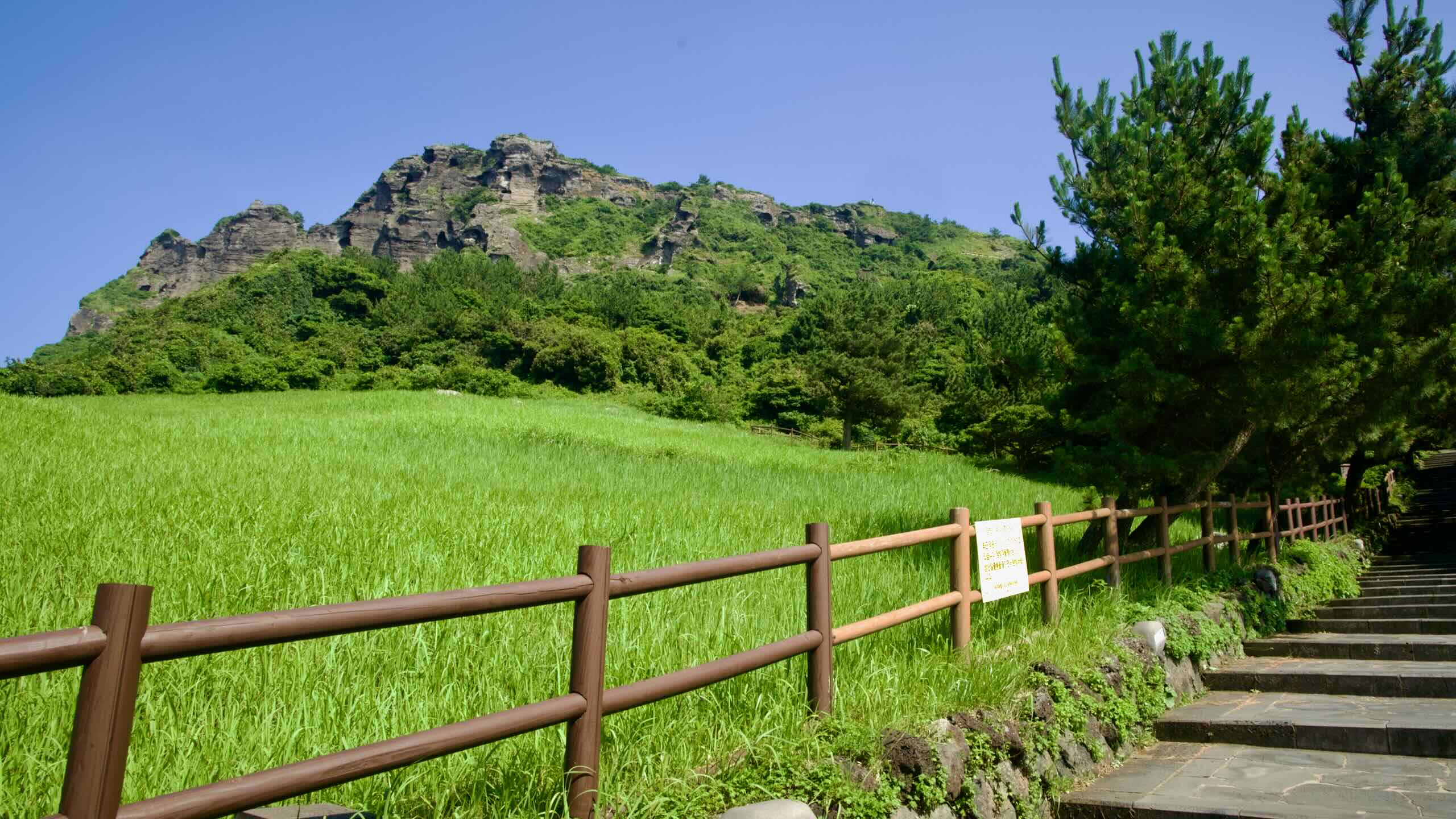
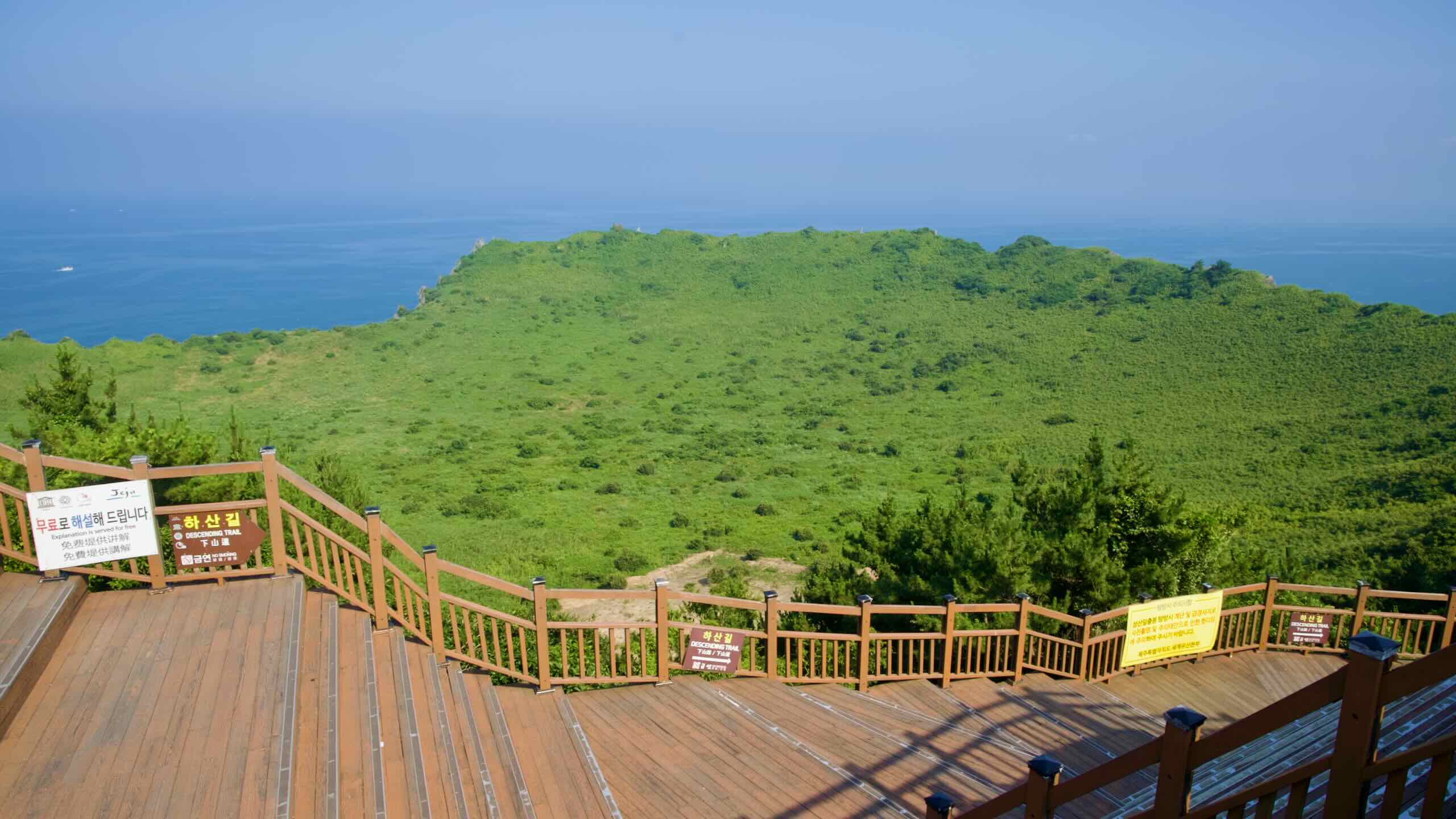
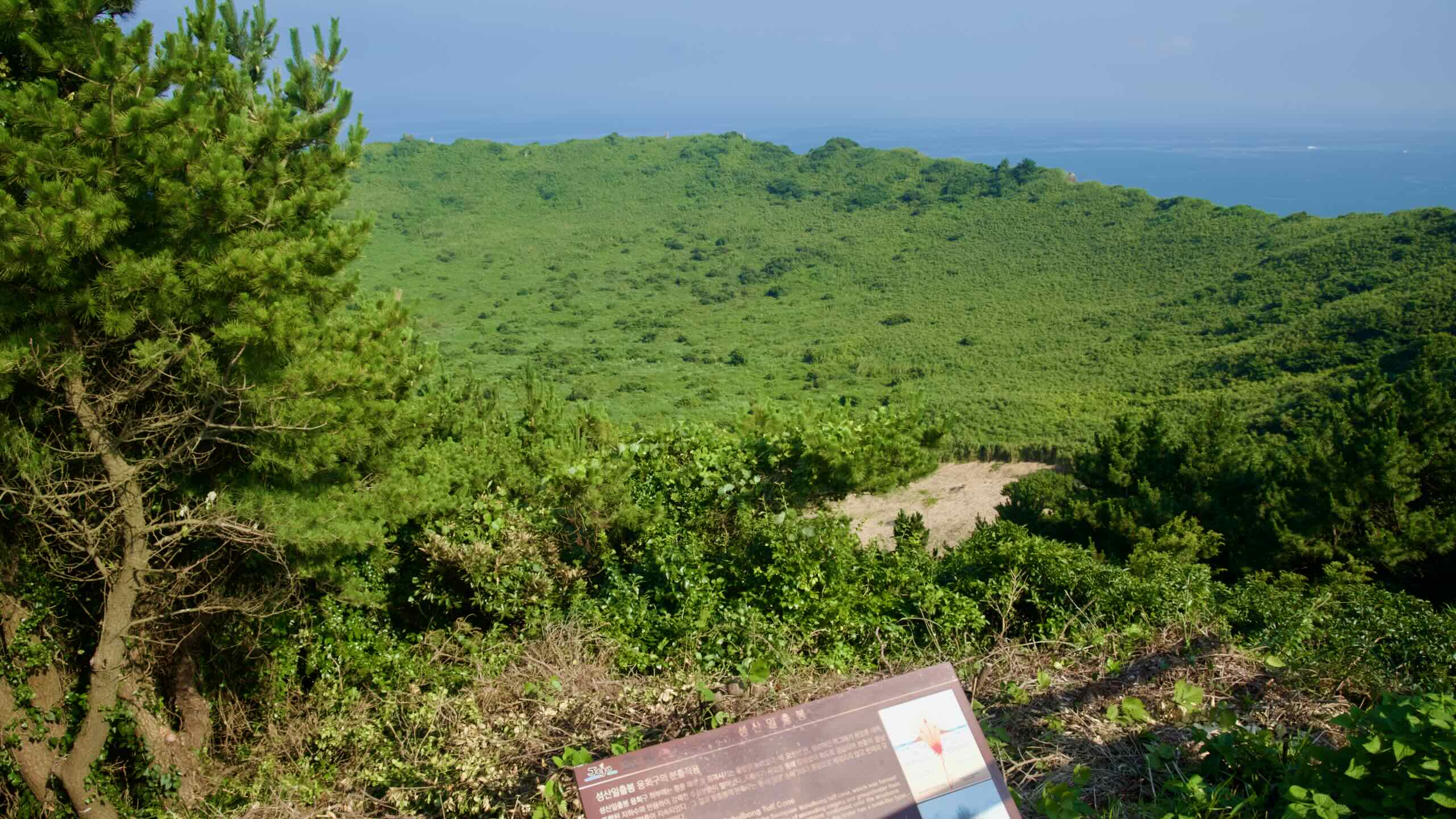
The resulting structure featured a nearly symmetrical cone with steep slopes, showing stratified layers of compacted volcanic ash, scoria, and pumice. At Seongsan Ilchulbong’s summit lies a wide, bowl-shaped crater approximately 600 meters in diameter and 90 meters deep. The remnants of a volcanic island that later connected to Jeju Island through sediment deposition.
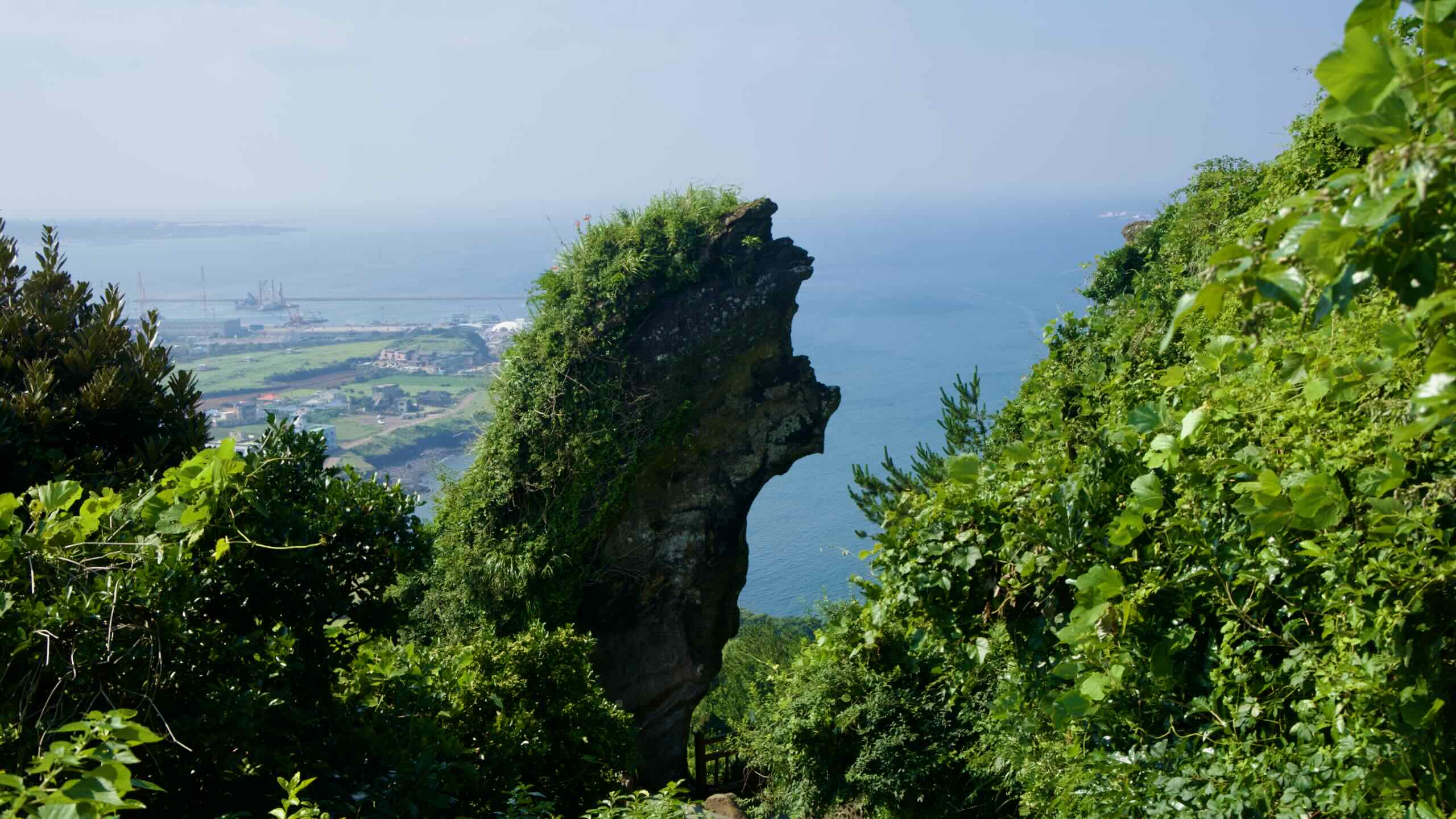
The cliffs surrounding Seongsan Ilchulbong expose tuff layers with alternating bands of darker, denser material and lighter ash deposits. These offer insights into the volcanic and sedimentary processes that occurred during its formation.
Seongsan Ilchulbong shares similarities with other tuff cones globally, such as Diamond Head in Hawaii and Maungawhau (Mount Eden) in New Zealand.
However, unlike other tuff cones that erode rapidly due to exposure to wave action, Seongsan Ilchulbong retained much of its original shape. The harder layers of basaltic material interspersed among softer ash layers, preserving its steep crater walls.
Seongsan Ilchulbong’s location within Jeju Island’s volcanic landscape offers great context with nearby features like Halla Mountain’s shield volcano and Jeju’s lava tube systems, such as Manjang Cave.
Preservation
Over thousands of years, wind, rain, and wave erosion reshaped parts of Seongsan Ilchulbong’s cliffs and crater edges. Coastal processes continue to wear away at the cone, while human activities, including tourism and fishing, have contributed to localized degradation.
To mitigate these impacts, UNESCO and Jeju authorities put in place restricted zones around vulnerable cliff areas, while providing pathways to minimize foot traffic on fragile surfaces.
Seongsan Ilchulbong supports over 127 coastal plant species, including Jeju pink grass, which blankets the slopes in autumn, and seasonal wildflowers bloom in spring.
Salt-tolerant grasses and shrubs thrive on its volcanic soil, particularly on the crater’s upper slopes. These grasslands were historically maintained by grazing livestock.
Seongsan Ilchulbong’s base contains tide pools that host crabs, shellfish, and small fish. And the cliffs serve as nesting grounds for seabirds such as gulls and cormorants. Migratory species like herons rest here during their seasonal journeys.
History and Culture
During the Joseon Dynasty (1392 ~ 1897), Seongsan Ilchulbong served as a beacon point to ward off invasion and pirate activity. Signal fires were lit at the summit warning of impending danger. The site was just one of a broader network of beacon mounds (봉수대; bongsudae) that extended across Korea, linking coastal and inland areas in a rapid communication system.
Historically, the steep slopes of Seongsan Ilchulbong provided a natural fortress, offering clear visibility of the surrounding seas and deterring potential attackers. Its strategic location on Jeju’s eastern coast also made it a vital navigational landmark for seafarers, aiding in the orientation of ships traveling between the Korean Peninsula, Japan, and the East China Sea.
The crater’s grassy plains were also used by local villagers for grazing livestock. The fertile soil, enriched by volcanic ash, supported the growth of grasses and shrubs.
Seongsan Ilchulbong is steeped in Jeju Island mythology. The most well-known legend involves Seolmundae Halmang, a mythical giantess who is said to have created Jeju’s topography.
According to folklore, Seolmundae Halmang used Seongsan Ilchulbong’s summit as a wash basin for her daily chores. Her immense size and strength are said to have shaped the island’s volcanic features, including its distinctive craters and cliffs.
Another tale revolves around the crater’s 99 spires, believed to represent unfulfilled aspirations. Lore suggests that if the formation had reached 100 spires, tigers could inhabited Jeju Island. The “missing” spire is believed to have brought balance and harmony.
The nearby rock formations and tide pools around Seongsan Ilchulbong are imbued with significance. Villagers once performed rituals to appease the sea gods and ensure bountiful harvests and safe voyages.
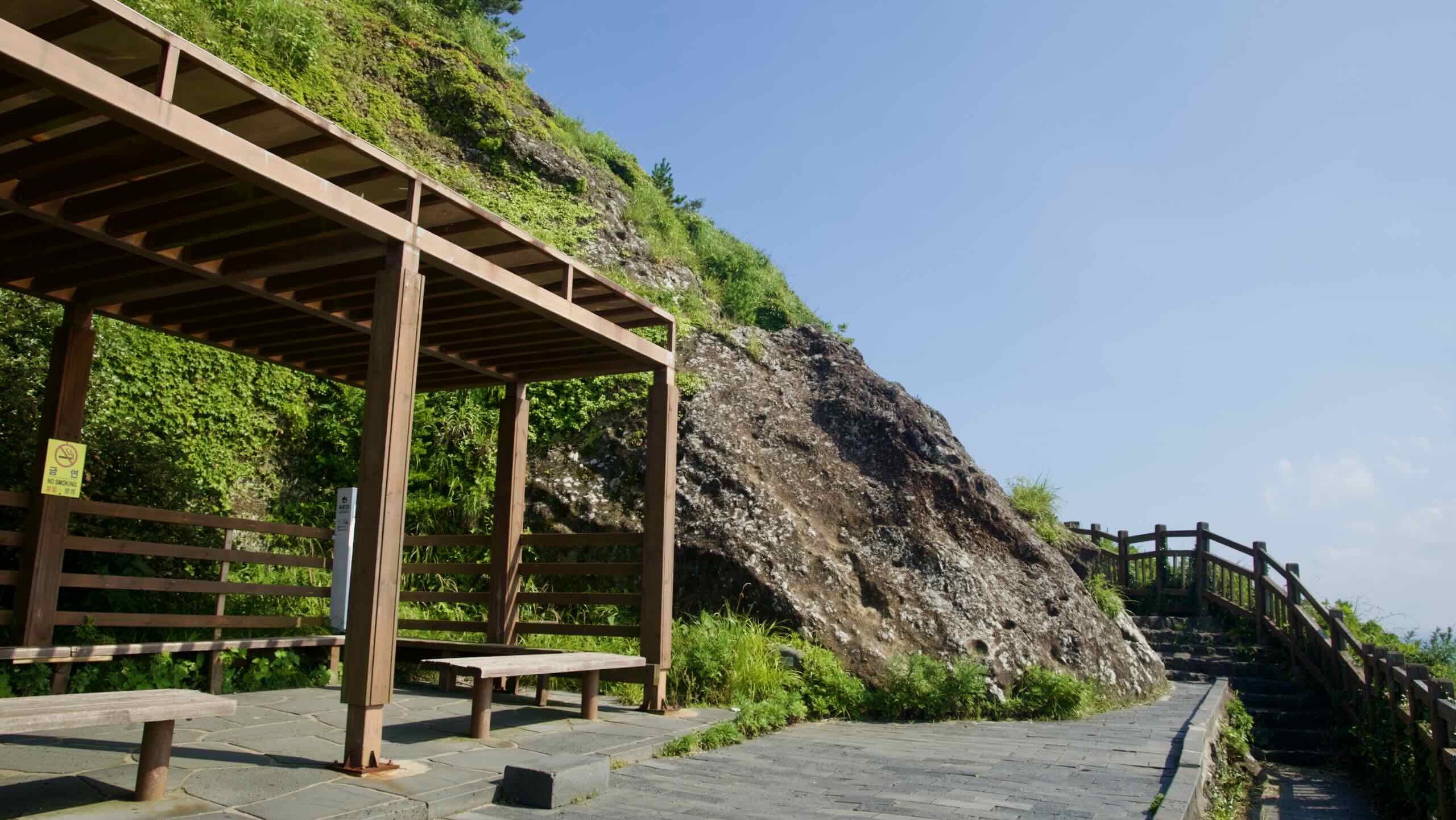
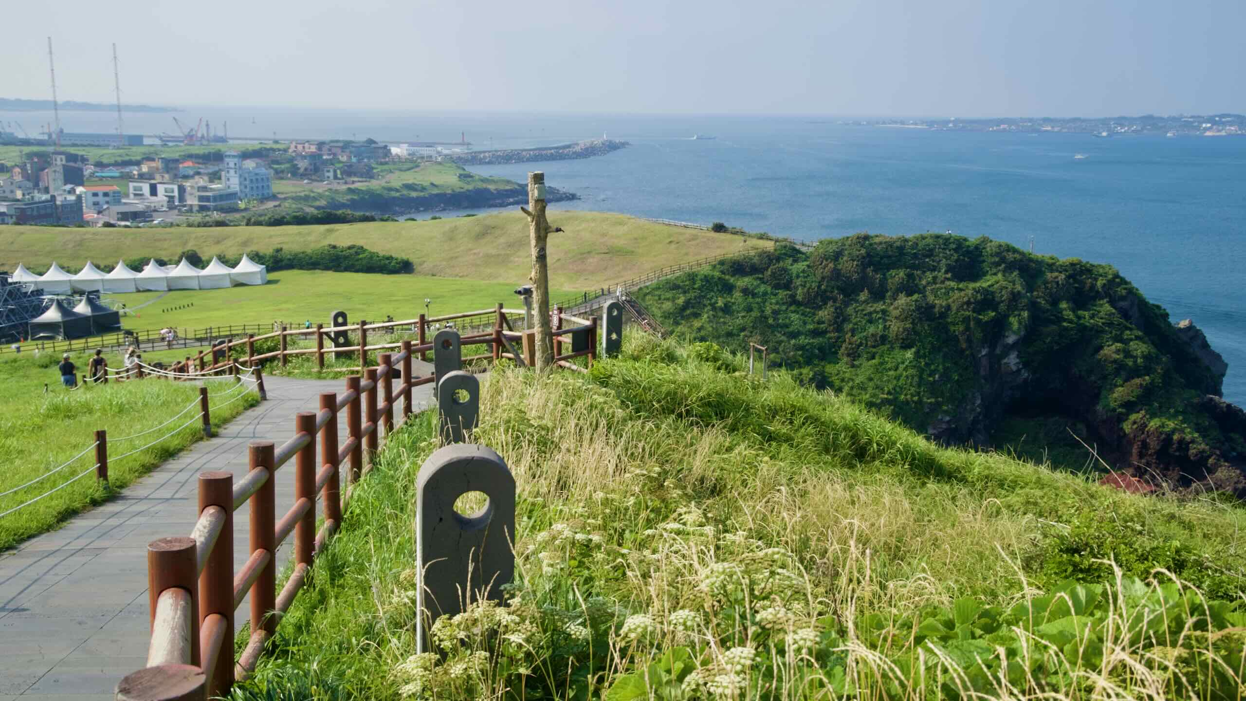
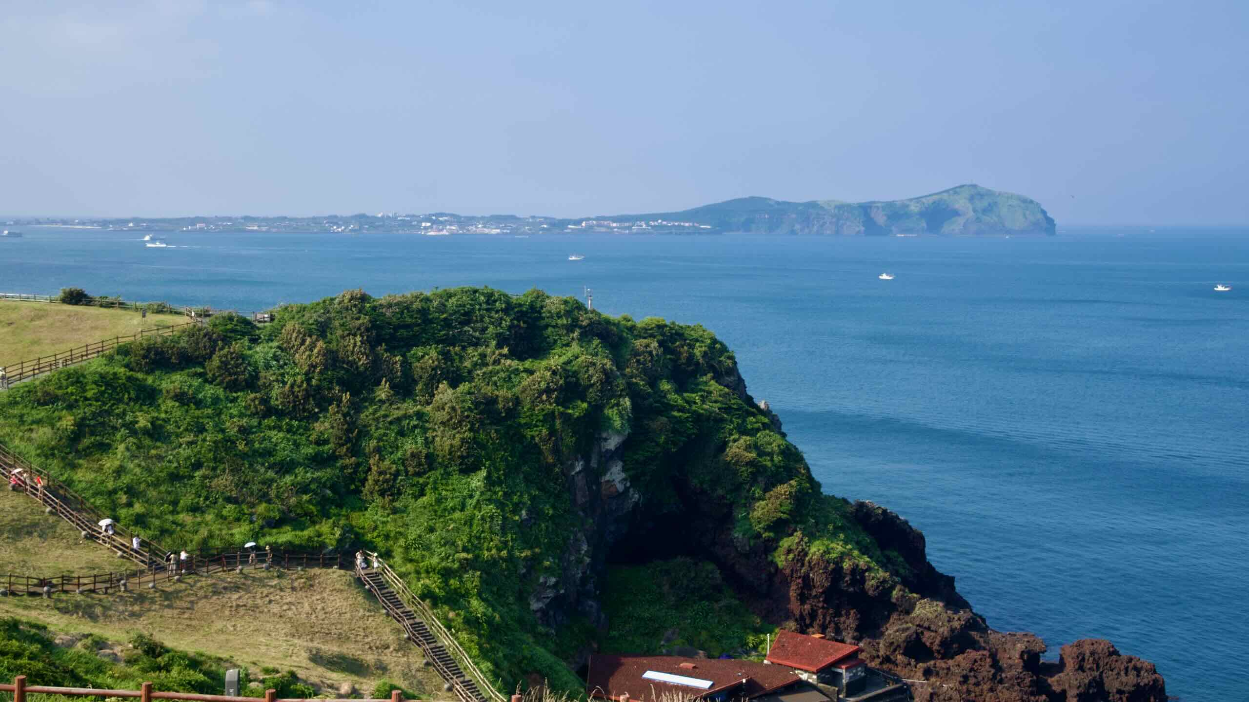
Visiting
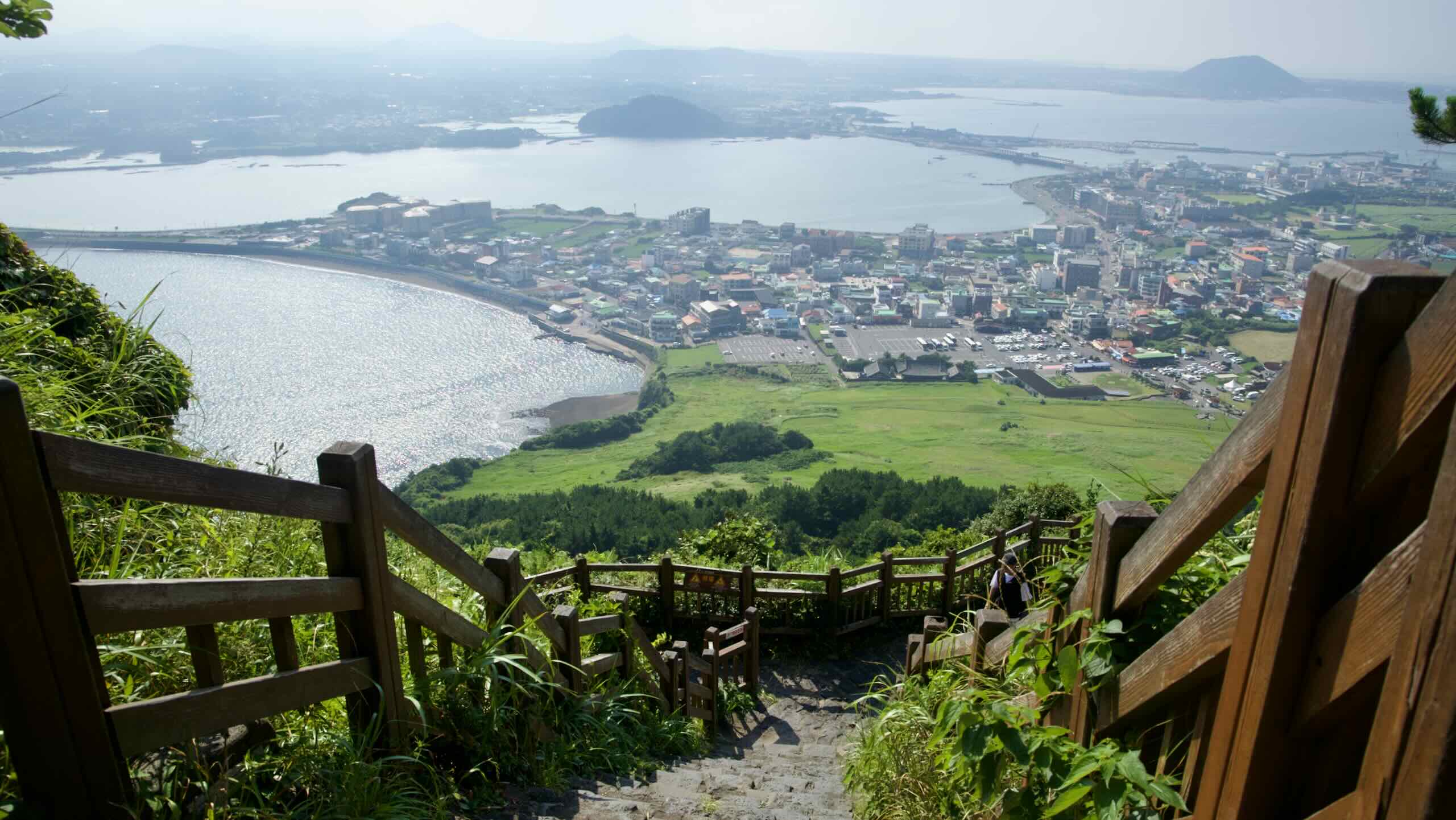
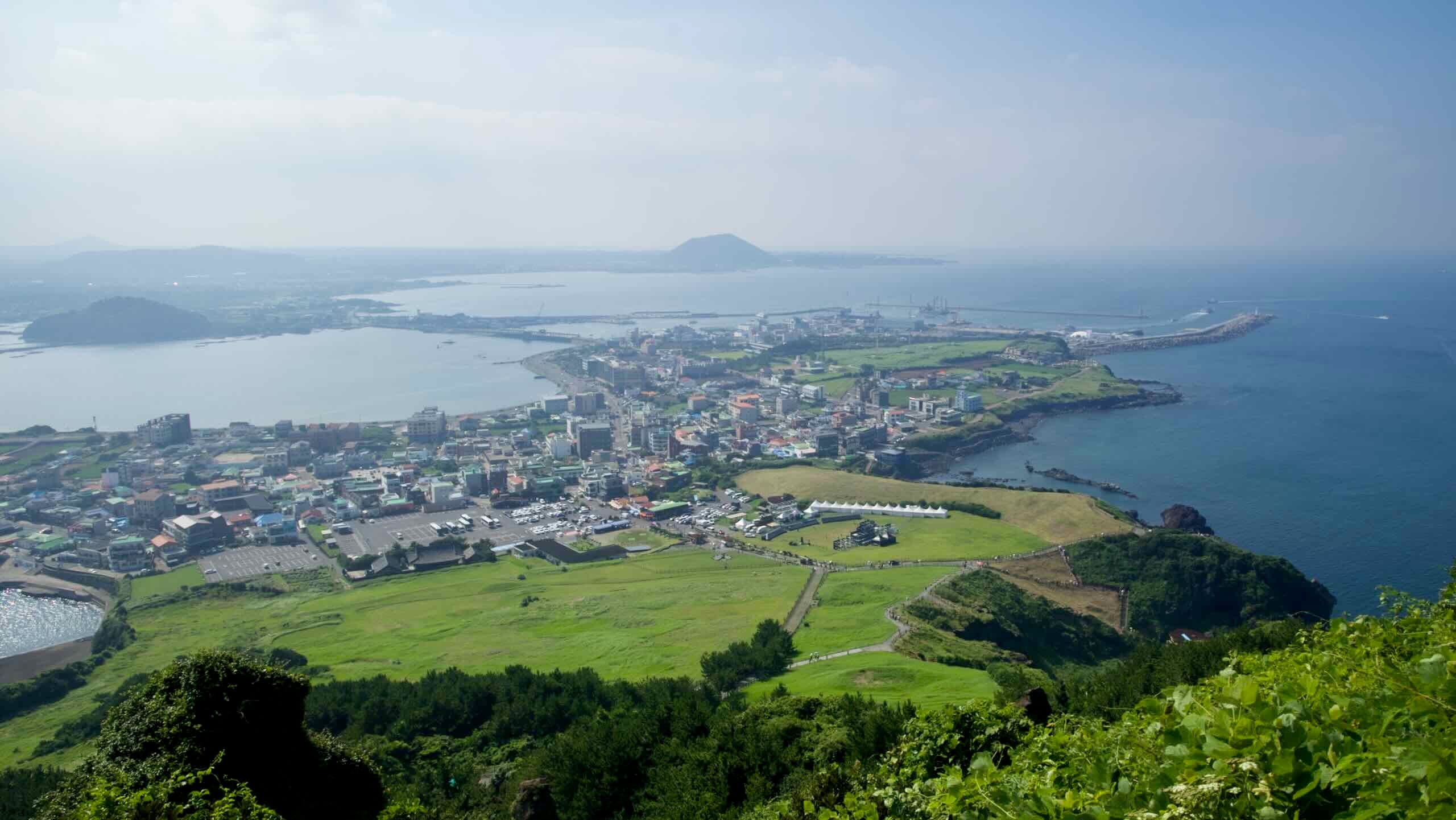
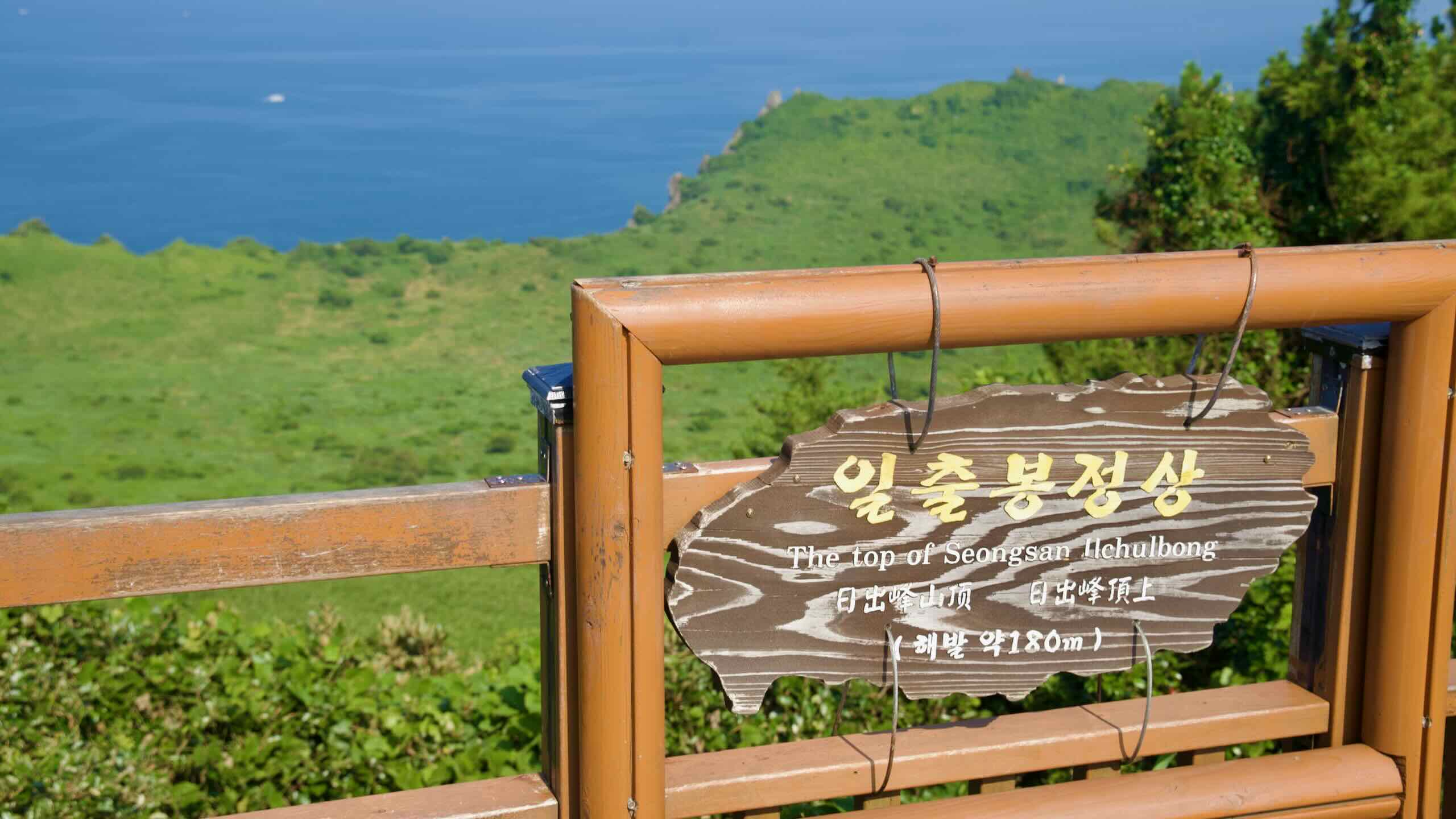
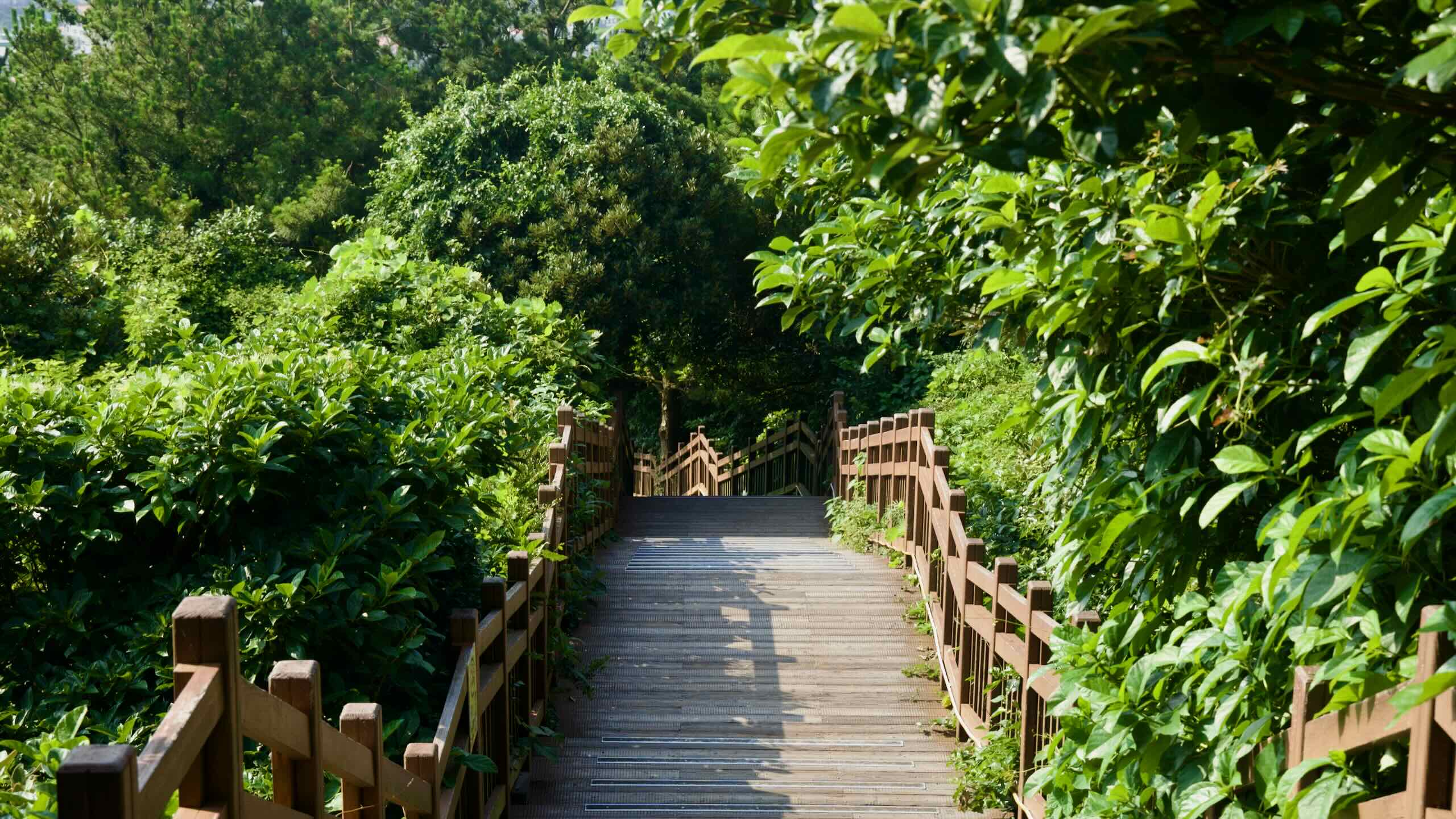
The hike to the summit takes approximately 20 to 30 minutes. While steep, the path is well-paved with steps and railings. Rest points along the trail offer sweeping views of the coastline and surrounding countryside. At the top, visitors can view the peak’s volcanic crater, the East Sea, and Udo Island.
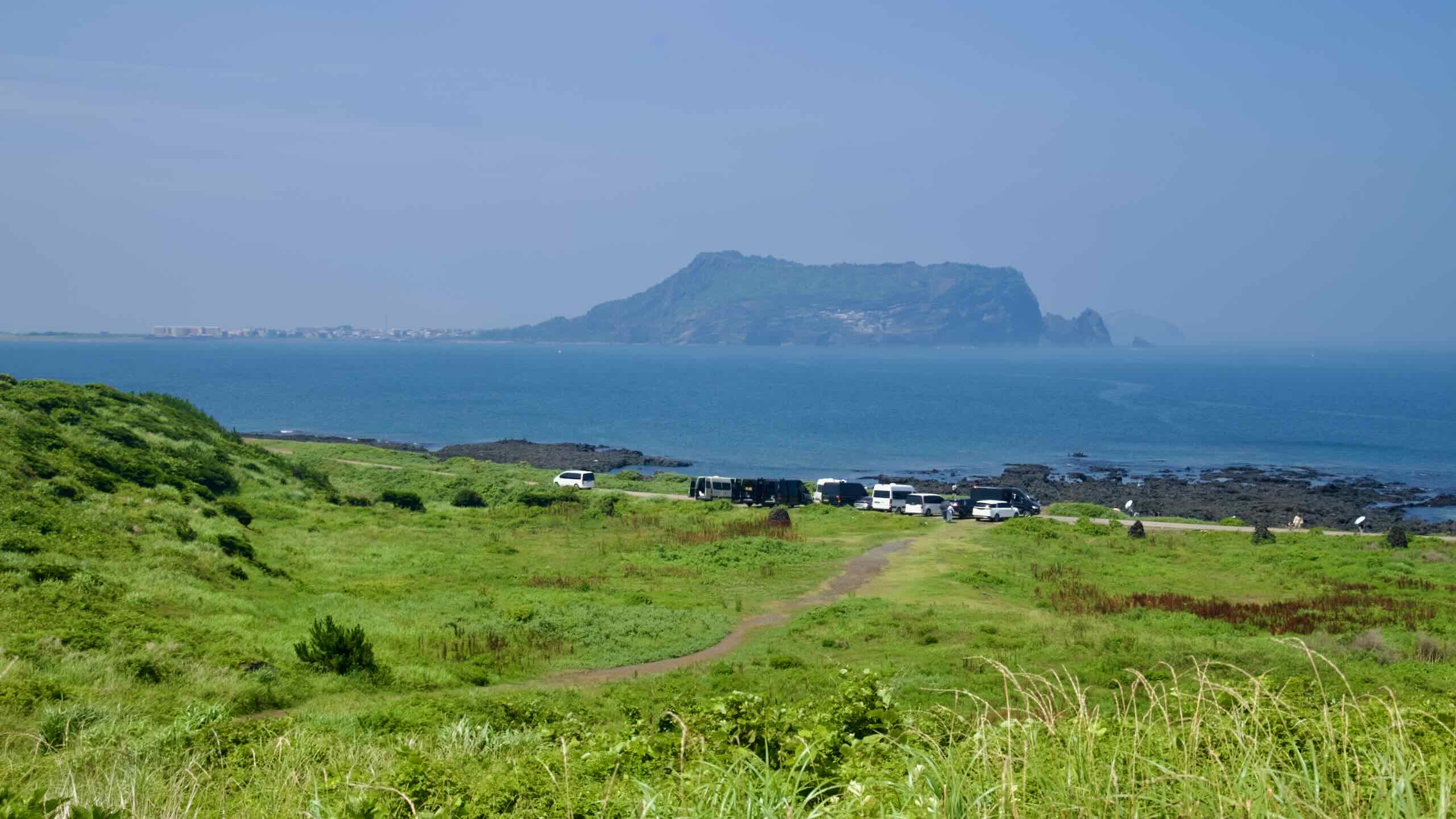
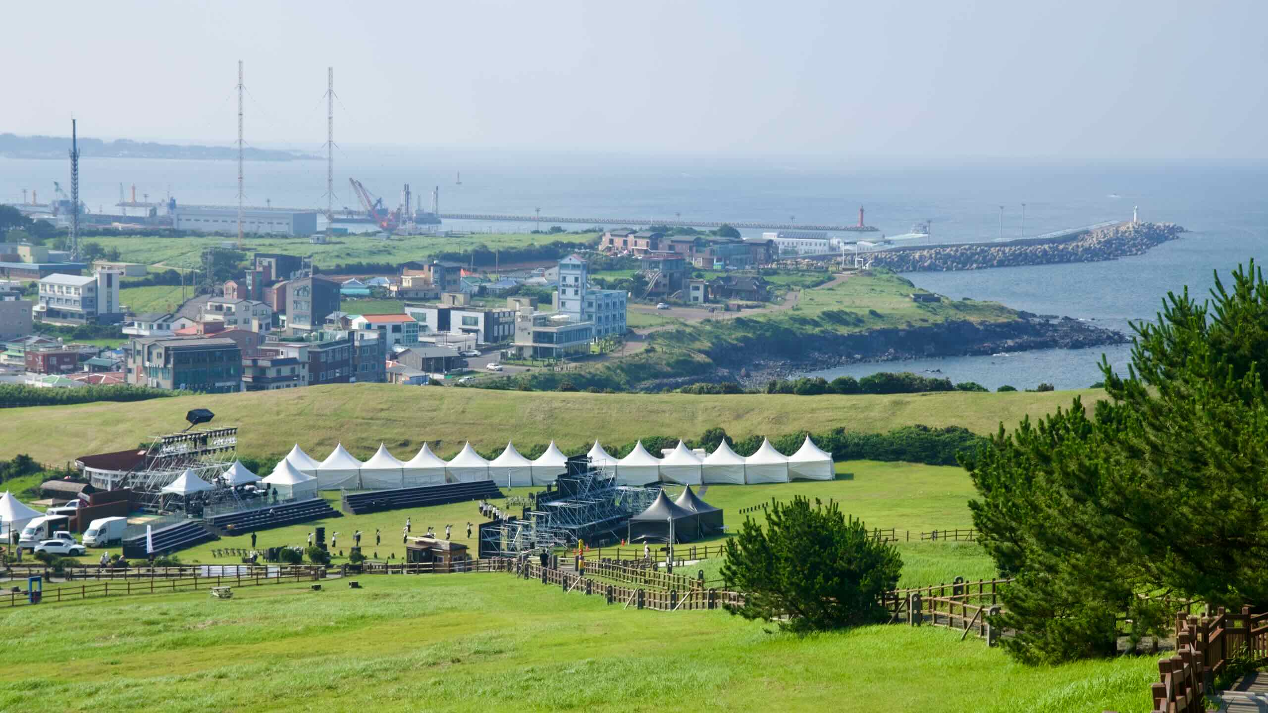
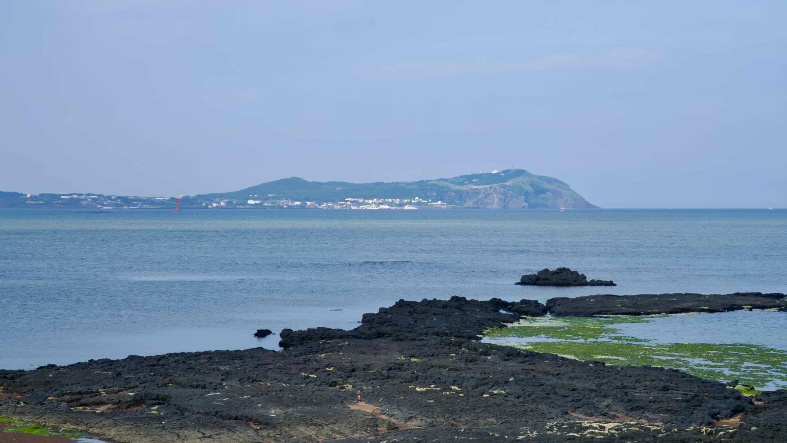
Sumapo & Umutgae Coasts
The southern and northern coasts of Seongsan Ilchulbong are attractions by themselves, offering a way to explore Seongsan Ilchulbong without having to make the mighty climb to its top. These areas are known as:
Sumapo Coast on the south side of Seongsan Ilchulbong.
Umutgae Coast on the north side of Seongsan Ilchulbong.
The Sumapo Coast (수마포해안; map) is accessible by descending the right side of the Seongsan Ilchulbong entrance. Less frequented by tourists, it features a black-sand beach—formed from fragmented basalt—and a narrow stretch of coastline. During low tide, the receding waters reveal the geological layers at the base of Seongsan Ilchulbong.
The Sumapo Coast also holds 18 tunnel fortifications constructed by the Japanese military during World War II. These caves, carved into the coastal cliffs, were intended as defensive positions in anticipation of Allied landings.
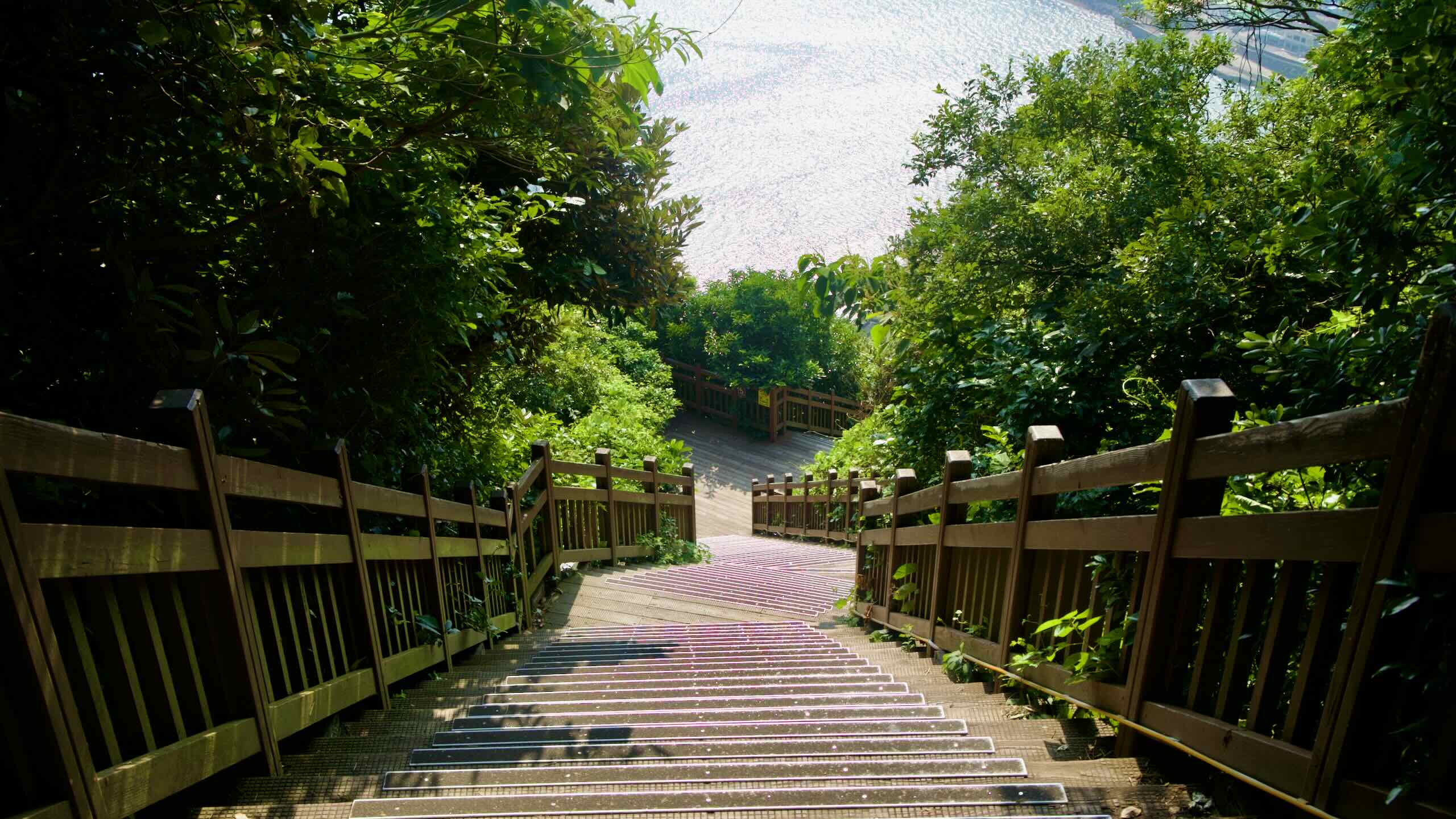
Umutgae Coast (우뭇개해안; map) lies beneath the north face of Seongsan Ilchulbong, reached by the free path that descends left from the main entrance. The stairs drop to the shoreline in roughly ten minutes. At low tide, the base of the tuff cone shows its layered geology beside tide pools, giving one of the closest ground-level views of the crater walls.
Along the water sits the Seongsanpo haenyeo demonstration area and the Haenyeo’s House, where working divers stage short sea entries and sell their catch. Times change depending on the season and weather.
Fame
Seongsan Ilchulbong has been celebrated in Korean art, literature, and folklore and was included in the Yeongju Ten Sights (영주십경; Yeongju Sip Gyeong), a list of the ten iconic views of nature on Jeju Island.
In contemporary times, the peak is a symbol of Jeju’s identity, featured prominently in traditional Korean paintings and modern media, including films and television dramas.
Held every year on December 31st, the Seongsan Sunrise Festival celebrates the New Year with cultural performances, local food stalls, and fireworks. Some climb Seongsan Ilchulbong to witness the first sunrise of the year, a symbol of renewal and hope.
The temple opened in 1937 under the name Ilgwangsa and later used several names before adopting Dongamsa in 1964.
The grounds are compact and easy to understand. The Daeungjeon (main hall) anchors the site, with a bell pavilion and modest stonework added during later renovations. In 2012 a standing Avalokiteśvara statue was installed on the terrace.
The Korean Buddhist Taego Order is the country’s second-largest Seon order. Dongamsa holds regular services and keeps old traditions alive like sharing red-bean porridge on the winter solstice with residents in nearby villages.
Udo Island (우도; map) is a volcanic island located 3.9-kilometer (15-minute ferry ride) off the eastern coast of Jeju Island. Its name translates to “Cow Island” because it resembles a cow lying down.
At approximately 6.18 square kilometers, Udo is the largest of Jeju’s satellite islands and is part of the Jeju Volcanic Island and Lava Tubes UNESCO World Heritage Site, which visitors can explore using rental bicycles, electric scooters, or local buses, which circulates the island’s 17 km perimeter.
Udo Maritime Park (우도해양도립공원) encompasses the entirety of Udo. Established in 2001, the park preserves the island’s heritage, seascane, and landscapes, which are often seen as a microcosm of Jeju Island. Its coastline is dotted with scenic beaches with crystal clear waters, sheer cliffs, and sea caves.