The Eight Views of Yeongsan River (영산강 팔경) showcase the most significant landmarks and landscapes along Yeongsan River, a lifeline of Korea’s Honam region. This river, stretching 138 kilometers from its source in Damyang to the Yellow Sea, has long shaped the culture, economy, and identity of the area.
In 2010, the Ministry of Land, Transport, and Maritime Affairs officially designated these eight scenic spots to highlight the river’s natural beauty, historical depth, and ecological importance.
From mist-covered bamboo forests to ancient pavilions that once hosted Korea’s greatest scholars, each site reflects a different facet of the river’s enduring legacy.
Traveling from north to south, these are the Eight Views of Yeongsan River:
Juknokwon Bamboo Forest (죽녹원; map), located in Damyang County, is a sprawling bamboo forest covering 31 hectares along the Yeongsan River. The garden features eight distinct walking paths, including Lover’s Lane and Philosopher’s Path, each meandering through dense bamboo groves. These paths are interspersed with traditional pavilions where visitors can rest and take in the calming surroundings. A tea house within the garden serves bamboo leaf tea, adding local flavor.
In the evenings, soft lighting highlights the bamboo, casting an ethereal glow that enhances the space. The garden also serves as a cultural hub, with nearby attractions like the Hyanggyo Confucian School, which offers a glimpse into Damyang’s heritage. The combination of the bamboo garden’s serene atmosphere and its connection to local history makes it a unique highlight along the Yeongsan River.
Pungyeong Jeong Pavilion (풍영정; map), located in Gwangju City, dates back to the mid-16th century. It was built by Kim Eongeo, a prominent scholar and official of the Joseon Dynasty (1392 ~ 1910), after he retired. The pavilion became a gathering place for intellectuals of the time, hosting figures such as Yi Hwang (Toegye), Kim Inhu, and other renowned Confucian scholars, making it a symbol of Joseon-era academic and cultural life.
The pavilion’s architecture reflects traditional Korean design, with a four-column layout and a gabled roof supported by granite foundations. Originally part of a larger complex with 12 structures, Pungyeong Jeong is the only pavilion that survived the Imjin War and the passing centuries. Inside, the pavilion features inscriptions from prominent scholars, including calligraphy by Yi Hwang and a plaque by Han Seokbong, a leading Joseon-era calligrapher.
Situated along the banks of the Gwangju Stream, the pavilion once offered expansive views of the flowing water and nearby landscapes, though urban development has since altered the surroundings. Despite these changes, Pungyeong Jeong is a cherished part of the Eight Views of Yeongsan River.
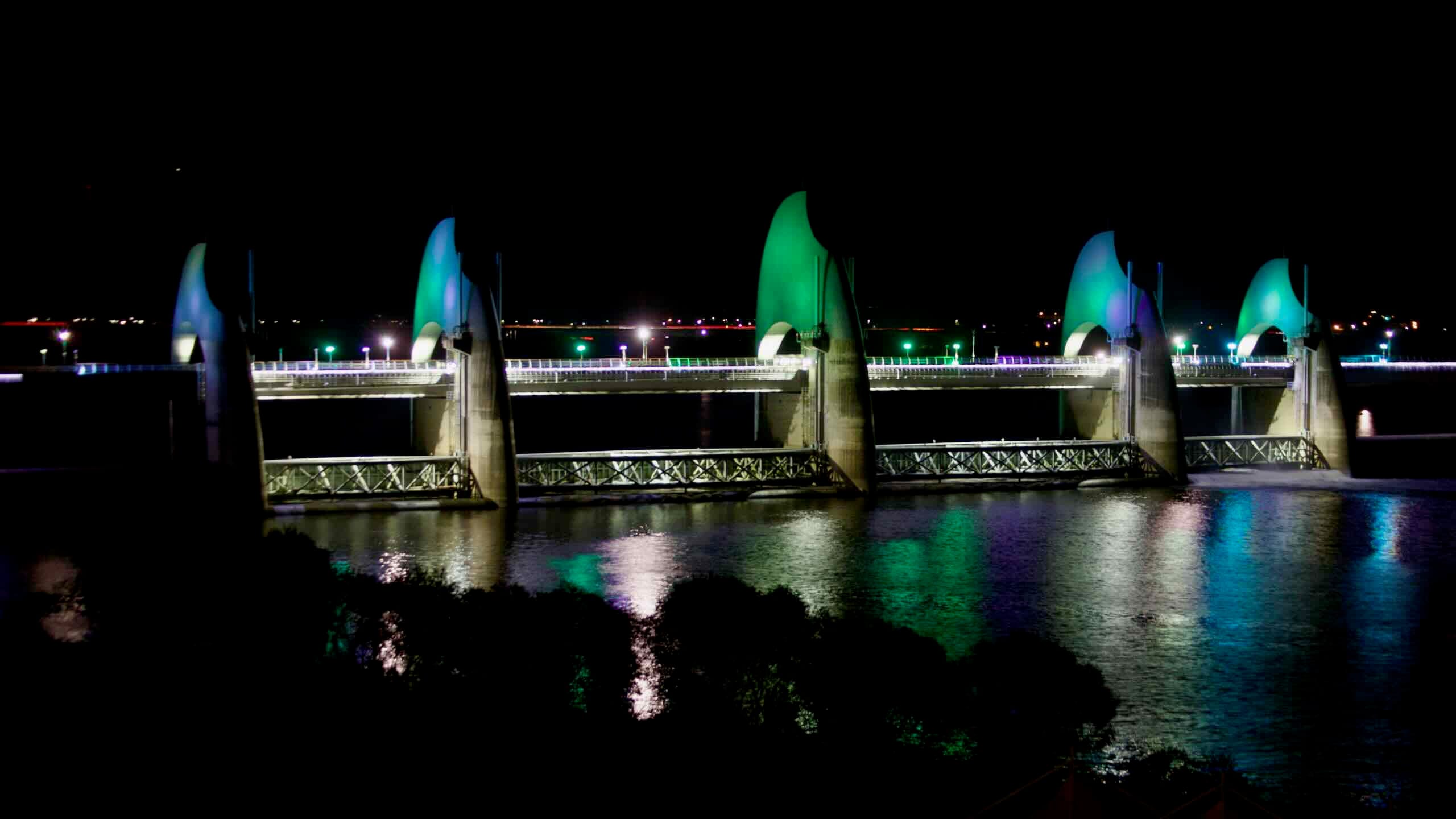
Seungchon Weir (승촌보; map) on the Yeongsan River in Gwangju blends was completed in 2011 as part of the Four Rivers Restoration Project. The 180-meter weir features a pedestrian and vehicle bridge spanning 568 meters. Its design, inspired by rice grains, celebrates the agricultural heritage of the nearby Naju Plain. The weir also generates renewable energy through an 800-kilowatt hydroelectric plant and supports water management and ecological preservation, making it a model of modern engineering.
Adjacent to the weir, Seungchon Island (승촌섬; map) offers vibrant flower fields, walking trails, and a well-equipped camping site. Visitors can enjoy shaded picnic areas, river views, and activities like kayaking or birdwatching. The island complements the functionality of the weir, drawing families, outdoor enthusiasts, and photographers year-round.
Seungchon Weir is a key stop on the Yeongsangang Bike Path, with the Seungchong-bo Certification Center (승촌보 인증센터; map) seated nearby where cyclists can stamp their Bike Passports. The Yeongsan River Culture Center provides the area with interactive exhibits on the river’s history and biodiversity.
The Naju Plain (나주평야) spans the fertile lowlands around the Yeongsan River, covering areas of Naju City, Gwangju City, and neighboring regions like Muan County and Hampyeong County. Known as one of Korea’s key agricultural hubs, this expansive floodplain produces over 50,000 tons of rice annually, along with barley, vegetables, and fruits. Its role as a grain-producing area dates back to the Baekje era, around 2,000 years ago.
The plain’s flat terrain and rich alluvial soil, coupled with improved irrigation and the Yeongsan River Estuary Bank, transformed the area into a highly productive agricultural zone. Once prone to flooding, the area now thrives as a stable farming region, with golden rice fields in autumn and lush greenery in spring creating a striking seasonal landscape.
The Naju Plain is deeply tied to regional history and culture. The Yeongsan River’s role in trade and cultural exchange helped shape the area’s identity, which visitors can explore through historical landmarks, traditional villages, and ecological parks.
The Hwangpo sailboats (황포돛배; map), with their distinctive yellow sails, are a symbol of the Yeongsan River’s historical role as a bustling trade route. These traditional vessels, first used during the Goryeo Dynasty, were designed to transport goods like rice and fish from Naju’s fertile plains to the Yellow Sea and beyond. Engineered to navigate the river’s currents, the sailboats relied on wind and tides for efficient travel.
Today, Naju City brought these iconic boats back to life, offering visitors the opportunity to experience a piece of the region’s rich maritime heritage. Travel to Yeongsan Port (map) in downtown Naju and discover recreated Hwangpo sailboats that provide 50-minute tours along the Yeongsan River. During the trip, passengers can take in river landscapes, including views of farmlands and the Yeongsan Port Lighthouse.
More than just a tourist attraction, the Hwangpo sailboats celebrate the ingenuity of the communities that relied on the Yeongsan River for commerce and communication.
Juksan Weir (죽산보; map) stretches across the Yeongsan River in Naju City. Built along with Seungchon Weir in 2011 as part of the Four Rivers Restoration Project, Juksan helps manage the flow of water along the river. Its design reflects the natural curves of the river, incorporating observation decks and flowing architectural elements.
A key feature of Juksan Weir is its multifunctionality. The 172-meter structure regulates water flow, supports renewable energy generation with its 1,220-kilowatt hydroelectric plant, and promotes biodiversity through a 104-meter fishway.
Observation decks offer panoramic views of the Yeongsan River, letting visitors view the natural environments. The site also serves as a waypoint on the Yeongsan River Bicycle Path, with the Juksanbo Certification Center (죽산보 인증센터; map) sitting nearby for cyclists to stamp their Bike Passports.
Known as “Juksan Spring Dawn” for the tranquil beauty of its early morning vistas, the weir’s design honors Korea’s tradition of harmonizing human structures with nature.
Slow Muan (무안 느러지) is less a single landmark and more an atmosphere—one shaped by Muan County’s tranquil landscapes and the unhurried flow of the Yeongsan River. Here, the river meanders in slow, wide arcs, forming an S-shaped curve that mirrors the Korean Peninsula. This distinctive feature, known as 느러지, reflects the gentle rhythm of the water, fostering rich ecosystems and serene views.
The riverbanks in Muan are home to wetlands and diverse wildlife habitats, while centuries-old pavilions, nestled among towering zelkova trees, overlook the picturesque 느러지 bends. Nearby, ecological parks feature winding trails, willow-lined paths, and seasonal blooms, such as autumn cosmos, creating a peaceful retreat for visitors.
A section of the Yeongsan River Cycling Path runs through Muan, offering scenic rest stops and river views. In addition, community-created forests add to the area’s charm, providing shaded trails and quiet spaces for relaxation.
Yeongsan Lake (영산호; map) is a centerpiece of the Yeongsan River’s transformation. Created in 1981 by the construction of the Yeongsan River Estuary Bank (map), the lake spans 34.6 square kilometers and supports 227 square kilometers of farmland, providing water for agricultural and industrial use. Its establishment reshaped the region, turning tidal wetlands into fertile farmland and stabilizing water resources for surrounding communities.
The Yeongsan River Estuary Bank plays a crucial role in protecting the lake and upstream areas from tidal saltwater intrusion. Historically, the region suffered from salinity reaching as far as Naju, harming crops and freshwater supplies. The embankment solved this issue, boosting agriculture and creating Yeongsan Lake. Observation towers on the bank offer panoramic views of the river, estuary, and lake.
Today, Yeongsan Lake is a hub for recreation and exploration. Visitors enjoy walking and cycling trails, picnic areas, and activities along its shores. However, the lake also faces ecological challenges, including sedimentation and water quality concerns from agricultural runoff. Restoration efforts aim to address these issues, ensuring that Yeongsan Lake continues to balance its role as a critical water source.