Hangang
Bicycle Path
The Hangang Bicycle Path (한강 자전거길; map) follows the Han River and South Han River . It is the second stage of the Cross-Country Route.
Beginning on Seoul’s western boundary, where the Ara Bike Path ends, the course cruises through the capital on both the north and south banks of the Han River. It offers some of the best perspectives of Korea’s premier city.
The Hangang Bike Path then slides onto the South Han River, gliding past picturesque river islands, unique weirs, and royal tombs. It concludes in Chungju City, the center of the Korean peninsula.


Seoul City
(서울시)
11 hours
Chungju City
(충주시)
- Time 11 hours (2 to 3 days)
- Length 192 km (119 miles)
- Elevation 209 m | 2 m (686 ft | 7 ft)
- Difficulty 🚲🚲🚲
- Certifications Hangang (Seoul), Namhangang, Four Rivers, Cross-Country, Grand Slam

Ride the south side of the Hangang Bicycle Path in Seoul.
Explore the north side of the Hangang Bike path in Seoul.
Sail through converted railroad tunnels and by hulking water gates.
Pass river islands and arrive at the toes of the Sobaek Mountains.
Learn the top highlights along the Hangang Bicycle Path, from tunnels to bug buildings.

Learn how to take a subway, bus, train, or airplane to the Hangang Bicycle Path.
Learn the history and geography of Korea’s most important river.
Bike Path Overview

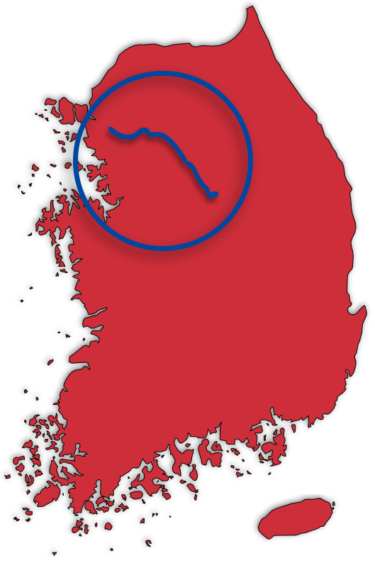
The Hangang Bicycle Path starts at the western border of Seoul, where the Ara Bicycle Path stops. The course slides through Seoul, Gyeonggi Province, and ends in Chungju City (충주시; map).
Before we delve into the bike path’s details, let’s look closer at the rivers it follows.
Three Rivers, Three Bike Paths

The Hangang Bike Path follows the Han River (한강; Hangang; map). As we will learn, for most of its length, the Han flows as two separate rivers: the Bukhangang (북한강; map) and the Namhangang (남한강; map).
Let’s take apart their names.
- “Buk” (북) means “north”
- “Nam” (남) means “south”
- “Gang” (강) means “river”
So Buk-Han-Gang (북 + 한 + 강) translates to “North Han River.”
And Nam-Han-Gang (남 + 한 + 강) translates to “South Han River.”
These two waterways converge east of Seoul (map) to create the Han River (Han-Gang; 한 + 강). The Han River then stretches for 138 kilometers through Seoul and western Gyeonggi Province before spilling into the Yellow Sea near the DMZ.
Three Han Bicycle Paths
A certification bike path follows each of these three rivers. The bike path takes the name of the waterway it follows.
- Hangang (Seoul) Bicycle Path (한강자전거길 (서울); map)
- Namhangang Bicycle Path (남한강전거길; map)
- Bukhangang Bicycle Path (북한강전거길; map)
Hangang (Seoul) Bicycle Path
The Hangang (Seoul) Bicycle Path follows the unified Han River as it flows through Seoul. It begins on the capital’s western border. It ends in Hanam City (하남시; map).
It is part of the Cross-Country Route and connects with the Ara Bike Path in the west and the Namhangang Bike Path in the east.
Namhangang Bicycle Path
The Namhangang Bicycle Path picks up where the Hangang (Seoul) Bike Path leaves off. It crosses Yangpyeong Dumulmeori (양평 두물머리; map), where the North and South Han Rivers converge. Then it continues along the South Han River, carrying riders through Gyeonggi Province and into Chungju City.
The Namhangang follows the Cross-Country Route and connects with the Saejae Bicycle Path.
Bukhangang Bicycle Path
The Bukhangang Bicycle Path traces the North Han River (Bukhangang). It starts in Chuncheon City (춘천시; map) and ends seventy kilometers later at Yangpyeong Dumulmeori, where the North and South Han Rivers converge.
The Bukhangang Bicycle Path is not a part of the Cross-Country Route. It connects only with the Namhangang Bike Path at its southern end point.
The Unified Hangang Bicycle Path
Let’s simplify. Korea by Bike clumps the Hangang (Seoul) Bicycle Path and Namhangang Bicycle Path into one, referring to them as the Hangang Bicycle Path. Both connect and follow the Cross-Country Route.
The Bukhangang Bicycle Path isn’t a part of the Hangang Bike Path. Though unique and picturesque, the path is a seventy-kilometer detour.
Lost in Translation
Korean words often get lost in translation. Some translators convert every Hangul (Korean) utterance into English. For example:
- Banpo-dae-gyo (반포대교) — “dae-gyo” means “large bridge.” So it reads “Banpo ‘Grand’ Bridge.”
- Jeju-do (제주도) — “do” means island. “Jeju Island.”
- Ipo-bo (이포보) — “bo” means weir. “Ipo Weir.”
- Insa-dong (인사동) — “dong” means neighborhood. “Insa Neighborhood.”
- Hangang (한강) — “gang” means river. “Han River.”
All those consonant-dense bike path names are just a case of overzealous transcription.
- Hangang Bike Path — “Han River Bike Path”
- Nakdonggang Bike Path — “Nakdong River Bike Path”
- Yeongsangang Bike Path — “Yeongsan River Bike Path”
The Course
The Hangang Bike Path — Hangang (Seoul) and Namhangang — runs 192 kilometers. It starts from the Ara Hangang Lock Certification Center on the western border of Seoul and ends at the Chungju Dam Certification Center in Chungju City.
The cycling journey passes through the heart of Seoul, then travels under mountains along the South Han River.

Hangang (Seoul) Bike Path
The Hangang (Seoul) Bike Path traces both the North and South Sides of the Han River in Seoul. Each cycling course snakes 50 kilometers through back-to-back riverside parks.
Are you riding the Cross-Country Route from the Ara Bike Path? Start at the Hangang Bike Path at Ara Hangang Lock Certification Center on the Han River’s South Side. Cycle to Paldang Bridge to the edge of Hanam City just east of Seoul.
Which side of the Han River in Seoul will you ride along? It’s up to you.
Bike Seoul’s North Side

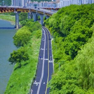
The bike path on the Han River’s north banks follows an almost flat course for 55.7 kilometers, crossing four Hangang Parks.
This cycling course runs below the historic heart of Korea’s old capital. Highlights include a decommissioned battleship, outdoor art, and World Cup parks.

Bike Seoul’s South Side

The cycling route on the south banks of the Han River travels a breezy 53.6 kilometers. It crosses seven Hangang Parks.
The South Side is the official Cross-Country Route. It holds two of the three certification centers in Seoul. (You only need the south side’s stamps to complete the Hangang and Cross-Country Certifications.)
Highlights include Yeouido Island, Banpo Fountain Bridge, and Jamsil Sports Complex.

Namhangang Bike Path
The Namhangang Bike Path begins at Paldang Bridge, where the Hangang (Seoul) Bike Path ends. It travels 132 kilometers through Gyeonggi and North Chungcheong Province, concluding at the Chungju Dam Certification Center.
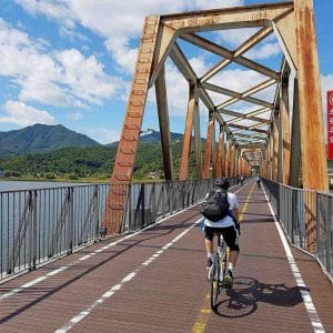
Along the way, the cycling course rides on a converted railway, passes three modern weirs and picturesque river islands.
Bike Seoul to Yeoju

The route from Seoul to Yeoju travels over a decommissioned railroad bridge, by repurposed train station, and through eight old rail tunnels. It also crosses two of three South Han weirs, whose designs reflect their local cultures.
In Yeoju City, find the tomb of King Sejong, Korea’s most revered ancient leader.

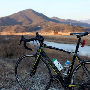
Bike Yeoju to Chungju

The course from Yeoju to Chungju sinks deeper into the countryside. Climb a few inland hills after passing the last Han River Weir. Then sail by bird sanctuaries and river islands until you reach Chungju, the center of the Korean Peninsula.
From downtown Chungju, you have a choice:
- Take a 12 kilometer detour to Chungju Dam and grab the last Hangang Bike Path stamp.
- Or skip the detour. Continue from Tangeumdae Park onto the Saejae Bike Path and along the Cross-Country Route.

Elevation
The Hangang Bike Path doesn’t feature the fearful mountains of the Saejae Bike Path or spiky surprises of the East Coast Route. But you will find inclines.
Amsa & Mieumnaru Passes
Near the end of the Hangang Bike Path in Seoul rises a pair of mountain passes. They straddle opposite sides of the Han River in eastern Seoul.
The Mieumnaru Pass occupies the river’s North Side. Rising to a 54 meter peak, it marks the steepest incline in Seoul (directions).
- Total Climb: a 42-meter ascent over 605 meters with a 6.9% average incline.
Amsa Pass sits on the South Side. With a 51-meter top, it’s a little less biting than the Mieumnaru Pass (directions).
- Total Climb: a 40-meters ascent over 875 meters with a 4.6% average incline.
Throngs of cyclists with differing skill levels and risk tolerances cram onto these passes’ narrow bike paths. This creates a dangerous combo. Keep your safety senses tingling.
Hills on the South Han River
Like Seoul, the South Han River’s bike paths are flat. However, a couple of riverside mountains push the cycling course inland and up steep inclines.
Just past downtown Yangpyeong, Gaegun Mountain (개군산; map) intrudes on the bike path. It forces riders off the river and up the 109-meter-tall Humigae Pass (후미개고개; map; directions).
- Total climb: a 75-meter ascent over 980 meters with a 7.7% average incline.
A little beyond Gangcheon Island, a trio of mountains shoves the cycling course away from the waterway and up the 122-meter-high Changnam Pass (창남이고개; map).
- Total climb: a 52-meter ascent over 1.3 kilometers with a 4% average incline.
Hills on the South Han River
Like Seoul, the South Han River’s bike paths are flat. However, a couple of riverside mountains push the cycling course inland and up steep inclines.
Bike Path Types
Worried about riding on roads beset by cars? Don’t fear. Over 90% of the Hangang Bike Path travels on bike-only lanes. In the countryside, however, the route hops onto bucolic roads for short stretches.

Seoul City Bike Paths
Like the Ara Bicycle Path, the bike paths in Seoul are protected. No vehicle roads. No shared pedestrian walkways. Just an uninterrupted cycling path that tracks the Han River’s flat course.
Don’t turn off your safety senses!
In the sunny months, Seoul’s parks swell with waddling young ones, canoodling couples, and shaved cyclists approaching highway speeds.
When in popular areas like Yeouido and Ttukseom, expect park goers to step into bike lanes; cyclists checking their phones; and kids dashing across lanes.
Recently, Seoul added cycling safety infrastructure to reduce accidents in its Hangang Parks. The city:
- Created medians between bike and pedestrian lanes.
- Added speed limits (20 km/h) for bicyclists, e-bikers, and electric scooters.
- Installed roundabouts at intersections.
- Paved separate lanes for leisurely bikers and high-speed commuters.
- Placed lights to warn cyclists to slow down before entering pedestrian areas.
- Installed speed-detection systems, alerting cyclists with a warning sound if they travel over 20 km/h.
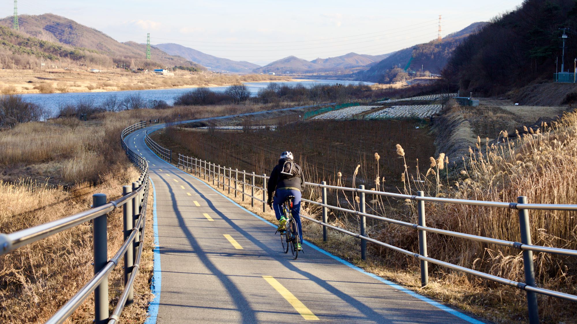
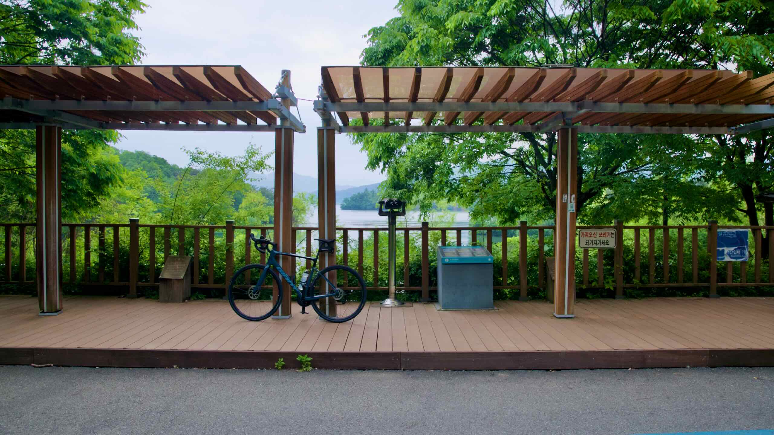
The Namhangang Paths
Most of the route along the Namhangang (South Han River) follows protected bike lanes. However, the farther outside of Seoul, the more you’ll encounter country roads.

Certification
There are ten certification centers on the Hangang Bicycle Path.
Collect all stamps and receive the Hangang (Seoul) and Namhangang Bike Path certifications. You need both bike paths to complete the Cross-Country, Four Rivers, and Grand Slam certifications.
You don’t need the Bukhangang Bicycle Path’s certification stamps to receive the Cross-Country certification.
Certification Centers
Below, find a complete list of certification centers along the Hangang and Namhangang Bike Paths.
- Yeouido (여의도 인증센터; map)
- Ttukseom Observatory Complex (뚝섬전망콤플렉스 인증센터; map)
- Gwangnaru Bicycle Park (광나루자전거공원 인증센터; map)
- Neungnae Station (능내역 인증센터; map)
- Yangpyeong-gun Art Museum (양평군립미술관 인증센터; map)
- Ipo-bo (이포보 인증센터; map)
- Yeoju-bo (여주보 인증센터; map)
- Gangcheon-bo (강천보 인증센터; map)
- Binaeseom (비내섬 인증센터; map)
- Chungju Dam (충주댐 인증센터; map)
Missed Checkpoints

In Seoul, the Ttukseom Observatory Complex and Gwangnaru Bicycle Park Certification Centers sit directly across the river from one another. Their stamps are interchangeable. If you get one, it will count the other automatically.
The Chungju Dam Certification Center (충주댐 인증센터; map) ends the Hangang Bike Path. But it sits ten kilometers (20 km return) from the Cross-Country Route.
- Just trying to get the Cross-Country certification? Skip the Chungju Dam stamp.
- Want the Grand Slam or Hangang certifications? Saddle up for a detour. You’ll need it.
An Extra Stamp
The Balgeun Gwangjang Certification Center sits under the Bukhanggang Railroad Bridge in Namyangju City, just off the Hangang Bike Path. This red booth is the first on the Bukhangang Bicycle Path. It’s not a stamp for the Hangang (Seoul) or Namhangang Bike Paths.
The Han River
- Length — 494 km (307 mi)
- Basin Area — 35,770 km² (22,226 mi²)
- Origin — Mount Taebaek (태백산; map), Gangwon Province
- Termination — Yellow Sea (West Sea; 황해)
For most of its length, the Han River (한강; map) flows as two separate waterways: the North Han River and South Han River. Both start on the eastern edge of the peninsula. Near Seoul, they converge and forge a wide path through the center of the capital.
The Han is only the fourth longest river on the peninsula (2nd in South Korea). But this ancient waterway represents history and power for North and South Koreans.

Geography
The Han River spends 375 kilometers of its total 513-kilometer length as two rivers:
- The Bukhangang (North Han River; 북한강) and,
- The Namhangang (South Han River; 남한강).
Because the South Han River is a tad longer, Koreans site its source — Mount Taebaek (태백산; map) in Gangwon Province — as the true start of the Han River.
At Yangpyeong Dumulmeori on the eastern edge of Seoul, the two rivers combine and flow 138 kilometers through the capital and Gyeonggi Province. It spills into the Yellow Sea (황해) along the DMZ (Demilitarized Zone).

History
It was once believed that whoever controlled the Han controlled the peninsula. Why?
- Like the Nile, the river’s banks held bountiful farmland.
- Its 320 kilometers (200 miles) of navigable waterway connected Korea’s heartland with the Yellow Sea and trade with China and Japan.
- Located in the center of the peninsula, the Han River was an ancient highway. Rice, troops, and tax collectors flowed up and down the waterway.
Highlights
The Hangang Bike Path doesn’t just cover Seoul, Korea’s most highlighted bedecked city. It extends down the South Han River, past weirs, river islands, and marshy parks.
Let’s take the Hangang Bike Path highlight tour.

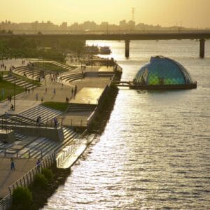
Yeouido (여의도; map), or Yeoui Island (도 or /dō/ means “small island”) is an 8.4 square kilometer island (3.2 sq mi) sitting on the southern banks of the Han River in Seoul.
Seoulites often give the Yeouido New York analogies: the Manhattan of Seoul. Korea’s Wall Street. Why? First, some context.
The currents of Yeouido’s history run shallow. Before weirs and dredging, the big bad Han River often huffed and puffed and flooded any settlement perched upon the island’s shores.
The River Parks of Seoul
The Hangang Bike Path through Seoul runs through eleven parks on the banks of the Han River. So I created two sections: North Side and South Side. I further broke up the cycling route into guides detailing each Hangang Park.
From an insect-inspired exhibition space to a Grand Fountain Bridge, each riverside park holds unique curiosities and attractions.
And because the Han River passes through the middle of Seoul, the bike paths veer close to the capital’s other major landmarks.

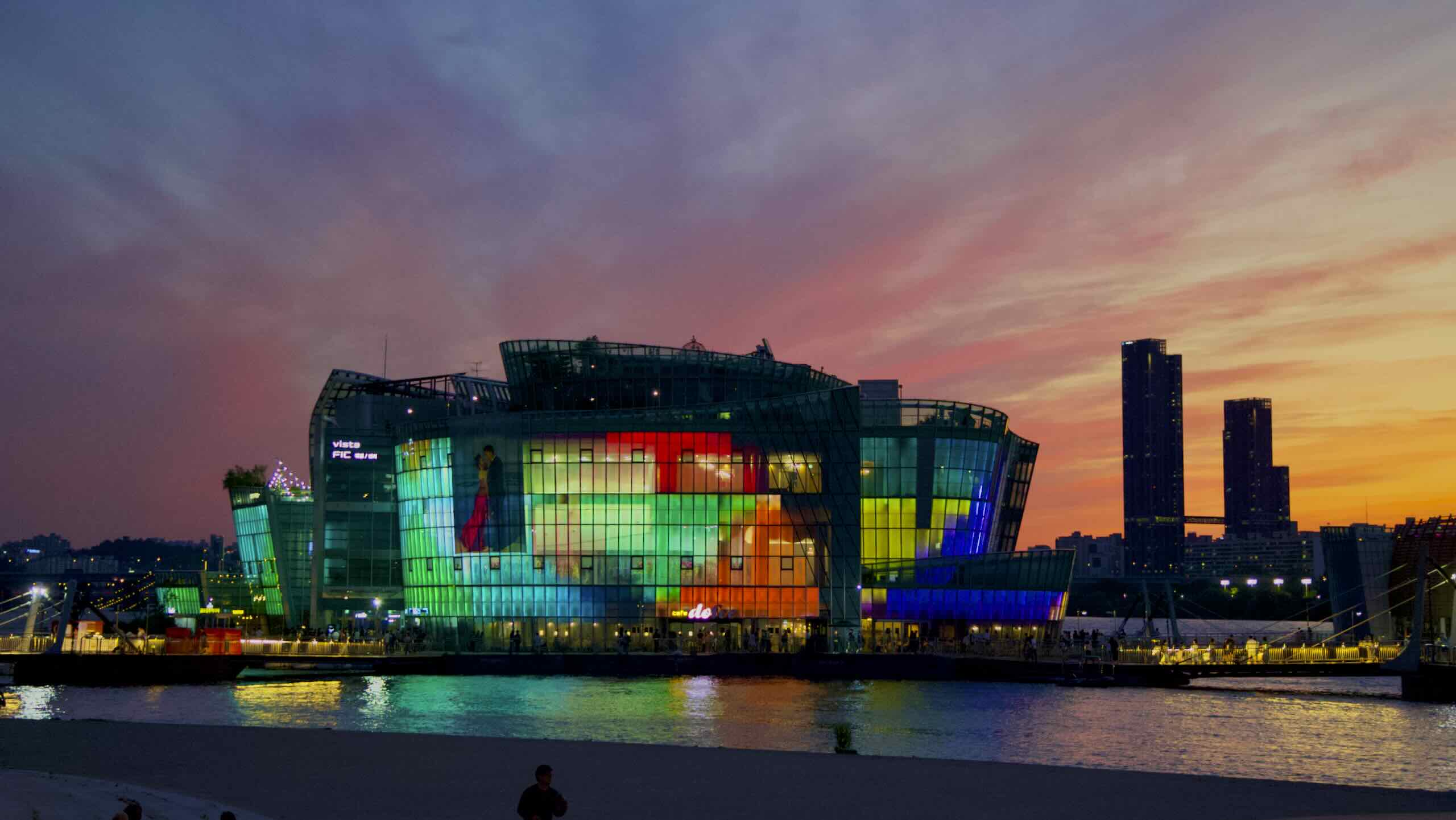
Banpo Grand Fountain Bridge crosses the Han River in the middle of Seoul. Two special features set it apart from normal bridges.
As its name suggests, Banpo Bridge is a fountain bridge. It sucks 190 tons of water a minute and shoots it through 308 jets mounted to its top deck.
The bridge’s other feature? It’s the only double-decker bridge in Seoul.
Views of the Namhangang
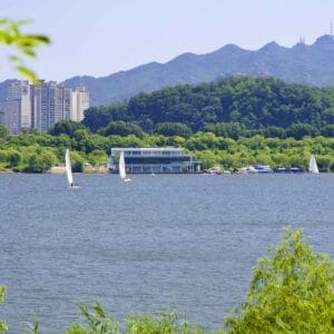
Outside of Korea’s capital, the bike path hops onto the Namhangang, or South Han River Bicycle Path, and sails into the middle of Korea.
Local tourist boards compiled a list of Eight Scenic Views along this portion of the Hangang Bike Path. They reflect the natural and people-made sights along the South Han River.

Ipo Weir (Ipo-bo; 이포보; map) in Yeoju City (여주시; map) is the northernmost Four Rivers Restoration Project watergate and Third Scenic View of the South Han River. Engineers created the weir to regulate the flow of water on the waterway.
Workers built the weir as part of the Four Rivers Restoration Project, which sought to control flow of South Korea’s major rivers — South Han, Nakdong, Geum, and Yeongsan. The weirs can trap water during droughts and release it downriver during heavy rains.
How To Get There
The first section of the Hangang Bike Path lives in Seoul. The city’s top-notch transportation and prime location on the Han River make it the easiest cycling route to access in Korea.
Plentiful train stations and intercity bus terminals also make getting to the South Han River Bike Path super simple.
Let’s explore four options to get you and your bike onto the Han River Bike Path.
Subway
It’s the weekend or national holiday. You’re in Seoul. What’s the best way to the bike paths? Subway. Riding the subway in Seoul is straightforward. Buy a transportation card and ticket. Head to the station. Board the first or last train car. But beware of some important restrictions.
It’s the weekend or national holiday. You’re in Seoul. What’s the best way to travel to the Han River Bike Paths? Subway.
Riding the subway in Seoul is straightforward. Buy a transportation card or a subway ticket. Head to a station. Board the first or last subway car.
But beware! There are some important restrictions.
Commuter Train
Ten commuter trains integrate into the Seoul Subway System. They pass through the city and into the surrounding Gyeonggi Province and beyond. Like subways, most commuter trains allow full-size bikes aboard on weekends and holidays.
The two most useful — the Gyeongchun Line and Gyeongui–Jungang Line — scoot along the Namhangang and Bukhangang Bike Paths outside Seoul.

Intercity Bus
Subways and trains are best for getting around Seoul on the weekends. But intercity buses are the best way for cyclists to get to the South Han River Bike Path anytime.
Year-round, they travel to every city and county along the waterway. Just buy a ticket, nestle your bike in the intercity bus’s underbelly, and hop aboard.
Year-round, they travel to every city and county along the river. Just buy a ticket, put your bike in the bus’s undercarriage, and board.
Airplane
Flying into Korea with your bike?
Incheon International Airport, the gateway to South Korea, lives on Yeongjong Island in the Yellow Sea, about fifty kilometers from Seoul.
Districts on the Han
Below find a complete list of cities, counties, and provinces on the Han River. You can also find links the bike path breakdowns.
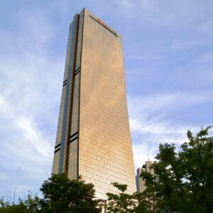
Seoul Special City (서울특별시; Seoul-si) is the gravitational center of Korea. Like London is to the U.K., Paris is to France, everything flows to and from the megacity. It:
- is the capital of South Korea.
- claims the headquarters of most Korean corporations.
- houses the biggest K-Pop labels.
- boasts the most awe-inspiring cultural relics.
Gyeonggi Province (경기도) is the most populous province in Korea. Why? The name says it all, translating to “the area around the capital.” But the province not only surrounds Seoul City (서울특별시; Seoul-si), the largest city. It also cuddles up to Incheon (인천시), Korea’s third largest metropolis.
Hanam City (하남시; Hanam-si) is satellite cities of Seoul (서울특별시; Seoul-si). First established in 1989, the city closely ties itself to the capital, borrowing many resources, including a subway (Line 5; 5호선) and commuter train (Gyeongui–Jungang Line; 경의·중앙선).
Yangpyeong County (양평군) sits on the South Han River (남한강; Namhangang) near the middle-north of South Korea. Its borders touch the bottom of Hanam City (하남시) in the north and the top of Yeoju City (여주시) in the south.
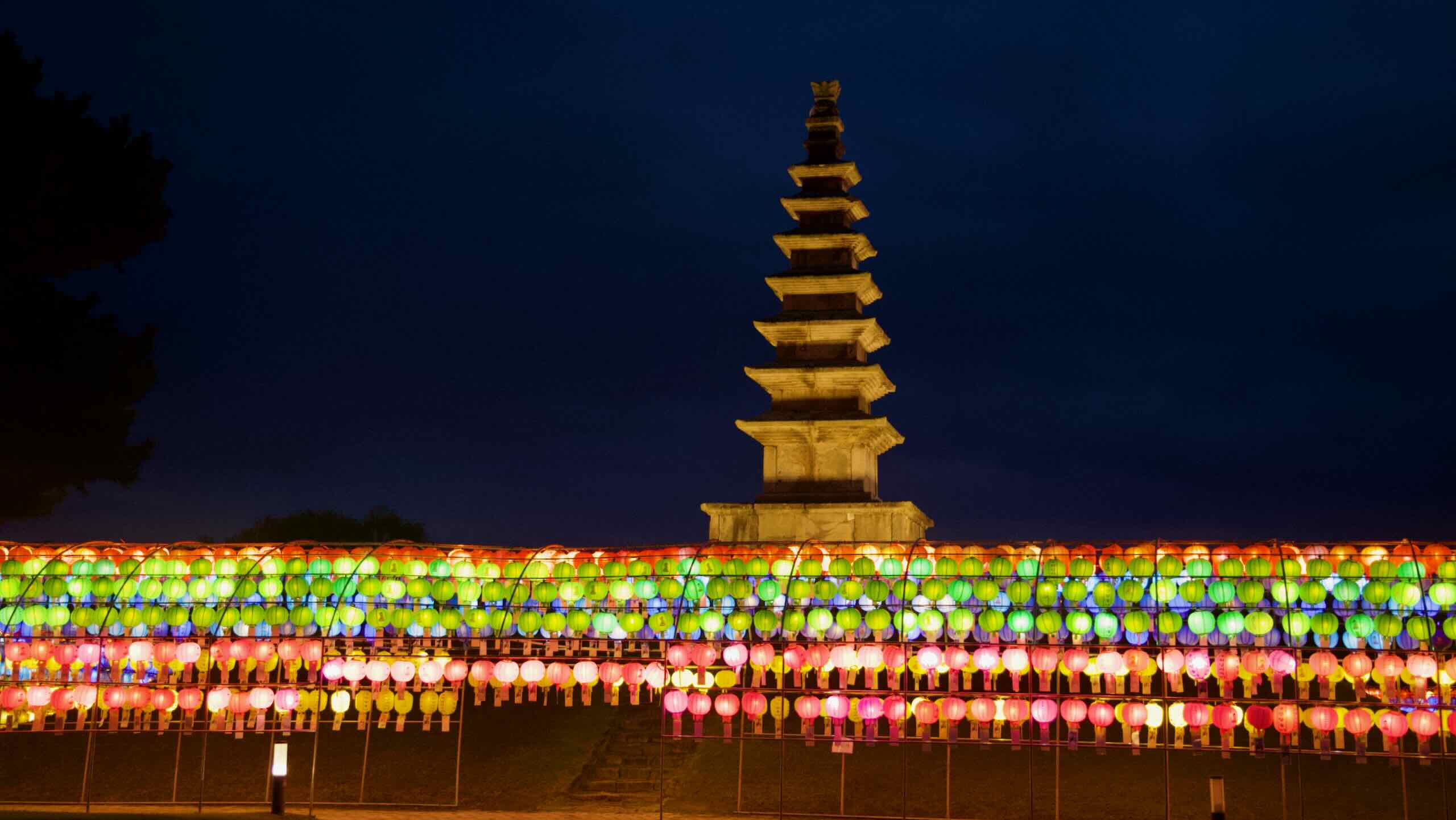
Yeoju City (여주시) lies on the southeastern edge of of Gyeonggi Province (경기도; Gyeonggi-do). South Korea recognizes Yeoju for two things.
- Its farmlands were some of the first to cultivate rice on the Korean peninsula.
- And the city birthed and holds the tombs for some of Korea’s most important leaders.
North Chungcheong Province (충청북도) sits in the center of South Korea. It is the only landlocked province in the country.
The province’s name comes from its two historically important cities, Chungju (충주시) and Cheongju (청주시). Chungju + Cheongju = ChungCheong.
Chungju City (충주시; Chungju-si) sits near the middle of South Korea in North Chungcheong Province (충청북도; Chungcheongbuk-do).
Just east of the city, you’ll find Chungju Lake. This body of water transforms the Donggang River (동강강) into the South Han River (남한강; Namhangang). This makes Chungju City the first or last stop on the Hangang Bicycle Path.


