Cycle a flat course through Uljin County’s largest port, then a parade of highlights, including a seaside mountain and skywalk, a sculpture park, and prized pavilions overlooking the East Sea.
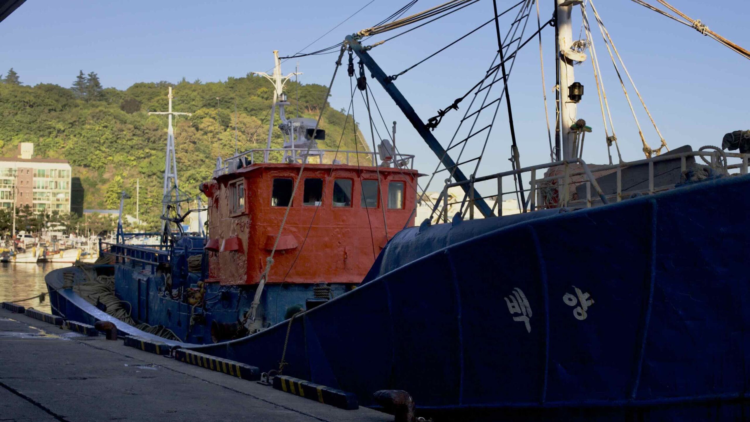
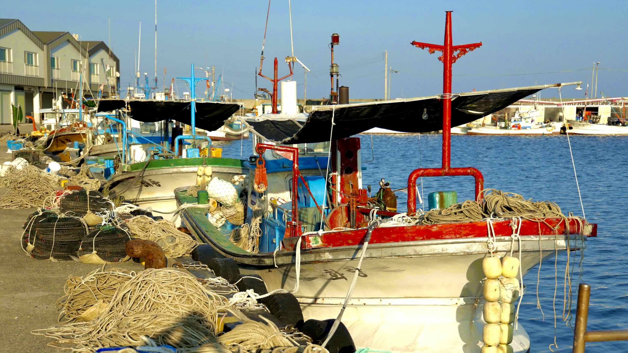
Peak season, between November and April, tourists visit Hupo Port for its fresh seafood. The port’s restaurants and markets buzz with fishers, distributors, and gawkers, buying, selling, or eating the sea’s bounty, including snow crabs, octopuses, squid, sea snails, flounder, and mackerel.
Cycle down the main road and spot a few of the port’s highlights:
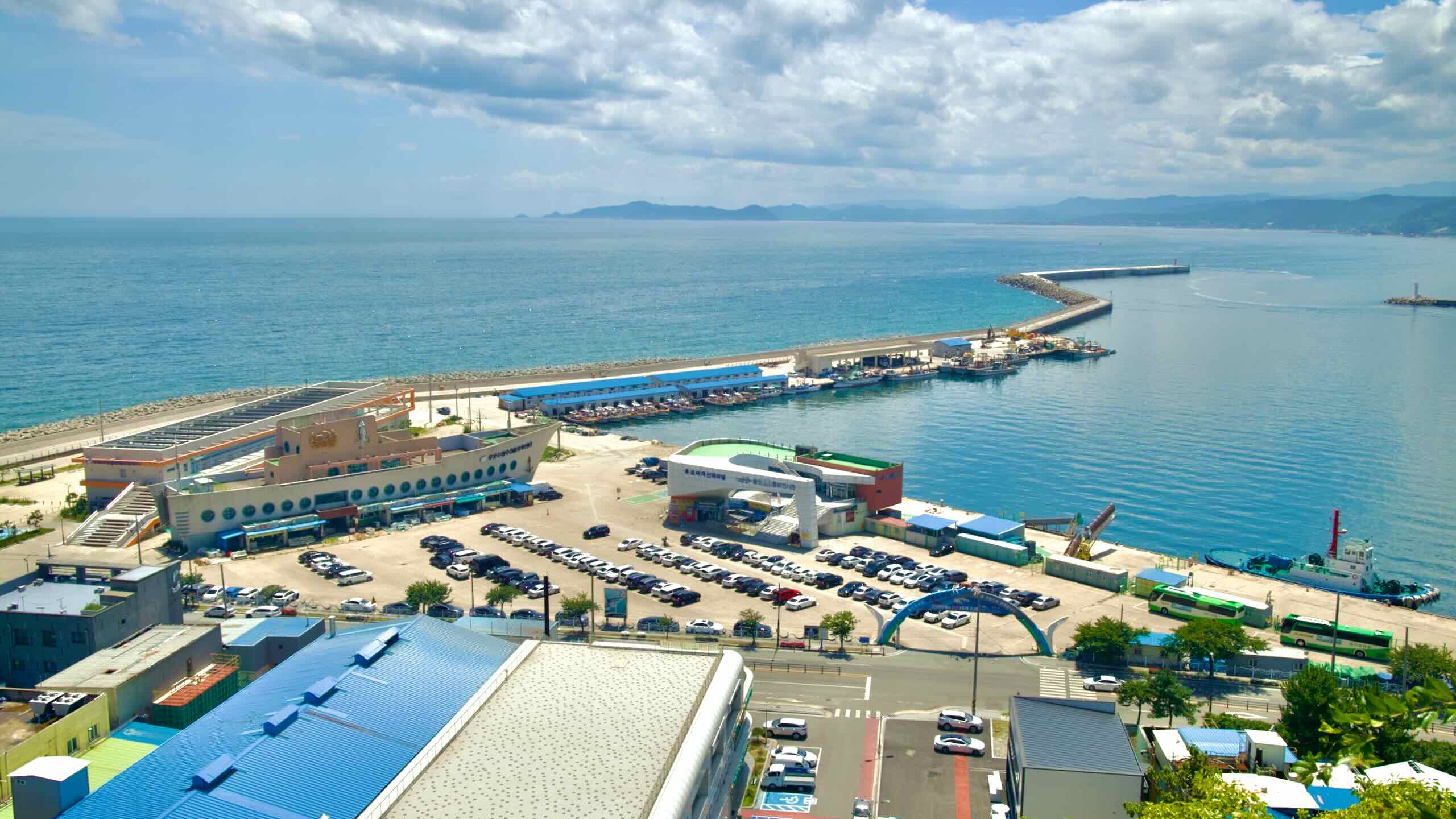
Hanmaeum Square (한마음광장; map; road view) sits above the port’s breakwaters. The area holds Hupo Port Fish Market (후포어시장회도매센터; map). Here, visitors can buy a sea creature and have a nearby restaurant cook it up.
Hupo Fisheries Cooperative Distribution Center (후포수협수산물유통센터; map) perches on the east end of the port. Shaped like a giant ship, this three-story building hosts a seafood market. Again, visitors can purchase a sea critter and have a restaurant on the building’s 1st and 2nd floors cook and serve it to their table.
Hupo Passenger Terminal (후포여객선터미널; map) shares a parking lot with the coop distribution center. It has two jobs:
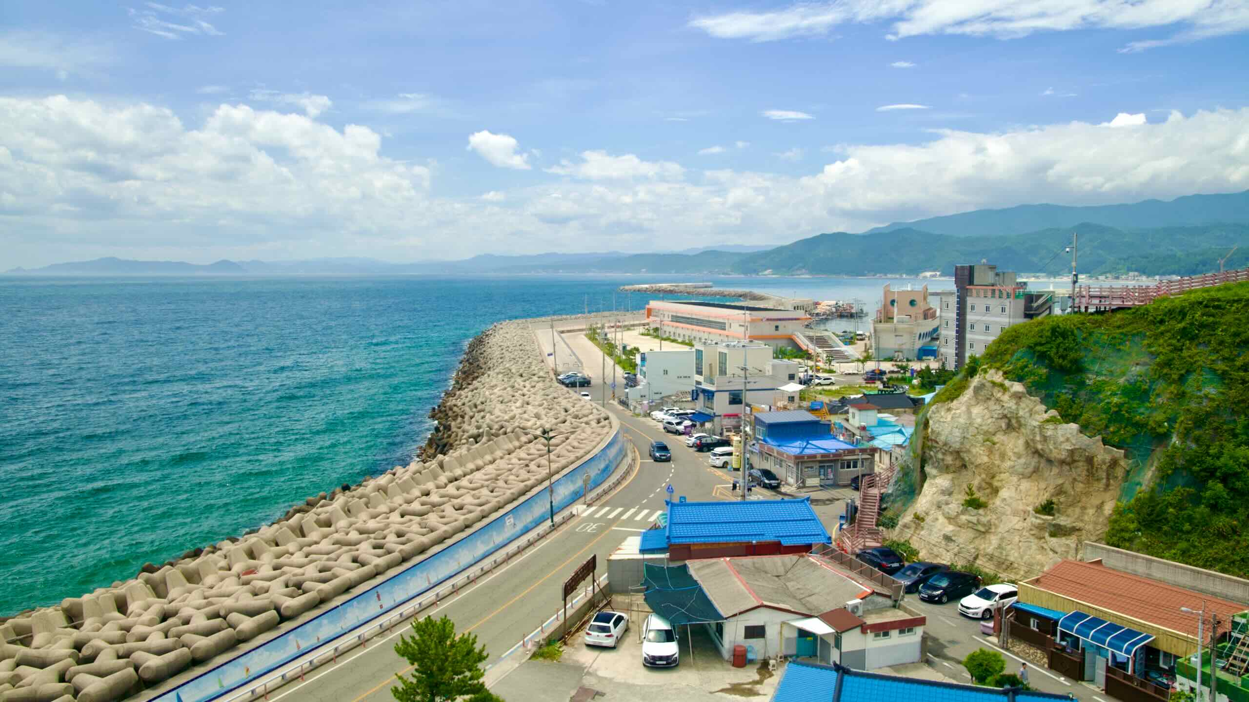
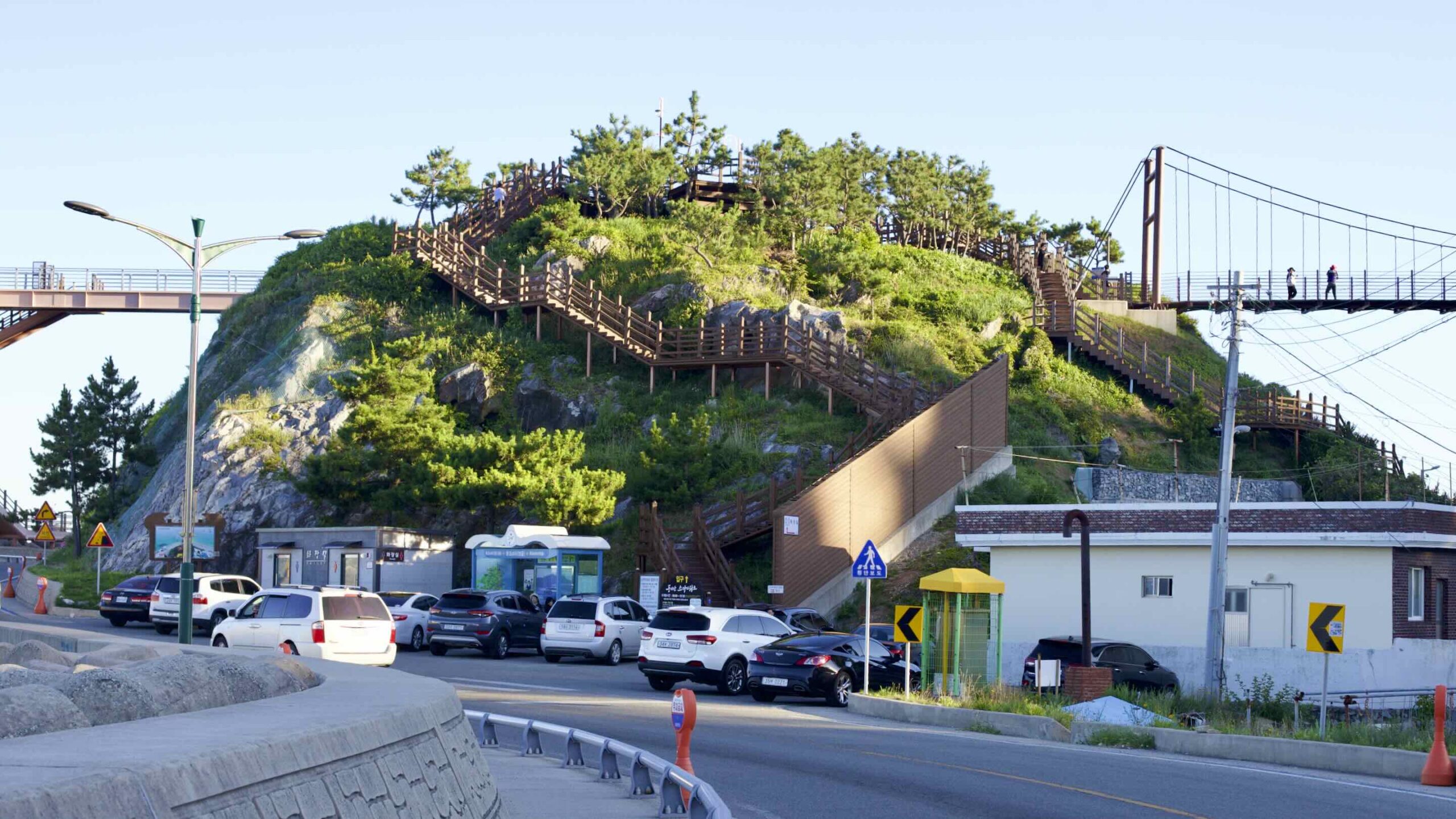
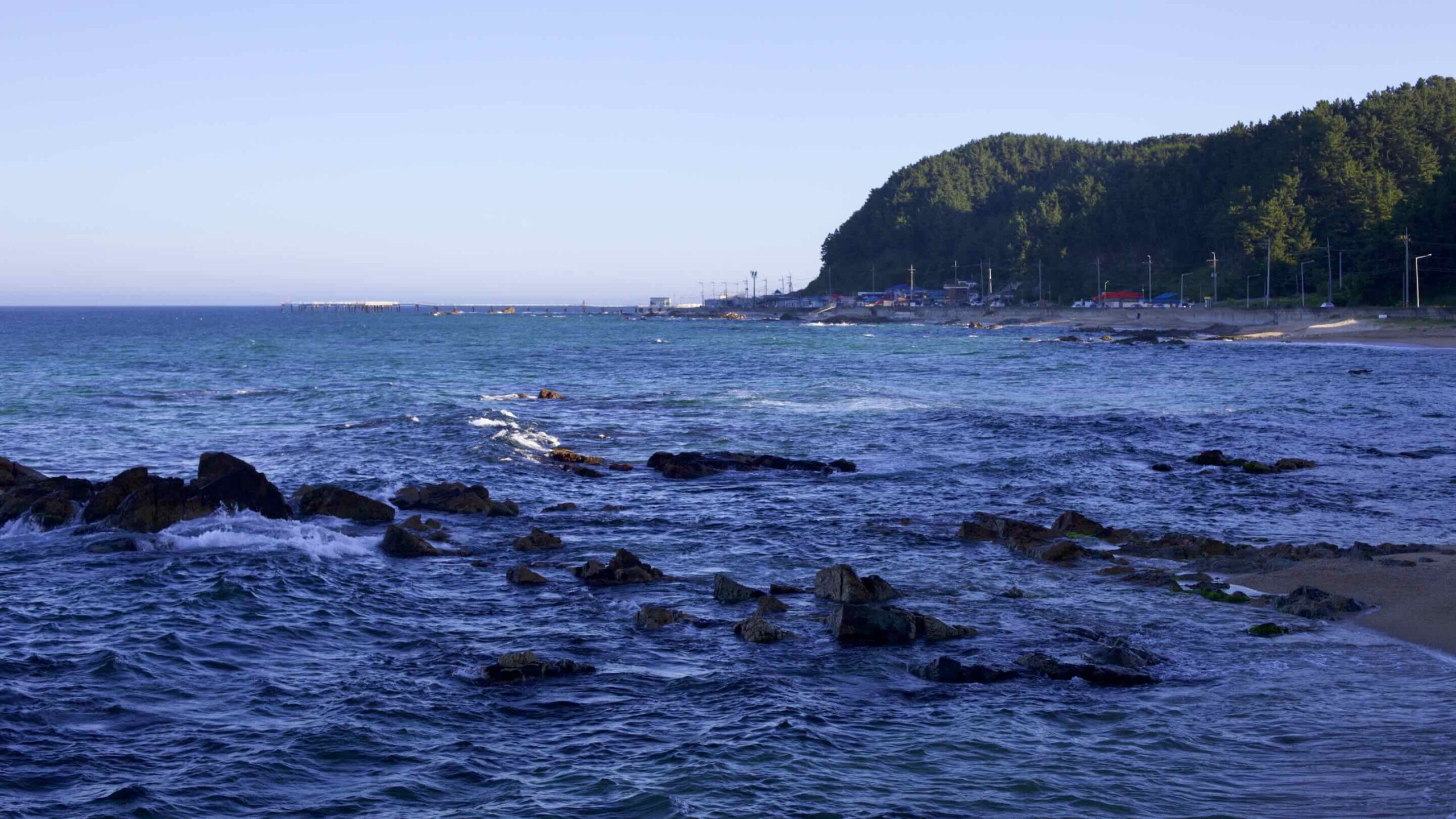
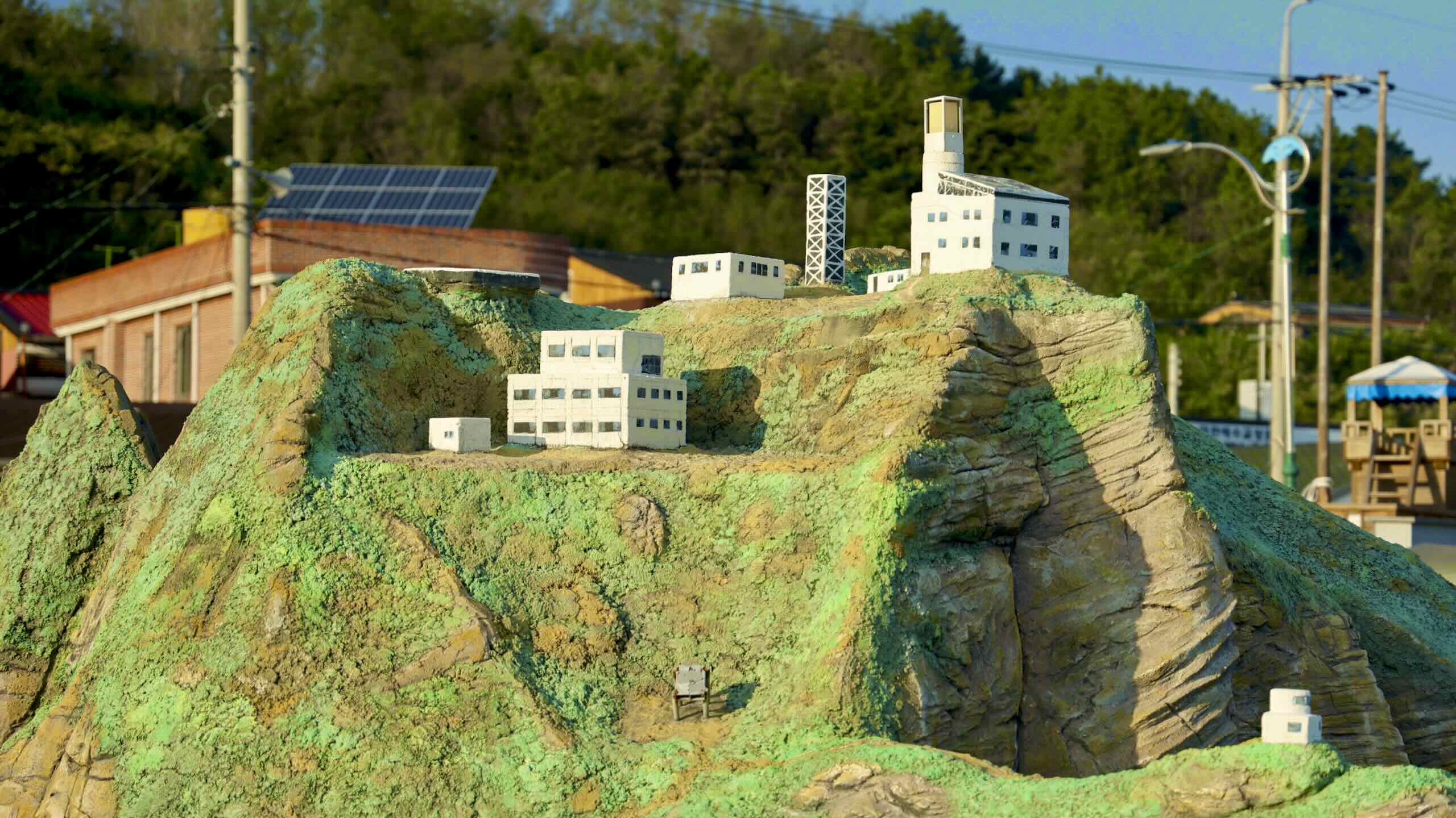
Deunggi Mountain rises 64 meters on the north end of Hupo Port. A Gyeongbuk Bike Path highlight, this outcrop hosts a park with several notable features.
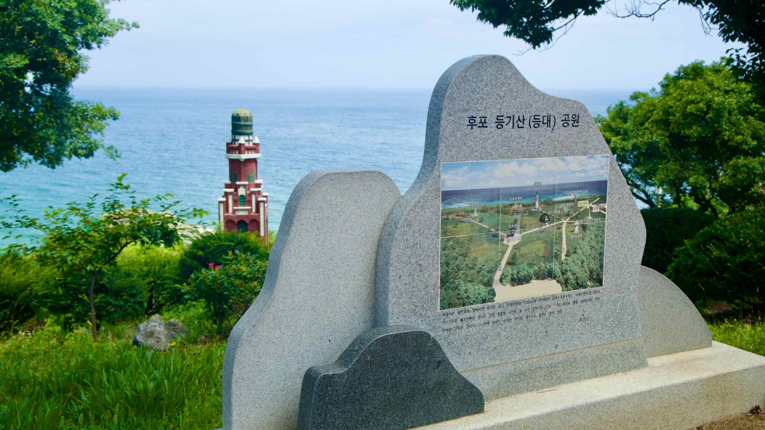
Deunggi Mountain Park (후포등기산공원; map) sits at the east end of Hupo Port. It blankets the 64-meter tall Deunggi Mountain (등기산; map).
Since ancient times, locals have used the mountain to communicate with ships out at sea. During the day, signalmen planted white flags. And at night, they lit beacon fires.
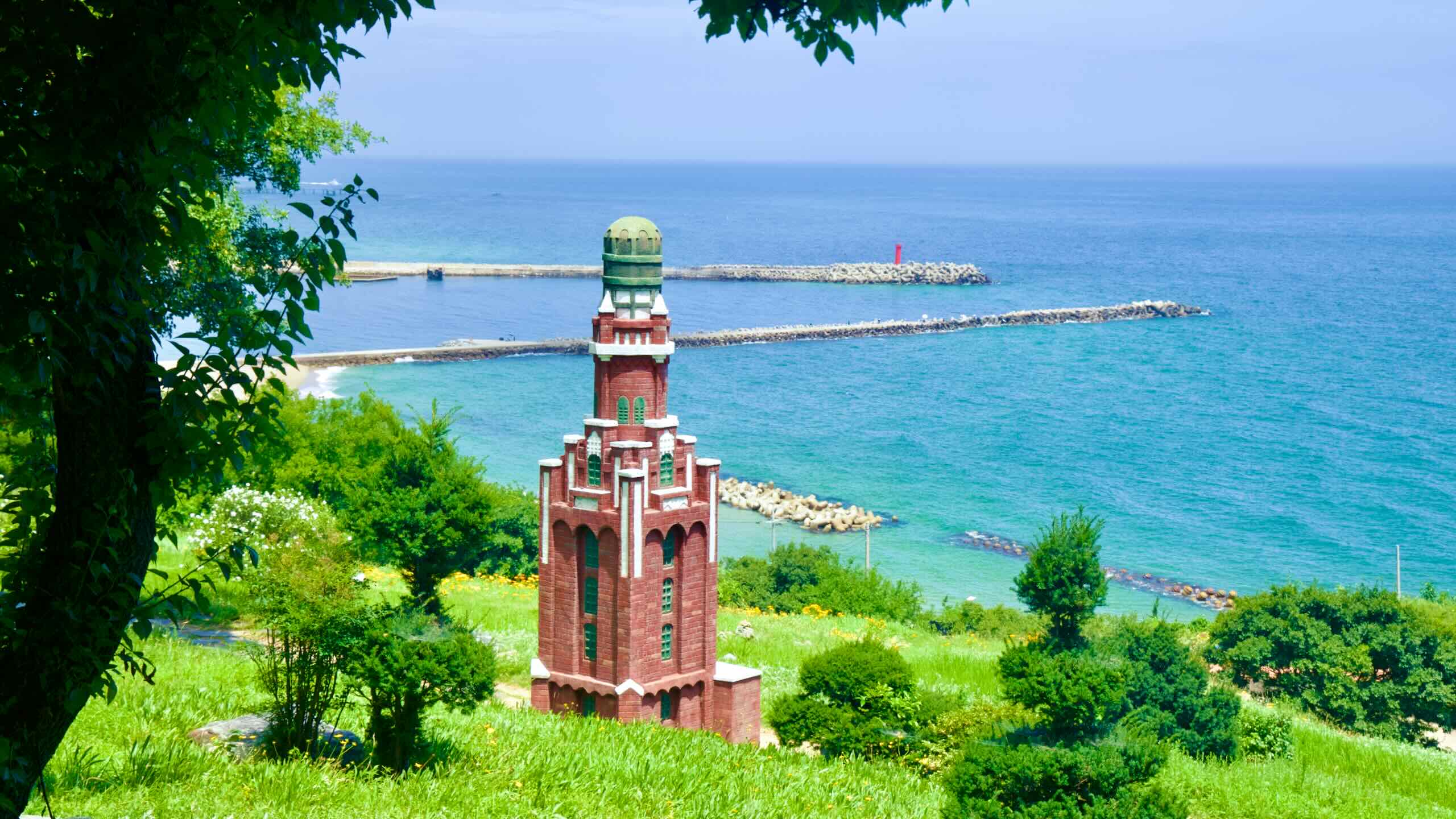
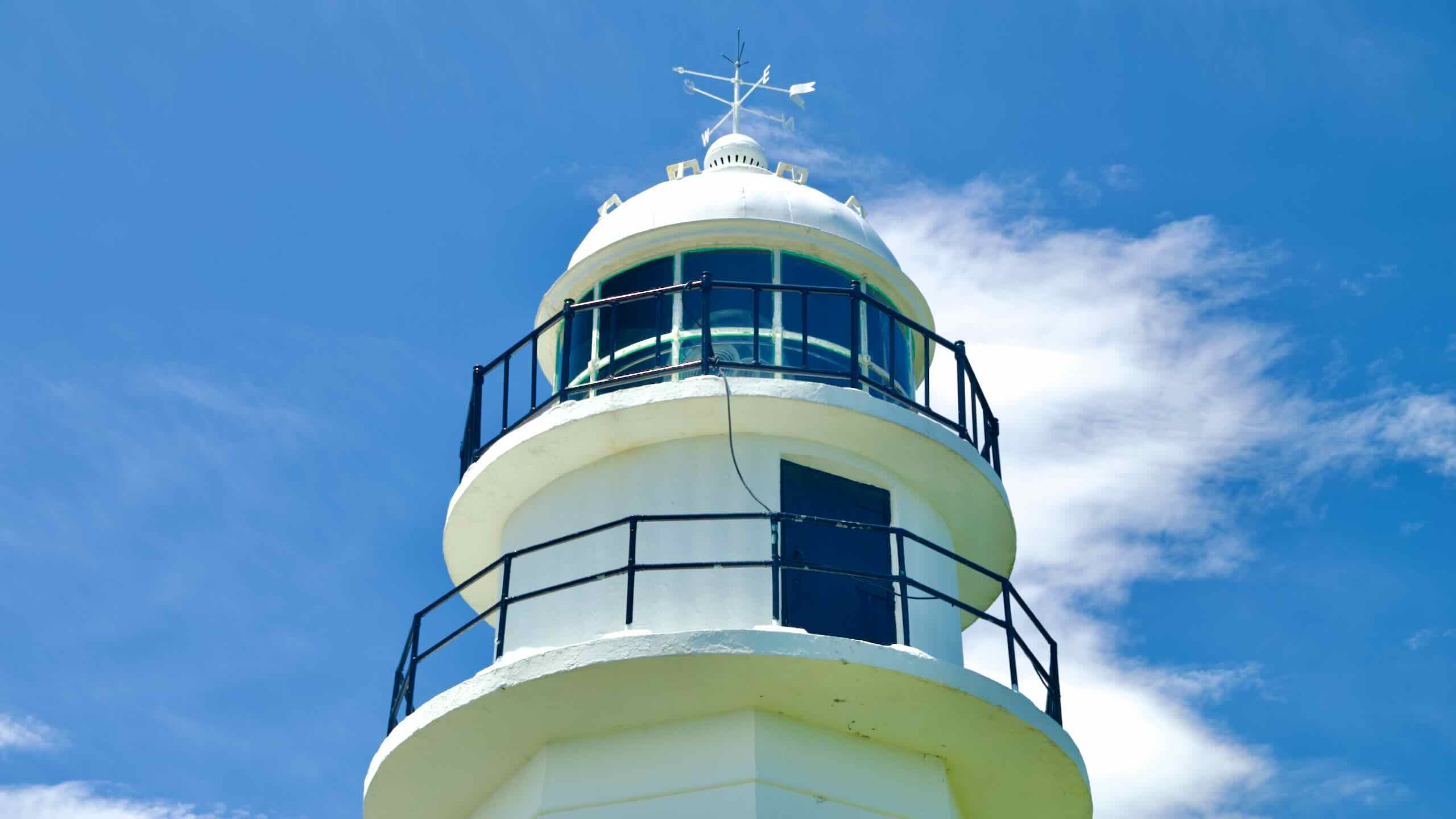
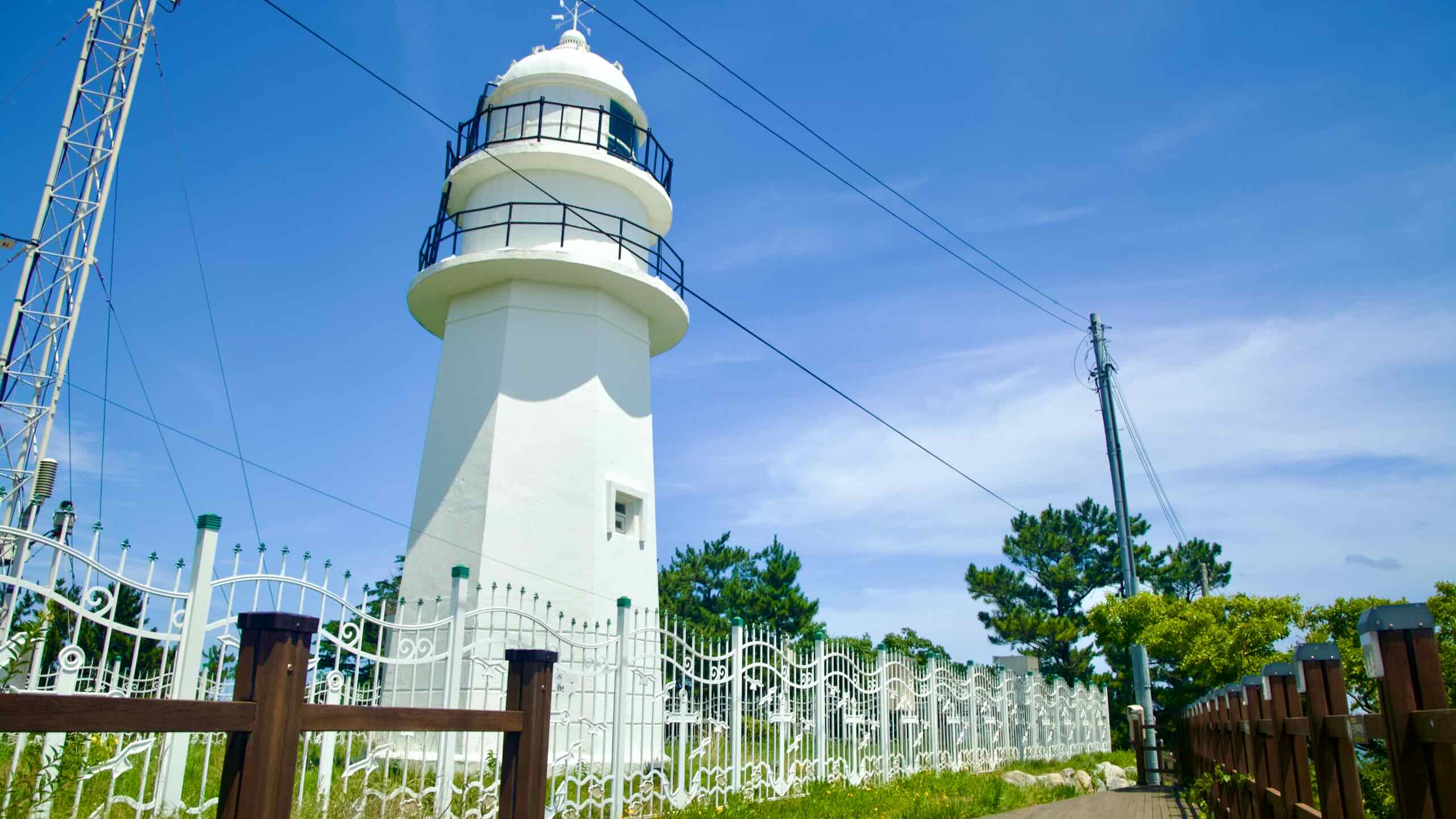
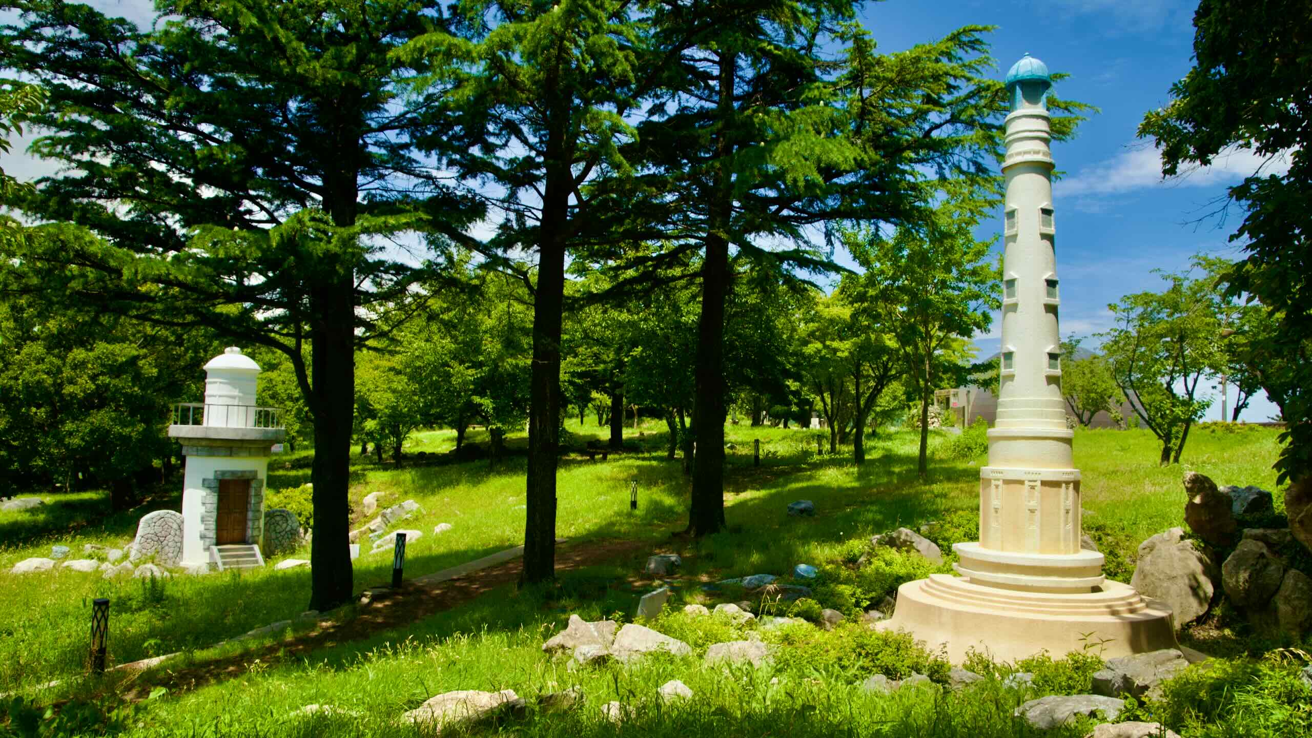
Today, the park contains a skywalk, miniature lighthouses from around the world, decks for viewing the East Sea, and Hupo Lighthouse (후포등대; map).
Cycle around Deunggi Mountain Park and pass two of its highlights.
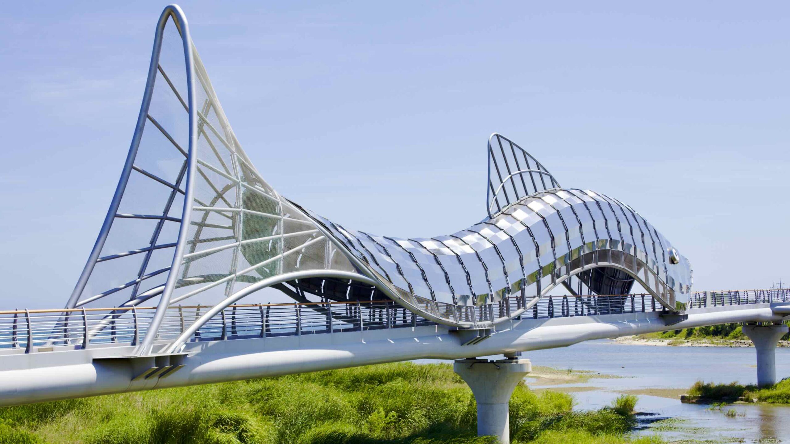
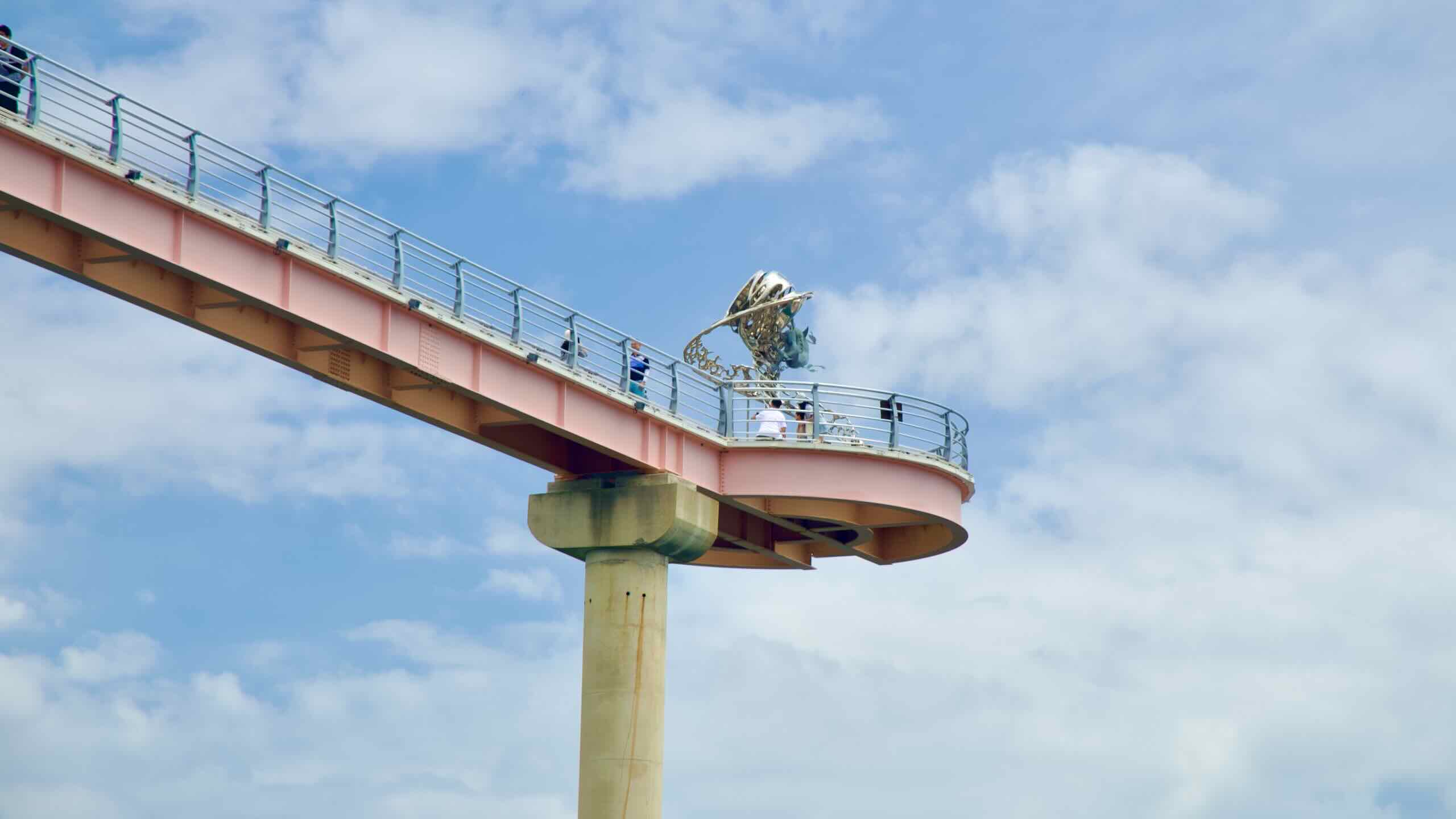
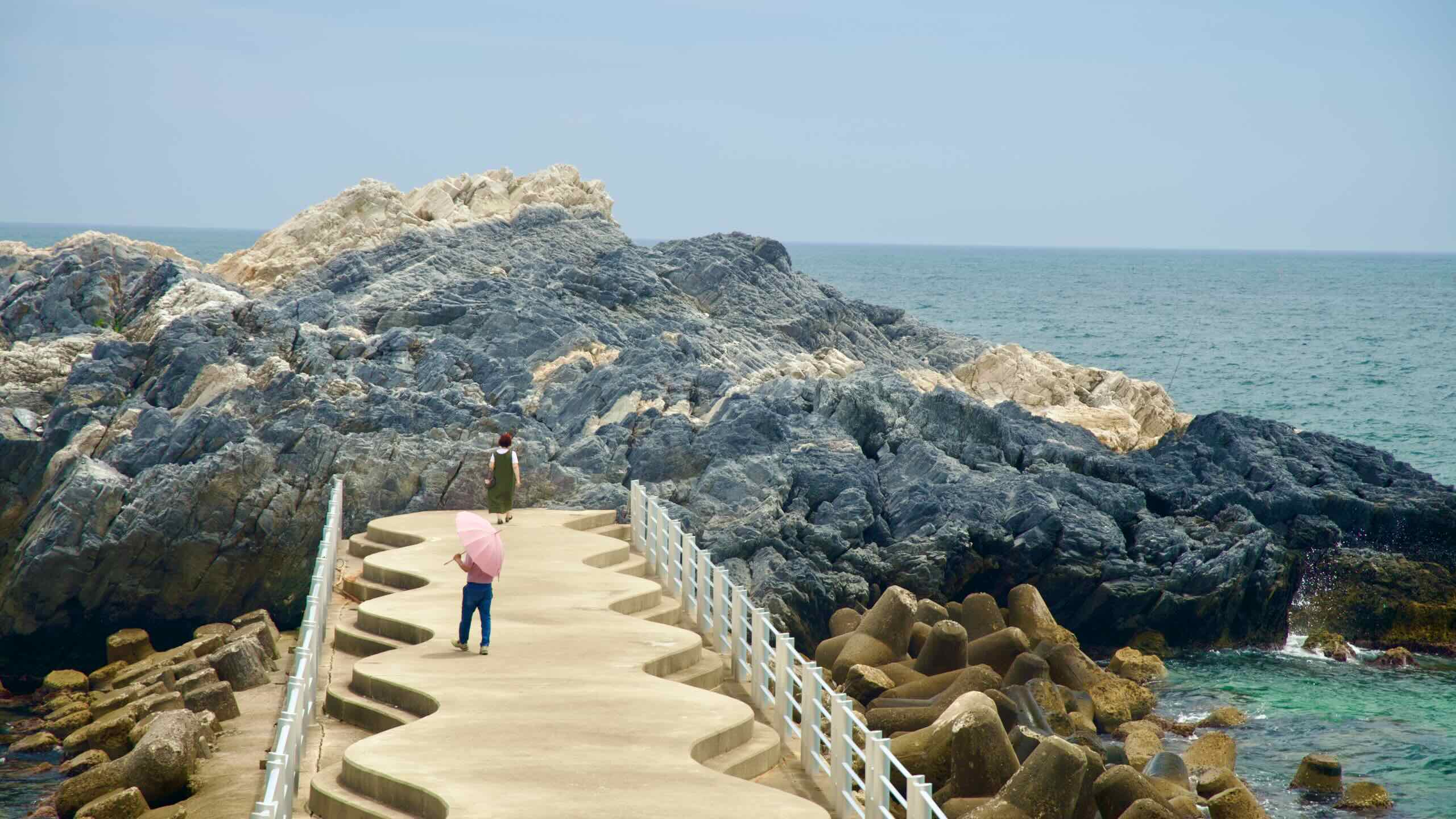
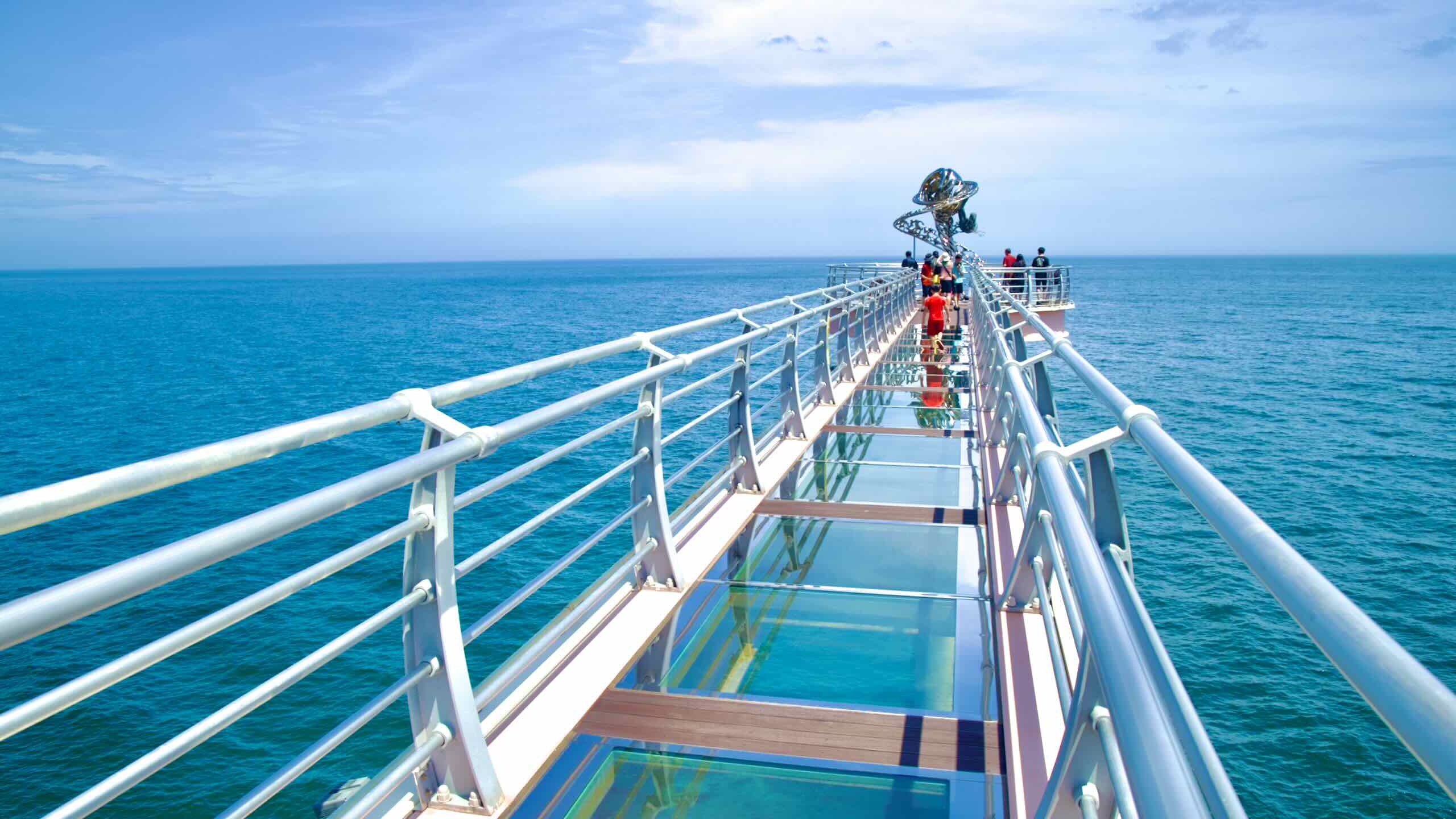
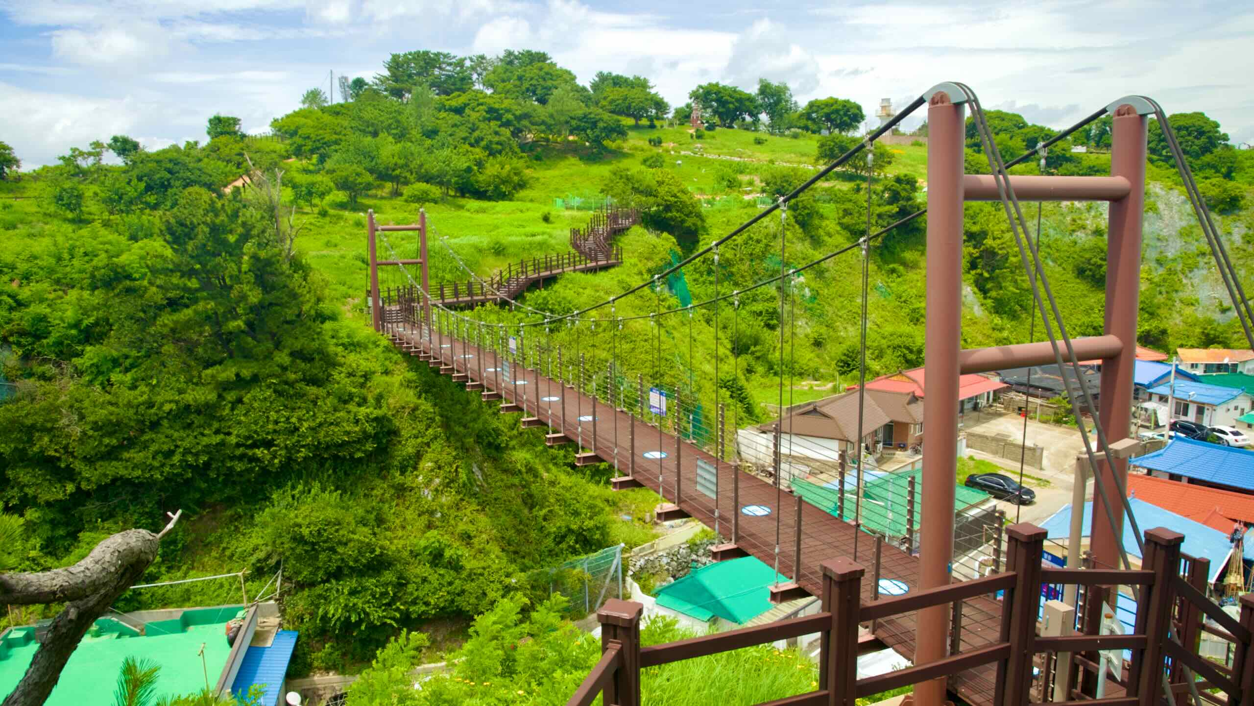
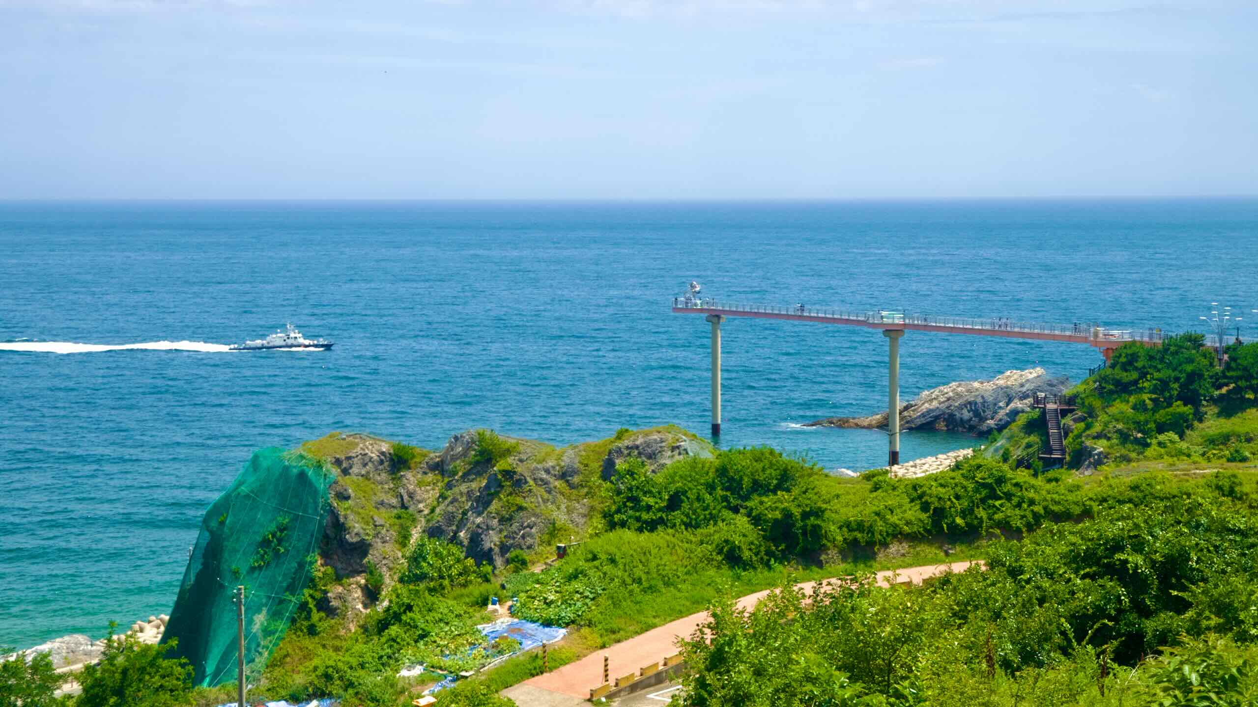
Deunggi Mountain Skywalk (등기산 스카이워크; map) is the park’s principal attraction. This 20-meter tall pedestrian pier extends 135 meters from the edge of Deunggi Mountain over the East Sea. The final 57 meters of the skywalk’s floor features tempered glass, allowing visitors to gaze down at the rocks and waves below.
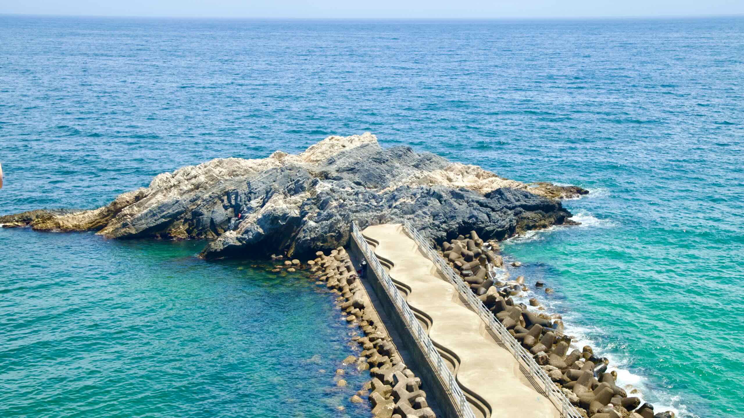
Gatbawi Rock (후포갓바위; map) is a rocky outcrop that perches in the East Sea below Deunggi Mountain Skywalk. Sightseers can stroll down the connecting concrete bridge and explore it.
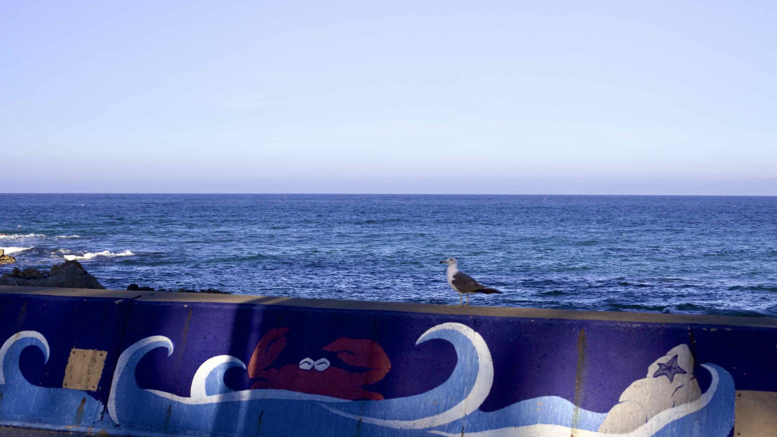
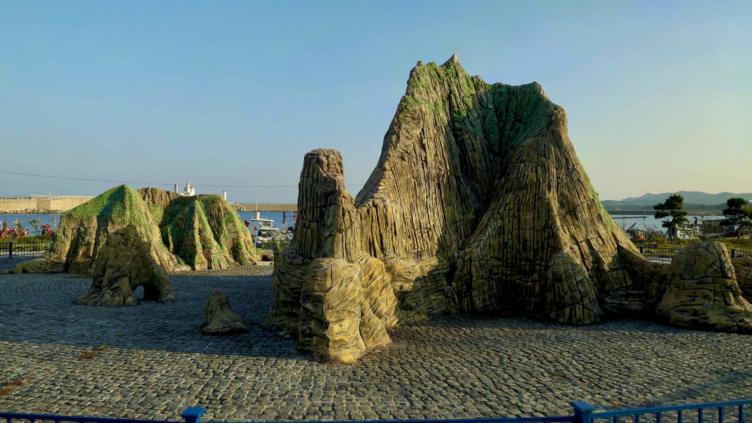
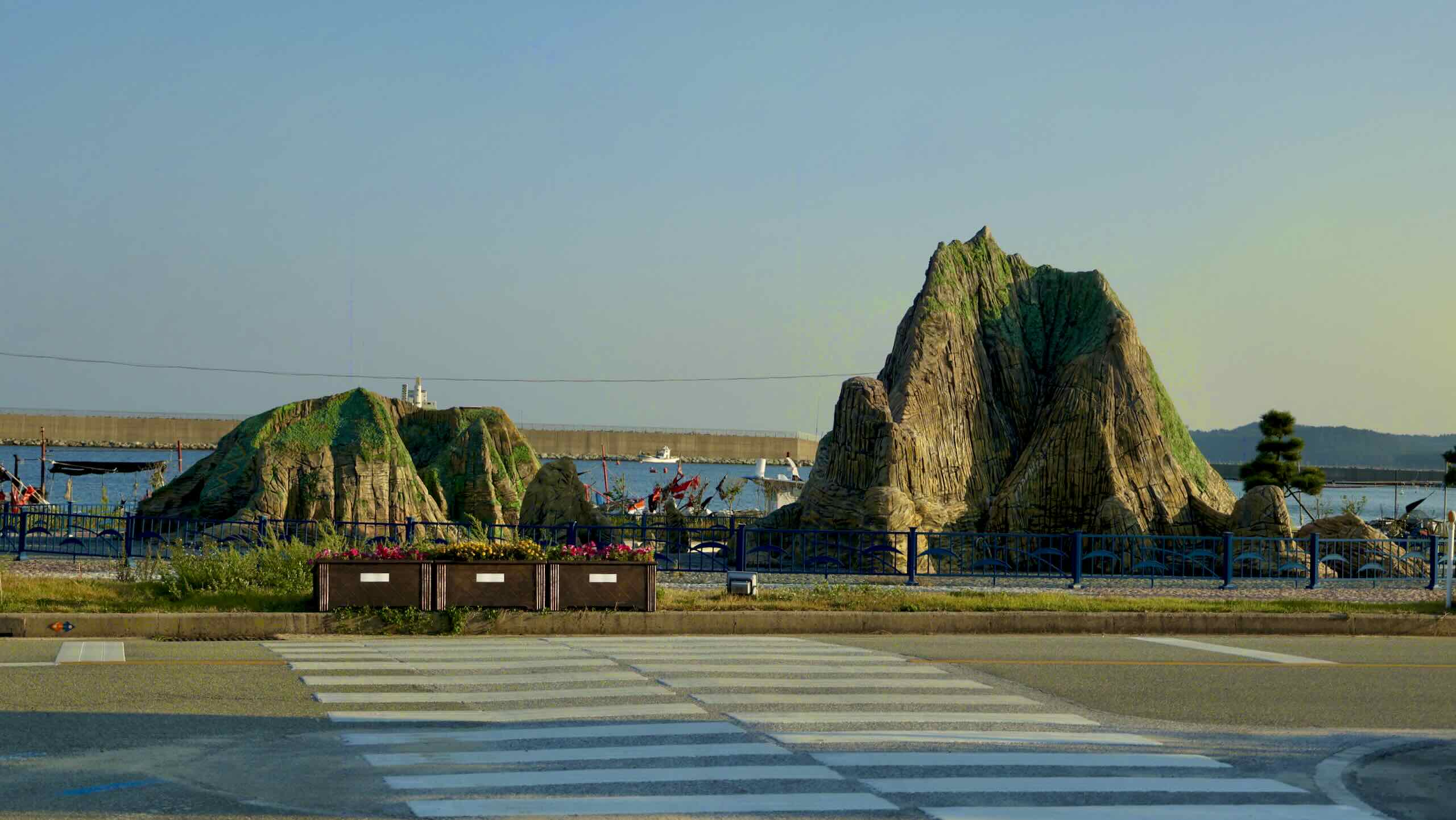
This sculpture park depicts a giant snow crab climbing out of the waves onto the seawall. A fishing boat, fishers, and other sea-life sculptures surround it.
Twenty-three kilometers off the coast of Geoil Village lives an underwater ridge teeming with life.
Called Wangdolcho (왕돌초), this underwater mountain rises from 60 meters to just to 3 meters below surface. Besides hosting over 120 marine species, Wangdolcho is home base to giant snow crabs in Korea.
Snow crab season runs from November to May, with crabs reaching peak weight in late-February. During this time, fishing boats from Yeongdeok and Uljin journey to Wangdolcho, fill their hulls with snow crabs, then sail back to their respective ports.
Jiksan Port
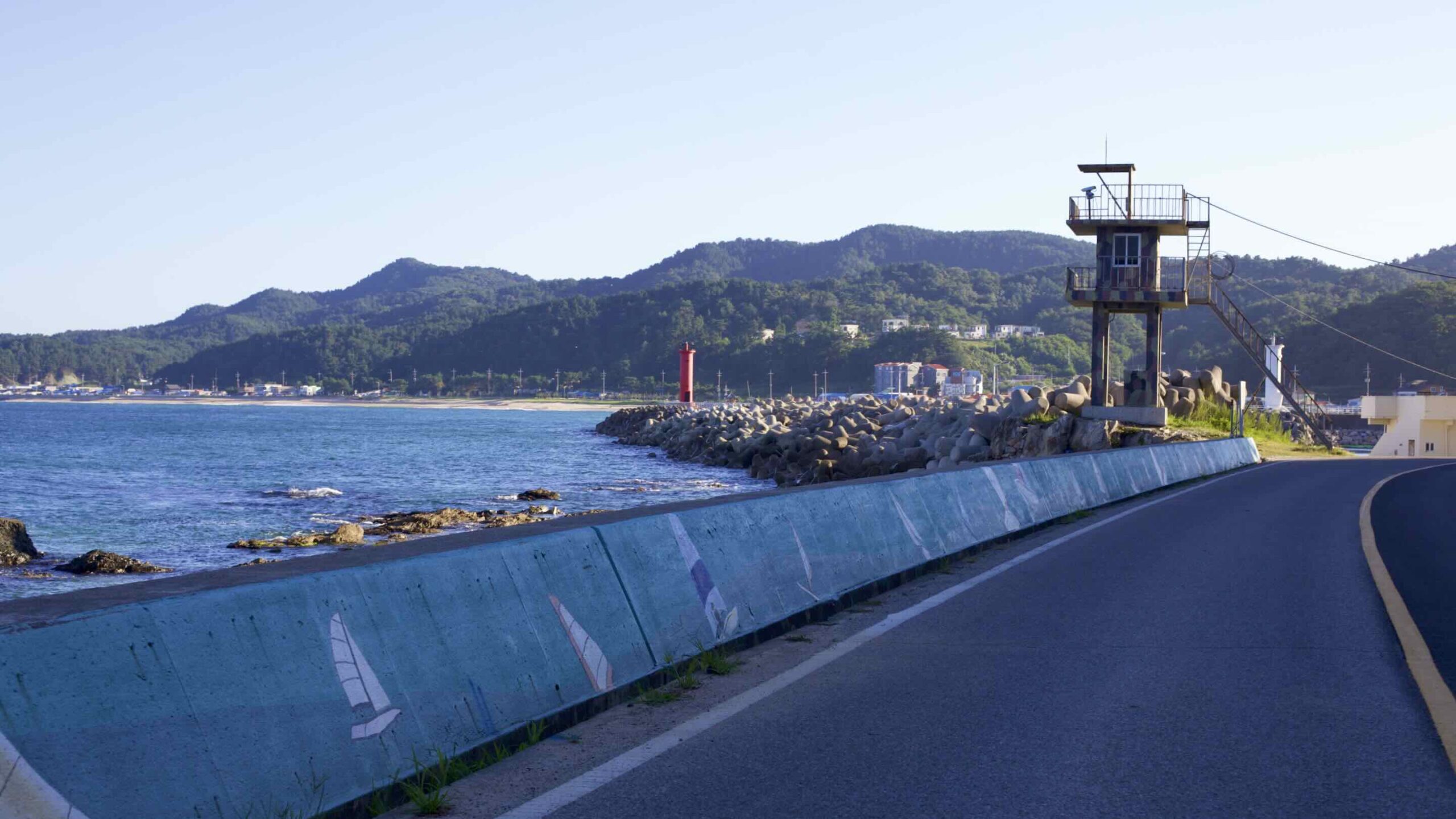
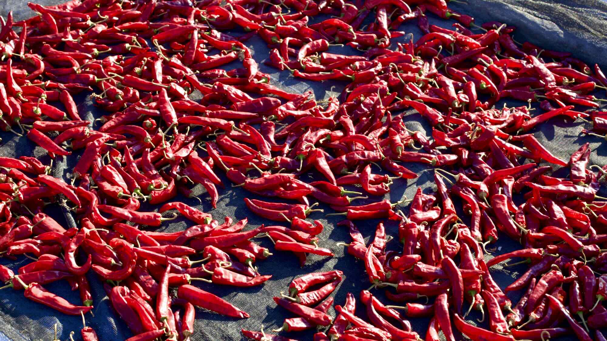
Continue north into Jiksan Port (직산항; map), famous for silver anchovies. Between May and October, locals catch and dry the tiny fish behind their extensive seawall.
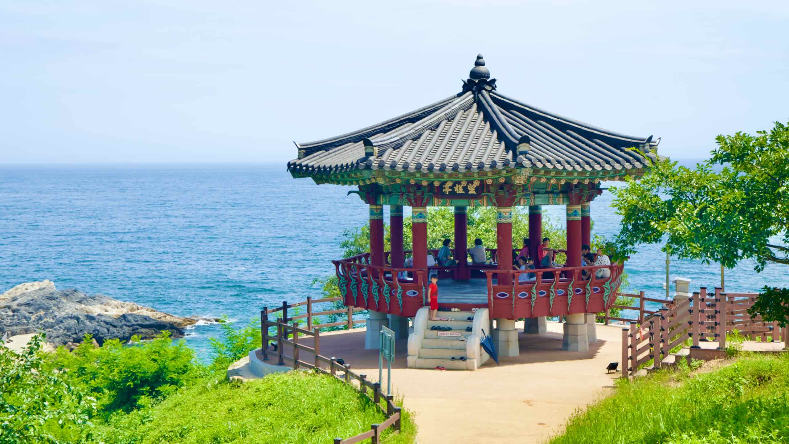
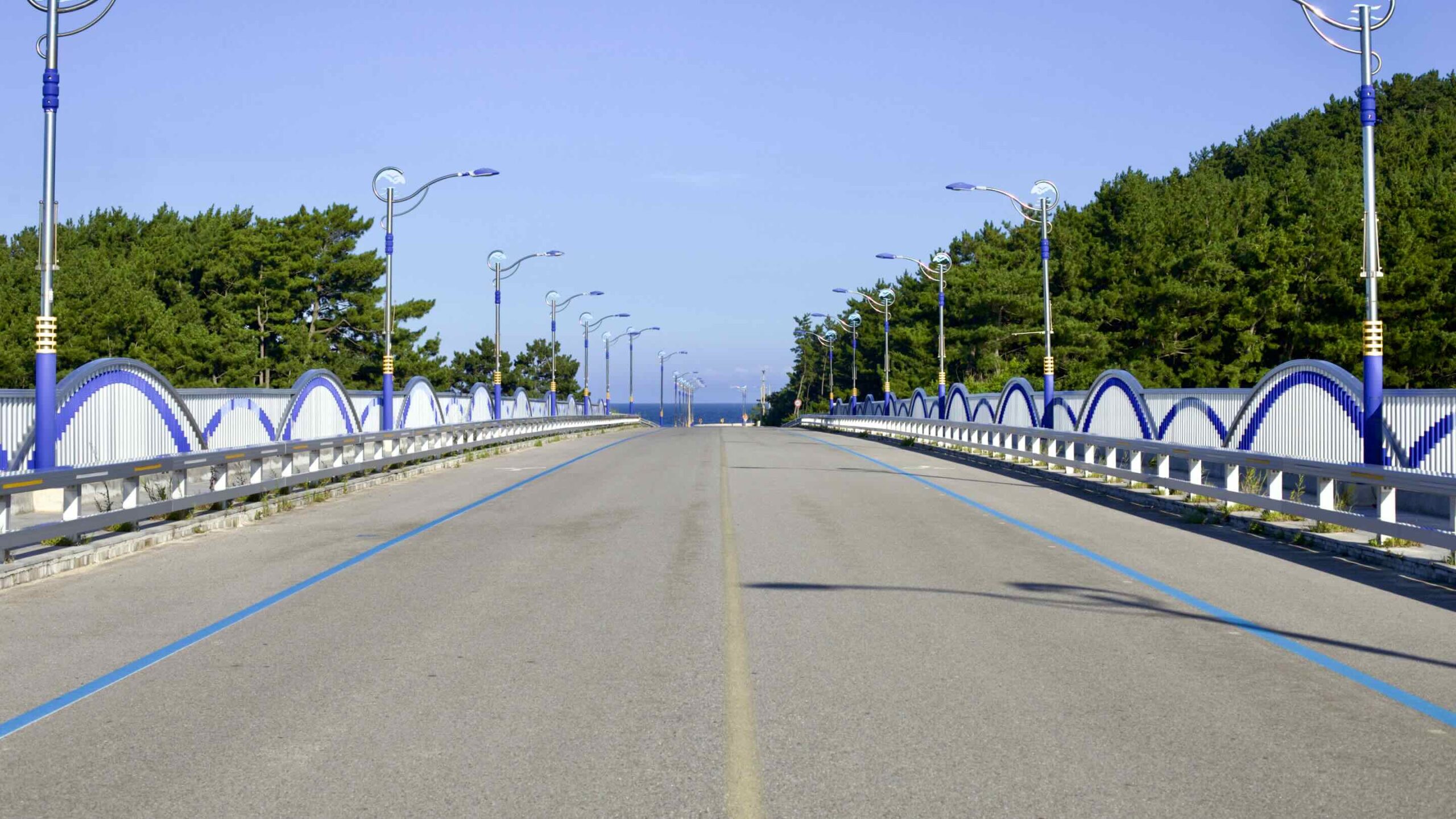
Cycle around a bend and hop over Namdae Stream (남대천; map) on Wolsong Pavilion Bridge (월송정교; map).
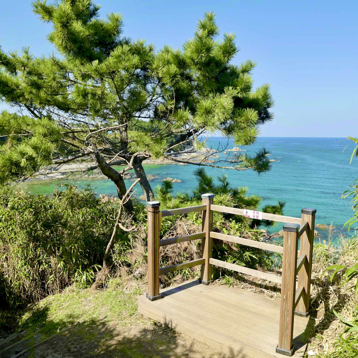
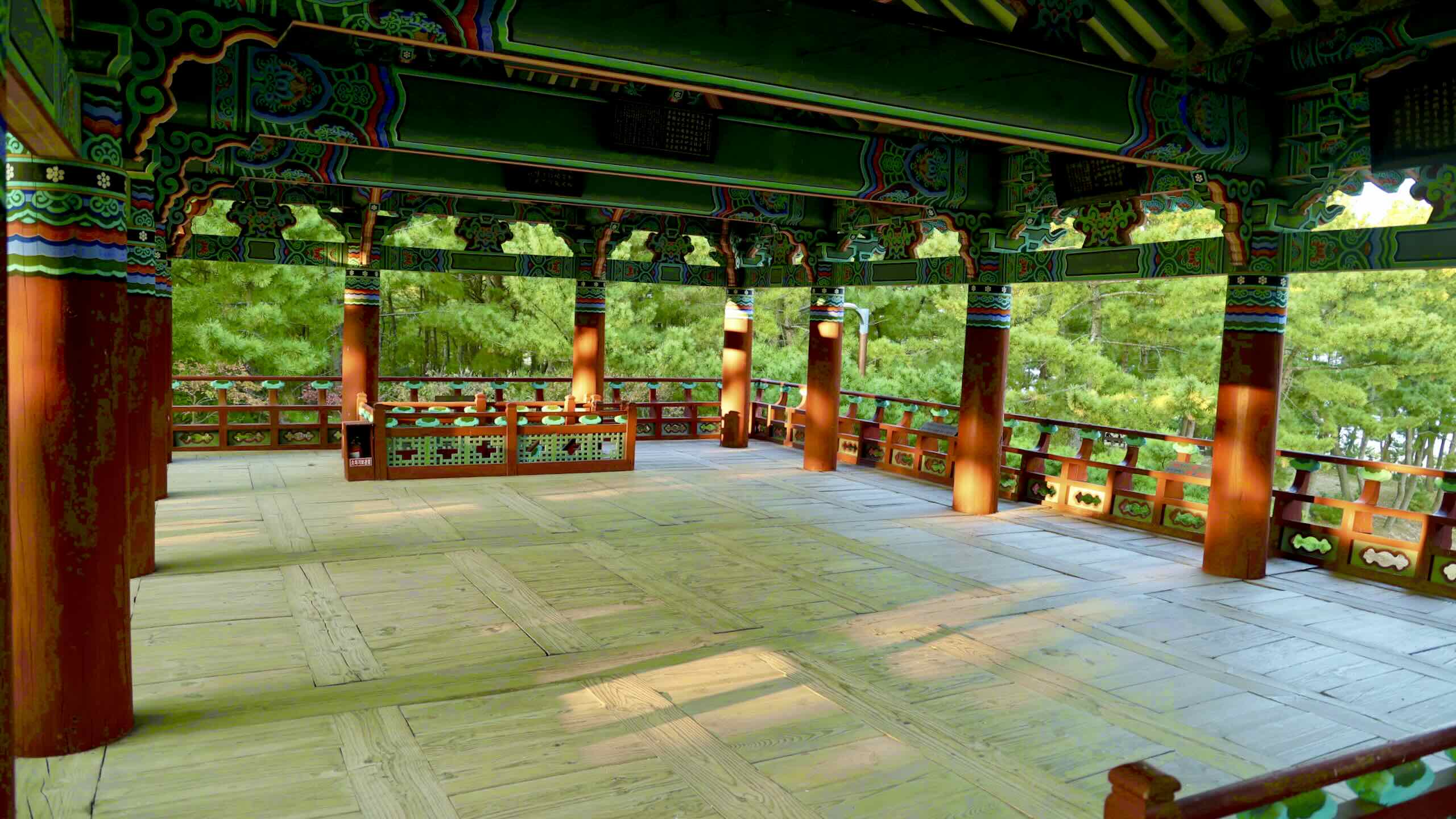
Wolsong Pavilion (Wolsongjeong; 월송정; map) was first built in 1326 during the Goryeo Dynasty. It rests in a forest with over 10,000 pine trees overlooking the white sands of Gusan Beach and the East Sea.
“Wol” (월) translates to “moon.” Folklore says that the Kingdom of Silla’s four ancient explorers (신라사선) once played in the moonlight beneath the pines.
Others believe “Wol” (월) refers to Wolguk, a region in China. Legend tells that those same explorers (신라사선) planted pine seedlings taken from Wolguk.
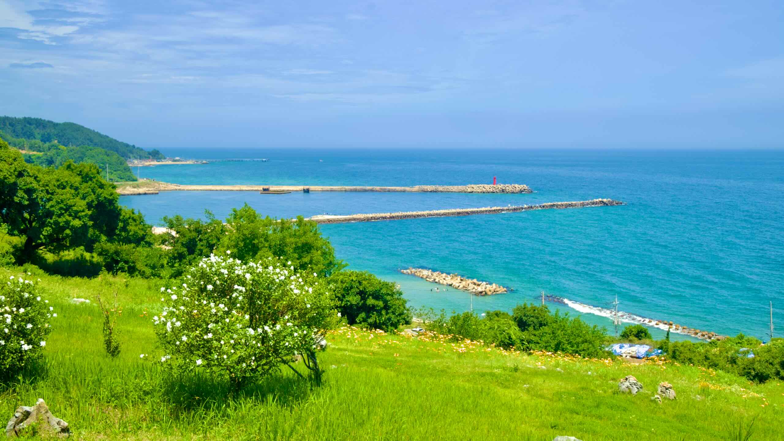
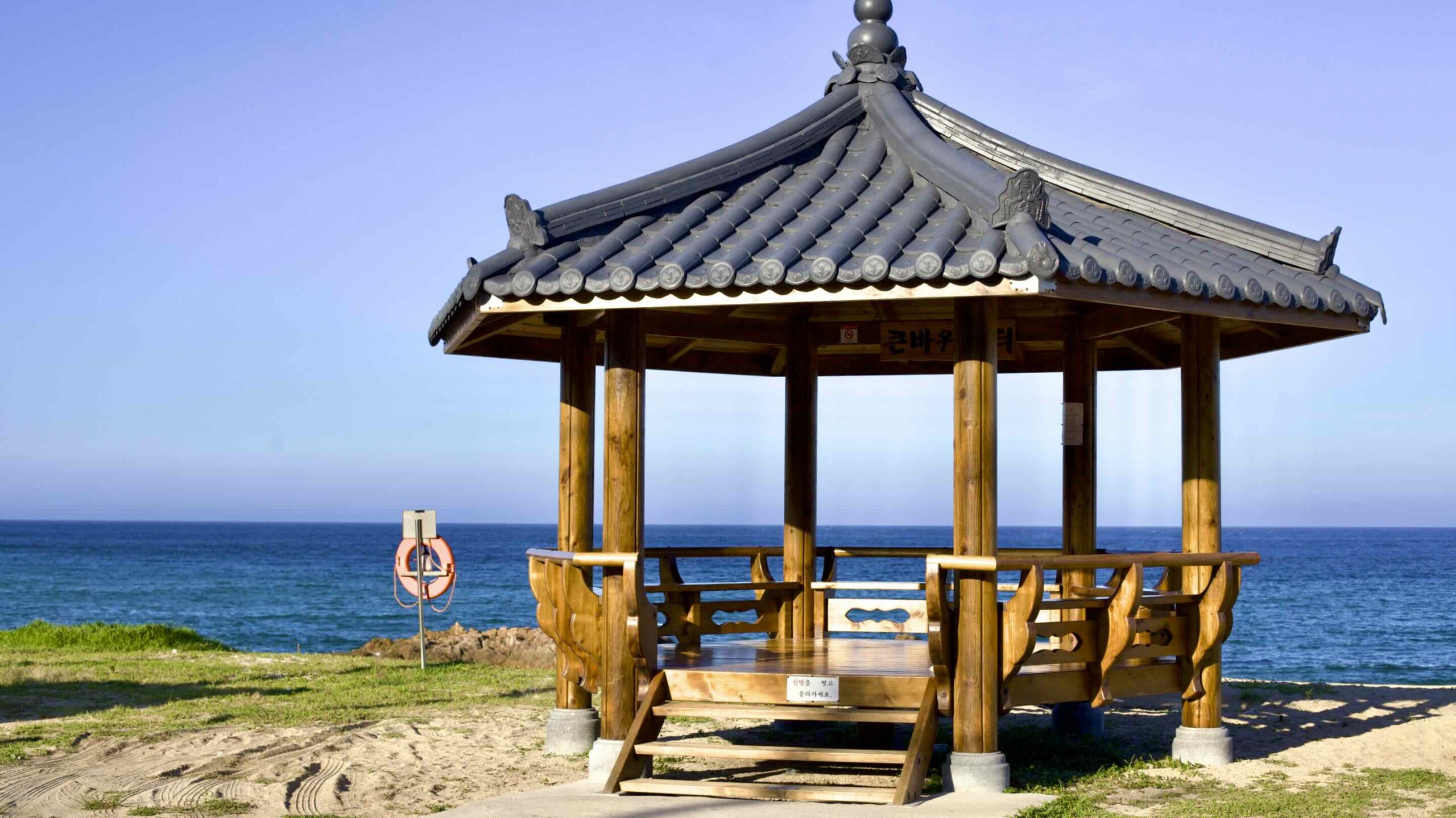
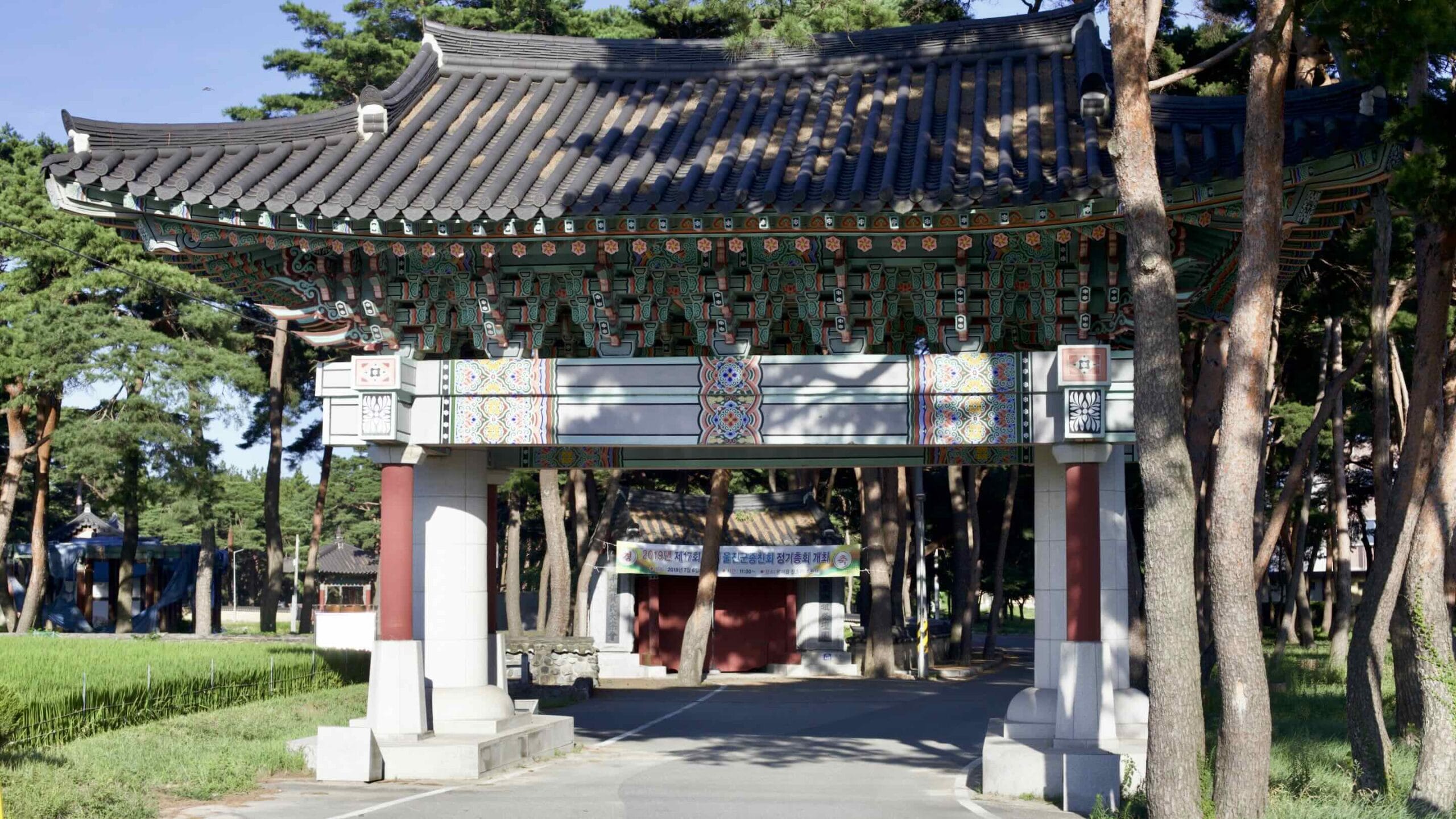
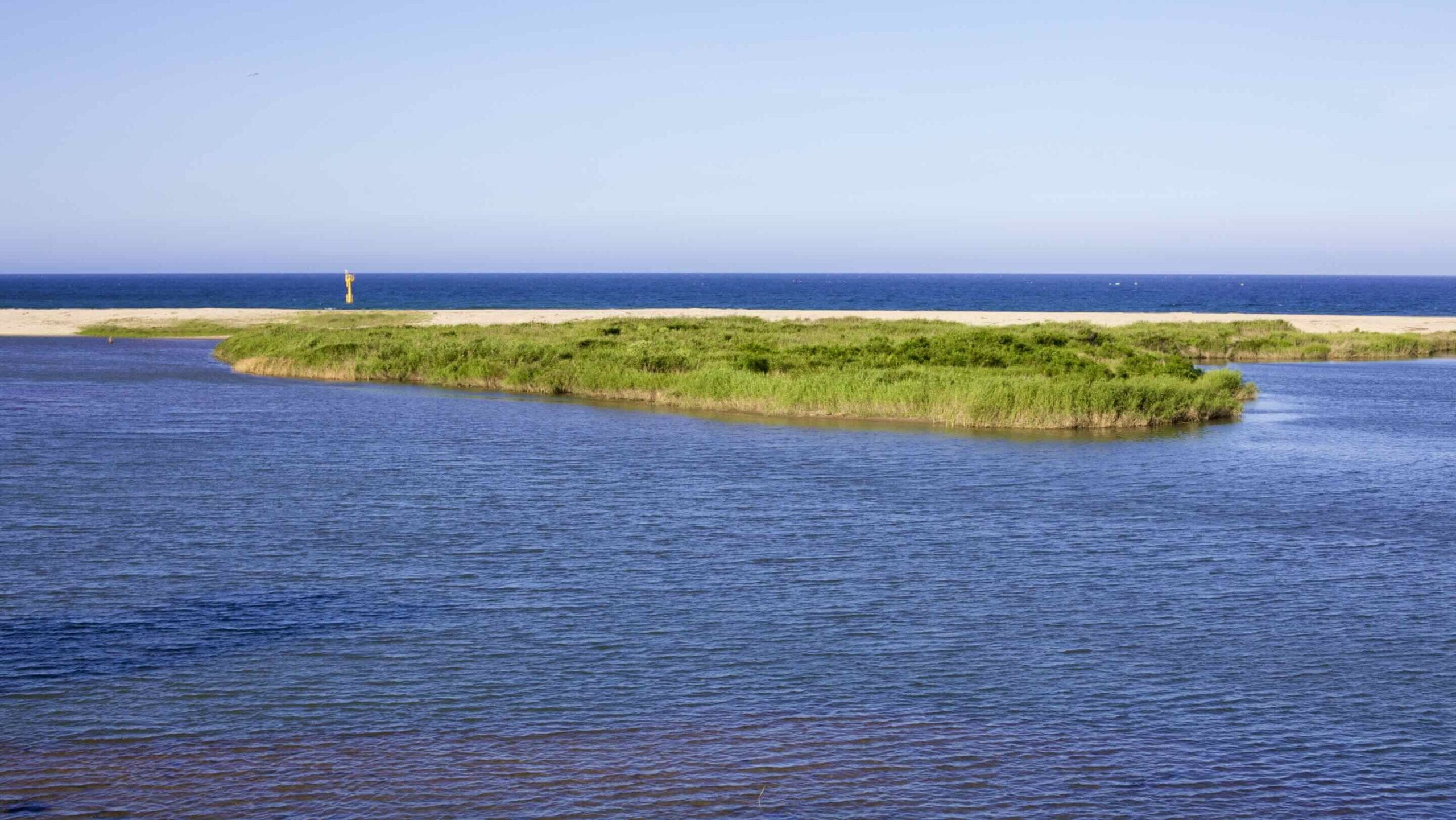
Leave Wolsong Pavilion’s entrance gate, head back to the coast, and arrive at Gusan Beach (구산해수욕장; map). The popular 400-meter long beach contains a paid campsite with tents and caravans tucked away in its bordering pine forest.
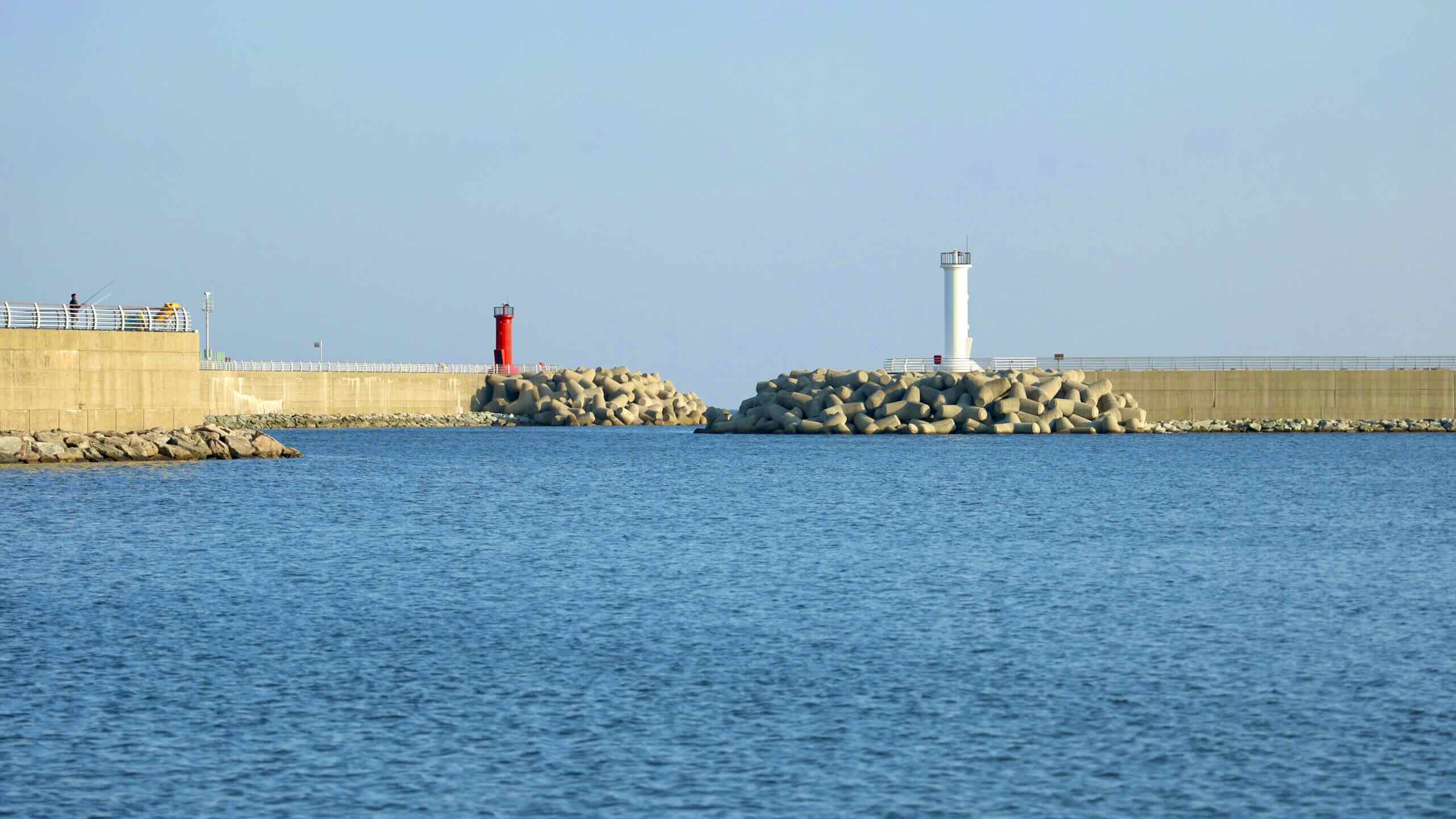
North of the beach sits the two large breakwaters that form Gusan Port (구산항; map). Famous for octopus, squid, and flounder, the port also features a few tourist amenities:
Gusan Seafood Experience Center (구산수산물위판체험장; map) is a concrete building with fish tanks and a walk-up observatory next to the park.
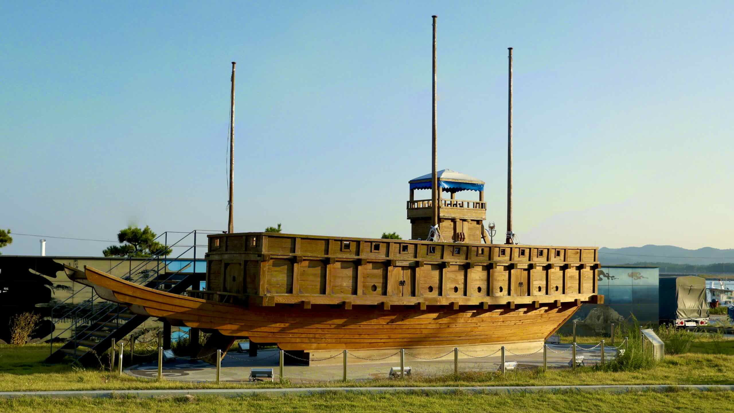
A small park (road view) beside the port holds model sculptures of Ulleungdo and Dokdo Islands, which lie hundreds of kilometers out in the East Sea, and a scale model panokseon (판옥선), a ship from the Joseon Dynasty (1392 ~ 1897).
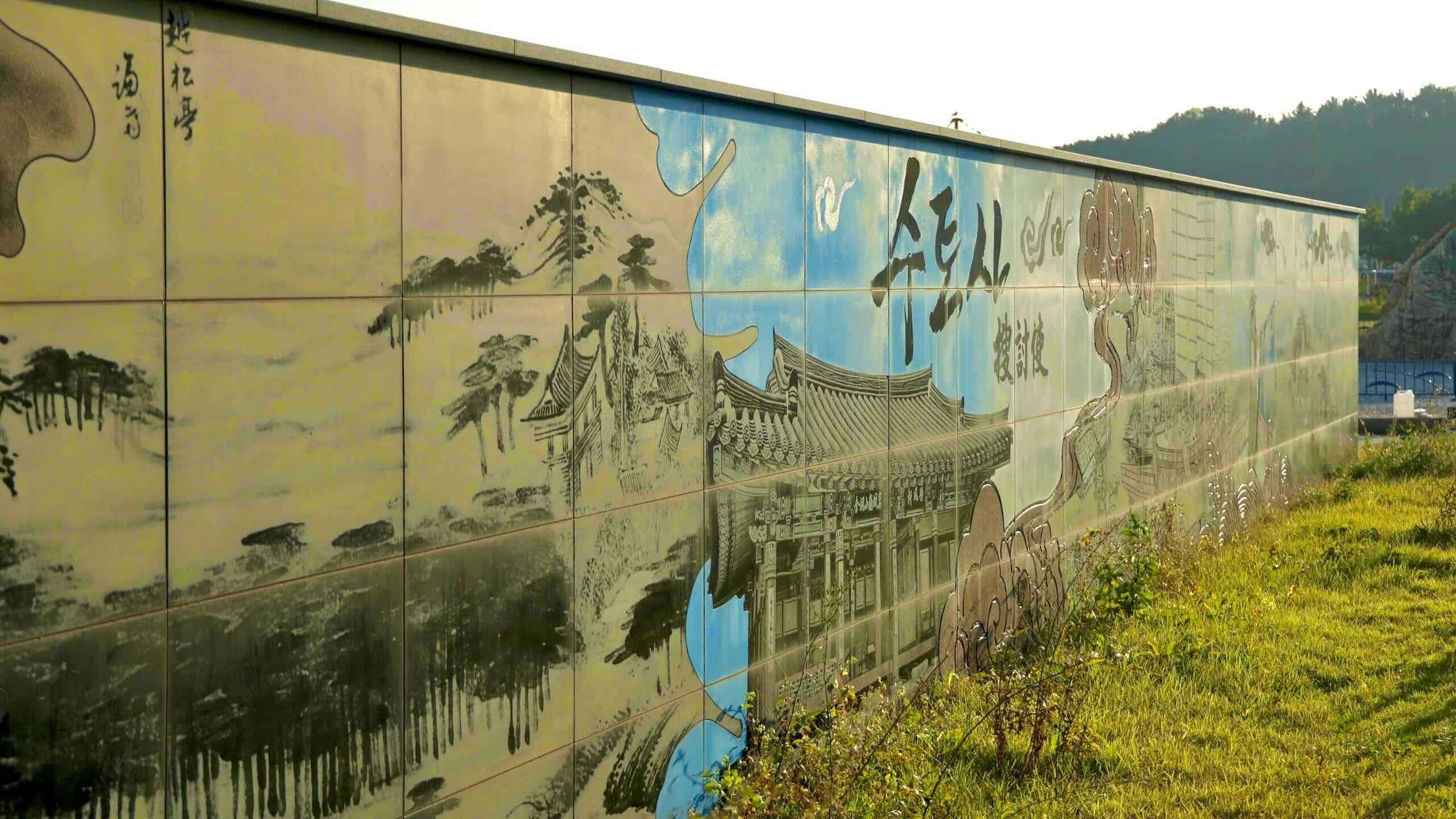
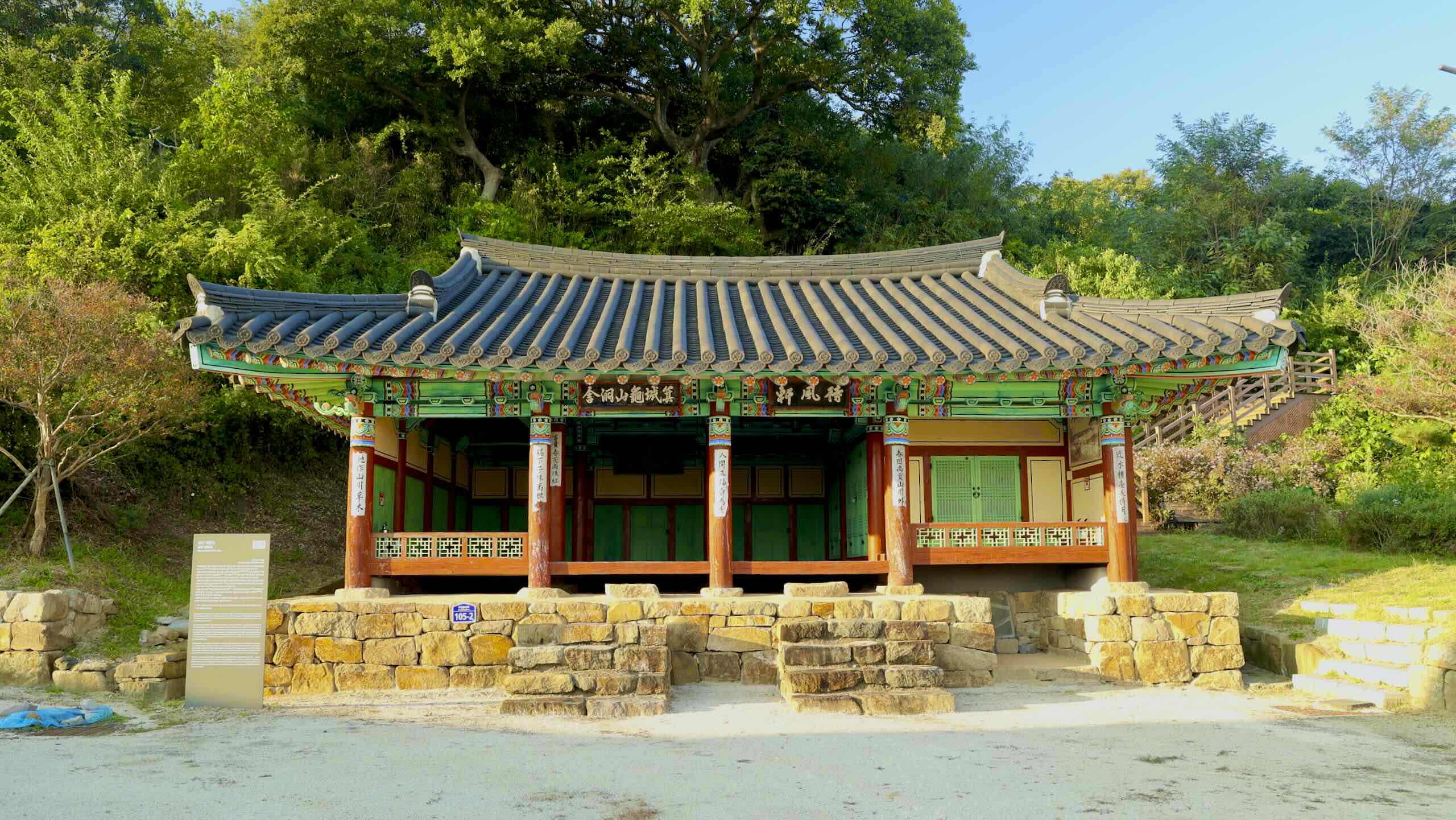
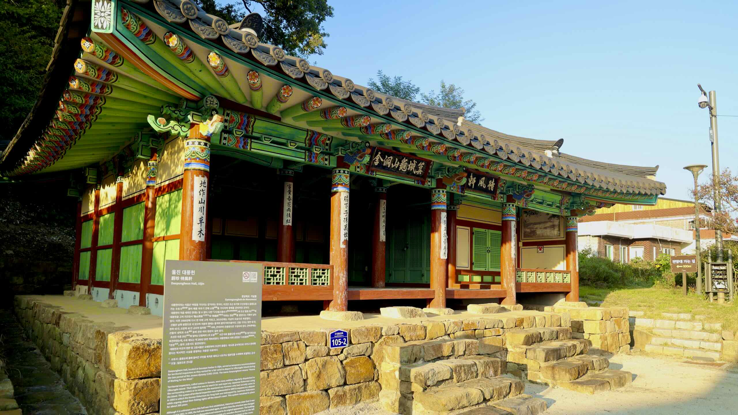
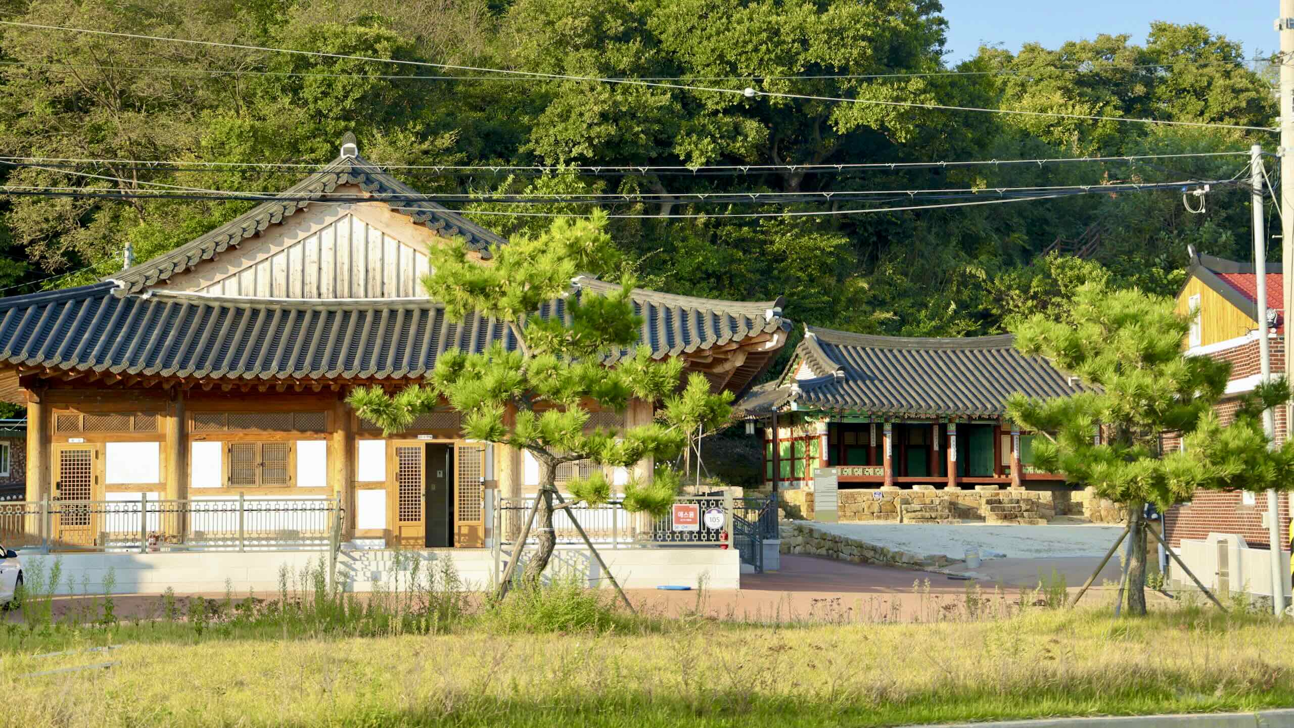
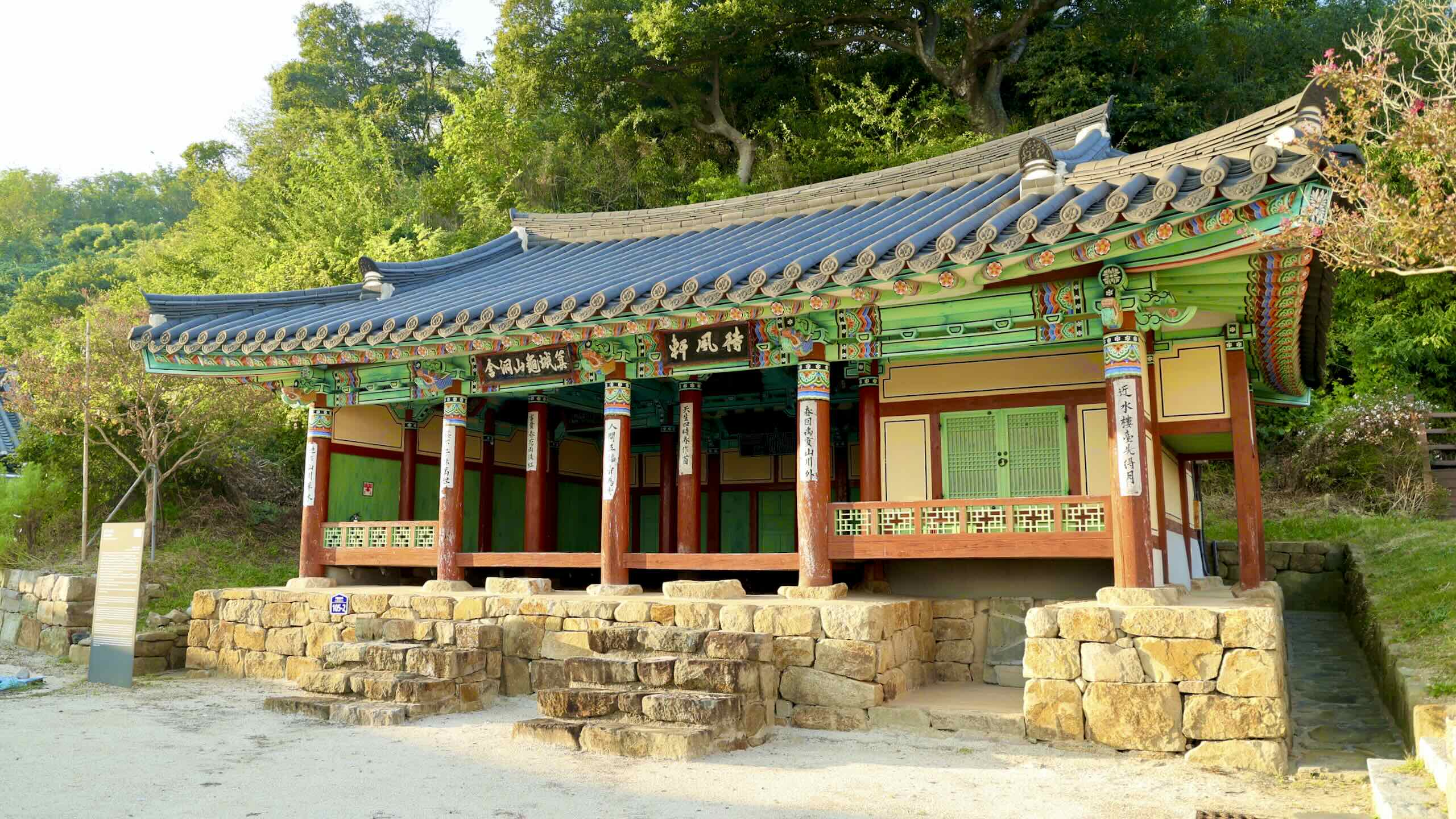
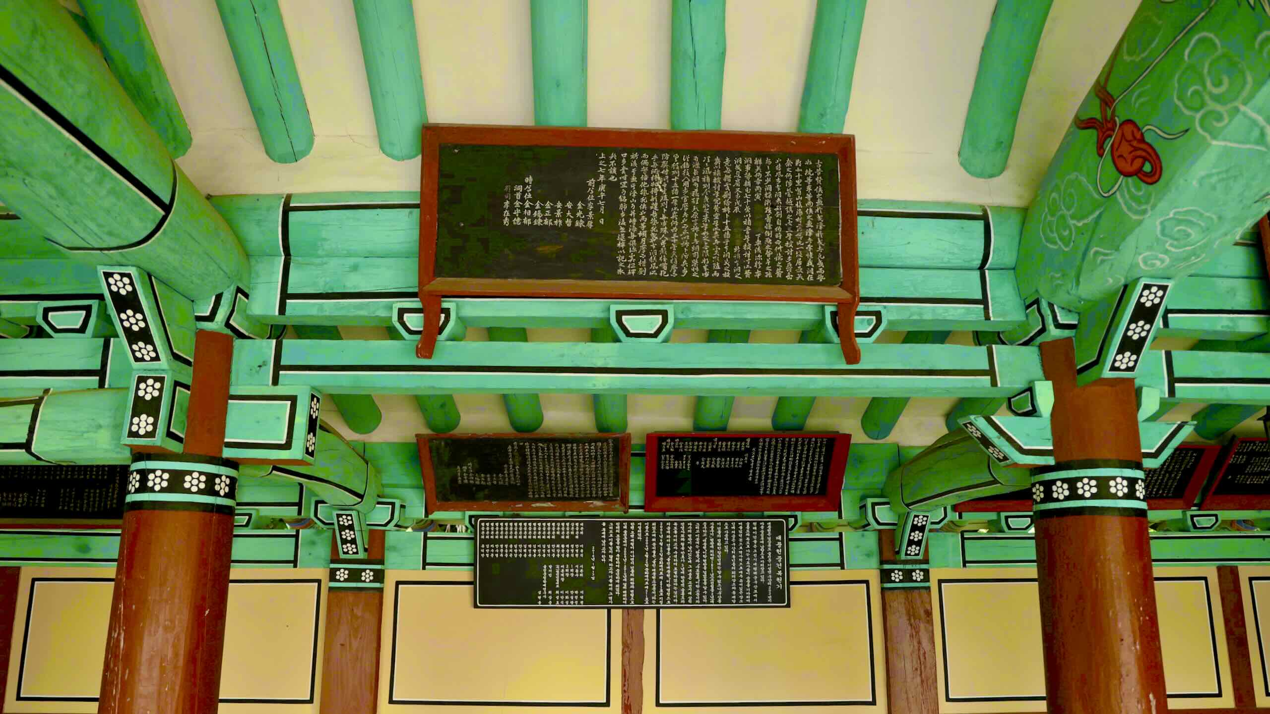
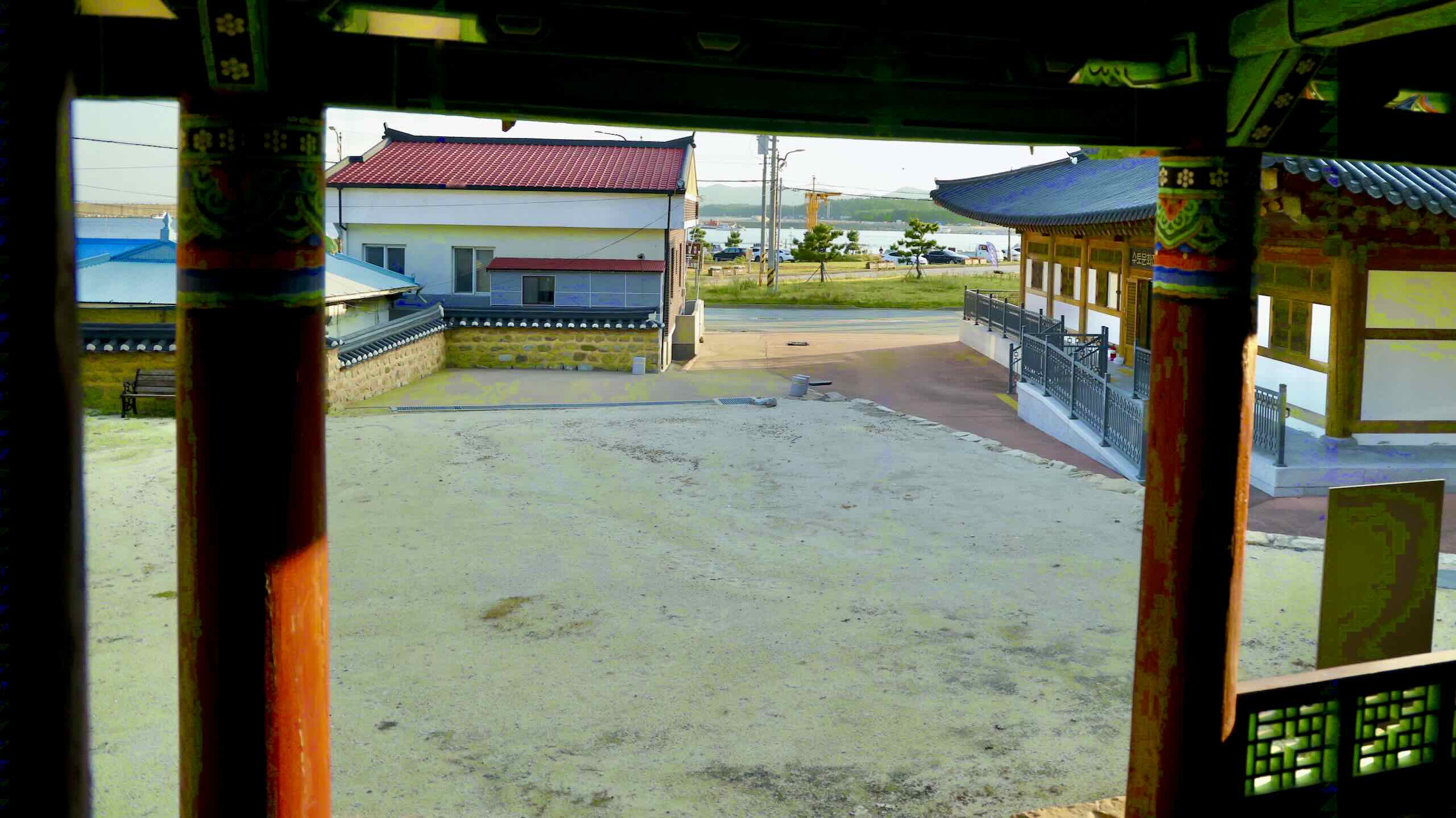
Daepung Pavilion (Daepungheon; 대풍헌; map) hides behind houses in Gusan Port. No one knows the exact date of its completion, but records show builders repaired the pavilion in 1851 during the Joseon Dynasty.
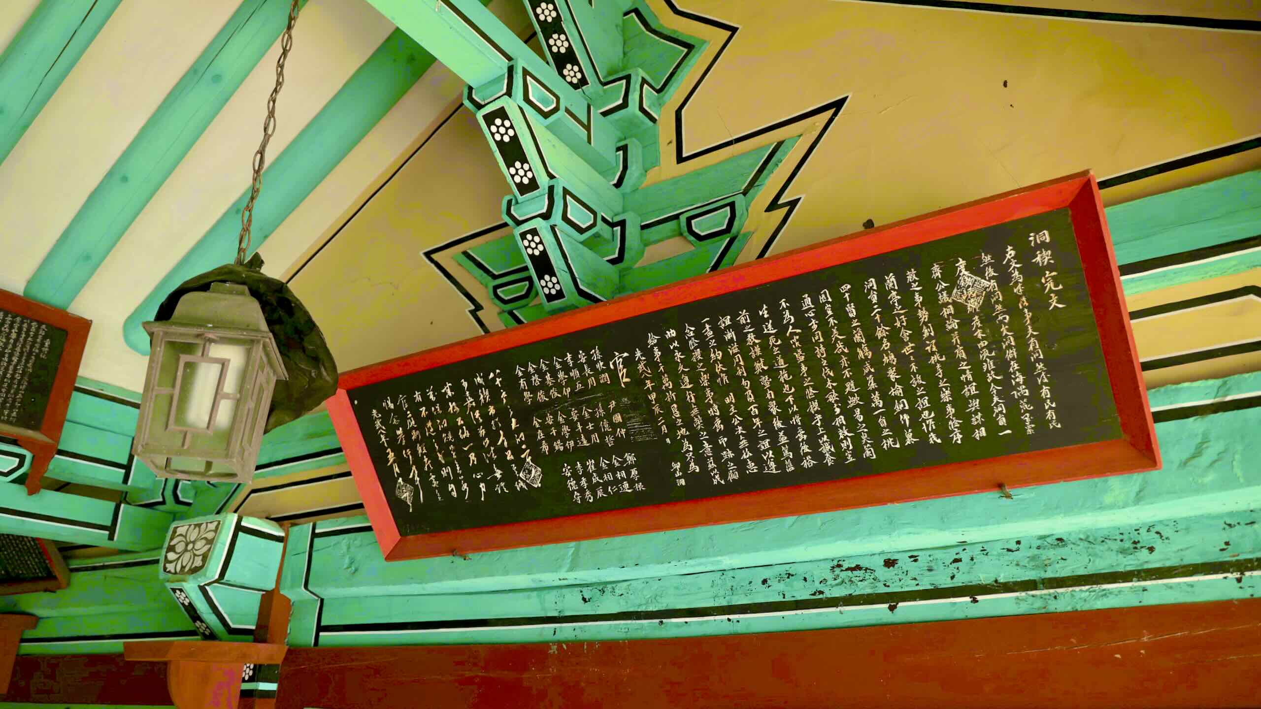
The signboard hanging in its rafters is the most important aspect of Daepung Pavilion. The ancient plaque describes how Joseon officials waited at this pavilion in Gusan Port for winds to pick up and carry them across the sea to the distant Ulleung Island (울릉도; map) and Dokdo Island (독도; map).
For hundreds of years, Japan and Korea have claimed Dokdo Island and its surrounding waters as theirs. Because wars and imperialistic occupation on the Korean peninsula destroyed many ancient records, Daepung Pavilion’s signboard is one of the few historic artifacts that proves Korea has governed Ulleungdo and Dokdo for centuries.