Want to travel the Cross-Country and East Coast Routes back-to-back? Easy. Sort of… Let’s map out the route.
The Cross-Country Route travels between Incheon City in the northwest and Busan City on Korea’s southeastern tip.
The Gyeongbuk and Gangwon Bike Paths form the East Coast Route. They run from Korea’s lower third to the DMZ. However, cyclists can navigate a series of coastal roads from Busan north to the bottom end of the Gyeongbuk Bike Path in Yeongdeok County.
So Busan City can act as a pivot point, allowing adventurous folks to string together two of Korea’s best cycling backdrops.
Give me the details!
Sure. Let’s break it down in two directions.
Cross-Country Route First
To begin your epic journey, take the Airport Express (AREX) or an intercity bus to the Ara West Sea Lock (map), the first stamp booth on Ara Bike Path and Cross-Country Route.
(Learn how to get to the Cross-Country start line here.)
Pick up a Bike Passport from the nearby management center, open from 9:30 AM to 5:30 PM (map). (There are no Bike Passport stores on the East Coast Route.)
Now cycle 633 kilometers south to Busan (directions).
(Remember, you don’t need the Chungju Dam or Andong Dam Certification Centers stamps for the Cross-Country Certification. They lie at the bottom of major detours.)
Here comes the tricky part.
Busan covers a large swath of land. The end of the Cross-Country Route, the Nakdonggang Estuary Bank Certification Center (map), sits on the western edge of the city. My recommended start line for the East Coast Bike Path, Igidae Park (map), sits on the eastern edge of the city.
If you were to cycle this gap, because of congested city streets, it’ll take close to two hours to travel 25 kilometers (directions).
If it’s the weekend or public holiday, I recommend hopping on a subway (directions).
- From Hadan Station (map), near the Nakdonggang Estuary Bank, travel Line 1 for 17 stops.
- Transfer to Line 2 at Seomyeon Station (map).
- Ride 7 stops and get off at Kyungsung Univ./Pukyong Nat’l Univ. Station (map).
- Now cycle 2.7 kilometers to the tip of Igidae Park (directions).
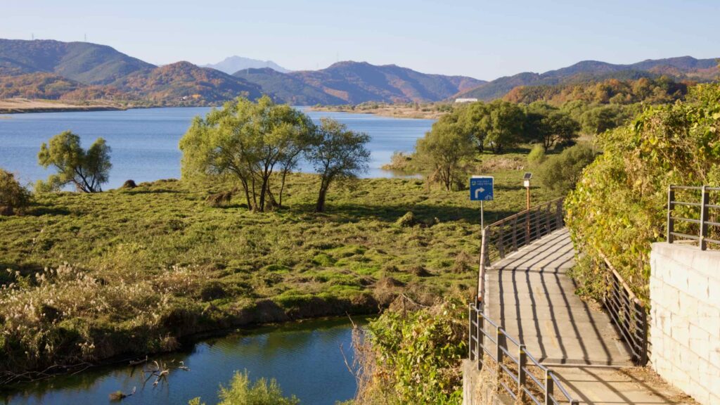
From Igidae Park (map), cycle through Busan and up the East Coast for 247 kilometers (directions) until you reach the Sunrise Park Certification Center (map), the first stamp booth on the Gyeongbuk Bike Path in Yeongdeok County.
(Read more here about this bottom section of the east coast bike paths.)
Cycle the 4.8-kilometer gap (directions) between Gyeongbuk and Gangwon Bike Path and end at the Unification Observatory Certification Center (map).
This final stamp booth on the East Coast Route doesn’t sit near the Unification Observatory (map). It perches 2.7 kilometers down the road at a rest stop.
It’s not possible to cycle to the actual Unification Observatory, which offers a view over the DMZ into North Korea. Military guards don’t allow cyclists or civilian cars down the access road. You’ll need to catch a bus or taxi to visit.
From the Unification Observatory stamp booth, cycle to the Daejin Bus Terminal (map) a 3.8 kilometers south (directions). You will have passed it earlier.
Thirteen buses depart daily from the Daejin Bus Terminal for Dong (East) Seoul Bus Terminal (map). Of those, five offer non-stop service. Here is a timetable.
East Coast Route First
To begin your epic East Coast Route then Cross-Country Route journey, catch one of four daily intercity buses from Dong (East) Seoul Bus Terminal to the Daejin Bus Terminal at the top of the Gangwon Bicycle Path. Here is a timetable.
(Remember, none of the East Coast Route’s Certification Centers sell Bike Passports. You’ll need to visit a Staffed Certification Center. Your best Bike Passport pickup spot? The Ara West Sea Lock, the start of the Cross-Country Route Path in Incheon.)
Once you reach Daejin Town in Goesang County, get off the bus and cycle 3.8 kilometers up to the Unification Observatory Certification Center (map; directions) and grab the first stamp on the Gangwon Bicycle Path.
(Remember, the actual Unification Observatory, which looks into North Korea, sits down a 2.7 kilometer road. The road is closed to cyclists and citizen drivers. It’s only possible to visit via taxi or tour bus.)
From the first stamp booth, cycle south to the end of the Gangwon Bicycle Path in Samcheok City. Then shoot through a 4.8-kilometer gap onto the Gyeongbuk Bike Path in Uljin County.
The official East Coast Route ends at the Gyeongbuk Bike Path’s finish line at the bottom of Yeongdeok County. Nevermind. Continue south along coastal roads until you reach Busan 247 kilometers later (directions).
(Read more here about this lower section of Korea’s east coast.)
In Busan, land at Haeundae Beach (map). Cycle by Centum City (map), Gwangalli Beach (map), and finish at Igidae Park (map; directions) overlooking Gwangan Bridge (map).
Now, let’s hop over to the Cross-Country Route.
One issue. Its start line, the Nakdonggang Estuary Bank Certification Center (map) lies down 25 kilometers of crowded, unappealing city streets. And, depending on traffic, it’ll take up to two hours to slog through it (directions).
So, if it’s the weekend or holiday, I recommend taking your bike on the subway.
- Cycle 2.7 kilometers from Igidae Park to Kyungsung Univ./Pukyong Nat’l Univ. Station (map; directions).
- Travel Line 2 to Seomyeon Station (map; 7 stops).
- Transfer to Line 1. Ride 17 stops. Get off at Hadan Station (map)
- Cycle 2 kilometers to the Nakdonggang Estuary Bank stamp booth (directions).
From Busan, complete the 633-kilometer Cross-Country Route north to Incheon (directions).
(Remember, you don’t need the Andong Dam or Chungju Dam Certification Centers stamps for the Cross-Country Certification. They each lie down epic detours.)
Grab the final stamp at the Ara West Sea Lock then head inside the nearby management building, open from 9:30 AM to 5:30 PM (map). A friendly worker will certify your Bike Passport’s stamps.
Is it the weekend or holiday? Cycle 8.4 kilometers back down the Ara Bike Path to Geomam Station (map). Catch the Airport Express (AREX) eastward to visit Seoul, or westward to go to Incheon International Airport.(Read more here about transportation to and from the Ara Bike Path.)