Cycle along natural wonders and interesting landmarks on the bottom of Jeju Island.
The Jeju Fantasy Bicycle Path’s second of three legs starts in Daejeong Town (대정읍; map) in Seogwipo City (서귀포시; map). Climb over a rolling hill and land in the Jungmun Tourist Complex, filled with tourist highlights. Then skirts along the island’s south coast until you land in Pyoseon Village (표선면; map).
Meet a few rocky wonders before embarking on the most challenging climb along the Jeju Fantasy Bike Path. After the ascent, roll down into one of the island’s tourist epicenters.
Well rested from your first leg of the Jeju Fantasy Bike Path? Good. Let’s keep it rolling.
From Songaksan Certification Center (송악산 인증센터; map), ride along the coast past along Hyeongjehaean Road (형제해안로; map; Brother’s Coast Road) by coffee shops (map), accommodations (map), and restaurants (map).
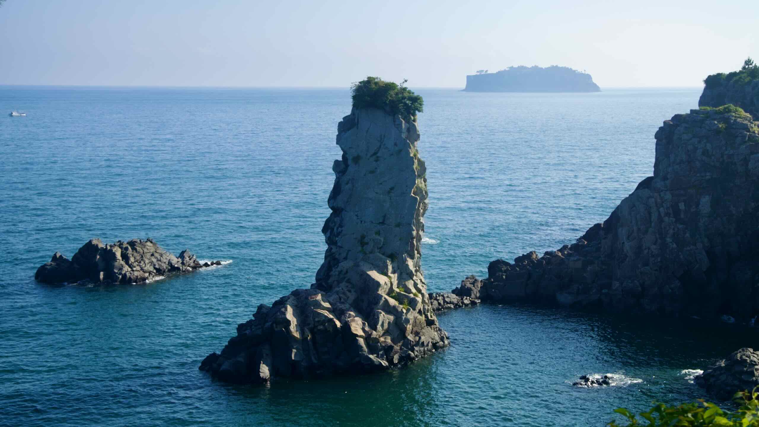
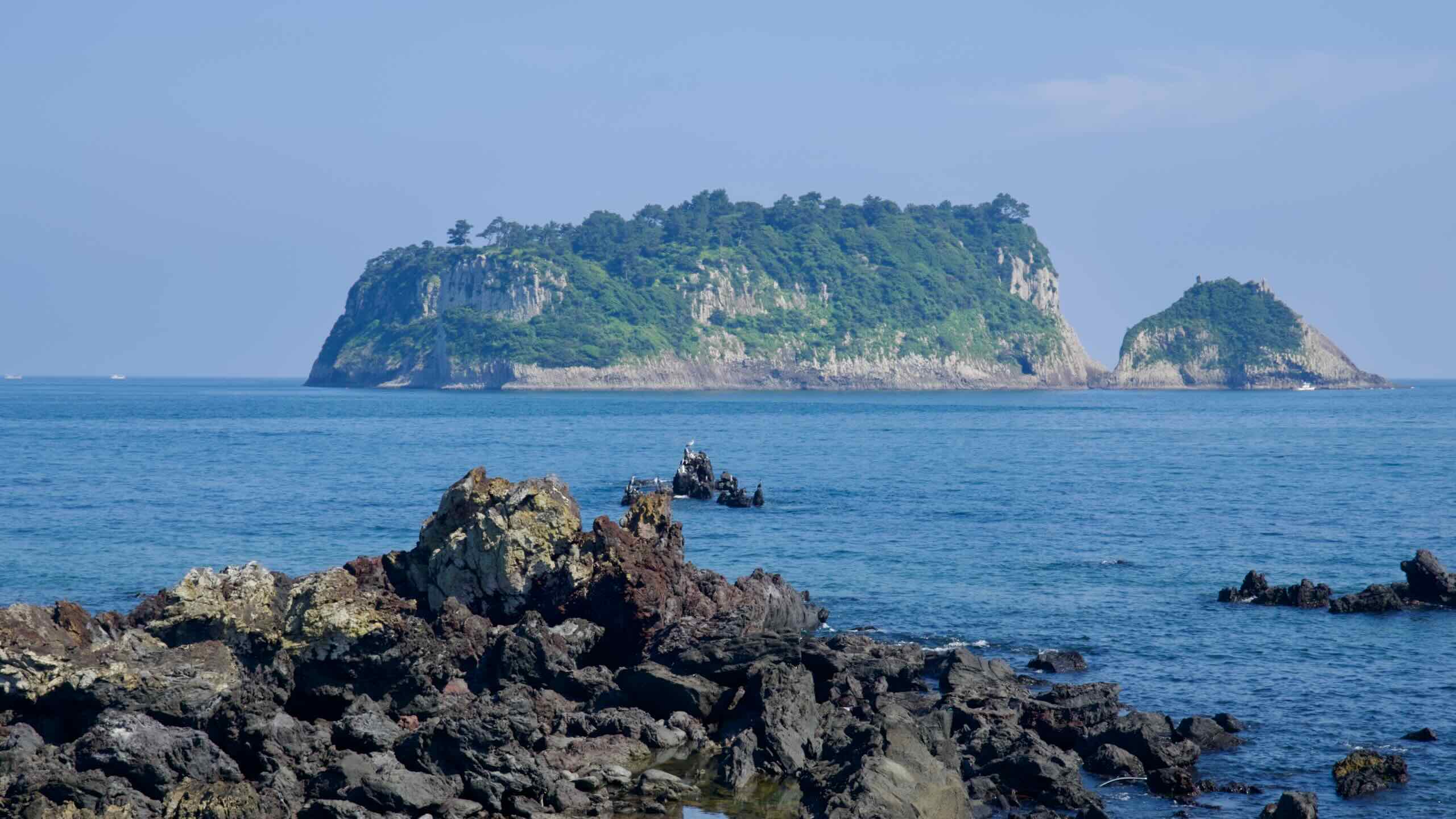
Why the name “Brother’s Coast”? Look into the waters and find Hyeongje Islets (형제섬; map Brothers’ Island).
These two uninhabited rocky islets just off Jeju’s southern coast resemble two brothers—one low and wide (Bonseom), the other taller (Otseom). Though, depending on the tide and vantage point, submerged reefs and smaller formations may appear, adding a few more islets to the island family.
The surrounding waters are renowned for fishing and seascapes. Divers can explore submerged arches and dense marine life of seagrass, soft corals, and schools of fish like tang and chromis. On land, many photographers flock to the coast to catch the sun setting between the brother islets.
Sagye Coastline
This stretch along Jeju’s southwestern shoreline is also called the Sagye Coastline, because it runs between Sagye Port and Hwasun Port (outside of the cycling route), passing Sagye Beach along the way.
Sagye Port (사계항; map) is a compact fishing harbor that serves as a practical waypoint for nearby boat tours and seafood vendors.
Sagye Beach (사계해변; map) is a lava rock-lined beach with patchy sand and strong wind. Not ideal for swimming, but its backdrop of Sanbang Mountain and open ocean offer a great setting for seafood (map) restaurants and seaside parks (map).
Hwasun Port (화순항; map), which the Jeju Fantasy Bike Path does not cross, is a quiet working port surrounded by green farmland and basalt seawalls. Without much tourist infrastructure, it gives a snapshot of Jeju’s coastal fishing life.
Hwasun Golden Sand Beach (화순 금모래 해변; map) rests beside Hwasun Port. Despite its name, the beach features smooth black sand and a freshwater pool, fed by cool spring water, popular with families for its shallow depth and kid-friendly features.
After traveling this windswept coastline past Sagye Beach, flow through Sagye Port and find a small lookout at its far end (map)
Yongmeori Coast, seated at the base of Sanbang Mountain, is known for its dramatic sandstone cliffs, tidal pools, and historical significance. Its name, meaning “Dragon’s Head Coast,” derives from its resemblance to a dragon extending its head into the sea.
The coast’s formations are the result of millions of years of geological activity, including underwater volcanic eruptions and subsequent erosion, resulting in features such as parallel strata, tafoni (honeycomb weathering patterns), and sea caves.
Yongmeori is a UNESCO Global Geopark, one of Jeju’s oldest volcanic formations, and also a window into the island’s geological evolution.
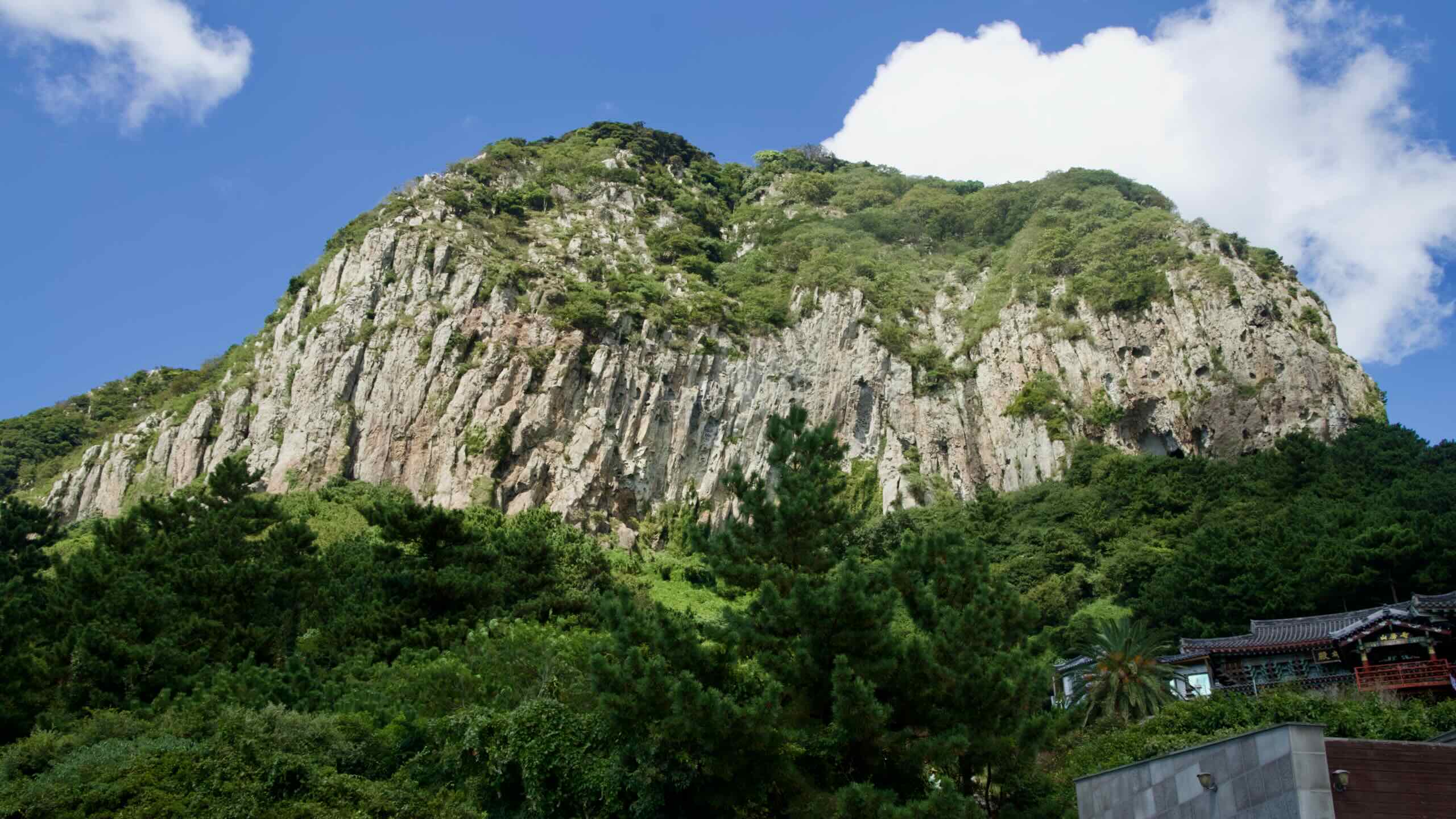
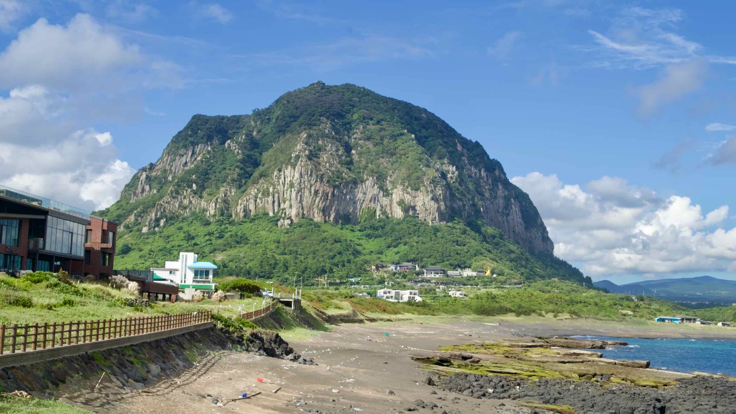
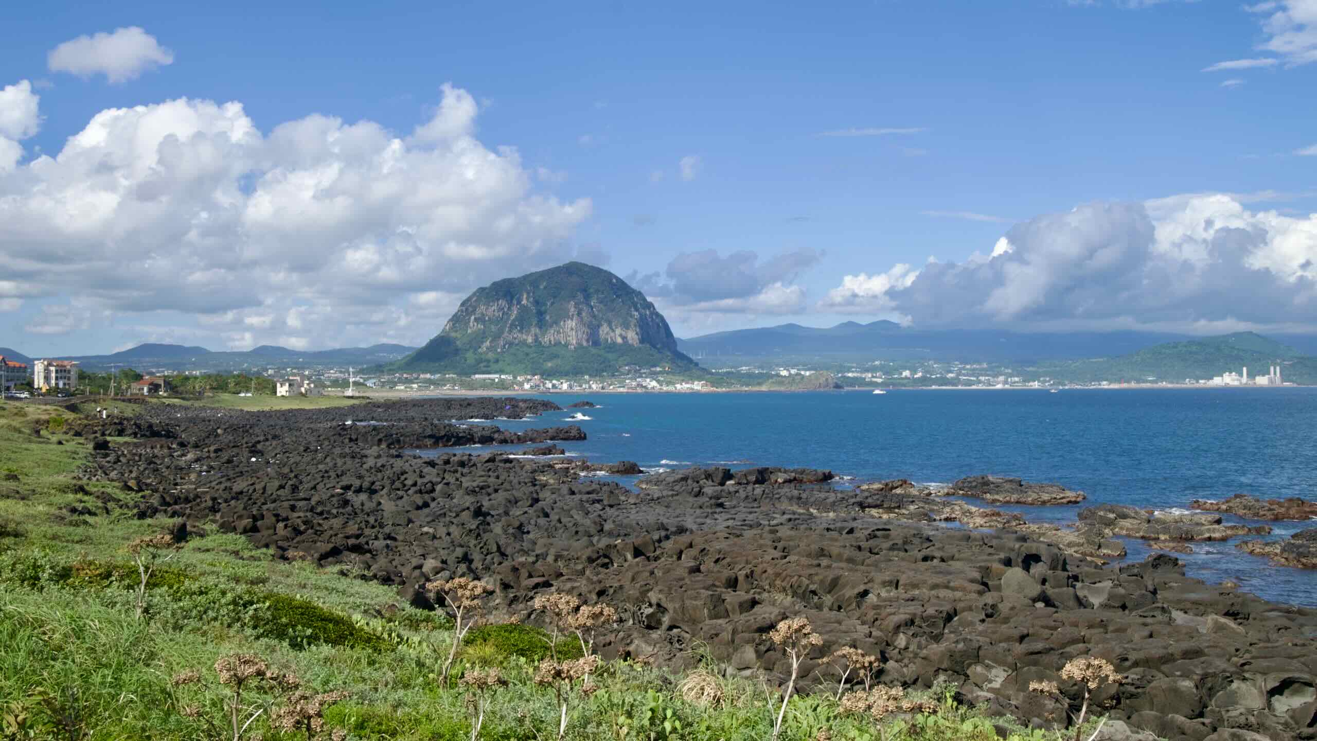
Now from Sagye Port’ s lookout point, glance up at the towering sheer mountain with sheer rock walls. Say hello to Sanbang Mountain, one of Jeju Island’s most striking natural peaks.
Standing 395 meters tall, this dome-shaped volcanic mountain stands out against the flat surrounding landscape. Formed approximately 80,000 years ago during ancient volcanic activity, Sanbang Mountain is unique for its lack of a summit crater, distinguishing it from other volcanic formations on the island.
The mountain’s name, meaning “mountain with a cave,” reflects its defining feature: Sanbanggulsa (산방굴사; map), a natural grotto that hosts a temple.
The Sanbang Mountain Pass (directions) begins near the bottom of Sagye Port. It features a 54-meter climb over 1.9 kilometers with a 2.84% gradient.
Cycle up through quaint but busy towns on city streets, passing accommodations (map) and eateries (map).
Sanbanggulsa & Bomunsa Temples
As Sanbang Mountain grows closer, notice a large gold buddha statue and temple perched at the base of the sheer cliffs. That’s Bomunsa Temple (보문사; map), which many believe dates back centuries. It features pavilions and statues depicting famed Buddhist legends.
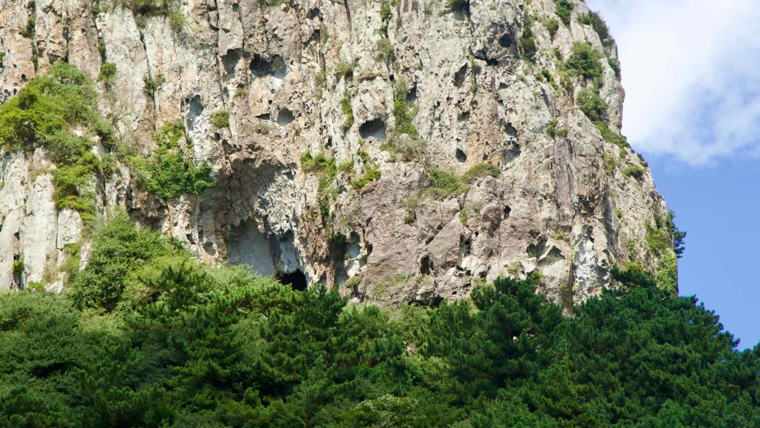
Veer 400 meters off the Sanbang Mountain Pass climb (directions) and then climb a short but steep stairway and come to Sanbanggulsa—literally “Mountain Cave Temple”—a small, cave-set Buddhist shrine offering a blend of legend, nature, and quiet reverence.
The cave, about five meters tall, houses a seated statue of the Historical Buddha, said to date back to the Goryeo dynasty, with water droplets falling from the ceiling into small rock pools below—a mystical sight tied to local folklore.
Sanbangsan Canola Flower Fields
Continue on up the Sanbang Mountain Pass. Hit the top of Sagye Port’s town and turn left on another vehicle road with a bike-lane shoulder (road view), rounding the base of Sanbang Mountain.
If you’re cycling in late March or April, the fields surrounding the mountain should be swelling with yellow. Lining the mountain’s foot, find Sanbang Mountain Canola Flower Fields (산방산유채꽃밭; map). These open-air agricultural fields have become popular stops for photographers and tourists.
As you round the mountain, take another right at a four-way intersection (road view) and pedal onwards until you meet Iljuseo Road (일주서로; map; road view). This main thoroughfare with protected shoulders and sidewalks for cyclists will carry you over the next climb and drop you in the Jungmun Tourist Complex.
Ride along the bustling Iljuseo Road east along the backside of Sanbang Mountain. In about 2.5 kilometers, the road begins to tilt uphill.
Welcome to the Gunsan Oreum Climb (directions). This extended uphill section rises a total of 111 meters. The ascent takes place over several stages, broken up by the busy intersections along Iljuseo Road. The 5.7-kilometer ascent usually features a gentle but persistent 1.95% gradient.
Gunsan Oreum
The Gunsan Oreum Climb also features the most extended sections away from the coastline. Why?
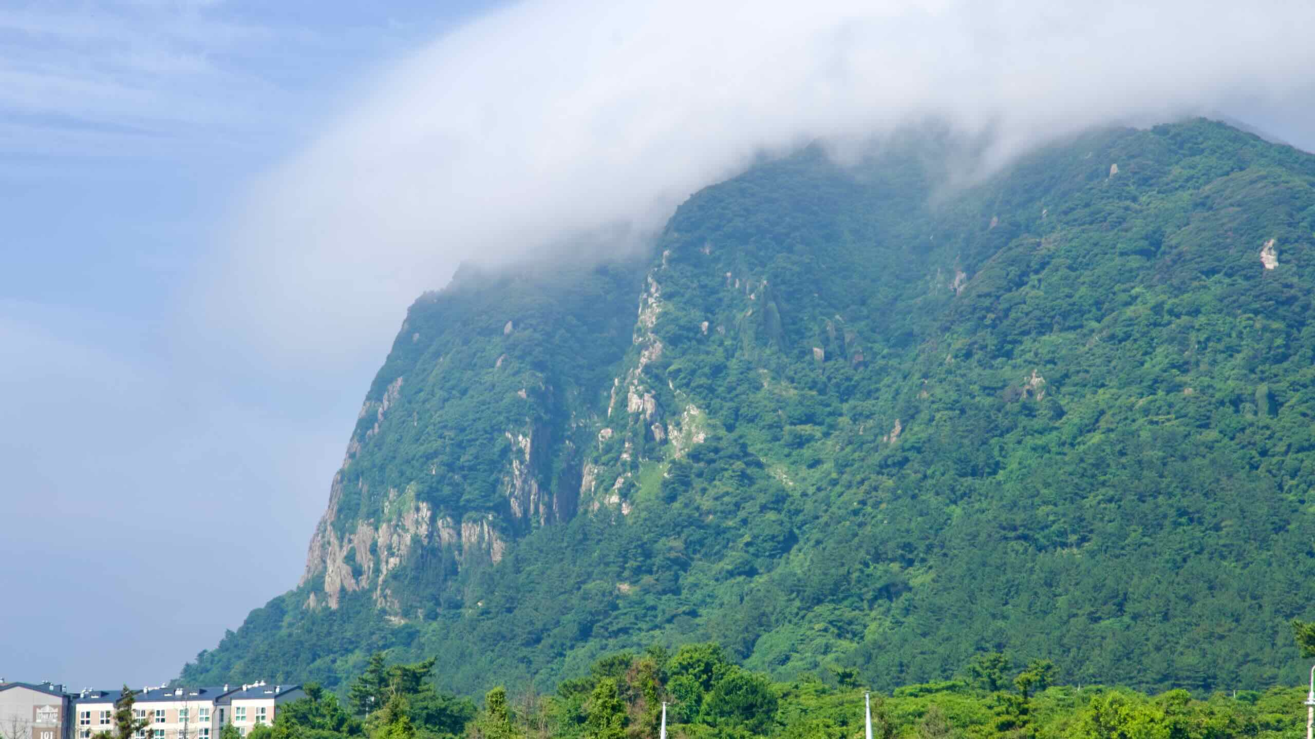
This area of Jeju is littered with volcanic hills like Walla Peak (월라봉; map; Walabong) and the expansive Gunsan Oreum (군산오름; map), the largest parasitic cone on Jeju with a hikable 334-meter peak offering 360° views of Hallasan and Marado.
Ancient geomancy (feng shui) practitioners believed that Gunsan Oreum holds great energy. They believed that burials on Gunsan Oreum’s summit blocked its positive energy and created droughts.
As you cycle onwards and upwards, pass by loads of shops selling Hallabong (한라봉 or dekopon). Born from crossing the Kiyomi orange and Ponkan tangerine, hallabong has been cultivated almost exclusively on Jeju Island since the 1990s, thriving in the island’s volcanic soil and mild, sun-drenched winters.
Hallabong’s name honors Mount Halla—Jeju’s towering volcanic peak—and mirrors the peak’s distinctive rounded form topped with a characteristic “bump.”
Often given during celebrations, hallabong features sweet, juicy flesh, low acidity, few seeds, and an easy-to-peel skin, making it ideal for effortless snacking.
After reaching the top of the Gunsan Oreum Climb, the road tilts and begins descending into one of the tourist hearts of Seogwipo City.
Dip down to a four-way intersection (road view), then flow up a tree-lined side road (road view) along the back side of a golf course and the Grand Joseon Jeju (그랜드조선 제주; map), one of Jeju’s five-star resorts with a lineup of upscale offerings, including six restaurants, a rooftop bar, and indoor and outdoor pools.
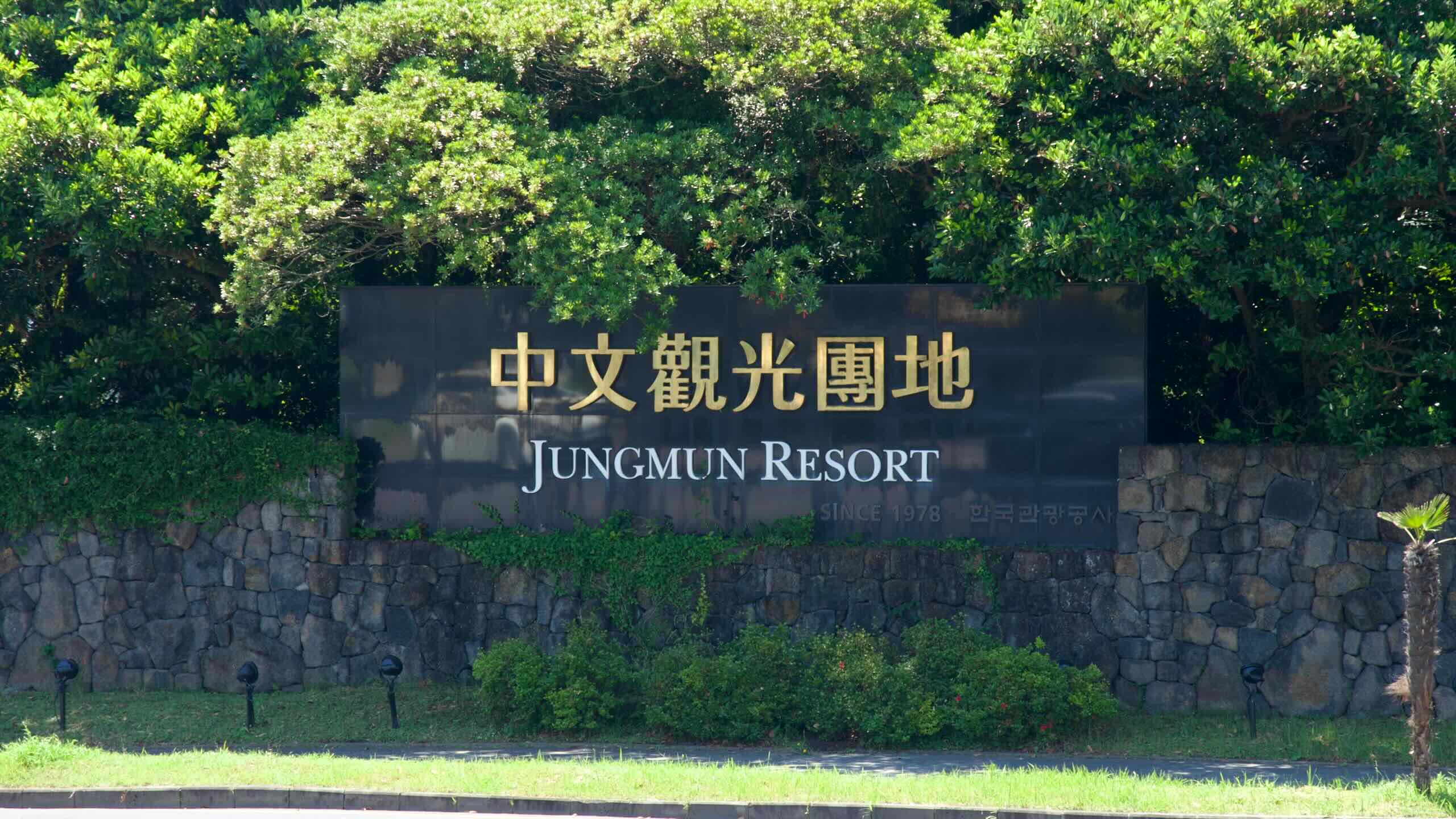
The Jungmun Tourist Complex is Jeju’s most expansive resort district, spanning Jungmun, Saekdal, and Daepo neighborhoods in Seogwipo. Established in the late 1970s as a global tourism hub, it today features luxury hotels like The Suites and Lotte Hotel Jeju, an international convention center, and golf courses.
Let’s take a look at some of the area’s notable attractions.
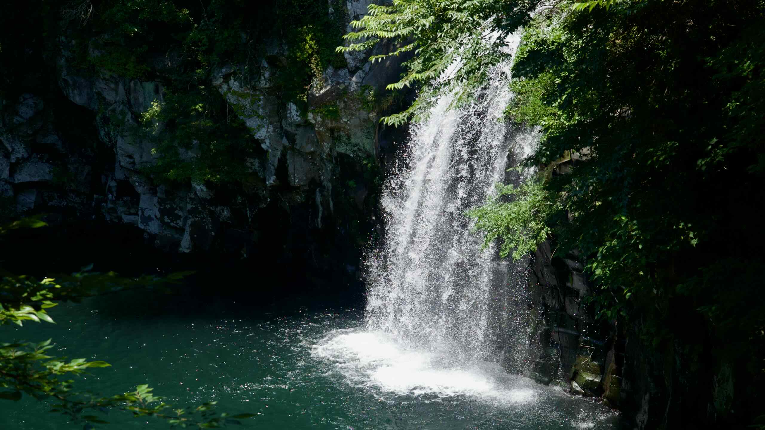
Cheonjeyeon Falls is a trio of waterfalls—each feeding into the next—pouring from a dramatic 22-meter drop into an emerald pool below. The surrounding warm-temperate forest, a designated natural monument, is lush with rare plant species. Nearby stand the curving arch of Seonim Bridge (Seven Nymphs Bridge) and Cheonjeru Pavilion.
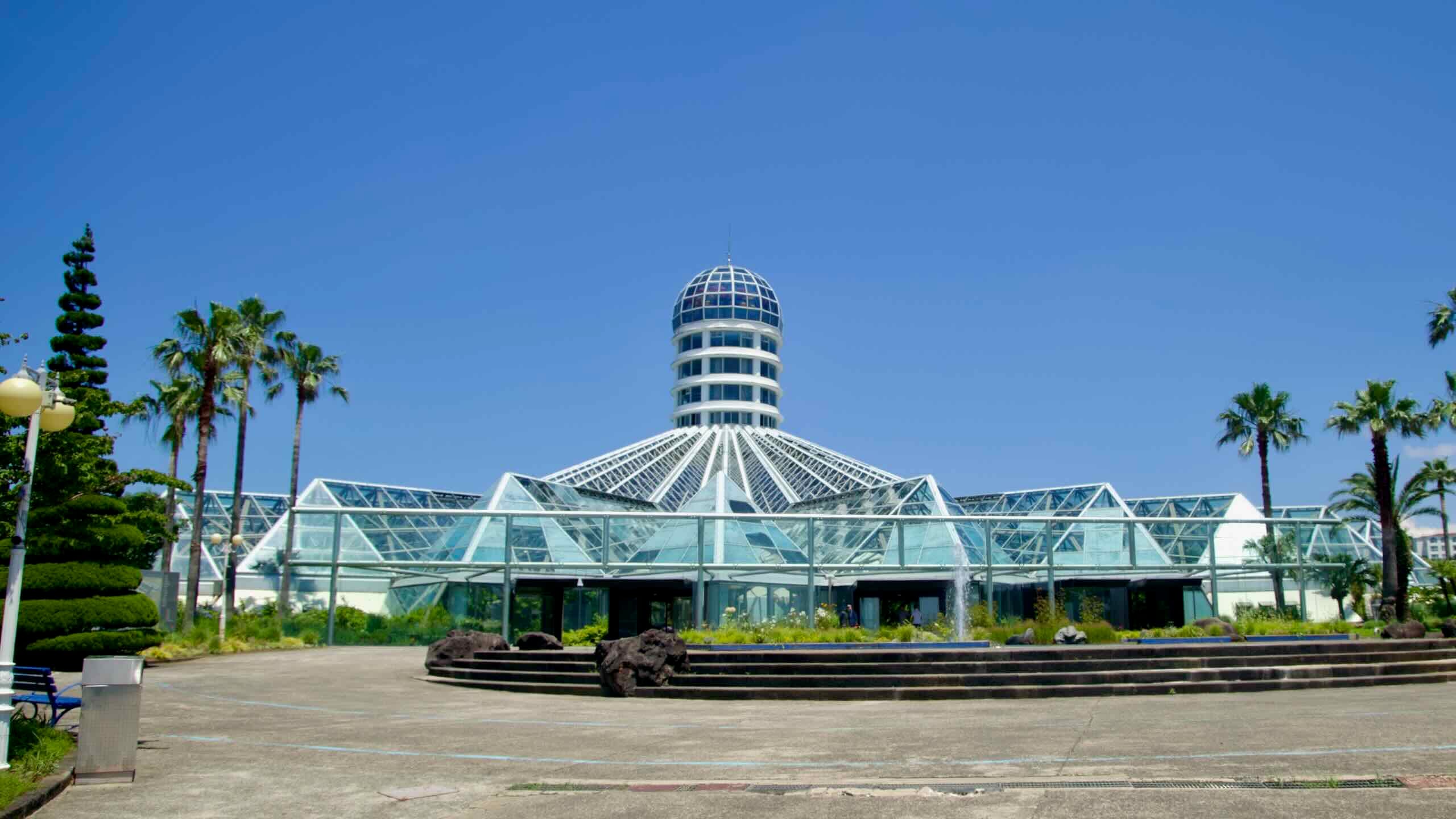
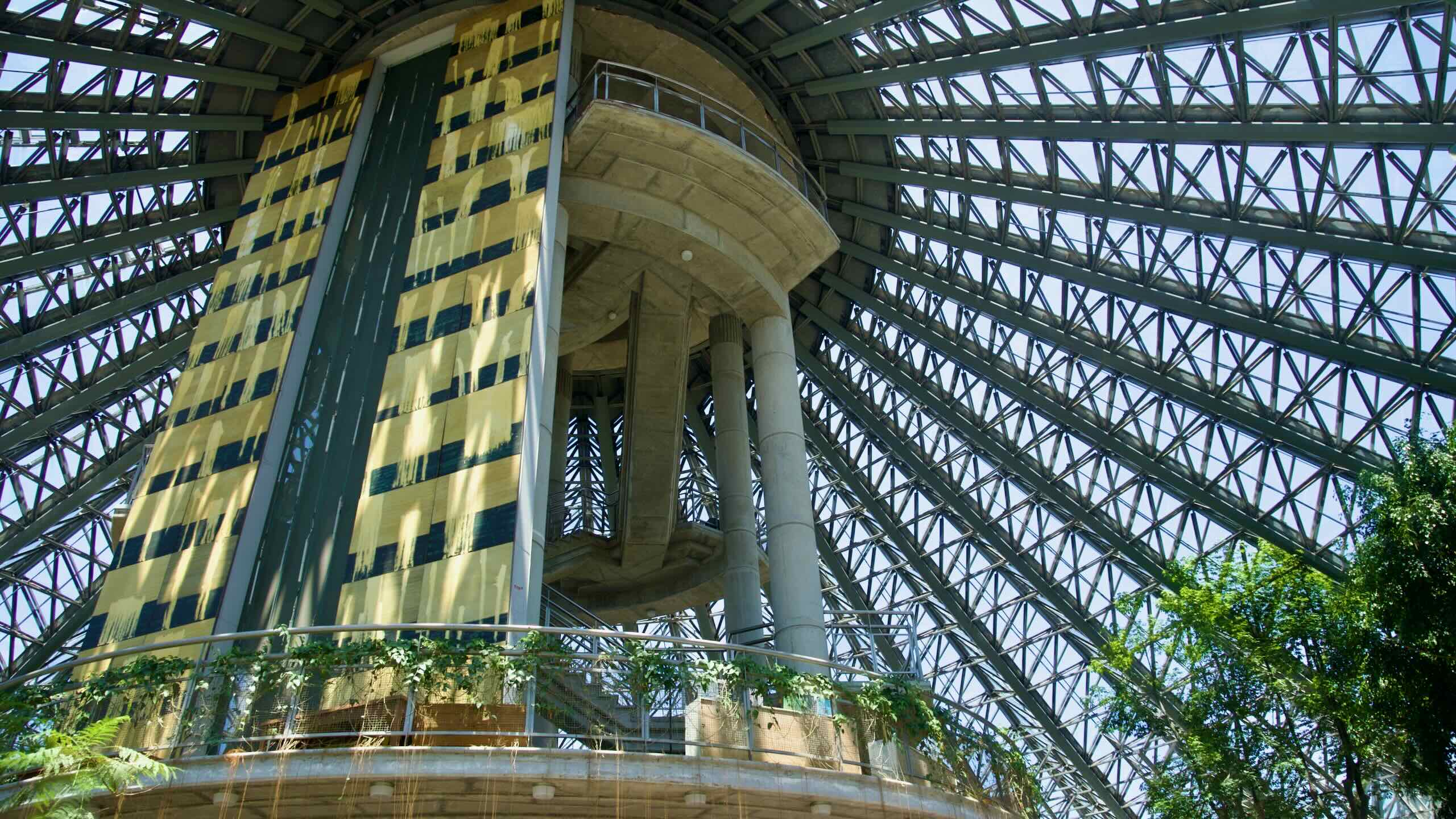
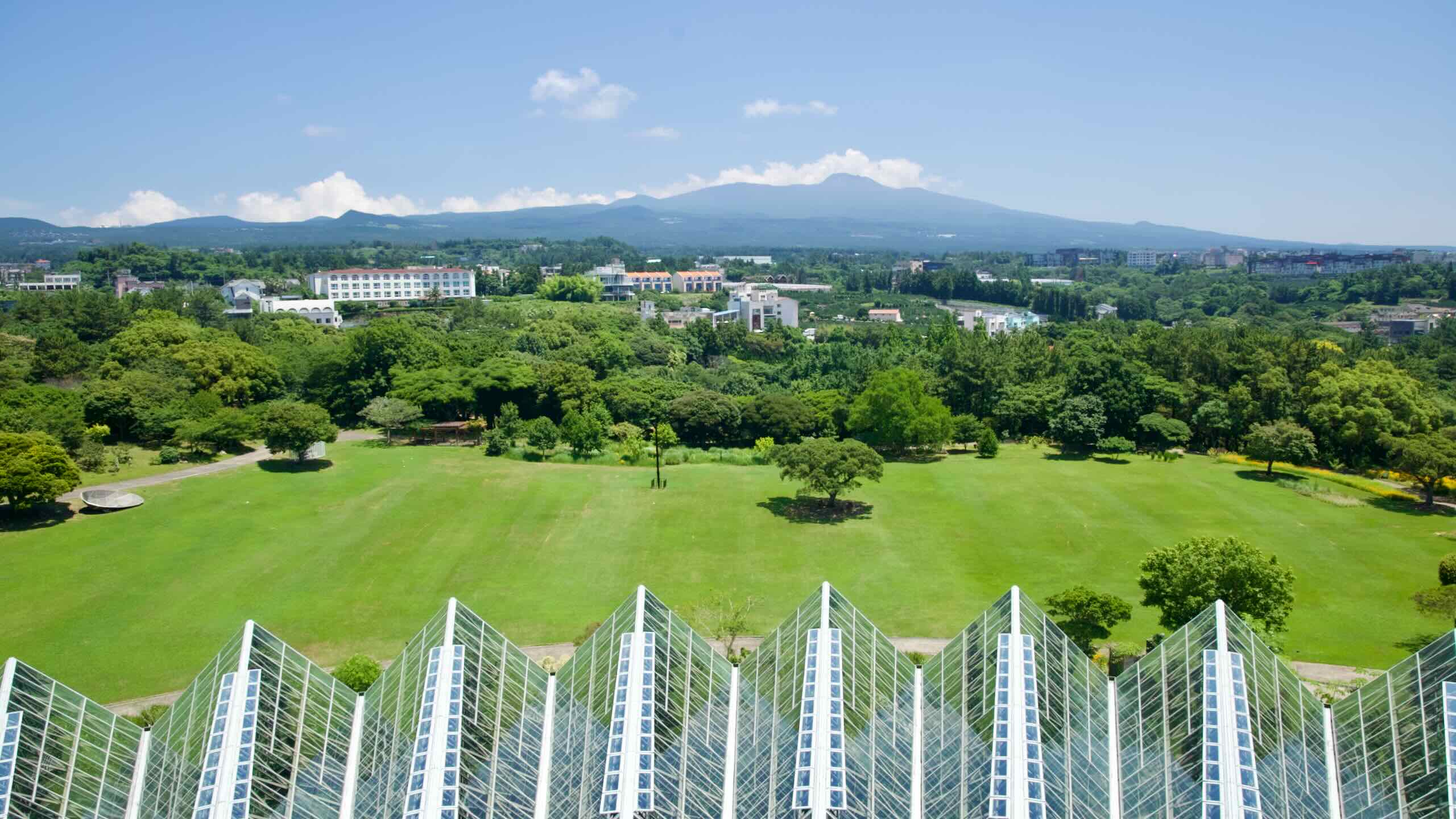
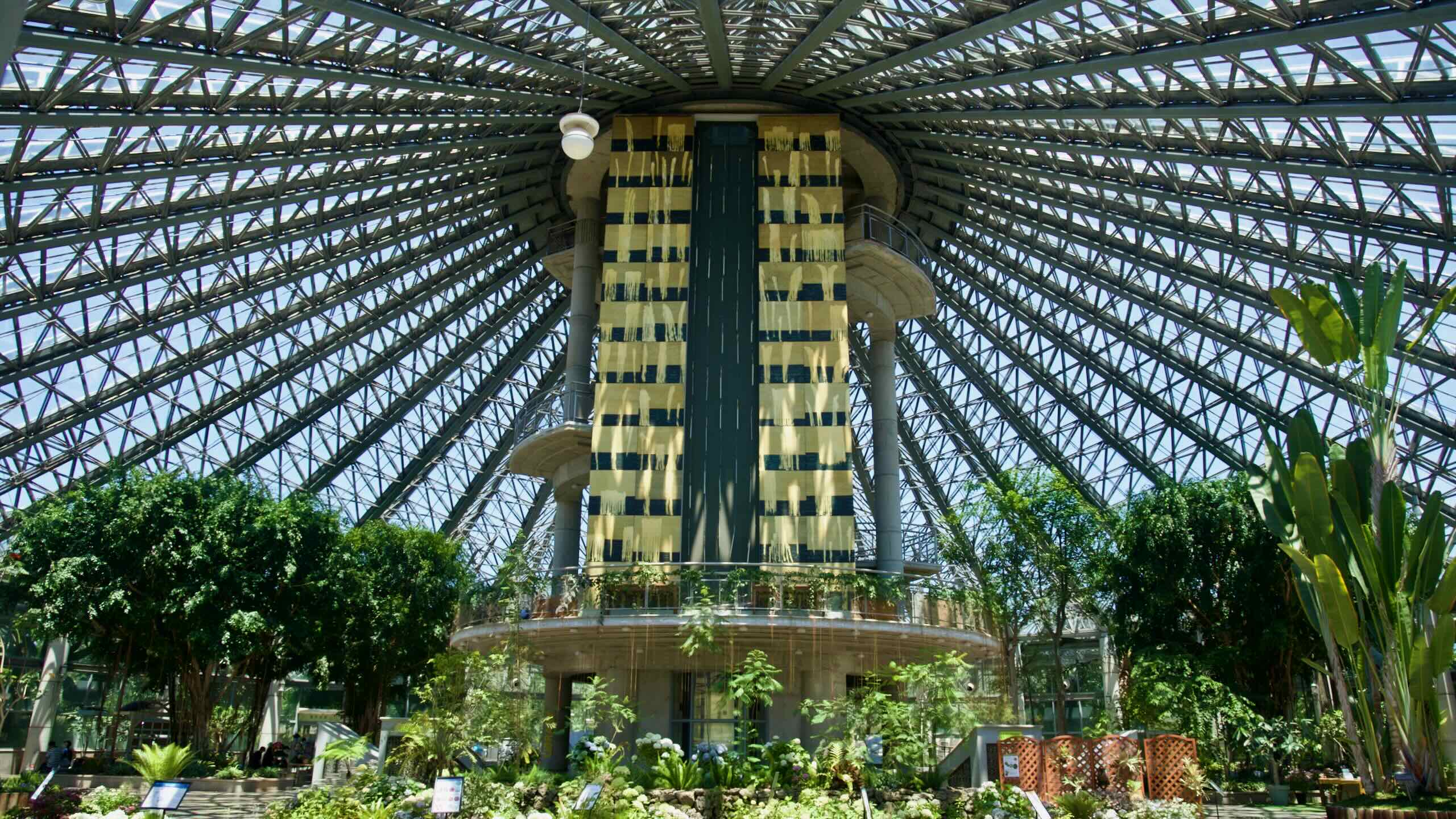
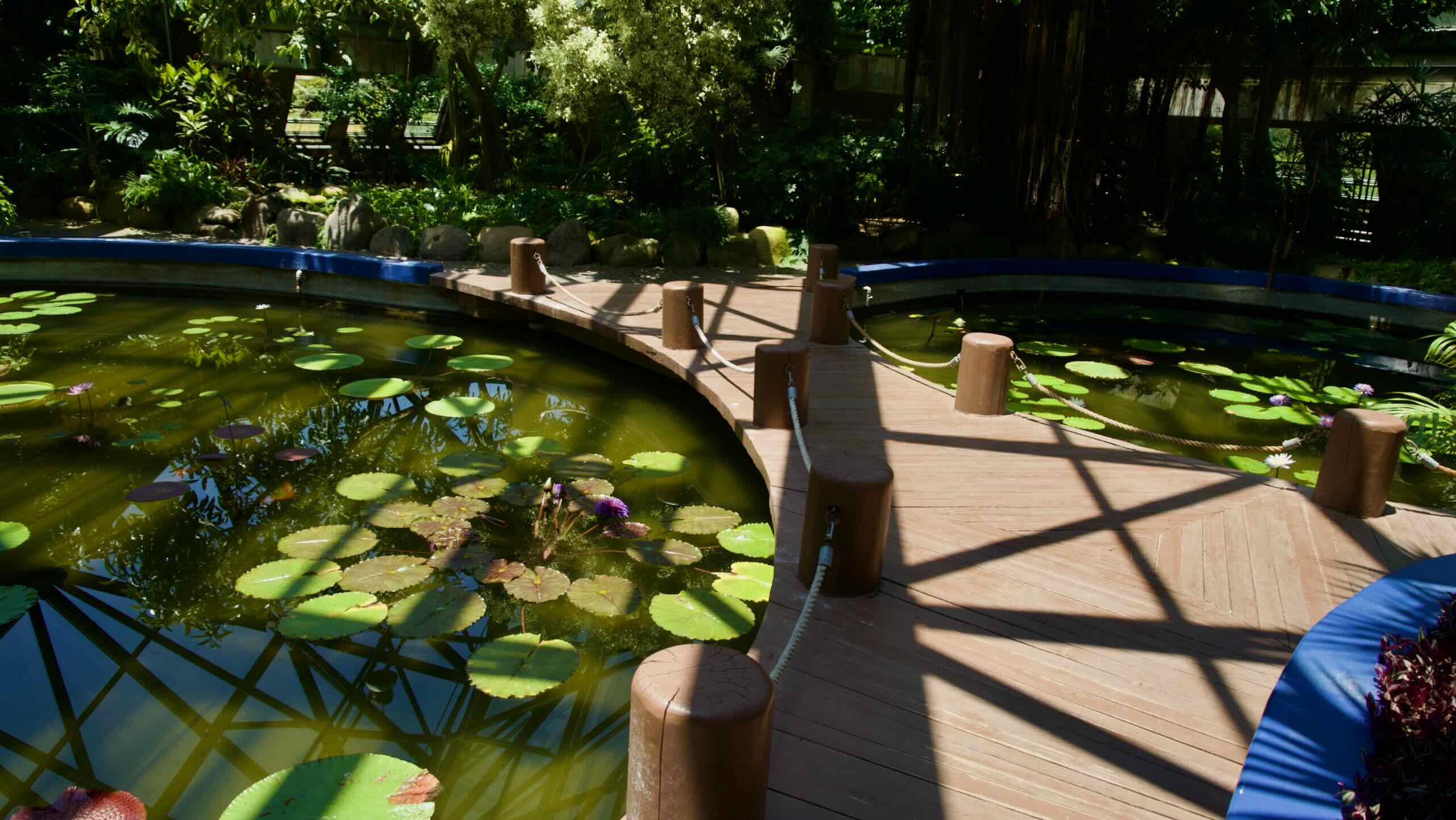
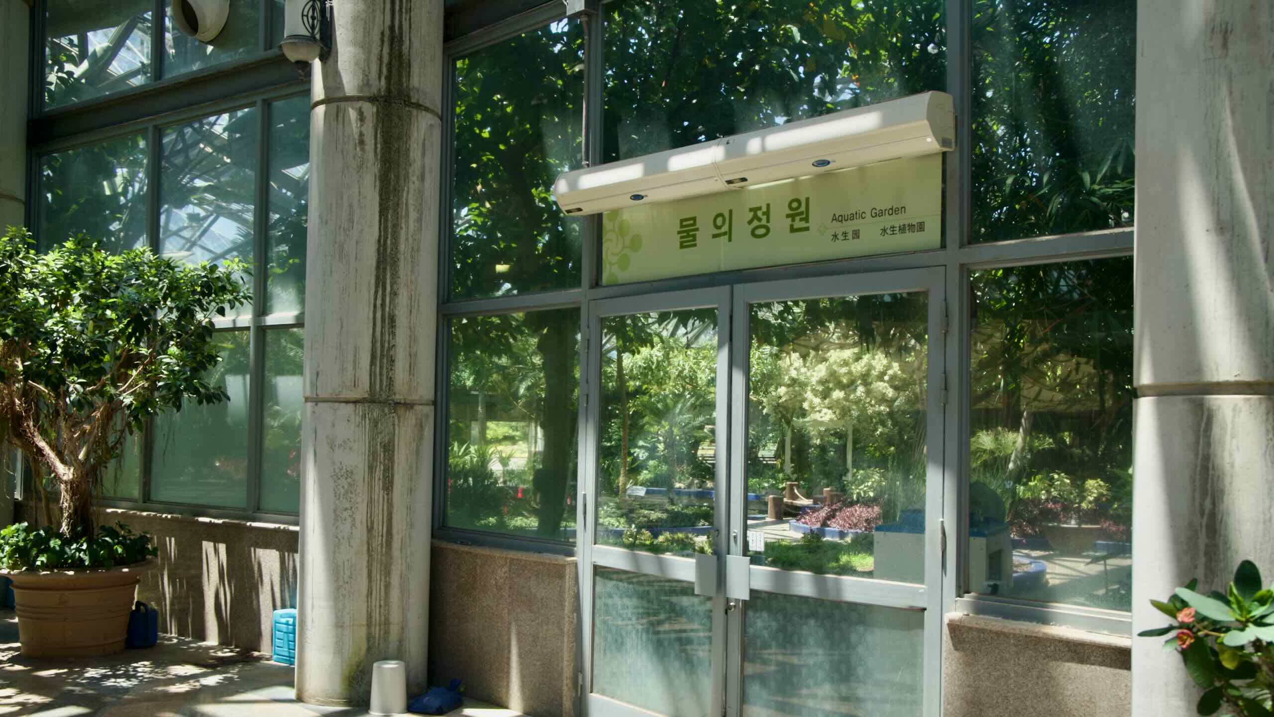
One of Asia’s largest indoor botanical gardens, Yeomiji Botanical Garden spans over 12,500 m² under a sunflower‑shaped greenhouse. Inside, six themed gardens—ranging from tropical jungle to cactus and aquatic displays—are complemented outside by internationally styled landscapes like French, Italian, and native Korean gardens.
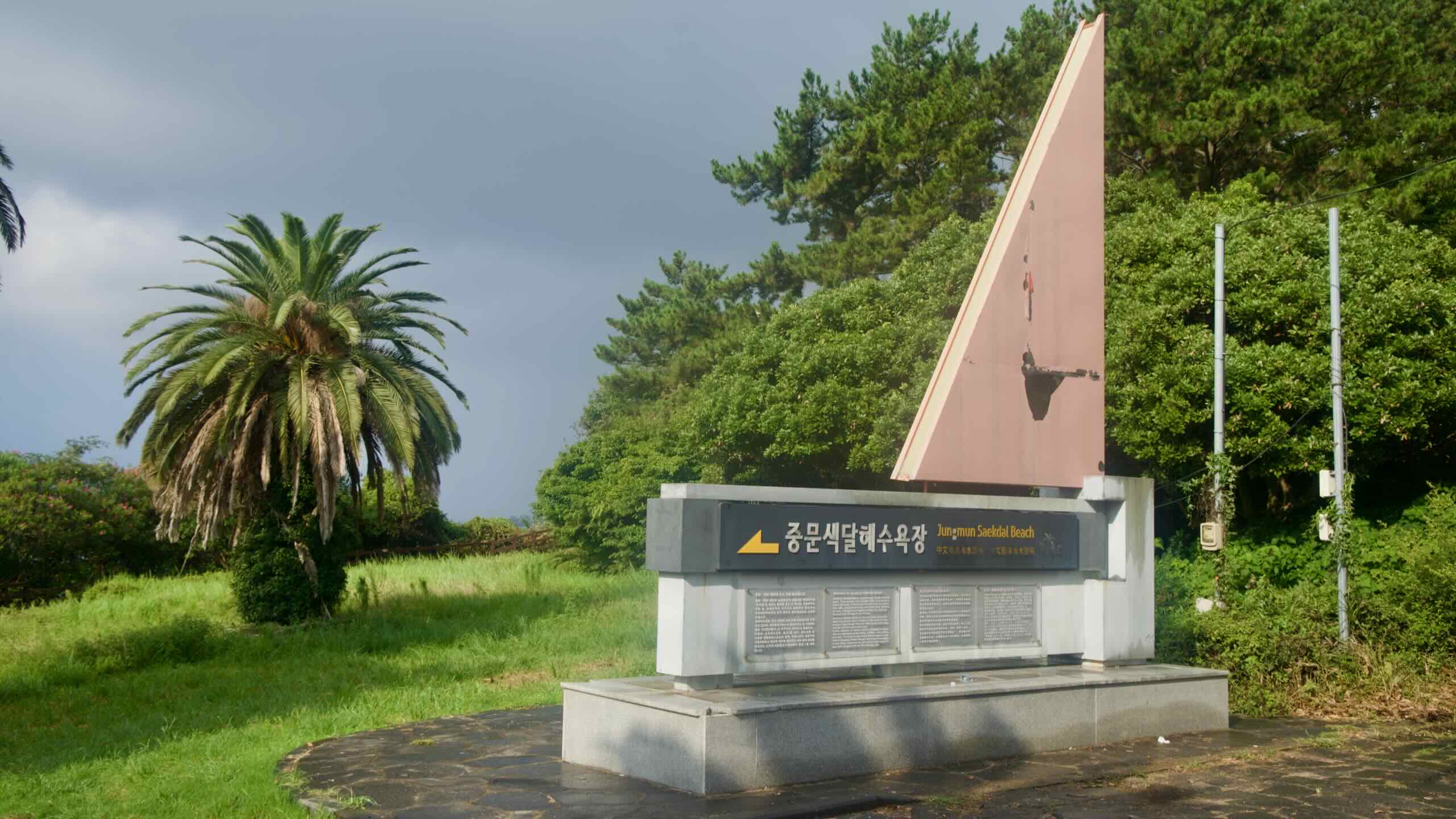
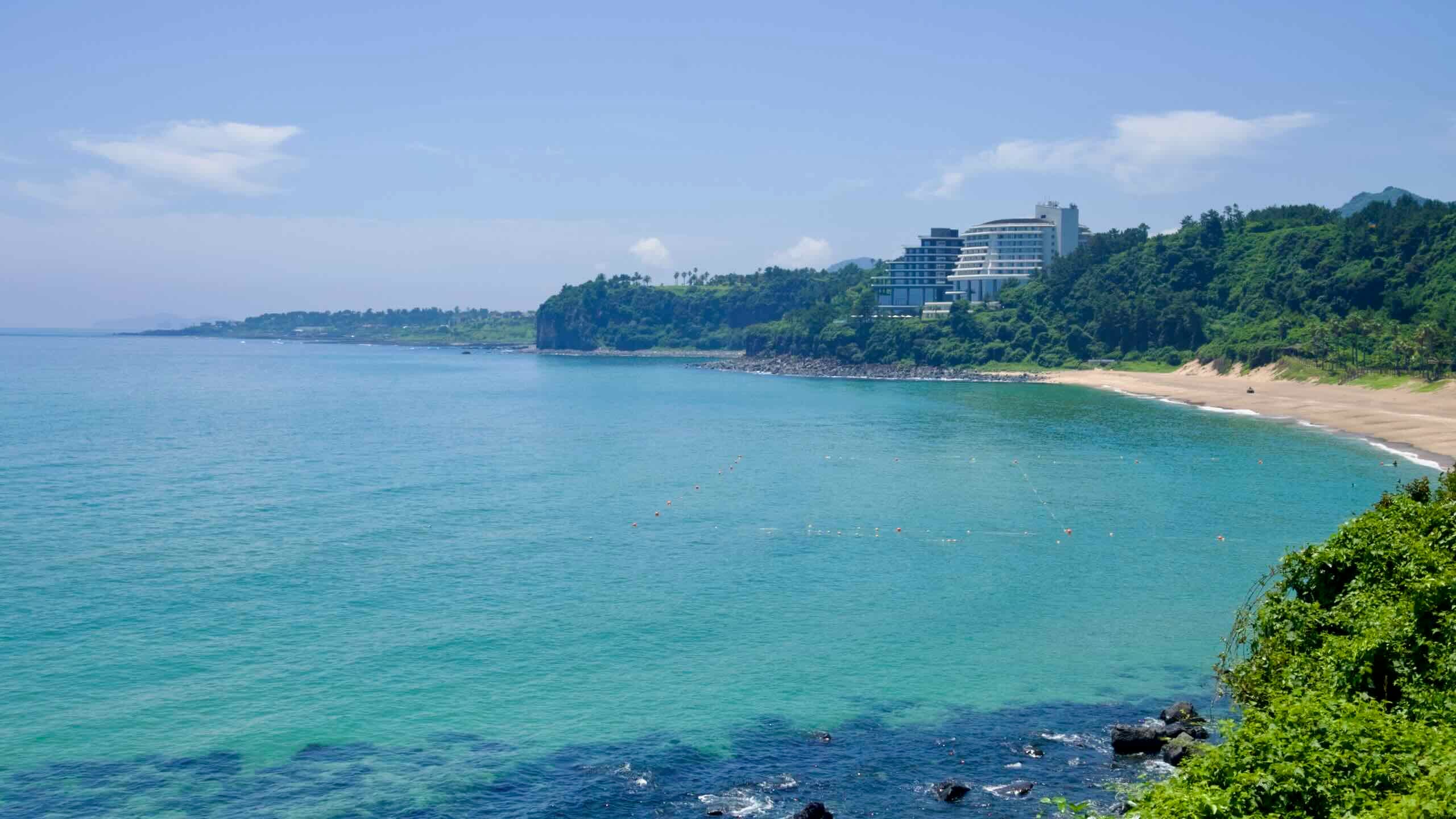
Jungmun Saekdal Beach is famed for its 560-meter-long crescent shape and striking multicolored sands, showcasing hues of black, white, red, and gray against dramatic cliffs. It regularly ranks among Korea’s best beaches, celebrated for its scenic beauty and safe swimming conditions. The beach also offers windsurfing, water-skiing, parasailing, and surfing, with annual events adding to its lively beach vibe.
Wait! Many make the mistake of following the curving road that brought into the area. But if you do that, you’ll land at the doorstep of the ritzy Jungmun Country Club House (중문CC클럽하우스; map).
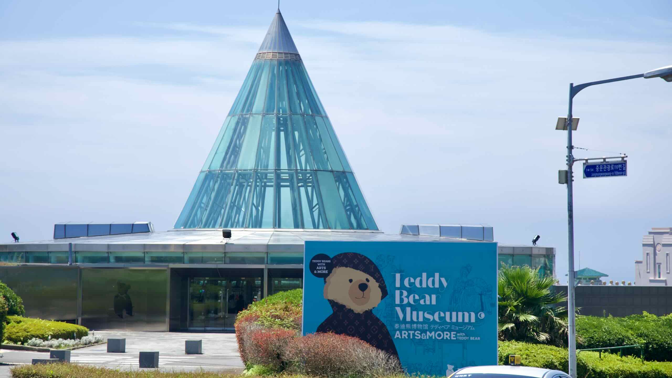
So before you let momentum carry you away, turn left just before the Teddy Bear Museum (road view). Now cycle past Yeomiji Botanical Garden and the park surrounding Cheonjeyeon Falls and down towards Jungmun Saekdal Beach.
Turn left, cross over a bridge and climb up a 20-meter embankment. After curling around a roundabout near the Jeju International Convention Center (제주국제컨벤션센터; map), continue along the high coastal Ee-eo-do Road (이어도로; map) until you spot a side road (road view).
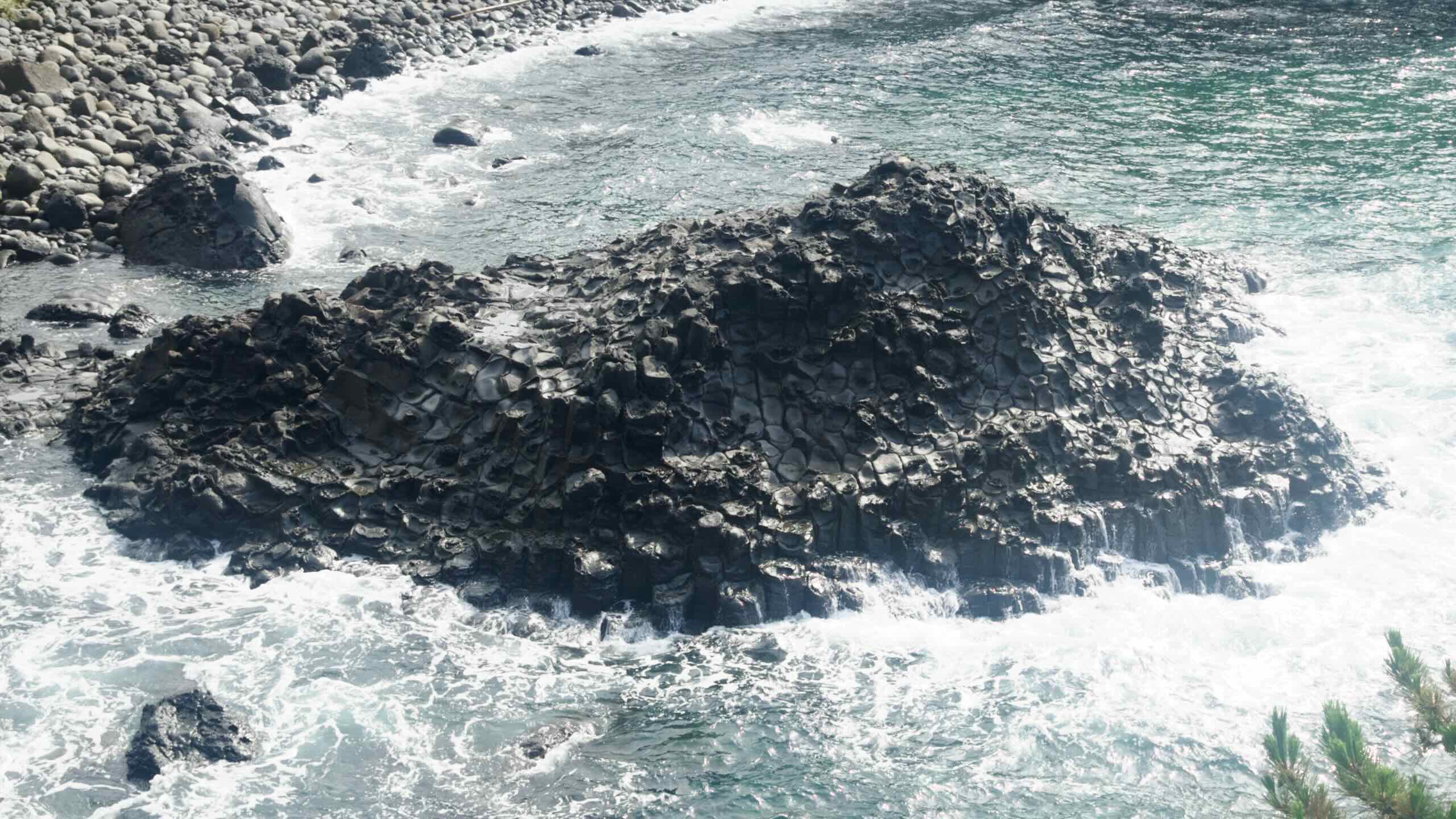
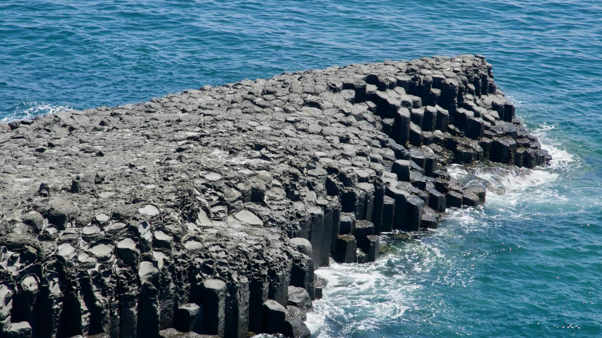
Daepo Jusangjeolli Cliff was formed by volcanic activity over hundreds of thousands of years. The site, a designated Natural Monument of Korea, is celebrated for its dramatic landscape of hexagonal basalt columns rising from the sea.
The Jusangjeolli Cliffs were formed approximately 140,000 to 250,000 years ago during the Pleistocene Epoch. Lava from the Hallasan volcano flowed into the ocean, cooling rapidly and fracturing into polygonal columns as it contracted.
The resulting structures, called columnar joints, are predominantly hexagonal. The cliffs stretch for about 2 kilometers along the coastline, with some columns reaching up to 40 meters in height.
After visiting the volcanic cliffs, climb back up to the high Ee-eo-do Road.
Cycle onwards and out of the sprawling Jungmun Tourist Complex. Zoom down a hill to the small Daepo Port (대포포구; map), known for its water sports and yacht tours.
Now power up a moderately challenging 41-meter climb over 2.4 kilometers with a 1.71% gradient (directions).
Halfway up the climb, glance inland and find Yakcheonsa Temple (약천사; map) perched on a slope facing the sea.
Yakcheonsa translates to “temple of medicinal spring,” and is named after a nearby mineral spring—locally known as Dwaeksaemi or Doyaksaem—known for its healing properties.
The site originally housed a modest hermitage, but gained prominence when Monk Hyein, after arriving in 1981, oversaw substantial construction that culminated in 1996 with the completion of the grand Daejeokgwangjeon hall.
This main hall is celebrated as the largest Buddhist prayer hall in East Asia. Rising approximately 29 to 30 meters high with a floor area of around 3,300 square-meters, it features a Buddha statue constructed from wood sourced from Baekdu Mountain region. It is one of the largest of its kind in South Korea.
The complex also holds a three-story pavilion with an 18-ton bronze bell, a drum hall, monk dormitory, and enshrines spirit tablets of notable royals—the late King Munjong and Queen Hyeondeok, as well as King Yeongchin (Crown Prince Euimin) and Empress Bangja.
Yakcheonsa offers Templestay programs, where Korean and foreign visitors can meditate, participate in tea ceremonies and rituals, and stay overnight in temple lodging.
Crest the Yakcheonsa Temple hill and travel down along inland roads to the outskirts of Gangjeong Port (강정포구; map). Known as the site of the Jeju Naval Base, the port also holds a low-key traditional village, the inactive Gangjeong Cruise Terminal (map), and Haegwansa Temple (해관사; map), a quiet shrine near the naval base.
Keep pedaling along the high, inland road lined with places to sleep (map) and eat (map).
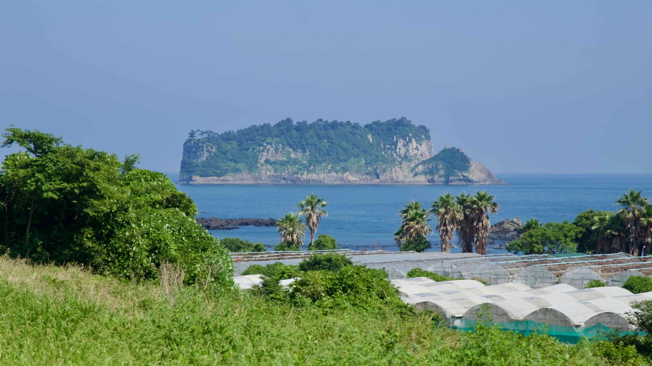
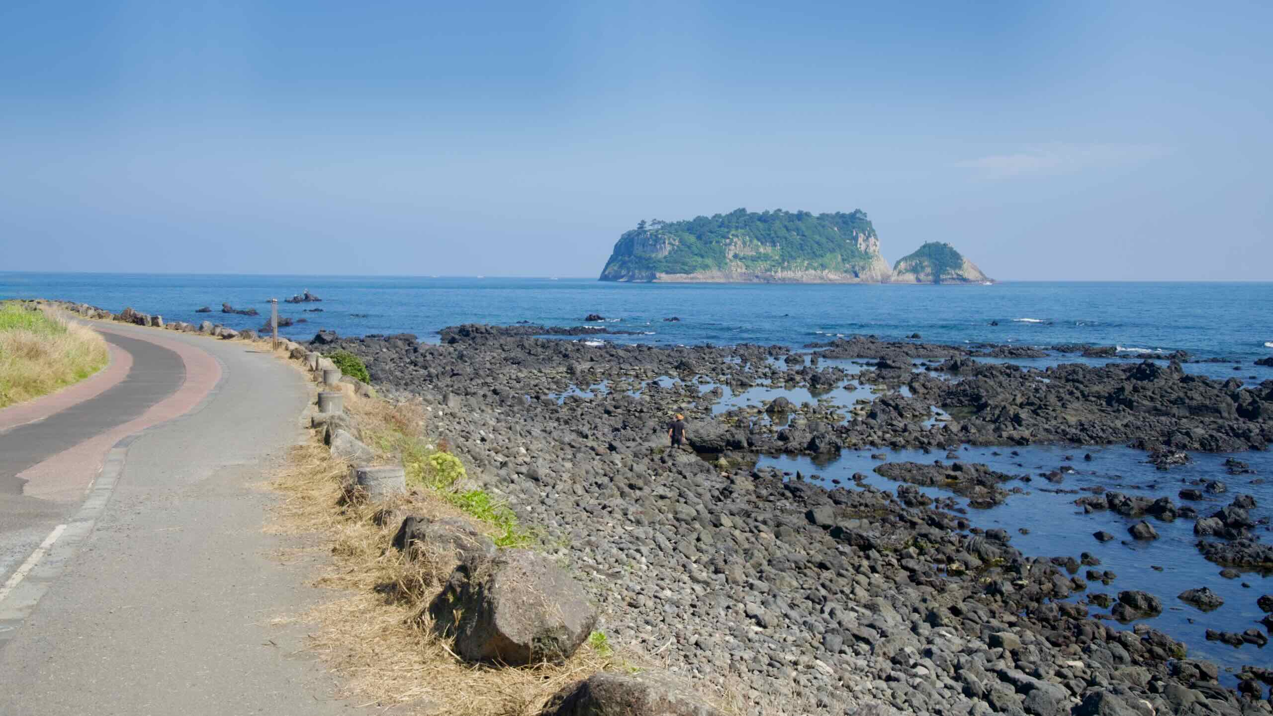
After about 2 kilometers, turn right at a major intersection (road view) and glide back towards the sea. As you round a bend onto the coastline, spot the tall, craggy face of Beom Island (범섬; map; Beomseom).
Beophwan Badang Coast offers a glimpse into Jeju’s traditional fishing culture and views of three ecologically protected islands off Jeju’s coast.
With its black volcanic coastline, the area is also part of the famous Olle Trail Route 7, which is often regarded as one of the most scenic segments of Jeju’s extensive hiking trails.
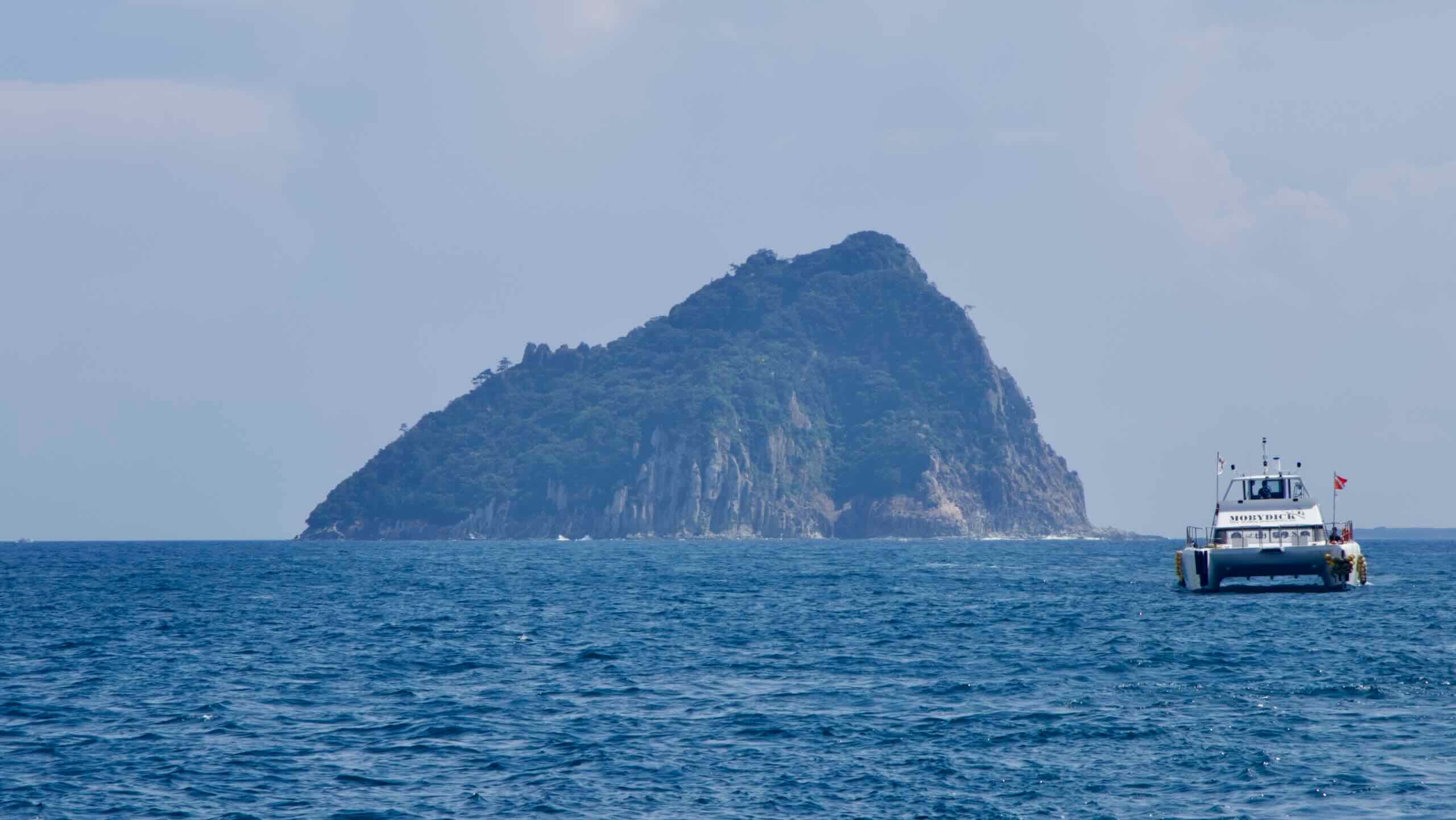
Three large uninhabited islands—Beomseom, Museum, Seopseom—lie along the Beophwan Badang Coast. Designated Natural Monuments and a UNESCO Biosphere Reserve, they form part of the Seogwipo Provincial Marine Park.
Beom Island (범섬; map; Beomseom) is located about 1.5 kilometers off the Beophwan Badang Coast. It’s named for its resemblance to a crouching tiger.
Formed by underwater volcanic eruptions like Seongsan Ilchulbong, Beom Island features dramatic vertical rock formations and sea caves.
One of the island’s defining features is the presence of twin sea caves. According to local legend, the caves were created by Seolmundae Halmang, the mythical giant credited with forming Jeju Island, as she rested on Hallasan. As she lay down using Hallasan Mountain as a pillow, her toes extended and punched holes into the rock, forming the sea cave.
Begin your cycling journey along the Beophwan Badang Coast in Dumuneemul Park (두머니물공원; map), or “Two Faces Pool.” Since long ago, the park’s freshwater spring has refreshed haenyeo divers after arduous dives and served as a meeting point for community leaders, fostering harmony and resolving disputes over fishing rights.
In fact, the Beophwan area holds the largest population of haenyeo in all of Jeju, hosting the Beophwan Haenyeo School (map) just down the road in Beophwan Port.
From June through October, visitors can join guided muljil (diving) sessions led by local divers at Dumuneemul Park.
Keep pedaling along the winding and gently undulating coastal road until you land in Beophwan Port (법환포구; map). Also known by the old name “Maksukgae,” Beophwan Port is known for snorkeling, dolphin sightings, and marks the end of the Beophwan Badang Coast.
Beophwan Badang Certification Center
Near the port’s breakwaters, amidst cafés and restaurants, find Jamnyeo Square. It hosts sculptures of sealife and the revered haenyeo divers.
Climb back aboard your bike, pedal out of Beophwan Port, and begin your climb along one of Jeju’s most challenging cycling hills, the Sammae Peak Pass.
While the ascent begins near sea-level and tops out at 88 meters, it spans over 3.5 kilometers with a 2.51% gradient (directions).
As you reach the summit, pass switchback road leading to a ritzy Marriott compound (map) and then enter a forested stretch known as the Sammae Peak Park (삼매봉공원; map), which centers around Sammaebong or Sammae Peak, a volcanic oreum (parasitic cone) rising to about 153 m above sea level.
The neighborhood park features a pergola, library, Gidang Art Museum, and a pavilion called Namseongjeong (남성정), which offers panoramic views across the southern sea.
Just before you pedal through the middle of the park, find a side road leading downhill (map).
Have time for a short detour or reroute? Cruise down 500 meters to a small parking lot with a gift and fruit shop and find the entrance to a coastal hiking trail (road view). Trek down it two minutes and stumble upon Oedolgae Rock, a Jeju Fantasy Bike Path highlight.
Oedolgae Rock (외돌개; map) is a towering, solitary rock pillar and natural wonder of Jeju Island. The rock rises 20 meters above the sea and measures 7 ~ 10 meters wide.
Formed approximately 1.5 million years ago during a volcanic eruption, Oedolgae is a prime example of a sea stack shaped by relentless waves eroding the softer rock surrounding its volcanic core. The result is a dramatic stone pillar set against the backdrop of Seogwipo’s rugged coastline.
Located near Sammaebong, the rock is part of a larger coastal ecosystem featuring steep cliffs, sea caves, and unique rock formations. The area has been recognized as Scenic Site No. 79 since 2011, joining other iconic Jeju landscapes like Sanbang Mountain and Soesokkak.
Now, hike back up to the road. From here, you have two options:
Pedal back up where you came from and climb a 40-meter hill, then continue along the main route (directions).
Or continue eastward along the low road and tackle a gentler 20-meter ascent (directions).
Either way, you’ll land on Seogwi Bridge (서귀교; map) in the administrative heart of Seogwipo City. Unlike the Jungmung Tourist Complex, this part of the city houses all the government main administrative buildings, including Seogwipo City Hall and the Jeju World Cup Stadium, as well as banks, local shops, cafés and restaurants
The area, which includes Seohong (서홍동; map), Daeryun (대륜동; map), and Donghong (동홍동; map) Neighborhoods, is quieter than the Jungmun Tourist Complex, but still shows life around Maeil Olle Market (서귀포매일올레시장; map) and Lee Joong-seop Street (이중섭거리; map), where locals and travelers mingle at food stalls and galleries.
An important landmark is the Jeju World Cup Stadium (제주월드컵경기장; map). With a capacity of about 29,791, the stadium opened in December 2001 and is home to Jeju United FC. Its design structures the shape of nearby volcanic oreums.
Geolmae & Chilsimni Parks
From Seogwi Bridge (서귀교; map), look around you. What’s all that green valley to the north and south of you? That’s Geolmae Eco Park (걸매생태공원; map) and Chilsimni Park (칠십리시공원; map). These pair of parks in the middle of downtown Seogwipo feature protected natural areas, well-maintained walking paths, art sculptures, and Cheonjiyeon Falls, a Jeju Fantasy Bike Path highlight.
Cheonjiyeon Falls is one of Jeju Island’s most celebrated natural landmarks. The journey to the falls begins at its ticket office (map) near the waterfront of Seogwipo Port (map).
With a name “Cheonjiyeon” translating to “Pond of Heaven and Earth,” the 22-meter waterfall cascades into a deep, clear pool with surrounding subtropical vegetation, basalt cliffs, and tranquil ambiance.
The pool at the base of the falls is home to the giant mottled eel, a migratory species protected as Natural Monument No. 27. These eels travel thousands of kilometers between freshwater and marine environments to spawn. Although the eels are elusive during the day, their presence highlights the importance of conserving this delicate habitat.
Travel through downtown Seogwipo City and bounce from port to port, veering close to striking cliff-faced islands and a wondrous waterfall pouring itself into the sea.
Seogwipo Port (서귀포항; map), at the bottom of downtown Seogwipo, is a base of operations for both fishing boats and sightseeing tours around the area’s protected, vibrant seascapes.
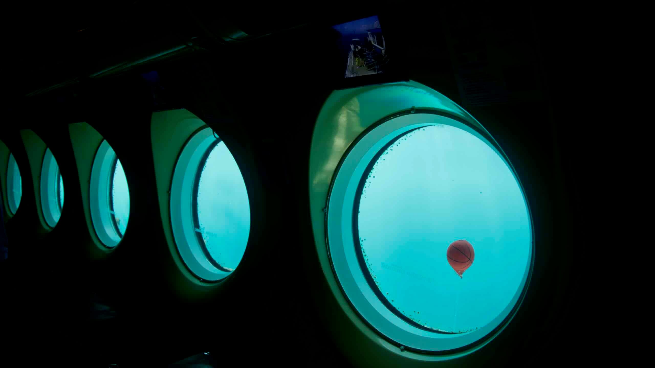
Boats for short coastal cruises and the Seogwipo Submarine depart from Seogwipo Port, sailing to the nearby islets of Munseom, Seopseom, and Beomseom, which form Seogwipo Provincial Marine Park and the Jeju Biosphere Reserve.
The submarine tour descends to about 40 meters near Munseom’s soft-coral habitat, celebrated for its diverse marine life.
Saeseom Island & Saeyeongyo Bridge
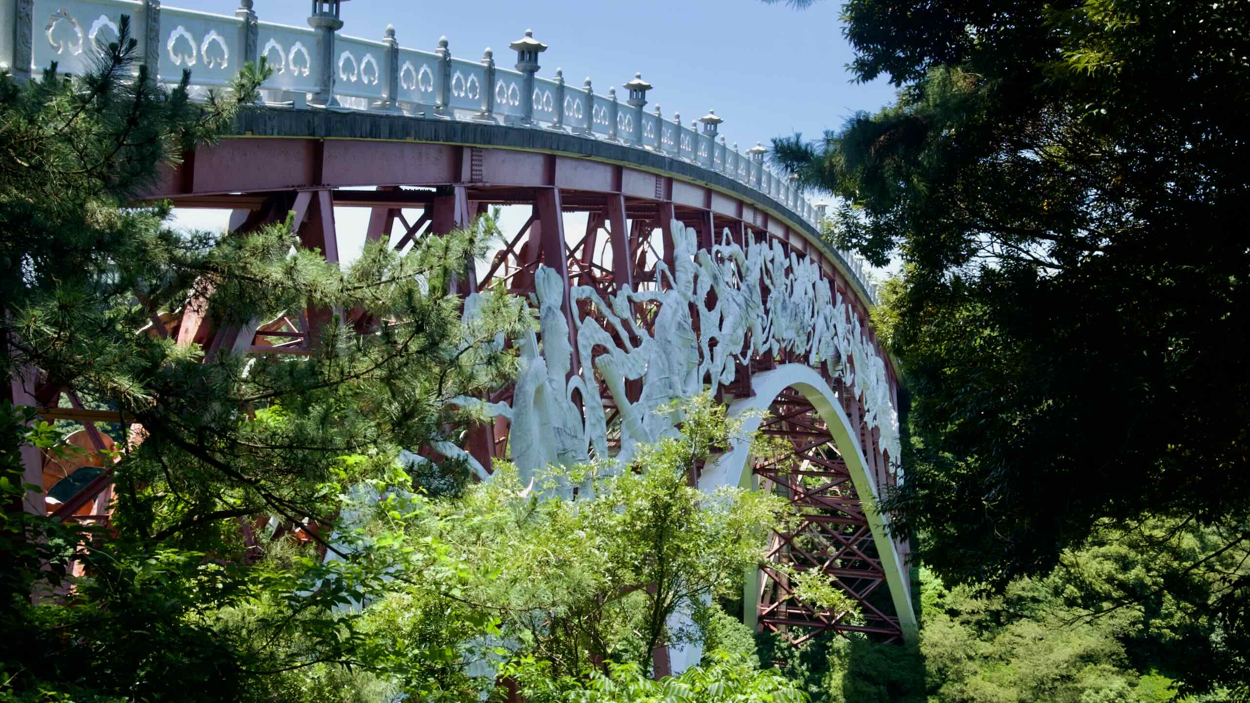
Seogwipo Port also hosts Saeyeongyo Bridge (새연교; map), a single-pylon pedestrian bridge styled after Jeju’s traditional flat wooden boat (teu).
The bridge spans 169 meters from the port and lands on Sae Island (새섬; map; Saeseom), also called Saeseom. The uninhabited islet just off the coast gets its name from sae grass (silvergrass), once used to build thatched roofs on Jeju houses.
The island holds a natural park with a 1.2-kilometer loop of dirt trails and viewing decks, taking 30 to 40 minutes to complete. From the loop, you’ll find magnificent views of Beomseom, Seopseom, and Munseom.
Speaking of Munseom, or Mun Island (문섬; map), Seogwipo Port offers the closest look at this rocky islet, which lies about 1.3 km south of the port’s breakwaters.
Named “Mosquito Island” for its once-plentiful mosquitoes, Munseom is composed of fine-grained volcanic rock (trachyte), sea-stack formations, and wave-cut benches that form its rugged 73-meter-tall cliffs. On top, a dense grove of evergreen trees includes Elaeocarpus, protected as Jeju Natural Monument No. 45.
Make your way from the Seogwipo Port area and hop across a few city roads until you reach downtown Seogwipo’s eastern waterfront. There, amidst a carpet of green grass and sculptures, lies Jaguri Culture and Arts Park (자구리문화예술공원; map).
Known for its scenic views of Seopseom and Munseom, the park also features art installations, evening illumination, and walking paths.
Jaguri Culture and Arts Park marks one endpoint of the “Artist’s Walk,” a cultural trail that begins at the Lee Jung-seop Art Museum (map), dedicated to the Korean War–era artist Lee Jung-seop (1916 ~ 1956), whose work bears similarities to Fauvism.
Below Jaguri Culture and Arts Park, along the sea, sits Jaguri Freshwater Pool (자구리공원담수욕장; map). Fed by shore springs (용천수) historically used as drinking water—locals call them “Jaguri-mul”—the pool is popular for wading and kids’ swimming, and there are basic facilities nearby.
From Jaguri Arts Park, turn left and head up a short hill. Find an ornate traditional gate (road view) stationed before a parking lot and a paved pedestrian walking path. Travel under and into the Sonammeori Area (소남머리; map).
This pine-covered headland and its lava cliffs along the Jaguri Coast witnessed tragic events during the Jeju 4·3 Uprising (1948–49), when an armed rebellion and government suppression led to the deaths of between 15,000 and 30,000 Jeju citizens.
During that time, detainees were interrogated by the military and police, brought to Sonammeori, and executed. The area is recognized as an official 4·3 heritage site, with markers and memorials.
Keep pedaling down the pedestrian area and arrive at a second parking lot on a steep cliffside. At the end of the parking lot, find a ticket booth leading down to Jeongbang Falls—one of Korea’s most famous waterfalls and a Jeju Fantasy Bike Path highlight.
Jeongbang Falls is the only waterfall in Korea where water flows directly into the sea. Situated about 1.5 kilometers southeast of downtown Seogwipo, the 23-meter-high falls, fed by the Donghong Stream, cascade over a rugged volcanic cliff into the open ocean.
It is also one of the few waterfalls in the world where freshwater flows directly into the ocean—a rare feature that sets it apart on Jeju and globally. The dual streams create a roar that echoes through the nearby cliffs, especially after heavy rainfall.
Jeongbang is steeped in local legends. According to one tale, a sacred dragon resides beneath the falls, its spirit capable of healing ailments and bringing rain to end droughts. Many visitors feel a sense of reverence for the mythical energy attributed to the site.
Head out from the Jeongbang Falls parking lot and follow an access road onto Chilsimni-ro (칠십리로; map). As you pedal along, notice an expanse of green covering the coastal lowland. It holds a few notable stopovers, from the Seogwipo KAL Hotel (서귀포KAL호텔; map) to the small but charming book café Sora’s Castle (map).
Amid the man-made attractions, you’ll also find Sojeongbang Waterfall (소정방폭포; map). This 5-meter-high waterfall lies only 300 meters east of the more popular Jeongbang Falls and offers a quieter, more leafy setting. Though smaller and less famed, Sojeongbang means fewer crowds and more greenery.
Gudumi Port
Curl around the green lowland on a high ridge and veer off Chilsimni-ro. Zoom down a gentle descent.
Near a hiking trail beneath a patch of trees, look for a stone marker reading Socheonji (소천지; map; road view). This short route gets its name—“small Cheonji”—because the freshwater pools it passes resemble the famed crater lake atop Baekdu Mountain on the North Korea–China border.
At the end of the section, round a bend into Gudumi Port (구두미포구; map). This tiny fishing cove takes its name, “Gudumi,” from its turtle-like shape along the coast. Its waters are known as a great place for casual swimming, snorkeling, and fishing.
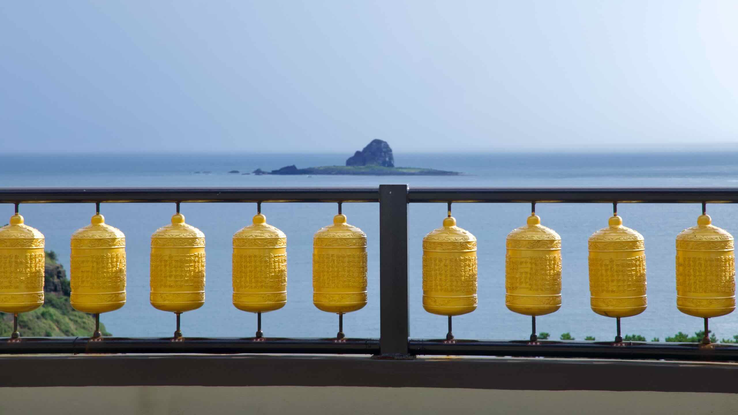
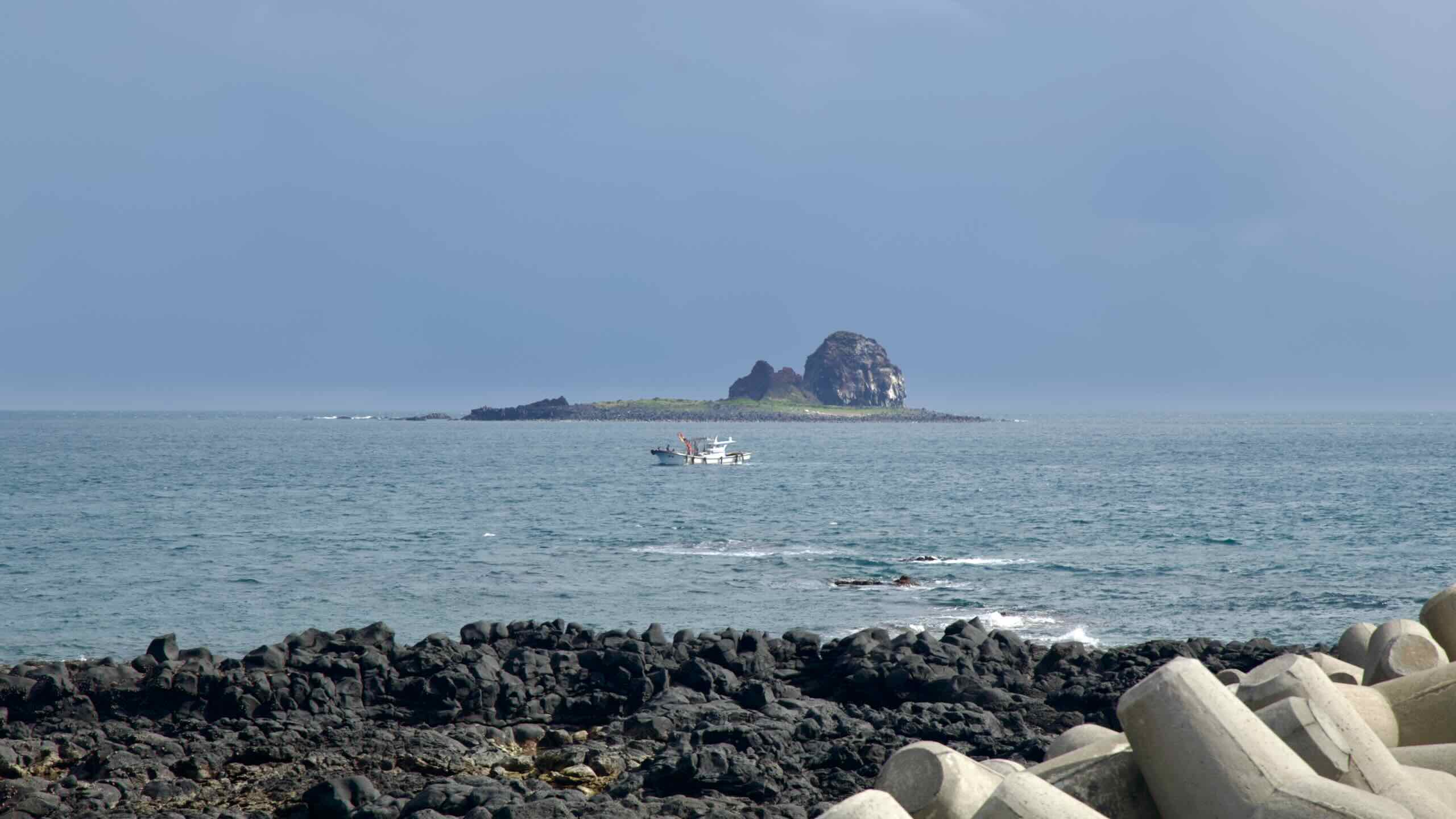
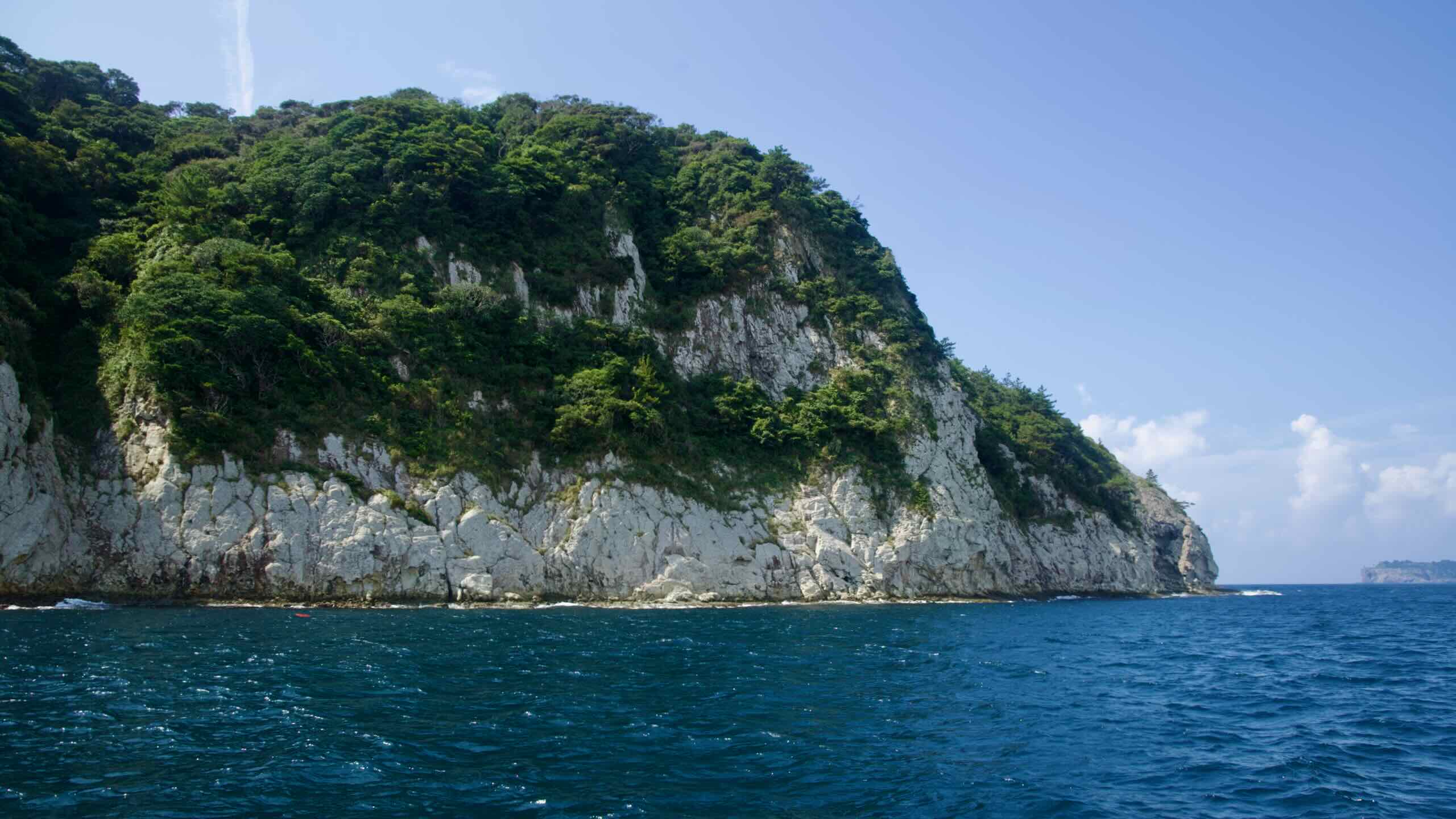
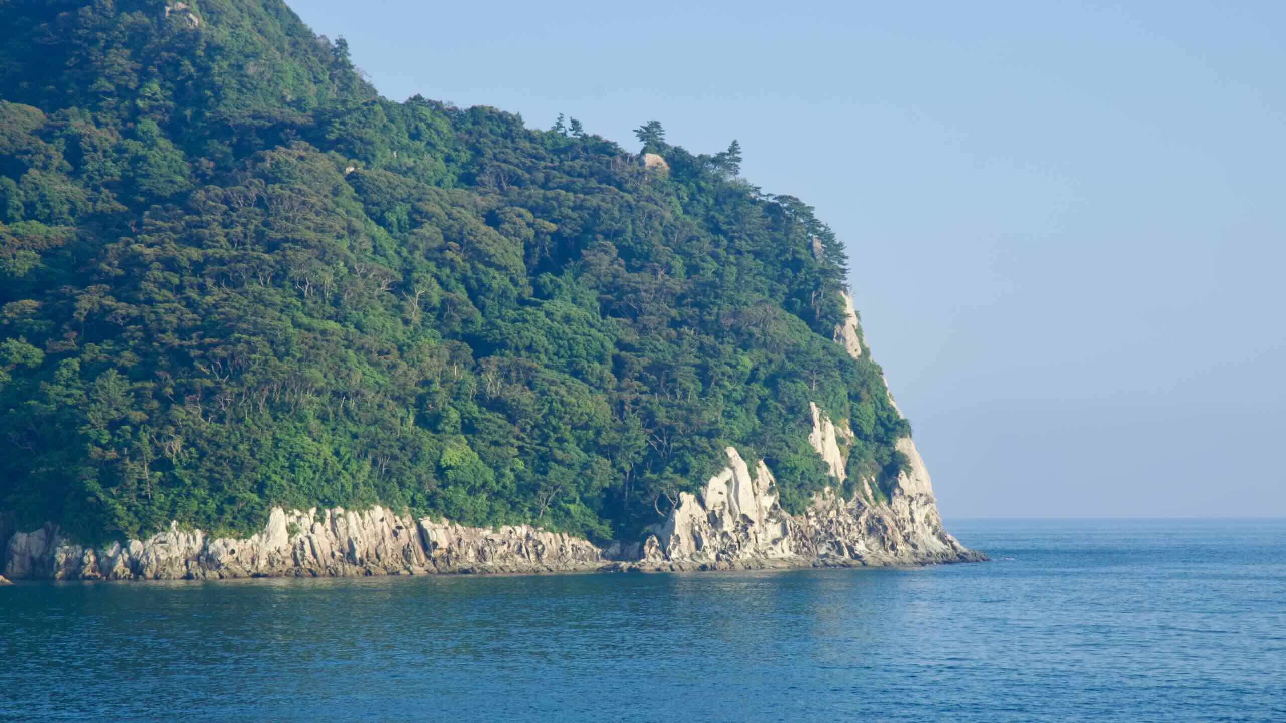
But Gudumi Port’s main claim to fame is its view. Just 400 meters from its breakwaters sits Seop Island (섭섬; map), or Seopseom—the third of three uninhabited, protected islets off Jeju’s south coast. Photographers often visit Gudumi to frame the port’s small fleet with the islet and sunset in the background.
Seopseom’s name means “Island of Dense Forest,” but its most noticeable feature is its fine-grained volcanic rock, which rises 155 meters above sea level in steep hillsides and cliffs.
Though Seopseom has a less flamboyant underwater environment than Munseom or Beomseom, its hard-coral formations attract both amateur and intermediate divers.
Pedal past the port. At its end, turn inland and navigate through the village houses of Bomok Neighborhood (보목동; map).
Roll up and down short but steep roadways, then turn right (road view) to follow the blue cycling lines, which guide you back to the seaside and Bomok Port (보목포구; map).
This picturesque harbor is known for its basalt stone staircase descending into the sea and for jari-mulhoe (자리물회; map), a cold raw damselfish soup. This Jeju specialty is popular in summer when damselfish are in season.
Travel just east of the port to Jejigi Oreum (제지기오름; map). This small volcanic cone takes about 10–15 minutes to hike and offers a broad view of Seogwipo Bay, including Seopseom, Munseom, Beomseom, and even Hallasan on a clear day.
Now wheel along the coast for about a kilometer past a row of seafront accommodations (map), cafés (map), and restaurants (map).
The blue-lined road narrows and climbs a bluff to a high-angle view of long breakwaters topped with red and white lighthouses (road view). That’s Hahyo Port (하효항; map), a small working harbor where recreational charter boats operate, including seasonal squid outings (한치).
Wind down the bluff and through Hahyo Port, passing a quay with a small trick-art photo zone. Immediately beside the harbor sits Hahyo Soesokkak Beach (하효쇠소깍해변; map), a pocket of black sand created by erosion of nearby basalt at the mouth of Hyodon Stream (효돈천; Hyodoncheon; map).
Before exploring the estuary, check the grassy courtyard where Hahyo Soesokkak Beach meets Soesokkak Estuary. It holds nautical decorations and a red stamp booth. Hop off your bike, step inside, and collect the Soesokkak Certification Center (쇠소깍 인증센터; map) stamp in your Bike Passport.
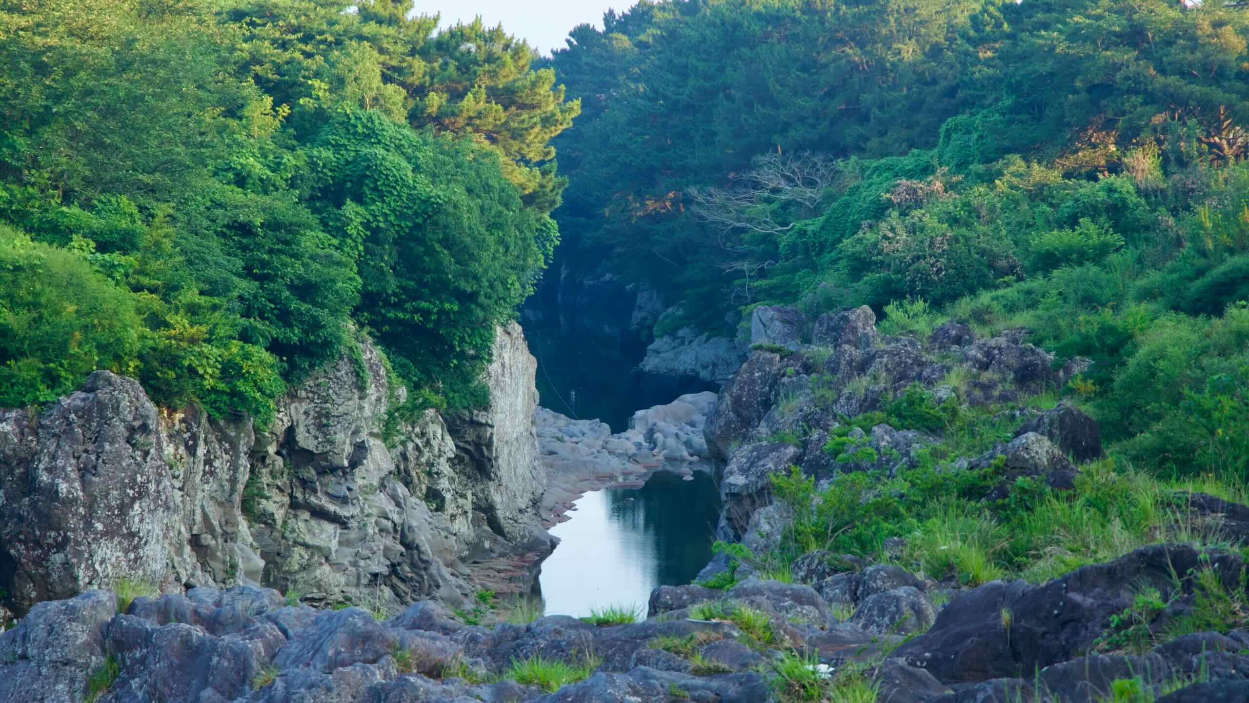
Soesokkak Estuary (쇠소깍; map) is a short, lava-cut gorge at the mouth of Hyodon Stream (Hyodoncheon).
The estuary marks the meeting point of fresh and salt water, forming a deep, emerald-green pool surrounded by volcanic rock formations and pine forest. Traditional flat wooden rafts (teu) run short out-and-back rides on its waters, and canoes are also available for rent.
The estuary was once called “Soedun” because the pool and banks resembled a cow at rest. Over time the name settled as “Soesokkak,” literally “cow-pool-end” (soe = cow, so = pool, kkak = end).
Finished exploring the hidden coastal gem? Climb back on your bicycle. Head up the estuary and cross a bridge. Glance down to trace the estuary’s rocky path as it winds to the sea.
Continue along the road and turn left (not right) at the first T-intersection (road view). After a few hundred meters, join Iljudong Road (일주동로; map; road view), a coastal Seogwipo thoroughfare running from downtown Seogwipo to Seongsan Ilchulbong on Jeju’s east side.
We won’t take it that far. This six-lane highway carries us 8 kilometers (directions), mostly at an arm’s-length from the coastline, passing the backsides of a handful of small harbors.
The first notable feature is a small climb. After first meeting the road, make a short descent and then begin a 41-meter climb over 4.8 kilometers with a very gentle 0.8% gradient (directions).
Wimi Port
As you travel the inland section, you’ll skirt the outskirts of Wimi Port (위미항; map). If you’re up for a couple-hundred-meter detour, coast down to the quay and check out its fleet—over 700 full-time fishers targeting tilefish (okdom), amberjack (bang-eo), and damselfish (jari-dom).
The port also features a new pedestrian sightseeing bridge called “Wimi Way,” crossing the inner harbor (road view). The 198-meter footbridge offers views of Jigwido Island.
Thanks to its southern location, many visitors flock here in mid-March to see some of Korea’s earliest cherry blossoms.
Continue along Iljudong Road’s protected cycling lane until the blue cycling lines and signs point you right (road view). Drop 700 meters straight down a side road to reach the coast again.
Before heading east along the shore, note the patch of green to your right (road view). Known as the Namwon Keuneong Coast (남원 큰엉해안; map), this section offers short trails traversing 30-meter-tall, 200-meter-long lava cliffs with observatory decks and rest areas.
The area’s name comes from a Jeju term for “hill,” describing cliffs with sea caves that gape like an open mouth to the sea.
Power along the coast for another kilometer to Namwon Port (남원항; map). This small working harbor—famous for summer squid hauls—marks the starting point of Jeju Olle Trail Route 5 and offers plenty of places to eat (map) and stay (map).
Namwon Port to Pyoseon Beach
Travel a quiet section along Jeju’s southeast coast. Pass ancient battlements and small ports. Finish at an expansive beach and an open-air museum.
Push off from Namwon Port and continue along the coast. Notice low stacks of volcanic rock lining the shore (road view). These are not natural formations but sections of the island’s coastal defense walls, known as Hwanhaejangseong (환해장성), which once ran for long stretches around Jeju’s coastline.
In this area they’re called Taeheung Hwanhaejang Fortress (태흥환해장성; map). The walls were first built during the Goryeo period (918–1392) and were repaired and expanded in the Joseon era (1392–1897) to defend against pirates and other maritime threats.
Much of the Taeheung section is now damaged or collapsed. Short, scattered remains are visible along the shoreline. Though not a developed tourist site, these walls are among the few surviving traces of Jeju’s early coastal defense system.
Follow the volcanic coastline on coastal roads with a bike-lane shoulder.
Up ahead, reach Taeheung 1-ri Port (태흥1리포구; map), the first of two ports in Taeheung Village (map). It sits at the mouth of Uigwi Stream (map) where it meets the Korea Strait.
Locals also call this spot Naetgakmok. The port serves inshore boats and shore anglers and was rebuilt after Typhoon Hinnamnor (2022). A handful of restaurants (map) and accommodations (map) sit nearby.
Continue through covered aquaculture facilities farming abalone and sea cucumbers along the sea.
Next, a cluster of sports fields and a water park (map) mark your approach to Taeheung 2-ri Port (태흥2리포구; map).
Larger than its neighbor, it anchors Jeju’s “Okdom Village,” known for red tilefish (okdom; 옥돔). Taeheung 2-ri also runs Jeju’s only village-managed tilefish auction.
Public auctions are typically held most days at 1:00 pm (except the 1st, 2nd, and 4th Sundays). Visitors can observe the auction and buy same-day catches such as tilefish and croaker, with nearby restaurants ready to prepare the fish.
Flow past the Taeheung ports and hug basalt coastlines as they rise and fall along Jeju’s southeastern edge.
A few kilometers later, roll into Deokdol Port (덕돌포구; map). Surrounded by aquaculture farms, the port’s clear water and stone seawalls show local fishing culture. Anglers visit its breakwaters for rockfish, sea bream, and cuttlefish.
Just west, pass the seafront MoCada Cafe (모카다방; map). With a distinctive yellow storefront, it’s known for retro decor and desserts and smoothies using local ingredients.
Continue along a narrowing coastal road (one-lane wide) to Sinheung Village Port (신흥리포구; map). This compact harbor has basalt shelves and a short inner wall. Local anglers target seabass, bigfin reef squid, and red seabream.
Along the busy thoroughfare, climb a 29-meter hill at a gentle 1.25% gradient along the protected bicycle lane. After about 3 km (directions), cross a second freshwater stream and turn right (road view).
Return to the coast at Sehwa Village (세화리; map) below Mae Oreum (매오름; map) in Pyoseon Town (표선면; map). Haenyeo (female divers) work from the local port, and nearby restaurants serve their catch. Along the shoreline, bulteok (불턱) appear as paved pads among the basalt, with low windbreak walls and fireplaces where haenyeo change, prepare for dives, warm up, and talk.
Continue east along the coast. Pass Geomeun Meocheo (거문머처; map), a rocky point with a white lighthouse. The name means “black reef,” a nod to its dark basalt. Local anglers use the reefs here for fishing.
Continue on the road and climb a gentle 9-meter hill past the Jeju Marine Fisheries Research Institute (map), which monitors fish stocks and the marine environment. Then pass White Hill (흰동산; map, Huin-dongsan), named for the white foam that breaks over its light-colored stones. Anglers target bream and wrasse.
After passing a seaside resort, curve around a headland to reach Pyoseon Port (표선항; map).
Historically called Dangpo (당포) or Danggae (당개), the harbor developed during the Joseon period and expanded in 1915 when Japanese abalone boats based here.
Today, about 30–50 fishing boats operate from the port. A cluster of seafood restaurants (map) serves the catch. The Pyoseon 5-Day Market (표선5일시장; map) runs on days ending in 2 and 7 and sells local produce and seafood.
Just beyond Pyoseon Port, Pyoseon Beach (표선해변; map) sits in a shallow bay and changes shape with the tide.
At low tide, a broad sand flat appears, extending up to 500 meters from the shoreline into the bay.
At mid to high tide, the beach becomes a knee- to waist-deep lagoon (around 1 meter).
Pyoseon Beach has fine, shell-based sand and a gentle slope, creating wide areas for wading and swimming.
Plan around the tides: visit at mid to high tide for swimming and wading; go at low tide for long shoreline walks.
Facilities include restrooms, changing rooms, showers, and shaded picnic areas. During the official summer period, lifeguards staff the inner arc. Nearby accommodations range from hotels to budget guesthouses.
Jeju Folk Village (map) is an open-air museum near Pyoseon Beach. Based on archival research, it recreates late-19th-century Jeju with 100+ traditional houses and buildings set among stone walls, fields, and coastal trees.
Exhibits cover Jeju’s mountain, mid-slope (jungnansan), and fishing villages, plus shamanic practice and government/penal history. Many structures were rebuilt on site with original stones and timbers, with rooms staged with period tools and furnishings. Craftspeople demonstrate traditional techniques in several houses.