Tour Yeouido Hangang Park on the Han River Bike Path in Seoul.
13 km (Seoul (South Side))
24.3%
Yeouido Hangang Park (여의도한강공원; map) sits on Yeouido Island on the south banks of the Han River. A wealth of attractions litter both the park and island.
Yeouido Hangang Park is the second largest park along the Han River in Seoul. It presents some of the best views of the capital. Its unique facilities include:
Swimming pools.
An art park.
Floating stage.
Marina and river cruise.
And an oversized waterpark and fountain.
Why such lavish accouterments? The park lives on Yeouido Island (여의도), a wealth infused river isle that locals often refer to as “the Manhattan of Seoul.”
Let’s explore!
Yeouido Island
Yeouido (여의도; map) — or Yeoui (여의) Island (도; /dō/ “island”) — is an 8.4 square kilometer island sitting on the south bank of the Han River in the Yeongdeungpo District (영등포구; map).
Glance at Yeouido on a map. It doesn’t look like an island. But zoom into the Yeouido’s southern border and you’ll discover the Saet Stream (샛강; map). The meters-wide stream, whose name literally translates to “a river that creates an island,” separates the Yeouido from the mainland.
Yeouido was once a shrunken, riverside clump of sand. Locals avoided it because of flooding from the tempestuous Han River. Instead, they tossed cattle on the island to graze its grassy expanse.
Air Island
Before 1963, all land south of the Han River remained under the control of Gyeonggi Province, which surrounds Seoul.
One exception! Japanese Occupied Korea reorganized Seoul’s borders in 1914 to incorporate Yeouido. Two years later, Japan built Seoul’s first airfield, Yeouido Airport. Its twin runways dominated the island for the first half of the 1900s, serving as Seoul’s only air hub.
In December 1922, Ahn Chang-nam (안창남) became the first Korean to fly and land on Korean territory. Over 50,000 Seoulites, a fifth of the population, clustered in the frigid wind to witness Ahn’s historic landing at Yeouido Airport.
Seoul opened the Gimpo International Airport (김포국제공항; map) in the Gangseo District in 1958. The larger, gleaming airport stole traffic from Yeouido Airport. The small island runways closed in 1971.
Bamseom Go Boom!
Yeoui Neighborhood (여의도동; map; Yeoui-dong) governs Yeouido Island. But its border doesn’t stop on the river’s edge. It reaches out over the Han and grabs half of Bamseom Island (밤섬; map) — or “Bam” (밤) “Island” (섬; /seom/ “small island”).
Seoul exploded Bamseom island decades ago to fill out Yeouido. Now it’s an ecological paradise. No humans allowed.
Bamseom Island sits in the middle of the Han River. It once held an active town, with buildings, a port, and a thousand souls. However, government officials blew up the island in 1968. Acme dynamite and all.
Why? Two reasons.
Beginning in the 1960s, Seoul attempted to tame the flood-prone Han River. Engineers calculated that erasing Bamseom would make the river’s flow more predictable.
Seoul’s then-mayor had a problem: lots of people. No land. So he saw an opportunity. Take Bamseom’s rocky remains and expand nearby Yeouido Island. The new land would be cheap and lack the voters to oppose development.
The demolition proved successful. Bamseom Island seemingly disappeared. Workers transplanted its earthen leftovers, giving Yeouido a few extra square kilometers.
However, Bamseom’s bedrock remained just under the Han’s waters. Over the years, silt from the river’s currents rebuilt the broken island and formed its present-day shape: two islets divided by a sandy inlet.
Now Bamseom is a protected ecological park. Only birds, swaying reeds, and sandy beaches inhabit it. No humans allowed.
How did Seoul upgraded Yeouido Island? In 1968, it built apartments. Then engineers completed Mapo Bridge (1970) and Wonyo Bridge (1981; 원효대교; map), improving access to the once pastoral island.
Soon two elemental forces invaded Yeouido: money and politics.
Built in 1975, the National Assembly is a complex that covers an eighth of Yeouido and comprises ten buildings.
The National Assembly’s political clout attracted the country’s major broadcast networks to Yeouido. Each established their headquarters or an annex on the island.
The Hanwha Life Insurance Company completed Building 63 (63빌딩; map) in 1985. Exclude North America and the skyscraper’s 63 floors (60 usable) were the tallest in the world.
Though not the tallest on Yeouido, 63 Building remains the island’s most recognizable landmark.
Building 63 took center stage during the 1988 Olympics in Seoul. Its gold-clad windows represented Korea’s economic ascendence from poverty after the Korean War, just 30 years earlier.
In the late 80s, Yeouido became the wealthiest in Seoul. Today, it ranks second only behind the glitzy Gangnam District. And while taller, sleeker skyscrapers sprouted up around it, Building 63 still acts as a symbol for prosperity on the island and in Korea.
Money Street
Some refer to Yeouido as Korea’s Wall Street. Why?
Seoul houses the country’s major institutions. The national assembly, the Blue House, and national stock exchange. And it lies within artillery range of the DMZ. So spreading the wealth and increase security, Korea split the nation’s ₩2.6 quadrillion ($2.1 trillion) KRX in two.
The official KRX headquarters lies in Busan (한국거래소; map). It handles Korea’s futures trading.
The Seoul office sits on Yeouido (한국거래소 서울사무소; map). It runs all the KRX’s day-to-day stock trading.
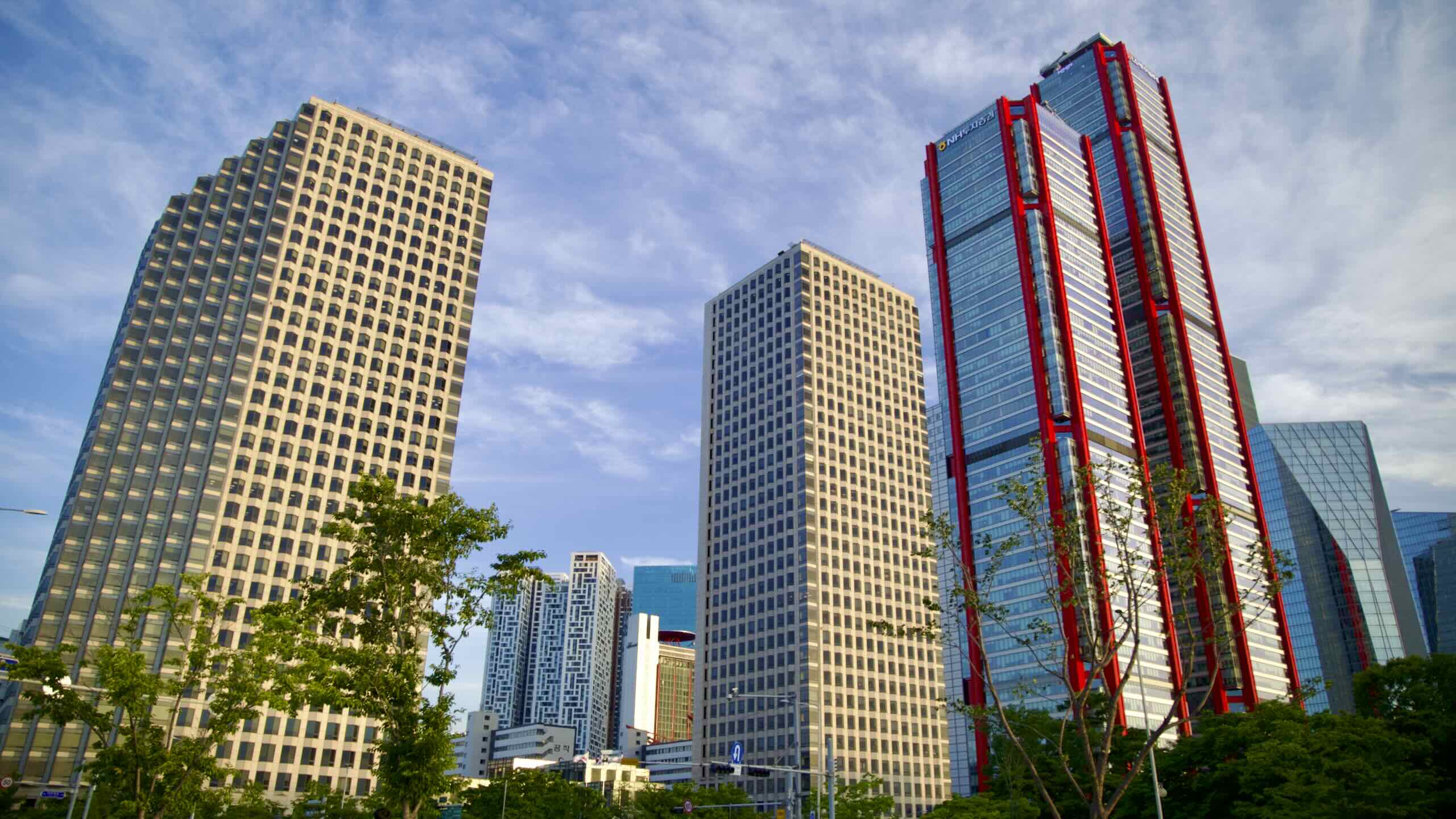
Tall, Tall Towers
Yeouido also shows off its riches with its skyscrapers. The small river island accounts for five of Seoul’s tallest buildings.
Yeouido shows off its riches with its skyscrapers, accounting for five of Seoul’s tallest buildings.
Parc1 (파크원 타워1; map; 69 floors; 333 m) and Parc2 (파크원 타워2; map; 53 floors; 256 m) were completed in 2020. They are a pair of skyscrapers that include a hotel and a department store. Parc1 is the tallest structure on Yeouido and second in Seoul.
FKI Center (FKI전경련 회관; map; 51 floors; 246 m) won a few design awards after its opening in 2013. A Sky Farm (스카이팜; map) hosts weddings, corporate events, and lets the public peep Seoul from its top floor.
Parks Galore
Though a mix of business and politics shape Yeouido’s social scene, parks dominate most of Yeouido’s physical space.
Yeouido Hangang Park sits on Yeouido Island on the south banks of the Han River.
Yeouido Hangang Park (여의도한강공원; map) sits on the top of Yeouido. The island’s largest park, it features waterparks, picnic spaces, and concert venues. Read below.
Saet Stream Ecological Park (샛강생태공원; map) follows the Saet Stream (샛강). Its name, “saetgang,” translates to, “a stream that creates an island.” The stream and park form the bottom border of Yeouido. They offer a parade of trees, water-filtering vegetation, and verdant paths.
Yeouido Park (여의도공원; map) lies in the middle of Yeouido, between the Hangang and Saet Stream Parks, below skyscrapers and shopping malls. It hosts walking paths, shady trees, and pavilions.
Completed in 1975, the National Assembly is a complex that covers an eighth of Yeouido and comprises ten separate buildings, including legislator offices, a memorial hall, a library, and more.
Korea added extra space to the National Assembly’s six-story main building. Why? Hope. They’d need the room if Korea’s north and south reunite.
Let’s look at the main building’s key design features:
Twenty-four octagonal pillars surround the lower facade. They represent Korea’s traditional lunisolar seasons (절기).
The 64-meter wide dome on top of the building symbolizes democracy’s convergence and compromise.
Originally a matte white, rain and time tinted the main building’s dome a pastel green. Similar to the Statue of Liberty, the National Assembly’s new look became a feature, not a bug.
Yeoui West Road
Continue deeper into Yeouido. Glance over Olympic Boulevard. Find one of a pair of roads that circle Yeouido.
Both roads hold lanes for vehicles, bikes, and feet (road view).
Near the middle of April, Yeoui West and Yeoui East host the Yeouido Spring Flower Festival. Visitors can walk the roads around Yeouido, closed to traffic, and marvel at 1,600 cherry blossom trees flushed with white.
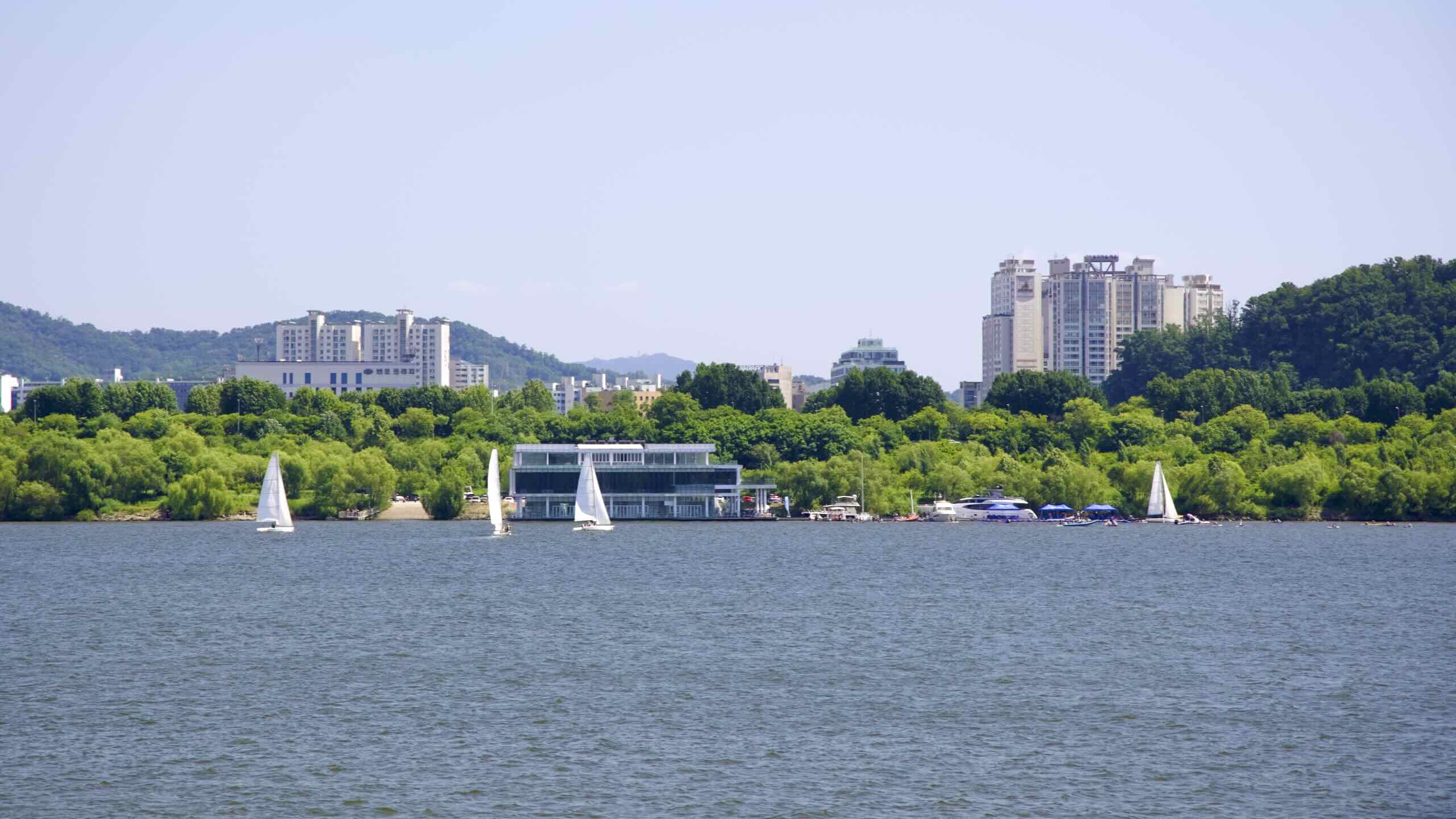
Cycle up a bunny slope. On your left comes the blue and silver swoosh of the Seoul Marina Club & Yacht (마리나클럽앤요트; map; road view), the home dock for a fleet of small yachts and other pleasure craft on the Han.
Pedal under an overpass and beside the National Assembly’s expansive parking lot, which holds a pedestrian bridge and the splendid view of its green dome.
Continue riding Yeouido. Pass a floating police station, 119 rescue center (map), and water taxi dock on your left; and fields, pools, and skate park (map) on your right.
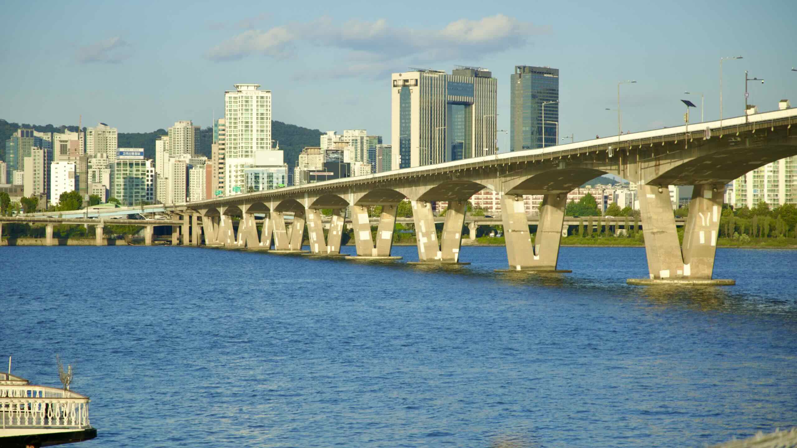
Seogang Bridge (서강대교; map; difficult crossing point), which shoots over Bamseom Island, marks the end of Yeouido’s first third.
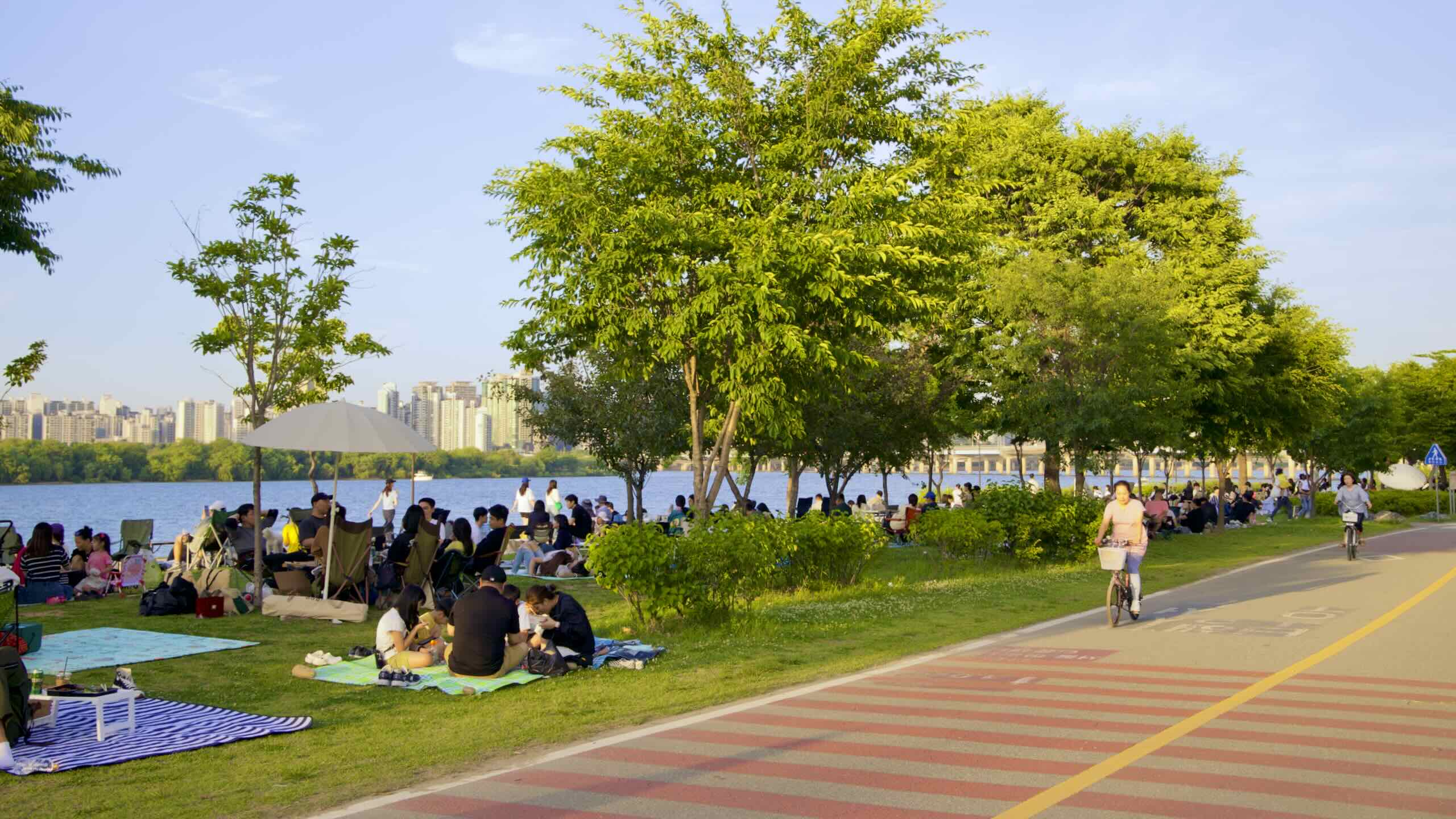
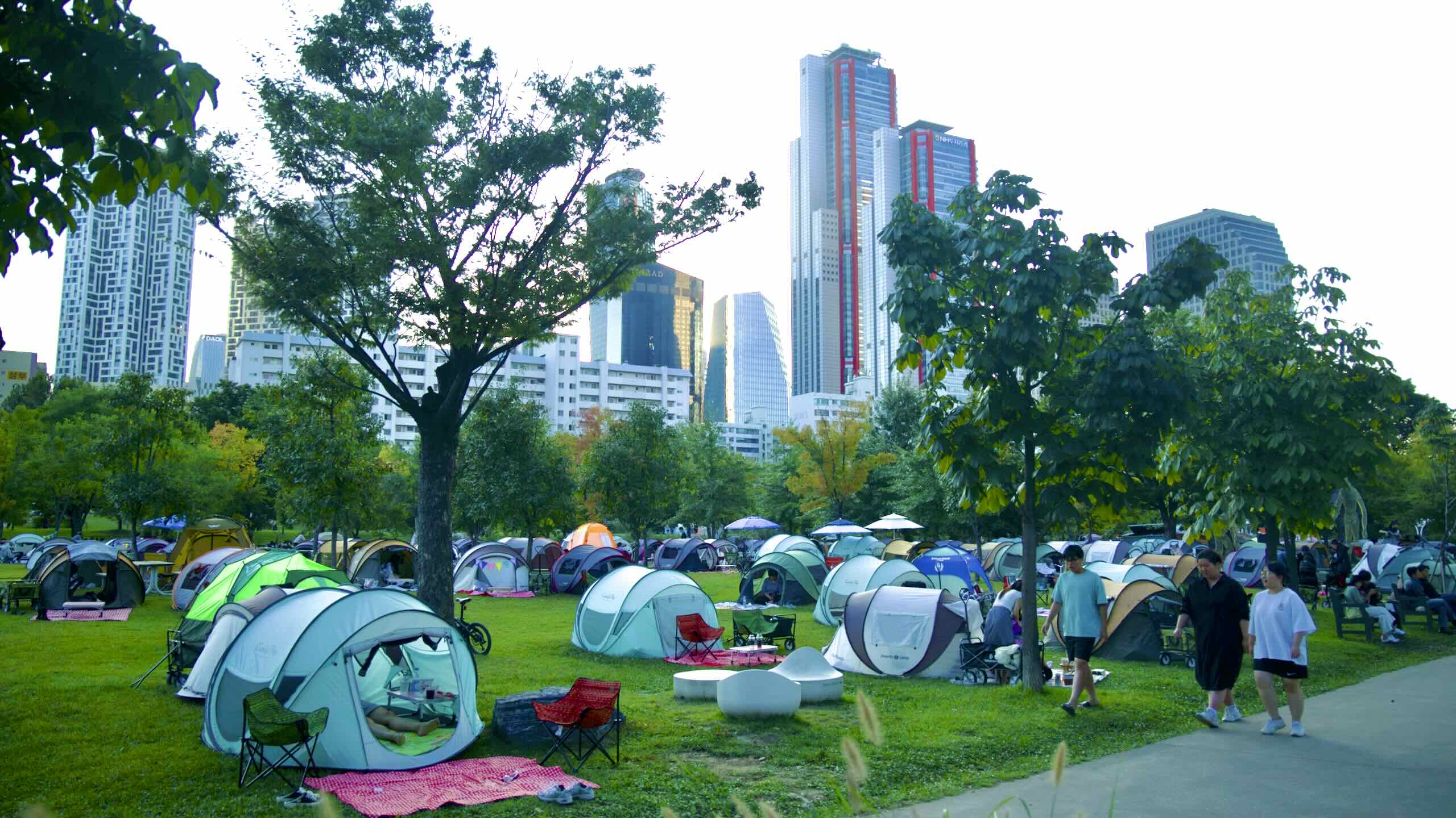
Shoot out from under Seogang Bridge. Leave the National Assembly in the rear view, slide by a riverfront convenience store, and find a grassy field unfurling before your eyes.
Year round, families find a shady spot on these lawns to pitch their temporary nylon homes. Also known as day tenting, they then lounge, eat meals, and then venture around the park for fun and sun.
What happens at nightfall?
They pack up their tent. They’re cold. And they’ve got phones to charge.
Waterlight Stage
Walk to the foot of the day tenting lawn and you’ll find another unique Yeouido landmark: Waterlight Stage (물빛무대; map).
Bobbing just on the placid Han waters, this swiss-army-knife performance space features a geodesic, glass front dome that can retract into the LED bedecked back.
When closed, Waterlight Stage holds 200 viewers inside its dome. Opened, it becomes an open air concert hall for 2,200 riverbank spectators.
Yeouido Floating Stage Water Fountain (물빛무대; map), one of the Hangang Park system’s seven fountains, is mounted on the Han River to the left and right of Waterlight Stage. Throughout the year, it puts on four to seven 40-minute shows each day, with musical accompaniment and LEDs at night.
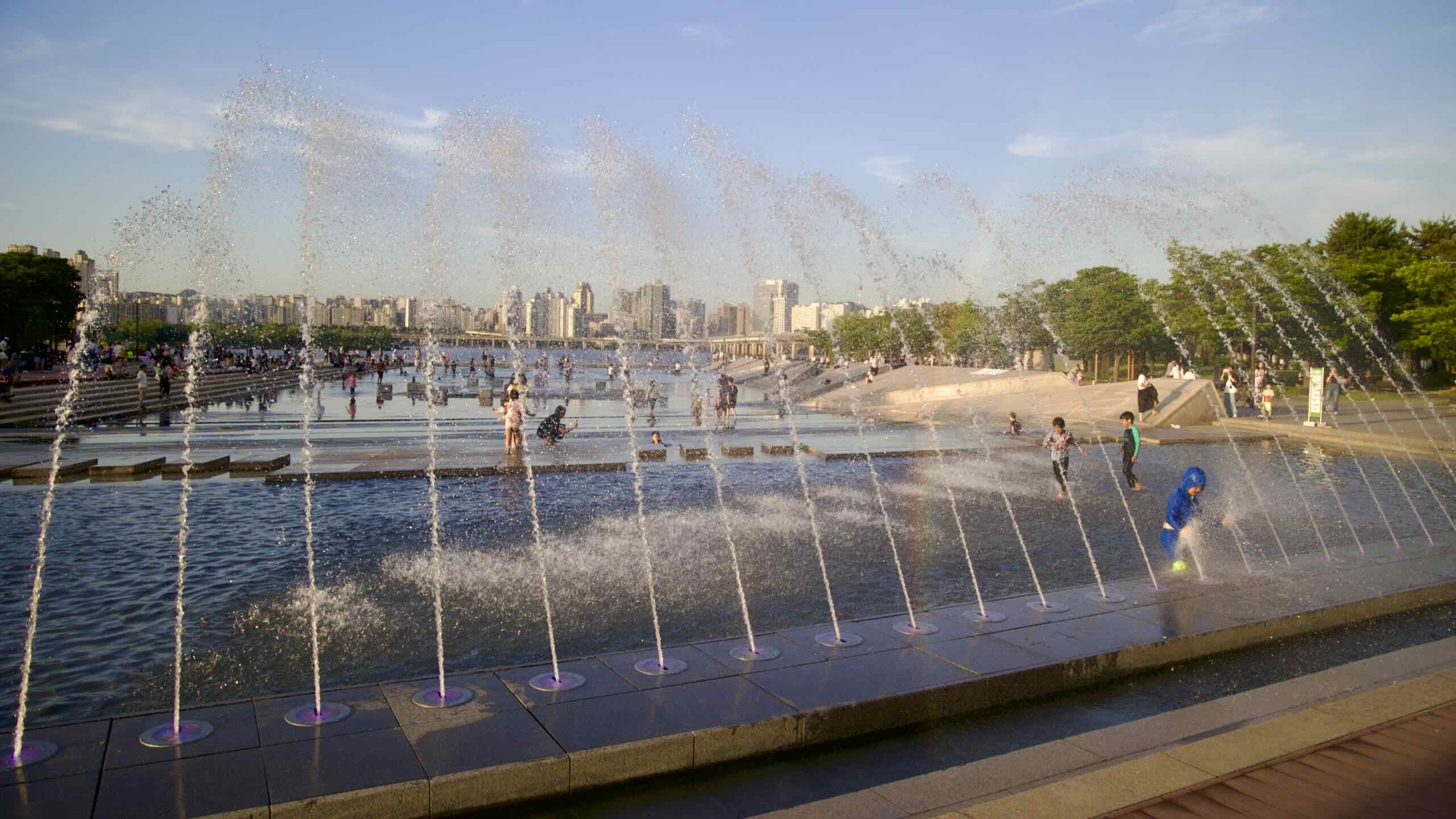
Waterlight Square Fountain
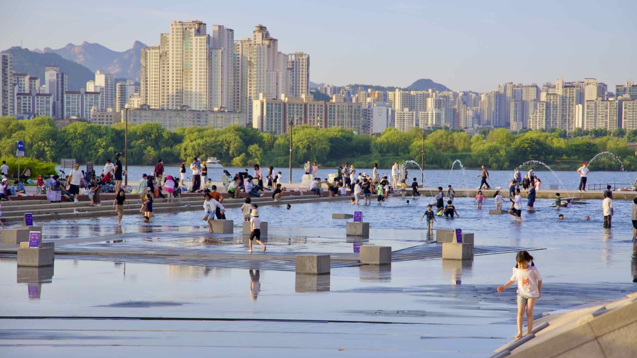
Hop back on Yeouido Hangang Park’s bike path. Inch your way just beyond the day tenting lawns and stumble upon Waterlight Square Fountain (물빛광장; map), Yeouido’s second water-centric attraction.
This fountain ain’t no Trevi. It’s a 40-meter by 196-meter concrete basin (road view).
During cold months, its blanched slopes and squares sit barren, waiting for canoodling couples and feral young ones.
When hot outside, Waterlight Square Fountain fills with ankle-deep water, recycled and filtered from the subway station below. Punctuated by spritzing jets, water cascades down steps, around islands of concrete, and towards the river.
Why ankle-high water? Waterlight Square Fountain isn’t just to look at. It’s for kiddos to splash, scream, and scramble about in.
Opposite the fountain, find a pair of buildings (road view):
Yanghwa (South Side) — motor boating, kayaking, canoeing, water skiing, wakeboarding, banana boating, duck boating
Yeouido (South Side) — motor boating, water biking, water skiing, wakeboarding, banana boating, blob jumping
Banpo (South Side) — yachting, sailing, jet surfboarding, kayaking, motor boating
Jamwon (South Side) — motor boating, water skiing, wakeboarding, wakesurfing, banana boating, fly-fishing, jet skiing, kayaking, paddle boarding, water slide
Nicknamed the “Bridge of Life,” Mapo Bridge is infamous as Seoul’s most popular suicide bridge. Some believe, because of its proximity to Korea’s stock exchange on Yeouido, brokers fled to the bridge after having their margins called.
To prevent attempts, Seoul installed an inward curving, 2.5-meter tall railing topped with a free-spinning mechanism. While still an issue, suicide successes have fallen by half.
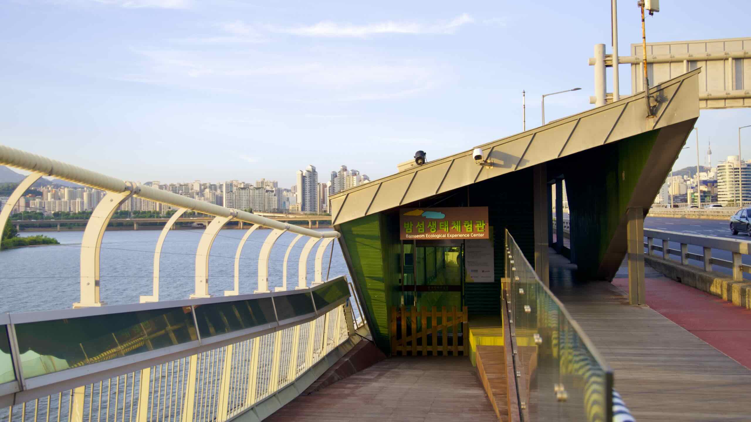
On platforms and through binoculars, spectators can gaze south over the Han River and view Bamseom Island (밤섬; map), a pair of sandy islets in the middle of the river.
As we learned before, Bamseom once held a thriving village. Then the government made it go boom and used its rocky remains to expand Yeouido Island.
Over the years, river sediment rebuilt Bamseom. Now it’s an eco park inhabited by migratory birds, sandy beaches, and swaying reeds. No humans allowed (aerial view).
Late Yeouido
Ride under Mapo Bridge and discover two open spaces. The first offers another grassy expanse for day-tenters and kite flyers (road view). The second?
A Concrete Center
A concrete sheet crowned with a wide set of stairs covers the second open space (road view).
The concrete stairs are Yeouido Hangang Park’s main entrance. Waves of park goers emerge from Yeouinaru Station (여의나루역; map; Subway Line 5) and stream into the park during peak season.
Thirteen outdoor art installations dot the fields between Mapo Bridge and Wonhyo Bridge (map). Artists from Asia, the Americas, and Europe add their beguiling works to the collection.
Along the river, a pair of docks float next to the artsy lawns (road view). They host sport cafés, restaurants, and E-Land Cruise Ships (이랜드크루즈; map), Seoul’s premier river boat tour.
Notice something? A towering wall of gold dominates the east end of the Yeouido (road view). That’s 63 Building (63빌딩; map), the island’s flagship skyscraper.
63 Building’s golden exterior represents the rapid development of the Korean economy after the Korean War. But architects didn’t put the real thing in its 13,516 windows panes. They combined glass and nickel alloy to create a golden sheen, which also helps insulate the offices inside.
It was the world’s tallest building outside of North America when completed. And it remained Korea’s tallest skyscraper until 2003.
63 Building is only 60 stories tall (249.6 m; 819 ft). However, some argue its three basement floors and rooftop huts count towards the total. (So… “63½ Building.”)
The tapered form of 63 Building looks like the Chinese symbol “人,” which translates to “people.” Fitting. A life insurance company built it.
Notable facilities include 58th & 59th floor restaurants, an aquarium, and glass elevators. 63 Art occupies the top floor and claims the title of “World’s Highest Art Gallery.”
The 69-story Parc1 (파크원 타워1; map) snatched Yeouido’s tallest building crown in 2020. But, along with the National Assembly, 63 Building remains the island’s most recognizable landmark.
Curl around the back end of Yeouido past a ssireum pit and gateball course on the riverside green. Cross a bridge over Saet Stream and hop off Yeoui Island (road view).
But Yeouido Hangang Park doesn’t end at the island borders. Continue through a roundabout (road view), where the Saet Stream Eco Park bicycle road merges back onto the Hangang Bike Path.
Spot the bridge with green trusses (road view). Measuring 1.1 kilometers, it became the first modern bridge to cross the infamously wide Han River when completed in 1900.
At the start of the Korean War (1950~1953), the retreating South Korean army demolished the bridge. Citizens were still crossing. Hundreds died.
During Seoul’s post-war Miracle Years, a booming economy rebuilt it and added neighboring bridges, labeled Bridge A, B, C, and D. They each carry a variety of trains in and out of Seoul, including subway, ITX, and KTX trains.


